
.
Honzawa Onsen 本澤温泉 – Mt. Tengu 天狗岳 – Shibunoyu 渋の湯
Distance: 15.8 km
Elevation change: 1140 metres
Highest point: 2640 metres
Start: Midori-no-ike Bus Stop
Finish: Shibunoyu Bus Stop
Difficulty: ▅▅▅▅▅▅▅▅▅▅ ❹
Map: Yama to Kogen Chizu 山と高原地図 [No.35 八ヶ岳 YATSUGA-TAKE]
GPX TrackKML TrackGSI MAPPDF Topo Map
Enjoy Some of Yatsugatake Best Hiking
This hike is almost a reverse offering of my previous trip to Yatsugatake a couple of years back, with difference being this time starting a little way up the mountain chain. Though daily distances seem short, the Yatsugatake terrain shouldn’t be underestimated and weather conditions are also highly changeable.
Day 1: Take a Soak in Japan’s Highest Hot Spring (5 km)
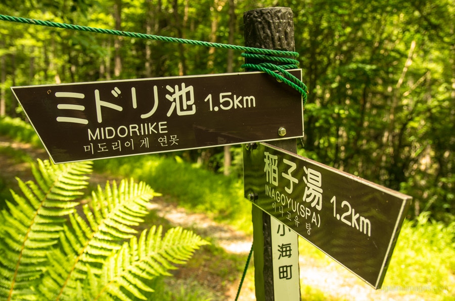
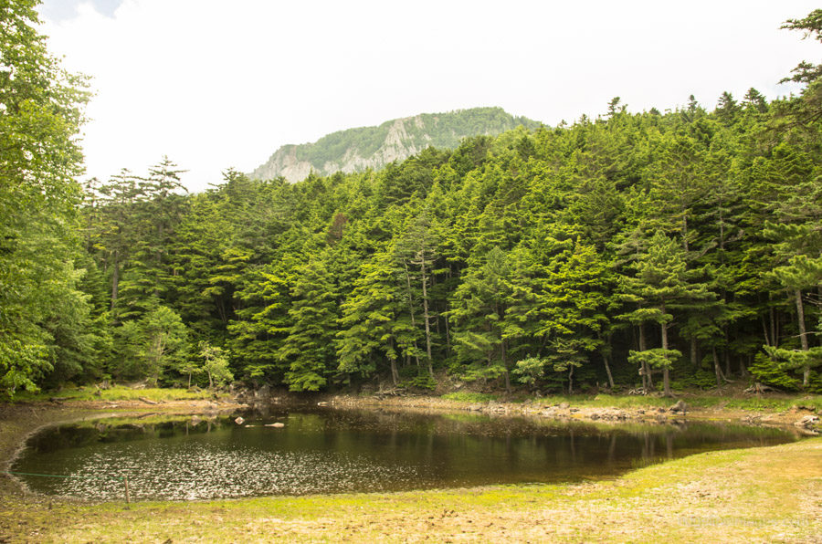
From Tokyo the only realistic option to make the first morning bus at 09:23 from Koumi Station, take the Hokuriku-Shinkansen from Omiya to Sakudaira Station. From Sakudaira you’ll need to transfer to the Koumi Line, which takes another 45 minutes. Everything going well; the train and bus connections should time nicely. The bus is actually headed for Inagoyu Hot Spring 稲子湯 but tell the driver you want to get off at the Lake Midori bus stop みどり池入口 (one stop before, 780 yen). The start of the trail is well signposted, and you have a choice of either walking along the road or following shortcuts that bypass some sections of the road. Look out for a sign to Midori-ike on your left side. The hike initially passes through some delightful lowland forest before kicking into steeper action for the final 40-minute push-up to the lake. Take lunch on the roughhewn benches overlooking Lake Midori, with vistas of Yatsugatake augmenting the fine scenery.
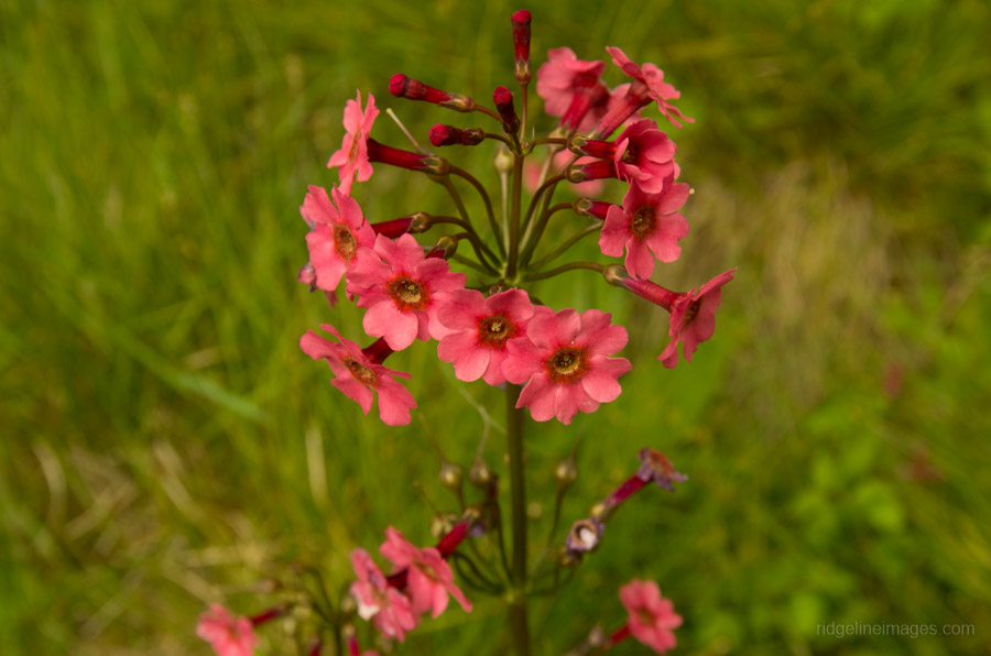
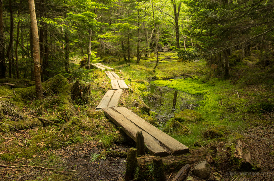
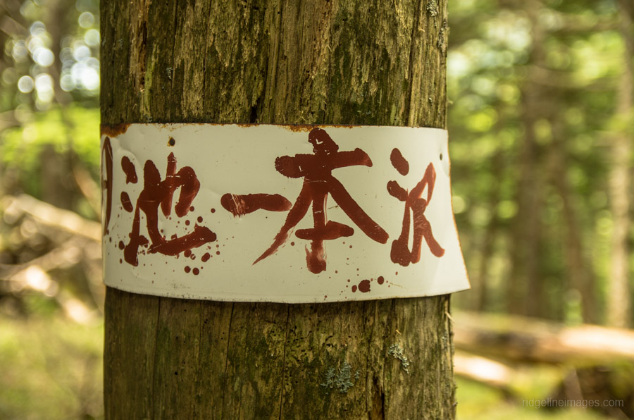
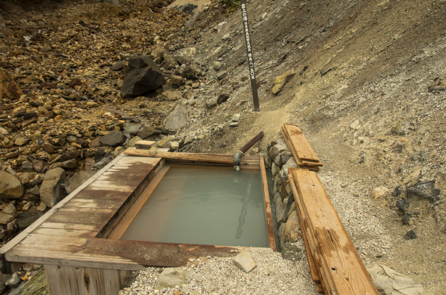
When you’re ready to head off, continue along the trail beside the lake. A little further down the trail forks, look for a sign pointing to Honzawa Onsen 本澤温泉. In the early summer watch for Japanese primrose (Kurinsou) coming into bloom. This section of the hike is otherwise unremarkable, and an hour or so after leaving the lake, you’ll arrive at a 4WD drive track where you need to turn right for a 10-minute walk up to the campsite. The Honzawa Onsen campground (600 yen) is spacious and has a water hole, and on this particular weekday, I was luckily the only camper. Honzawa Onsen’s claim to fame is that it holds the distinction of hosting the highest open-air bath (rotenburo) in Japan at 2,150 metres! After setting up camp, take a well-deserved soak in the sulphur-infused waters. Make sure to pack a small towel.
Day 2: A Campsite with 360 Degree Views (5.8 km)
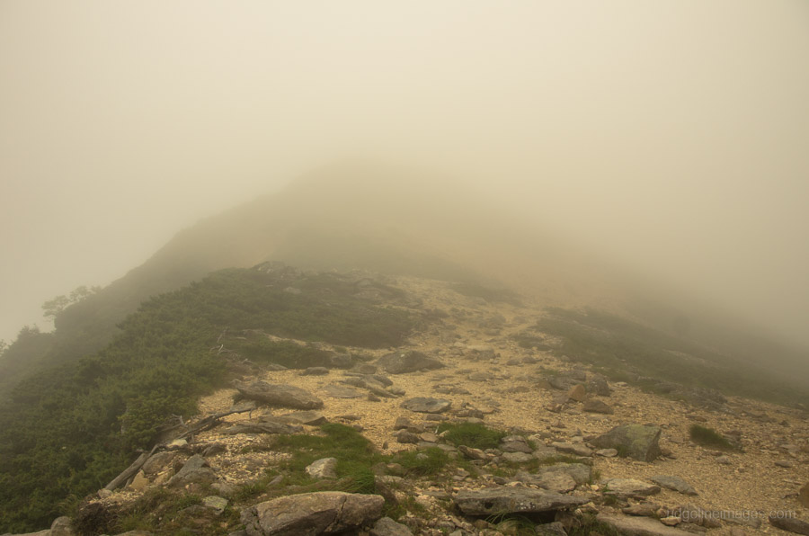
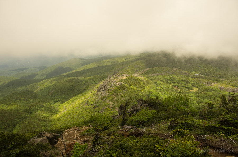
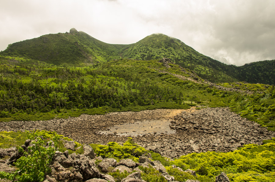
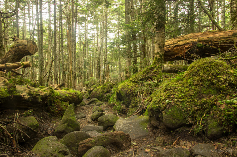
A flat camping site makes all the difference, and after a restful night’s sleep, I arose to find Yatsugatake cloaked in a heavy mist. I decided to make an early start, and by 07:00 am, I was on my way. The trail (Shiransuna Shindo 白砂新道) up to Tengudake starts from behind the mountain lodge and becomes progressively steeper, with a couple of slightly exposed sections to deal with before hitting the upper ridgeline. The mist and wind conditions at the top were significant, reducing visibility to around 30 metres. Even in bad weather, following the path is relatively straightforward, and it takes 20 minutes to reach East Tengu Peak 東天狗岳 (2,640 m). In better weather, most climbers make a short detour over to the west peak, but under the circumstances, there wasn’t much point. There are two options for getting down to the Kuroyuridaira Plain 黒百合平 with the left trail scrambling through a rock field and being somewhat more taxing.
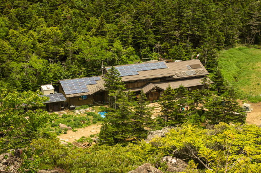
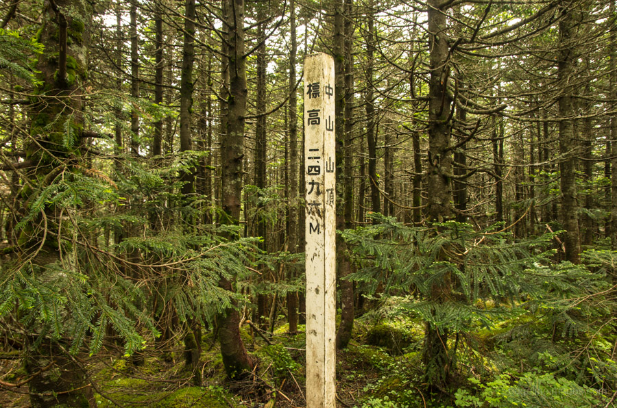
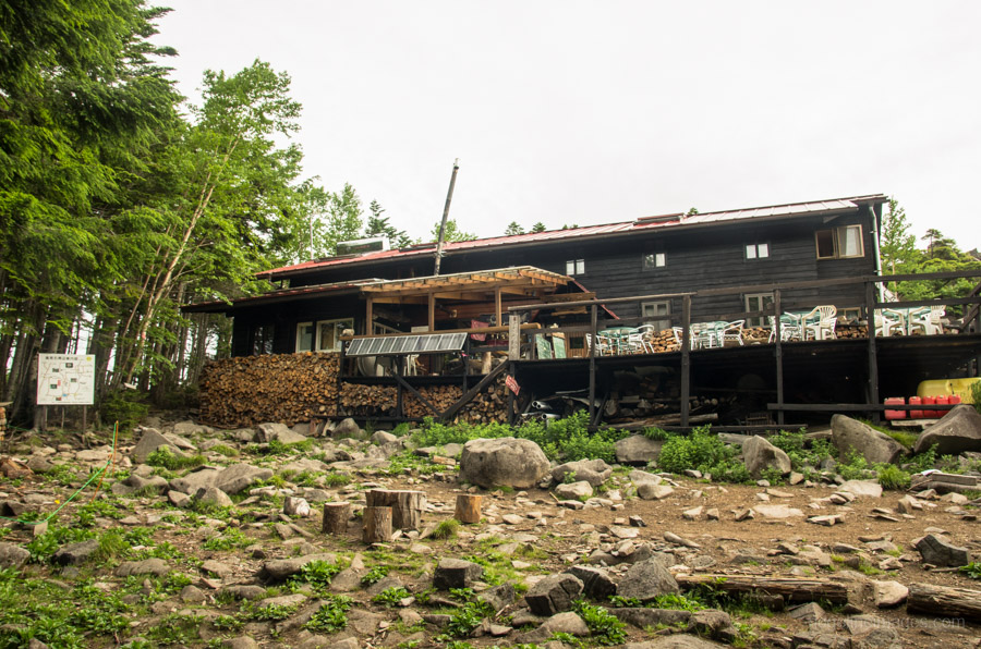
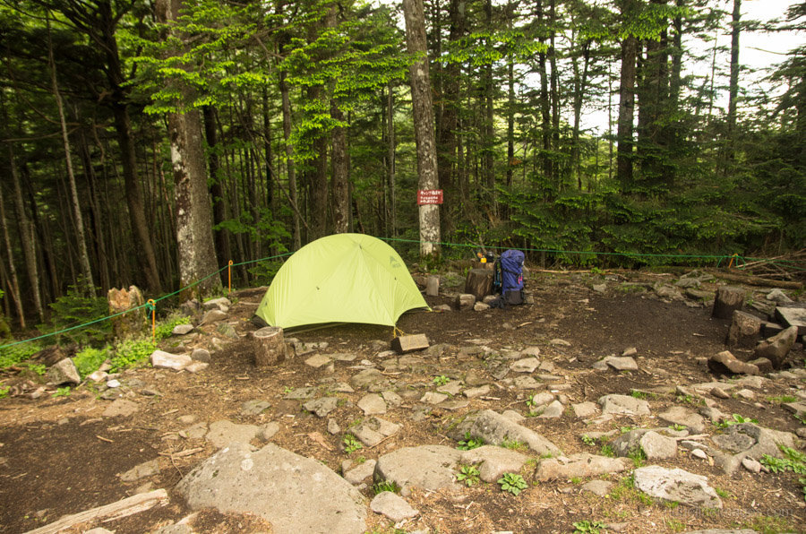
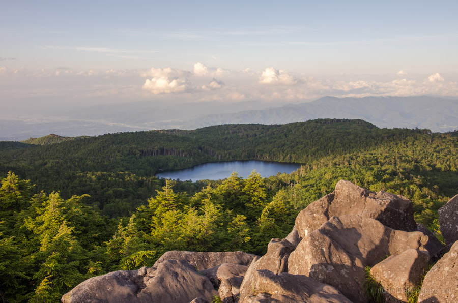
After taking an early lunch break at the Kuroyuri Hyutte 黒百合ヒュッテ next to its rather forlorn-looking campsite, take a short walk to Nakayama-toge 中山峠. Turn left here for another brief climb up to Nakayama 中山 (2,496 m). From here down to the Takamiishi hut 高見石小屋 the trail is akin to following a dry river bed, so pay careful attention to your footwork. The campsite (550 yen), while quite small, is significantly nicer than Kuroyuri Hyutte, and behind the hut is a rocky outcrop with superb 360-degree views. Note that while this campsite doesn’t have a water hole, you are provided with 2 complimentary litres, and it costs 50 yen a litre thereafter.
Day 3: Scramble Down an Extensive Boulder Field (5 km)
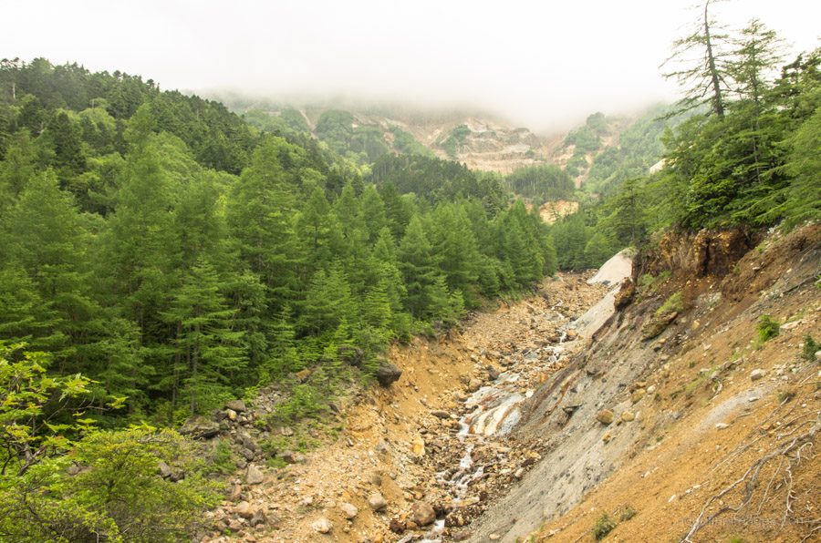
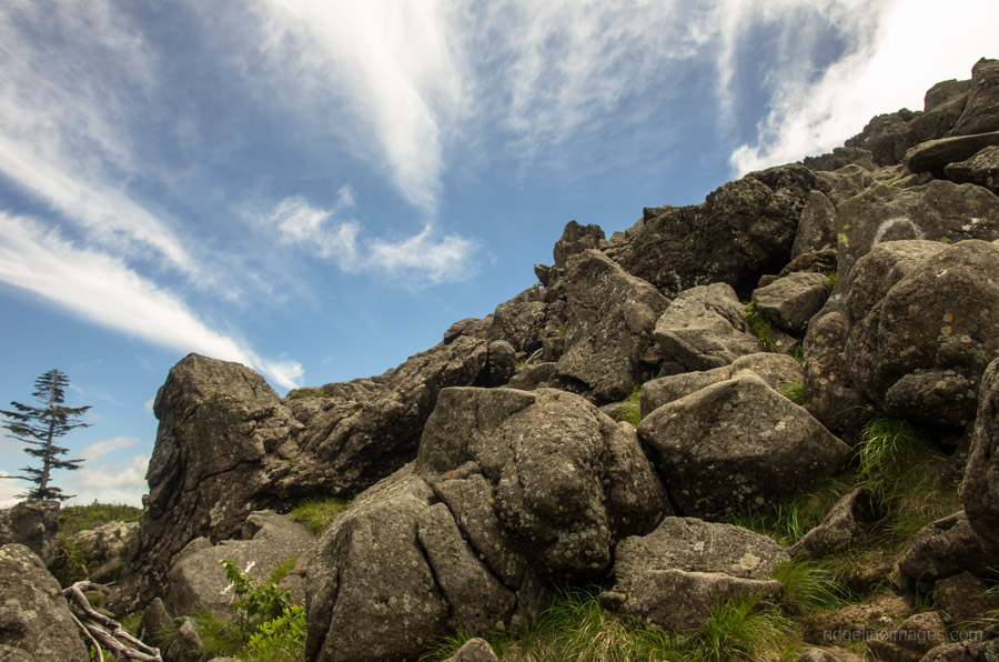
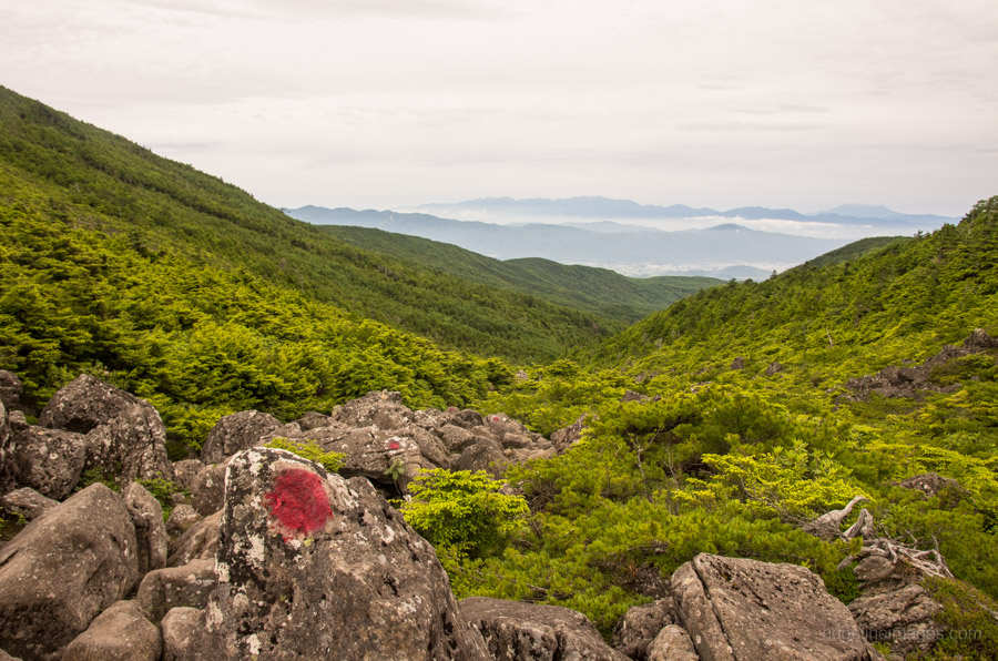
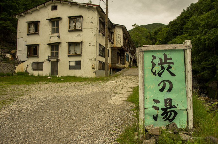
The final day down to the Shibunoyu 渋の湯 can be challenging, not so much from a navigational standpoint as from negotiating an extensive boulder field. Similar to the trail coming off Tengudake, suggested map travel times here are tight, and I would advise giving yourself extra time. Apart from the busiest times of the year, there are also only two daily buses back to Chino Station 茅野 (1,150 yen). On your ventures through the boulder field, keep an eye on the red and white spots painted onto the rocks. In other sections, the route is indicated by pink tape. Importantly, if you encounter heavy rain the option exists to avoid a major stream crossing by means of a lesser-used course about halfway along.


Been there in GW, still a lot of snow but has been awesome!
Definitely want to go back again, this time doing more days like from Tengudake to Akadake
Hi Riccardo, I remember you telling me about your GW trip. Your right, Yatsugatake is definitely one of those places that is deserving of more than one visit.
Is it possible to mountain bike through this route? I’m looking for some challenging mountain biking trails around Tokyo? Thank you
The short answer is no. These mountains are part of a Quasi-National Park so are mainly geared (no pun intended) towards hiking and mountaineering. If you’re into enduro / all mountain trails I would suggest checking out some of the excellent trails surrounding Ome City (West Tokyo).
Hi David,
Thanks for all your efforts to provide such details advice on mountain trails. You one of my go to’s for inspiration.
I’m wondering what your view is on snow up there this time of year? Mainly gone/gone/need crampons? Do you know of a place I can check without calling?
Thanks for the kind words about the blog, Collette.
Due to the appreciably warmer weather, the bulk of the snow on the Yatsugatake Mountains has now melted. To find out the latest trail and snow conditions, I would encourage you to check recent hike reports and photos posted on the mountain-climbing community sites Yamareco and Yamap. I have written a detailed how-to guide about including these sites and others as part of your preparations here: Three Steps for Planning a Safe Hike in Japan.
I hope this helps 🙂