.
Mt. Ogura 御座山 – Zeneimine 前衛峰 – Miharashidai 見晴台
Distance: 11 km
Elevation change: 972 metres
Highest point: 2112 metres
Start: Kuryu bus stop
Finish: Shiraiwa bus stop
Difficulty: ▅▅▅▅▅▅▅▅▅▅ ❸
Map: Yama to Kogen Chizu 山と高原地図 [No.21 西上州 NISHIJYOSHU]
GPX TrackKML TrackGSI MAPPDF Topo Map
A 200 Famous Mountain Worth Spending a Night
When planning an overnight hike there are three things I look for. First is water which needs to be available either near the campsite or collected en route. Second it should be accessible by public transport although I’m not immutable to the occasional taxi provided it’s only one way and not wallet draining. Finally, it shouldn’t be too crowded and if it can be done mid-week all the better. As you may have guessed the Mt. Ogura hike ticked all the boxes and makes for an excellent overnight hike to enjoy one of the 200 famous mountains in Japan.
Day 1: Hike Through Primeval Forest (3.9 km)
Access to the trailhead is a tad time consuming. First ride the Hokuriku Shinkansen to Sakudaira Station, change to the scenic Koumi Line and get off at Koumi Station. The JR Tokyo Wide Pass gives you unlimited travel on JR East trains (including the Hokuriku Shinkansen) for three consecutive days for 10,000 yen. From here you need to catch two buses. The first departs at 09:40 and takes you to Nakashima 中島 (20 mins, 100 yen) followed by a short walk to a second minivan to Kuryu 栗生 (10 mins, 100 yen). You read that correctly 100 yen for each bus! I assume heavily subsidised by the prefectural government. The wait between buses is 20 minutes and the final bus to Kuryu doesn’t run on Sunday’s where you need to walk an extra 50 minutes.
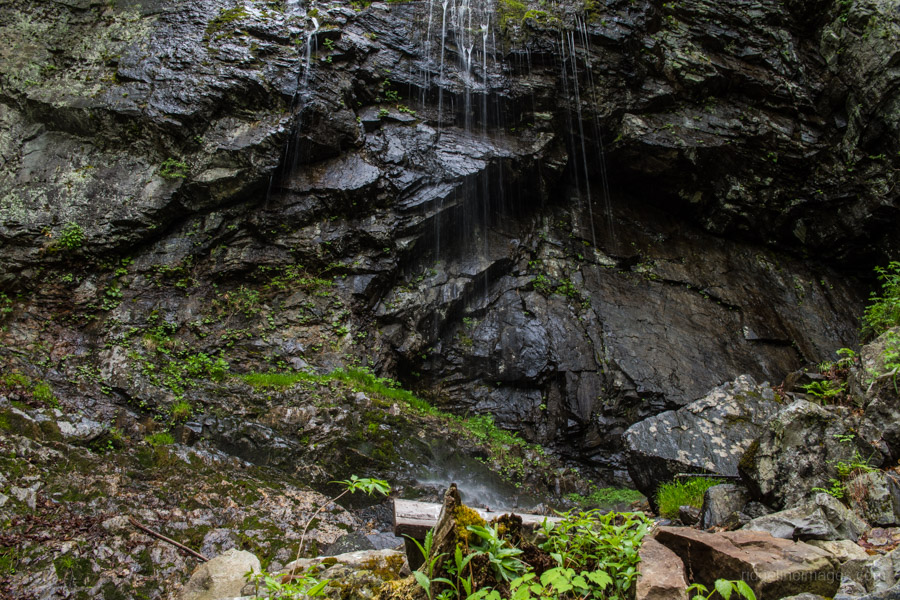
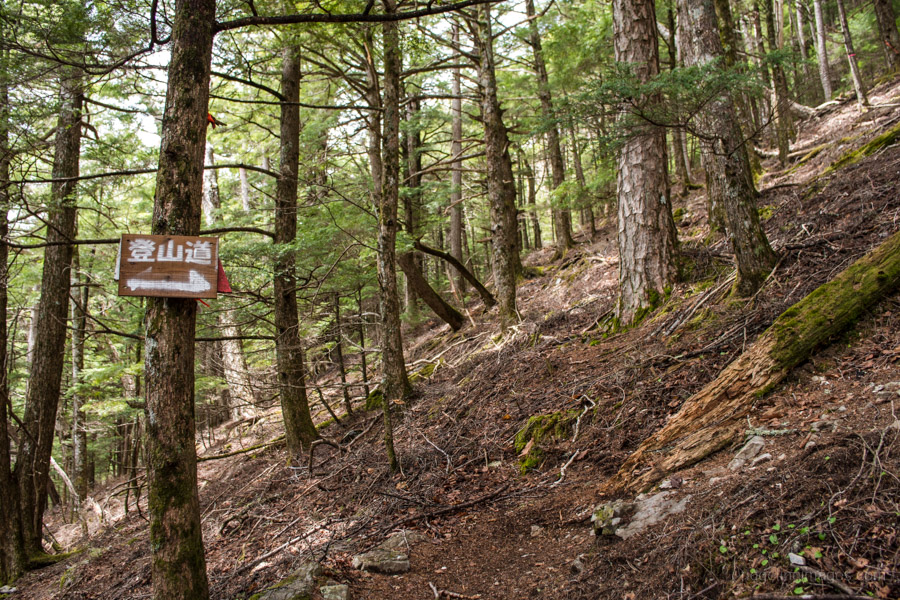
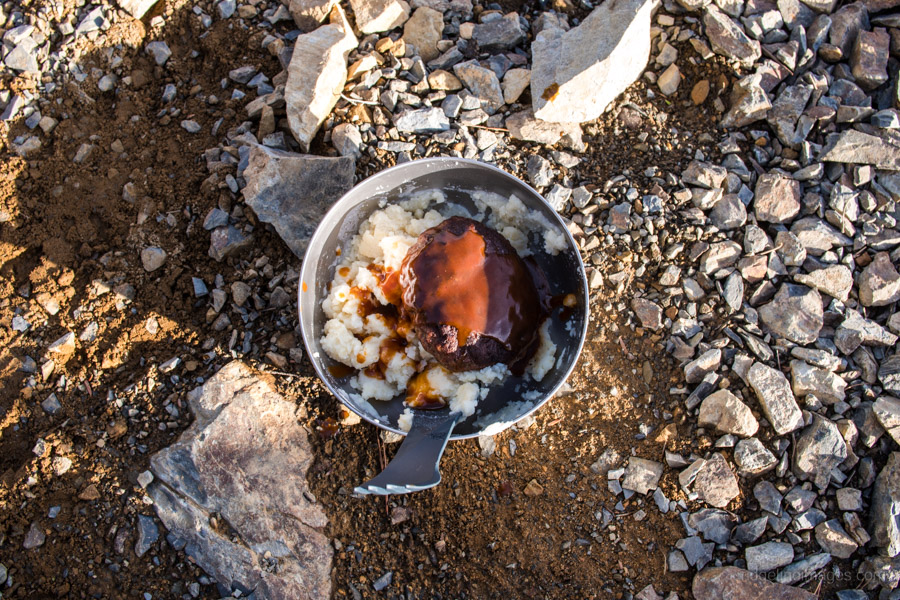
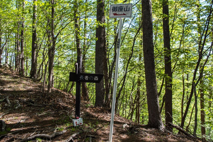
From the Kuryu bus stop head up the road, cross the bridge and look for a sign pointing to Mt. Ogura on your right. The trailhead proper is at the end of this 1.6 km gravel road. At the Kuryu trailhead 栗生山口 there was only one car and later I passed its owners, two blokes, the only two hikers I would meet over the two days. The trail from the outset is picturesque and was ameliorated by a light mist. The first target is the Fudonotaki Falls 不動の滝 reached after 50 minutes and the only waterhole along the hike. I recommend taking lunch here as it’s a good opportunity to rehydrate and collect enough water to cover you for the next day.
After lunch the trail launches into a series of tightly laced switchbacks as it makes its way up to the ridgeline. The forest around 500 metres shy of the summit is primeval with Japanese white birch (Betula platyphylla) and rare Asian black birch (Betula dahurica) which is considered endangered in this part of Honshu. After tackling a longish section of chain there is a small shrine after which you need to climb down a slab of precipice rock again by means of thin chain which isn’t the easiest to grip with a pack ladened with water so take care.
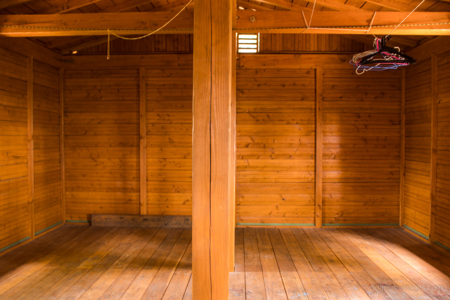
The Mt. Ogura refuge hut 御座山避難小屋 on the leeward side of the mountain, a stone’s throw from the summit is one of the best I’ve stayed at. Based on the reports in the logbook it appears to have opened in 2012, can accommodate up to 20 people and best of all it’s free to stay. Note there is no toilet or water nearby which probably cuts down the number of prospective users. What most impressed me about this hut apart from its overall cleanliness was the glass sidling door and windows and retractable metal covers to protect the windows.
Day 2: Exquisite Views Minus the Crowds (7.1 km)
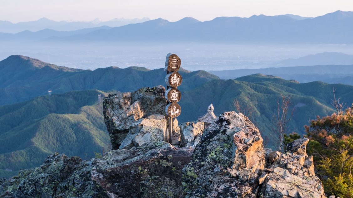
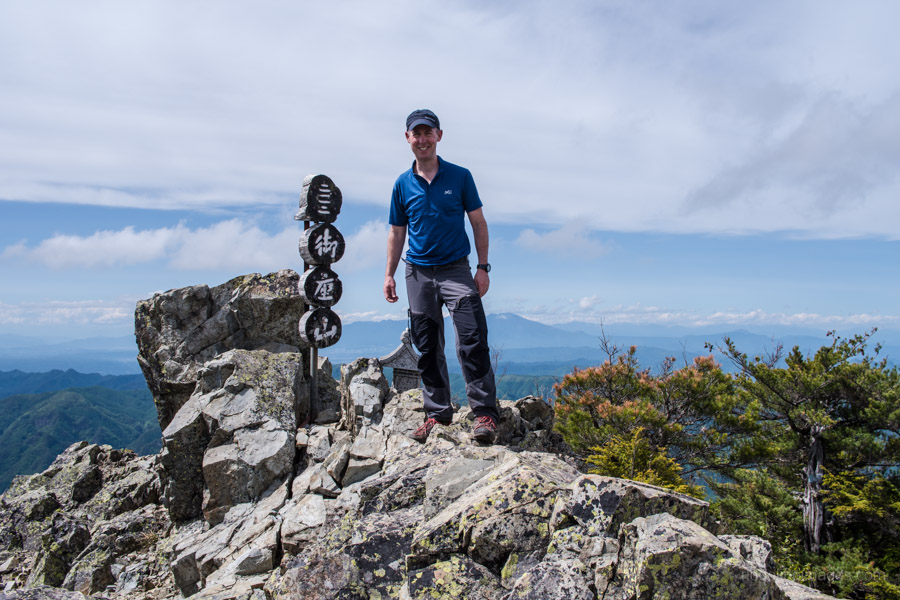
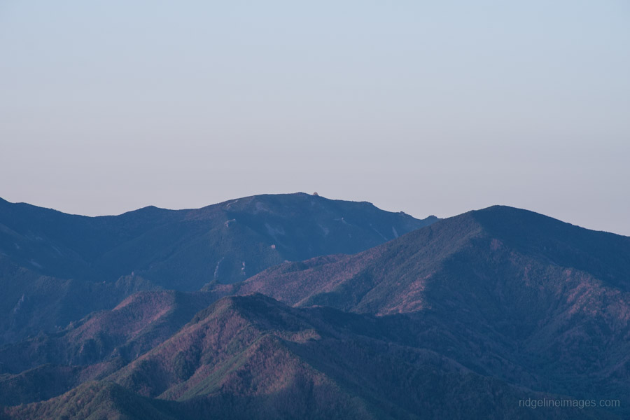
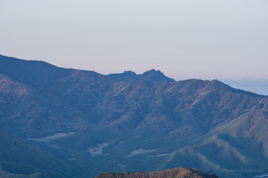
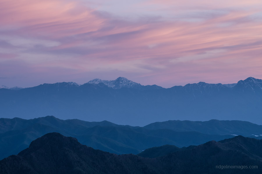
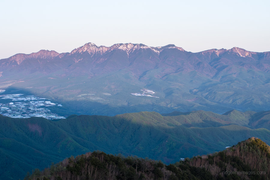
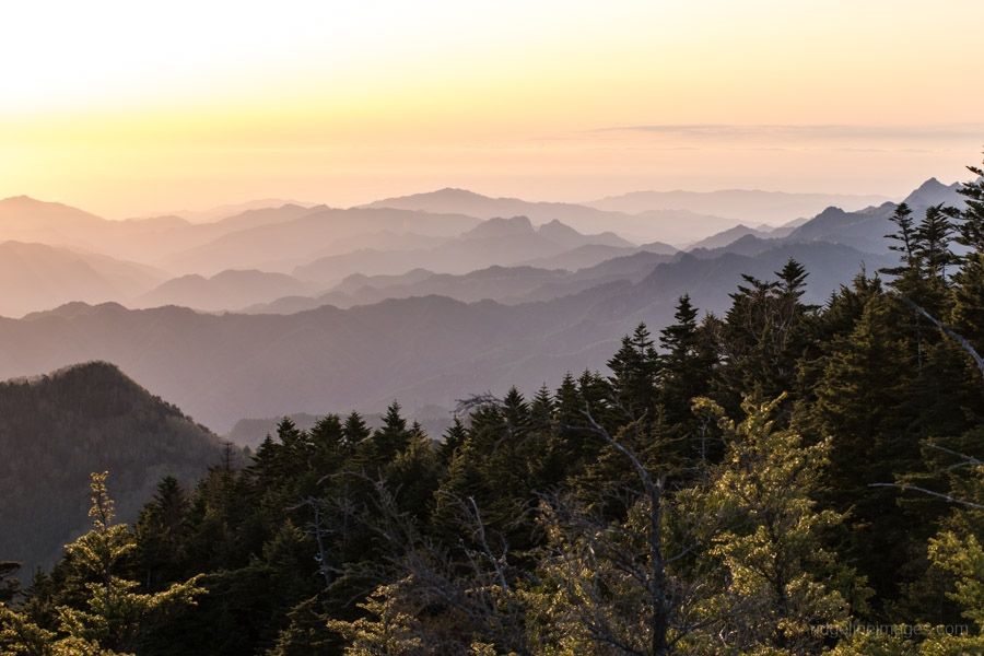
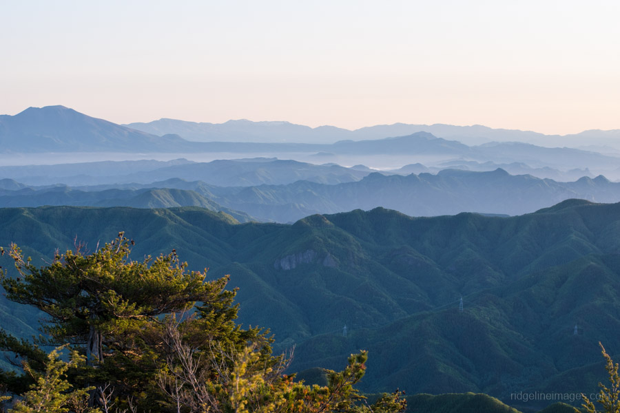
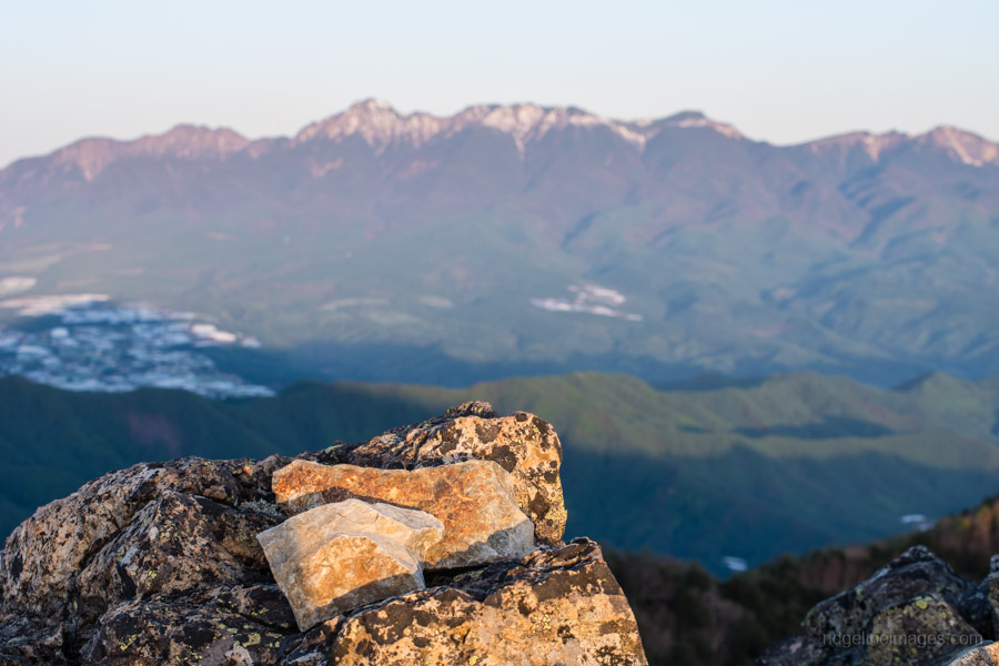
After enjoying the beautiful light from Mt. Ogura (2112 m) at sundown I was keen to rinse and repeat at sunrise. The fine weather does have a downside with the temperature inside the hut dipping to a meagre 2 degrees overnight. From the craggy summit the 360-degree view was superb, unleashing a veritable who’s who of famous mountains. Kisokoma in the Central Alps, Okuhotaka and Yarigatake in the Northern Alps, Yatsugatake Mountains and nearby Mizugaki, Kinpu and Kobushi.
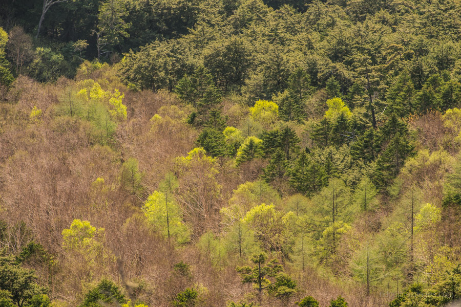
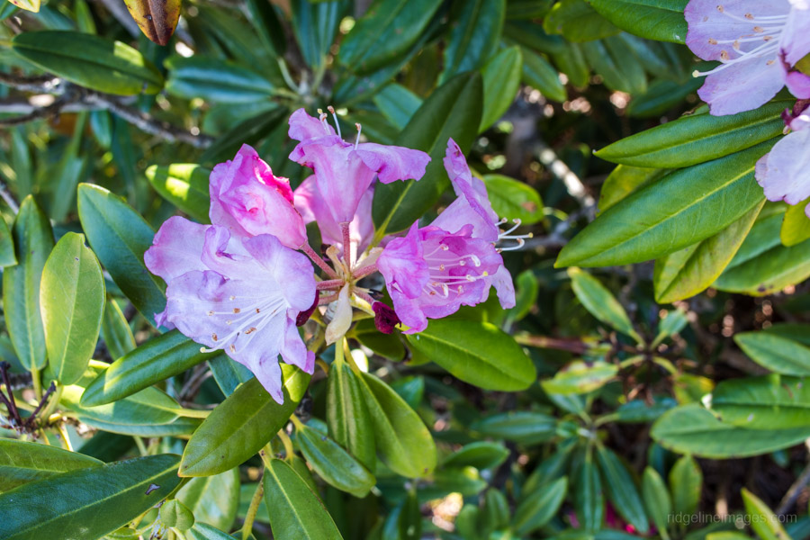
The nice thing about staying in a hut is there is no tent to deal with and after wolfing down breakfast you can be packed up in no time. From the hut follow the sign which heads north towards Zeneimine 前衛峰 (1992 m). This lower peak provides another decent view of the Kita Alps. The trail continues a mildly undulating course as it passes Miharashidai 見晴台 before reaching a trail branch 合流点. A little after Miharashidai note a large rock which steers the trail right and slightly off the ridgeline. In early June enjoy pink infused Shakunage Japanese Rhododendron flowers which line the trail.
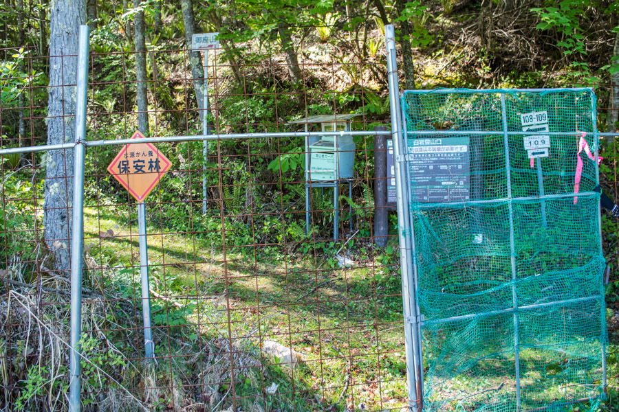
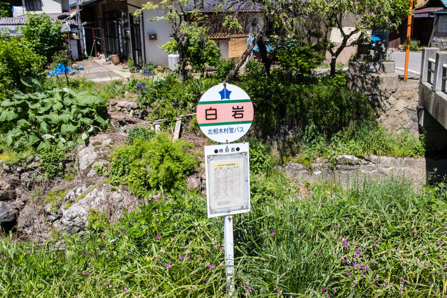
Take the left trail branch which makes its way down to the Shiraiwa trailhead 白岩山口 with the last section passing through fern forest. At the trailhead there is a secured deer gate along with a mountain climbing registration mail box. From here follow the paved road through a lettuce farm. After you reach the main road, cross it and the Shiraiwa bus stop is on the left just over the bridge. On weekdays there are 9 buses heading to Koumi Station (30 mins, 100 yen) and about half that on weekends.


David
Thank you for another interesting post and hike idea. I have a question. I presume Ogura san is also accessible as a reasonable day hike, particularly if one is doing some car-based touring so has good trailhead access mobility? If so, do you think the more scenic side to approach from is the north or the south (noting it would be an out and back to the car type of choice)?
Best wishes
Stewart (Australia-based Japanese mountain hobbyist)
Hey Stewart, Ogura san is doable as a day hike especially if you have your own wheels as you can park at the Kuryu trailhead (10 cars). From here the map time to the summit is only 2 hrs 45 mins. The other option is parking at Shiraiwa in the north though it has limited parking (3 cars). While the trail from both sides is similarly scenic, I feel the approach from south has more varied terrain and passes the waterfall which is worth seeing.