.
Bukkasan 仏果山 – Mt. Takatori 高取山 – Miyagase Dam 宮ヶ瀬ダム
Distance: 9.3 km
Elevation change: 445 metres
Highest point: 747 metres
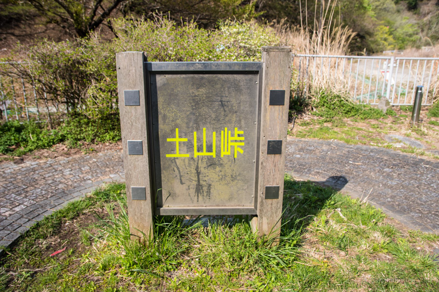
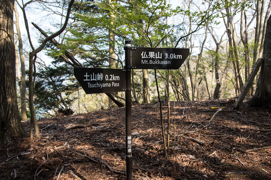
Start: Tsuchiyama-toge Bus Stop
Finish: Hanbara Bus Stop
Difficulty: ▅▅▅▅▅▅▅▅▅▅ ❷
Map: Yama to Kogen Chizu 山と高原地図 [No.31 丹沢 TANZAWA]
GPX TrackKML TrackGSI MAPPDF Topo Map
A Gateway Hike Towards Mt. Tanzawa
For those looking for a limbering up hike before tackling the Tanzawa Mountain Range, Mt. Bukka is a good starting point. The mountain has long been a popular haunt for United States Army folk stationed at nearby Camp Zama. The downside is if you’re coming from Tokyo you are made to take the train all the way to Hon-Atsugi Station on the Odakyu Line before having to ride a bus back up through the valley. This hike runs lengthwise along the range rather than up and down the shortest approach as some other bloggers have done. Be warned though the area like Mt. Tanzawa a haven for land leeches yama-hiru so pack some salt from early to late summer.
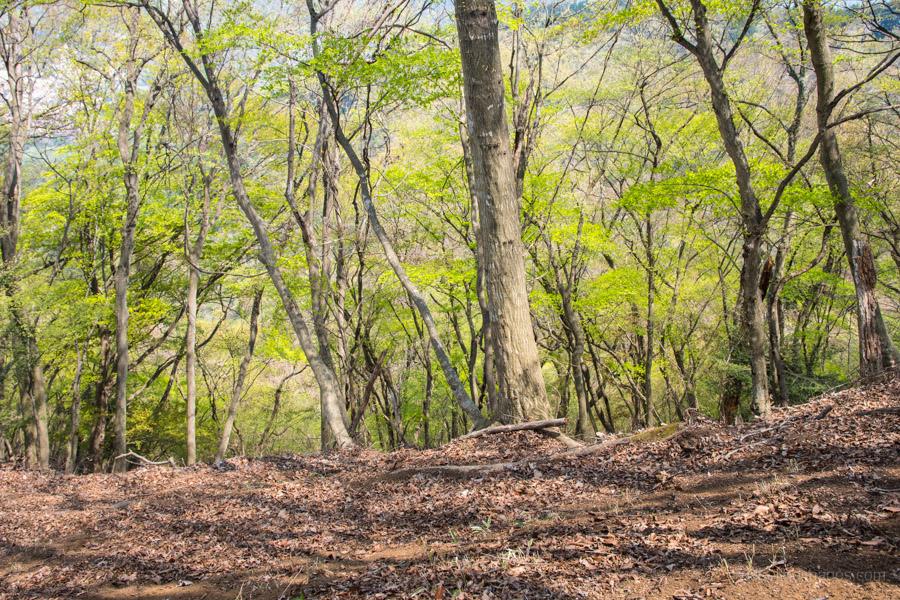
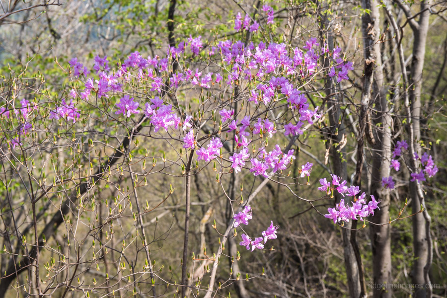
At Hon-Atsugi Station take the north exit and nosey across to the number 5 bus stop. On this particular weekday morning there were only a few of us lined up for the 07:40 bus. At Tsuchiyama-toge 土山峠 (50 mins, 560 yen) cross the road and backtrack 100 metres to the trailhead. From the bus stop it takes around an hour to reach the saddle at Kawagoishiyama (640 m) before the final push to the summit of Mt. Bukka 仏果山 also colloquially known as Bukkasan (747 m). In the springtime the “shinryoku” or fresh green livens up the backdrop interspersed with the occasional purple tsutsuji or azalea flowers.
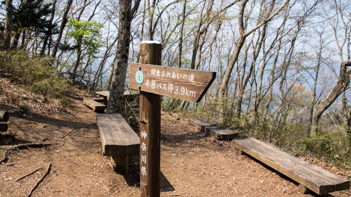
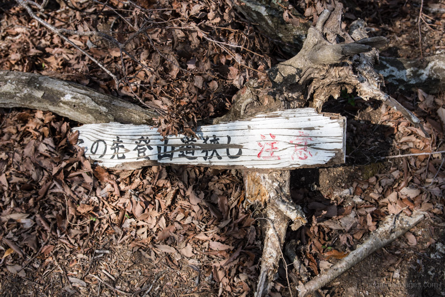
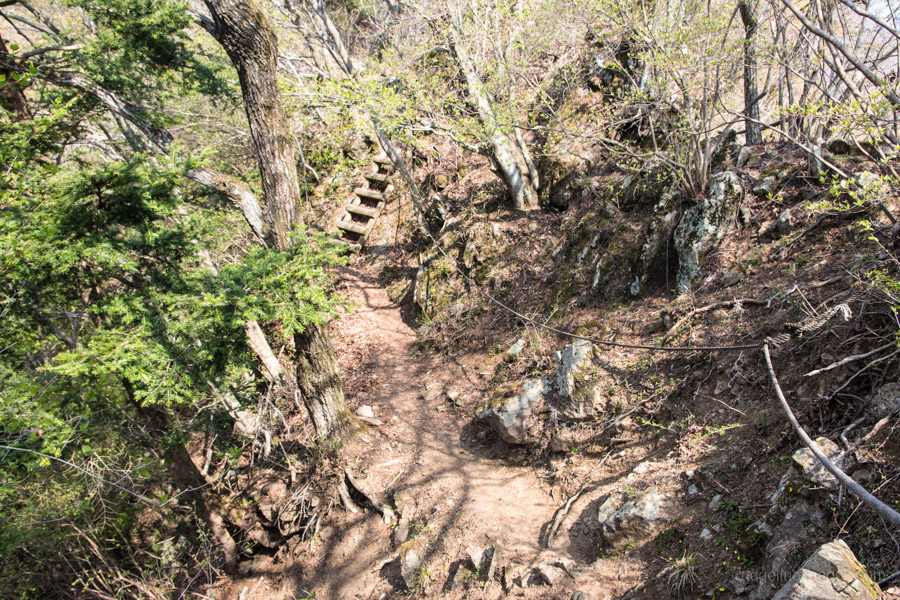
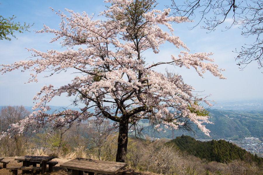
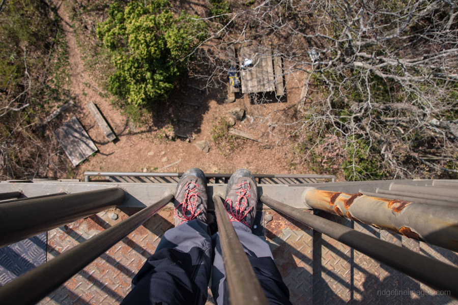
Much of the trail follows the Kanto Fureai no Michi or the Metropolitan Area Nature Trail and is narrow at times with fixed ropes and ladders in place to maintain a secure footing. Both summits of Mt. Bukka and nearby Mt. Takatori 高取山 (705 m) have lookout towers which loom above the canopy providing a terrific bird’s-eye view. Note the trail continuing across to Mt. Takatori veers left from the summit of Bukkasan. Take lunch at either of these mountains with Mt. Takatori blessed with cherry blossom trees in mid-April.
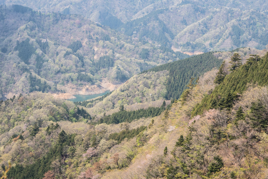
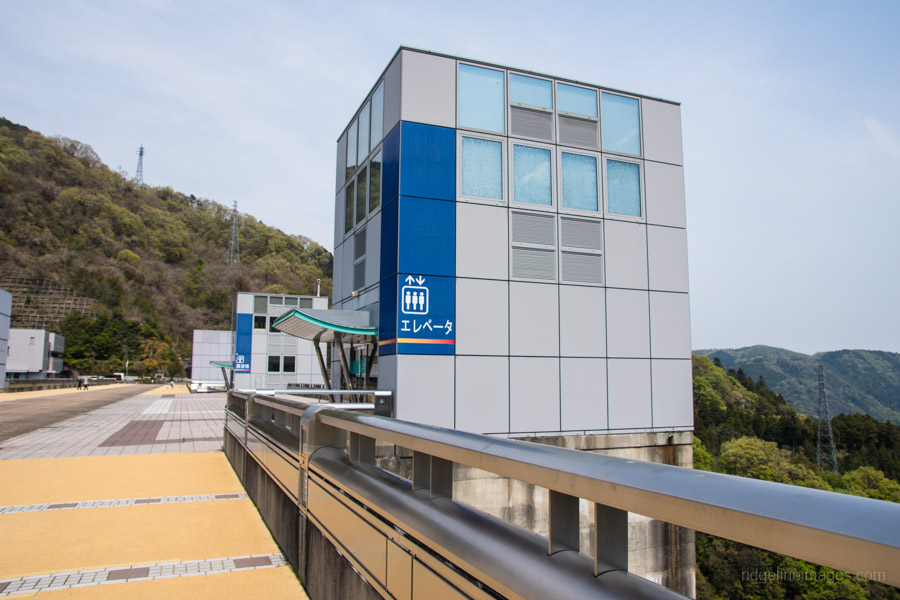
After lunch the trail continues along the ridgeline passing through tracks of cypress (hinoki), cedar (sugi), fir (momi), nutmeg-yew (kaya) and hemlock (tsuga). The final section of stairs from the clearing above the Miyagase Dam 宮ヶ瀬ダム down to the road are eroded and poorly maintained. Once at the bottom you can either ride either the Miyagase Dam “Incline” or an elevator 120 metres down to the Aikawa Prefectural Park. Follow the road above the Nakatsugawa River to the Hanbara 半原 bus stop for the return ride to Hon-Atsugi Station (50 mins, 560 yen).


Ah this brings back a lot of memories. Thank you for posting this article. I really miss Japan and your wonderful site helps keep the dream alive of my return.
I haven’t done a lot of Kanagawa area hikes, but I’m pleased I did this one. I hope to get out to Mt.Nabewari one of these days also. Anyway, thanks for the kind words and for supporting this blog over the years.
Did this one today (early February 2020). Just to update the Trail Notes for others: after
you pass Kawagoishiyama, the trail becomes quite dangerous, I would say. It is very narrow in parts, with precipitous drops either side at times. There are some chains and ropes, but you need to be really, really careful. On the plus side, after passing Mt. Takatori, you’ll come out on a stunning unobstructed vista of jade-green Miyagase Lake with the Tanzawa Mountains as a backdrop, and nice benches to sit and admire the view. Also, the eroded stairs down to the lake have been replaced by new steps, with some ropes in place to help. Hanbara village, with a light green river through it, is picturesque, too. From Hanbara Bus Terminal, buses back to Hon Atsugi Station leave every 20 minutes weekdays; every 30 minutes weekends.
Good to hear they have replaced those hazardous ‘steps’ it was more akin to a death-defying slope when I hiked down. Sounds like the dicier part is now up on the main ridge. Thanks for the update.
Thanks to your blog, I hiked part of this hike in late February.
A part of ridge from Bukka while getting down towards tsuchiyama pass is quite exposed.
It was quite windy that day, and I just wanted to cover that short distance quickly !
Keep the good work up !
Thanks Naresh hope you scored some half decent views from the lookout towers.
As a previous user mentioned, the stairs above the damn have been replaced and are in good condition. As a new hiker in Japan my initial impression is that Japanese trail designers love stairs and do not know what switchbacks are! So many stairs! Today we did a loop clockwise from Aikawa Park to Mt. Bukka and then to Miyagase Dam. We got to the bottom of the damn just in time to see the 6 minute release of water at 2PM which was a nice treat. Overall the trail was in good condition except for one blowdown between the damn and Mt. Takatori, somewhat close to Mt. Takatori. Was a little tricky but I managed to climb over it while my wife removed her pack and went under it. Our gpx track is here: https://www.gaiagps.com/map/?loc=13.3/139.2421/35.5324&pubLink=B0axFTgt9AouKXWoNXUOa8Uj&trackId=deadf26c-a589-4737-a1d7-4737d37d0687