.
Okinomimi オキノ耳 – Mt. Mantaro 万太郎山 – Mt. Tairappyou 平標山
Distance: 25.7 km
Elevation change: 1363 metres
Highest point: 2026 metres
Start: Doai Station (Joetsu Line)
Finish: Tairappyou bus stop
Difficulty: ▅▅▅▅▅▅▅▅▅▅ ❺
Map: Yama to Kogen Chizu 山と高原地図 [No.16 谷川岳 TANIGAWA-DAKE]
GPX TrackKML TrackGSI MAPPDF Topo Map
Crossing the “Mountain of Death”
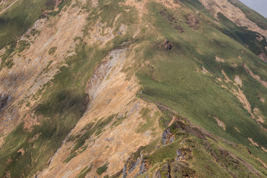
Let’s get this out the way first. I can’t stress it enough: if you decide to do this hike, plan carefully. The trail for the most part follows the Gunma-Niigata prefectural border, Japan’s watershed or dividing ridge between the Sea of Japan and the Pacific Ocean. The area is susceptible to rapid changes in weather which were encountered on this hike even under reasonably stable atmospheric conditions. From Mt. Tanigawa to Mt. Tairappyou the route is highly exposed and apart from the occasional refuge hut there is nowhere to cut and run if the weather turns for the worst. It’s not uncommon for hikers to be held up for extra days at these refuge huts.
A quick online search impresses upon the dangers of Tanigawadake 谷川岳 or mountain of death as it’s also commonly known. Since the 1930s more than 800 people have lost their lives which is four times as many compared to Mt. Everest in the same period on its mountain slopes and precipitous rock walls making it the deadliest mountain in the world. Reasons for this include the changeable weather, easy access to Tokyo and a false sense of security as most peaks along the divide fall under the 2,000-metre ceiling. The result being hikers caught out unprepared in a dangerous environment. It should be said however many of the casualties are from off-trail climbing, backcountry skiing and mountaineering as from a technical standpoint the Mt. Tanigawadake twin peaks pose little real danger.
Day 1: Hiking into No Man’s Land (9.8 km)
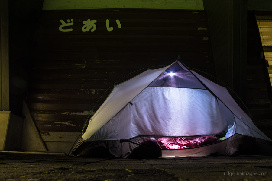
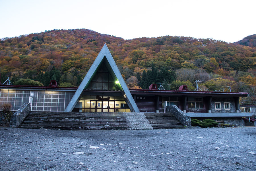
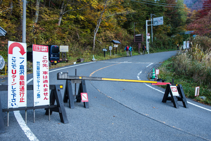
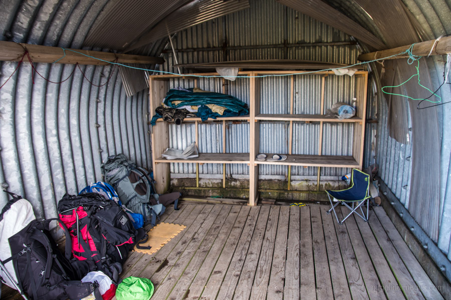
The hike starts out from the depths of Doai Station on the Joetsu Line in Minakami, Gunma. If you plan to arrive at Doai on the first train at 08:33 you’ll need to make an early start as the travel time from Ueno Station is around 3.5 hours or an hour less using the Shinkansen. For this hike I decided to forgo a little comfort and “camp” the previous evening at Doai Station. The advantage being getting an early start the next morning. On the Saturday night I stayed there were six of us sleeping in and around the ticket gate. Note the building lights are kept on all night and being a tourist magnet means ghost hunters dropping by for a look-see into the wee hours. The restroom has been recently refurbished however the tap water is not of drinking quality, so bring enough to hold you over until the first campsite.
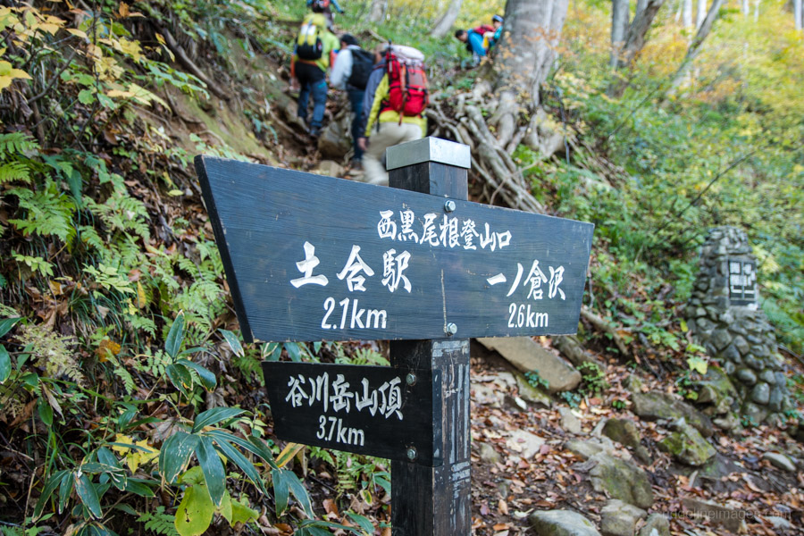
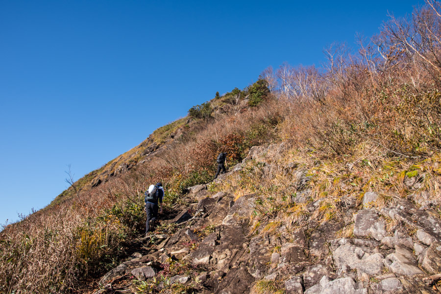
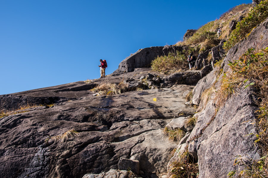
After eating breakfast and packing up, turn right and follow the road towards the Tanigawadake Ropeway 谷川岳ロープウェイ. The ridge known as the Nishikuro-one 西黒尾根 starts a short distance from where they have cordoned off the road. This ridge trail claims one of Japan’s top 3 steep climbs 日本三大急登 but don’t let that discourage you. While the route is steep and has a large elevation gain it isn’t technically difficult with the few short rocky sections well protected by chains. The first landmark to look out for is a transmission tower which takes around 15 minutes to reach. A timely spot to remove a layer or two before the real climbing begins. The forested area of the ridge recedes after 90 minutes of solid hiking, replaced with an alpine zone.
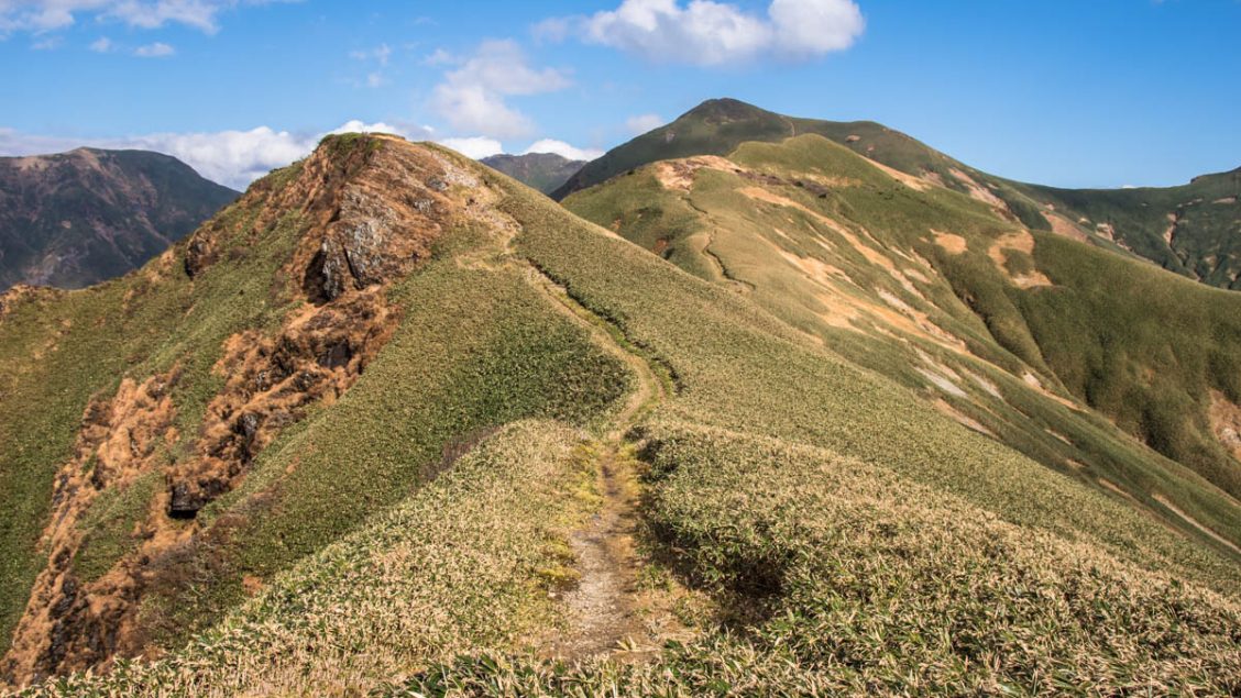
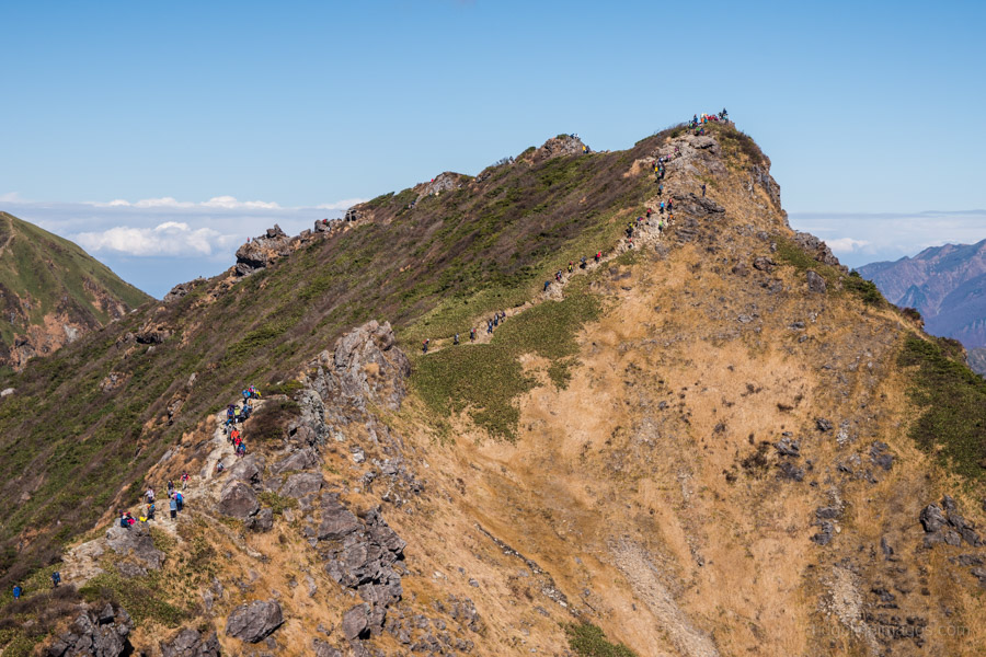
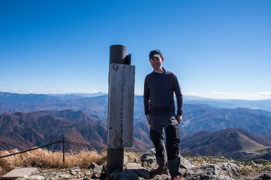
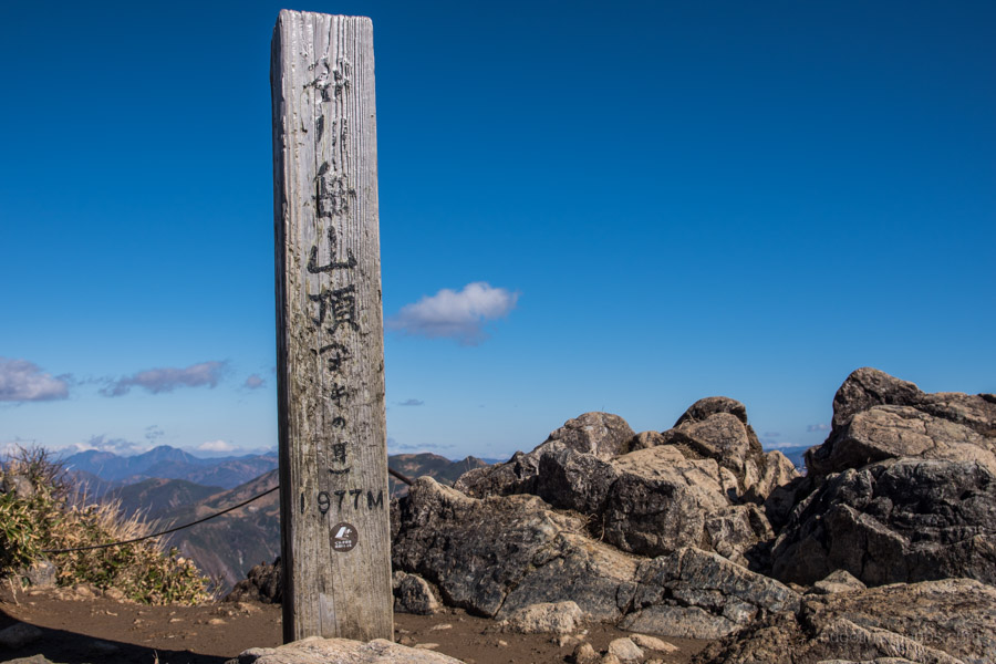
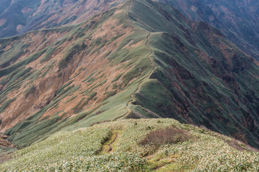
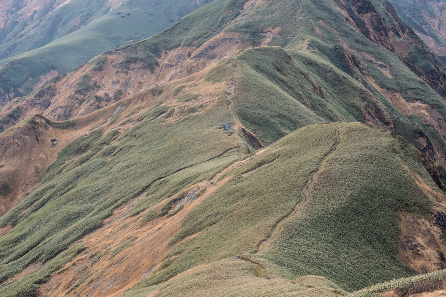
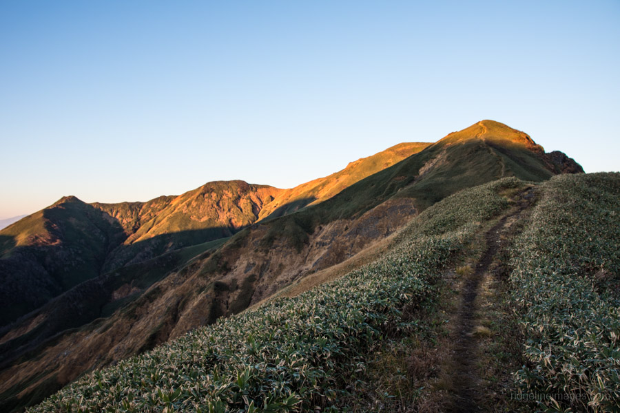
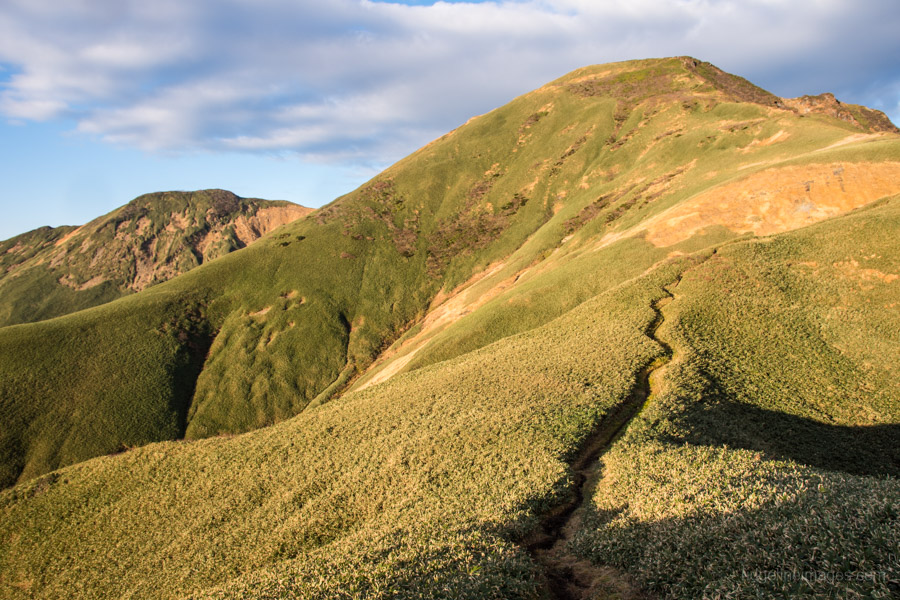
From the ラクダの背 or “back of the camel” the trail zigzags up to the watershed ridgeline. Take note of the yellow painted rocks indicating the safest course. All told it should take around 4 hours to ascend the 1,300 metres from Doai Station to the Kata no Koya 肩の小屋 yamagoya. Drop your pack off at hut before joining the masses that have hiked up from the ropeway via the Tenjin-one route to bag Tomanomimi トマノ耳 (1,963 m) and its loftier neighbour Okinomimi オキノ耳 (1,977 m). Savor the festive lunch atmosphere at hut as for next day and a half as you’ll encounter few, if any, other hikers.
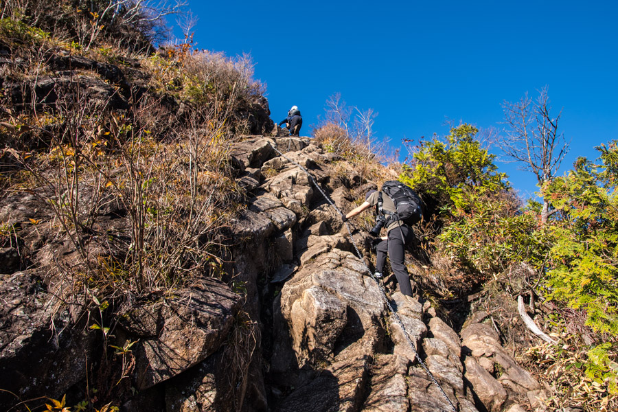
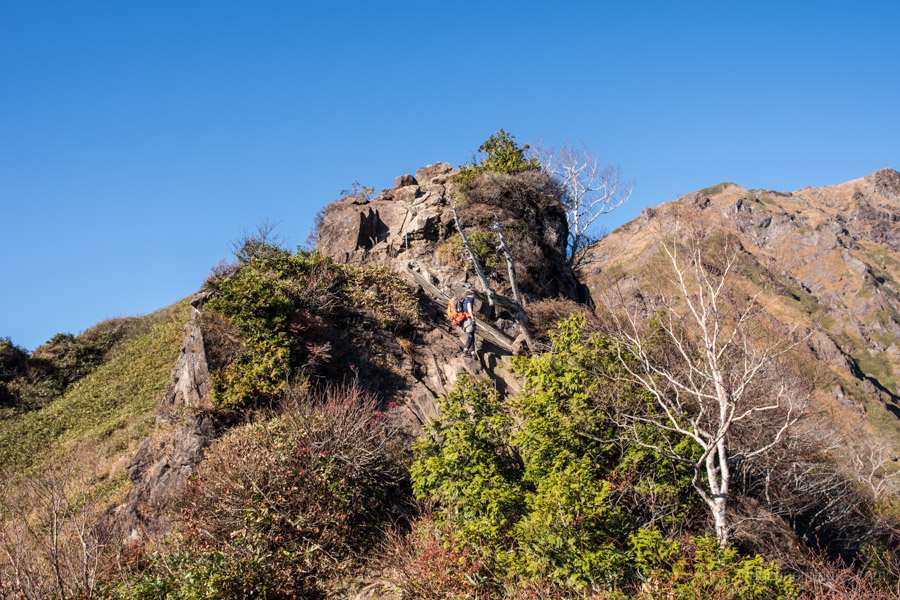
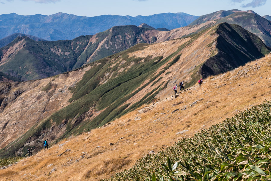
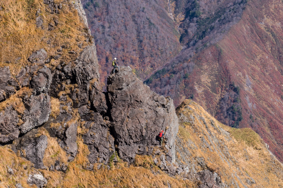
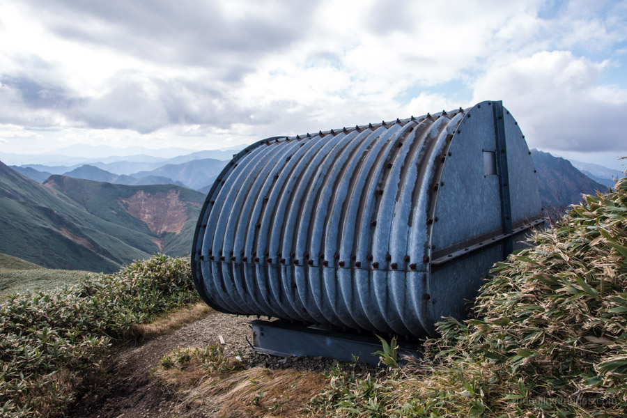
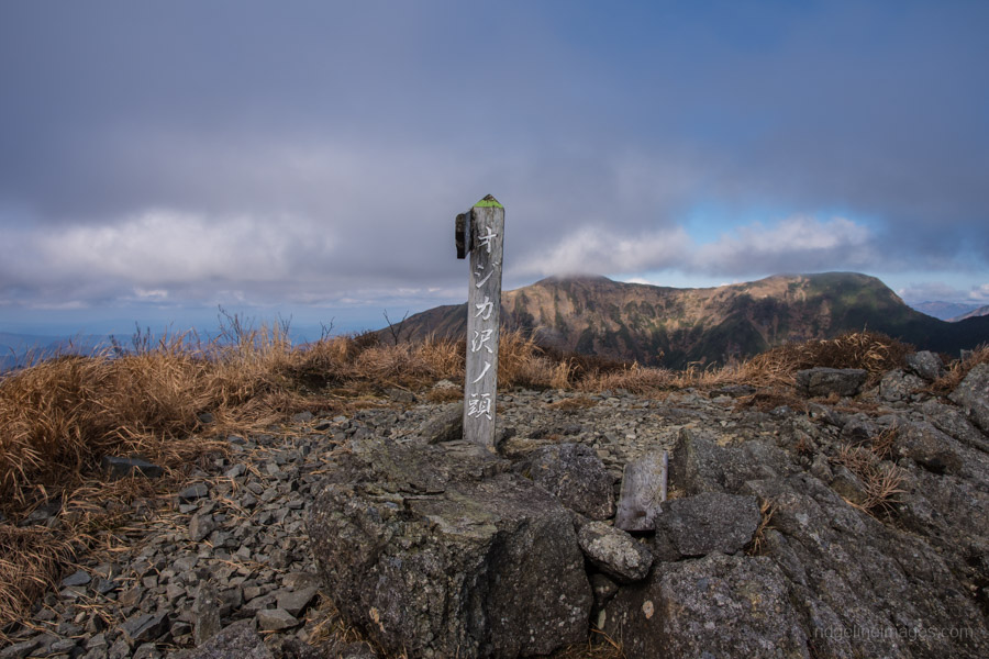
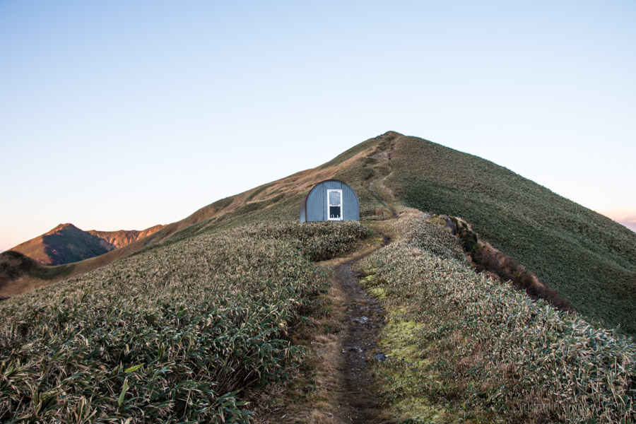
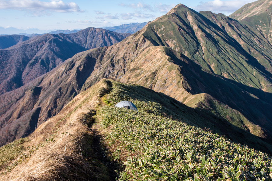
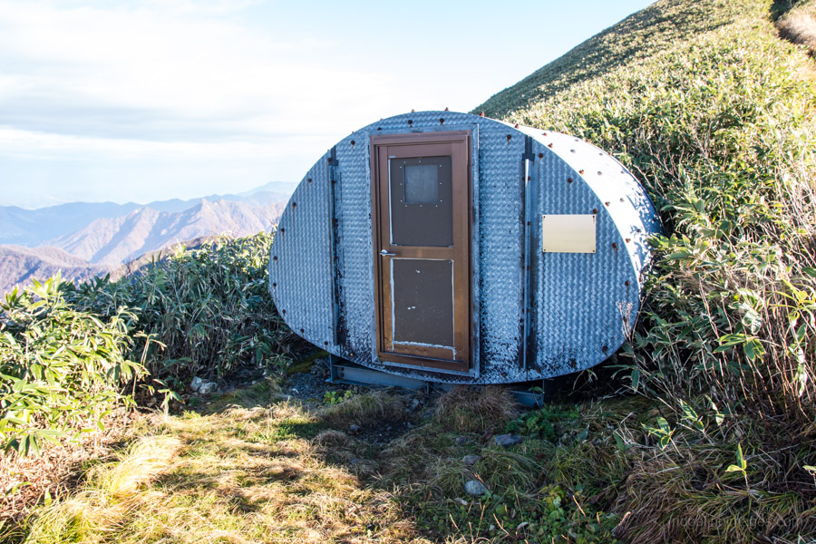
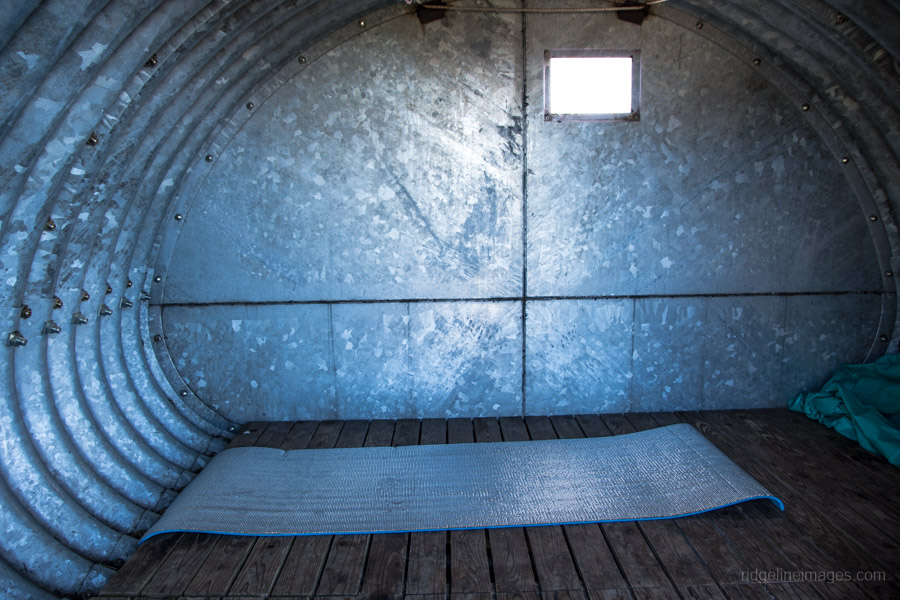
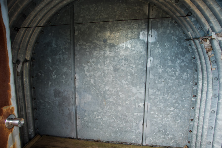
From the Kata no Koya hut you drop a little elevation as the ridgeline makes its way through low-lying Kuma-zasa (Sasa veitchii) bamboo grass. From a distance the path looks almost manicured as it ekes out lengthwise from Tanigawadake to Mt. Tairappyou. The first obstacle is a near vertical chain section which needs to be scaled before arriving at Ojikasawa no atama hinangoya オジカ沢ノ頭避難小屋 the first of four galvanised steel refuge huts dotted along the route. This first one is in particularly dire condition, with rotting floorboards and a musty odour (2-4 people). The day’s goal is the second shelter Oshojiiwa hinangoya 大障子避難小屋 a further 50 minutes along. This refuge hut is easily the most spacious (7 people) and in good nick.
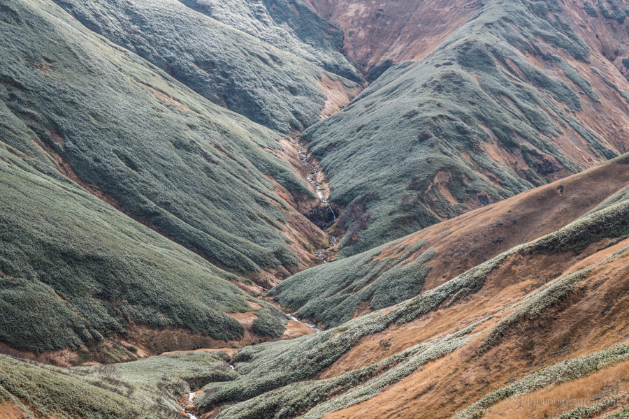
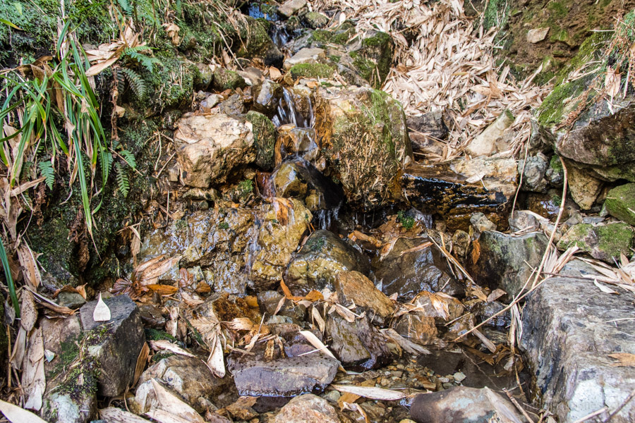
To collect water, take the path on the left just before the hut. Drop your pack and only bring your water bottles as trail is in rough shape. A return trip takes 20 minutes and from all accounts it’s a reliable waterhole. Nearby the hut I spotted a family of Japanese boar (inoshishi) so thought best to treat the water with some Taharmayim chlorine purification tablets. I was later joined by some college students so decided to pitch my tent which was all fine and dandy until the wind threatened to blow me off the mountain. Much to the chagrin of the lads fast asleep inside I had to unceremoniously avail myself of the hut later in the evening. Officially camping is prohibited along the mountain range, but as a precaution carry a tent in case the emergency shelters are fully occupied.
Day 2: Continuing the Manicured Ridge Path (10.2 km)
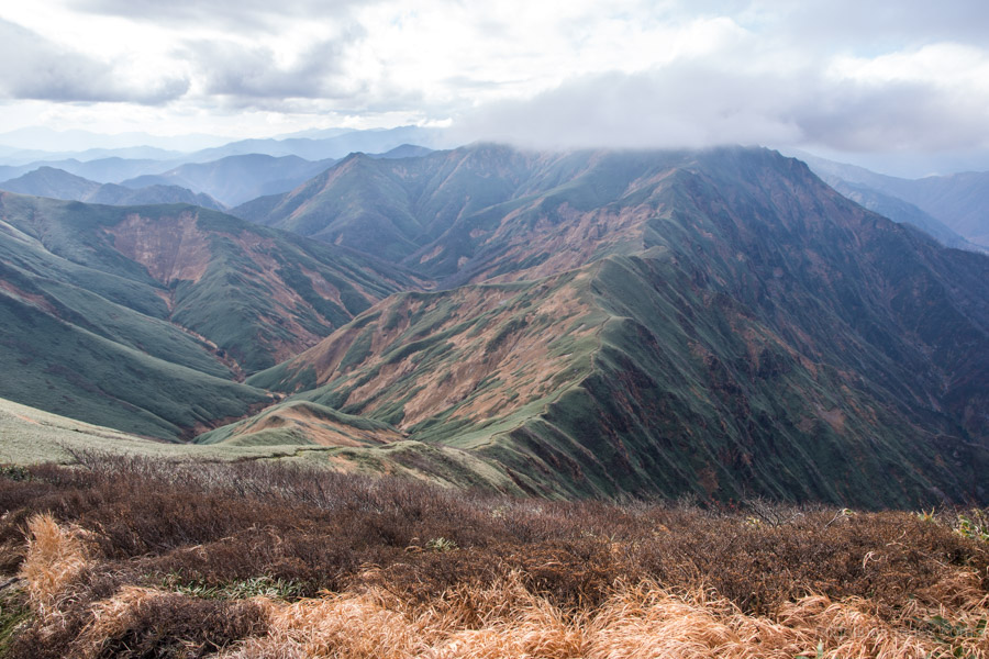
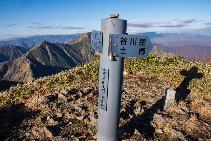
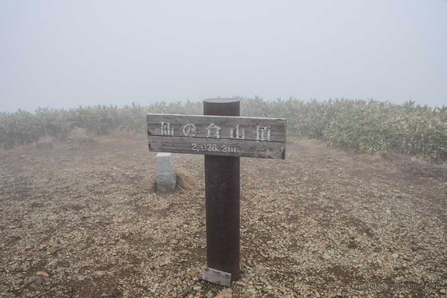
By day break the wind had thankfully died down leaving clear skies in its wake. Mt. Fuji could be seen in the distance, but unfortunately couldn’t capture a decent picture. The morning’s first objective is climbing to the top of Mt. Mantaro 万太郎山 (1,954 m) around 90 minutes away. The true summit a few minutes’ further on delivers a bird’s-eye view towards to Mt. Sennokura 仙ノ倉山 (2,063 m) and lay of the land beyond. After passing the cosy Koshiro hinangoya 越路避難小屋 (5 people) there is a lesser used trail veering down on the Gunma side towards a waterhole.
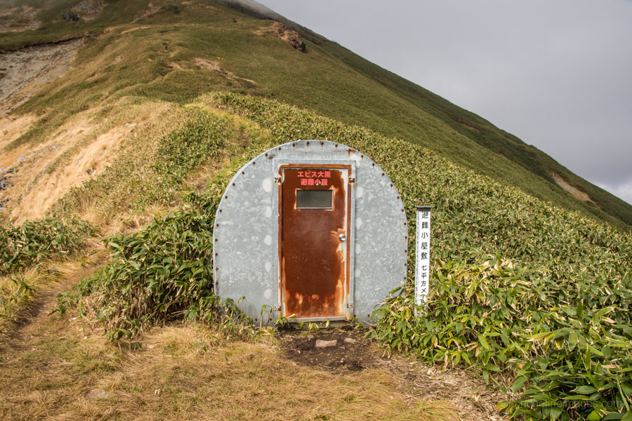
The mountain path continues along the lip of the ridge as it heads up to Ebisu Daikoku where you can catch a glimpse of the hut known as Tairappyou no ie 平標山ノ家 on the opposite ridge. With the weather starting to deteriorate I picked up the pace and opted for an early lunch at the Ebisu Daikoku hinangoya エビス大黒避難小屋 (5 people) which has an uncanny resemblance to 1950s fallout shelter. By the time lunch was over the mist had enveloped Mt. Sennokura the only 2,000 metre class mountain on the range. This also put paid to further views until I began to descend towards the Tairappyou no ie. From Mt. Sennokura the trail is well maintained with alternating wooden steps and boardwalks as the area sees a fair share of day hikers coming up from Naeba.
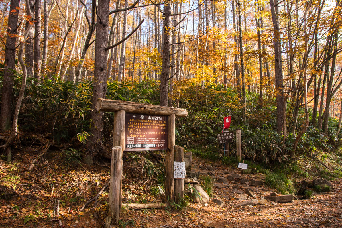
From Mt. Tairappyou it’s possible to continue to continue straight ahead picking up the Matsuteyama course 松手山コース down to the Tairappyou bus stop. Another option is looping around via the Tairappyou no ie which takes approximately the same time.
Day 3: Evening at the Mt. Tairappyou House (5.7 km)
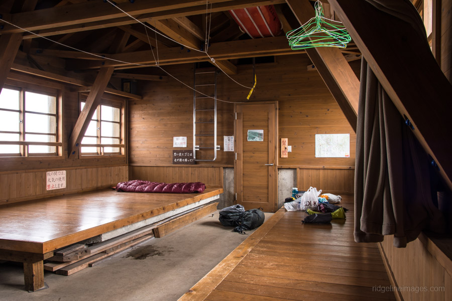
Rather than rushing back to Tokyo I decided to spend the night at the charming Tairappyou no ie. This mountain lodge is unusual in that it offers two of lodging only or sudomari tariffs. First is staying in the main hut with bedding (4,000 yen) or for cheapskates like myself with own sleeping gear there is a second but more basic adjoining lodge (2,000 yen). I considered myself fortunate that I didn’t have to share the place with anyone. It is also possible to pitch a tent and water is freely available.
In typical Tanigawadake style the morning skyline was cloudless but didn’t take long for the mist to set in. The trail from the hut to the Tairappyou bus stop for the return trip to Echigo-Yuzawa Station (32 mins, 600 yen) is in excellent condition which made quick reckoning of the steep terrain down to the forestry road. Once you hit trailhead proper it’s a relaxing and picturesque hike back to the bus stop.


I did this hike but in reverse a few weeks ago. I knew it would be tough based on the videos and blogposts I’ve seen but I underestimated how tough it actually was irl. It was the toughest hike I’ve ever done. I’m just amazed at how there’s a lot of people on YAMAP doing this trail in a single day.
Some parts of the trail are very exposed and the weather does change rapidly. The weather forecasts I’ve used mentioned of 1mm/h rainfall in the afternoon, but I got caught in a pretty heavy rain and hail that I had to use one of the shelters. The hike had me incredibly gassed out but I’m already yearning for the next adventure.