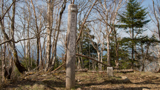
Hiked on May 5, 2022 Jul 3, 2022 . Nanahaneyama 七跳山 – Hinatadani-no-atama 日向谷ノ頭 – Toridaniyama Refuge Hut 酉谷山避難小屋 Duration: 2 days Distance: 30.4 km Elevation change: 1098 metres Highest point:...
David grew up in the eastern suburbs of Melbourne, Australia, with hiking and outdoor pursuits being a major part of his life for as long as he can remember. He has been writing, snapping photos, and sharing his adventures on RIDGELINEIMAGES.com since 2013.
At university, David majored in environmental management and holds a Graduate Diploma of Education. He has been living in Japan for over 15 years, first in Fukushima Prefecture and now in the Tokyo Metropolis. With a love of hiking and photography, he felt the best way to combine the two was a blog to provide some inspiration for others to enjoy the myriad of trails and outdoor offerings on Tokyo’s doorstep. You can follow David on Instagram @ridgelineimages.
Hiked on May 5, 2022 Jul 3, 2022 . Nanahaneyama 七跳山 – Hinatadani-no-atama 日向谷ノ頭 – Toridaniyama Refuge Hut 酉谷山避難小屋 Duration: 2 days Distance: 30.4 km Elevation change: 1098 metres Highest point:...
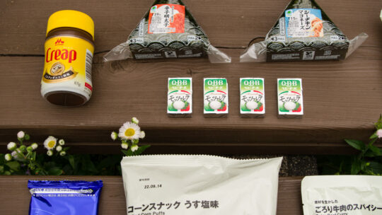
Backpacking Food Ideas and Meal Planning A common question I get is what food I pack for an overnight hike. The simple answer is foodstuffs that I enjoy eating and not too much as food is heavy. In stark contrast to my first overnight hike, when I...
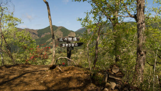
Hiked on Apr 19, 2022 . Kaze no Kamisama 風の神様 – Mt. Koyashiro コヤシロ山 – Mt. Minashi 実成山 Duration: 3 hours Distance: 8.5 km Elevation change: 402 metres Highest point: 609 metres Start: Arai Bus Stop Finish: Arai Bus Stop ...
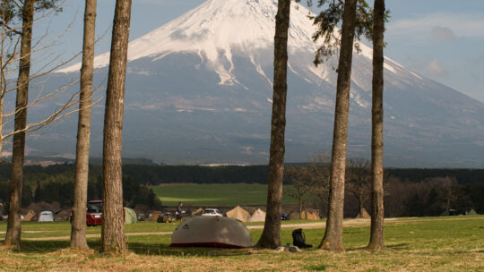
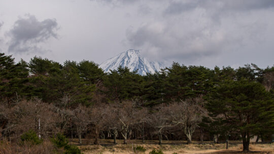
Bask in Fujisan’s Shadow On my latest getaway to try and sneak in one final hike before returning to my teaching post, I spent a night at Fumotoppara campground just a hop, skip and jump away from Mt. Ryugadake. Fumotoppara is located in Shizuoka...
Hiked on Mar 29, 2022 . Stone Buddha 石仏 – Hashita-toge 端足峠 – Lake Motosuko 本栖湖 Duration: 5 hours Distance: 11.1 km Elevation change: 550 metres Highest point: 1485 metres Start: Lake Motosuko Bus Stop (Blue Line) Finish: Lake...
Hiked on Mar 20, 2022 . Mt. Yougaisan 要害山 – Tenguiwa 天狗岩 – Umabikisawa-toge 馬引沢峠 Duration: 4 hours Distance: 11.2 km Elevation change: 228 metres Highest point: 414 metres Start: Miyanohira Station (Ome Line)...
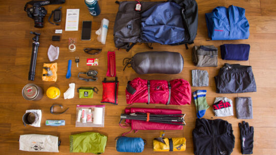
3-Day, 3-Season Backpacking Gear (Updated 2022) It’s been a couple of years since I last whipped out the scales and took inventory of the gear, I take with me on a three-season, three-day hike. Not surprisingly the bulk of the stuff I carry is...
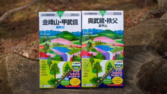
MAPPLE Special Online Maps Campaign Continues in 2022 The map images and contents of this article have been obtained with the permission of the publisher (株式会社昭文社 Shobunsha Publications, Inc.). Like always at the beginning of spring Shobunsha...
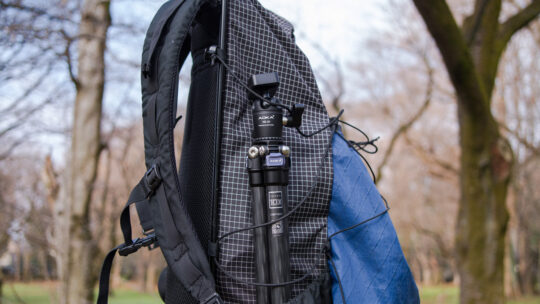
Best Backpacking Tripod for Lightweight Adventures Let’s start with why even bother bringing a travel tripod along when hiking. Many readers no doubt see a tripod as kind of ridiculous luxury especially when the majority weigh something akin to...
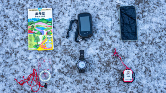
Navigation Toolkit You Need to Safely Hit the Trail Over the years one thing this blog has tried to hammer home probably the most is keeping safe and out of harm’s way on the trail. Even with the best preparation it doesn’t take much for...
Hiked on Jan 30, 2022 Mar 15, 2024 . Warabiyama Lookout 蕨山展望台 – Mt. Fujidana 藤棚山 – Konpira Shrine ruins 金比羅神社跡 Duration: 5 hours Distance: 9.6 km Elevation change: 664 metres Highest point: 1044...
Hiked on Jan 16, 2022 . Maruyama Lookout 丸山展望台 – Ono Pass 大野峠 Duration: 4 hours Distance: 10.3 km Elevation change: 650 metres Highest point: 960 metres Start: Ashigakubo Station (Seibu Chichibu Line) ...

Hiked on Jan 1, 2022 . First Rays of 2022 Above the Sagami River For this year’s hatsuhinode (first sunrise), I decided to skip the customary pilgrimage of heading to a mountain summit like last year, instead picking a quiet spot along an...

Outdoor Bloggers to Follow in Japan (2022) Putting together a list that celebrates the diverse international outdoor blogging community in Japan is something that I have wanted to do for some time. The reason is twofold. If there is one thing just...
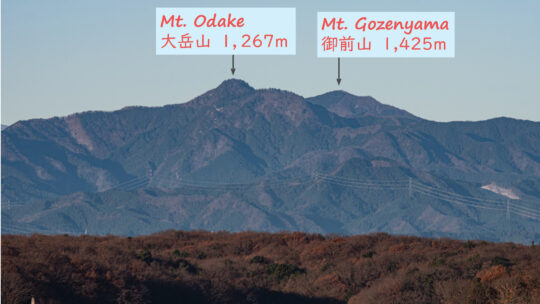
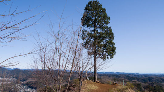
A Panorama of Mountains from Tama Lake in Tokyo. The Tokyo Metropolis sits on the Kanto Plain, the largest lowland area in Japan and home to around a third of the country’s population. To the east, the city is bordered by the Edogawa River and Chiba...
Hiked on Oct 28, 2021 . Mt. Kinpu 金峰山 – Mt. Asahi-dake 朝日岳 – Odarumi-toge 大弛峠 Duration: 2 days Distance: 24.3 km Elevation change: 1089 metres Highest point: 2599 metres Start: Mizugaki-sansou Bus Stop...