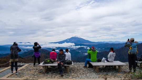
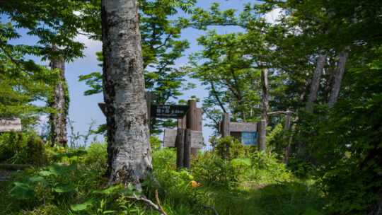
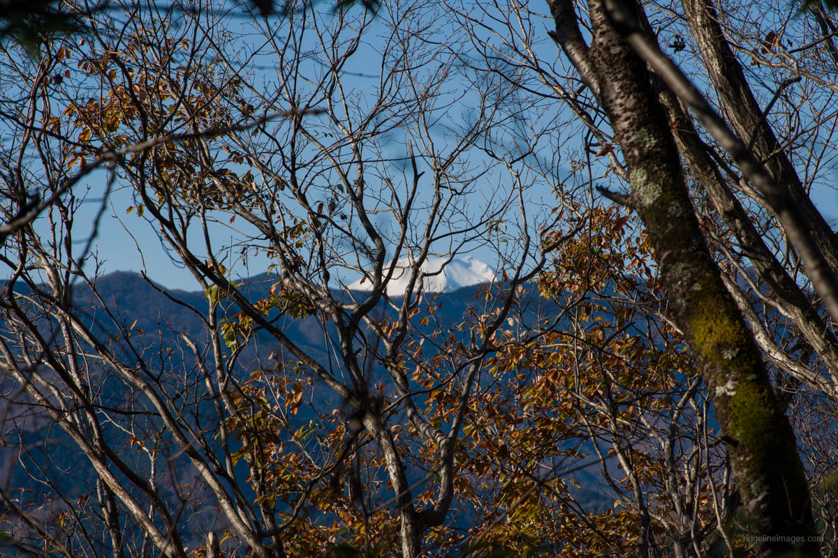
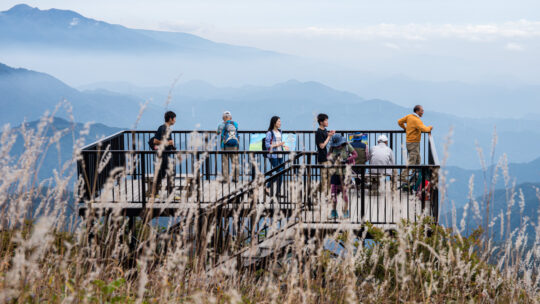
Hiked on Nov 1, 2025 . Mt. Ninoto 二ノ塔 – Mt. Sannoto 三ノ塔 – Mt. Gyoja 行者ヶ岳 Duration: 7 hours Distance: 15.1 km Elevation change: 1161 metres Highest point: 1491 metres Start: Yabitsu-toge bus stop Finish: Okura bus stop ...
Hiked on Nov 1, 2025 . Mt. Ninoto 二ノ塔 – Mt. Sannoto 三ノ塔 – Mt. Gyoja 行者ヶ岳 Duration: 7 hours Distance: 15.1 km Elevation change: 1161 metres Highest point: 1491 metres Start: Yabitsu-toge bus stop Finish: Okura bus stop ...
Hiked on Mar 21, 2025 . Mt. Jinba 陣馬山 – Meio-toge 明王峠 – Sokozawa-toge 底沢峠 Rather than looping back to the Jinba Kogen Shita Bus Stop, this route can also be extended to finish at either Sagamiko Station or Takaosanguchi Station. ...
Hiked on Feb 20, 2025 . Hisari-toge 尺里峠 – Nishihirabatake Park 西平畑公園 Duration: 5.5 hours Distance: 14.6 km Elevation change: 711 metres Highest point: 801 metres Start: Takamatsu-iriguchi Bus Stop ...
Hiked on Dec 10, 2024 . Mt. Myojingatake 明神ヶ岳 – Yagurasawa-toge 矢倉沢峠 Duration: 6.5 hours Distance: 15.7 km Elevation change: 1144 metres Highest point: 1169 metres Start: Tsukahara Station (Daiyuzan Line)...
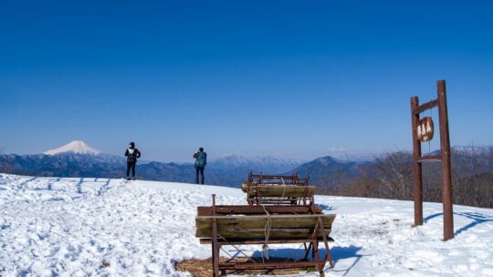
Hiked on Jun 14, 2024 . Nishi Tanzawa Visitor Center 西丹沢ビジターセンター – Gorasawa-deai ゴーラ沢出合 – Aogatake Sanso 青ヶ岳山荘 Duration: 5.5 hours Distance: 11 km Elevation change: 1061 metres Highest point: 1601 metres Start: Nishi Tanzawa...
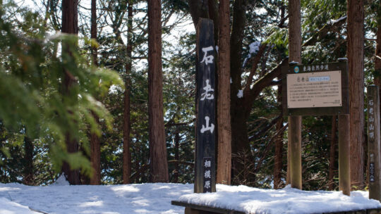
Hiked on Feb 10, 2024 . Kenkyoji Temple 顕鏡寺 – Daimyojin Observation Deck 大明神展望台 Duration: 4.5 hours Distance: 8.5 km Elevation change: 482 metres Highest point: 702 metres Start: Sekirozan Sanpaisha carpark Finish: Sekirozan...
Hiked on Apr 28, 2023 Feb 16, 2025 . Nishi Tanzawa Visitor Center 西丹沢ビジターセンター – Mt. Komotsurushi 菰釣山 – Mt. Takazasu 高指山 Duration: 2 days Distance: 23 km Elevation change: 839 metres Highest point: 1379...
Celebrating 10 Years Blogging in Japan This month, RIDGELINEIMAGES.com celebrates its 10th anniversary. For a decade now, I’ve been snapping pictures, sharing my hikes, adventures, gear selections, and how-tos. It’s hard to believe I’ve been...
Hiked on Dec 7, 2022 . Mt. Hizure-kongozan 日連金剛山 – Mt. Yasaka 八坂山 – Mt. Takara 宝山 Duration: 3.5 hours Distance: 10.4 km Elevation change: 297 metres Highest point: 460 metres Start: Fujino Station (Chuo Main Line) Finish:...
Hiked on Jun 18, 2022 . Daimyojin Observation Deck 大明神展望台 – Lake Sagami 相模湖 The trail via Kenkyoji Temple has been repaired, and it is now possible to undertake the hike as a loop course, starting and finishing at the Sekrozan Iriguchi bus...
Hiked on Oct 23, 2021 . Yaga Station 谷峨駅 – Mt. Ono 大野山 – Yamakita Station 山北駅 Duration: 4 hours Distance: 11.3 km Elevation change: 557 metres Highest point: 723 metres Start: Yaga Station (Gotemba...
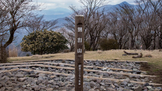
Hiked on Apr 9, 2021 . Futamata 二俣 – Nabewari Sanso 鍋割山荘 – Kinhiyashi 金冷シ Duration: 7 hours Distance: 17.1 km Elevation change: 1096 metres Highest point: 1386 metres Start: Okura Bus Stop Finish: Okura Bus Stop ...
Mountains You Can Climb in a Day from Tokyo Unless otherwise stated, all prices are for one-way travel using local trains and bus services. For residents and tourists alike spending too much time in Tokyo can well make you go bonkers after a while...
Hiked on Jan 1, 2021 . “Hatsuhinode” Capturing the First Sunrise from Mt. Jinba A rite of passage for any hiker worth their salt is to witness a hatsuhinode or first sunrise of the New Year from a mountaintop and yesterday was my turn...
Hiked on Nov 28, 2020 . Umenokidaira 梅ノ木平 – Odarumi Pass 大垂水峠 – Mt. Takao 高尾山 Duration: 6 hours Distance: 17.7 km Elevation change: 480 metres Highest point: 670 metres Start: Takaosanguchi Station...
Kamakura Travel with Ease The nice thing about living in west Tokyo is its easy access to Okutama though heading south to Yokohama and Kamakura can be a drag. However, help is at hand. Enter the little-known Holiday Rapid Kamakura ホリデー快速鎌倉 a...