Another Piece of the Puzzle Let’s rewind to the early 1960s in Tokyo. The city was in the midst of massive transition both socially and economically, a stark contrast to just 20 years before. If you were a Japanese housewife, you pined for the...
Another Piece of the Puzzle Let’s rewind to the early 1960s in Tokyo. The city was in the midst of massive transition both socially and economically, a stark contrast to just 20 years before. If you were a Japanese housewife, you pined for the...
Some Great Places to Explore Around Tokyo There’s lots to love about Tokyo including its vibrant culture, nightlife and atmospheric alleyways full of nook and cranny style eating establishments. However, you need the occasional getaway whether...
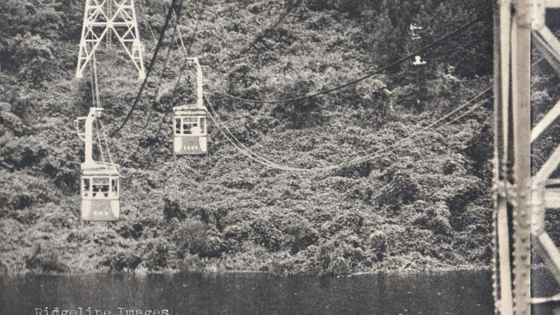
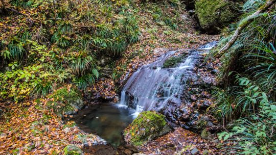
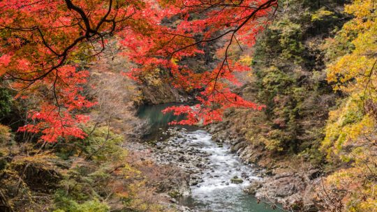
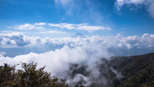
A Short Getaway from Tokyo Even on a freezing cold morning it’s nice just to escape Tokyo even if just momentarily. Today’s walk starts from Miyama Bridge at the far end of Lake Okutama which I visited on a previous winter outing and when I hiked to...
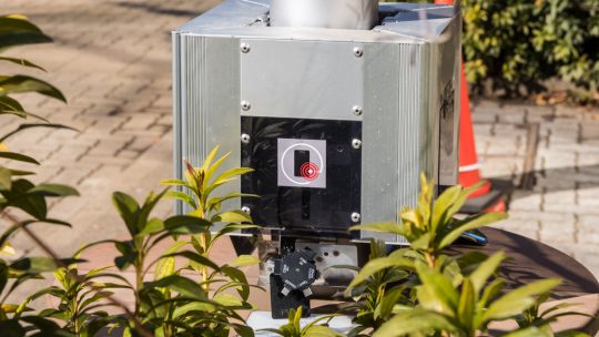
Self-Supporting Solar Stands If your smartphone battery suddenly finds itself out of juice and in desperate need of a recharge the Tokyo Metropolitan Government might just save the day. Over the past two years they have been busily installing...
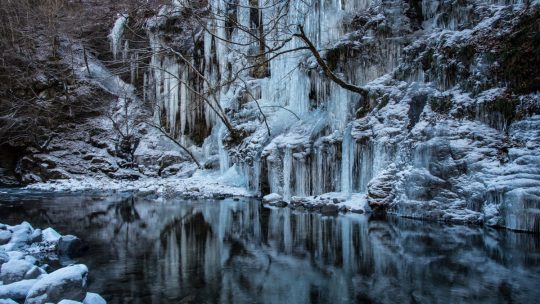
Chichibu’s Natural Ice Sculpture If you’re looking for a day adventure to get your nature fix during the winter months the Misotsuchi no Tsurara 三十槌の氷柱 (Icicles of Misotsuchi) could be just the ticket. Located in a remote pocket in Chichibu, Saitama...

Tokyo Travel with a Dark Twist Like most major cities around the world Tokyo isn’t all beer, salarymen and skittles and has a definite dark side if you care to look. If you’ve checked out most of the traditional tourist attractions or are...
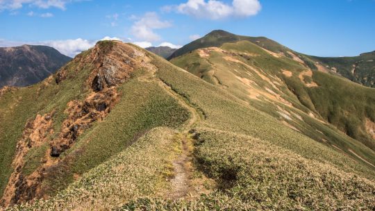
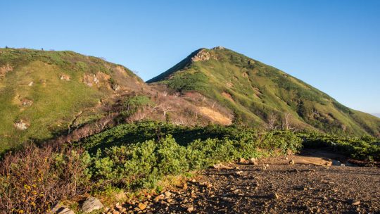
Hiked on Dec 1, 2018 Jan 3, 2022 . Mt. Aso 麻生山 – Mt. Hinodeyama 日の出山 – Tsurutsuru onsen つるつる温泉 Duration: 3.5 hours Distance: 8 km Elevation change: 597 metres Highest point: 902 metres Start:...
Hiked on Nov 20, 2018 May 9, 2022 . Sogaku Ravine 惣岳渓谷 – Lake Okutama 奥多摩湖 Duration: 4 hours Distance: 9.7 km Elevation change: 190 metres Highest point: 540 metres Start: Okutama Station (Ome Line)...
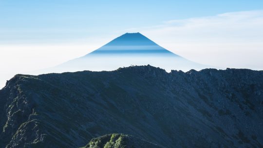
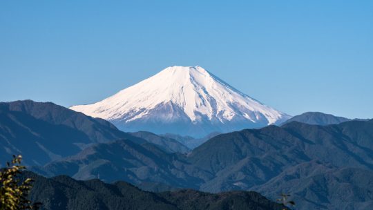
Japan’s Most Prominent Peaks For better or worse, Kyuya Fukada’s 1964 best seller “100 Famous Japanese Mountains” (日本百名山 Nihon Hyaku-meizan) has had a profound influence on modern alpinism in Japan. It has led to a decades long hiking boom...
Hiked on Oct 28, 2018 . Okinomimi オキノ耳 – Mt. Mantaro 万太郎山 – Mt. Tairappyou 平標山 Duration: 3 days Distance: 25.7 km Elevation change: 1363 metres Highest point: 2026 metres Start: Doai Station (Joetsu...
Hiked on Oct 21, 2018 Apr 19, 2022 . Mt. Takao 高尾山 – Mt. Shiroyama 城山 – Mt. Kagenobu 景信山 Duration: 6 hours Distance: 17.2 km Elevation change: 665 metres Highest point: 857 metres Start: Takaosanguchi...
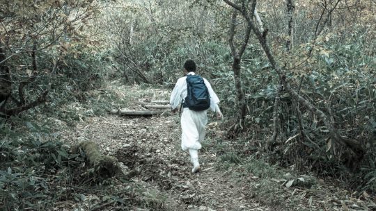
The Weird and Wonderful World of Yamabushi # 1. What is a Yamabushi? Yamabushi also known Shugenja are the mountain-wandering priests of Japan. Their name literally means “those who lie in the mountains” from kanji 山 (yama) mountain and 伏 (bushi) in...
Hiked on Oct 9, 2018 Feb 4, 2021 . Mt. Kaiun 開運山 – Mt. Tenjo 天上山 Duration: 6.5 hours Distance: 17 km Elevation change: 1171 metres Highest point: 1785 metres Start: Mitsutoge Station (Fujikyuko Line)...
Hiked on Oct 2, 2018 . Lake Oze 尾瀬沼 – Mt. Hiuchigatake 燧ヶ岳 – Mt. Shibutsu 至仏山 Duration: 3 days Distance: 32.4 km Elevation change: 1166 metres Highest point: 2356 metres Start: Oshimizu Bus Stop ...
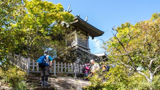
Hiked on Sep 28, 2018 . Tsukuba Shrine 筑波神社 – Mt. Nantai 男体山 – Mt. Nyotai 女体山 Duration: 3.5 hours Distance: 5.9 km Elevation change: 600 metres Highest point: 877 metres Start: Tsukuba Shrine bus stop ...
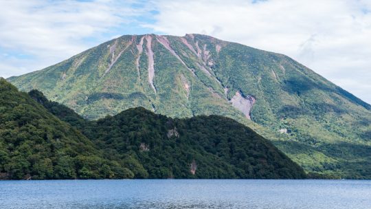
Hiked on Sep 22, 2018 . Shobugahama Campground 菖蒲ヶ浜キャンプ場 – Senjugahama 千手ヶ浜 Duration: 2.5 hours Distance: 11.3 km Elevation change: 80 metres Highest point: 1295 metres Start: Shobugahama Campground Finish:...