.
Makihatayama Refuge Hut 巻機山避難小屋 – Mt. Makihata 巻機山
Distance: 16.3 km
Elevation change: 1372 metres
Highest point: 1967 metres
Start: Shimizu bus stop
Finish: Shimizu bus stop
Difficulty: ▅▅▅▅▅▅▅▅▅▅ ❹
Map: Yama to Kogen Chizu 山と高原地図 [No.15 越後三山 ECHIGO-SANZAN]
GPX TrackKML TrackGSI MAPPDF Topo Map
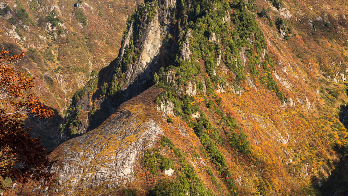
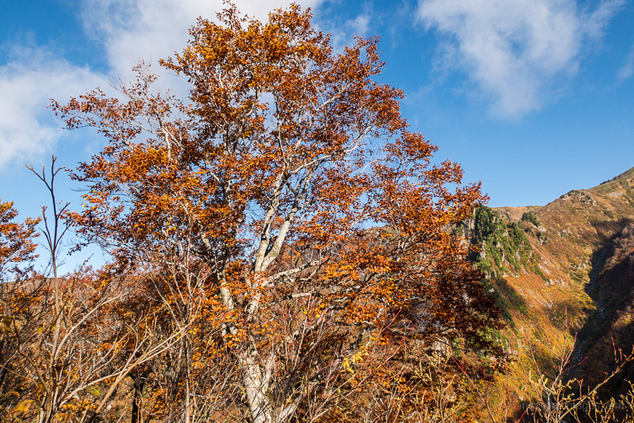
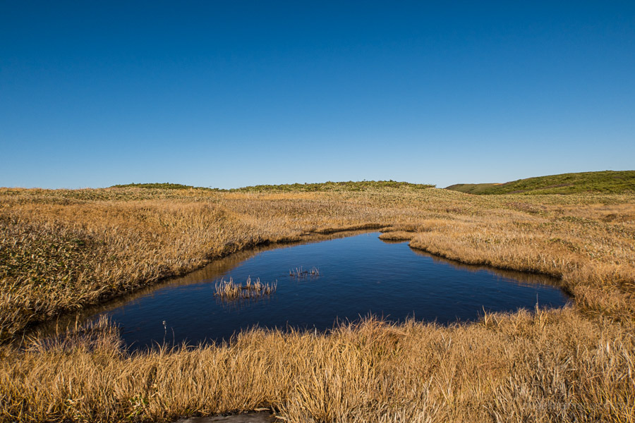
Vast Grasslands and Limpid Ponds
Mt. Makihata is a broad open peak dotted with grasslands, flower meadows and ponds on the border of Gunma and Niigata. It has been selected as one of Japan’s 100 Famous Mountains. While day hikes are possible provided of course you have your own wheels a better strategy is to spend a night at the excellent refuge hut below the summit. Due to lingering snow means climbs are best left until at least June.
Day 1: Foothills Swathed in Primeval Forest (9.8 km)
First up Mt. Makihata 巻機山 is not recommended as a day trip from Tokyo. In fact, even if you were to catch the first shinkansen from Tokyo Station you would still miss the first morning bus by around 10 minutes as the bus timetable aligns with trains arriving from Nagaoka. Instead what I did was catch local trains to Muikamachi 六日町駅 arriving at 12:36 which meant only waiting one hour for the connecting bus to Shimizu 清水 (45 mins, 480 yen). If you’re pushed for time taking taxi could also be an option. The single bus stop is located outside the east exit. I also suggest paying a visit to the adjacent supermarket and stocking up on water as there is a sign at the campground advising not to drink the untreated water.
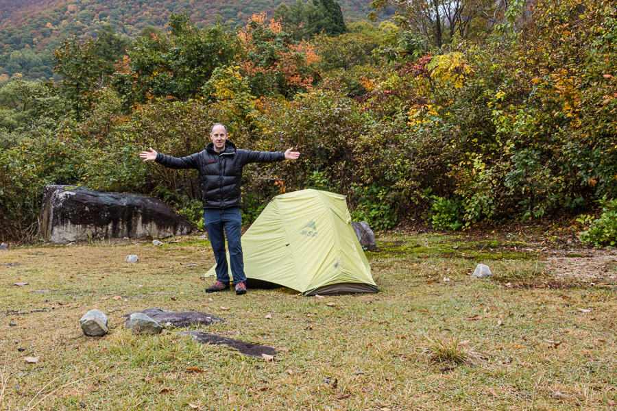
In typical fashion I was the only person riding the bus which flanks the Nobori River on the right and the Mikuni Mountain Range 三国山脈 which rises abruptly on the left. From the Shimizu bus stop follow a minor road uphill until you reach a sign pointing to the Makihatayama Campground 巻機山麓キャンプ場. The spacious campground set across multiple levels just beyond a small bridge 30 minutes’ walk from the bus stop. Officially it costs 600 yen a night to camp although it was unclear how and where to pay.
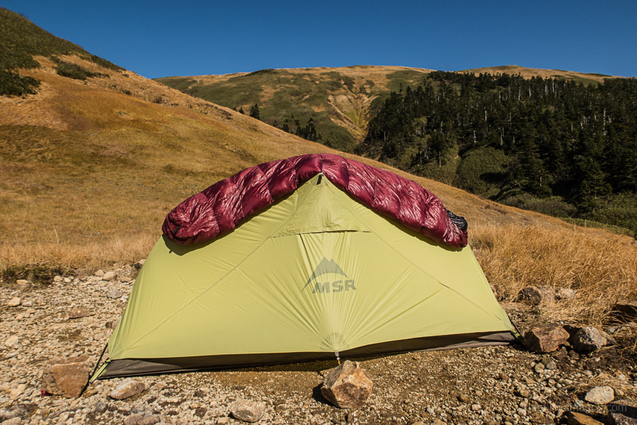
The damp conditions plus the fact the campground rests beside a river caused ketsuro (condensation) hell. After many years of faithful use, I think my MSR Hubba HP tent is finally due for replacement. After breaking camp I headed up to the trailhead proper around 6:30am expecting to be one of the first hikers. Evidently, far from it based on the number of cars that had materialised overnight. I guess to be expected owing to the glorious autumnal weather. As a word of caution there are numerous warnings about not attempting the Nukubi course ヌクビ沢 which while not technically closed is poorly maintained and foolhardy to try especially after rain.
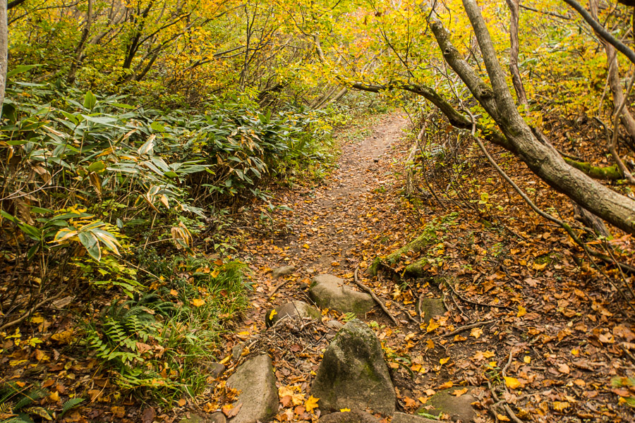
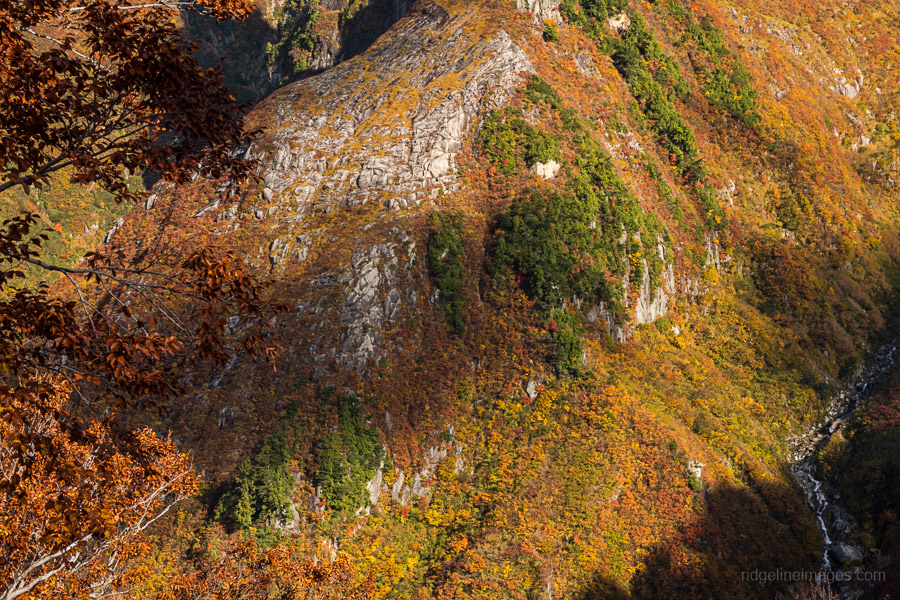
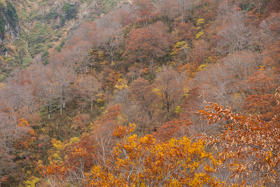
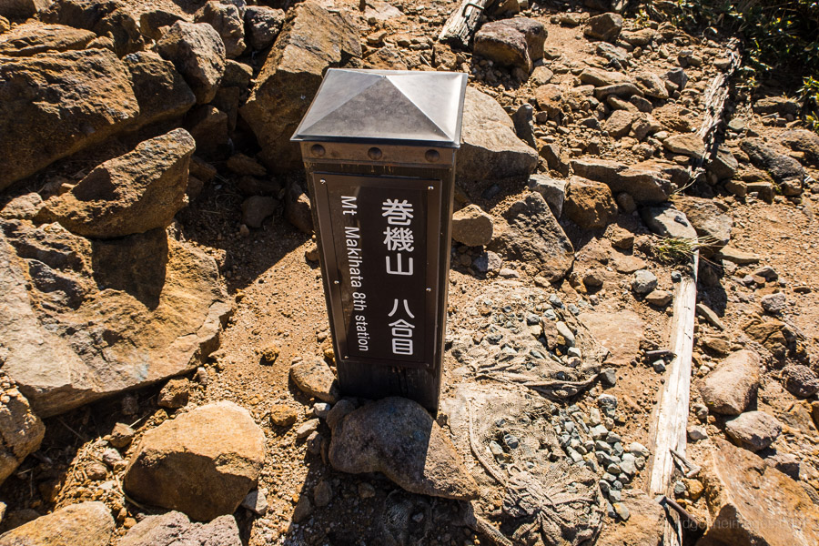
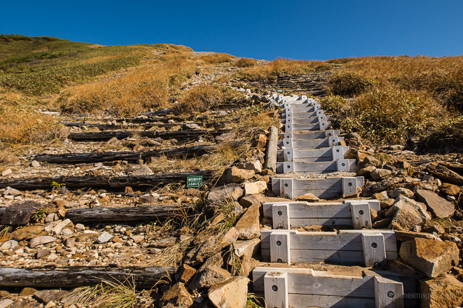
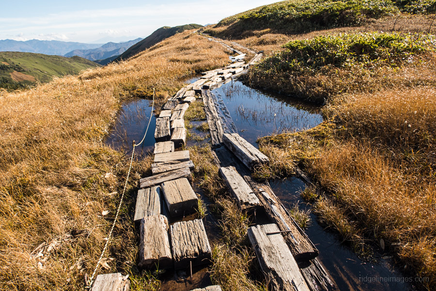
The main ridge route is divided into 10 stations (10合目) with an elevation change of just over 1,200 metres from the Sakurazaka carpark to the summit. Up to the 3rd station the climb is relatively gently but steepens from the 4th station onwards. The trail passes through stunning beech forest opening out at the 5th station with a dazzling view of the Tengu-iwa 天狗岩 alongside the Nukubi River making a great spot to take a breather. Not long after the 6th station the tree line recedes. From the eroded hillside a little further ahead you can make out a false summit above and a view back down to the main road below. From here the trail zigzags through dense shrubbery before picking up a flight of wooden steps to the upper ridgeline.
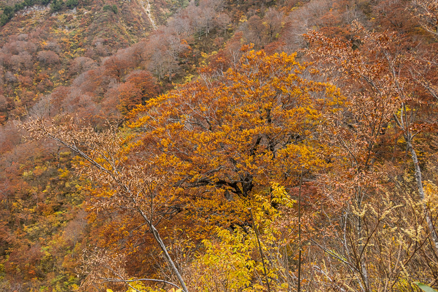
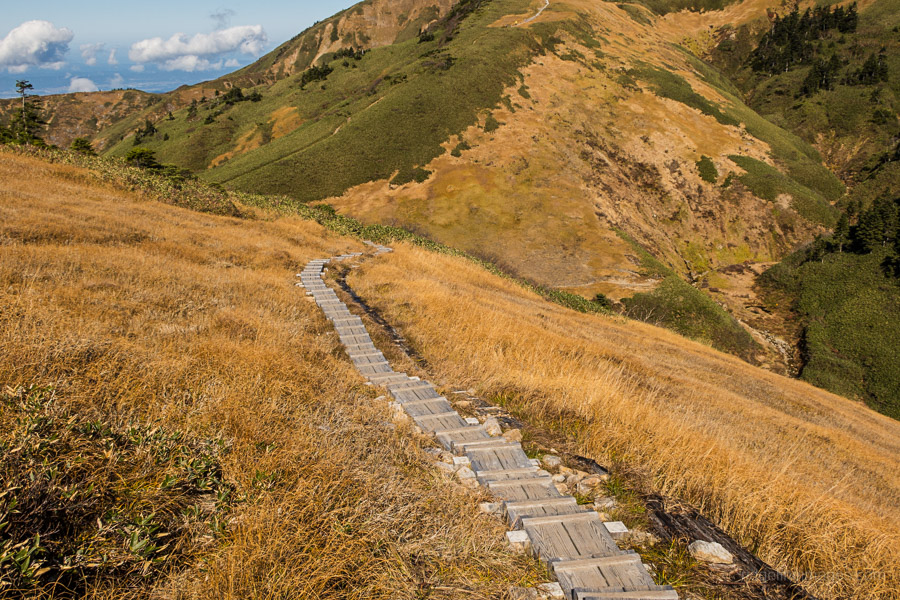
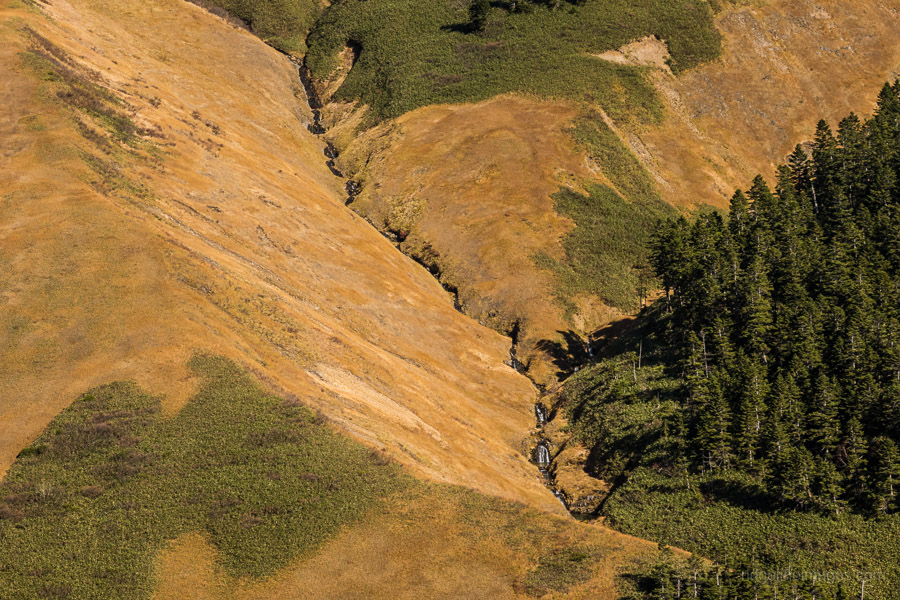
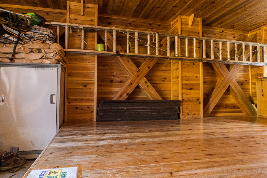
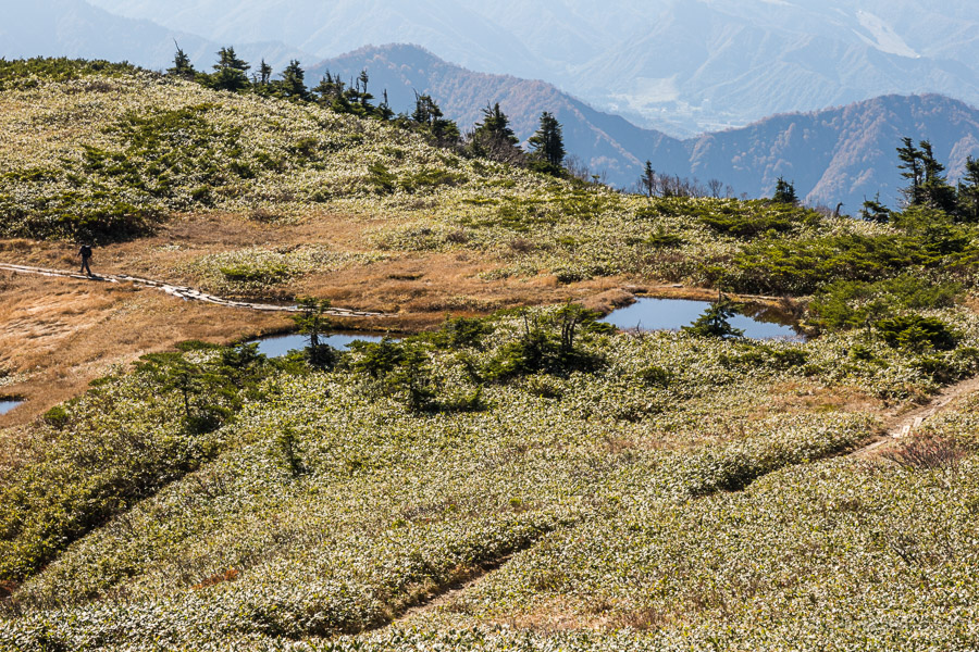
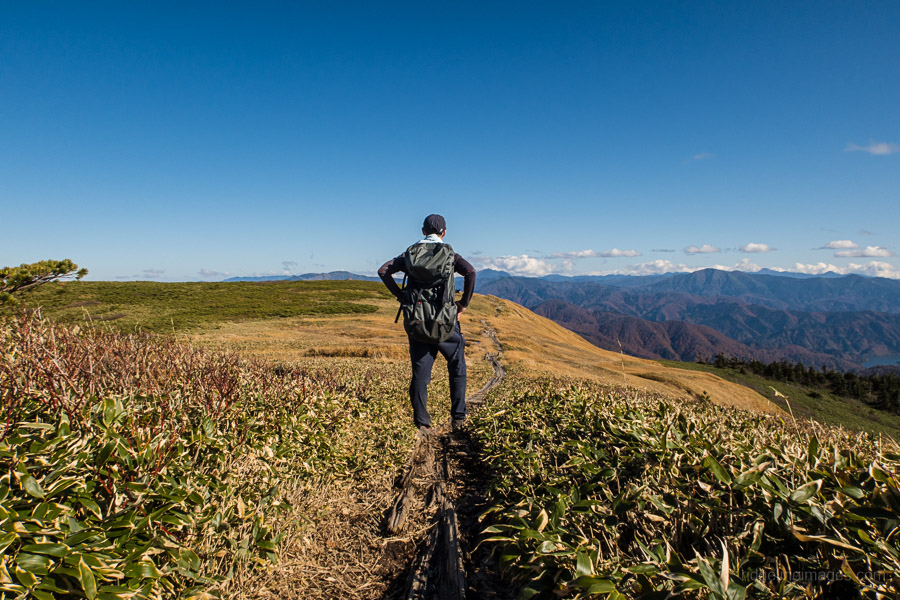
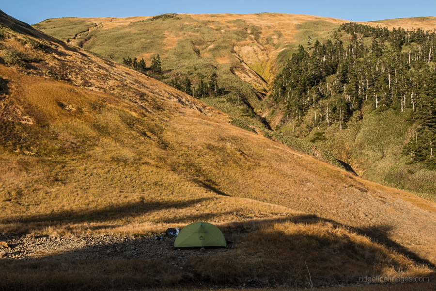
In the autumn, the hillside is a patchwork of pine trees, Kuma-zasa (bamboo grass) and native grasses. Around 10 minutes further on you will arrive at the Makihatayama Refuge hut 巻機山避難小屋 (30 people). This double storey unmanned hut is exceptionally clean making it popular with hikers looking to split the hike over two days. Flush the toilets by pedalling a bicycle for 30 seconds! There is also a small campsite downhill from the hut with space for approximately six tents. A reliable waterhole is a 5-minute walk.
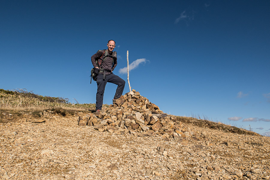
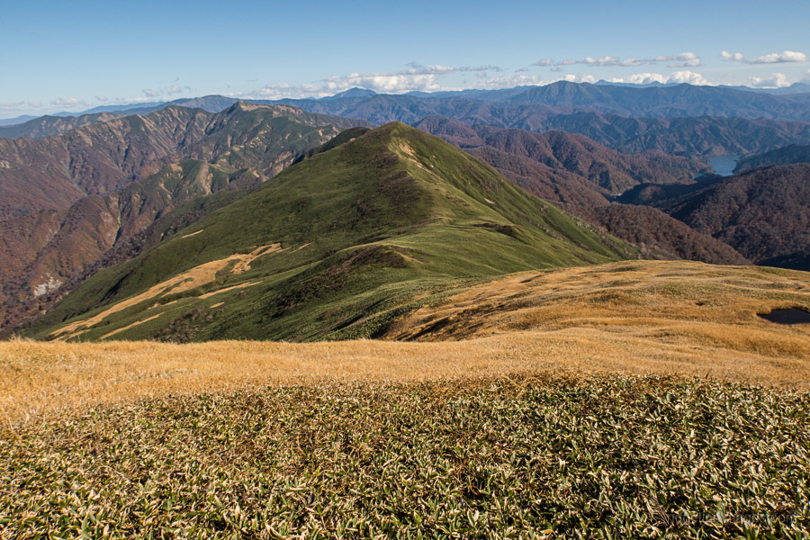
From the refuge hut it takes around 40 minutes to reach the summit of Mt. Makihata (1967 m) note the true summit is a further 10 minutes away. Most probably this was done to minimise trail erosion. The rough-hewn benches make a good place to take lunch. To escape the crowds and enjoy some of the best scenery continue across to Ushigatake 牛ヶ岳 (1961 m). The trail passes through flat alpine meadows interspersed with limpid ponds. From this remote point enjoy views of Mt. Tanigawa, Mt. Hotaka and Mt. Shibutsu. When your ready to head off repeat the route back to the refuge hut.
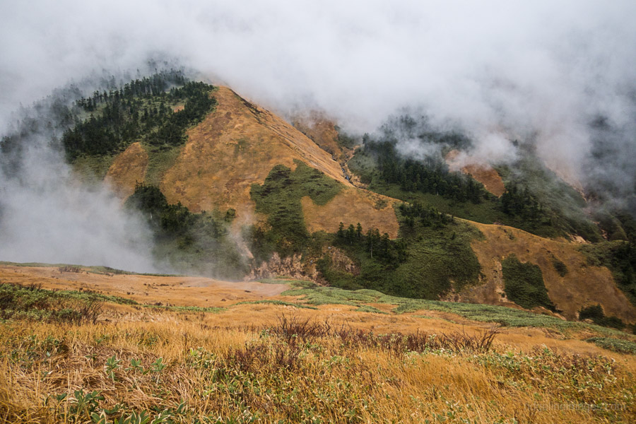
Day 2: Mist Envelopes the Mountain (6.5 km)
Before nightfall it had been very still with the temperature dropping to 3 degrees by 5 pm. Not long after snuggling into my sleeping bag the dreaded wind picked up. It was almost an identical repeat of last year on Tanigawa where I had to make an impromptu tent break down and head for the safe confines of the hut. Thankfully, this time no one was sleeping on the ground floor.
Unlike last year the wind was still gusting at daybreak along with a blanket of fog. Navigationally this was not a problem as the trail is well marked. The weather conditions improved after passing back over the ridgeline. Getting back down is just a matter of retracing your steps all the way back to the bus stop. Take care in the wet as the clay ridden trail can be as slippery as buggery.


Great write-up. This really is a mountain for all seasons. The normal route, as described here, also makes a very good ski-tour as long as there’s snow to the lower slopes (beware avalanches, though). In a good winter, you may find the refuge hut buried up to the eaves. And there is a fine sawa-nobori climb up Komeko-sawa. Not too technical, but be careful on the slippery upper reaches.
Thanks, it was a really enjoyable hike, especially in the autumn. I knew about the Nukubi course but the Komeko-sawa (米子沢) didn’t get a guernsey on the Yama to Kogen map though did find some hike reports on YamaReco. Looks stunning and definitely one for adventurer seekers. I would suggest anyone considering this route come equipped with a helmet and auxiliary rope to ensure a safe ascent. I am also guessing like the Nukubi-sawa snow remains in the valley until early summer.
David,
Thanks for the always informative blog!
I’m a little confused by this write up. Did you spend 2 nights and 3 days here?
Is it feasible to hike to the hut on the first day, stay overnight, then summit and head back on the second day?
Thanks!
That’s right Alex, I spent one night at the Makihatayama Campground and second night at the refuge hut below the summit. If you’re driving it’s feasible to hike to the hut on the first day and possibly even summit as it isn’t too far away. On the other hand if you’re relying on public transport you’ll have to spend an extra night or fork out for a taxi from Muikamachi Station. If there’s a couple or more of you taking a taxi is probably the way to go.
Good work warning people from attempting the Nukubi Trail. I did this “option” about 10 years ago, after a rain no less, and it was perhaps the most harrowing 3 hours I can remember. The drops along the traverse are huge, and the trail was not even as wide as my shoe in some spots. And once this traverse is negotiated, then the trail goes through a canyon with severe rockfall issues. It was like getting shot at. One pebble finally winged me on the elbow, fortunately doing no real damage.
Clearly the Japanese guide book I was using was several decades out of date, since it had the Nukubi Trail as a viable option. Should have noted all those fresh warning signs 😉
I’ve read that trail is a real doozy so thanks for reminding any would-be daredevils to steer well clear. Your description could well be the basis for a survival drama film!
Thank you for the write up. Inspiring, as always!
Cheers for that RC and for taking the time to have a read.
This is going on my near-term bucket list now. I’m close enough that I can drive up and back in a day, I think. Thanks for the inspiration.