.
Jinzasan 神座山 – Mt.Shakagatake 釈迦ヶ岳 – Shindo Pass 新道峠
Distance: 18.4 km
Elevation change: 1028 metres
Highest point: 1793 metres
Start: Himine jinja mae Bus Stop
Finish: Kawaguchiko Natural Living Centre Bus Stop
Difficulty: ▅▅▅▅▅▅▅▅▅▅ ❹
Map: Yama to Kogen Chizu 山と高原地図 [No.34 富士山 FUJI-SAN]
GPX TrackKML TrackGSI MAPPDF Topo Map
Fujisan, Lake, Shrine, and Bear!
Rising above the northern shores of Lake Kawaguchiko finds Mt. Kurodake the highest of the mountains surrounding the Fuji Five Lakes (second highest being Mt. Mitsutoge). The mountain has numerous approaches with the lion’s share of climbers setting off from Tenkachaya and Mitsutoge-iriguchi. This hike chooses a somewhat unorthodox tack starting with a bus ride from the Chuo Main Line to the foothills of the Misaka Mountains, sleeping out near the summit and finishing the following day at Lake Kawaguchiko. Although I have described the route as a two-day hike, it can also be completed in one day provided you get an early start.
Day 1: A Tough Climb Culminates with a Spectacular View (11.4 km)
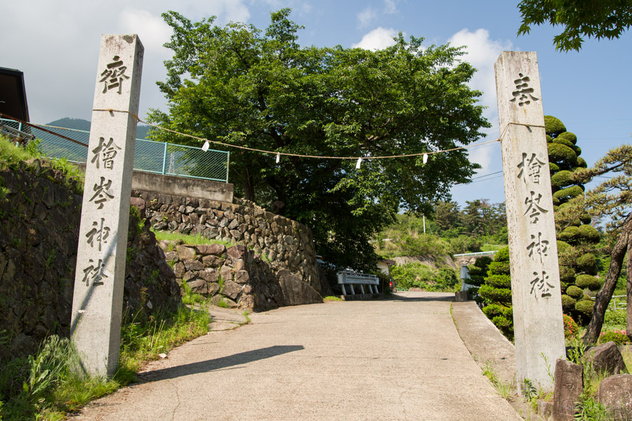
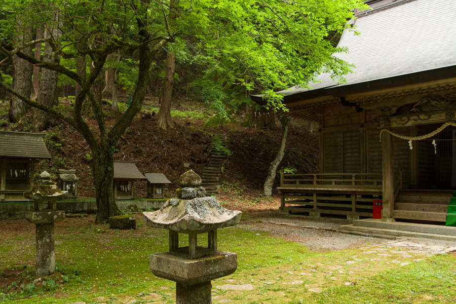
From Takao Station take a Chuo Main Line bound train for Kofu and Matsumoto and get off at Isawa-Onsen Station 石和温泉駅. Head out the south exit and around to bus stand 5. From here get on a bus bound for Mount Fuji Station 富士山駅 and alight at Himine jinja mae 檜峯神社前 stop No. 239 (24 mins, 590 yen). The train arrived at 08:02 with the bus scheduled to depart one minute later, thankfully though it was fashionably late. At the bus stop look for two stone columns on the opposite side. Follow the paved road uphill and across the busy Misaka-michi to an unlocked gate. From here it takes about an hour to the quaint Himine Shrine 檜峯神社 encircled by enormous Japanese cypress. Look for a sign on your right that allows you to bypass a section of road as you near the shrine.
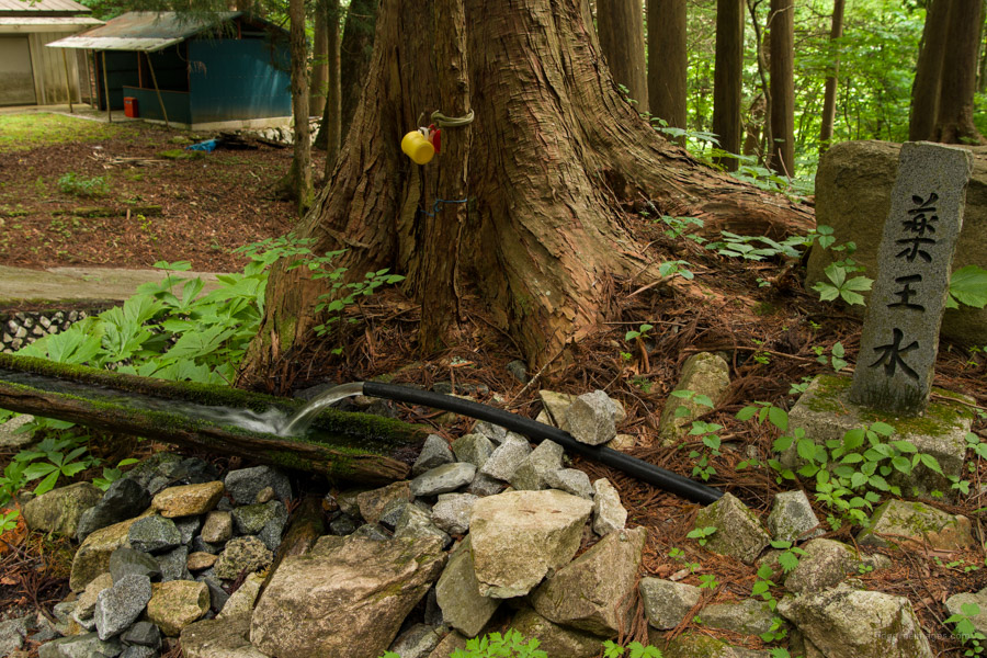
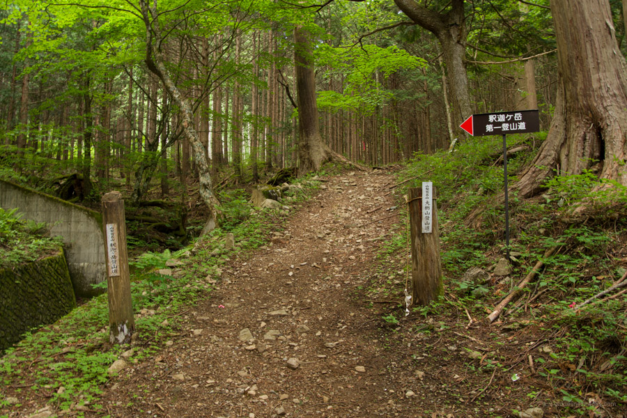
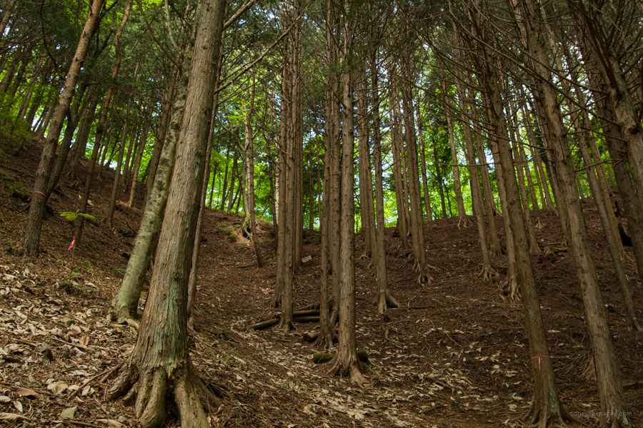
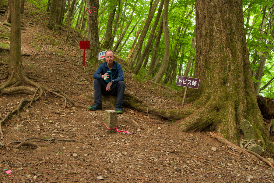
In front of the shrine there is a water hole called Yakuosui 薬王水 where you can replenish your reserves. If you intend on camping out fill up your bottles as there isn’t any at the summit nor for the first few hours, the following day. As a point of reference, I carried five litres which was sufficient. The Himine Shrine also marks the trailhead proper. The trail climbs gently through plantation forest to Tobis Pass トビス峠. Around halfway up I heard a rustling sound in the distance that turned out to be a Japanese black bear foraging in the undergrowth! Not sure if it saw me but soon scurried away. The first and hopefully last tsuki no waguma ‘crescent moon bear’ I’ll bear witness to on a hike (pun intended).
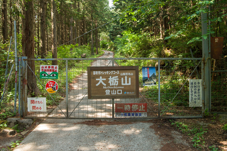
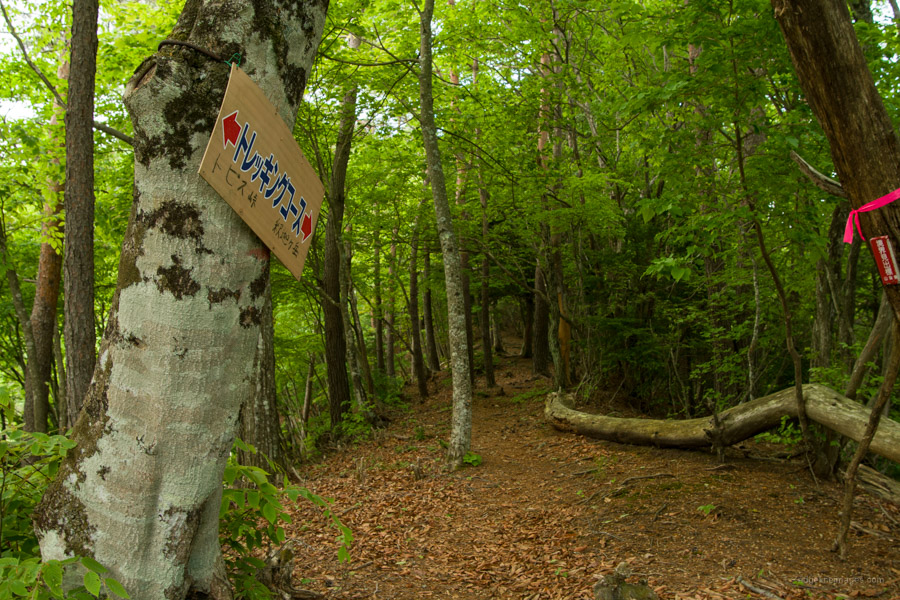
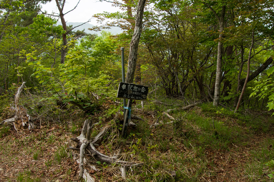
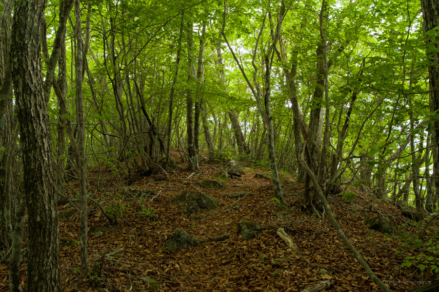
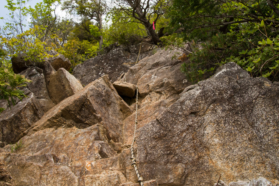
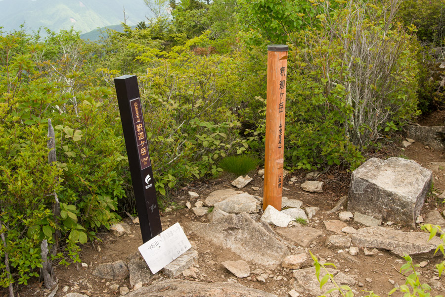
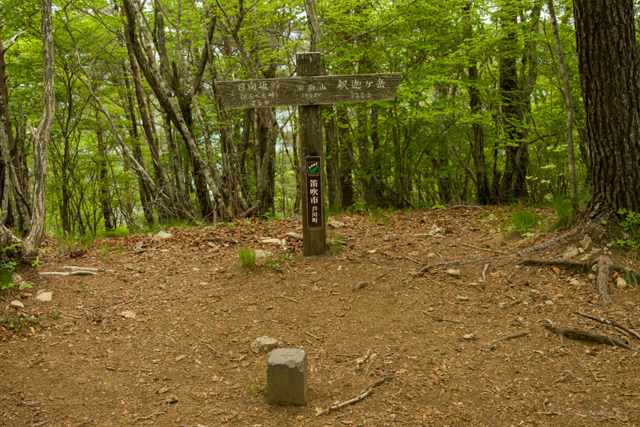
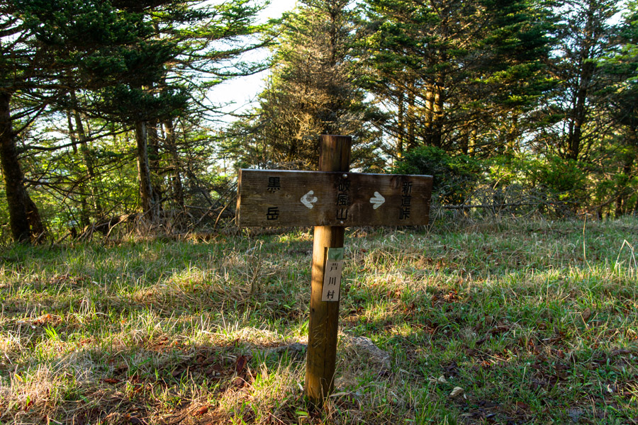
For the eager amongst you consider a side trip to Odochiyama 大栃山 otherwise take a breather before tackling a steep ascent to Mt. Jinza 神座山 (1474 m). The broad-leaved forest around 1,500 metres elevation had plenty of greenery a remarkable contrast to just three weeks earlier at Mt. Toridani where it was withered still from winter. In good weather views of Fujisan can be had from the summit. Along the ridgeline from Mt. Jinza to the cone-shaped Mt. Shakagatake 釈迦ヶ岳 (1641 m) there are a lot of small ups and downs. The final push to Shakagatake includes some minor scrambling protected with fixed ropes though can otherwise be climbed maintaining three points of contact. Near the summit there is a nice view back to Tobis Pass.
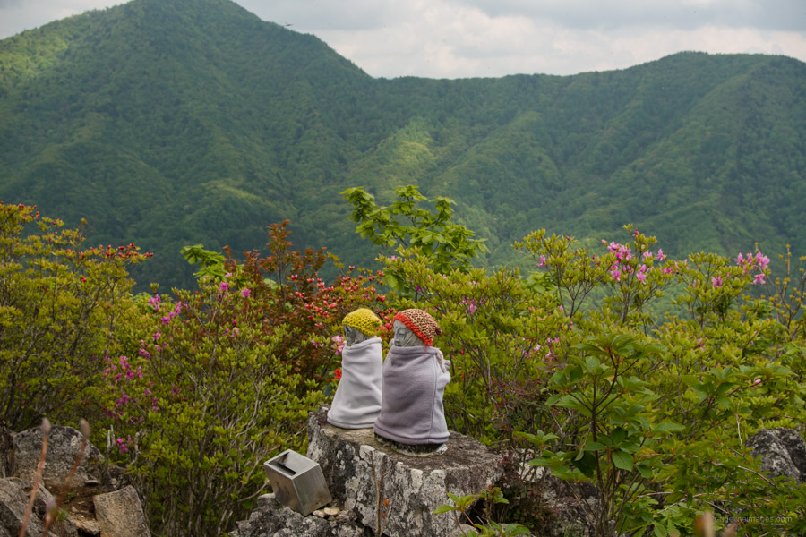
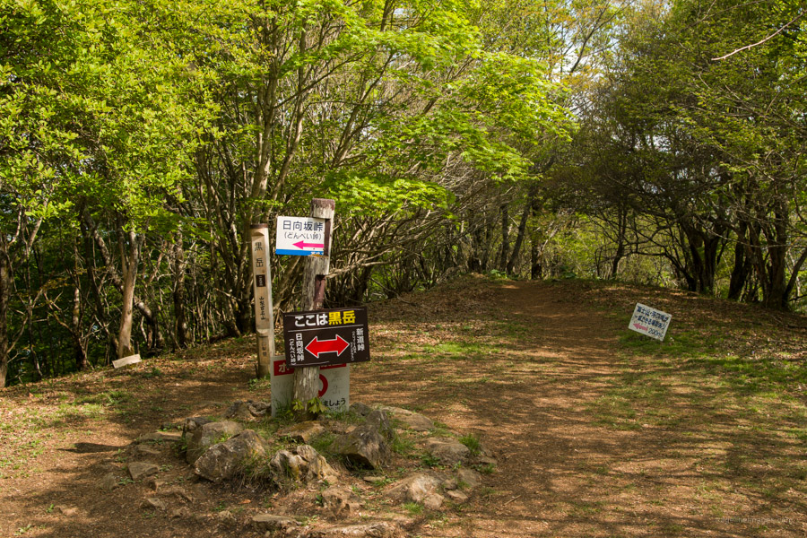
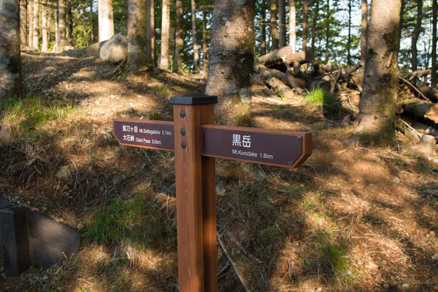
At the summit a couple of signposts pay homage to its rightful place as one of the 100 Famous Yamanashi Mountains along with a pair of Jizo statues wrapped in neck warmers. You should also be able to make out Mt. Kurodake looming in the distance. The descent on the opposing side starts off steep but eases off as you approach Hinatasaka Pass 日向坂峠. Cross the road at the pass to begin the final mission of the day, that is hauling yourself and water stashes up 400-metres in elevation gain between the road and Mt. Kurodake. An hour later with energy levels sapped I arrived at the broad flat-topped summit of Mt. Kurodake 黒岳 (1793) that rests amongst beautiful Japanese beech forest.
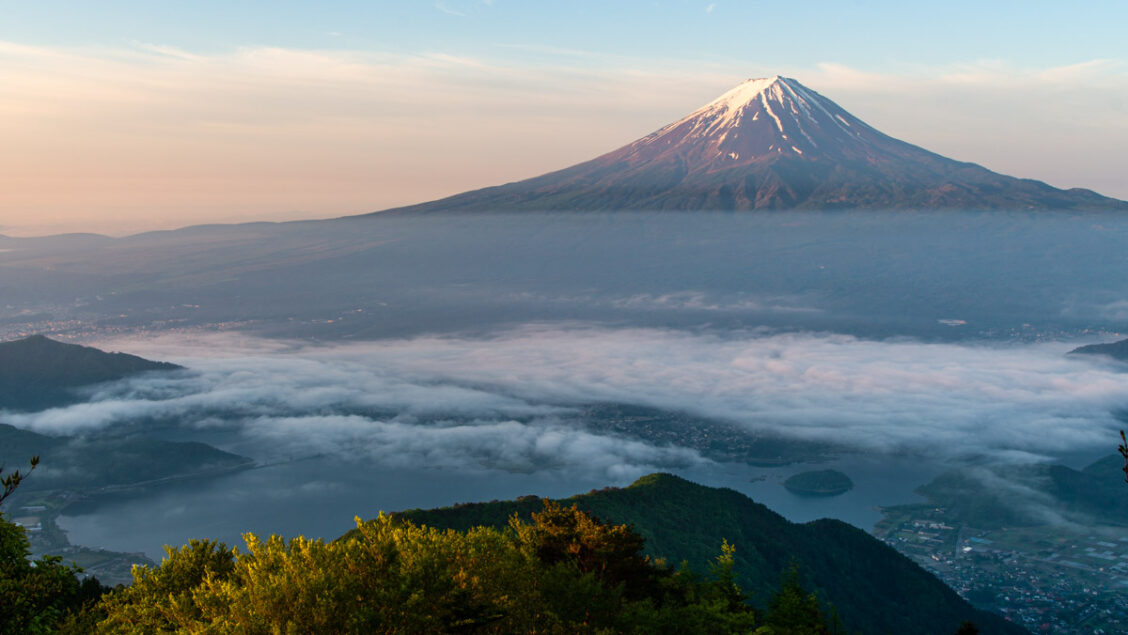
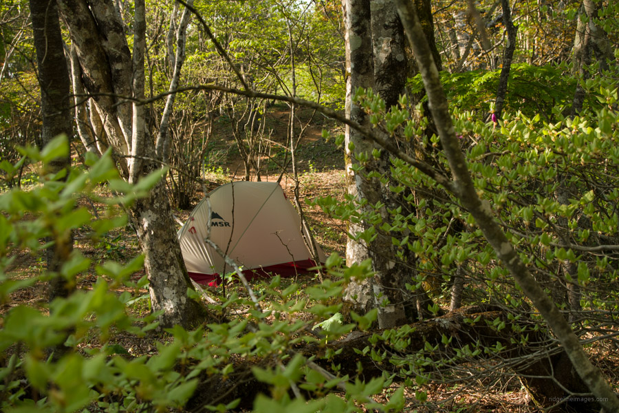
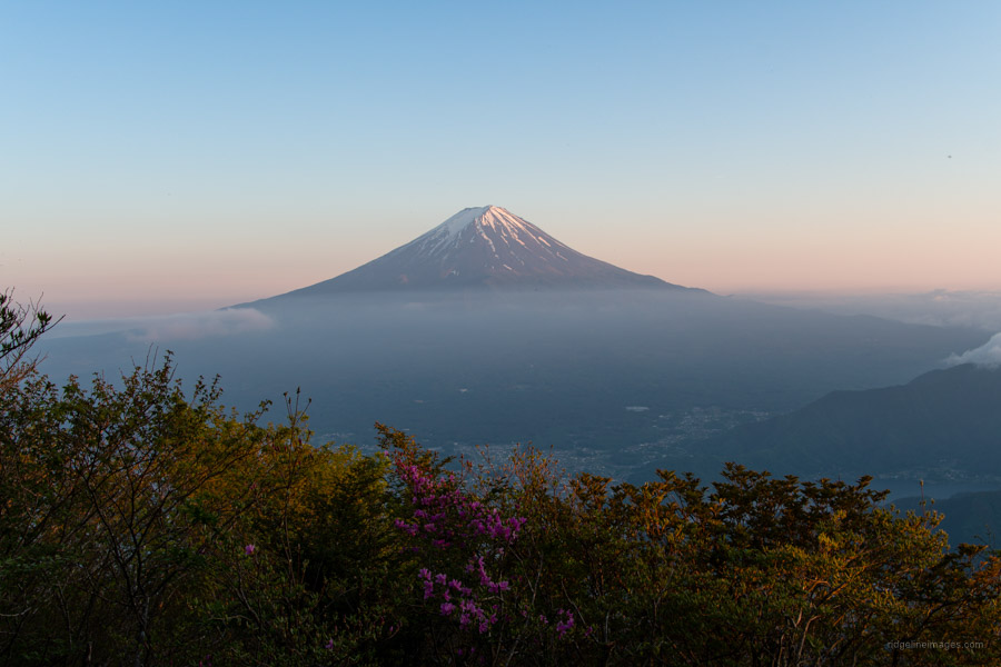
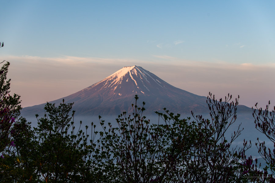
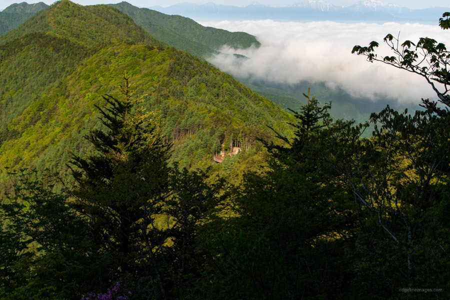
The weather was about perfect with virtually no wind and being mid afternoon meant the day-trippers had moved on. I spied an ideal spot to pitch my MSR tent (Fast & Light configuration a measly 770 g) and brewed a cuppa to enjoy gazing over Fujisan. There is no view at the top of Mt. Kurodake, but you can get a wonderful panorama of Mt. Fuji with Lake Kawaguchiko 河口湖 in the foreground along with the Minami Alps from the ‘Observatory’ a scenic point a couple minutes’ walk south. Neighbouring antenna clad Mt. Mitsutoge can be glanced through the vegetation. As the sun began to set it became clear why Mt. Kurodake is hands down one of the most spectacular settings to view Fujisan.
Day 2: Fujisan Sights Galore (7 km)
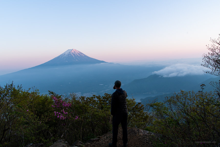
The overnight temperature was a comfortable 8 degrees, only fleetingly heard the call of local deer and slept like a proverbial log. Like dinner the previous evening, breakfast was enjoyed overlooking a similarly exquisite vista made possible by the Observatory. From the summit two main downward spirals to Lake Kawaguchiko are from the scenic point and another a bit further along the forested Misaka Mountain ridgeline 御坂山地 as described below. Note both of these descents are steep and not recommended to attempt in winter.
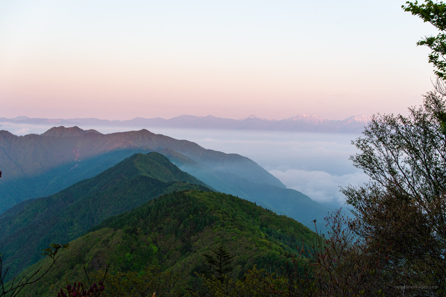
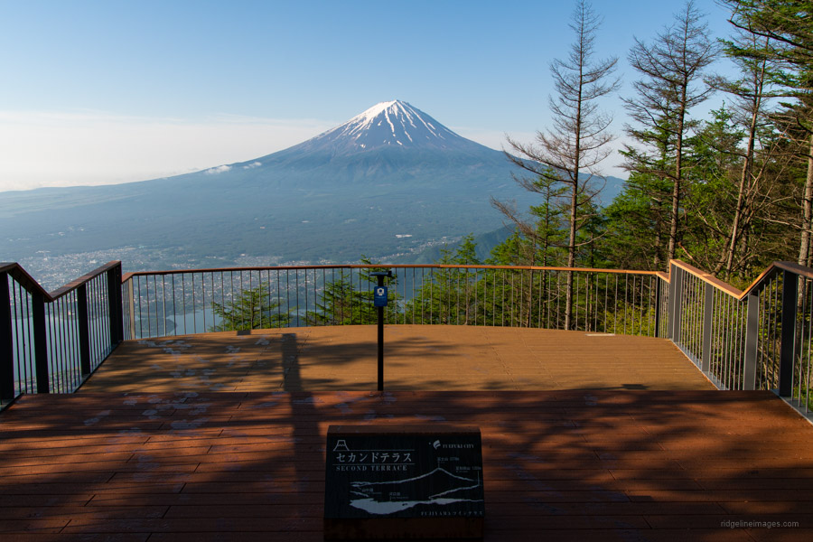
Return to the summit and begin heading in the direction of Shindo Pass 新道峠. After an initial steep descent to Suzuran-toge すずらん峠 the trail flattens, and views intermittently materialise through the trees in the direction of Fujisan. Next up along the undulating ridgeline is the rather indistinct summit of Mt. Hafu 破風山 (1674 m) and 20 minutes thereafter the FUJIYAMA Twin Terrace amphitheatres at Shindo Pass 新道峠. It’s apparent that Fuefuki City and the Yamanashi Prefectural government have invested a ton of money in this tourist enterprise (opened 2021) and perhaps rightly so as both terraces offer a breathtaking view of Mount Fuji augmented with Lake Kawaguchiko.
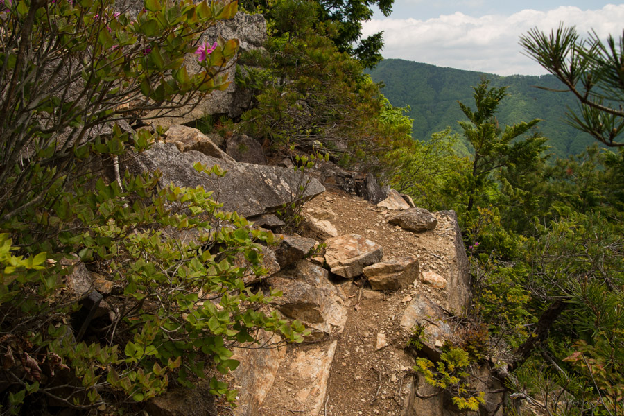
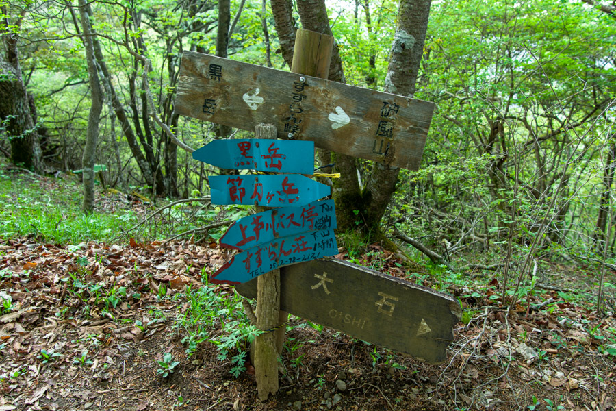
After savouring a final view of the big fella, the trail to Lake Kawaguchiko commences immediately to the left of Second Terrace. It’s not properly signposted aside from a slapdash laminated notice wrapped around a tree trunk. Evidently the budget ran out to rustle up a proper sign that would courteously marshal would be hikers down the mountain slope. The narrow winding trail is in good condition with minimal erosion and pristine forest makes it a pleasure to hike down. About midway to the road is the first and only signpost as the trail enters cedar forest.
After reaching a gravel forestry road veer left, past a stream, a mammoth concrete dam and finally a residential area as you enter the township. The signboard at the forest road indicates it takes two hours to reach Lake Kawaguchiko but should take most folk about half as long. Return buses to Kawaguchiko Station (24 mins, 490 yen) depart from a newly constructed bus stop on your right, just before the main road and across from the Kawaguchiko Natural Living Centre 河口湖自然生活館.


Thanks for the inspiration, David!
I have tomorrow and Monday off. I was planning on somewhere else but think I’ll head down where you were. I did Kurodake and Hafu a month or so ago but was denied a good view because of clouds. They spent a lot of money on those terraces, didn’t they?
You pitched your tent right on Kurodake, right?
No worries, Pat. I think this hike would suit you. I camped about 50 metres south of the summit along the trail to the scenic point. You’ll spot it, a nice flat area perfect for a one-person tent. Not many deer about so you’ll sleep well. Yep, those terraces are quite something aren’t they.
That was a great trip. The weather was spectacular.
The bear is still around. Two people at the shrine mentioned that someone else reported a sighting that morning around the Tobis Pass. Another guy I talked to saw some scat.
Keep on hiking.
Pretty unusual to see bear activity this early. That’s unlucky
The Fuji lakes area I hike in late autumn/ late winter.
Summer + lakes + car campers + meat barbeques + volatized air + large garbage sites + hiking back late afternoon (toward dusk) = asking for trouble bear-wise
Those terraces offer some amazing views. I climbed from the Fuefuki City side. I didn`t make it across to Kurodake because it was just so cold (there was snow on the terraces. Your hikes are really inspiring. Thanks for posting them with some amazing pictures.
I appreciate the kind words about the blog. Indeed, those views are truly something. I’d imagine even better under clear and cold winter skies.