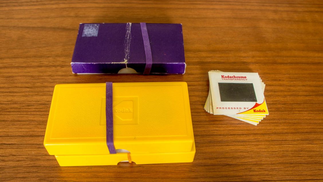
Montbell Expedition Pack 70 Review

Go Lightweight without Sacrificing Durability For an outdoor apparel company as large as Montbell there are surprisingly few hiking backpack reviews. This is a shame as Montbell packs are very reasonably priced, lightweight and well-constructed. I...

Another Reason to Buy an EIZO Monitor

One LCD Monitor Brand that Holds its Resale Value When shopping for a new computer monitor its future resale value probably isn’t something you put much thought into. Like most people I just assumed that after many years of heavy use it would be...

Mt. Tateshina 蓼科山

Hiked on Aug 3, 2017    Jul 18, 2022 . Mt. Tateshina 蓼科山 – Ogawaratoge Pass 大河原峠 – Mugikusa Pass 麦草峠   Duration: 3 days   Distance: 16.2 km   Elevation change: 886 metres   Highest point: 2530 metres  ...

Geodetic Datum Origin of Japan

Central reference point for all Japanese surveys First up this sightseeing locale is only really recommended for mapping diehards. To give some perspective the place doesn’t even make TripAdvisor’s list of 623 ‘things to do’ in the Minato ward...

Kosuge Shiraito Falls

Not the Easiest Access but a Gorgeous Spot Nestled in the back hills of Kosuge Village just inside Yamanashi Prefecture contains a couple of rather beautiful waterfalls. First is the Shiraito Falls (not to be confused with the waterfall of the same...

It’s Coffee Time: How to Support this Blog

Help Me Help You Publishing this blog provides a lot of pleasure and as such I want to do it well. That means not just helping or entertaining my existing readers, but also bringing new people in and encouraging them to get out and explore the...

Odashirogahara Marshland 小田代原

Hiked on Jun 9, 2017    June 15, 2023 . Ryuzu Falls 竜頭ノ滝 – Odashirogahara 小田代原 – Yumoto Onsen 湯元温泉   Duration: 4.5 hours   Distance: 10.4 km   Elevation change: 120 metres   Highest point: 1520 metres  ...

Using a Garmin Handheld GPS in Japan

Navigating the Pitfalls of Garmin Japan As someone who enjoys in the simplicity of navigating using a map and compass to find my way, I never really saw the necessity of investing in a handheld GPS unit. However, it’s not always beer and skittles...

Recapturing this 500-yen Banknote Classic

Mt. Fuji as Seen on the 500-yen Banknote Until the release of the 500-yen coin in 1982, its corresponding paper equivalent reigned for more than 40 years. In fact, it wasn’t until 1994 that the 500-yen banknote was finally withdrawn from circulation...

Mt. Gangaharasuriyama 雁ヶ腹摺山

Hiked on May 3, 2017    Apr 14, 2024 . Otoge 大峠 – Mt. Gangaharasuri 雁ヶ腹摺山 – Mt. Ubakoyama 姥子山   Duration: 2 days   Distance: 20.7 km   Elevation change: 1137 metres   Highest point: 1874 metres   Start:...

Archives