.
Mt. Tateshina 蓼科山 – Ogawaratoge Pass 大河原峠 – Mugikusa Pass 麦草峠
Distance: 16.2 km
Elevation change: 886 metres
Highest point: 2530 metres
Start: Ryugenbashi Bridge Bus Stop
Finish: Mugikusa Pass Bus Stop
Difficulty: ▅▅▅▅▅▅▅▅▅▅ ❹
Map: Yama to Kogen Chizu 山と高原地図 [No.37 八ヶ岳 YATSUGA-TAKE]
GPX TrackKML TrackGSI MAPPDF Topo Map
Climbing the Biggest Mountain Top in Japan
Hopes of climbing Mt. Tateshina last year were hampered by rain and cloud so this time round I was yearning for clearer skies. Rather than starting from the Kitayatsugatake Ropeway this hike tracks a course from the Ryugenbashi Bridge through to Mugikusa Toge. For those looking to shorten it into two days consider starting at the Tateshina Tozanguchi one bus stop further along and summit on the first day.
Day 1. Leisurely Hike up to Tenshojidaira (3 km)
Access to Mt. Tateshina like most of the Yatsugatake Mountains requires taking the Limited Express Azusa from Shinjuku to Chino Station (a little over 2 hours) followed by a connecting bus. Note there are only two daily buses which head to the Ryugenbashi Bridge 竜源橋 trailhead departing at 08:10 and 09:35 respectively (1hr 30 mins, 1,350 yen).
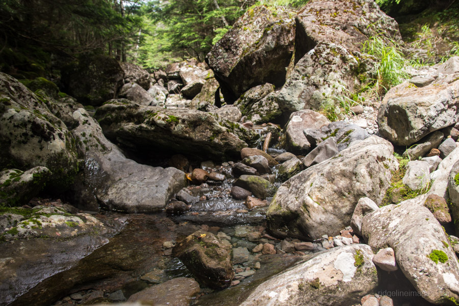
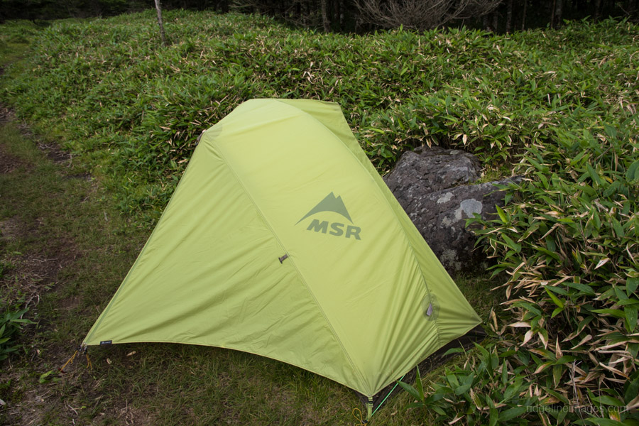
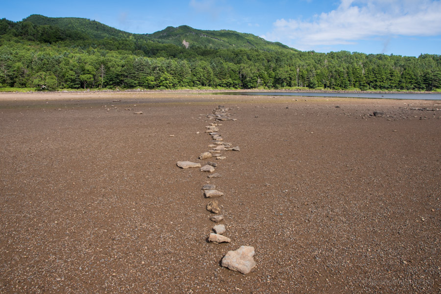
From the bus stop head across the road and look for a well-marked signpost pointing to Mt. Tateshina. The Yama-to-Kogen map shows the trail shadowing close to the river but in reality, it tracks a little inland for some reason. There is a bit of a steady climbing required at first until you eventually come to the river. Initially, I was a somewhat concerned about finding water along this part of the hike but I was fortunate to find a good amount of running water about 20 minutes downstream from Tenshojidaira 天祥時平. It should take around 90 minutes to reach Tenshojidaira where with enough tenacity you can find some tent space. I had a look around for alternative places to set up camp including along the trail up Mt. Tateshina but it’s very limited.
Day 2: Steep & Rocky Trails Await (7.2 km)
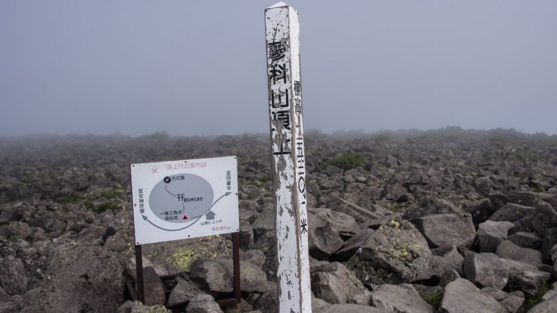
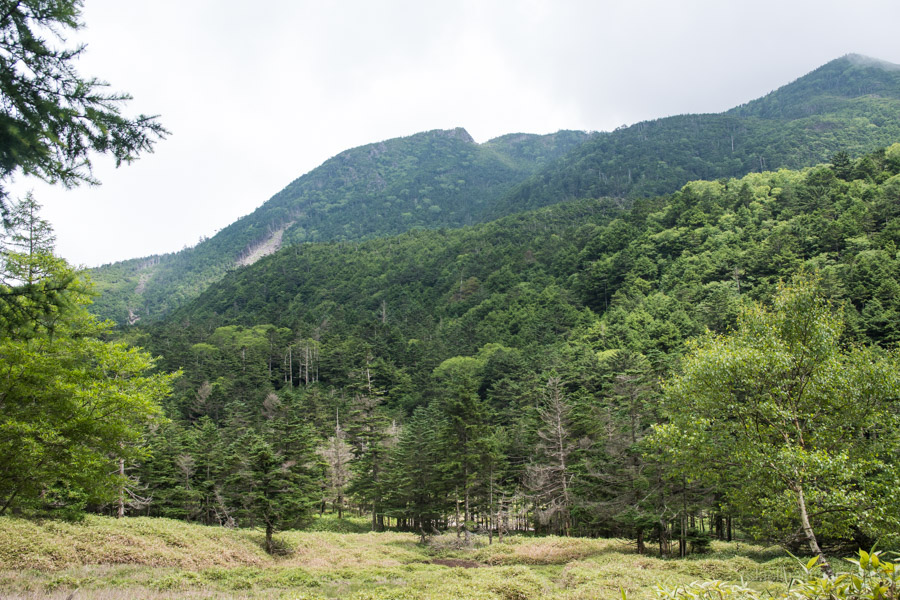
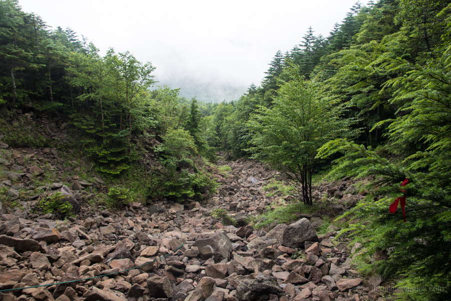
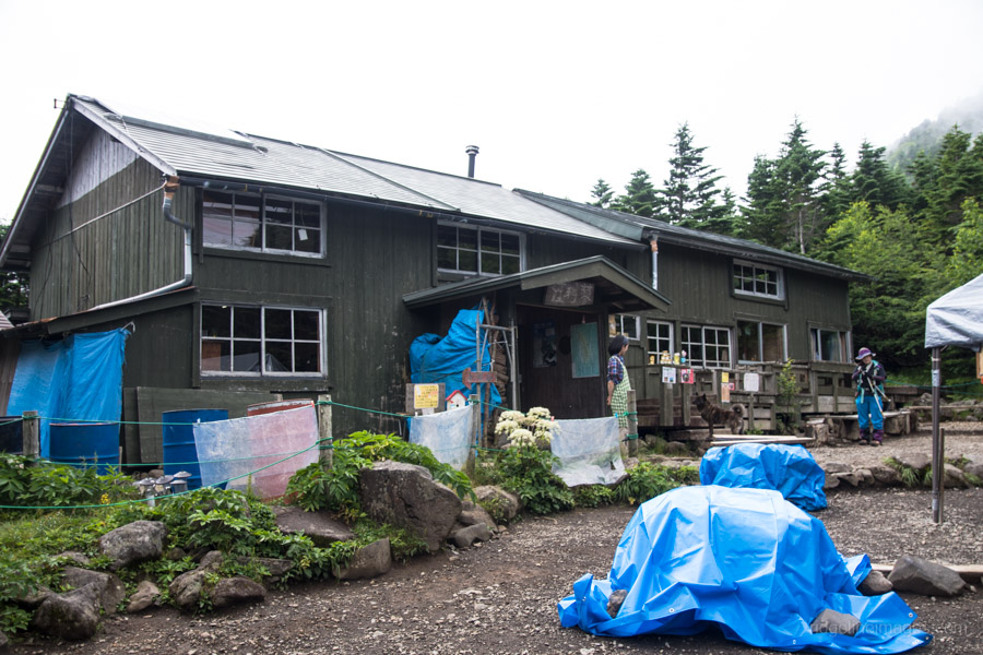
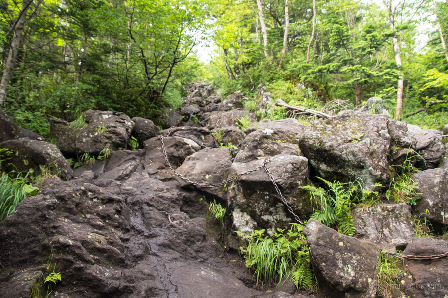
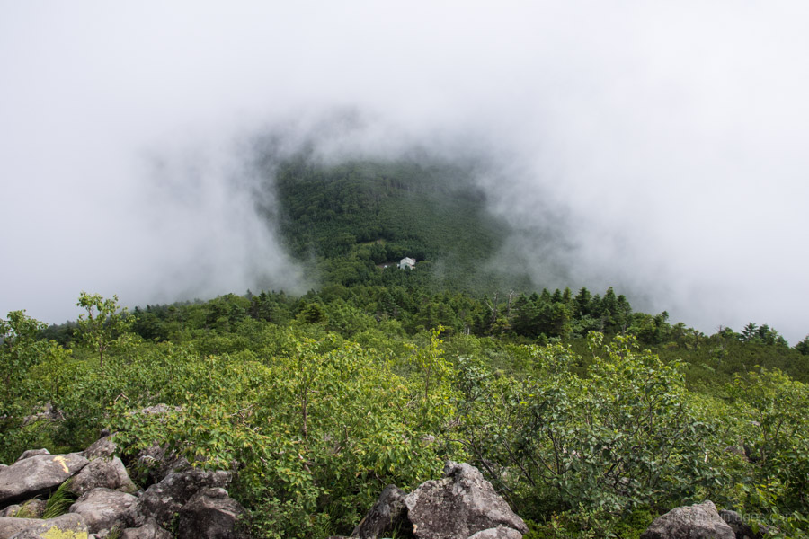
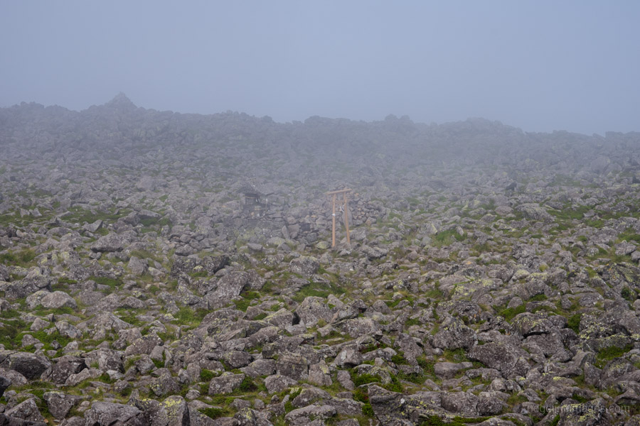
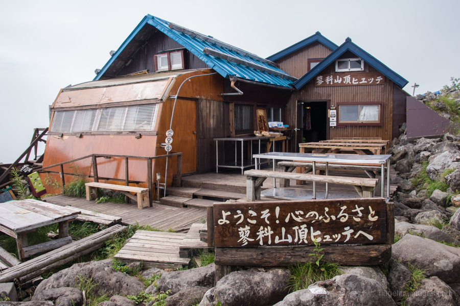
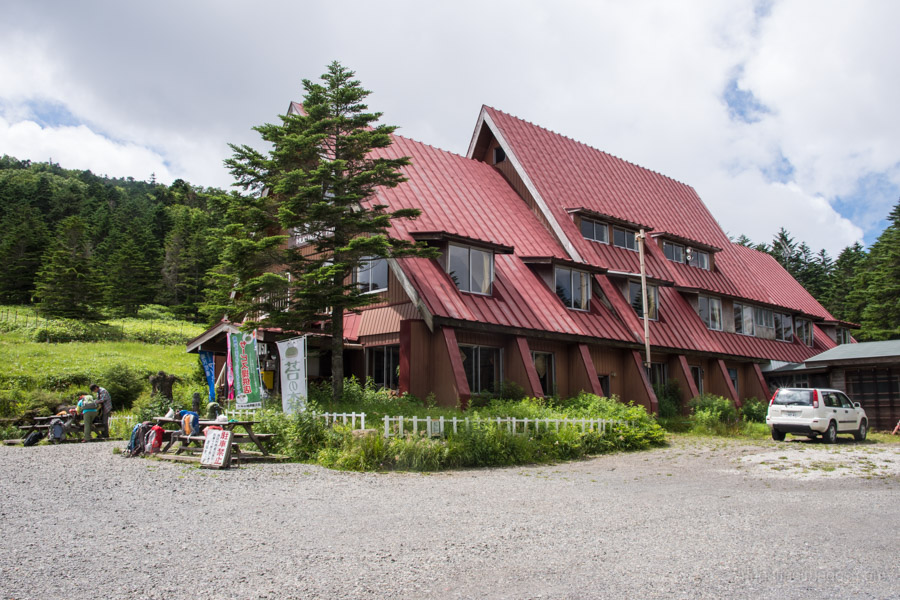
After enduring a heavy night of rain, it was nice to be greeted with some semblance of blue sky at dawn even if it was short-lived. After packing up my wet tent it was time to challenge myself on some equally wet rocks which the map explicitly cautions about after rain. This section of rocky trail is taped out with occasional ropes laid across the dry river bed to stop you wandering off course. The last section steepens as you finally pop out below the Tateshina Sansou 蓼科山荘. The hut caretaker was very friendly and introduced her lovely and rare Kai Ken (Japanese Dog). I recommend leaving your pack at the hut as the final 40 minutes to the summit of Mt. Tateshina 蓼科山 (2,530 m) requires some climbing on all fours.
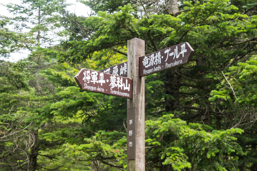
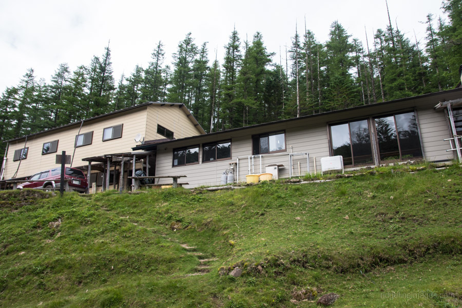
Having abandoned any hope of a summit attempt last year due to poor conditions I was resolved to make it this time even though the weather wasn’t much better. In fine weather Mt. Tateshina has incredible views of the Kita and Minami Alps and claims the title of the biggest mountain top in Japan. From the summit retrace your steps to the Tateshina Sansou, continue along the Shogun Plain before dropping down another rocky trail to the Ogawaratoge Pass 大河原峠. From here it’s another 20-minute hike up to Mt. Futago 双子山 (2,223 m) which doubles a nice lunch spot. When you’re ready head off it’s an easy 30-minute walk down to the campsite at Lake Futagoike 双子池 (800 yen). You can safely drink the water from the lake directly below the Futagoike Huette 双子池 ヒュッテ (not the campsite lake however).
Day 3: Lake Views and Boardwalks (6 km)
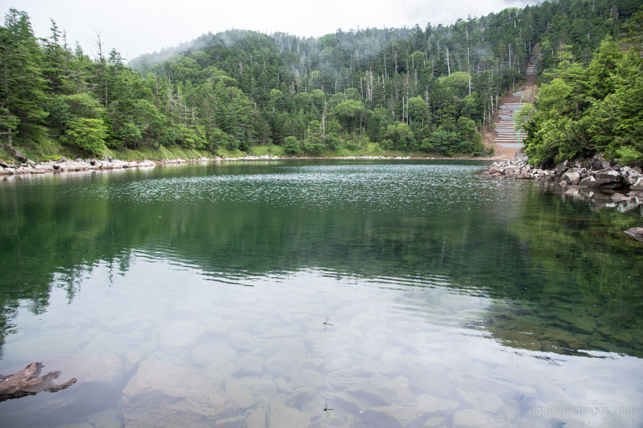
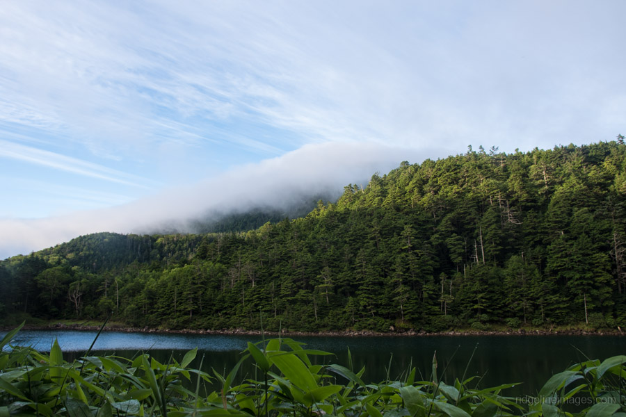
The trail back to Lake Ameike 雨池 and the Kitayatsugatake Ropeway 北八ヶ岳ロープウエイ starts outside the Lake Futagoike Huette. After 10 minutes look out for a sign on your right allowing you to bypass a section of road and there is also a waterhole a little further down if need be. The hike over to Lake Ameike is quite beautiful and the heavy canopy provides some protection from the elements. Like last year the lake waters were still rather depleted which is a little disconcerting.
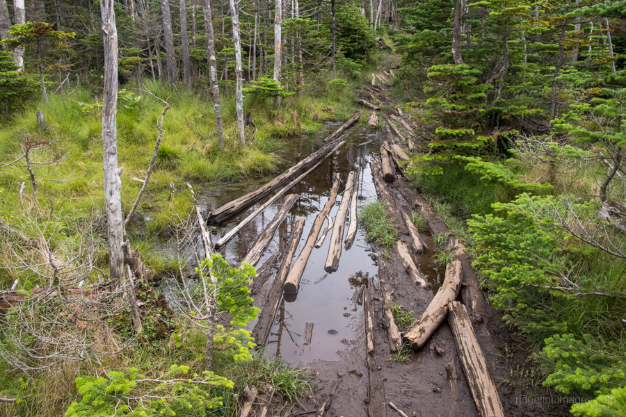
Take the trail along the western flank of the lake and look for a signpost to Mugikusa Toge 麦草峠 some sections of the trail have boardwalks to protect the delicate ecosystem and to spare you from wading through knee-deep mud. There are three-daily buses to Chino Station (1hr, 1,450 yen) departing from outside the Mugikusa Huette 麦草ヒュッテ on the opposite side of the road.


Thank you for another excellent and informative post David. It would appear this mountain is proving a little shy in offering up it’s highlights to you. A couple of years ago, I was fortunate in getting a brilliant September day to day climb Kirigamine (Kurumayama) first and then Tateshina from Tateshina Tozanguchi on route 192. It was just doable with a 7.45am Round Bus from Chino to Kurumayama Kogen, then on the 11am bus to Tateshina Tozanguchi and finally the bus and train back to Tokyo later. The Tateshina hike was lovely forest giving way to a rocky water run off path through the diminishing forest and then the volcanic rock up top with 360 degree vistas. A curious feature was a couple of gliders that flew closely overhead on the way up, I was amazed how much noise, that is wind noise, that these flying contraptions made.
Hi Stewart, I must say that’s quite an impressive effort completing in both Kirigamine and Tateshina in one day. I take it you were starting from Chino as I don’t think there is a train leaving Shinjuku early enough in the morning to catch the 7.45am bus. You’re right September is much better weather wise and sounds like you had some pretty spectacular views from the summit.
I’d been overnight in Matsumoto, so Chino was accessible early and, yes, the views were spectacular. This was part of a very memorable 20 hyakumeizan peak trip of 24 days in 2014, from Iwate in the north to Ibuki in the south, and multiple points between, using public transport all the way. When you travel from Oz you need to make the most of it. Most memorable were my first three hike days, which included Kita Alps’ Kasagatake, Washiba, Suisho, Kurobegoro and Yakushi and a wide mix of weather from heavy rain, mountain squalls and finally some brilliant post-storm clear skies that opened up vistas of the entire Kita Alps and much further afield. And the night views of Yari and the Jonen-Otensho ridge were to die for. I’ll confess to needing the better part of 36 hours total rest after that stint, mostly immersed in hot water.
What a fantastic trip and quite envious I must say. People often ask which month or season has the best weather and without doubt its September and October especially after a typhoon has ripped through. On such mornings even from my 6-floor apartment in west Tokyo it’s possible to see as far as Nikko and the mountains surrounding Tokyo you can clearly observe the micro texture of the valleys and ridgelines.