.
Kurotake 黒岳 – Shirayanomaru 白谷丸
Distance: 19.8 km
Elevation change: 1247 metres
Highest point: 1987 metres
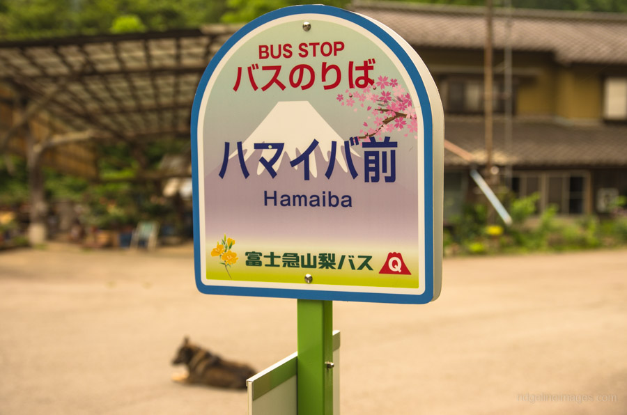
Start: Hamaiba Mae Bus Stop
Finish: Yamatoten Mokusan Onsen Bus Stop
Difficulty: ▅▅▅▅▅▅▅▅▅▅ ❸
Map: Yama to Kogen Chizu 山と高原地図 [No.26 大菩薩嶺 DAIBOSATSU-REI]
GPX TrackKML TrackGSI MAPPDF Topo Map
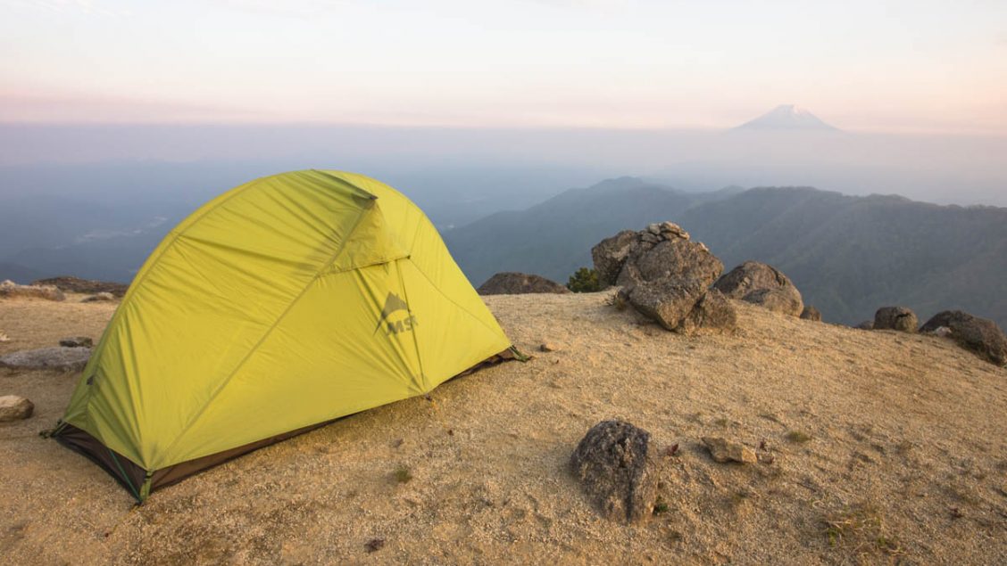
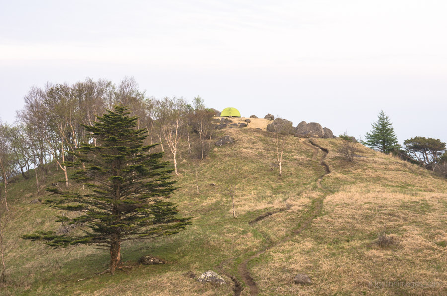
Wild Camping at its Finest
For superb mountain climbing close to Tokyo, it’s hard to go past the ranges neighbouring Mt. Daibsatsurei in Yamanashi Prefecture. This hike my third to the area in the past 18 months, was undertaken with the aim of parking my tent on an exposed, gravelly knoll scouted on a previous hike.
Day 1: A Long Roadside Walk and Ridge Scramble (12.8 km)
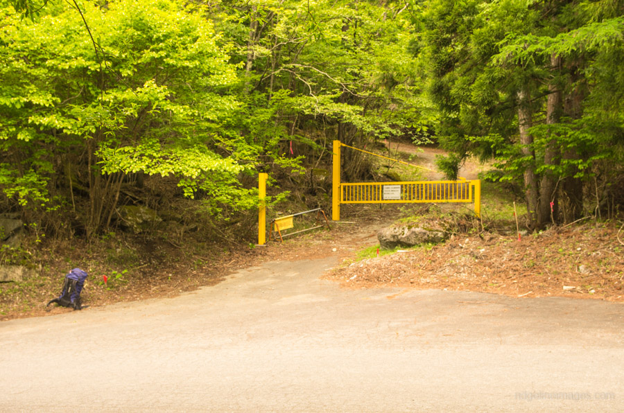
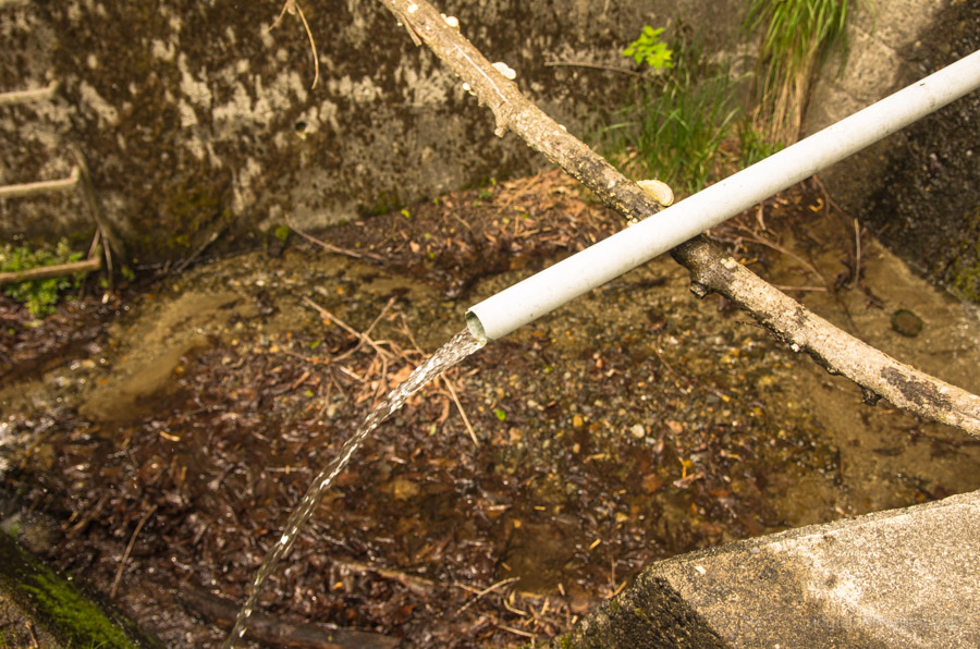
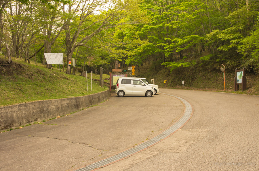
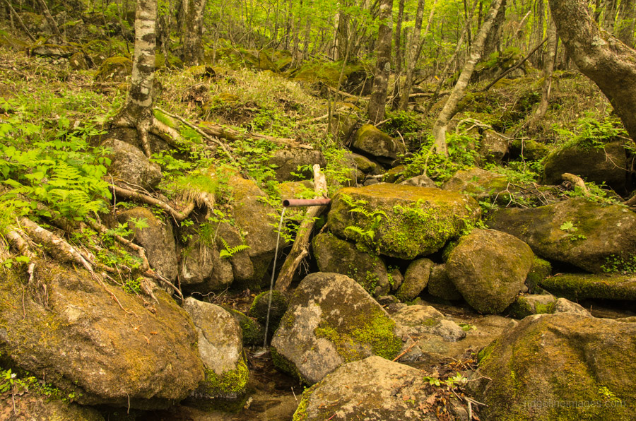
The hike starts from the Hamaiba Mae bus stop ハマイバ前 around a 30-minute bus ride from Otsuki Station (500 yen). The first aim of the morning is to start heading up to Otoge 大峠 from where the bus drops you off. The downside of this is the 10.8 km of roadside walking necessary to get there. As far as roads go, it has a nice steady incline, provides a couple of nice viewpoints, and has thankfully little traffic. The first landmark to look out for is a road gate (closed in winter) that you will reach after 30 minutes, followed by another road that heads towards Yunosawatoge 湯ノ沢峠 a further 40 minutes after that on your left side. Just before the road begins a series of hairpin turns, there is a watering hole by means of a PVC pipe that isn’t marked on the map.
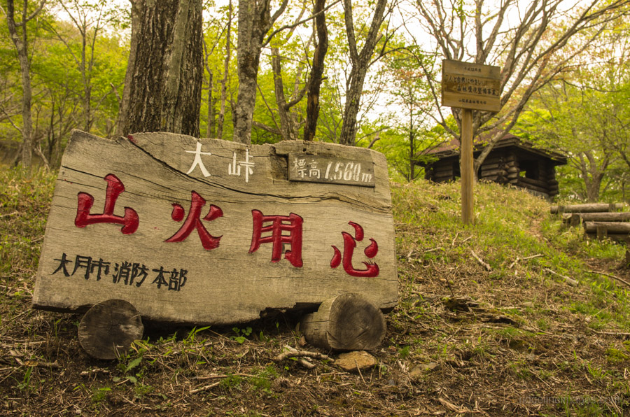
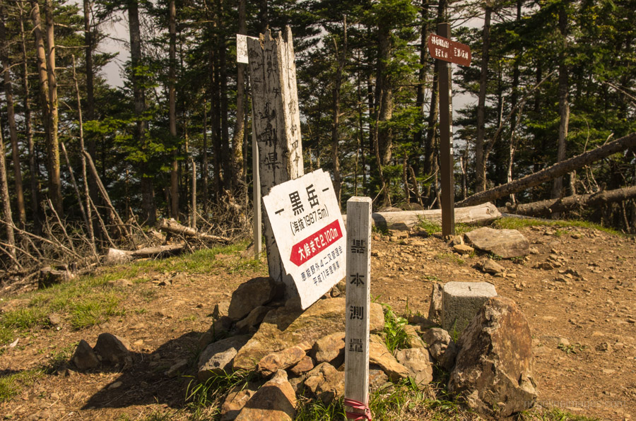
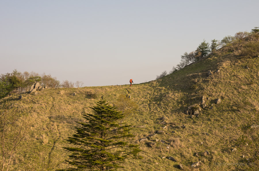
Depending on how much gear you’re carrying, it should take a little under three hours to reach the mountain pass. Along with a car park, there is a small pavillion that can be used as a makeshift shelter in a pinch and importantly a reliable water source can be found a couple of minutes along the trail towards Mt. Gangaharasuri. The natural surroundings here make a perfect spot to take a breather and enjoy some lunch. When you’ve filled up your water supplies, it’s time to tackle some real hiking. The first part of the trail up to Kurodake 黒岳 (1,987 m) is steep, although after reaching Akaiwanomaru 赤岩ノ丸 (1,792 m), it starts to ease off somewhat. Navigating this section of the trail gets a little vague at times, so keep a lookout for the pink strips to keep you on course. If you’re carrying extra water to camp out, it will likely take the full 90 minutes to reach the summit ridge line.
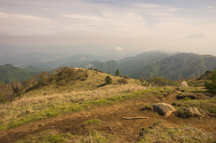
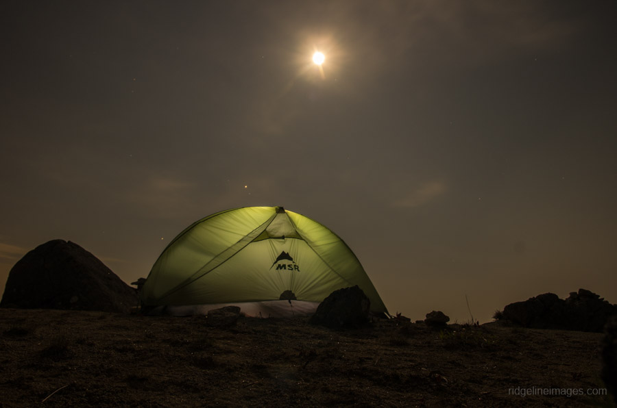
The goal for the night was to set up on a rocky outcrop below Shirayanomaru 白谷丸 (1,920 m). Given that this area is exposed and subject to strong crosswinds, it’s only going to be practical to camp here in near-ideal conditions. While the afternoon skyline displayed a slight haze, by late afternoon, Mt. Fuji came into its own and made a splendid backdrop.
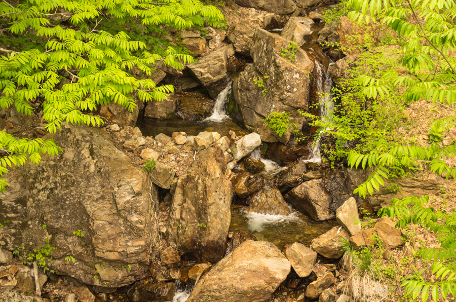
Day 2: A Tranquil Stream Guides you Safely off the Mountain (7 km)
The wind picked up early in the morning, and combined with an early sunrise, there was little chance of sleeping past 5 am. During breakfast, an elderly gent who camped at the Yunosawatoge hut wandered over for a chat and commented on the ‘gas’ that had now infused the previous day’s clear skyline. The hike down to the emergency hut should only take around 20 minutes, but it took slightly longer owing to trail erosion. From the hut, continue past the watering hole and follow the stream, which terminates at a vehicular road. From the terminus of the asphalt, it takes another hour or so of roadside walking to the bus stop outside the Yamatoten Mokusan Onsen where a short bus ride whisks you back to Kaiyamato Station.


Time table for the bus at Yamatoten Mokusan Onsen has changed URL —
http://eiwa-kotsu.jp/media/root_1_tt.pdf
Thanks for the heads up!