.
Takahatayama 高畑山 – Amamezasu Toge 天目指峠 – Nenogongen 子の権現
Distance: 13.6 km
Elevation change: 561 metres
Highest point: 851 metres
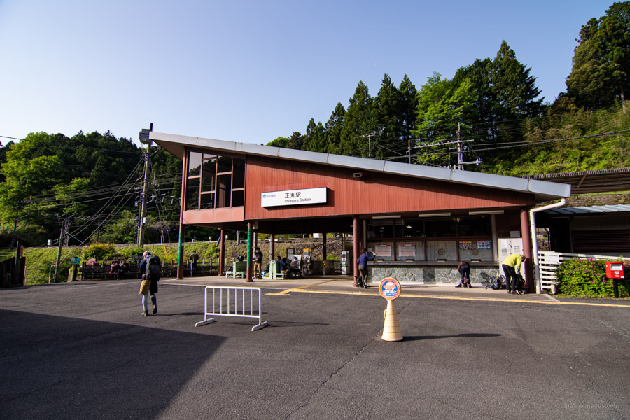
Start: Shomaru Station (Seibu Chichibu Line)
Finish: Agano Station (Seibu Chichibu Line)
Difficulty: ▅▅▅▅▅▅▅▅▅▅ ❸
Map: Yama to Kogen Chizu 山と高原地図 [No.23 奥武蔵・秩父 OKUMUSASHI·CHICHIBU]
GPX TrackKML TrackGSI MAPPDF Topo Map
Guide to Climbing Okumusashi’s Most Popular Mountain
Okumusashi is a general term for the mountainous area in the southwestern part of Saitama Prefecture. Thanks to its proximity to central Tokyo the area is a magnet for hikers and sightseers on weekends and holidays. Many mountains fall under the 1,000-metre ceiling making them climbable even in winter though lightweight crampons or microspikes should be carried. The most popular peak in this area is Mt. Izugatake suitable both for beginners as well as veteran hikers with a couple of expert routes to test your mettle. The hike described here is a standard course starting at Shomaru Station circling around to Agano Station. Mt. Izugatake rests along the “Okumusashi 105” a.k.a. Okumusashi Long Trail and from Mt. Ozo to Agano Station follows the Kanto Fureai no Michi.
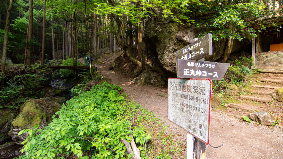
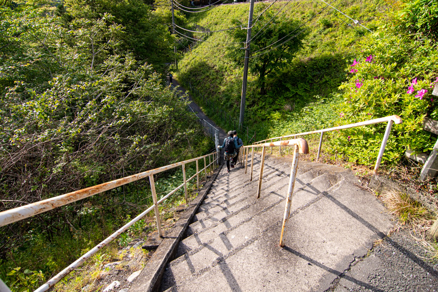
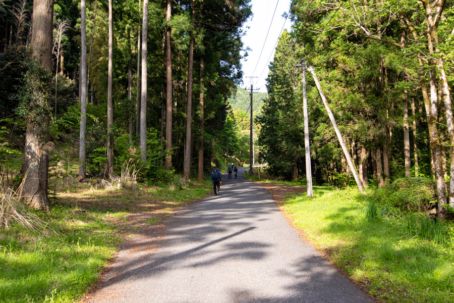
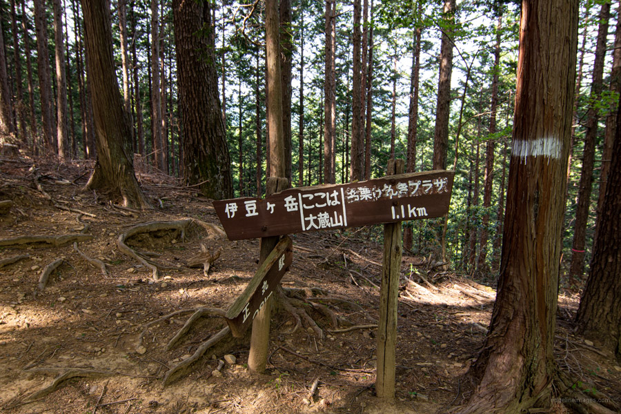
From Ikebukuro take the Seibu Ikebukuro Line to Shomaru Station 正丸駅 changing once at Hanno (90 mins, 690 yen). Leave by the only exit and walk down the diagonal stairway which leads under the railway line. The hike is well signposted though there are unmarked trails veering off every which way so be sure to carry a map and GPS device. Continue walking up the bitumen which shadows a small stream adorned with momiji (Japanese maple). It takes 25 minutes to reach the trailhead proper. After a short distance you’ll come to a trail junction. Turn right in the direction of Kameiwa 亀岩 and Mt. Ozo 大蔵山 (720 m).
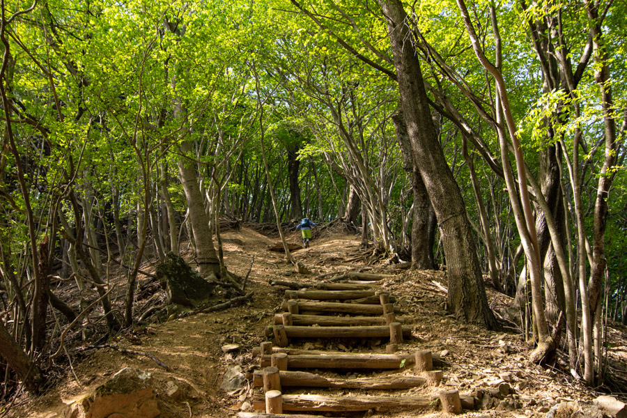
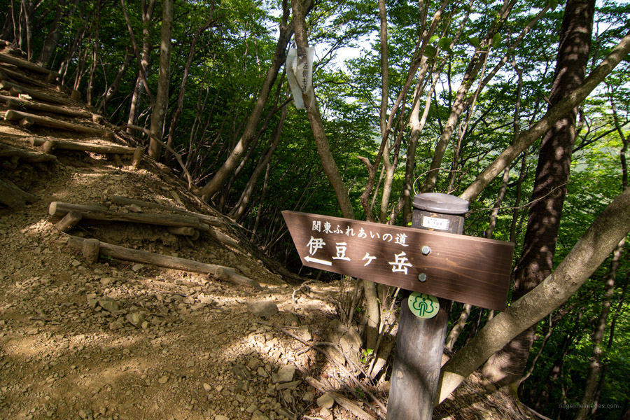
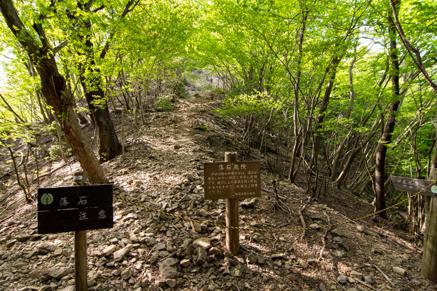
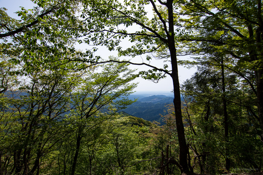
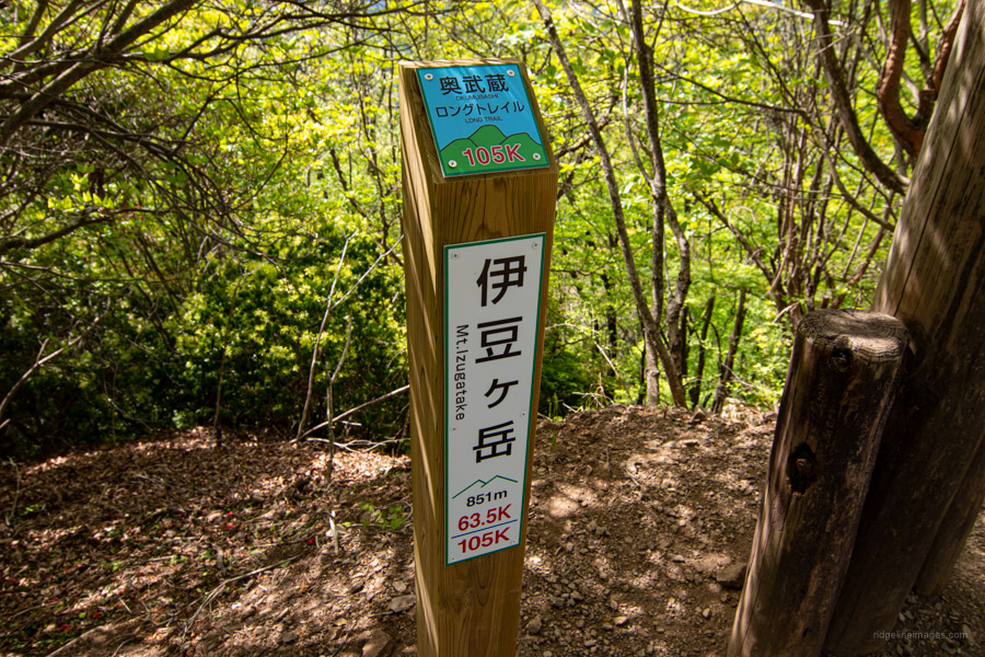
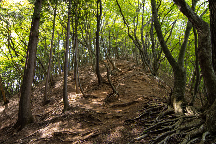
After reaching the upper ridgeline it steepens as you approach Mt. Gorinyama 五輪山 (770 m). Parts of the trail are poorly maintained with washed out wooden steps and plenty of loose gravely rocks and exposed tree roots to bring you unstuck. In the same vein as nearby Mt. Hiwada the compacted loamy clay path will be slippery as all hell in the rainy season so best avoided. Note the Otoko-zaka 男坂 trail is cordoned off due to rock-fall hazard so give the kusariba クサリ場 (chains) a miss and take the Onna-zaka 女坂 (now technically a detour) route for the final push up to Mt. Izugatake 伊豆ヶ岳 (851 m). As you approach the summit you can glimpse the shiny Seibu Dome roof and even Mt. Asama and Mt. Nantai on a clear day. Take care descending here as its steep and hard to get good traction.
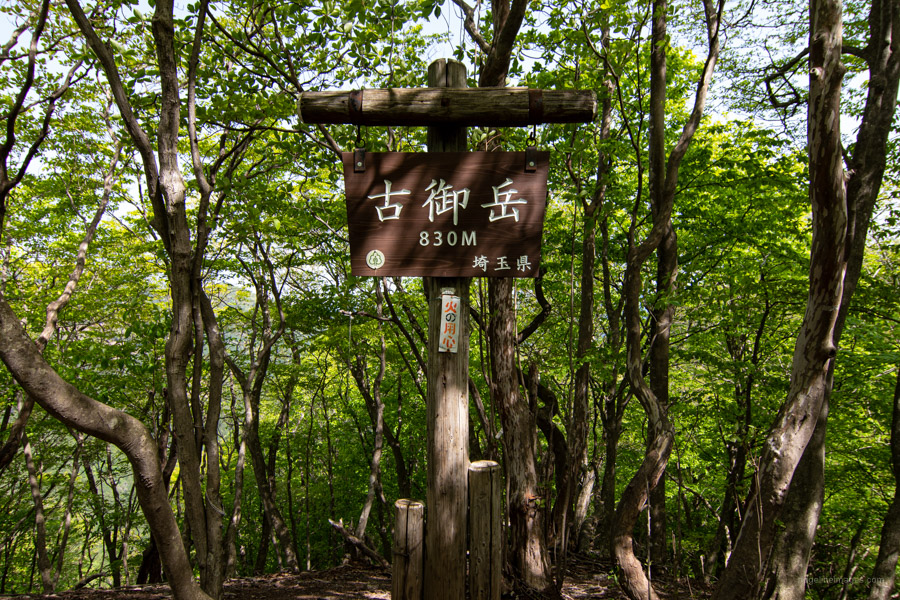
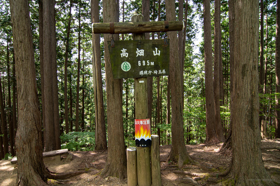
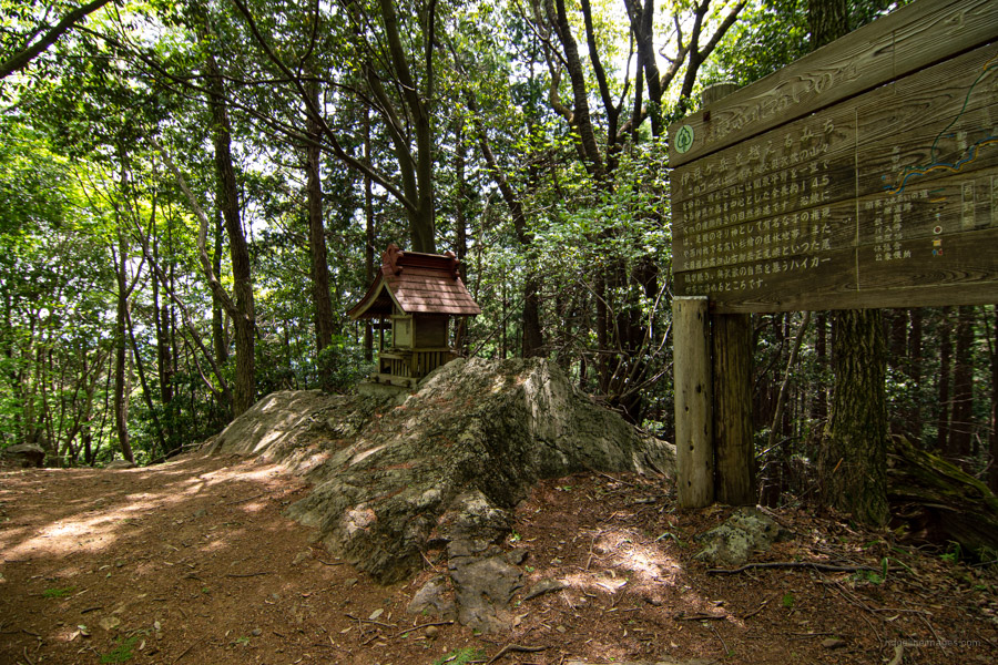
After dropping down to a saddle prep yourself for another climb up to Komitake 古御岳 (890 m) before repeating the process as you make your way across to Mt. Takahatayama 高畑山 (695 m) the fifth mountain along the ridgeline. The next landmark to look out for is a forlorn looking transmission tower near Nakanosawa-no-atama 中ノ沢ノ頭 which can be side stepped if desired. Following this the trail drops down to Amamezasu Toge 天目指峠 before making a sustained climb back up again. If you can bear it a little longer a nice spot to take lunch is a shaded open clearing just after the small shrine atop of Mt. Atago but before Nenogongen 子の権現.
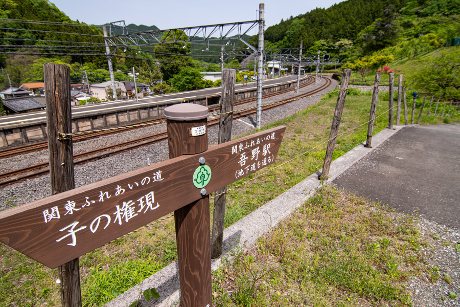
As you might have surmised from the gargantuan straw sandals, geta footwear and king-sized Nio statues the ancient Tenryuji Temple enshrines the ‘God of Legs’. From here it’s still another 5 km back to Agano Station 吾野駅. Walk downhill from the temple, when you hit the road look for a signpost on your right that begins a series of zigzags through cedar forest to the bitumen road at the valley bottom. As far as roadside walking goes the final stretch back to the station is rather picturesque. Just before the main highway swing right and follow this minor street for 1.5 km alongside the Koma River over the railway crossing and through a gloomy tunnel which runs beneath the Seibu Chibu Line.


Nice one. This hike is in parts very easy and also tough w/ the saddle work. In summer, Nenogongen’s stalls sell delicious cheap blueberries and pears.
Good to know about the blueberries and pears – another reason to wander back up there along that lovely stream from Agano Station.
While on my mind:
Looking into Japan Long Trail Association. Want to start off with the Central Divide Trail (Chuo Bunsuirei).
Awaiting some updated bus schedules to see if it’s feasible this summer
https://longtrail.jp/
Last autumn I did quite a lot planning on Shin-etsu Trail which runs for 80 km (5 days) along the border between Nagano and Niigata. Still hoping to have a crack at it at some point.
Me too. I read it’s a bit like the Appalachian Trail in that’s it’s mainly a “green corridor”: not so many views. A few designated camp sites, but getting water was an issue.
The Central Divide (38km) is mainly across ridgelines, Access from Chino Station, which we both know; finishing up w/ a bus to Matsumoto City, so convenient coming home
How natsukashii – this was a favourite hike during my student days in Tokyo. The sound of my iceaxe glancing off a rock still reminds me of the clang of the bell of that temple with the giant geta. Probably the temple bell is more mellifluous, though …
Oh boy…did that bell clang could hear it ringing a good hour before I arrived there. Nice hike all the same and I can understand why it became a favourite haunt. Helped having perfect spring weather.
Thanks for the excellent website and useful information! I did this hike yesterday and really enjoyed it. Planning to do Takigoyama next weekend after reading your write up.
Thanks for the comment, Joel and glad to hear you enjoyed it. Takigoyama is a terrific hike and hope to return there again myself come autumn.
Awesome site. I have read many of your posts. The detail and photos really bring wild Japan to life. I am trying to understand where overnight “wild” tent camping is available while backpacking. It seems that based on your experiences Yamanashi, Gunma and Nagano prefectures have more options than Kanagawa for pitching a tent while on the trail. Is there any tent camping allowed on these trails or those in the Kanagawa area?
Thanks for the kind words about the blog. To answer your question – camping away from designated campsites is generally frowned upon by the park authorities. Having said that, it can be unavoidable where the distance to be covered in a day is too great and no other practical option exists. So, as much as possible try to stick to campsites located next to mountain huts to reduce your impact on the environment. Official campsites are marked on the Yama to Kogen Chizu maps.
Thanks David. I’ll stick to map campsite indicators.
No worries Steve. Enjoy the autumn season.
(I agree. This is an awesome site!)
I don’t think you are allowed to pitch a tent anywhere in Kanagawa. I’ve done a fair bit of hiking in the Tanzawa range and I think they don’t want you to stay anywhere except for mountain lodges like on Hirugatake or down below in campgrounds. I did stay in an emergency hut once but I that’s really frowned on that in these days of COVID.
There are a few spots in Okutama where you can pitch a tent. Around Takanosu I’ve seen a few spots that would work. You could probably pitch a tent right outside the emergency hut there if you wanted. And there is water nearby. There are a few spots between Nanatsuishi and Kumotori too. I usually see people pitching tents at a few spots in the general vicinity of the old Okutamagoya.
I am looking at this for an upcoming hike, but wanted to check something. In you summary, it has an elevation gain of 561m, but in your GPS map it says 867m and Yamap says 1046m. Do you happen to know the reason for the differences (the GPS & Yamap might be margin of error)? Thanks for any information.
Thanks for pointing this out—it’s a good question! The 561m figure represents the elevation gain, which is the difference between the starting elevation and the highest point of the hike. On the other hand, the 867m refers to the cumulative elevation gain, which includes all the ups and downs along the trail, summing up every ascent.
As for the discrepancy with Yamap’s reading of 1046m, it could indeed be due to differences in calculation methods or GPS accuracy. Apps like Yamap and GPS devices use slightly different algorithms to measure elevation changes, and factors like signal quality, terrain data, and how minor elevation changes are filtered or smoothed can lead to variations. It’s quite common for devices and apps to produce slightly different cumulative elevation figures for the same hike.
Thanks for the explanation. I’m finally hoping to get around to this one during Golden Week, so we’ll see what my GPS (Yamap/iPhone) comes up with.
I did this hike April 27, 2025. Based on the people getting off the train I was worried it was going to be crowded since it was during Golden Week. However, I kept a good pace and ahead of most of the groups and only had to worry about staying out of the way of trail runners.
It wasn’t as scenic as other hikes, but overall a nice hike. You have to save energy for that second climb in the second half.
I turned off early to go to Nishi-Agano Station to avoid the road walking (although the route to Nishi-Agano Station was a little hard to find). This way only the last 15 minutes were on the road, most of it following a little stream.
Thanks for sharing another good hike!
It appears as if the GPX file was deleted or is not accessible any more. Could you please fix that?
Sorry about that – it’s fixed now and the file should be accessible again. Let me know if you have any trouble with it.
Thank you so much and no worries!