Make Your Safety a Priority
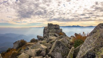
As I go about preparations for my summer hike in the Southern Alps, I thought it would be timely to reflect on how safety figures into the mix. I hope you find it useful.
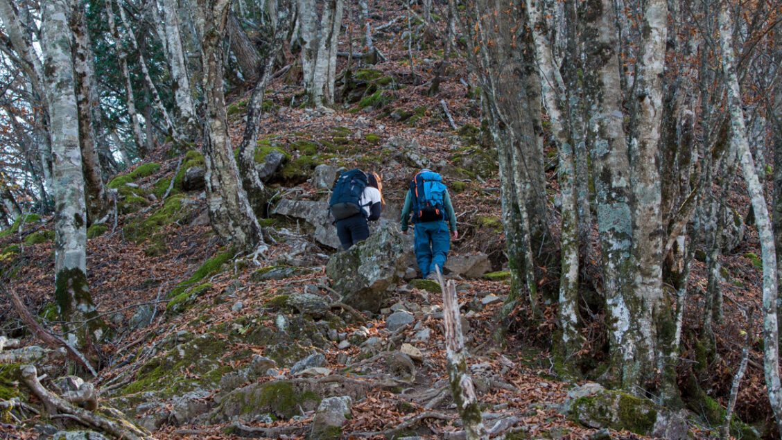
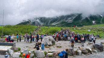
Last month, the National Police Agency released their most recent sangaku sounan 山岳遭難, or mountain distress, statistics for 2022. It makes for some sober reading. First up, according to the NPA, the number of people who got stranded on mountains was 3,506 (from 3,015 incidents), an uptick of 431 compared to a year earlier and the highest among comparable data since 1961. The number of dead and missing was 327, an increase of 44. Mountain distress incidents first exceeded 2,000 per year in 2013 and have remained above this number ever since, even during the height of COVID. This trend closely parallels the current hiking boom.
Getting lost is the most common form of mountain distress, followed by slips, falls, illness, and fatigue. What’s more, getting lost frequently results in trips and falls. In recent years, several non-Japanese have also tragically figured in the statistics here, here, and here, and incidences requiring rescue are common, with three groups of climbers this past June alone: here, here, and here.
Drilling down into the details, we find the largest number of incidents, not surprisingly, in areas close to Tokyo. The Chichibu mountains had the most with 194 (66 more than the average of the past 5 years), followed by Mt. Takao with 108, Mt. Fuji with 63, and the Hotaka mountain range with 61. Although it sounds utterly preposterous that more than 100 people needed rescuing from Takao-san, it is, after all, Japan’s (if not the world’s) most popular mountain, with upwards of 3 million annual visitors. Thus, those who experienced mountain distress represent a meagre 0.003 percent of all climbers.
Part of the increase can be attributed to the fact that the number of people going to the mountains has risen as the coronavirus pandemic has settled down and mountain huts have reopened. Also, better mobile phone reception in remote areas has enabled people to make reports of incidents that would have otherwise been taken care of at the scene. According to the NPA, inadequate equipment, poor planning, and underestimating the dangers present in nearby or low-lying mountains continue to be the main culprits. Along with climbers not considering weather conditions and their physical fitness.
So, what steps can you personally take to minimise ending up as a sangaku sounan statistic? It’s a good question, and while I don’t claim to have all the answers, what follows contains some of the preparations and precautions I make and take with every hike, irrespective of whether it’s a casual outing or an overnighter. One would hope that those of you reading this already do many of these things. If I’ve missed any biggies or you have any questions or comments, leave them below.
#1 Take out hiking insurance
This should be common sense by now; if you hike even semi-regularly, you should have yourself signed up with a Japan-based hiking provider. For the last 10 years, I have been a member of jRO, one of the largest, if not the largest, search and rescue insurance providers in Japan. If you’re here as a tourist, you can still sign up with an outfit such as Yamakifu that offers very affordable insurance for as little as one day. The only caveats are that you can navigate the website (in Japanese only) and that it needs to be tied to a Japanese mailing address. Or else find travel insurance that will cover you while hiking or trekking abroad. Nuff said.
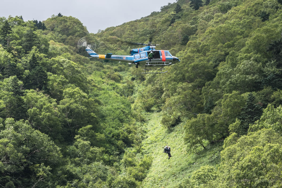
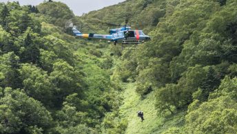
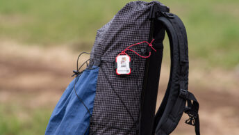
#2 Sign up with Cocoheli
![]()
On a hike earlier this year, I got chatting with another climber who was curious to know what the doodah attached to my pack was. I explained that it was a Cocoheli radio transmitter that sends radio signals up to 16 kilometres, and if I became lost, a search helicopter could be dispatched to find me. He seemed puzzled why someone would need such a device, as, in his own words, we were on a ‘well-marked trail’. Further conversation revealed that he was in his 70s, hiked weekly, and didn’t bother with hiking insurance either. Quite telling, as the statistics above also point out, is that people in their 70s accounted for the largest number of those that faced mountain distress. This one is another no-brainer for those of you who hike regularly. According to their website, of the 240 callouts to which Cocoheli has responded, 86 percent of missing hikers were found within 3 hours of the start of the search. If you’re not yet signed up and don’t have a jRO membership, you can enrol in the whole enchilada here.
#3 Monitor the weather
At least several days out, it’s a good idea to closely monitor the weather, taking note of looming typhoons, cold fronts, and unsettled weather patterns. Take all of this into consideration before heading out. There have been plenty of times I’ve had everything packed yet pulled the pin at the last moment after checking Tenki to Kurasu or the morning weather forecast on TV. If you’re doing a multiday trip, obviously you won’t have this luxury, but it maybe still possible to check the forecast on your smartphone or at the hut you’re staying at to help decide whether to stay put or press on. The weather in the mountains becomes unstable as the afternoon progresses. Expect thunderstorms in the summer and short daylight hours in the winter, so plan to finish your hiking for the day by 3:00 pm.
#4 Tell someone
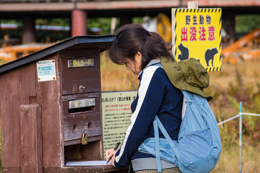
It can’t be overstated how important it is to give a copy of your intended itinerary to a family member or trusted friend. Each time I head out, whether on a leisurely hike up Jinba-san or a multi-day ramble, I always send a Yamareco link to my wife of the said route. I’ll also let her know as soon as I’m off the mountain safely. Try as much as possible to stay the course and update the trusted party if your plans happen to change. Submit your backcountry plan at the tozan posuto box located at the trailhead, along with regional police databases, via the web app Compass (English available). The app also allows your plan to be shared with others.
#5 Check the latest trail reports from Yamareco and Yamap

The mountain climbing communities of Yamareco and Yamap are great resources for finding out the most recent trail and snow conditions, as well as whether a water hole is running. With Yamareco, logged-in users have access to the whole collection of hike reports, whereas guests can only view the first page. The Yamareco routes are classified as S, A, B, C, and D, with S denoting those with the most thorough route descriptions and 20 or more images. Even if you don’t intend to subscribe to their premium versions, registering is still worthwhile. However, you can only access GPX track data if you are a paid-up member. Look over the reports, paying close attention to any images that indicate risks along the routes you are considering, such as the potential to get lost, dangerous drops, and landslides. Photos should only be used as a guide because they don’t always capture the full breadth of the situation.
#6 Carry a Garmin or GPS enabled smartphone
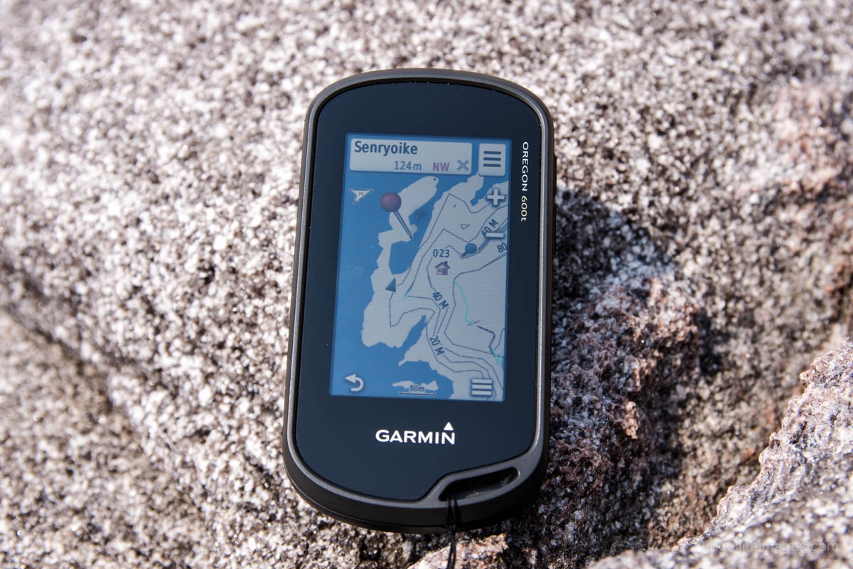
The single biggest shift I’ve seen over the past 15 years of hiking in Japan has been technology revolving around GPS navigation. Due to the availability of subscription services from companies like Yamap, Yamareco, and Yama to Kogen Chizu, smartphones used for navigation are now ubiquitous. I bought a Garmin Oregon 600t around seven years ago, and now I wouldn’t go on a hike without bringing it along. Paper maps are still useful to grasp the wider area, but the huge advantage of the GPS is that it allows you to keep track of your position and remain ‘staying found’. If you’re looking to go the extra mile, investing in a Garmin InReach Mini 2 or GPSMAP 66i allows friends or family to follow your trip progress via a map website page. It can also send and receive text messages and receive weather updates. The drawback is that in order to use these features, you must have an active satellite subscription that gives you access to the Iridium satellite network.
#7 Stay hydrated and maintain adequate nutrition
You could write a book on either of these topics, so I’ll get right to the point. Carry emergency food and water to prepare for the risk of mountain distress. Such as easy-to-eat calorically dense foods like CalorieMate (5 calories per gram), Brazil and macadamia nuts (7 calories per gram) or even Tengu jerky (3 calories per gram). For day hikes, eat both sweet and salty foods, and for longer outings, include a mixture of real foods and hiking snacks. For hikes near urban areas, carry enough water to see you through the day and only top up on the trail if necessary. In the summer, replenish salt and minerals to minimise cramps by staying hydrated with sports drinks and gels and adding powdered Aquarius since they have electrolytes and sugar. Sip or take mouthfuls instead of guzzling it. Morinaga inTablet Salt Plus also works well. Remember to take frequent breaks. Ideally, you should aim for a 5-10 minute rest each hour to ward off fatigue and dehydration.
#8 Know when to throw in the towel
Be it poor visibility, weather, illness, fatigue, or other unforeseen events be smart and know when to turn back or call it a day. This should be factored into your initial hiking plan. Consider potential exit routes in case you are unable to complete the full course. Unless absolutely necessary, soldiering on in the face of deteriorating weather is foolish. What’s more, understand your personal limits; if you haven’t hiked in a while, tackling 12 hours of map time might not be the smartest move. Always have some fuel left in the tank at the end of the day, just in case, rather than run yourself into the ground.
#9 Try and avoid hiking alone
This might sound a little hypocritical given that the bulk of my hiking is done solo. The truth is that climbing alone poses more risks than climbing with others, and I’m not necessarily advocating for others to follow suit. Statistically speaking, being in a well-led group in the mountains is safer. A National Police Agency survey found that in 2019, 7 percent of mountain-related incidents recorded by persons in groups died or went missing; however, this number increased to 16 percent for people who were solo climbing and encountered trouble. Little mistakes out in the wild can rapidly grow into major issues, and without someone to help, they can rise beyond the capacity of any person’s ability to deal with, even the most experienced. A case in point was a solo hiker who succumbed to hypothermia in the Daisetsuzan National Park in Hokkaido a couple of years ago. According to this report, the hiker could not set up his tent due to rain and strong winds. To minimise your risk and exposure when hiking alone, endeavour to go on weekends in clear weather conditions and stick to popular, well-marked trails wherever possible.
#10 Be attuned to your surroundings
This one may seem slightly obvious, but remaining alert and plugged into your surroundings is vital. Little things like paying attention to your footwork in narrow areas and stopping rather than continuing to walk while gazing at your phone or other devices can make tangible differences to your safety. Similarly, noticing subtle changes in the weather along with signage alluding to trail dangers like watch your head and beware of falling rocks. Regarding navigation, not paying attention at a crucial point, being distracted by others, or having a strong preconception that proves to be wrong are things that can cause you to go seriously awry. If the trail looks not kosher, even momentarily, always stop and verify your position. For further reading about why some people become lost and what happens to them when they do, check out Michael Bond’s book. Having a short chit-chat with passing hikers is a good way to get a sense of trail conditions or obstacles that may present themselves.

Incredibly helpful, many thanks.
Thanks for the comment. Glad the blog post was helpful.
All good tips, David! Thank you for the article.
I think unfortunately sometimes to really understand the importance of them, people have to live through an example. My Japanese acquaintance, an avid hiker, managed to fall down the stairs at night in a hut, injuring her foot in process. Wasn’t too serious and she managed to hike out on her own. But despite hiking really often, she didn’t have any insurance. Also goes to show that you don’t even have to be actively trekking to potentially require extraction by a helicopter.
I had an occasion while attempting Mt.Myoko where I had to deploy every single piece of kit I brought without exaggeration. Got into a surprise record-breaking downpour that was not on any single forecast and that ended up transforming the trail into a big mud-skating course. Ended up absolutely drenched despite having full rain gear on. Had to stay at a hut instead of a tent.
This is where things like extra warm articles of clothing, spare dry underwear, extra socks, change of a base layer to sleep, wrapping a sleeping bag in an extra plastic bag and carrying extra cash for a hut’s night stay ended up necessary _all at once_.
Knowing your limits is important too. I had previously paid little attention to it which eventually culminated into a Kita-dake hike. While a 3-day hike, we did all 3 white peaks on the 2nd AND pretty much hiked out that same day: https://www.yamareco.com/modules/yamareco/detail-4634681.html
That second day with 9 hours of hiking felt like 2 days in one and while we made it, it was just not enjoyable. Having to repeatedly climb above 3000, then drop, then climb again, got old pretty fast, partially because there was no end in sight. Not to mention you performance starts to suffer once you get to that 3000m mark.
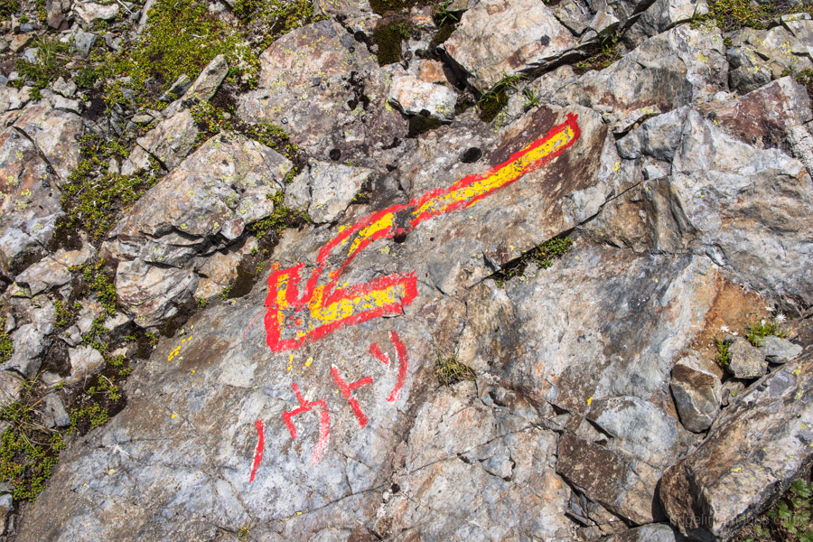
In hindsight, we should have just thrown the towel and stayed at Notori hut.
These days when planning a hike, I no longer care if a day seems short. If it doesn’t fit under 6 hours, I’d rather cut it short after just 3 or 4 and enjoy some downtime at a camp rather than pushing to 8.
Safe hikes!
Many thanks for the comment, Alex.
I can’t count the number of times I have tripped, fallen over, and slightly twisted my ankle around campsites and other innocuous spots often before even hitting the trail. I suspect there is an element of letting your guard down and not imagining something like that could happen.
The last time I was in the Minami Alps, I had a similar experience, though this time a typhoon barrelled down on the campsite. One chap toughed it out in his tent while the rest of us ponied up to stay safe in the hut. Probably the best 7,000 yen I’ve ever spent!
I had a look at your Yamareco trip. You’re right; the second day was quite a stretch. Although if you had stayed at the Notori Hut, it would have meant a pretty long third day. So, it’s really hard to know. When I did a similar hike in the area, I spent a night at both the Notori Hut and Daimonzawa before hiking out on the fourth day.
Enjoy the summer hiking season!