.
Kamikochi 上高地 – Dakesawa 岳沢小屋 – Karasawa Cirque 涸沢カール
Distance: 26.7 km
Elevation change: 1685 metres
Highest point: 3190 metres
Start: Kamikochi Bus Stop
Finish: Kamikochi Bus Stop
Difficulty: ▅▅▅▅▅▅▅▅▅▅ ❺
Map: Yama to Kogen Chizu 山と高原地図 [No.40 槍ヶ岳・穂高岳 YARIGA-TAKE·HOTAKA-DAKE]
GPX TrackKML TrackGSI MAPPDF Topo Map
Climbing Oku-Hotaka via the Jutaro-shindo Trail
At 3,190 metres, Mt. Oku-Hotaka proudly claims the title of Japan’s third-highest peak – though only by a whisker over Mt. Ainodake. With its imposing profile of sheer, jagged rock, it stands as one of the most iconic mountains of the Northern Alps. Along with Yarigatake, the most common approach is from Kamikochi via Yokoo Sanso – a route I attempted but didn’t quite complete back in 2017. This time, however, I tackled the Jutaro-shindo trail, the most direct way to the summit. While not considered the most difficult approach – that honour goes to routes via Gendarme or Mt. Kita-Hotaka – it was still a serious undertaking. The trail climbs unremittingly up steep, exposed slopes, gaining just under 1,700 metres of elevation. It’s a route that should not be taken lightly.
Day 1: The Climb to Dakezawa-goya (4.5 km)
There are several ways to reach Kamikochi, including an overnight bus from the Shinjuku Expressway Bus Terminal (Busta Shinjuku). However, unless you’re intent on completing the hike in just two days, a better option is to take the first Limited Express Azusa from Tokyo to Matsumoto. From there, transfer to the Kamikochi Line for Shinshimashima Station 新島々駅, and then board a bus bound for Kamikochi 上高地. This route will get you to the Kamikochi Bus Terminal 上高地バスターミナル around lunchtime. A one-way combined train and bus ticket from Matsumoto to Kamikochi costs 3,710 yen and takes around 1 hour and 40 minutes.
The days of simply turning up at Shinshimashima Station and expecting to board a bus are over. To guarantee a seat, reservations should now be made online in advance through Alpico Group. As I was waiting on the weather forecast, I only booked on the morning of departure but was lucky to secure one of the last two seats at my preferred time. The first Azusa was already sold out, as is often the case, though I was thankfully able to score a seat from Kofu onwards.
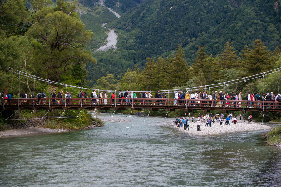
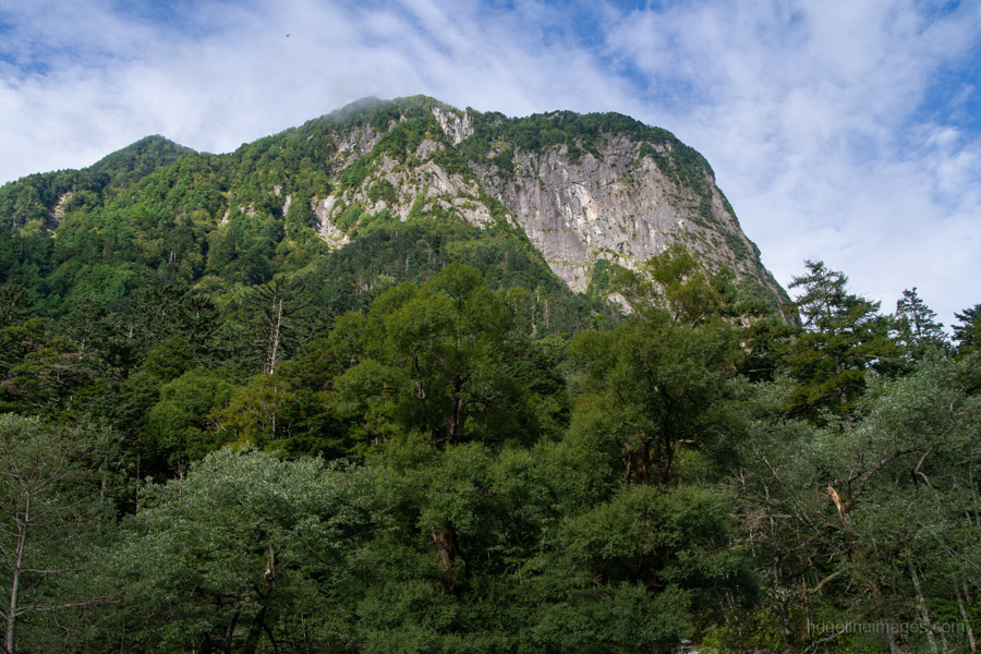
After getting off the bus, you can refill your water bottles at the free taps in the square opposite the bus terminal before crossing Kappabashi Bridge. Compared with my first visit seven years ago, Kamikochi now feels crowded with tourists. The good news is that few venture far from the main thoroughfare, so the congestion is short-lived. From Kappabashi Bridge, there is a fine view of Mt. Yakedake. In the past, an eruption of this volcano dammed the Azusa River and created Taisho Pond. Yakedake remains active today, with smoke still rising from its crater.
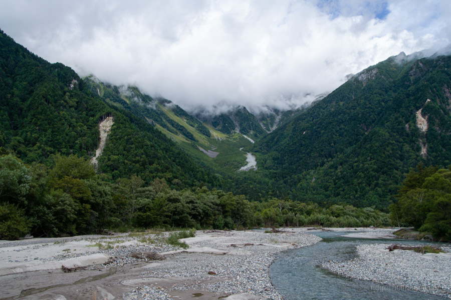
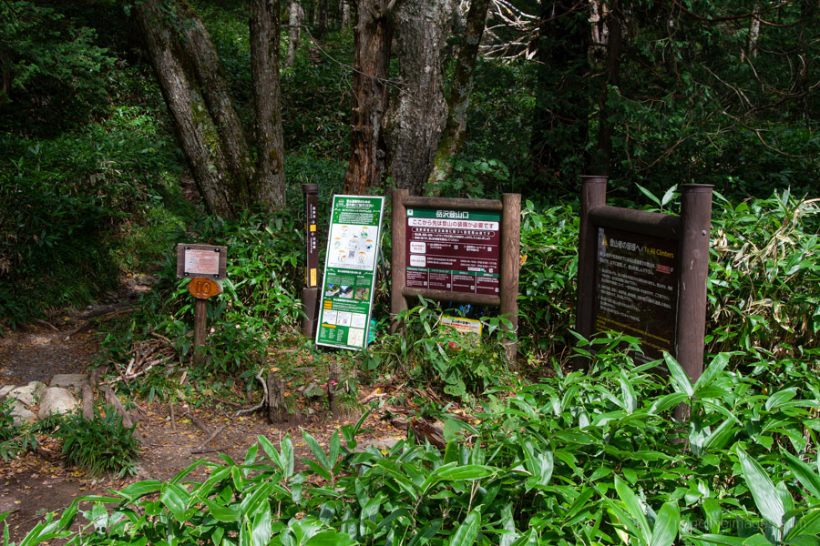
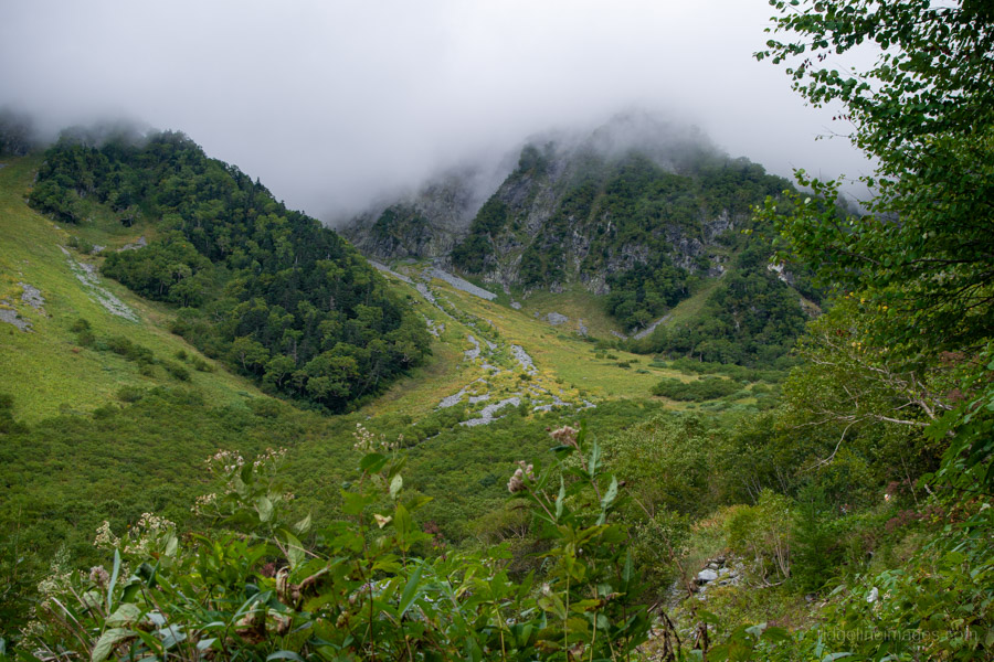
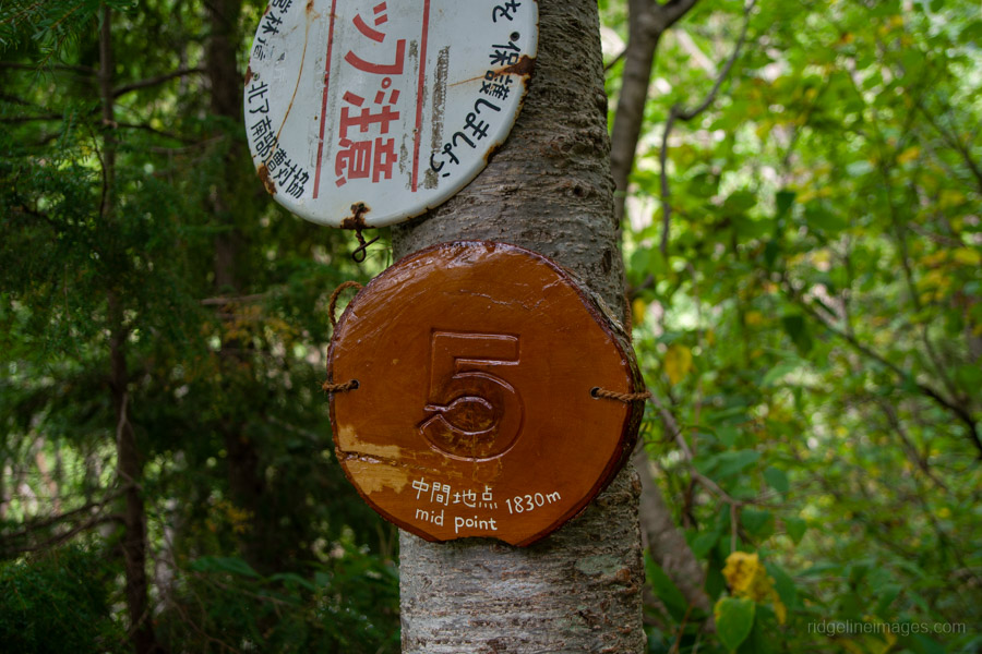
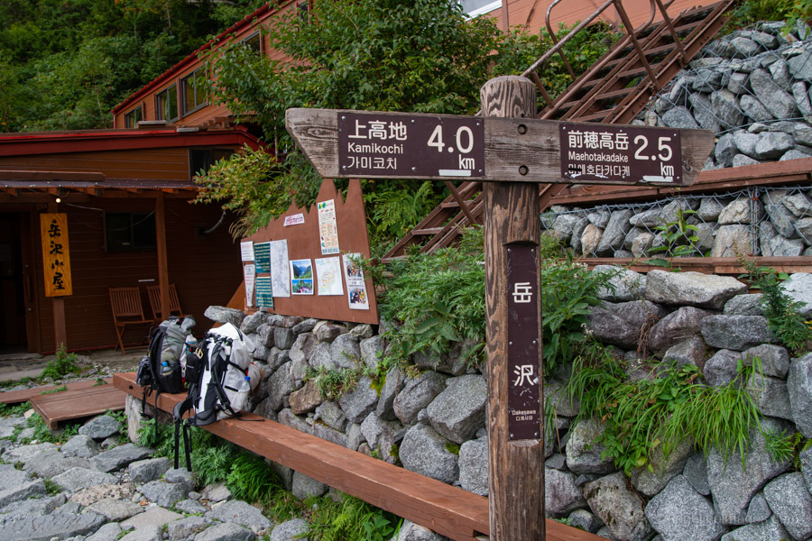
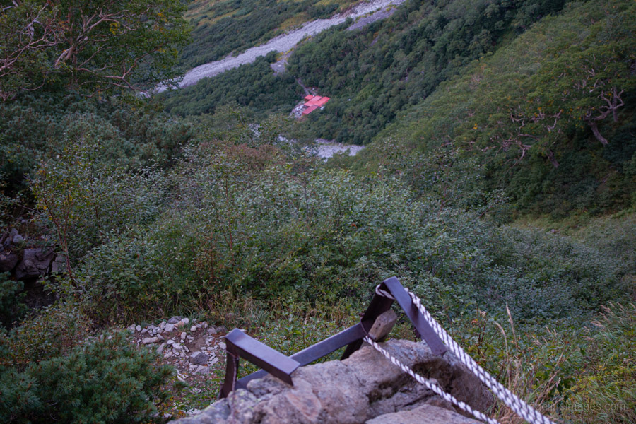
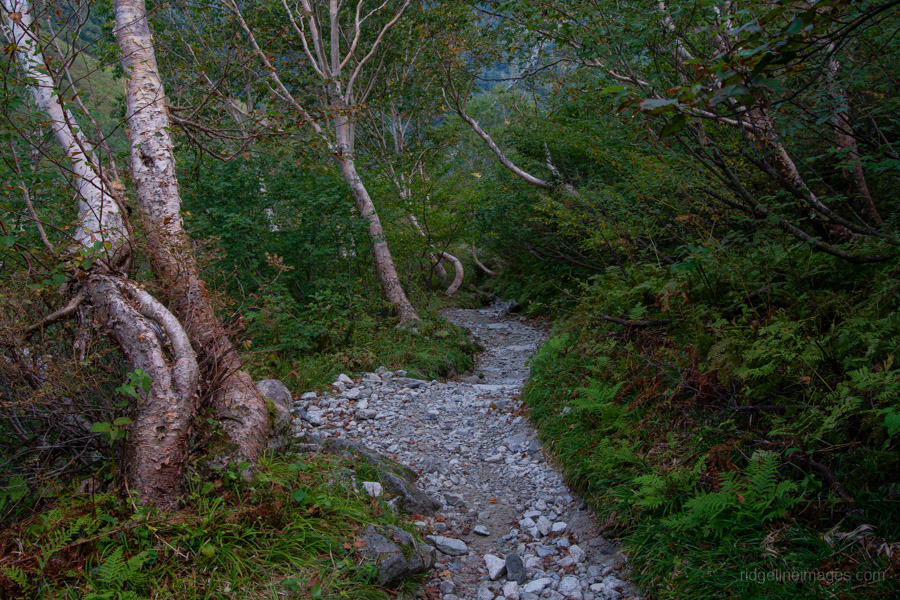
To reach the Dakezawa Trailhead, where the mountain path begins, follow the boardwalk crowded with day-trippers. From there, it takes about two hours to reach Dakezawa-goya 岳沢小屋. The trail starts in forest with a steady incline, occasionally opening up to give glimpses of the surrounding 3,000-metre peaks when the mist clears.
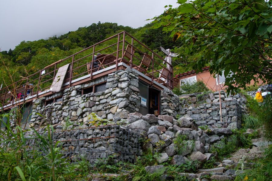
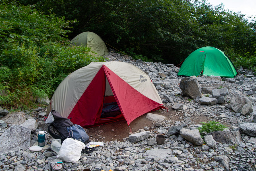
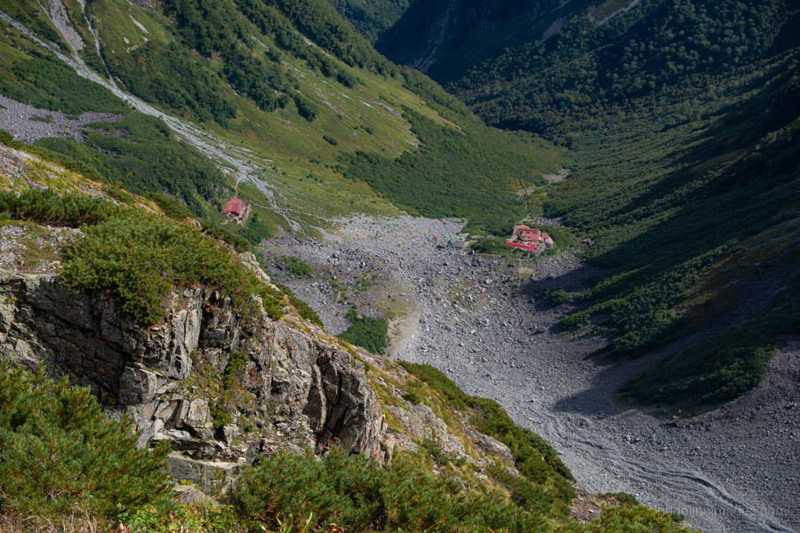
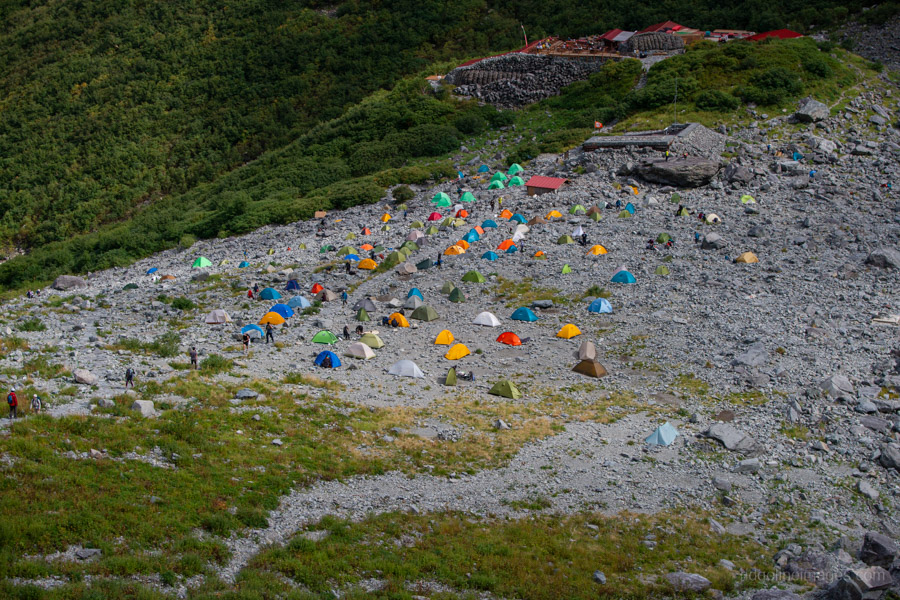
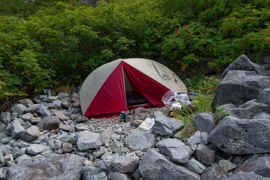
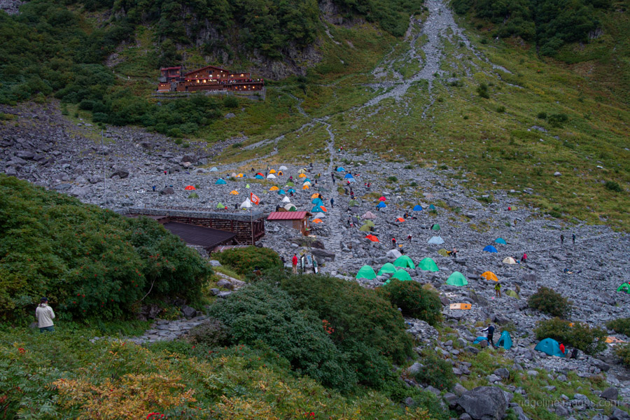
Dakezawa-goya was rebuilt in recent years after its predecessor was destroyed by a landslide. If you’re not confident about completing the entire Jutaro-shindo 重太郎新道 trail in a single day, it’s best to stay overnight here or at the campsite (2,000 yen) and begin the climb early the following morning. The elevation gain from Kamikochi to Dakezawa-goya is about 650 metres. The drawback is that most campsites lie on the far side of the Dakezawa River, making trips to the toilets and water source somewhat inconvenient.
Day 2: Steep Slopes and Rocky Ridges to Oku-Hotaka (6.5 km)
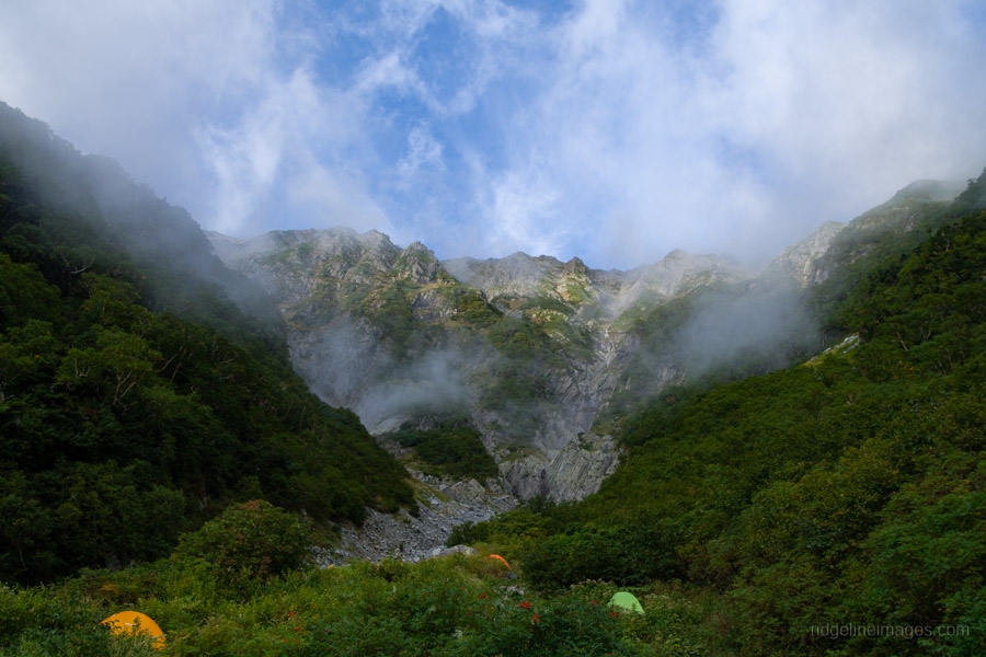
The previous afternoon, the mist briefly lifted, exposing the sheer, high peaks – a positive sign for the following day. Overnight the skies cleared, and I woke to find the tent fly drenched with condensation. For a Monday night, the campsite was surprisingly full, and a sign at the trailhead advising early arrival to secure a space was on the money.
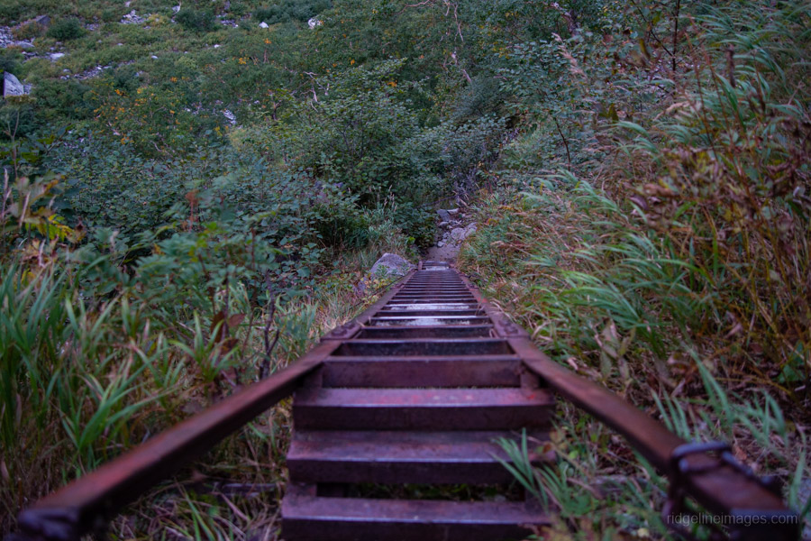
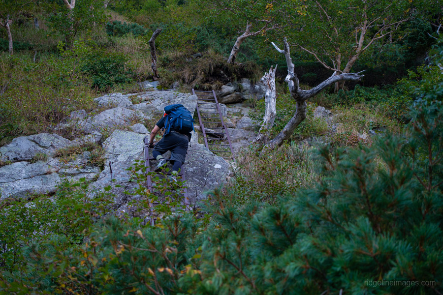
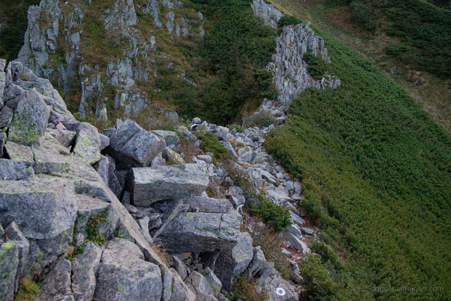
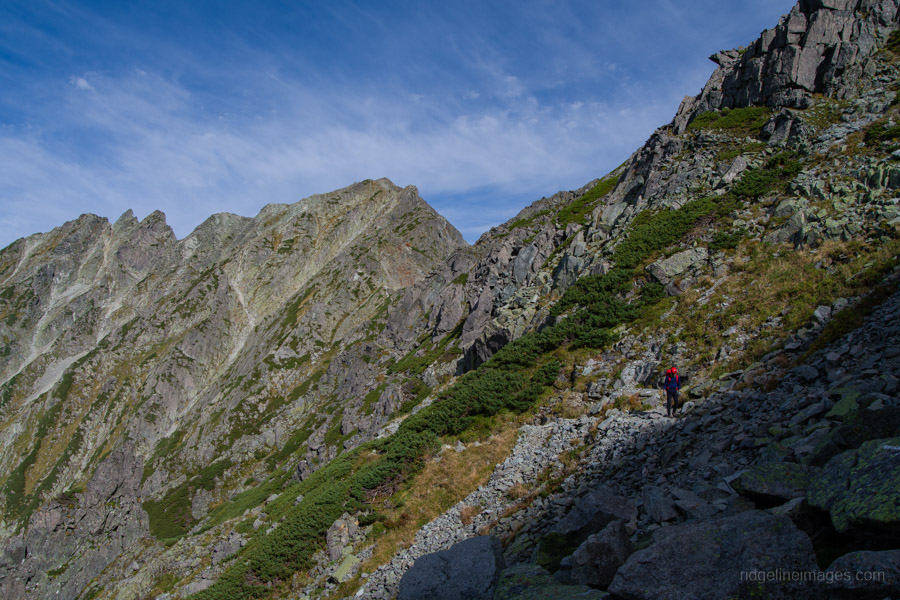
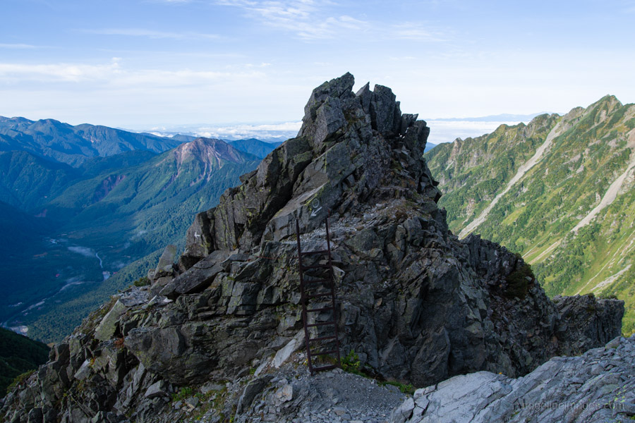
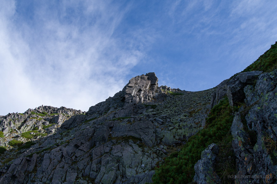
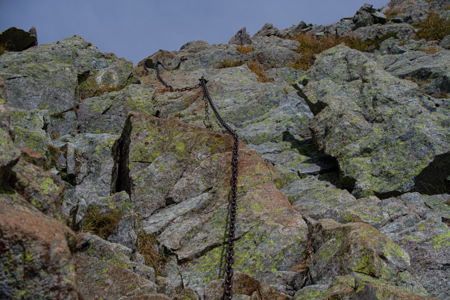
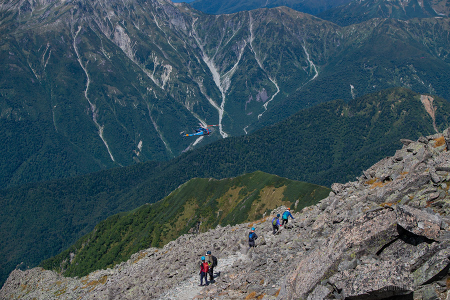
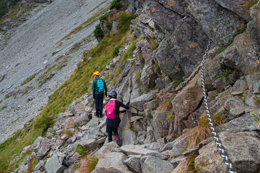
With the real climbing about to begin, this is the point to put on a helmet. From Dakezawa, the trail climbs steeply out of the valley. At the top of the switchbacks, the rocky terrain begins in earnest and continues all the way to the summit. After squeezing through a narrow passage in the rocks, the route requires scaling a long ladder that gives a true sense of height. Looking back across Kamikochi was spectacular, with low-lying mist in the valley and the morning sun touching summit of Mt. Yakedake.
Soon after, another iron ladder appears, followed by an exposed rock face equipped with chains (kusari-ba) and offering more panoramic views over Dakezawa and Kamikochi. The route then continues along a narrow, rocky ridge, marked with white painted circles and arrows, with Mt. Maehotaka – often shortened to Maeho – towering above. This stretch leads to Raicho-hiroba 雷鳥広場, a spot that lives up to its name as a likely place to encounter rock ptarmigan.
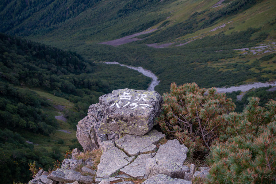
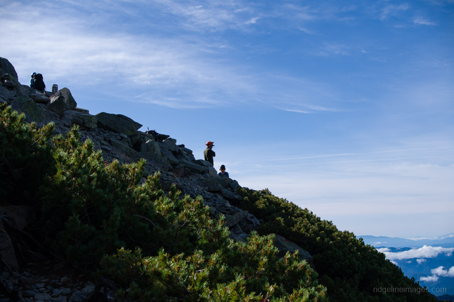
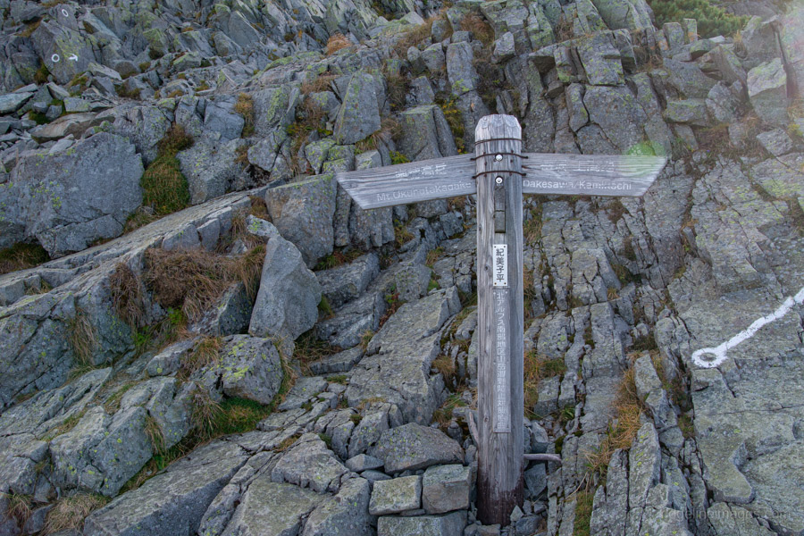
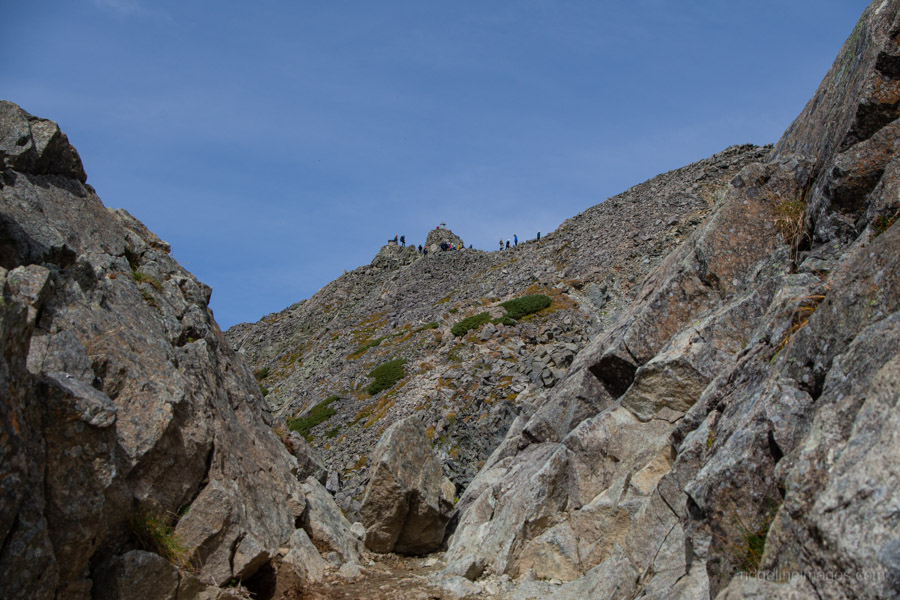
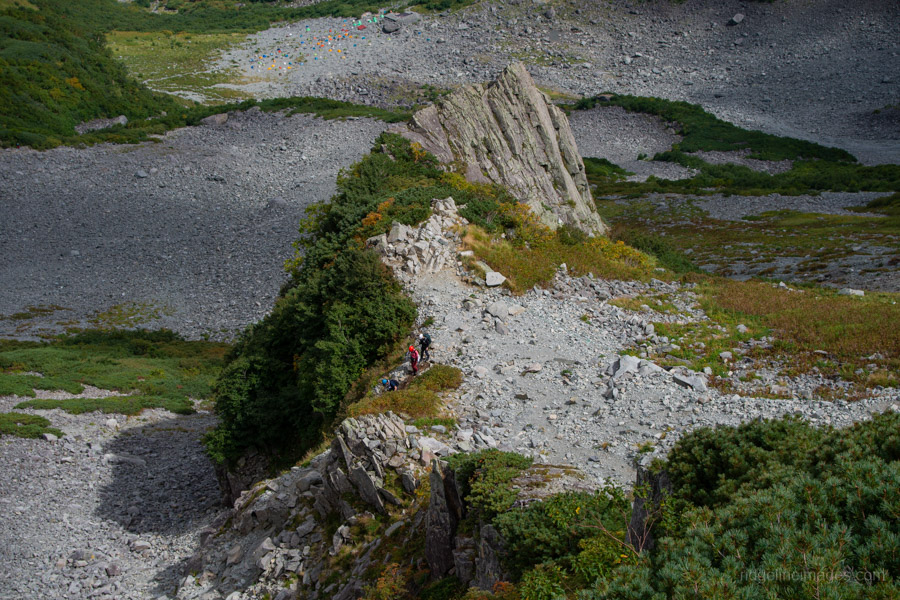
From here, one final push brings you to Kimiko-daira 紀美子平, said to be named after the daughter of the founder of the Jutaro-shindo trail. In any case, it makes an excellent place to set down your pack and take a well-earned break. I was in two minds about doing an out-and-back to the summit but decided against it, wanting instead to push on toward Oku-Hotakadake before the clouds moved in. If you choose to make the return scramble, allow about an hour for the round trip.
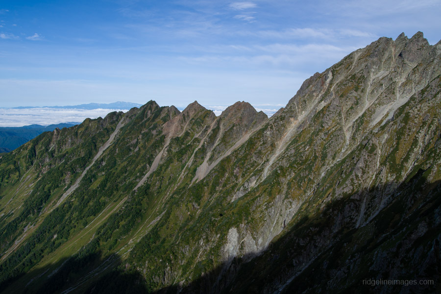
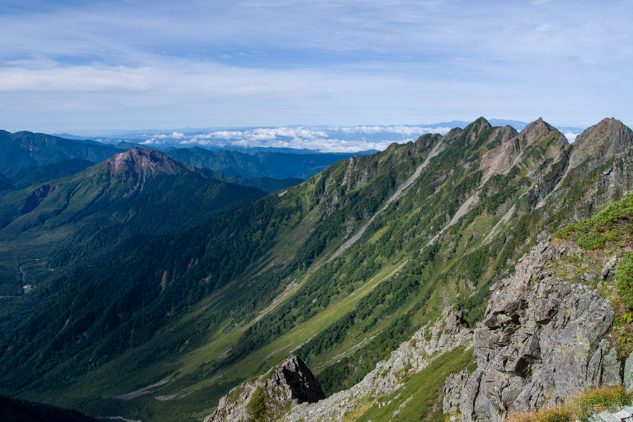
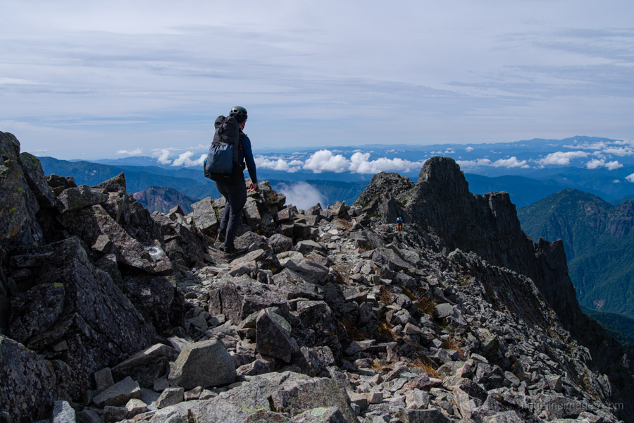
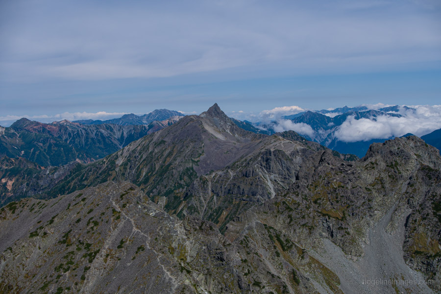
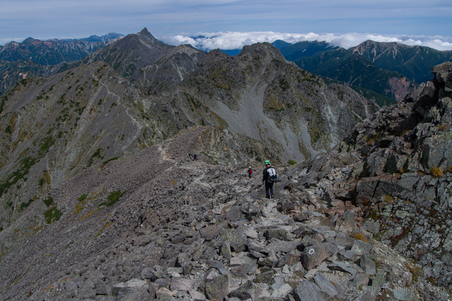
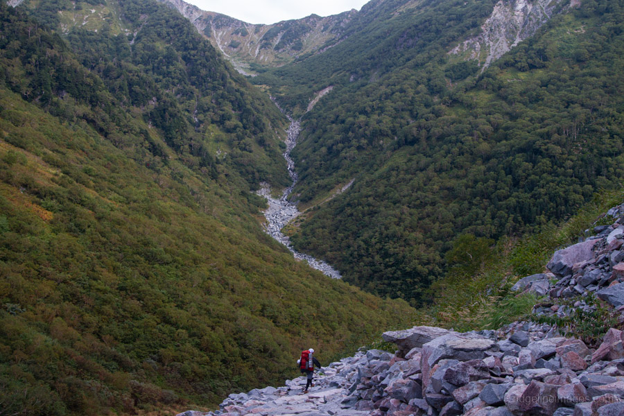
From here the route continues toward Okuhotakadake along the ridge connecting Maeho and Okuho, known as Tsurione Ridge 吊尾根. Rather than following the crest, the trail runs along the southern flank of the mountain. The path is generally wide enough to lessen the sense of exposure. Once on top of the ridge, a sweeping view of the Karasawa Cirque opens up on the opposite side. Most striking was the absence of snow around the hut, where there is usually still a good amount even in September.
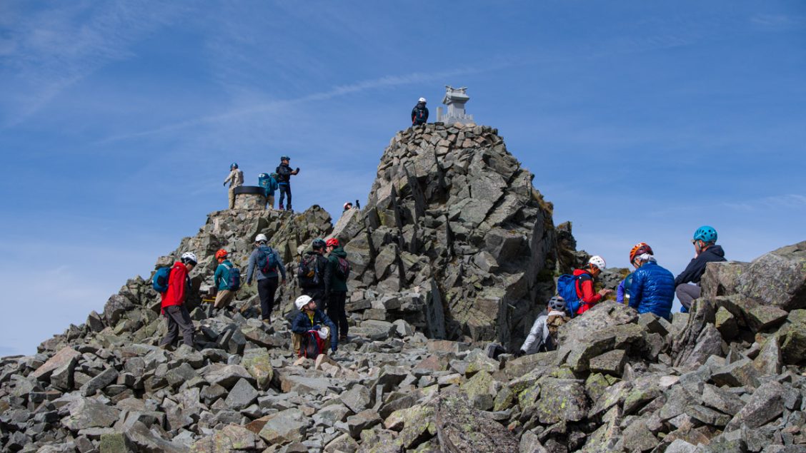
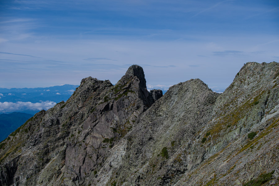
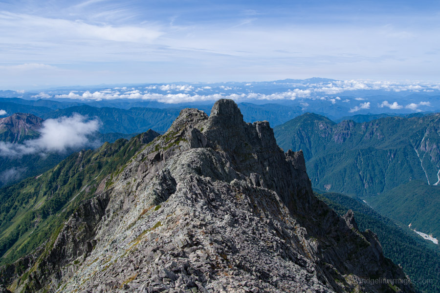
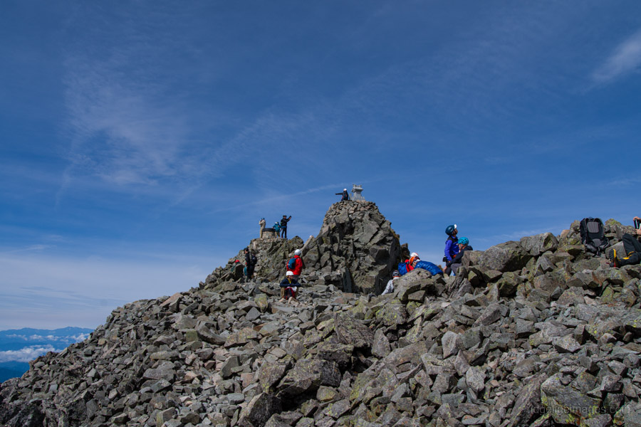
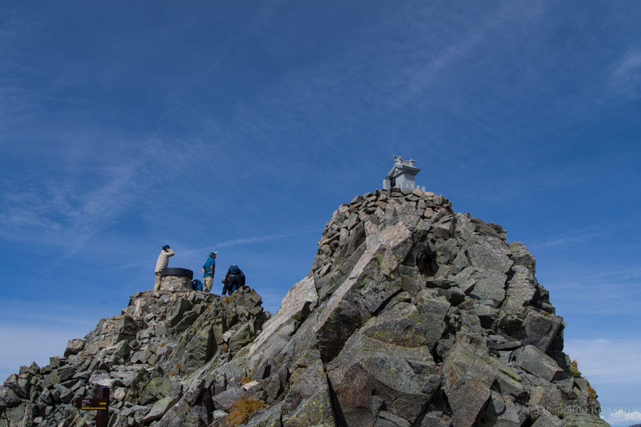
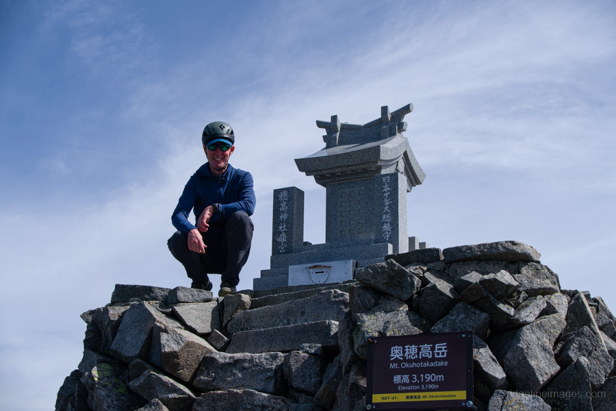
After clambering up a final set of fixed chains, there was a fine view of the infamous Gendarme before reaching the summit of Mt. Oku-Hotaka 奥穂高岳 (3,190 m). The peak is marked by a cairn with a shrine and was busy, with many hikers who had come up from Hotakadake-sanso 穂高岳山荘. While waiting in line for a commemorative summit photo, I struck up a conversation with a German climber attempting a full traverse of the range, and we remarked on how fortunate we were with the weather.
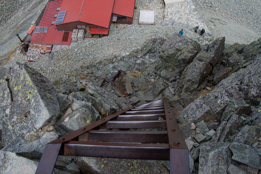
Leaving the summit, the trail descends toward Hotakadake Sanso, with extra care required on the final section involving chains and two precariously positioned ladders. From the Dakesawa campsite, it took about six hours to reach the hut, where I paused for a well-deserved lunch overlooking the Karasawa Cirque. Water can be purchased at Hotakadake Sanso for 200 yen per litre, and there’s also a small, exposed campsite that can apparently squeeze in 25 tents.
One thing that never fails to surprise me is the number of hikers happily downing 500 ml beers alongside bowls of ramen purchased from the hut. Fair enough if they’re stopping for the day, but it’s not something I’d want to do if I were continuing a climb.
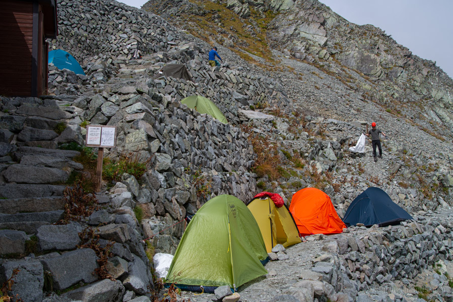
After refuelling, the final task for the day was the descent to both the Karasawa-goya 涸沢小屋 and Karasawa Hutte 涸沢ヒュッテ. This section of trail reconnected with the route I had taken on my Mt. Karasawa hike a few years earlier. The path along the Seitengrat ザイテングラート is not especially dangerous, though many accidents occur each year – likely due to hiker fatigue. Incidentally, the name Seitengrat is another mountaineering term of German origin, meaning “side ridge.”
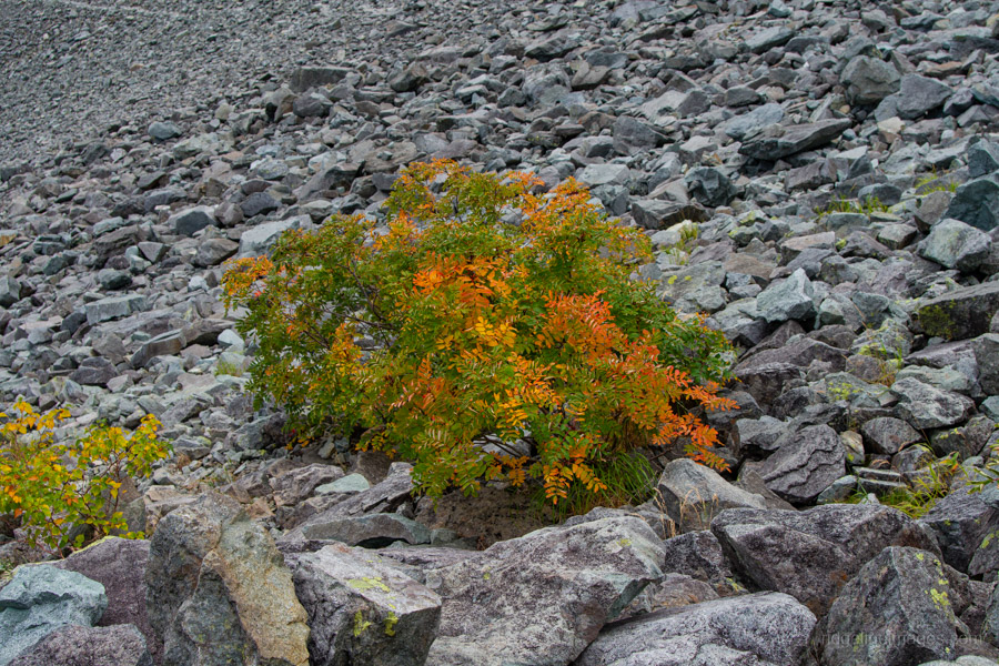
While there were a fair number of tents set up, it was nothing like the crowd I encountered on my previous visit, when there must have been close to 1,000 tents. I suspect I even ended up in the same campsite (2,000 yen) as last time, nestled beside some rowan trees heavy with bright red berries.
Day 3: Morning Glow and the Descent to Kamikochi (15.7 km)
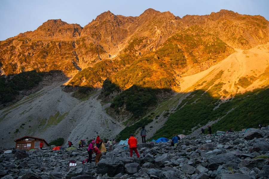
After dinner, I quickly fell asleep, exhausted from the long day’s hike. The following morning, after breakfast, I headed up to the terrace of the Karasawa Hutte to watch the morgenrot – the celebrated “morning glow” when the surrounding peaks of the Karasawa Cirque are tinted red by the first rays of the sun. After soaking up this early spectacle, it was all downhill back to Kamikochi.
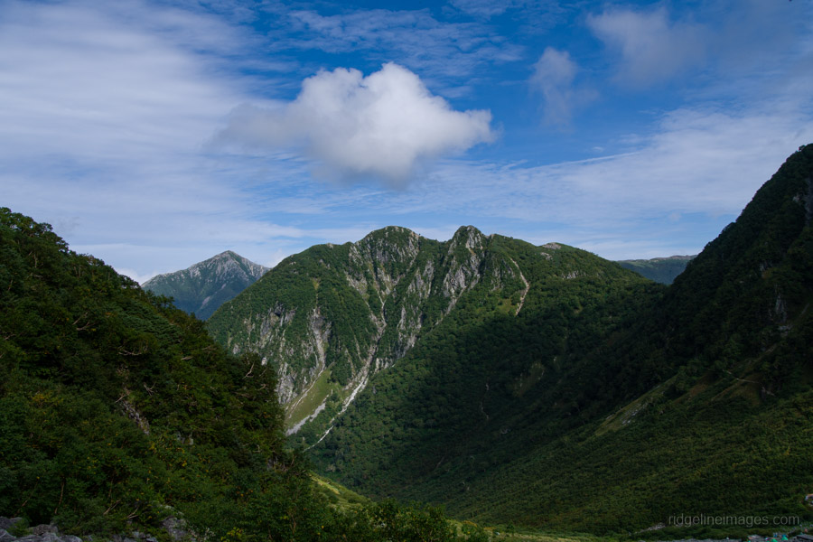
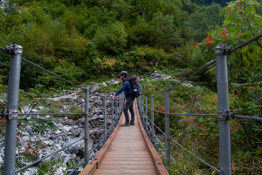
After descending for a while, the views fade as the trail re-enters the forest, though there is a couple last magnificent glimpses of Oku-Hotaka. Shortly after, the route passes through the remains of a large landslide, where the rocky terrain has been paved into a cobblestone-like path that’s easy to walk on. Across the valley, the roar of water can be heard from the Yokoo Hondani. Before long, you arrive at Mototani Bridge, where two crossings – a suspension bridge and a wooden bridge – span the river. This is a popular rest stop on the Karasawa route. From here to Yokoo Bridge, the path is almost entirely flat, marking the end of the alpine hiking zone and the beginning of the area frequented by regular tourists.
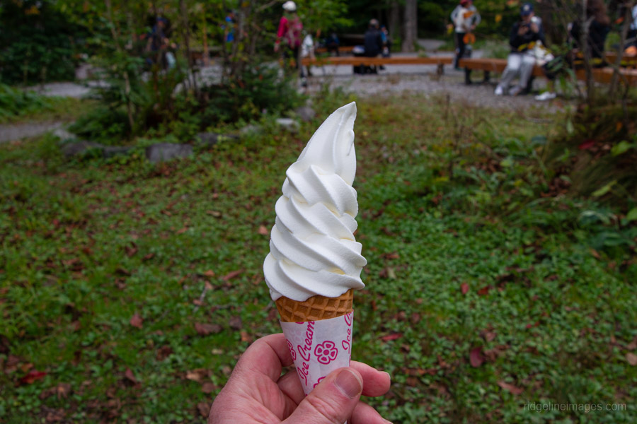
At Yokoo Sanso, my first priority was securing an online bus reservation back to Shinshimashima Station. It was just as well, as by the time I reached Kamikochi the next two buses were already sold out. The final 11 km back to the Kamikochi Bus Terminal takes about two and a half hours. Helping spur me along was the thought of a soft serve ice cream at Tokuzawa Lodge. The camping area at Tokuzawa, once a pasture, is very spacious and has a relaxed atmosphere – worth considering even if you come only to camp without hiking.
Being a public holiday, Kamikochi was bustling with visitors, the crowds providing a sharp contrast to the quiet of the mountains. From there, it was simply a matter of retracing my steps for the return journey back to Tokyo.


LOL, you’ve dislodged some forgotten memories with this nice post David! I did this in reverse in autumn 1996. That last climb to the Hotaka peak was no snap with 23kg on board although it helped keep me grounded with 70kmh winds on top. Looking back, it’s hard to believe the equipment we carried then.
Pleased to hear it, Stewart! It’s a tough hike but you’re certainly rewarded with the views. I remember lugging around a 75L Macpac Cascade for many years, even in the early days of this blog. Built to last a lifetime – and it certainly felt like that – but geez it was heavy. I don’t think my pack was quite as heavy as yours, but it was up there. These days my base pack weighs around 600 g, and even with a bottle of water I’m seldom over 10 kg on an overnight hike.
Many thanks for the great photos, the gripping ladder-by-ladder write-up (must have missed them in my snow season ascents and descents of this route) and also for the beta on transport arrangements. The sold-out trains and the need to book the bus into Kamikochi are novelties to me. This all argues for making a visit to the Hodakas in the off-season. But then, of course, there are no buses at all into Kami-kochi (sigh) ….
Late season access by hoofing it from Shinhotaka I found to be a good option.
Thanks for reading, PH. Ladders are certainly one thing that hike isn’t short of! Yes, with the influx of overseas visitors, the transport infrastructure is definitely being pushed to capacity – it was a novelty for most of us until quite recently. The Hodakas in the off-season would be incredible, as you say, just need to find a way in.