.
Ojiragawa Gorge 尾白川渓谷 – Shichijo-koya 七丈小屋 – Komagatake Shrine 駒ヶ岳神社
Distance: 24.4 km
Elevation change: 2282 metres
Highest point: 2967 metres
Start: Ojiragawa Gorge car park
Finish: Michi-no-Eki Hakushu bus stop
Difficulty: ▅▅▅▅▅▅▅▅▅▅ ❺
Map: Yama to Kogen Chizu 山と高原地図 [No.44 北岳・甲斐駒 KITA-DAKE·KAIKOMA]
GPX TrackKML TrackGSI MAPPDF Topo Map
A Challenging Ascent to Mt. Kaikomagatake
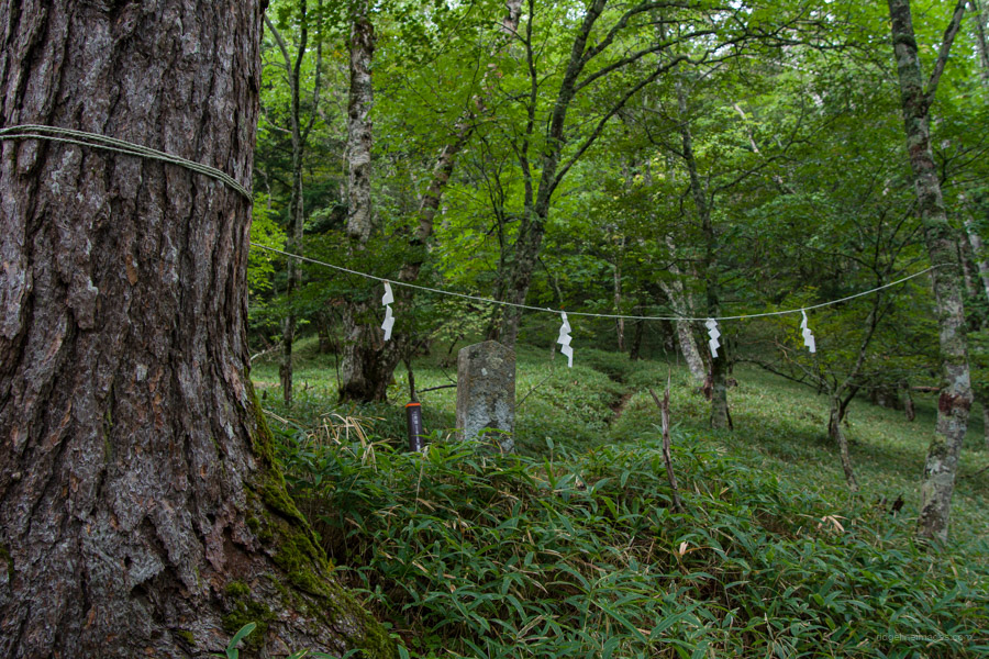
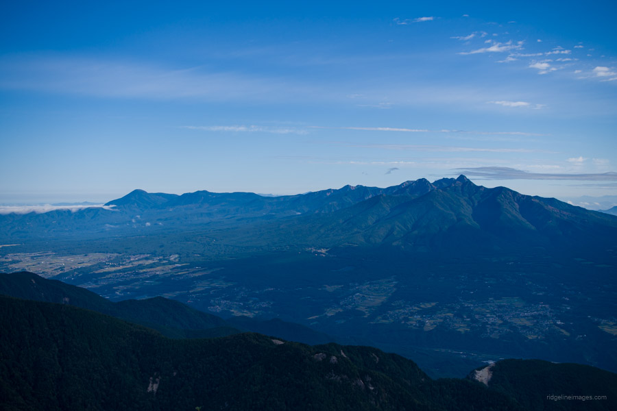
Mt. Kaikomagatake, standing at 2,967 metres, is located near the northern end of the Southern Alps, straddling Yamanashi and Nagano Prefectures. Its striking chalk-white appearance is clearly visible from the Kofu Basin at the foot of the mountain. Kyuya Fukada, author of Japan’s 100 Famous Mountains, wrote that even if he were to choose only ten mountains from all of Japan’s peaks, Mt. Kaikoma would never be left out. The hiking trail is lined with stone Buddha statues, shrines, and swords, offering a glimpse into the history of mountain worship, which dates back more than 200 years.
While Mt. Kaikomagatake is most commonly approached as a day hike from Kitazawa-toge (with an elevation gain of 935 metres), the hike described here follows the tough Kuroto-one Ridge route, considered one of Japan’s top three steep climbs 日本三大急登, along with Bunatate Ridge in the Northern Alps and Nishikuro Ridge on Mt. Tanigawa. What really sets this route apart, beyond the numerous ladders and chains, is the colossal near 2,300 metres of elevation gain!
Day 1: Misty Weather on the Kuroto Ridge (8.3 km)
There are a couple of ways to reach Ojiragawa Gorge 尾白川渓谷. The cheapest option is to take the JR Main Line to Nirasaki Station 韮崎駅. From there, catch the 8:45 am bus departing from bus stand 3 to Michi-no-Eki Hakushu 道の駅はくしゅう, a 33-minute journey costing 1,040 yen. From Michi-no-Eki Hakushu, it’s about a 50-minute walk to the car park at the entrance of Ojiragawa Gorge.
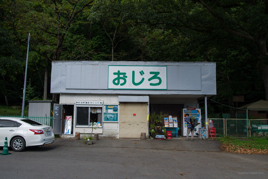
Recommended, however is to book a ‘mountain taxi’ departing from Kobuchizawa Station 小淵沢駅 at 9:00 am (bookings must be made online with a credit card by 5:00 pm the day before). The fare is 1,500 yen on weekdays and 1,800 yen on weekends. In 2024, this service operates from 15 June to 15 November. For this hike, I used the mountain taxi for the outbound trip, but as the return taxi doesn’t depart until 4:00 pm, I opted to take the bus from Michi-no-Eki Hakushu instead. If you’re planning an early start, you might want to camp at the nearby Hakushukanko Ojiro Campground 白州観光 尾白キャンプ場, which costs 1,500 yen.
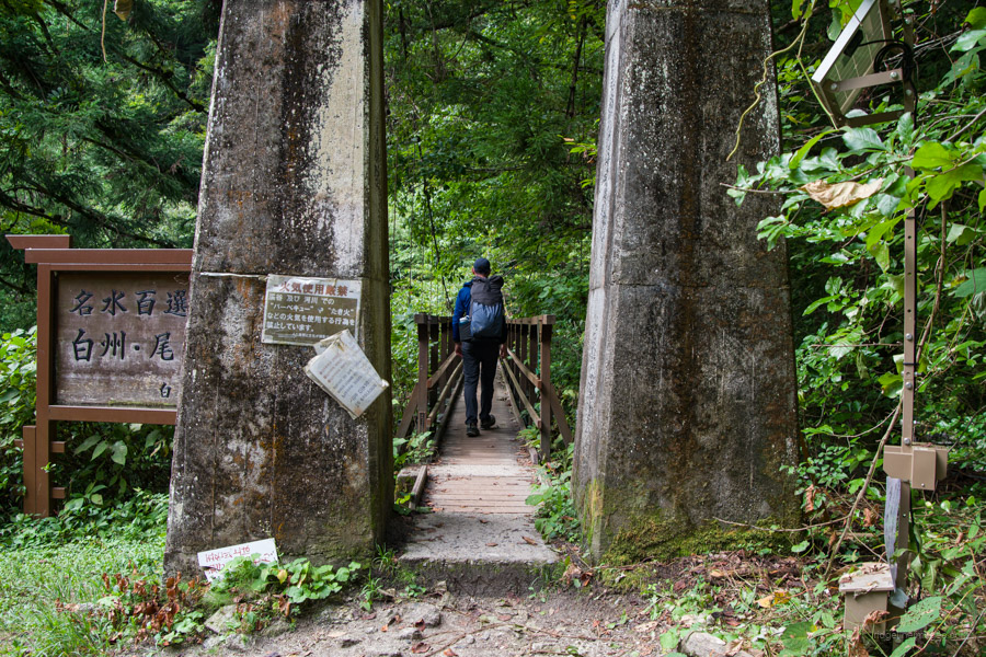
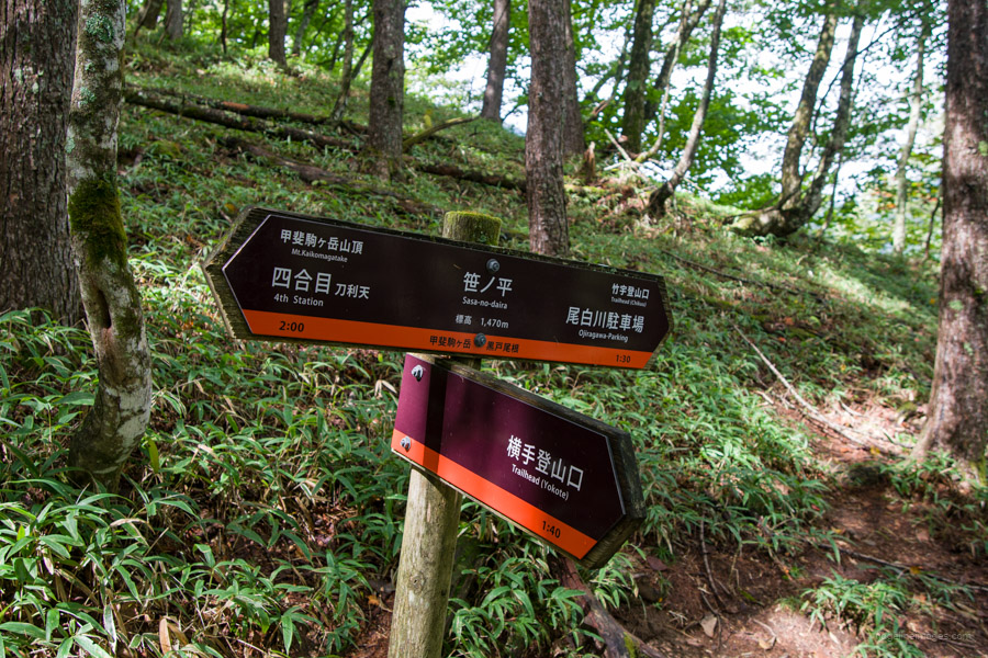
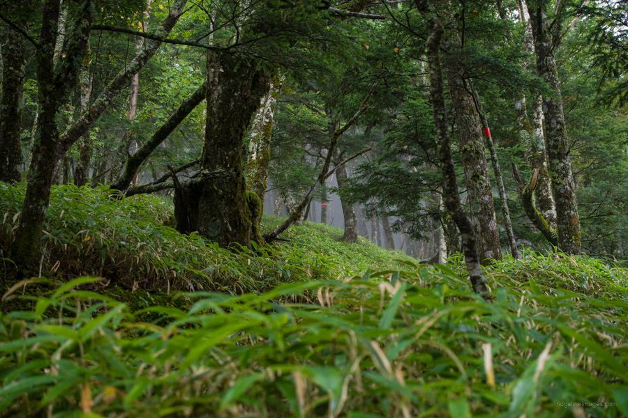
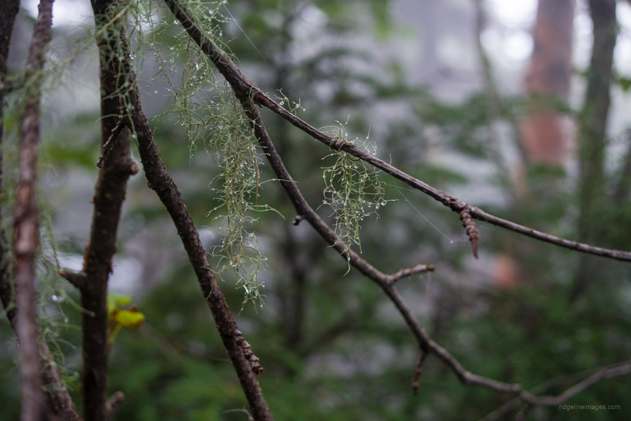
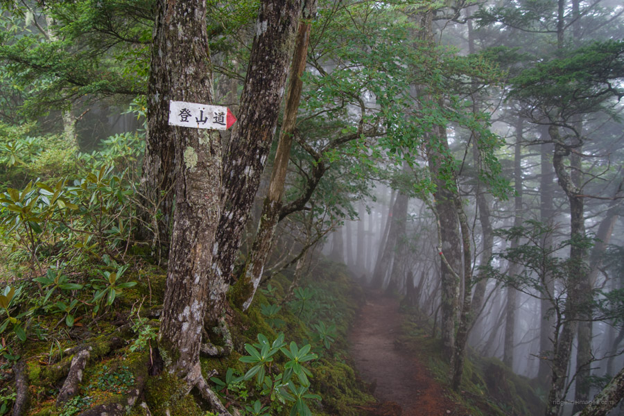
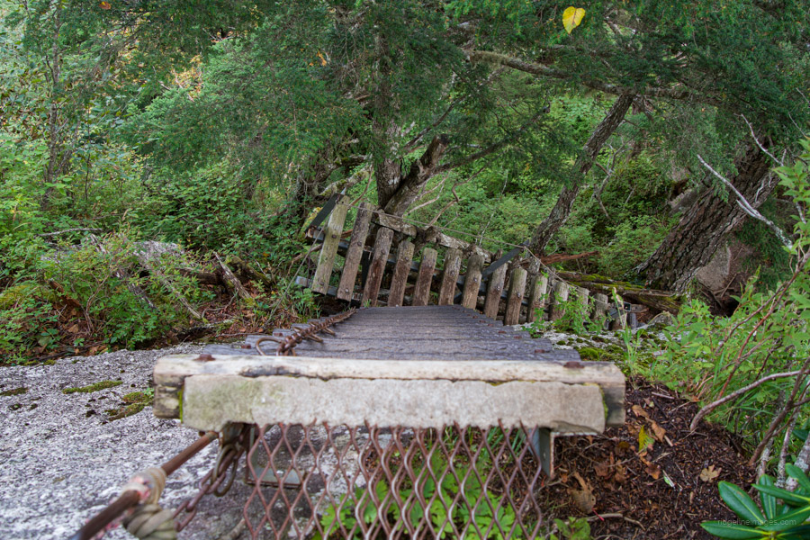
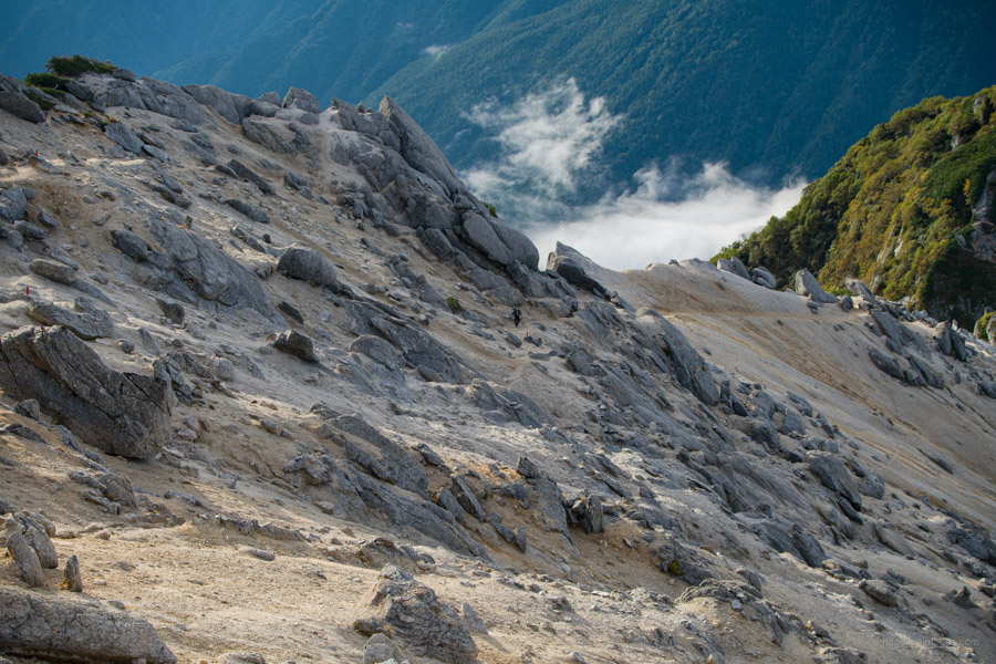
The hike begins at the Ojiragawa Gorge car park. After passing the turn-off for Mt. Hinata and the Chikukomagatake Shrine 竹宇駒ヶ岳神社, cross the suspension bridge to the opposite side of the valley. From there, start your ascent on a steep, winding trail through a forest of Japanese beech (buna) and chestnut trees. After about 2 hours of hiking, you’ll reach the Sasa-no-daira trail junction 笹の平分岐, where the trail merges with another route coming up from Yokote 横手登山口. Next, you pass through an area covered in Kumazasa bamboo grass. As you continue on the steep Kuroto Ridge 黒戸尾根, you’ll enter a stunning old-growth forest. Newly installed trail markers clearly indicate each of the nine stages to the summit.
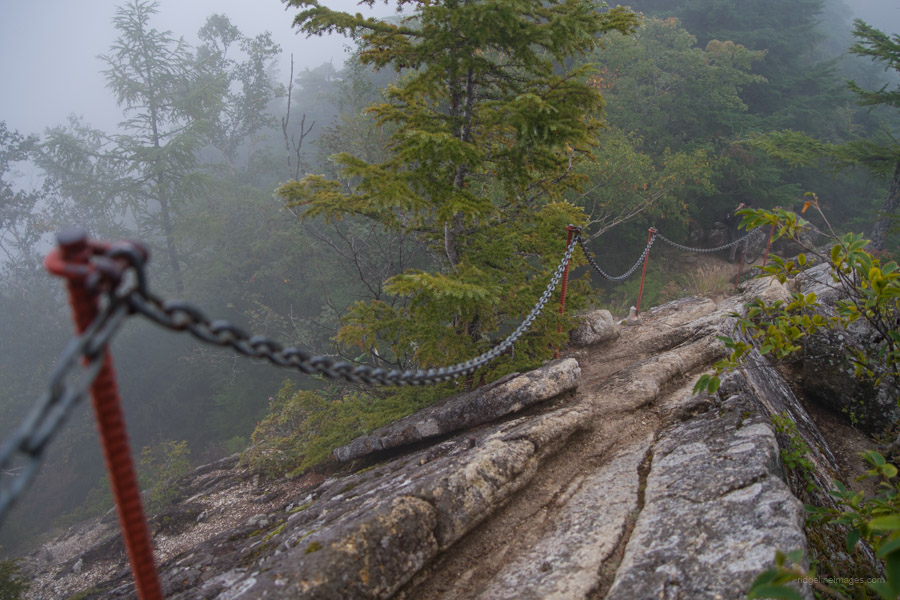
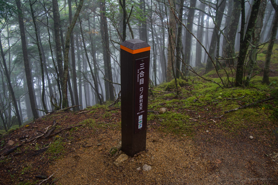
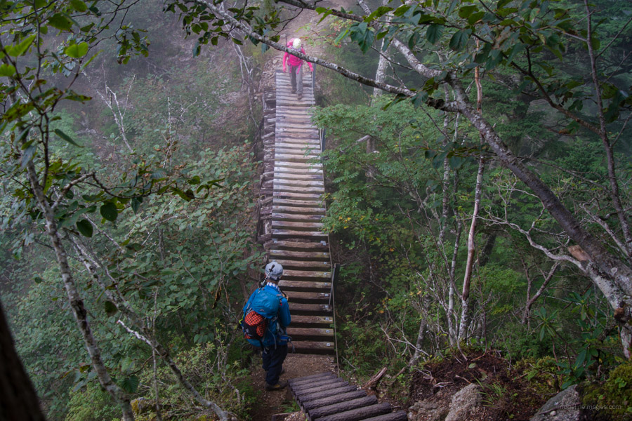
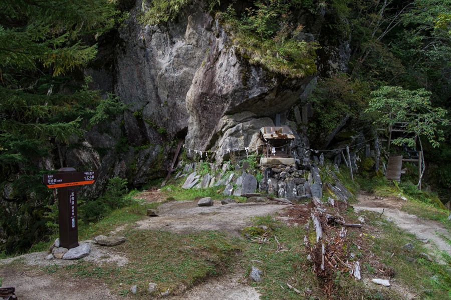
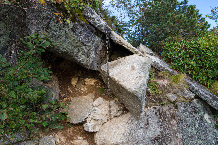
A little further along, you’ll reach the 3rd Station 三合目, followed shortly by Hawatari 刃渡り, a knife-edge ridge. Use the chains secured to the rock face to negotiate this short section. After crossing Hawatari, the trail follows the ridge closely. From this point, you’ll encounter a series of ladders and fixed chains. About 90 minutes after leaving Sasa-no-daira, you’ll arrive at Touri-tengu 刀利天狗, the 4th Station 四合目, marked by a small shrine.
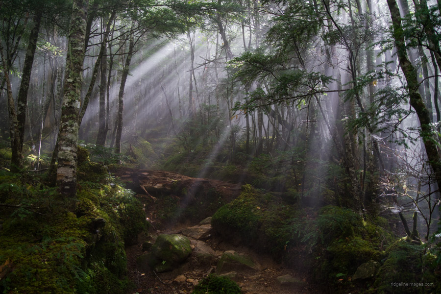
After that, the trail descends through a forest along the right slope of Mt. Kuroto 黒戸山, leading to a col known as the 5th Station 五合目. Up until the 1960s, two mountain huts stood around here, but now only a relief serves as a marker in the flat area before the final descent into the col. Around this time, the misty weather briefly cleared, allowing sunlight to filter through the trees, creating a beautiful komorebi 木漏れ日 effect.
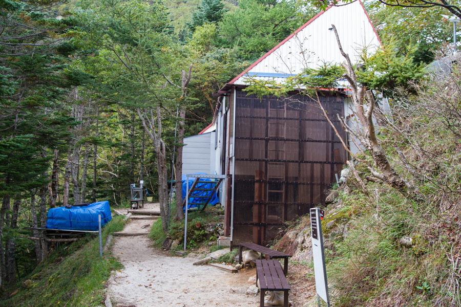
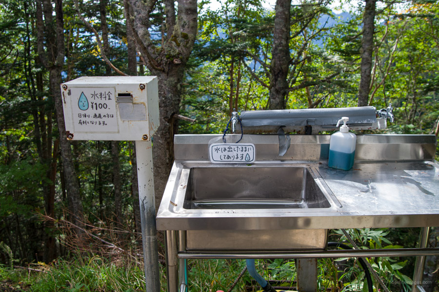
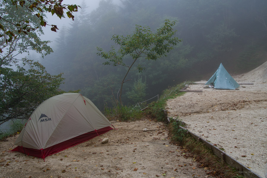
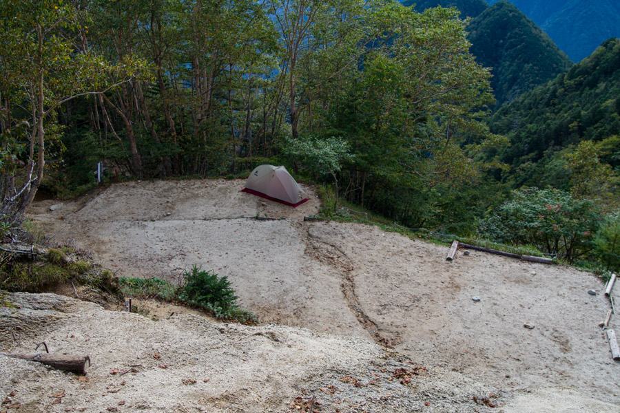
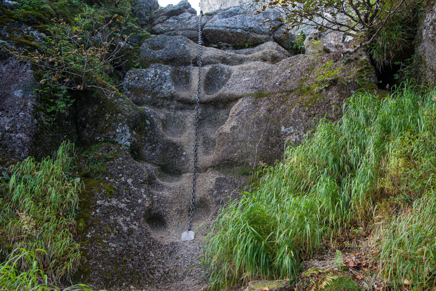
From the 5th Station, the trail becomes increasingly demanding, with more ladders and chains assisting your navigation of the steep terrain. After about 5.5 hours of hiking from Ojiragawa Gorge, you’ll reach the 7th Station 七合目, home to the Shichijo-koya 七丈小屋 hut (10,500 yen on weekdays and Sundays, 12,000 yen during peak times, including two meals). Water is available and camping spots for around 20 tents are available on a first-come, first-served basis for 1,000 to 1,500 yen.
Day 2: Early Morning Start Reaps a Stunning View (16.1 km)
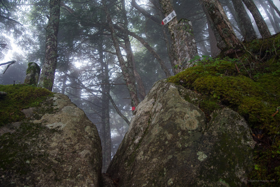
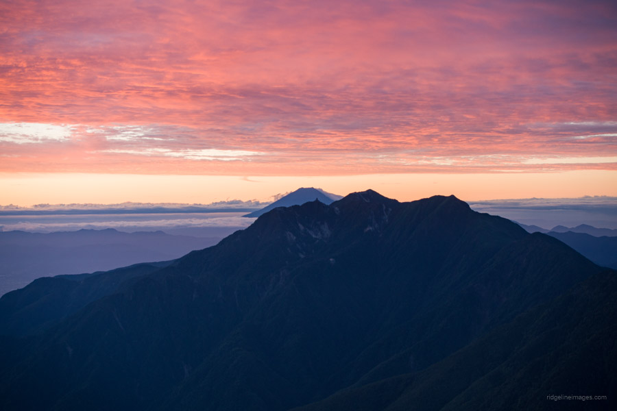
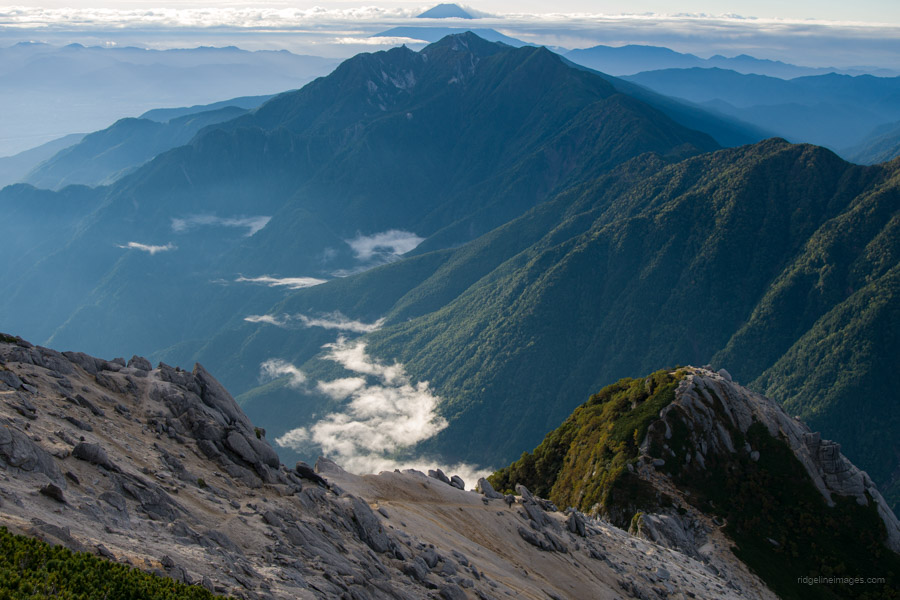
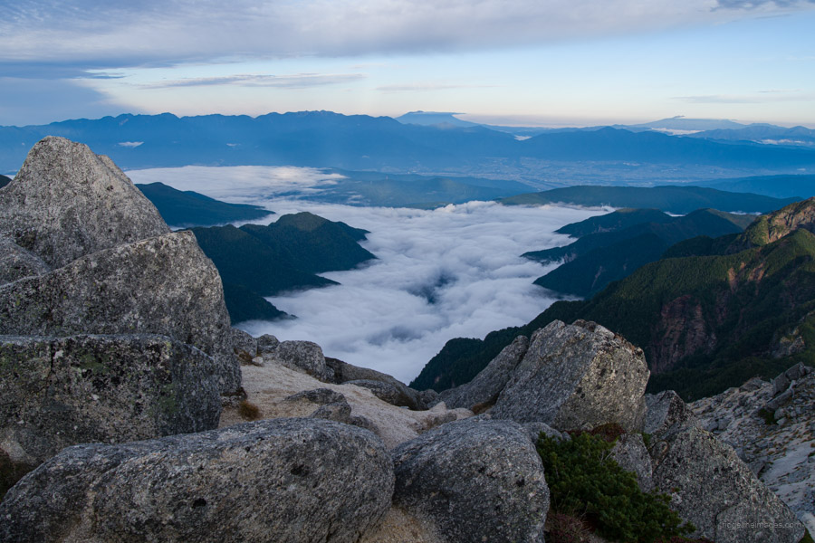
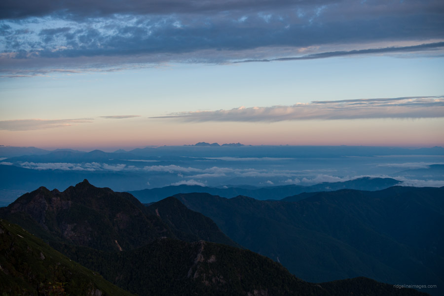
Overnight, the thick fog that had lingered over the ridgeline thankfully cleared, leaving only faint clouds in its wake. It was also the first chilly morning of the season, with the temperature dropping to 7 degrees. For those staying at the hut, begin by climbing the ladder behind Shichijo-koya, passing two camping areas, and tackling yet another series of ladders and chains. As you ascend through birch forest (Shirakaba), you’ll enter a zone of creeping pine (haimatsu-tai). After about an hour of hiking, you’ll reach the 8th Station 八合目, or hachigome, which offers excellent views of Fujisan, Yatsugatake, and the challenging ascent ahead. Note the remnants of a now-fallen stone torii gate that once stood here.
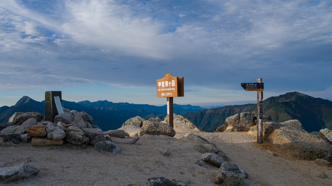
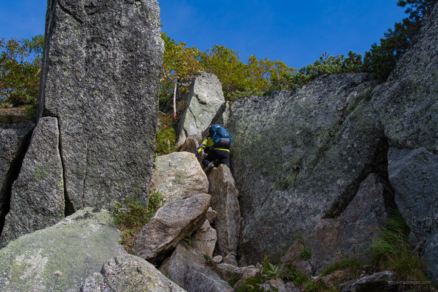
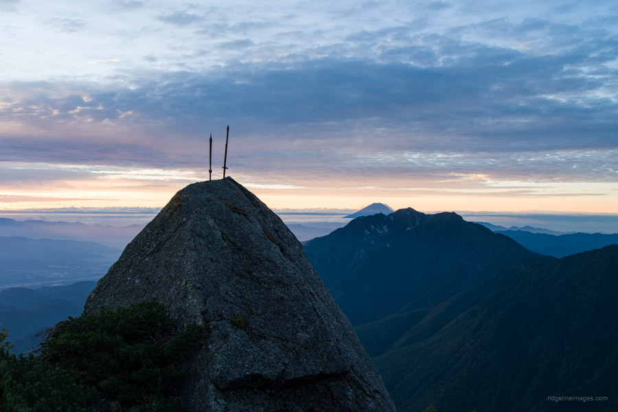
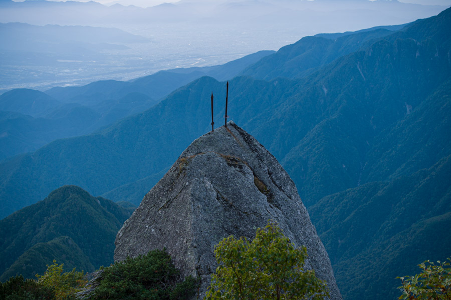
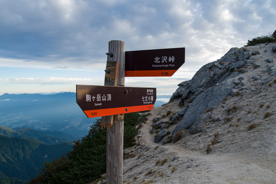
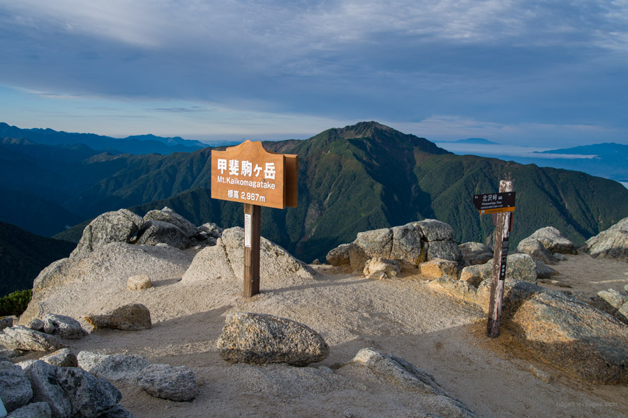
From hachigome, use the chains and footholds carved into the rock face to navigate a tricky corner. Carefully manoeuvre through a narrow rock gully, which requires some finesse. Shortly afterwards, you’ll arrive at the 9th Station 九合目, marked by a large boulder with the two swords of Mt. Kaikoma and Mt. Houou embedded in it. Beyond the 9th Station, the trail becomes gentler as it winds through more creeping pine. Pass Komagatake-jinja Honja (the main shrine) 駒ヶ岳神社 and continue towards the summit. Around this point, the trail merges with the one coming from Kitazawa-toge.
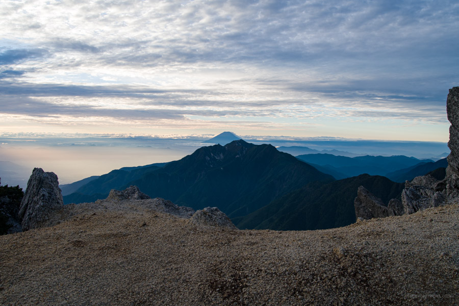
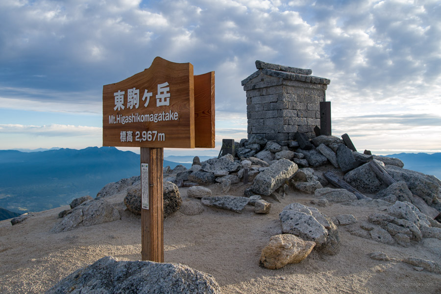
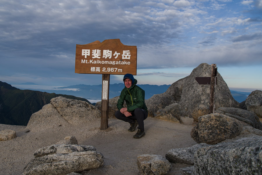
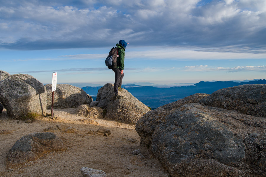
After about two hours of hiking from Shichijo-koya, you’ll reach the summit of Mt. Kaikomagatake 甲斐駒ヶ岳, where the Komagatake-jinja Okumiya (the inner shrine) stands. On a clear day, the summit’s granite gleams brilliantly, and the 360-degree views are breathtaking, including Senjogatake, Kitadake, Mt. Fuji, and even the spear-shaped peak of Yarigatake in the Northern Alps. What made it even better was that I had the summit all to myself for the 20 minutes I was there.
From the summit, you have a couple of options. The first is to descend to Kitazawa-toge 北沢峠, which is about three hours away. However, this route has limited transportation options, requiring two buses to return to Chino Station 茅野駅. First, you’ll need to take a bus from Kitazawa Pass to Todai Park (Senryuso) 戸台パーク (仙流荘), followed by another bus that departs only once a day at 5:00 pm, arriving at Chino Station at 6:24 pm. Outside of the peak season, this bus only runs on Fridays, Saturdays, Sundays, and holidays from 12 July to 14 October in 2024.
If you’ve made an early start, a more convenient option might be to retrace your steps back to Ojiragawa Gorge, followed by a 45-minute road walk to the Michi-no-Eki Hakushu bus stop. From there, you can catch the 2:49 pm bus back to Nirasaki Station.


Otsukareyama!
Well-done, David. That was quite a trek. I am jealous of the views you got.
A bit tough, but you ought to try it someday. Cheers.
Thanks for this excellent write-up: hmm, the public transport options don’t seem to have improved much over twenty-plus years ago. But never mind, that ridge is one of the most rewarding ascents in the Southern Alps. By coincidence, I had just read the corresponding write-up in Willie Walsh’s Tozan. Nobody forgets Kaikoma in a hurry ….
Thanks, PH. It’s a shame that public transport options haven’t improved much and, if the truth be told, are probably even worse these days. Still, it’s a rewarding and stoic route, with far fewer hikers than from Kitazawa-toge, making it a more appealing option.
I have to concur. There are a LOT of people going from the Kitazawa Toge.
Even so, I think I’m heading there again soon because that’s also a convenient trailhead for Senjogatake.
BTW, Mr Project Hyakumeizan, your blog is great.