.
Mt. Jinba 陣馬山 – Maruyama 丸山 – Mt. Mito 三頭山
Distance: 28.5 km
Elevation change: 1166 metres
Highest point: 1531 metres
Start: Wada bus stop
Finish: Tomin no mori bus stop
Difficulty: ▅▅▅▅▅▅▅▅▅▅ ❸
Map: Yama to Kogen Chizu 山と高原地図 [No.25 奥多摩 OKUTAMA]
GPX TrackKML TrackGSI MAPPDF Topo Map
Sun-bathed plateau to a Remote Mountain Path
During Golden Week last year, I tackled the Nagasawa ridgeline which straddles Tokyo and Saitama Prefectures. This time I’ve switched boundaries focusing on the Tokyo and Kanagawa border via the Sasaone Ridge 笹尾根 or bamboo grass ridge. The Sasaone is more of a gradual ascent apart from a steepish climb near the end, it’s also better maintained with several nice viewpoints to keep your spirits up. As you’re looking at around 13 hours map time it’s best done as an overnighter though there are plenty of spots to wild camp with a waterhole towards the end of the first day.
Day 1: Leaving the Crowds in your Wake (16 km)
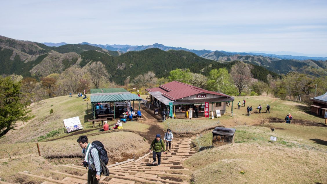
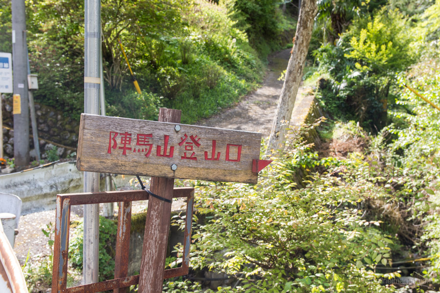
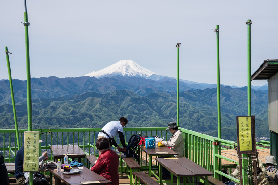
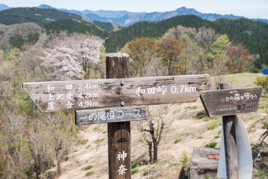
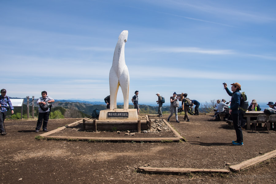
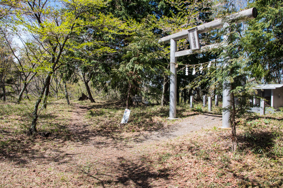
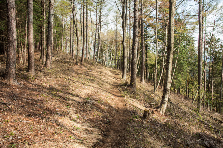
Jinbasan can be accessed either from Jinba Kogen Shita 陣馬高原下 bus stop using Takao Station or Wada 和田 bus stop a short ride from Fujino Station 藤野駅 as was done on this hike (15 mins, 250 yen). From the Wada bus stop walk up the road for 10 minutes where you’ll find a wooden sign signalling the way to Mt. Jinba 陣馬山 (857 m) around 2.5 km away. In the early spring the trail meanders through “shinryoku” (new green leaves) and after 45 minutes meets up with the main track leading up from the Mt. Jinba trail entrance. From here it’s a short hike to the summit where on a fine day you’ll be greeted with teems of hikers basking on a sun-bathed plateau.
I always find it amazing the numbers of hikers chugging down beers at 10:00 am at tea houses and restaurants – half their luck. In the meantime, I contemplate the 6 hours of hiking ahead of me. When you’re ready to head off proceed down the stairs on the opposite side of the summit which takes you to Wada-toge 和田峠. If you’re planning on attempting this as a day hike, I would suggest skipping Mt. Jinba and heading here directly from Jinba Kogen Shita.
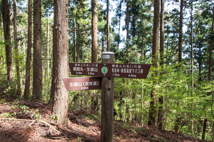
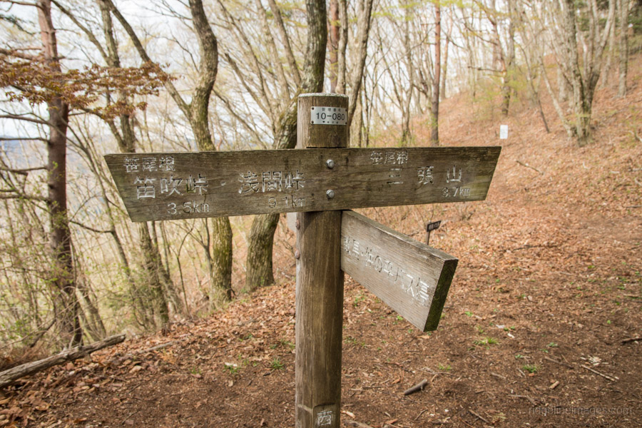
The Kanto fureai michi trail veers to the left a short distance along the road across from the carpark. The first target is a trail branch at Daigomaru 醍醐丸 (867 m) where you turn left. Alternatively, if you wish to miss out a summit or two there are plenty of maki-michi まき道 or winding paths around rather than over the peaks to save you time and effort. I had originally planned to take lunch at Mt. Shoto 生藤山 (990 m) but there isn’t much of a view, so a better option is resting up at Sangokusan 三国山 where there is some shade and picnic tables.
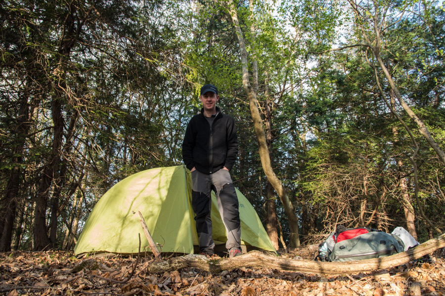
From here on the morning crowds peter out providing a welcome moment of respite. About an hour’s hike from the wooden gazebo at Sengen-toge 浅間峠 there is a very timely waterhole about 5-10 minutes detour off the ridgeline (on your right) from Hibara-toge 日原峠. Look for a white painted sign in black letters (inryo-sui 飲料水) drinking water. From what I gather this is a reliable waterhole and even after a dry winter it still managed a fair trickle. If you happen to arrive earlier in the afternoon continue along the Sasaone as there are plenty of camping spots otherwise a good location is near Dohyoudake 土俵岳 a little way up from the waterhole.
Day 2: Entering Tokyo’s Beech Forest (12.5 km)
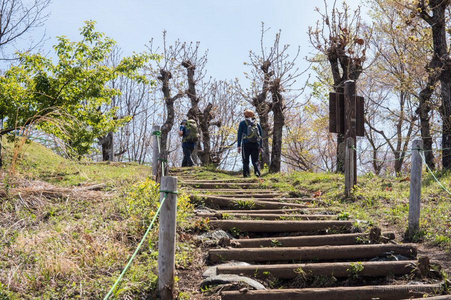
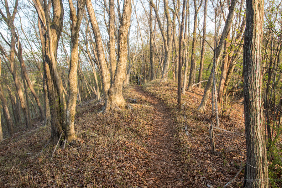
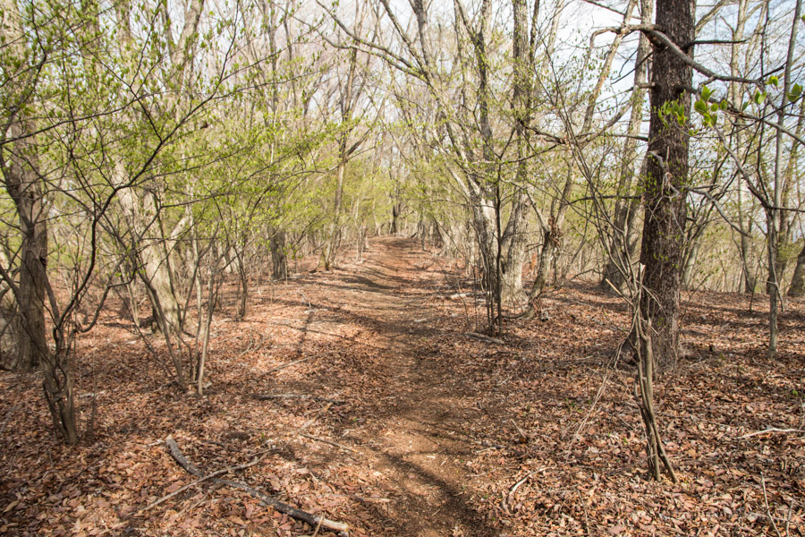
Overnight I had been expecting the temperature to dip close to freezing however at daybreak it was a relatively mild 8 degrees. The first 20 minutes is an easy stroll over to 小棡峠 Koyuzuri-toge before making a short climb to Maruyama 丸山 (1098 m). It’s worth mentioning the Sasaone has more than a few ‘escape’ routes off the ridgeline on both the Tokyo and Kanagawa sides though some don’t appear to get much use.
From the campsite to the summit of Mitosan I only passed a handful hikers as the far end of the ridge is pretty secluded. During those quiet moments you’ll probably come across the odd copper pheasant (yamadori 山鳥) scurrying away with a loud shriek as well as Japanese deer (nihonjika ニホンジカ) whistling and being highly vocal in the evening.
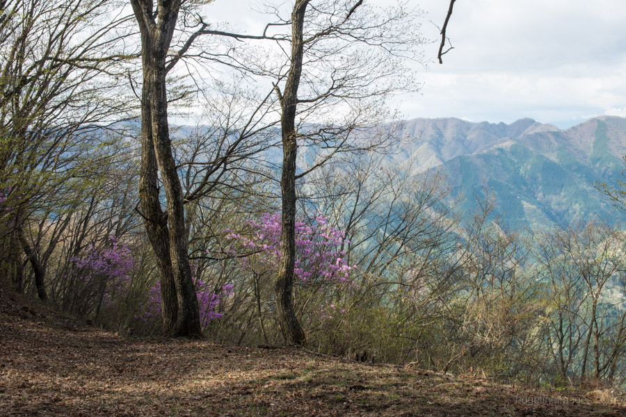
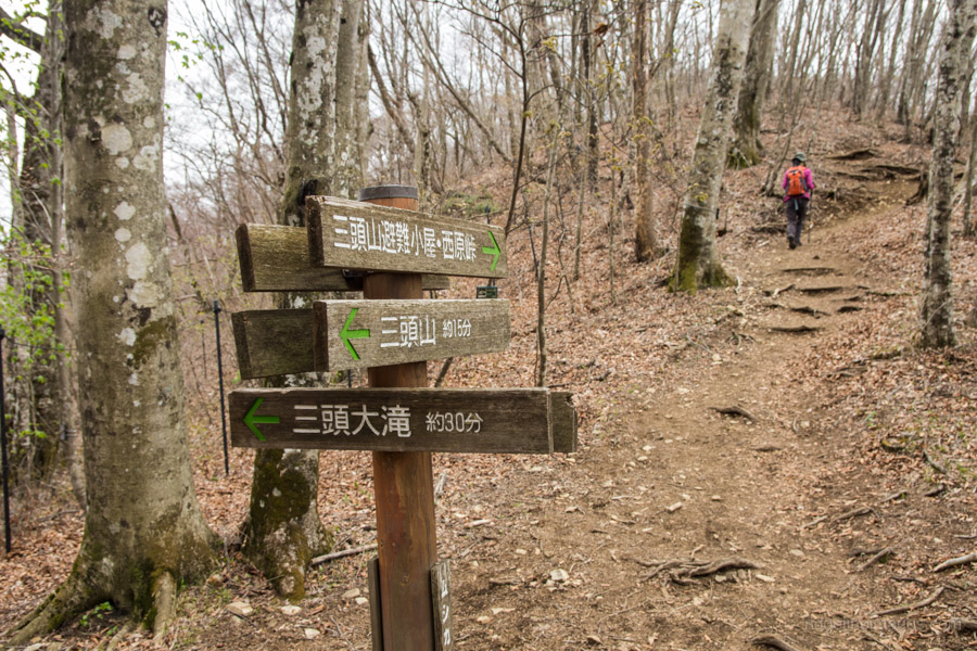
The ridgeline rises gently until you reach Saihara-toge 西原峠 and Mt. Makiyose 槇寄山 (1188 m). After this point the trail steepens markedly. The map time to Mt. Osawa 大沢山 (1482 m) is a generous two hours but should take significantly less. Here you enter the Hinohara Tomin no mori 檜原都民の森 and begin to pass day-trippers who have hiked up from the Shinrinkan parking area. There is a waterhole around a 10-minute walk along the trail towards the Mito no Otaki Falls. Along with being one of only two Japanese beech (Buna) forests in Tokyo there is also Erman’s birch (Dakekanba) and Japanese horse-chestnut (Tochinoki).
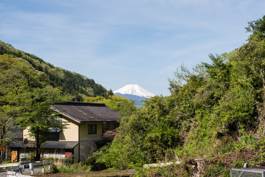
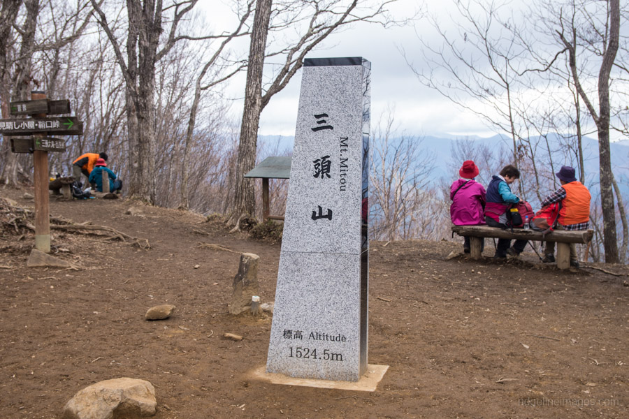
Mt. Mito is comprised of three summits with the highest point being the chuo peak 中央峰 (1531 m). Most folk however congregate around the west peak 西峰 (1524 m) where you can see Fujisan and the Tanzawa mountains. Surprisingly for a such popular mountain the signage is often ambiguous. To get to the Hinohara Tomin no mori bus stop follow the signs for Mt. Gozenyama. After reaching Saiguchi-toge 鞘口峠 turn right and it’s a 20-minute walk to catch the return bus to Musashi-Itsukaichi Station (1 hr 15 mins, 940 yen). Note you will need to transfer to a waiting bus at Kazuma 数馬. The last bus leaves the Shinrinkan at 16:45.


Dear David,
Thank you for this trail! My friends and I are looking to start hiking again this year and we plan to do an overnight hike like this.
I was wondering if you can help me out with some advice about the hike.
We’re looking to include Mt. Takao in Day1 trail.
We plan to ascend Mt. Takao then continue on to the Dohyoudake.
Time-wise, how long do you think we should allot? or is this even advisable?
It would also be our first time to wild camp.
We usually opt for a hut or camp sites near huts.
Any advice?
I’ll appreciate the help! Thanks!
Hi Gladys, happy to help. For very fit and very fast hikers this may be possible. The map time (no breaks) works out around 11 hours on the first day. If you don’t feel you fall into this category, I would advise sticking to these trail notes. Also take into account you will be carrying equipment to sleep out. Hope this helps.
Hey David, That’s good to know. We’ll definitely consider this. Thanks a lot! 🙂
Thank you for this great trail. Quick question, in my past experiences I noticed we were only allowed to camp at designated areas and 山荘(sansous). You said you camped near Dohyoudake 土俵岳 and that there were other campsites along the Sasaone. I just wanted to confirm that it is ok to camp along the Sasaone? If so, are there designated areas marked by signs or something?
Hi Ben. Thanks for your question. Yes, you’re correct National Parks and Forest Service officials request people to only camp at designated campsites which are usually located next to mountain huts. So wherever possible stick to proper campsites to reduce your impact on the environment. Sometimes however it’s unavoidable where the distance to be covered in a day is too great such as on this hike. Along the Sasaone there are technically no campsites, so you are camping at your own risk. Provided that you leave the site where you camp as pristine as you found it and plan to arrive late and depart early you should be fine. The location of official campsites are marked on the Yama to Kogen Chizu maps.
Thank you for the great notes. I hiked it late March 2021 and everything is largely as you say. Note that the sign for the water hole near Hibara-toge has broken off and is now laying on the ground. The water hole itself is farther down the detour ridgeline than you expect but can confirm that the water flow was strong. Dohyoudake was the best camping spot I found on day one despite a bit of wind exposure.
Thanks for commenting Alastair, especially about the flow at the water hole. If you check the photo above, the sign was laying on the ground even when I did it a couple of years back!