.
Kougen Hut 高原ヒュッテ – Mt. Kentoku 乾徳山 – Mt. Douman 道満山
Distance: 11.1 km
Elevation change: 1186 metres
Highest point: 2013 metres
Start: Kentokusan Tozanguchi Bus Stop
Finish: Kentokusan Tozanguchi Bus Stop
Difficulty: ▅▅▅▅▅▅▅▅▅▅ ❹
Map: Yama to Kogen Chizu 山と高原地図 [No.27 金峰山・甲武信 KINPU-SAN·KOBUSHI]
GPX TrackKML TrackGSI MAPPDF Topo Map
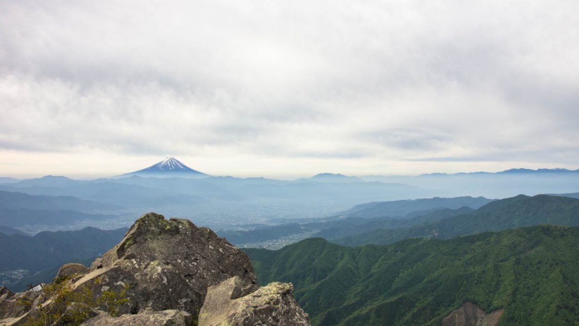
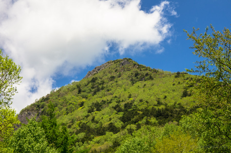
Spectacular 360-degree Panorama from Mount Kentoku
If there was ever a mountain sorely overlooked in Kyuya Fukada’s famous Japanese mountain list, it’s Mount Kentoku, as it includes some of the best mountain climbing near Tokyo. This hike is usually undertaken as a day trip from Tokyo, though spending an evening at the lovely Kougen Hut plateau is also a worthwhile option.
Day 1: Gradual Ascent to an Attractive Alpine Plateau (3.6 km)
This hike, like several others documented on this site, starts out from Enzan Station 塩山駅 on the Chuo Main Line, around 90 minutes by express train from Shinjuku Station or 2.5 hours by local. At Enzan Station head out the south exit and transfer to a bus bound for the Nishizawa Gorge and get off at the Kentokusan Tozanguchi Bus Stop (30 minutes, 660 yen). Note that this timetable is seasonal. From mid-April to the end of September, it runs only on weekends and public holidays. Exceptions to this rule include Golden Week, from July 9 to August 15, and October 1 to November 20, when it runs daily. If hiking on a weekday out of season you will need to alight two stations further along at Yamanashishi Station 山梨市駅 and take a bus from there. I recommend catching as early a bus as possible or shelling out for a taxi (approx. 4,000 yen) if there are two or more of you.
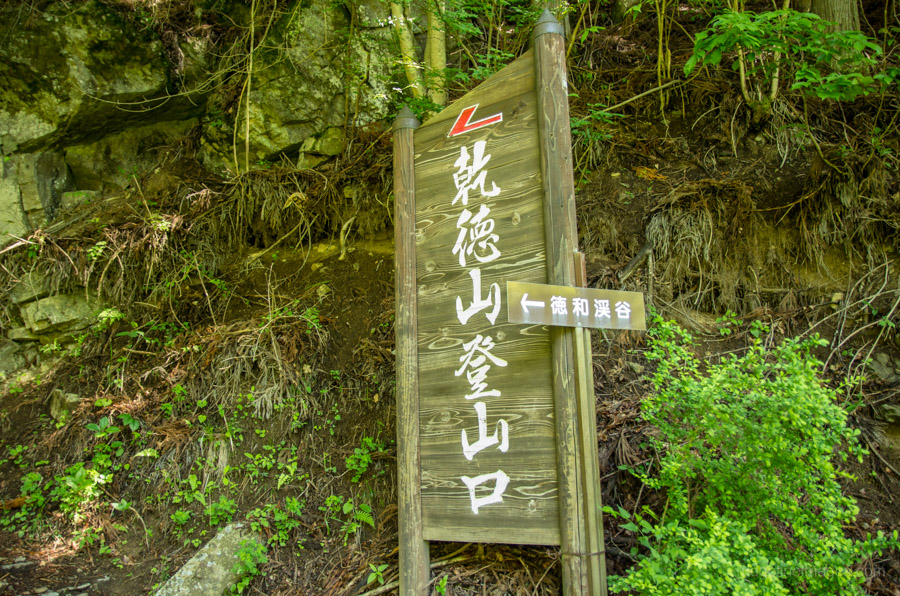
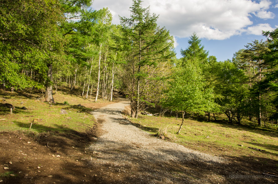
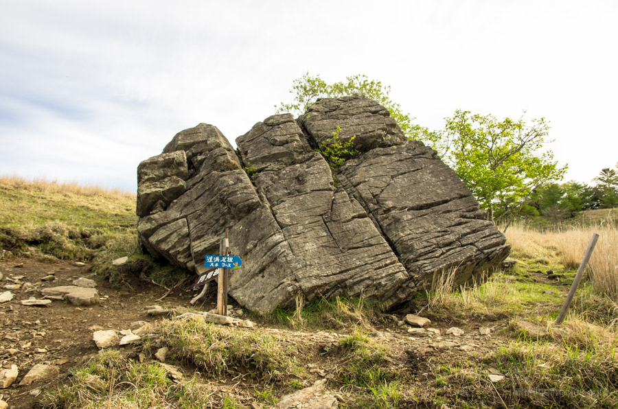
The previous evening, a sizeable thunderstorm passed through the Kanto region, which did a good job of blowing away the haze and delivered two days of clear skies in its wake. The friendly taxi driver at Enzan Station quickly whisked me to the trail entrance in seemingly record time while proudly pointing out some of the loftier nearby peaks. The taxi drops you off at the car park just above the bus stop. While two trails lead up to the Kougen Hut 高原ヒュッテ it’s recommended to track in a clockwise direction flanking the Tokuwagawa River up the main trail and return via the Douman Ridge 道満尾根 which is steeper.
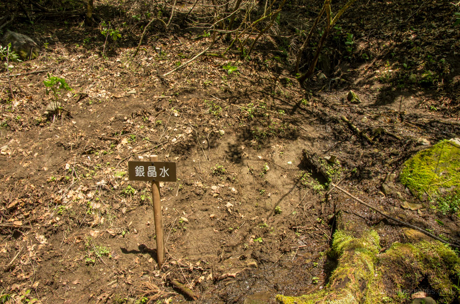
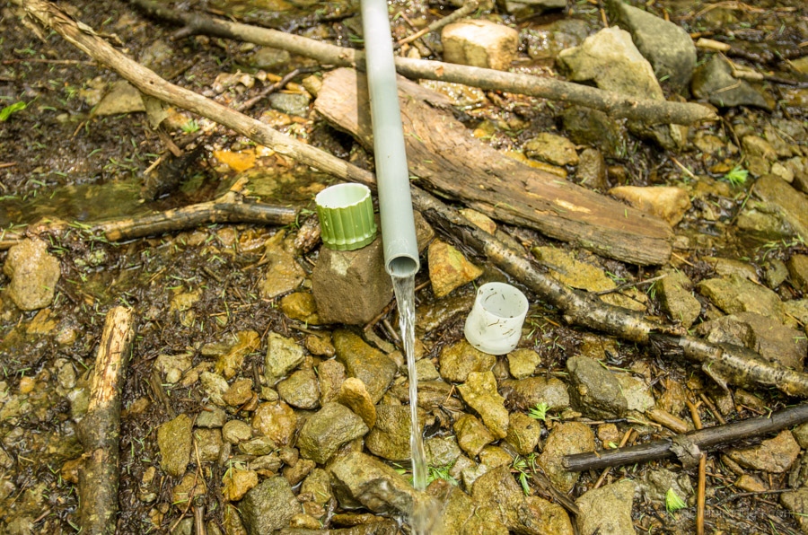
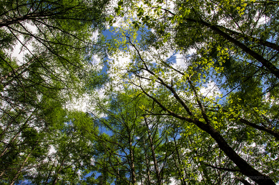
Walking along the road for around 20 minutes brings you to the trail entrance proper, and so begins a two-hour hike to the Kougen Hut. While not particularly steep, it certainly gets the blood pumping if you intend on carrying all your gear. Along the route, there are two reliable water holes to fill up, with the latter one a five-minute walk from the unofficial Kougen Hut campsite.
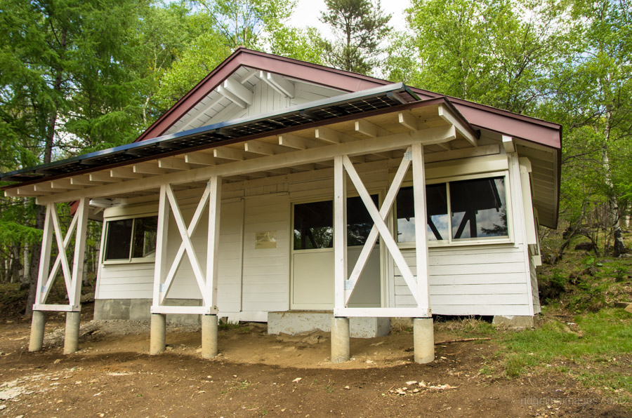
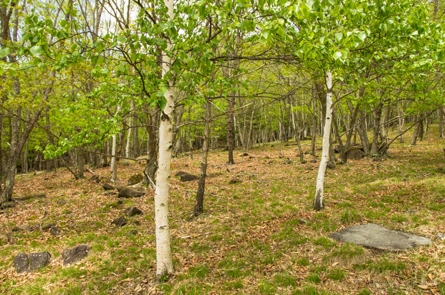
Upon arrival, the plateau was pretty much deserted, with presumably most hikers already making their way around the course. The campsite is set gracefully amongst groves of Japanese white birch, and there is no shortage of wildlife, including plenty of curious Japanese sika deer. I even managed to spot a Japanese marten. While camping spots are not marked out, the large open area provides plenty of options for setting up a tent. Otherwise, if you decide not to bring your tent, the unsupervised Kougen Hut underwent a substantial renovation last autumn with sleeping space for 10–15 people and an adjacent public restroom.
Day 2: Steep Rock Ledge Wall not for the Faint Hearted (7.5 km)
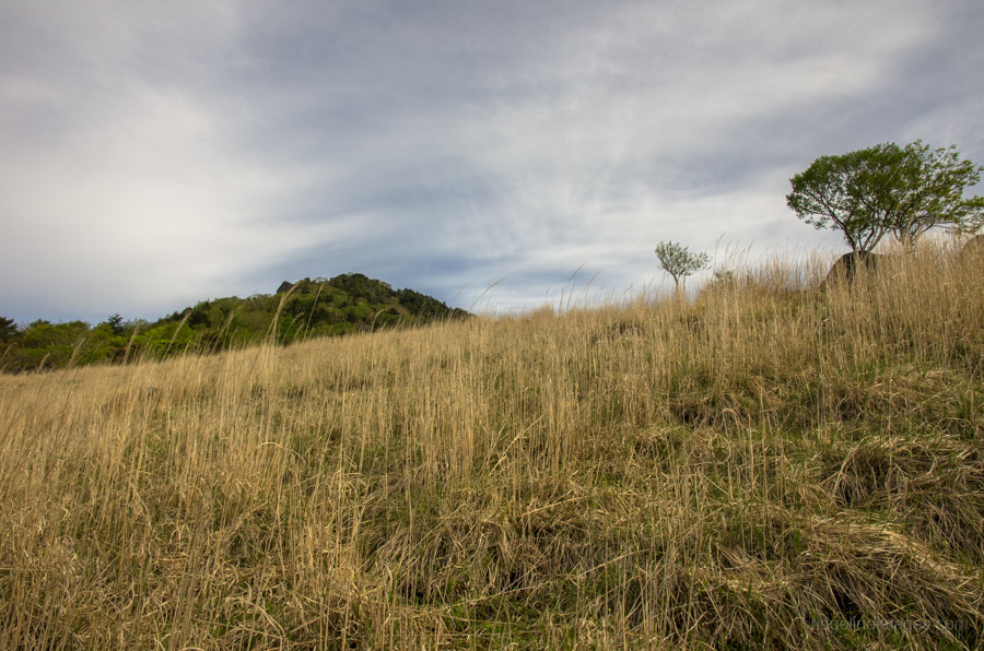
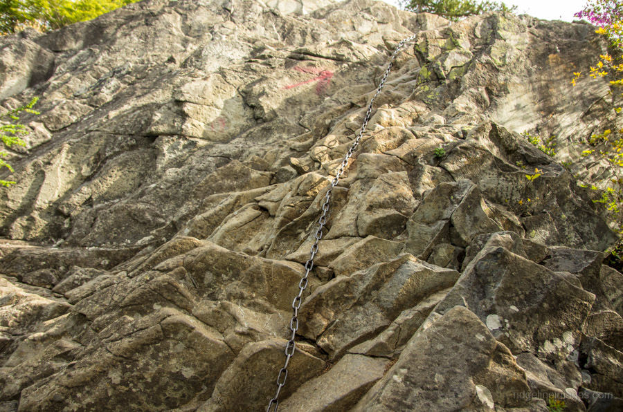
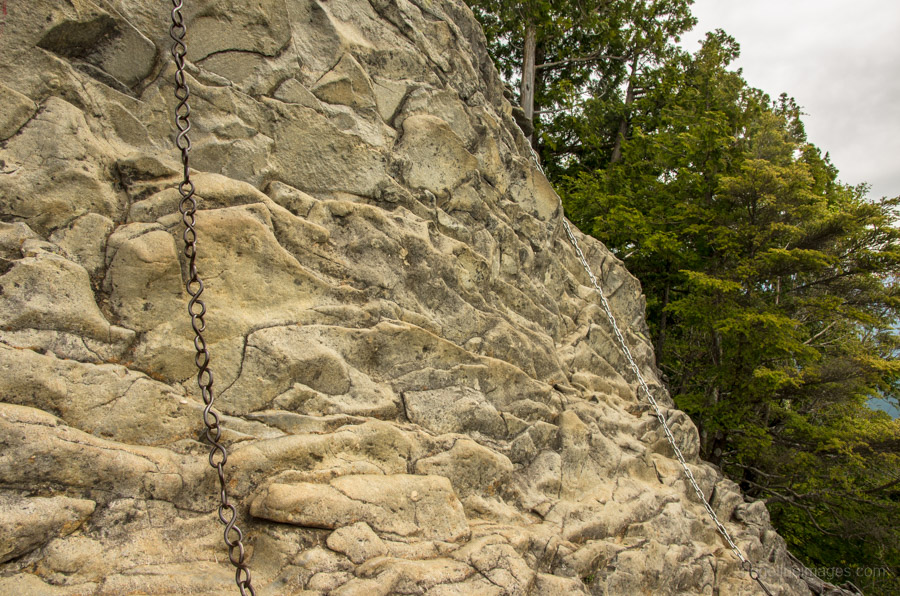
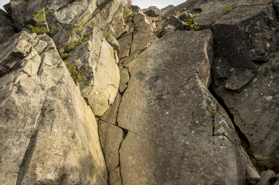
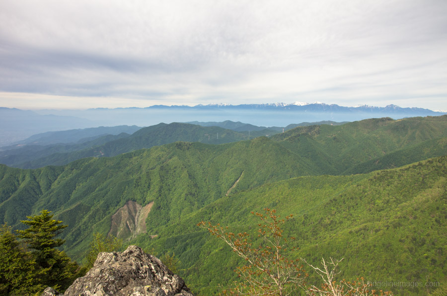
Like the first day, the morning was greeted with blue skies and only the slightest breeze. The hike begins with a short walk up to Oogihira, another open plateau a few hundred metres above the campsite, which provides the first of several excellent views of Mount Fuji and the Minami Alps. From Oogihira, the trail enters a wooded area where the real scramble for the summit begins. Here you will need to negotiate a series of ladders and chains, with one section of chain halfway up forcing you outside your comfort zone as you clamber precariously over an exposed rock ledge. Just before the summit is a sheer rock precipice that can be tackled via a long chain, or alternatively, this wall can be sidestepped by taking an easier route to the summit on your right.
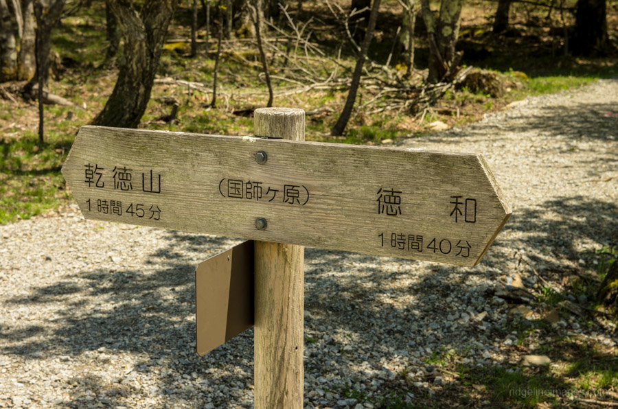
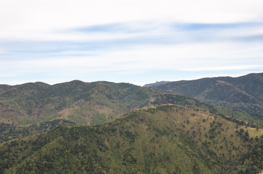
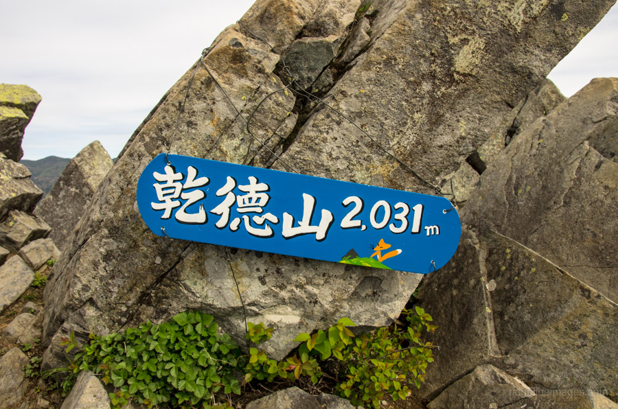
On clear days the craggy summit of Mt. Kentoku (2,031 m) delivers superb 360-degree views including the jutted Mount Kinpu bluff. Options from the summit include heading back the same route, continuing to Mt. Kurogane or sweeping around the rear side of the mountain using a lesser-travelled, though steeper, trail. I decided to play it safe and returned the same way to collect my belongings at the campsite. The route via the Douman Ridge trail over Mt. Douman 道満山 (1,314 m) back to the bus stop takes around 90 minutes.


Hi David
Did this hike last weekend as my 2nd one on your list. Unfortunately I got to the start of the hike late, so when I got to the top of the ridge where you either head on up the left to Mt Kentoku, or head right along to the Douman ridge, I went right and hence missed out on the summit.
It was a good move in the end, as I walked the last hour of the hike in the dark, which was pretty sketchy. Luckily I had a fully charged head torch just for such occasions.
It was also a pretty overcast day, so I missed out on the amazing views, but still took some OK mountain range and sunset photos. There was also light snow falling most of the walk, and hence a light covering of snow from just below the hut onwards.
Very impressed by the quality of the hut, including a pretty cool fireplace. Only downer is that the toilet are is locked up in the winter. Was thinking it would be good to do a 2 day hike where you get to the hut for sundown, sleep there over night, then head up to Mt Kentoku first thing the next day, and continue on over the ridge for the rest of the day. Not sure where you could get to over that way.
Look forward to doing the summit another time.
Hi Rob,
Thanks for your trip report. Too bad you didn’t make it to the summit on this occasion though it seems like you got some great views. You’re right it’s a lovely hut and it had just been rebuilt when I did the hike. Most folk tackle Mt. Kentoku as a day hike but given it’s kind of far from Tokyo sleeping at the Kougen Hut and summiting early the next morning makes a lot of sense. As for continuing along the ridge one option is to head up to Kuroganeyama 黒金山 and finish at the Nishizawa Gorge which takes around 5 hours.
Thanks David. An overnight at the Hut, then up to Mt Kentoku, and on to Kuroganeyama and Nishizawa Gorge, sounds like a good idea for a second go at this one – thanks.
Hi David!
Really appreciate the amazing site you have here.
For non-Japanese speakers like myself, this is a really good guide before we venture into a place where we cannot speak the language.
I wonder if you could give me some pointers.
I intend to visit Mt Kentoku. My plan is to arrive and stay at the hut before hiking up again at 5am to Mt Kentoku (I can start earlier if I have to). Considering I will have time after reaching the peak I would love to carry on to Kuroganeyama 黑金山. If I follow your recommendation to finish at Nishizawa Gorge, I worry I will miss the last bus (thanks to the bus timing link in your post) from 西沢渓谷入口 15.40pm (Sunday) back to Enzan Station.
My concern I do not have tip top physical strengths, am just an average Joe. So long I can be back to Shinjuku by midnight, I’m fine with other travelling methods.
Hope you can recommend something.
Once again, really appreciate this website.
Regards
Thanks for the kind words about the site.
I think your plan is doable though expect a solid second day of hiking. I would suggest making as early start as possible due to the hot weather this weekend. Provided you get moving by say 5:00 am should give you enough time. According to my map from the Kougen Hut via Kuroganeyama to the Nishizawa Gorge bus stop is around 8 hours (without rest breaks). The only thing I’d suggest is if you are carrying a tent, camp instead around 45 mins further up the trail as there is a relatively flat plain before you hit Mt. Kentoku. Note however there are no reliable waterholes after the hut.
Hi!
Thanks for your report! Since this is only going to be my second time hiking in Japan and I’ve never stayed in one of the huts, could you tell me how the hut is equipped? What would I need to bring if I wanted to stay overnight (sleeping bag, etc?)?
Also, how early would I need to get to the Enzan Bus Station in order to do this as a day trip?
Thank you very much!
Thanks for your comment and question. The Kougen Hut is a basic refuge hut rebuilt a few years back. The hut offers a dry place to sleep on a raised floor and an outside toilet but little else. You will need to bring a sleeping bag, sleeping pad, stove etc in other words everything other than your tent. There is a waterhole 5 mins walk from the hut and is safe to drink. If you’re planning to do this as a day trip, aim for the first morning bus leaving Enzan Station 08:30 arriving Kentokuyama Tozanguchi at 09:02. The bus runs every day from Oct 1st thru Nov 23rd (2018 schedule). The last bus for Enzan Station leaves at 16:08.
Hi David,
I did this a few days ago. I wanted to give a bit of my experience.
First, I could have chewed more than I bit off. I was up to Kentoku and down to my sleeping area by about 2. I’d set up base camp before heading to the summit so I was twiddling my thumbs for a long time when I got down. I was glad, though, to have dropped a lot of my heavy stuff off before getting up to the chains and rocks up near the top.
Second, is it just me or are deer a real nuisance these days? I had set up my tent next to the Kogen Hutte but, since I was bored (see point above), I decided to break it down and stay inside the hut. Well, around sunset, the deer started coming around and screaming at me. There were probably 3 or 4 groups of deer that dropped by. They were hanging around where I had pitched my tent earlier. I was glad to be inside the hut away from the noise because I’ve endured a night in a tent with a deer screeching at me all night near Kumotori. (Scared the crap out of me, honestly.)
Any thoughts on this? I don’t want to be an unwelcome visitor to Bambi, but I also don’t want to be molested by any more deer.
Oh, yeah. I just remembered one thing that was funny. That hut is great. Fewer bugs inside than I expected! The bathroom section has a light that is activated by a motion sensor. In the middle of the night, it came on a few times. I did not get up to relieve myself. 🙂
Hey Patrick,
Sounds like you set a good pace if you were back at the Kougen Hut by 2 pm. As you know Japanese deer are ever-present in the mountains and it’s pretty rare not hear them at night or startle them during the day. While they are normally timid the herd of deer circulating around the plateau aren’t which as you say can be a problem. I haven’t had one ‘scream’ at me or show aggression though, however some have come pretty close to my tent at night. In my experience they are most noisy from dusk until around 9 pm but after that they generally seem to quieten down.
Hi, David, did this one today after reading your post a couple of months back. 1/3 average usual sights (after you’ve done more than a coup mounting in the area), half part around the hut, spectacular with the golden grass (ignore its name), bright green moss and tempera blue skies. I took the scary road via the hut to the top and found lots of ice and snow and had no crampons. Getting down that wall with the chains wasn’t pleasant either. Stressful to say the least. The views are magnificent, found a mama dear with her fawn, some butterflies. It’s a great hike, but definitely not for families or beginners. Bring a helmet with you (I didn’t) and crampons till end March at least. Sending you some Ko-Fi as usual. Hope you’re doing great.
Hey Francisco, sounds like coming down was a bit sketchy with the snow and ice. Good advice suggesting bringing along a helmet and packing crampons at this time of year. Next time I recommend traversing across to Kuroganeyama which passes through some beautiful forest and finishing at the Nishizawa Gorge, though you’ll need two days to complete this hike. Cheers for the brews 🙂
I went to Kuroganeyama a month from Kentoku or so ago. That mountain also has gorgeous views. Just a one-day trip.
The path down to Nishizawa Keikoku was still out since that typhoon.
Hi David,
I did this hike as a day trip on Wednesday. I really enjoyed it, despite missing out on the views due to thick clouds. Thanks a lot for your description, it was really useful!
One little update on the bus situation: between Enzan and Kentokusan-tozanguchi, one has to change buses once. This made me opt for a taxi in the morning, since it was already 9am and I didn’t know how reliable the connection would be.
A direct bus line to the trailhead exists from/to Yamanashi-shi station, which is two stations farther from Tokyo on the Chuo line. The last two buses in the afternoon, scheduled for 3:08pm and 4:08 pm, go there. I got to the bus stop around 3:20, but luckily for me, the 3:08 bus showed up half an hour late.
Hi Tamas,
Thanks for commenting and glad to hear you enjoyed the hike. Sorry for any confusion about the bus situation. I have updated the hike report to reflect the current state of affairs and included a link to the 2022 Yamanashi Kotsu timetable.
Well-done, Tamas. Isn’t that a nice mountain?
I mistook the bus times coming home once and just walked to Enzan Station. Haha. It was a few hours, but it was a nice day so it worked out.
Yeah, I was mentally prepared that I would miss even the 4:08 bus, in which case I probably would have walked to Enzan, too. Luckily I was able to push it and finish relatively early.
I did indeed like this mountain. For example, that spring near the mountain hut is just perfectly located. By the way, I approached from the South but came down that other trail, to the West of the peak. There are chains and ladders there too, but I thought that part was more straightforward. A bit after that there is a steep and rocky hillside though which was not fun to descend on, but I guess it usually isn’t. Other than that it’s a pretty trail through the woods.
“Just before the summit is a sheer rock precipice which can be tackled via a long chain or alternatively this wall can sidestepped by taking an easier route to the summit on your right.”
I want to take the chain section, however, for my friends, it’s pretty scary. So, according to the line mentioned above, can they take the sidestepped way to reach the summit? Is there any map for that?
Yes, by taking the short detour, you avoid having to climb the chain section. No map is needed, as the trail is easy to follow near the summit.
Thank you so much for the information.
Hello David,
I would like to try this one as a day hike from Tokyo, with public transportation if possible. If I’m reading the bus schedule from Enzan Station to the Kentokusan Tozanguchi stop correctly, it looks like the earliest bus would arrive at 09:02 and the last bus would leave at 16:08, leaving 7 hours to complete the hike. Is that a realistic window for an average-speed hiker? Alltrails estimates 5h54m.
https://ykbus.jp/wp/wp-content/uploads/R51001nishizawa.pdf
https://www.alltrails.com/trail/japan/yamanashi/mount-kentoku-loop
I’ve done searching elsewhere online, but haven’t found reliable reports of people doing this. The other option, as you note above, would be to take an earlier taxi from Enzan Station to the trailhead. Thank you always for this terrific site.
I’m sure David will pipe up soon, so I hope he doesn’t mind me adding my 2 cents.
I think you probably can do it. I’m a little faster than most but I went as far as Mt. Kurogane within the same timeframe you’re thinking of. https://yamap.com/activities/9245750
If worse comes to worse and you miss the bus, you can walk to the station. I had to do that once. It was several more hours’ walk, but it’s still walking country roads in Yamanashi.
Hi Schlep,
Appreciate you checking out the hike!
You’re right, the bus gives you about a 7-hour window between 09:02 and 16:08, which matches the Yama-to-Kogen map time of 7 hours and 10 minutes for the full loop. The AllTrails estimate of 5h54m is on the faster side. It’s doable if you can keep a steady pace without taking too many long breaks.
If you’re planning to do the full loop, I’d aim to reach the summit of Kentoku-san around midday and make sure to start heading down no later than 1 pm to give yourself a buffer for the return bus. The out-and-back (piston) route is a bit shorter and offers a bit more flexibility if you’re unsure about timing.
If you’re hiking solo, I wouldn’t bother with a taxi, public transport should work fine as long as you keep an eye on the clock.
Hope you have a great hike; Kentoku’s a brilliant one!
Patrick and David, thank you for your helpful advice and great tips. Doing the piston route to shave off some time is a great idea. It’s also comforting to know that worst case, I can make the long walk out to Enzan Station. Cheers!
Schlep, I hope you enjoyed Mt. Kentoku and got some great views from the summit. I should add—if you did enjoy it and are looking for more of a challenge next time—I recommend doing it as an overnighter. You can summit Mt. Kentoku, continue along the delightful ridgeline to Mt. Kurogane, and camp for the night at Ushikubi Notaru, which offers great views back towards Mt. Fuji. On the following day, you can finish the hike at Nishizawa Gorge.
The only downside is having to carry water from the Kougen Hut, but that’s a small price to pay for what I’d call one of the best overnighters in Okuchichibu.
Thank you so much for your help and advice, David and Patrick. Had a terrific day on Kentoku, and by doing the piston route with an early taxi, I made it back for the bus with plenty of time. Indeed as advised, now that I’ve done it once at my own pace, next time I’m confident I could do it without the taxi. Well noted regarding overnighting. I will definitely be looking into doing this.
My pleasure. David turned me on to Kentoku years ago and I’m grateful for that. It is one of my favorite mountains. (One of thousands.)
re walking to the station. I have had to do that more times than I wish to admit. Despite having fairly good Japanese and really trying to confirm things, I have mistaken bus times many times.
One January I was told that the bus to Fuji’s 5th Station runs even in the off-season as long as there is no snow. I couldn’t believe that and I called the bus company. “Is it true the bus can run even in the off-season?” “Yes.” “Is it running now?” “If there is no snow, it runs.” “Is there snow now?” “There is no snow now.”
With this unexpected good information, I started that day at Shimoyoshida Station and climbed to the 6th Station of Fuji before turning down and heading to the 5th Station in confident expection of jumping on a waiting bus.
You can imagine what was waiting for me. A ghost town. Darn you anonymous bus company phone operator!
That planned 15 km hike ended up being 48 km. I walked back down the bus route in the pitch dark all alone with all sorts of animal noises around me. I caught a train home from Fuji Station around 10 PM.
I don’t get too upset about missing buses now. (Truth be told, I mostly drive now. My living circumstances are different.) When I miss a bus and have to walk, I just remind myself that that is the whole point–that I like to walk.
Enjoy Kentoku. The part with the chains is really sure to get your heart pumping.