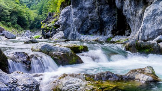
Hiked on Apr 5, 2016 . Karataki Waterfall 唐滝 Duration: 2.5 hours Distance: 5.2 km Elevation change: 300 metres Highest point: 440 metres Start: Tomijiro-shoten mae bus stop Finish: Tomijiro-shoten mae bus...
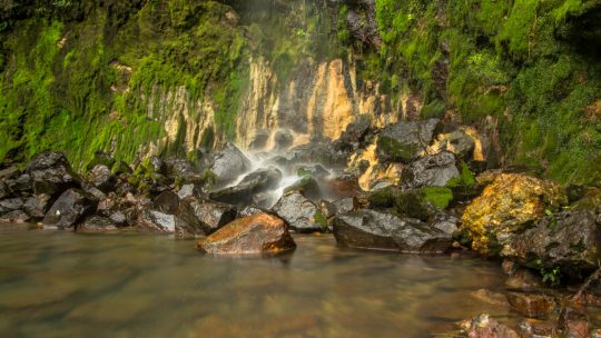
Hiked on Apr 5, 2016 . Karataki Waterfall 唐滝 Duration: 2.5 hours Distance: 5.2 km Elevation change: 300 metres Highest point: 440 metres Start: Tomijiro-shoten mae bus stop Finish: Tomijiro-shoten mae bus...
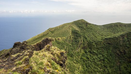
Hiked on Apr 6, 2016 Jul 20, 2021 . Hachijo-fuji 八丈富士山 Duration: 7 hours Distance: 17.1 km Elevation change: 854 metres Highest point: 854 metres Start: Sokodo Camping Ground Finish: Sokodo...
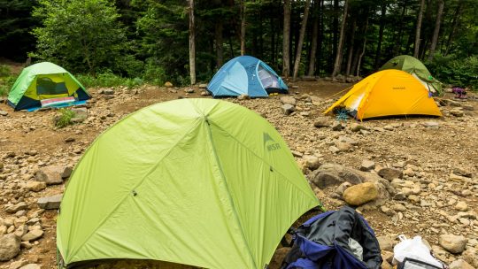
Some Great Places to Camp Around Tokyo Whilst holiday-makers in Japan largely gravitate towards traditional Japanese ryokan and large-scale hotels, gaining popularity in recent years has been car camping or in common Japanese parlance auto camp...
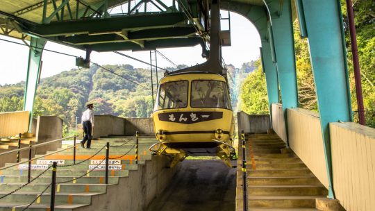
Hitching a Lift up Tokyo’s Mountains With seventy-two percent of Japan being mountainous it shouldn’t come as a surprise the country contains an extensive network of aerial lifts. In Japan, the term “ropeway” applies to all forms...
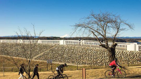
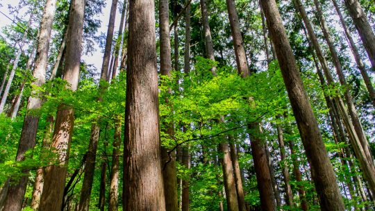
Exploring the Outdoors Around Tokyo The scale and diversity of Tokyo makes it hard to condense into a short travel write-up, especially the outdoor scene which caters for all and sundry. Having said that, what follows is a brief rundown of some...
Musings from 10 Years Hiking in Japan Whether setting out on your first hike or already an accomplished mountaineer there are definitely some quirks unique to hiking in the Japanese mountains. This was especially so coming from an Australian hiking...
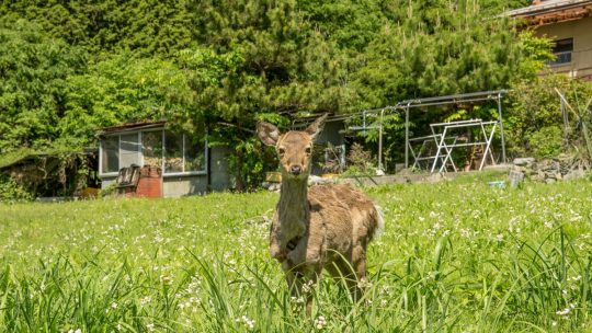
Weird and Wonderful Sights on the Trail Hiking around Tokyo provides a great chance to escape the crowds, unwind and feel some personal space often lacking in the city. While charming scenery is abound there are times you are left scratching head as...
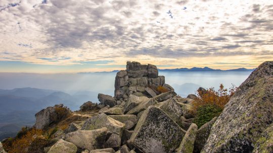
A Guide to Mountains in the Kanto Region The Kanto Region which includes Gunma, Tochigi, Ibaraki, Saitama, Tokyo, Chiba, and Kanagawa contains many of the most popular hiking trails in Japan. Whilst the following list is a work in progress, it aims...
Hiked on Nov 4, 2014 Jan 15, 2020 . Taiken no mori 体験の森 – Mt. Sasuzawayama サス沢山 Duration: 5 hours Distance: 10.9 km Elevation change: 1005 metres Highest point: 1405 metres Start: Sakaibashi Bus...
Hiked on Aug 4, 2013 Aug 23, 2023 . Mt. Kobutaka コブタカ山 – Mt. Honita 本仁田山 Duration: 4.5 hours Distance: 7.7 km Elevation change: 914 metres Highest point: 1224 metres Start: Hatonosu station (JR Ome...
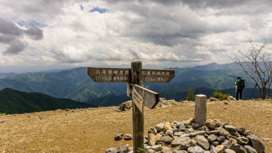
Hiked on May 22, 2014 Aug 23, 2023 . Mt. Takanosu 鷹ノ巣山 – Mt. Kayanoki 榧ノ木山 – Mt. Kurato 倉戸山 The Inamuraiwa Ridge remains closed due to collapses in several places. For the latest information please refer to the Okutama Visitor...
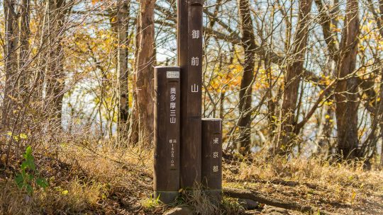
Hiked on Apr 26, 2014 Aug 23, 2023 . Hossawa Falls 払沢の滝 – Mt. Sengenrei 浅間嶺 Duration: 4 hours Distance: 7.8 km Elevation change: 623 metres Highest point: 903 metres Start: Hossawa no taki iriguchi Bus...
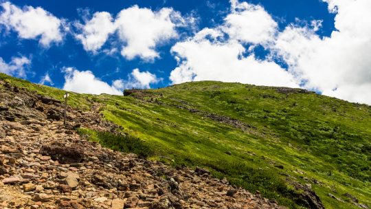
Hiking Trails on Tokyo’s Doorstep Given Japan’s mountainous terrain it should come as no surprise that Tokyo’s fringes boast many great hikes. So with that said, it’s time to dust off the hiking gear, grab some friends and hit the trails. The...
Hiked on May 4, 2013 Aug 23, 2023 . Mt. Odake 大岳山 – Nokogiriyama 鋸山 Duration: 5.5 hours Distance: 14.5 km Elevation change: 916 metres Highest point: 1266 metres Start: Mitake Cable lower station...
Waypoints Successfully Embeded! For sometime now I considered a drawback of this site was the failure to provide schematic hiking routes. I have now addressed the issue by manually embedding waypoints onto each map using WP Google Maps a WordPress...
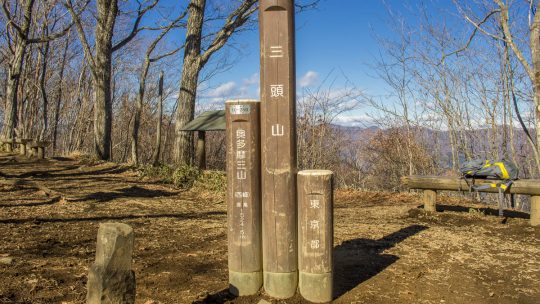
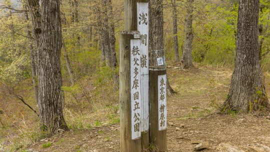
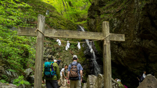
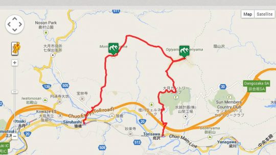
Hiked on Dec 12, 2013 May 5, 2024 . Mt. Iyo イヨ山 – Mt. Nukazasu ヌカザス山 – Mt. Mito 三頭山 The floating bridge near the Ogouchi Jinja Bus Stop is temporarily closed due to the declining water level of Lake Okutama. For the...