Hiked on Dec 12, 2013 May 5, 2024 . Mt. Iyo イヨ山 – Mt. Nukazasu ヌカザス山 – Mt. Mito 三頭山 The floating bridge near the Ogouchi Jinja Bus Stop is temporarily closed due to the declining water level of Lake Okutama. For the latest information about the...
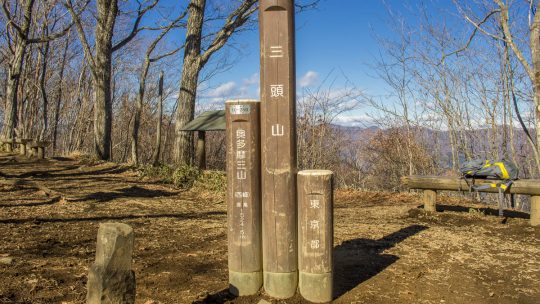
Hiked on Dec 12, 2013 May 5, 2024 . Mt. Iyo イヨ山 – Mt. Nukazasu ヌカザス山 – Mt. Mito 三頭山 The floating bridge near the Ogouchi Jinja Bus Stop is temporarily closed due to the declining water level of Lake Okutama. For the latest information about the...
Hiked on Jul 4, 2012 Aug 24, 2023 . Mt. Bonomine 棒ノ峰山 – Mt. Kuroyama 黒山 – Nasaka Pass 名坂峠 Duration: 6 hours Distance: 14.7 km Elevation change: 577 metres Highest point: 969 metres Start: Kawai Station (Ome Line) Finish: Kawai...
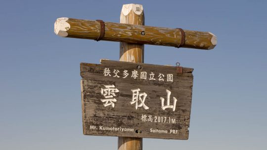
Hiked on May 23, 2013 Aug 22, 2023 . Mitsumine Shrine 三峯神社 – Mt. Kumotori 雲取山 – Mt. Mutsuishiyama 六ッ石山 Duration: 2 days Distance: 29.2 km Elevation change: 977 metres Highest point: 2017 metres Start: Mitsumine Shrine Bus Stop ...
Hiked on Apr 28, 2013 Aug 24, 2023 . Hinodeyamakita Ridge 日ノ出山北尾根 – Mt. Hinodeyama 日の出山 – Mt. Mitsumuroyama 三室山 Duration: 5 hours Distance: 11 km Elevation change: 652 metres Highest point: 902 metres Start: Mitake Station (Ome Line) ...
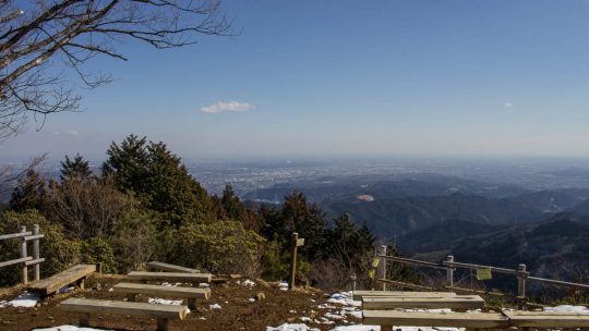
Hiked on Feb 13, 2013 Aug 23, 2023 . Mt. Hinodeyama 日の出山 – Mt. Mitake 御岳山 Duration: 6 hours Distance: 18.6 km Elevation change: 712 metres Highest point: 902 metres Start: Musashi Itsukaichi Station (Itsukaichi Line) Finish: Mitake...
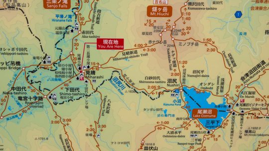
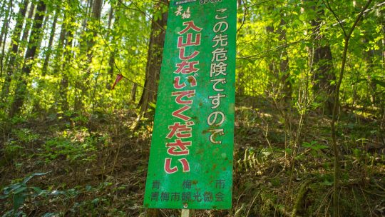
Japanese Mapping Nomenclature Debunked Knowing your limits, keeping safe and out of harm’s way should be your number one priority when hitting the mountain trails and a big part of this is being able to read Japanese maps. While maps, signs and...
Hiked on Jan 27, 2013 Aug 23, 2023 . Mt. Sogakusan 惣岳山 – Mt. Iwatakeishiyama 岩茸石山 – Mt. Takamizusan 高水山 Duration: 4.5 hours Distance: 9.2 km Elevation change: 543 metres Highest point: 793 metres Start: Mitake Station (Ome Line) ...
Hiked on Jan 17, 2013 Aug 23, 2023 . Mt. Kobotoke-Shiroyama 小仏城山 – Sagamiko Station 相模湖駅 Duration: 4 hours Distance: 11.4 km Elevation change: 409 metres Highest point: 670 metres Start: Takaosanguchi Station (Keio Takao Line) Finish:...