Hiked on Sep 28, 2018 . Tsukuba Shrine 筑波神社 – Mt. Nantai 男体山 – Mt. Nyotai 女体山 Duration: 3.5 hours Distance: 5.9 km Elevation change: 600 metres Highest point: 877 metres Start: Tsukuba Shrine bus stop ...
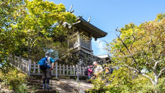
Hiked on Sep 28, 2018 . Tsukuba Shrine 筑波神社 – Mt. Nantai 男体山 – Mt. Nyotai 女体山 Duration: 3.5 hours Distance: 5.9 km Elevation change: 600 metres Highest point: 877 metres Start: Tsukuba Shrine bus stop ...
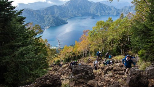
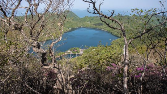
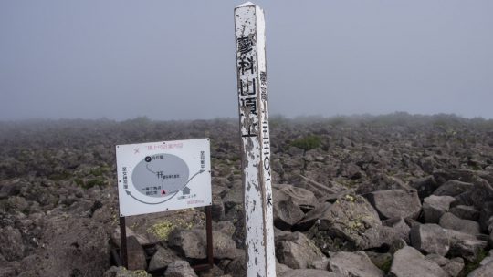
Hiked on Sep 23, 2018 Jul 15, 2022 . Futarasan Shrine 二荒山神社 – Mt. Nantai 男体山 Duration: 7 hours Distance: 13.4 km Elevation change: 1204 metres Highest point: 2484 metres Start: Shobugahama Campground...

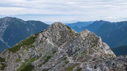
Hiked on Jul 20, 2018 Aug 15, 2021 . Mt. Mibudake 三峰岳 – Mt. Ainodake 間ノ岳 – Mt. Notoridake 農鳥岳 Duration: 4 days Distance: 27.5 km Elevation change: 1399 metres Highest point: 3189 metres ...
Hiked on May 24, 2018 May 15, 2022 . Mt. Kurobi 黒檜山 – Mt. Komagatake 駒ヶ岳登山 – Mt. Choshichiro 長七郎山 Duration: 2 days Distance: 22.3 km Elevation change: 1330 metres Highest point: 1828 metres ...
Hiked on Aug 27, 2017 Aug 10, 2022 . Hirogawara 広河原 – Shirane-oike 白根御池 – Kita-dake 北岳 Duration: 3 days Distance: 11.8 km Elevation change: 1673 metres Highest point: 3193 metres Start:...
Hiked on Aug 3, 2017 Jul 18, 2022 . Mt. Tateshina 蓼科山 – Ogawaratoge Pass 大河原峠 – Mugikusa Pass 麦草峠 Duration: 3 days Distance: 16.2 km Elevation change: 886 metres Highest point: 2530 metres ...
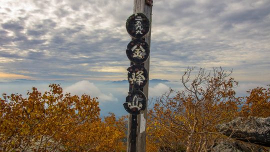
Hiked on Oct 2, 2016 Jul 15, 2020 . Moukidaira 毛木平 – Mt. Kobushi 甲武信ヶ岳 – Jumonjitouge Pass 十文字峠 Duration: 3 days Distance: 24 km Elevation change: 1173 metres Highest point: 2475 metres ...
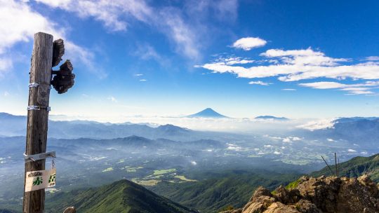
Hiked on Aug 19, 2014 Dec 15, 2024 . Mt. Akadake 赤岳 – Mt. Yokodake 横岳 – Mt. Ioudake 硫黄岳 For a rewarding and challenging 3- or 4-day traverse of the entire Yatsugatake Mountains, consider tackling the Yatsugatake Grand Traverse. ...
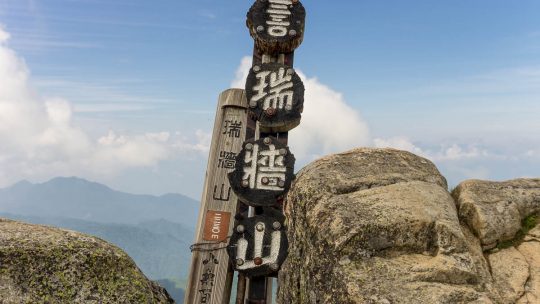
Hiked on Jul 31, 2014 Aug 23, 2023 . Mizugaki-sansou 瑞牆山荘 – Mt. Mizugaki 瑞牆山 Duration: 5.5 hours Distance: 5.9 km Elevation change: 720 metres Highest point: 2230 metres Start: Mizugaki-sansou ...
Hiked on Oct 31, 2013 Aug 23, 2023 . Hinata Ooya 日向大谷 – Mt. Ryokami 両神山 Duration: 2 days Distance: 10.3 km Elevation change: 1093 metres Highest point: 1723 metres Start: Hinata Ooya Bus Stop...
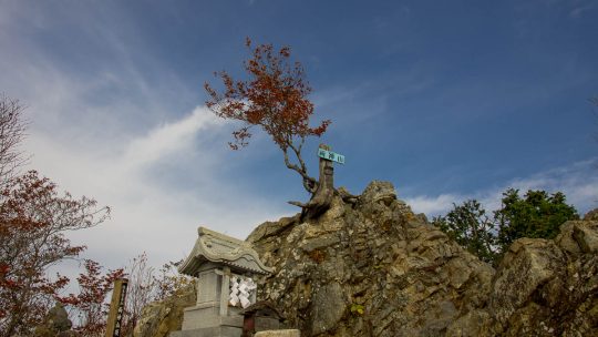
Hiked on Sep 30, 2013 Aug 23, 2023 . Mt. Kinpu 金峰山 – Mt. Kobushi 甲武信ヶ岳 Duration: 3 days Distance: 26.8 km Elevation change: 1089 metres Highest point: 2599 metres Start: Mizugaki-sansou Bus Stop...
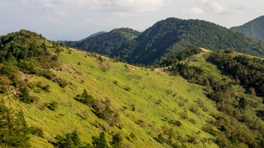
Hiked on Sep 21, 2013 Nov 10, 2024 . Mt. Daibosatsu 大菩薩嶺 – Daibosatsu-toge 大菩薩峠 – Tabayama Village 丹波山村 Duration: 2 days Distance: 20.7 km Elevation change: 1156 metres Highest point: 2056 metres ...
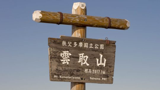
Hiked on May 23, 2013 Aug 22, 2023 . Mitsumine Shrine 三峯神社 – Mt. Kumotori 雲取山 – Mt. Mutsuishiyama 六ッ石山 Duration: 2 days Distance: 29.2 km Elevation change: 977 metres Highest point: 2017 metres Start:...
Hiked on Apr 4, 2013 Nov 2, 2025 . Mt. Tonotake 塔ノ岳 – Mt. Tanzawa 丹沢山 – Mt. Hirugatake 蛭ヶ岳 Duration: 2 days Distance: 23.7 km Elevation change: 1383 metres Highest point: 1673 metres Start: Okura Bus...