A Reservoir Laid Bare
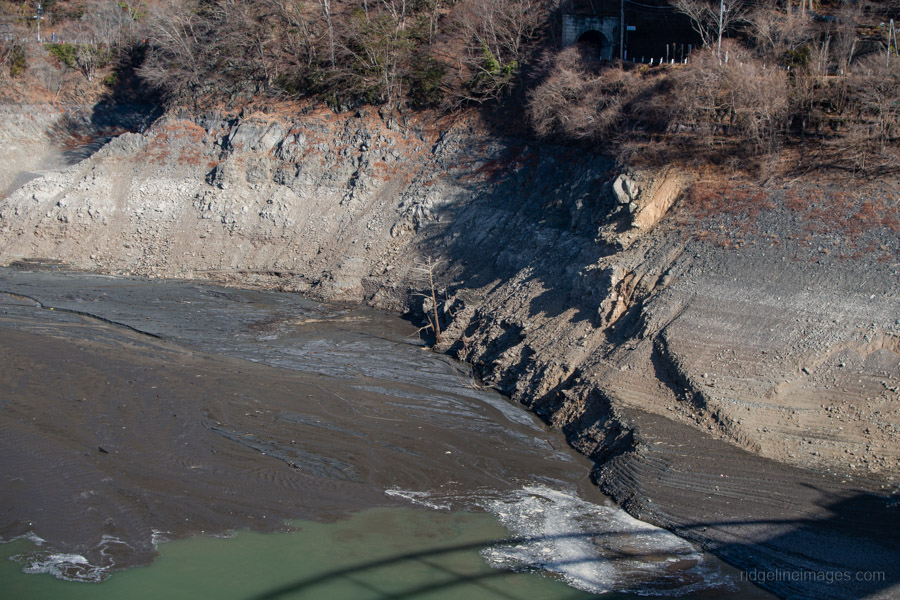
I’ve lost count of how many times over the years I’ve driven, ridden buses, or hiked – often directly across – the waters of Lake Okutama, via its two “drum bridges”. Formed by Ogouchi Dam, it has been both a familiar landscape and an important water source for Tokyo since the dam’s completion in 1957. Returning this past week and standing in much the same spot I stood almost exactly a decade ago, the view was noticeably different. Where I once looked out over a wide expanse of open water, much of the upper reservoir now lies exposed, with only a narrow, muddy channel tracing its way through silt and rock.
The numbers displayed at the dam’s management office reflect this change clearly. As of February 13 (2026), the storage rate stood at 40.7 percent, with a water level of 68 metres, well below its maximum depth of 142 metres. Water continues to be released to meet downstream demand, even as inflow remains limited. Okutama is not alone in this condition; reservoirs across the region are reporting similarly low levels, a situation attributed to a prolonged lack of rainfall. At Ogouchi Dam, current storage is at the lowest level recorded since the Heisei era.
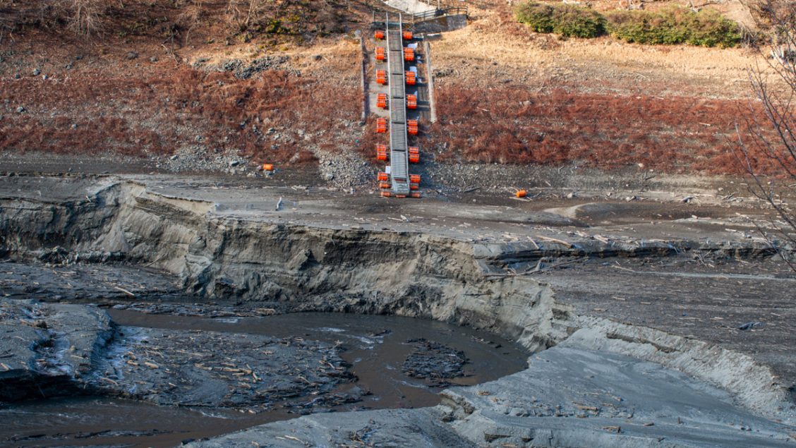
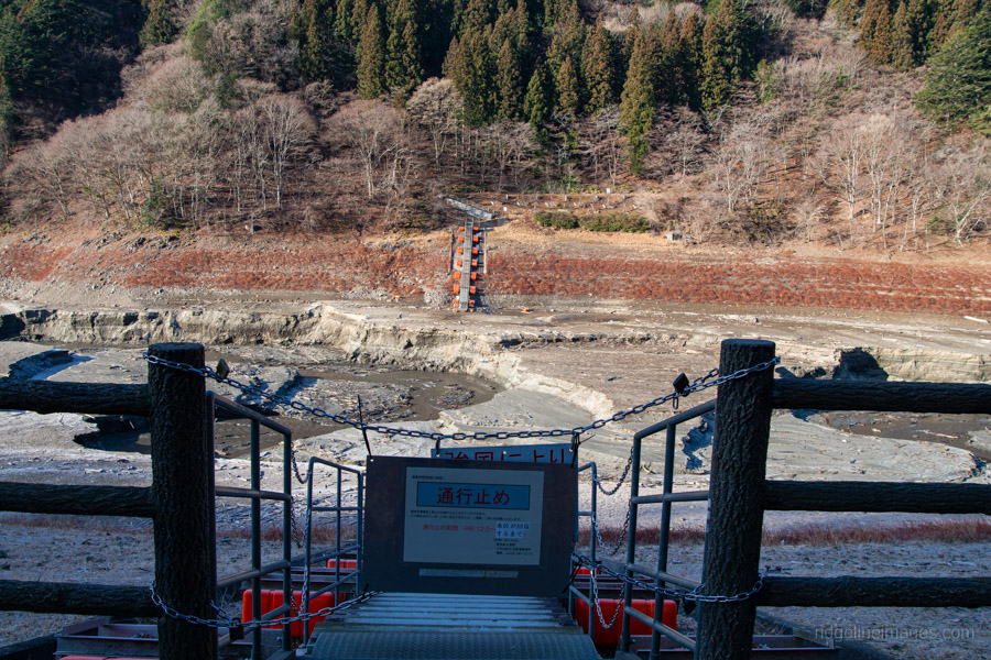
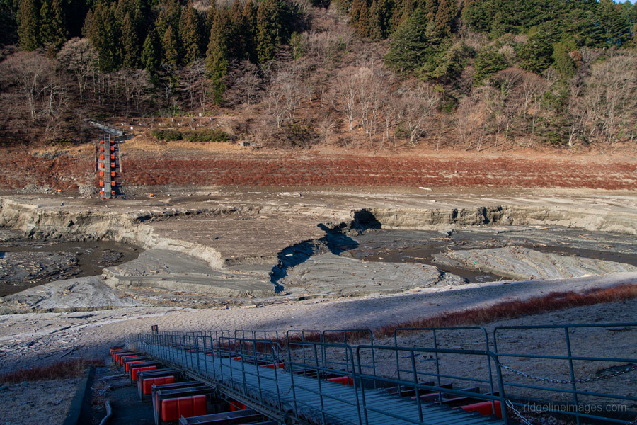
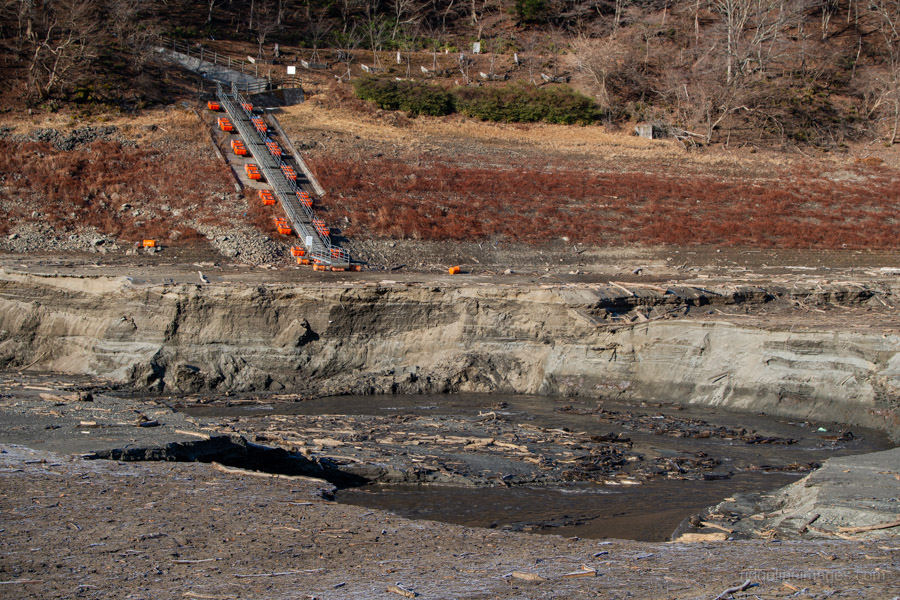
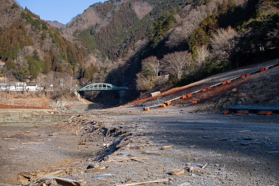
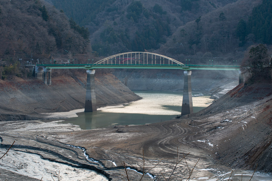
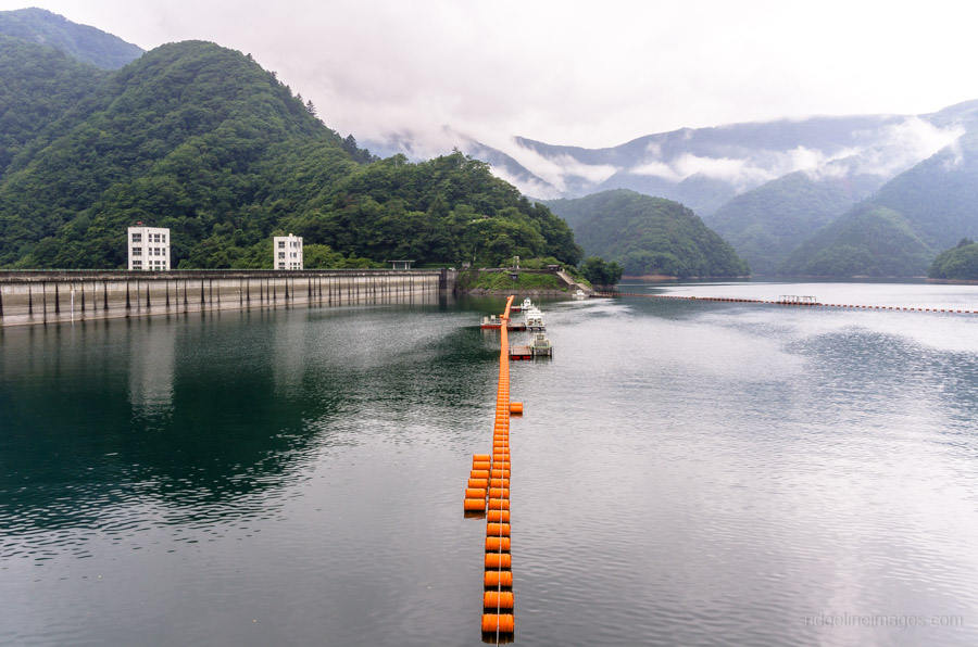
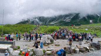
The day’s first close observation begins at the second of the lake’s two drum bridges: the Tozura Pontoon Bridge, located near the Kamosawa trailhead for Mt. Kumotori and a 30-minute bus ride from Okutama Station. Rather than spanning turquoise water as it typically does, the bridge lay separated into two sections, resting quietly along the lakeshore. The landscape here resembles something closer to a dry basin, its cracked surface interrupted only by a shallow, sluggish flow of muddy water. The exposed riverbed has also revealed a range of discarded Showa-era bottles and cans, now visible for the first time in decades.
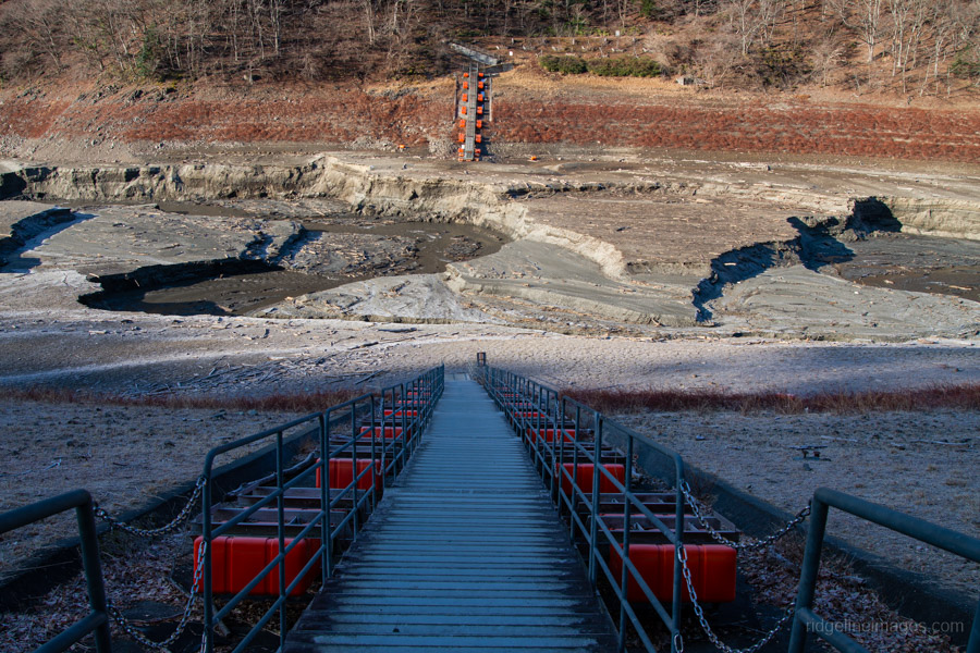
Tozura Pontoon Bridge, Lake Okutama, February 2026.
.
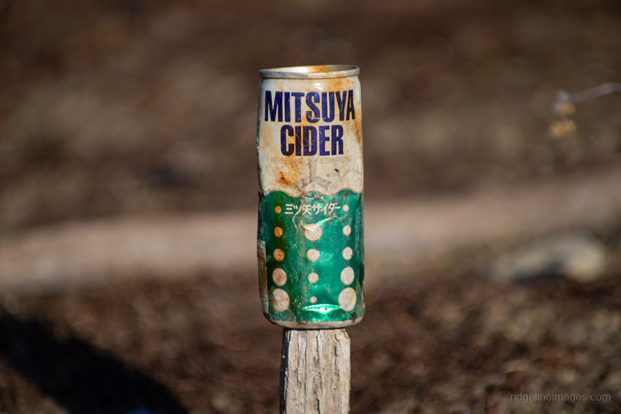
Mitsuya Cider aluminium can flat pull-tab, circa 1971.
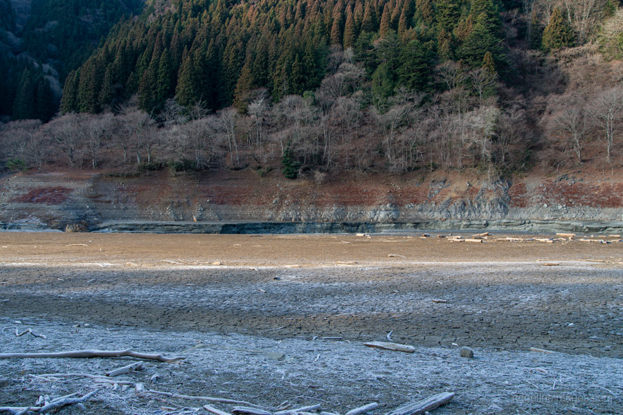
Cake-dry lake bed of Lake Okutama at Tozura.
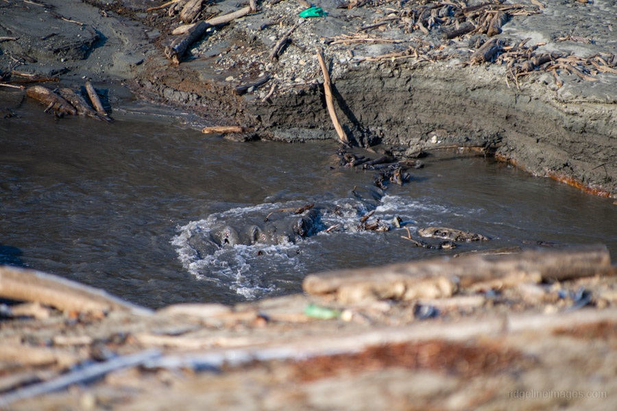
Shallow, sluggish flow of muddy water in Lake Okutama’s upper reaches.
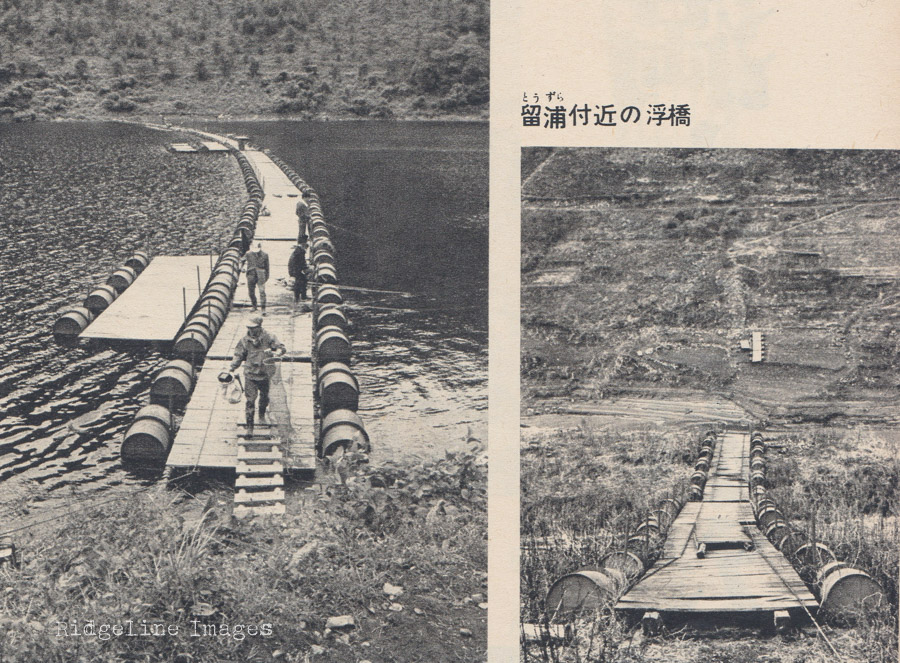
Tozura pontoon bridge (early 1960s on right).
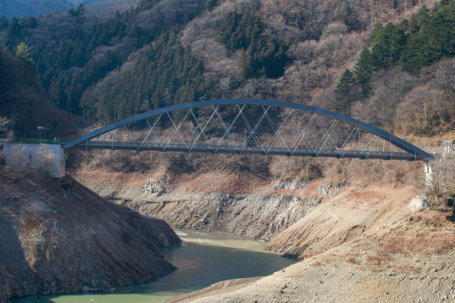
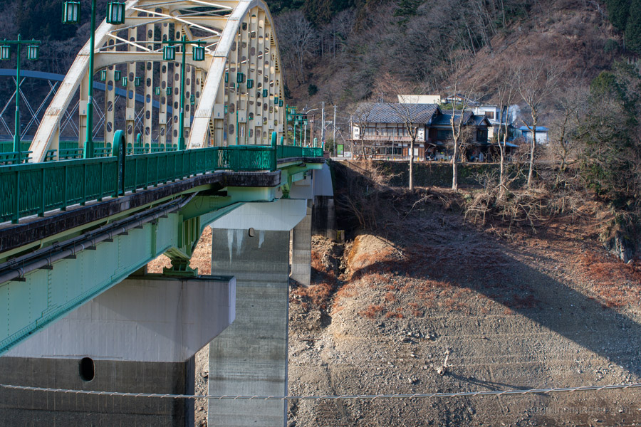
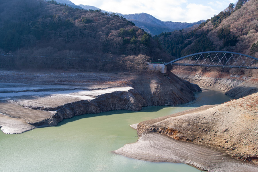
A short walk back down the road towards Okutama Station brought me to the day’s second inspection point at Miyama Bridge. Comparison photographs taken in February 2016 and February 2026 reveal a clear change. The shimmering green reflection once cast by the bridge’s painted steel onto the water below has disappeared, replaced by a noticeably lowered waterline. One of the more haunting features here is the skeletal remains of trees that once stood within the grounds of households in the former village of Ogouchi.
It is worth noting that conditions have been worse in the past. During what came to be known as the “Tokyo desert” in 1964 a severe drought that coincided with the Tokyo Olympics – water shortages across the capital reached critical levels. Archival photographs published at the time by Asahi Picture News document reservoir conditions that were even more severe than those seen today.
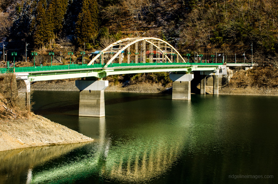
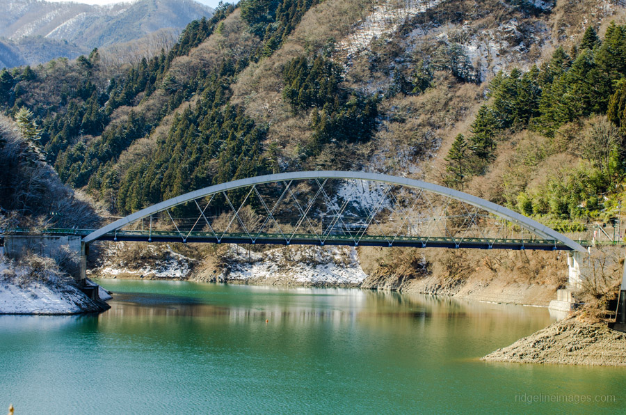
Miyama Bridge, Lake Okutama, February 2016.
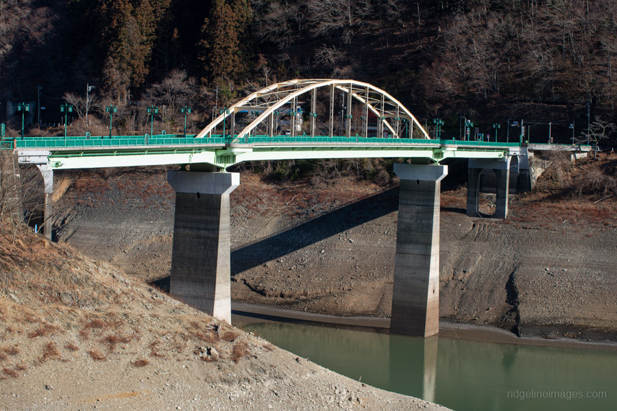
Miyama Bridge, Lake Okutama, February 2026.
Mito Bridge, Lake Okutama, February 2016.
Mito Bridge, Lake Okutama, February 2026.
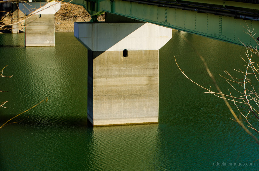
Miyama Bridge concrete pylon, Lake Okutama, February 2016.
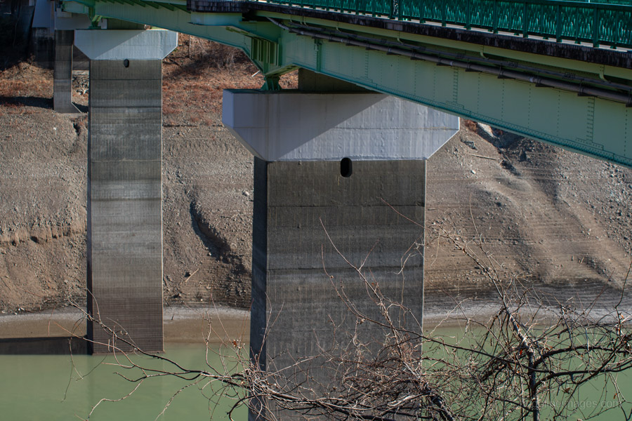
Miyama Bridge concrete pylon, Lake Okutama, February 2026.
.
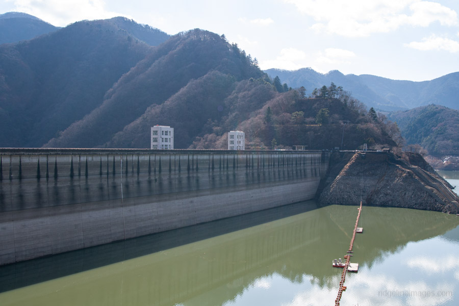
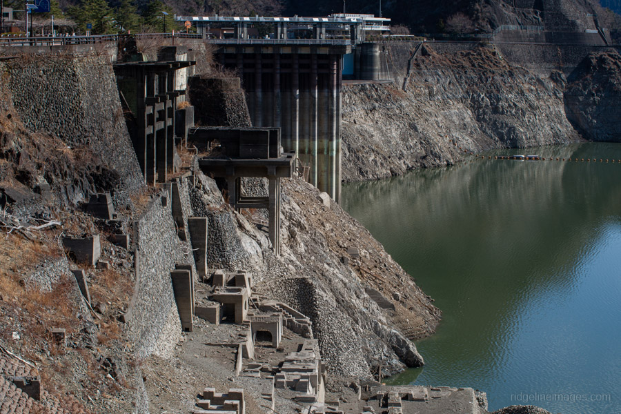
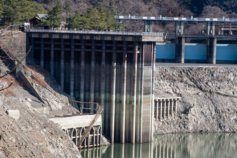
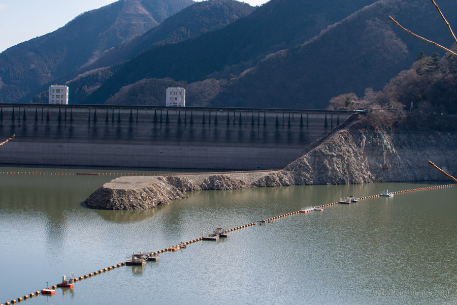
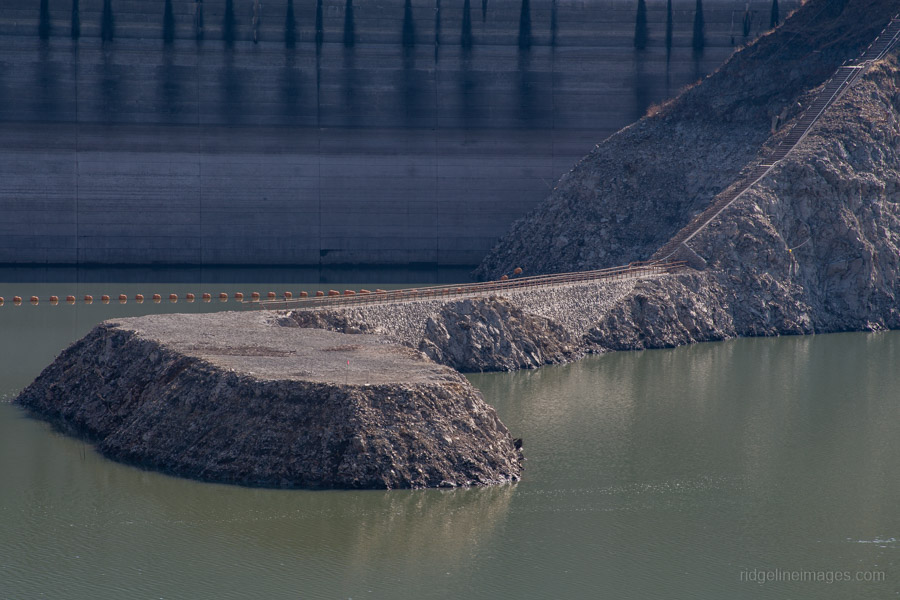
A return bus ride brought me to Ogouchi Dam itself. Comparing the scene with photographs I took in August 2014 reveals a marked change. An area that now resembles the eroded remains of an ancient settlement is, in fact, the former quarry site from which much of the 1.68 million cubic metres of concrete used in the dam’s construction was produced.
Interestingly, the scene captured in my recent photographs closely mirrors images taken here in the early 1960s, shortly after the dam’s completion, when drought conditions left reservoir water levels similarly low.
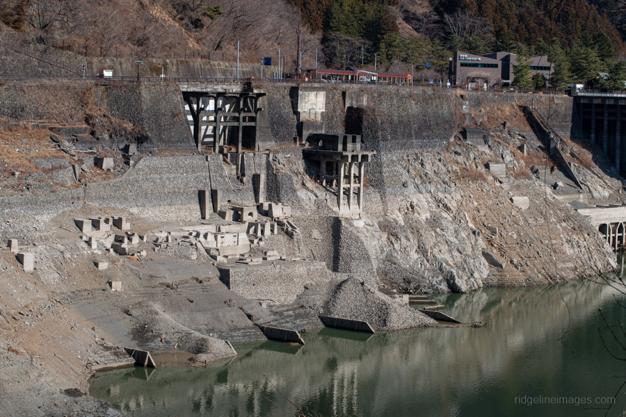
Ogouchi Dam former quarry site, February 2026.
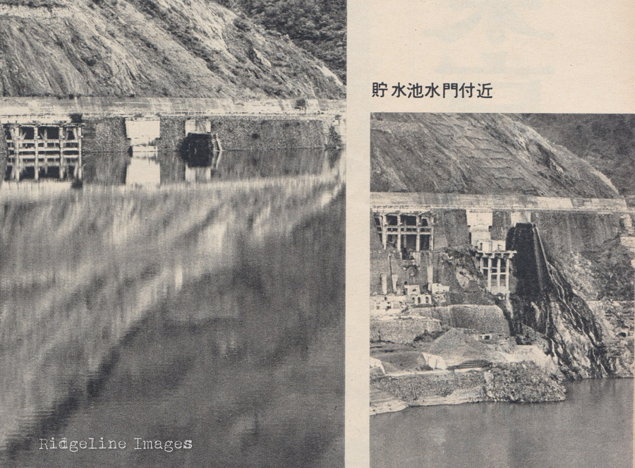
Waterline well below the road level (early 1960s on right).
Ogouchi Dam February 2014.
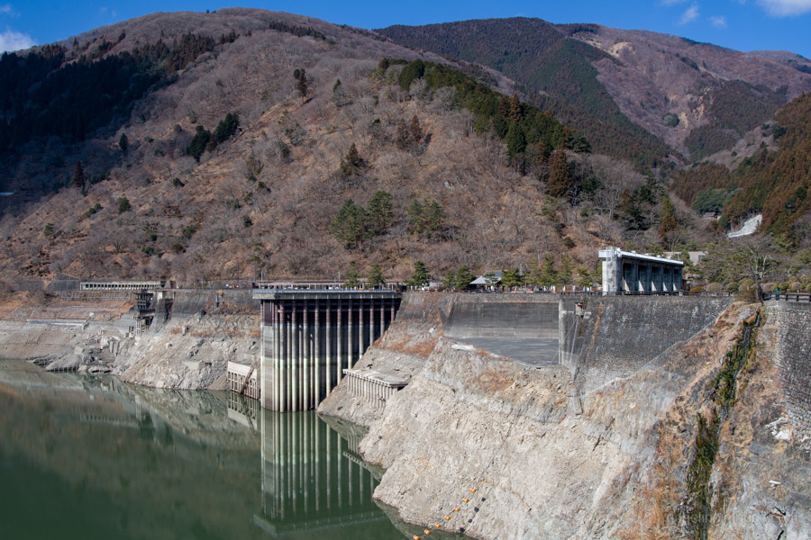
Ogouchi Dam February 2026.
Ogouchi Dam February 2014.
Ogouchi Dam February 2026.
.
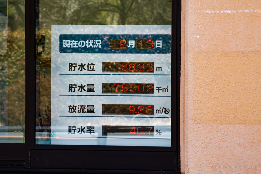
Numbers on plain display at the dam’s management office.
So, what does this all mean, and are we at imminent risk of water restrictions? The short answer is “not necessarily”. The vast majority of Tokyo’s drinking water, around 80 percent, is drawn from the broader Tone River and Arakawa River systems, with the Tama River playing a much smaller role. In other words, while Lake Okutama remains an important source, particularly for western Tokyo, it accounts for only about one-fifth of the city’s total water supply. While the “Tokyo desert” of 1964 may not be repeating just yet, the exposed relics of the Showa era serve as a quiet, muddy reminder of our reliance on the seasons.

Wow. That’s something. I’ve gotten so many beautiful pictures of the lake over the years, this is quite a contrast.
I’m glad you put this up. I think I might actually be going through Okutama next week. This kind of prepares me mentally.
I’d seen some photos circulating online, so I wanted to go and see it for myself. It was a real shock, to be honest. The recent snowmelt has had next to no effect, and unless there’s a decent spell of rain, it’s hard to see the water level heading in the right direction anytime soon.
I remember heading towards Mito on Sept 2nd 2024. On the way by bus, the driver announced to check our left. We saw the rare sight of the dam diverting water to the spillways. Never thought I would see that happen.
https://www.metro.tokyo.lg.jp/information/press/2024/08/2024083018?utm_source=chatgpt.com
That must have been quite a sight. It really shows how quickly things can change from near capacity to what we’re seeing now in the space of just 18 months.