.
Mt. Yonezawa 米沢山 – Mt. Oboyama お坊山 – Ojika-toge 大鹿峠
Distance: 13.5 km
Elevation change: 830 metres
Highest point: 1430 metres
Start: Sasago Station (Chuo Main Line)
Finish: Kai-Yamato Station (Chuo Main Line)
Difficulty: ▅▅▅▅▅▅▅▅▅▅ ❹
Map: Yama to Kogen Chizu 山と高原地図 [No.26 大菩薩嶺 DAIBOSATSU-REI]
GPX TrackKML TrackGSI MAPPDF Topo Map
Challenging Hike on the Old Koshu Kaido
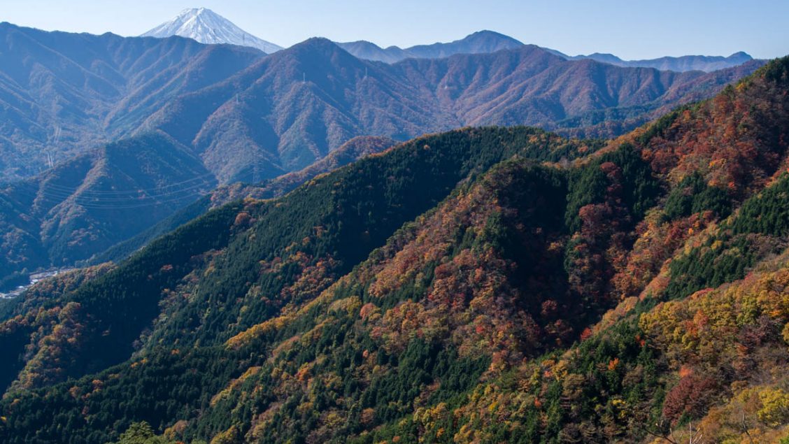
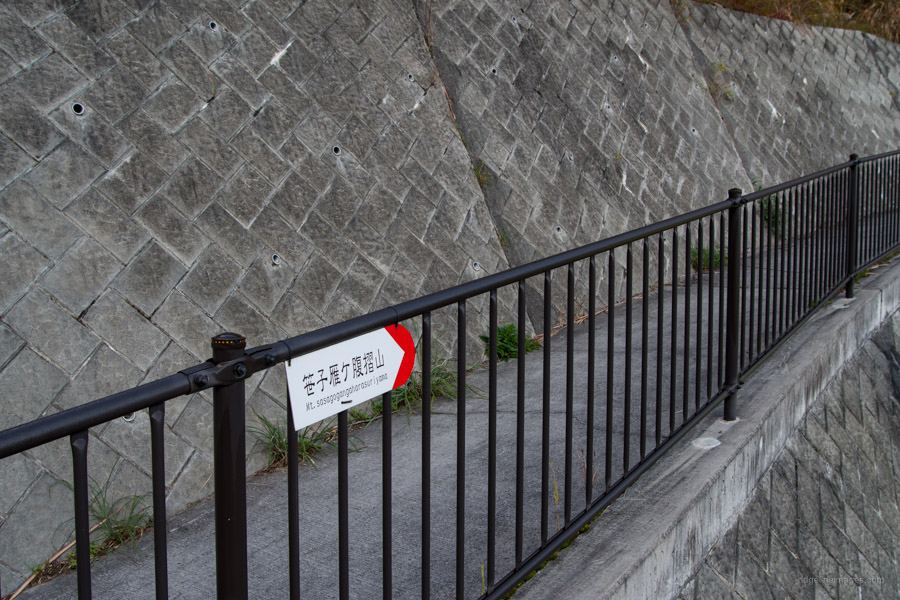
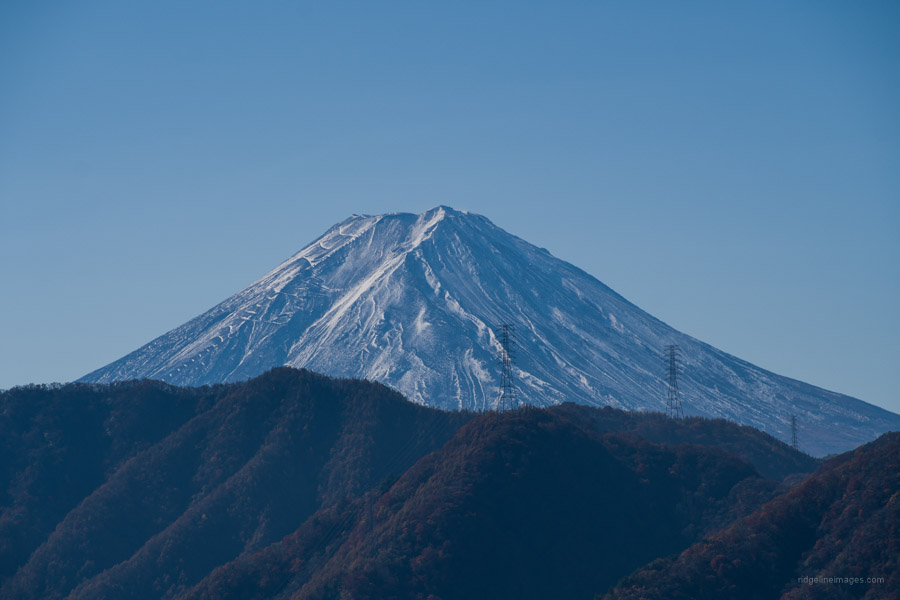
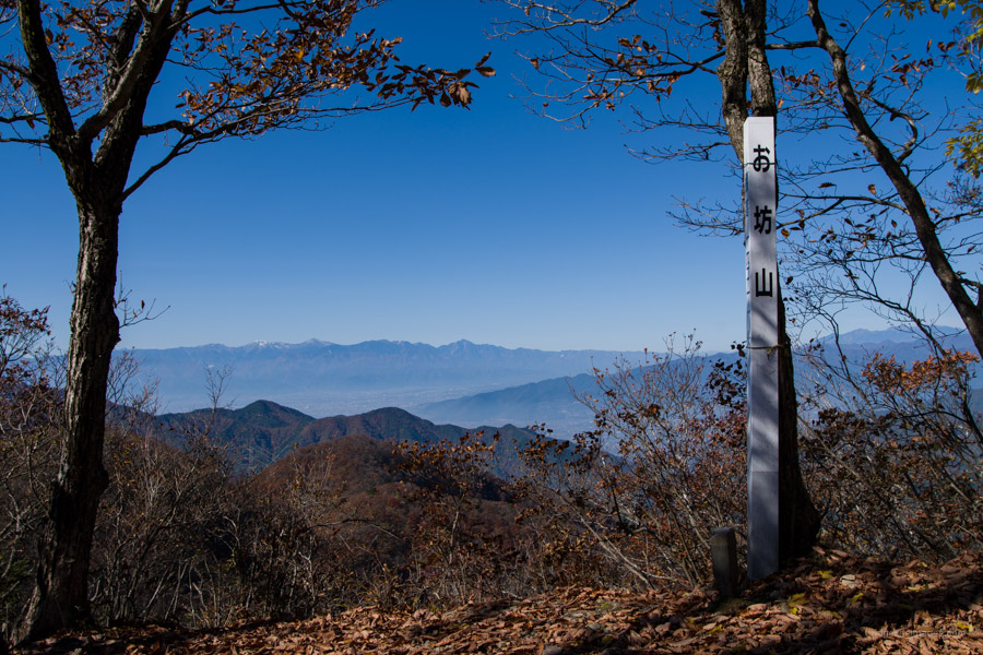
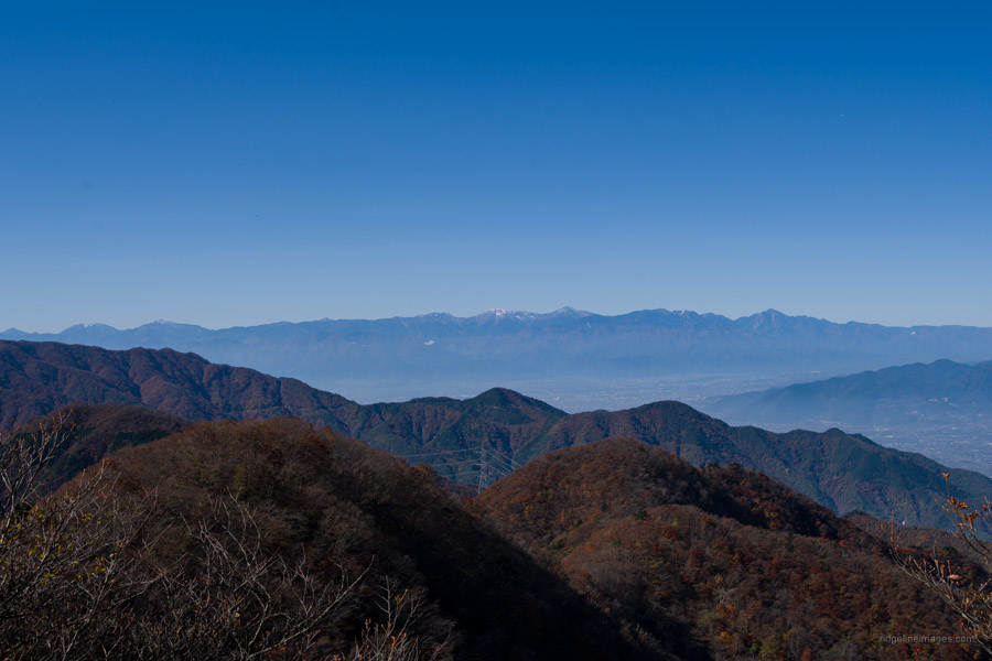
The frightfully named Mt. Sasagogangaharasuriyama is one of three ‘Gangaharasuriyama’s’ in Yamanashi Prefecture. Albeit, it’s three letters shy of lengthier Mt. Ushiokuno-gangaharasuriyama 牛奥ノ雁ヶ腹摺山 (that claims the longest mountain name in Japan). While somewhat lower than neighbouring Mt. Takigoyama its hillsides are precipitous and made for a challenging journey along the old Koshu Kaido 甲州街道 that once connected Edo (Tokyo) and Kai Province (Yamanashi Prefecture). These days, there are three tunnels buried deep beneath the mountain that do the hard work of moving goods and people. The view of the Southern Alps and Mount Fuji from the adjoining summit of Mt. Oboyama is quite good, as is the view of the Kofu Basin to the west.
It must be said, that this hike isn’t particularly beginner-friendly with fixed chains and the potential for getting lost approaching Ojika-toge. It is best to climb Mt. Takigoyama and Mt. Honjagamaru first before tackling this one. Looping counter-clockwise back to Sasago Station is one way to reduce the difficulty, however.
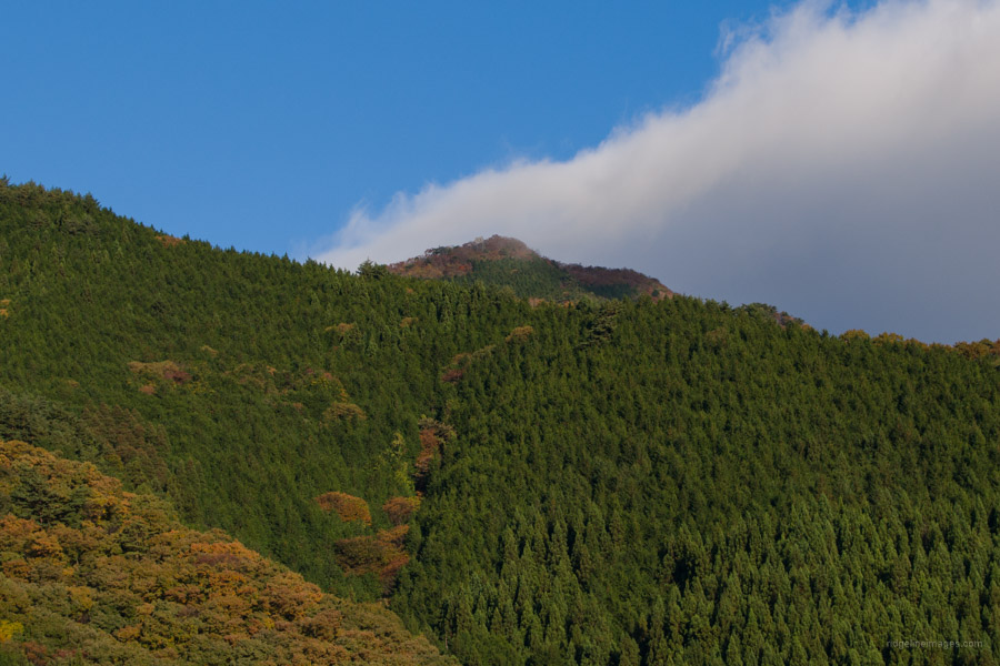
From Shinjuku Station, take the JR Chuo Line to Takao or Otsuki Station, change to a Kofu-bound train, and get off at Sasago Station 笹子駅 (1 hour and 50 minutes, 1,980 yen). Leaving by the only exit, swing left and walk along the busy National Route 20 for about 30 minutes to the trailhead, which rests downhill from the cemetery. Aside from a sign at the trailhead proper, there aren’t any others. About halfway along the road, just past a line of vending machines, you can spot the summit together with the conspicuous ‘passive repeater’. As a side note, the mountain’s name originates from the migratory wild geese that fly over it.
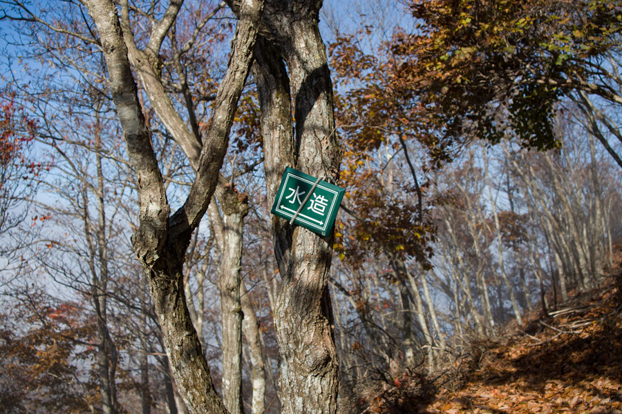
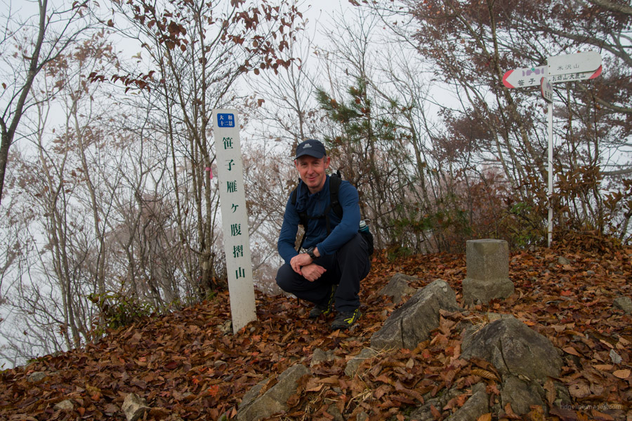
The steep climb kicks off in earnest. The first landmark is a transmission tower reached after about 15 minutes. The trail sticks to the ridge and sharpens before arriving at a ‘passive repeater’ that retransmits radio signals without power. Weather permitting, it’s possible to catch a glimpse of Fujisan. Along the way, be alert for the marker “mizu zo” 水造 which is an abbreviation for 水源林造成事業 (Watershed protection forest generation project) which follows much of the route. From the station to Mt. Sasagogangaharasuriyama (1,358 m) 笹子雁ヶ腹摺山 took just 2 hours. The pocket-sized summit is hemmed in on all sides, with not much of a view. Three signposts adorn the peak, namely the Yamanashi 100 Famous Mountains, the 12 Scenic Views of Mt. Fuji and the Yamato Twelve Views.
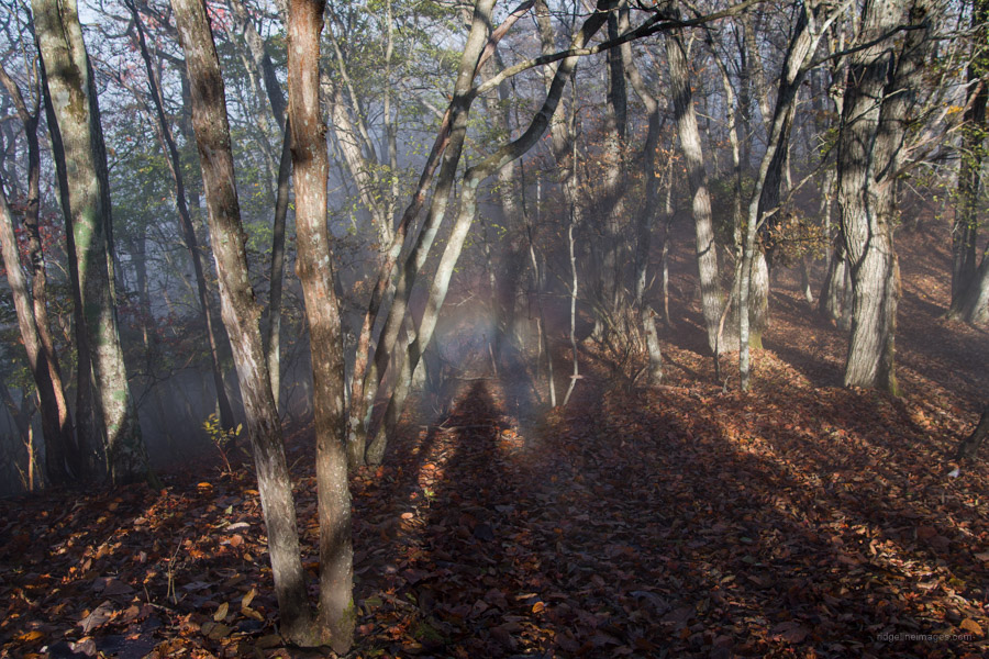
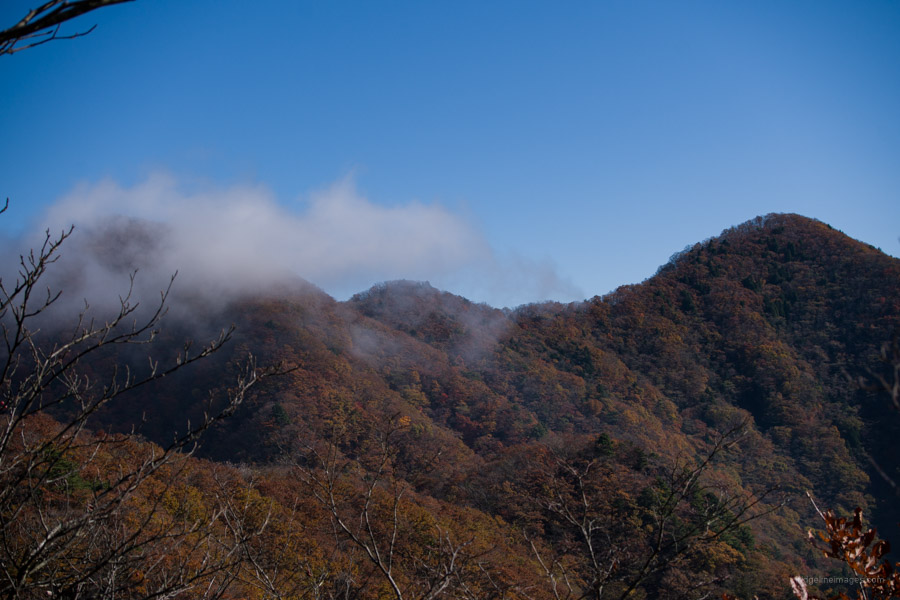
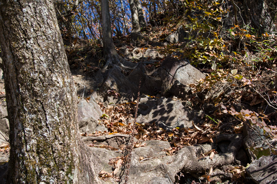
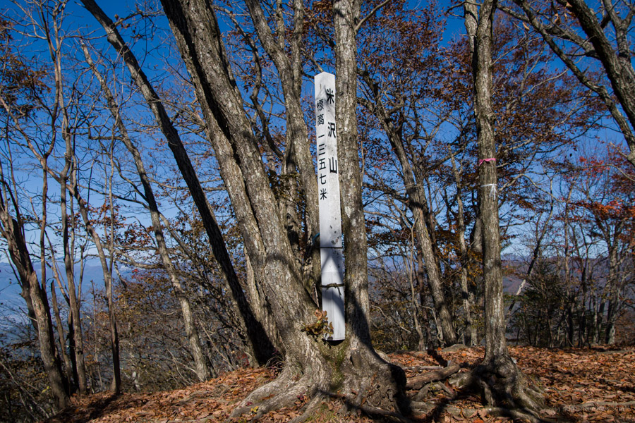
Next up is the most challenging part of the hike, with many ups and downs. The downward gradient on the north side of the mountain is much the same as the ascent. Both Mt. Yonezawa and Mt. Oboyama can be made out in the distance. Be sure not to miss a scenic spot on the way to Mt. Yonezawa with a lovely view of Mt. Fuji and back to Mt. Sasagogangaharasuriyama. As you approach Mt. Yonezawa 米沢山 (1,357 m) proceed with a degree of caution as the trail narrows and leaf debris increases. Finally, you are faced with a series of chains that can best be described as thrilling. In hindsight, it is probably easier to negotiate in reverse. The summit is similarly encircled with woodland. Next up along the Sasagomine Ridge Traverse 笹子嶺縦走 is Mt. Oboyama お坊山 (1,430 m) which marks the high point of the hike. From this peak, you can see the Kofu Basin, and the snow-capped Southern Alps along with Yatsugatake.
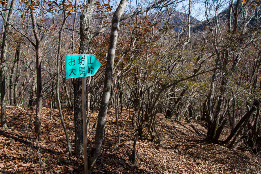
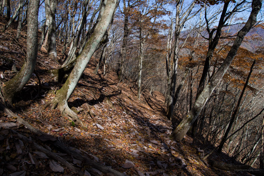
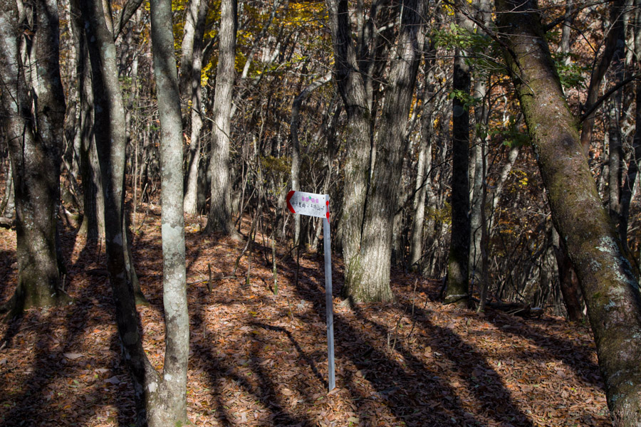
Here is where things became a little unsettling. As the rustling of the dead leaves underfoot increases, it becomes increasingly difficult to make out the trail until it all but disappears. Things aren’t helped by the fact that the trail signage on the hike wavers from barely adequate to non-existent, and where pink tape might ordinarily be a windfall, it’s missing. Given the proclivity to go awry, make sure to carry a GPS. All things go well; it should take 35 minutes from Mt. Oboyama to Ojika-toge 大鹿峠.
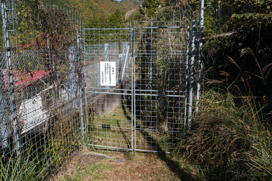
At Ojika-toge, veer left uphill towards the transmission tower and down the incongruous black plastic steps fitted and used by personnel that maintain the transmission line. After passing the Hikawa Shrine 氷川神社 there is a deer gate that is fixed with a drop rod. Just beyond here the trail literally passes through the frontage of someone’s private residence! It takes a further 30 minutes on foot from the deer gate to arrive at Kai-Yamato Station.


Just wanted to say I walked this very route yesterday for the first time in a few years. The ridge was still slippery from the rain but was drying off enough that it was do-able. Definitely would not want to attempt this one in the rain or snow, and there are not many potential escape routes once on the main ridge.
I also got lost at the section at the end towards 大鹿峠 before, but somebody has re-done the pink tape now and the route is very clear.
What a great hike this one is, plenty of action and some good views too.
It’s good to hear the pink tape has been redone in those sections—I remember some parts being a bit indistinct. You’re right; it’s a good, solid hike and far better than just tackling Sasagogangaharasuriyama on its own.
incidentally, the “水造 ” signs on the way up don’t mean “desalination”, but is actually an abbreviation for 「水源林造成事業」 (Watershed protection forest generation project)
Thanks for demystifying that! I’ve updated the information on the blog, as 水造 by itself was quite cryptic.
Thanks for the update. And congratulations on your amazing blog, what a fantastic English resource.
I appreciate the kind words! Thanks again for the clarification.