.
Mt. Jinba 陣馬山 – Meio-toge 明王峠 – Sokozawa-toge 底沢峠
Distance: 8.6 km
Elevation change: 434 metres
Highest point: 857 metres
Start: Jinba Kougen Shita Bus Stop
Finish: Jinba Kougen Shita Bus Stop
Difficulty: ▅▅▅▅▅▅▅▅▅▅ ❷
Map: Yama to Kogen Chizu 山と高原地図 [No.29 高尾・陣馬 TAKAO·JINBA]
GPX TrackKML TrackGSI MAPPDF Topo Map
A Beginner-Friendly Loop on Mt. Jinba
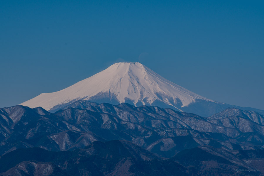
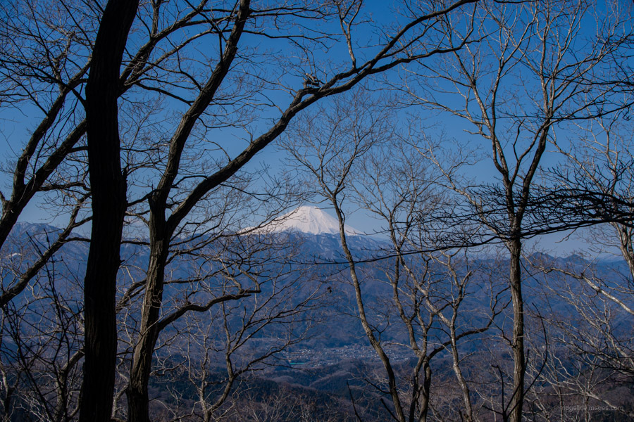
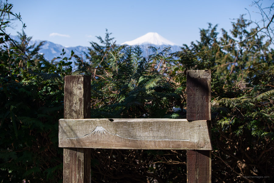
If Mt. Takao is the most climbed mountain in Tokyo, then Mt. Jinba – which straddles the border between Tokyo and Kanagawa Prefecture – can’t be far behind, and for good reason. Its wide, flat summit offers a best-in-class view, has been selected as one of the 100 Best Views of Mt. Fuji in Kanto, and is also fairly easy to access.
I first climbed Jinbasan more than 10 years ago and have since enjoyed its panorama on seven separate occasions, including the fairly long Takaosan-to-Jinbasan traverse, the even longer Jinbasan-to-Mitosan route, and a hatsuhinode (first sunrise of the New Year) from the mountaintop. This hike, which included taking in the recent snowfall, is a beginner-friendly loop starting and finishing at the Jinba Kogen Shita Bus Stop.
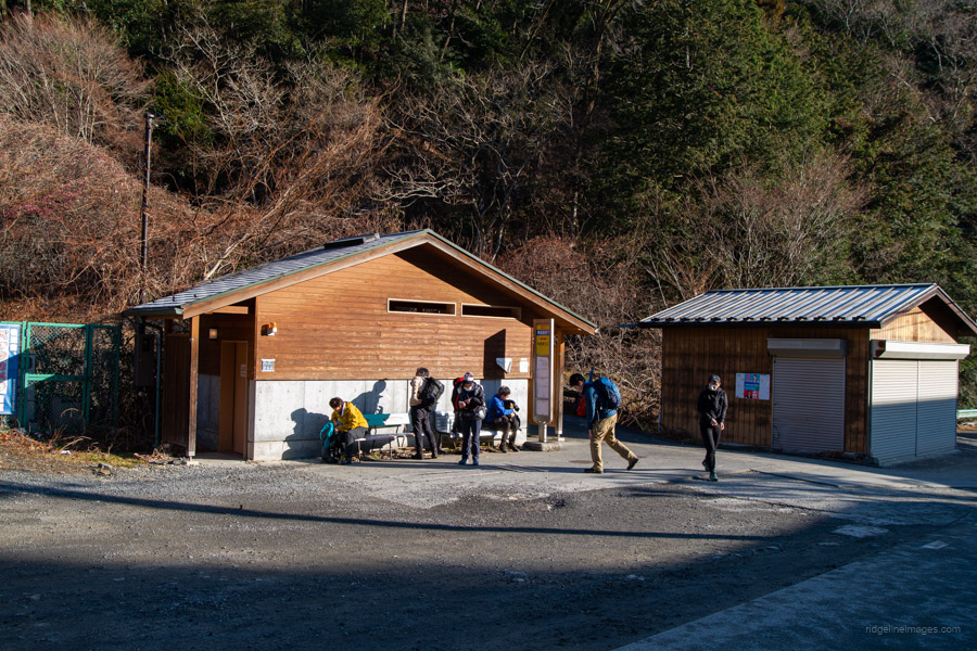
Access to the trailhead is the same as for my original hike from Mt. Jinba to Sagamiko Station. Buses depart from outside the north exit of Takao Station 高尾駅 look for one bound for Jinba Kogen Shita 陣馬高原下 at bus stop 1. The ride follows the Jinba-Kaido Ave, takes around 35 minutes, and costs 640 yen. Given the mountain’s popularity, it’s wise to aim for the first morning bus, which departs at 6:47 AM on weekdays and 6:50 AM on weekends.
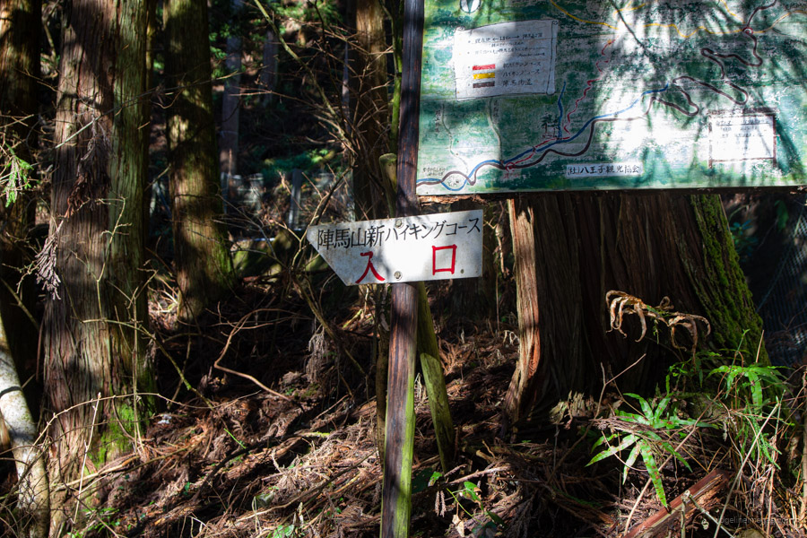
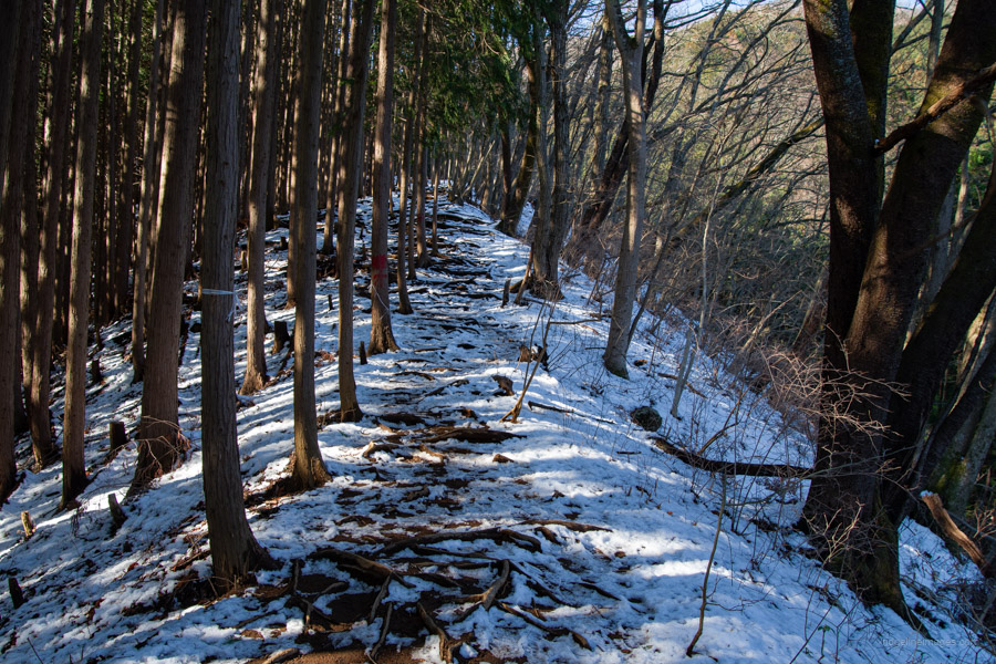
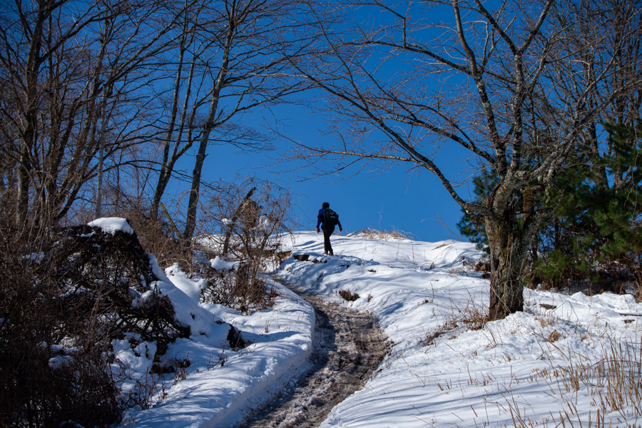
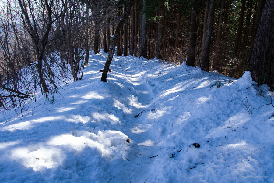
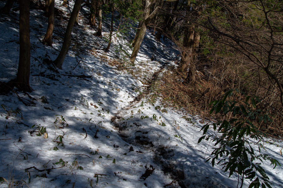
At the Jinba Kogen Shita bus stop, you’ll find an area guide map for reference if needed. Look for a sign on your right pointing toward Wada-toge 和田峠 and Mt. Jinba. The first section follows a paved road with a slight uphill gradient for approximately 1.5 km, after which the trail entrance veers off to the left. As expected, the trail is well-trodden, though some sections are washed out. It should take a little over an hour to reach the summit from the bus stop. I debated whether to put on chain spikes, but in the end, I decided against it.
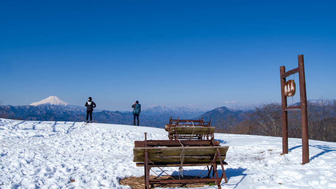
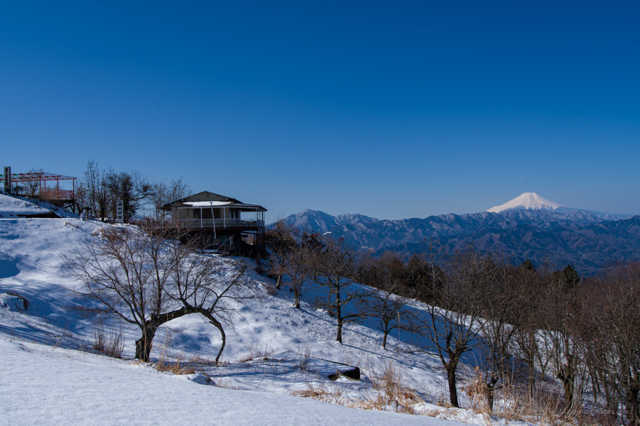
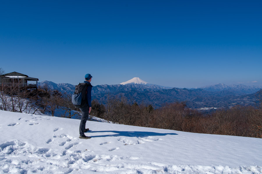
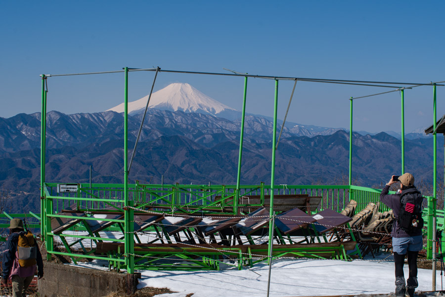
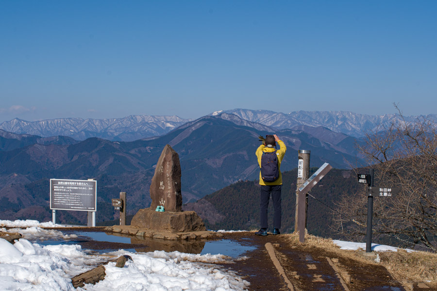
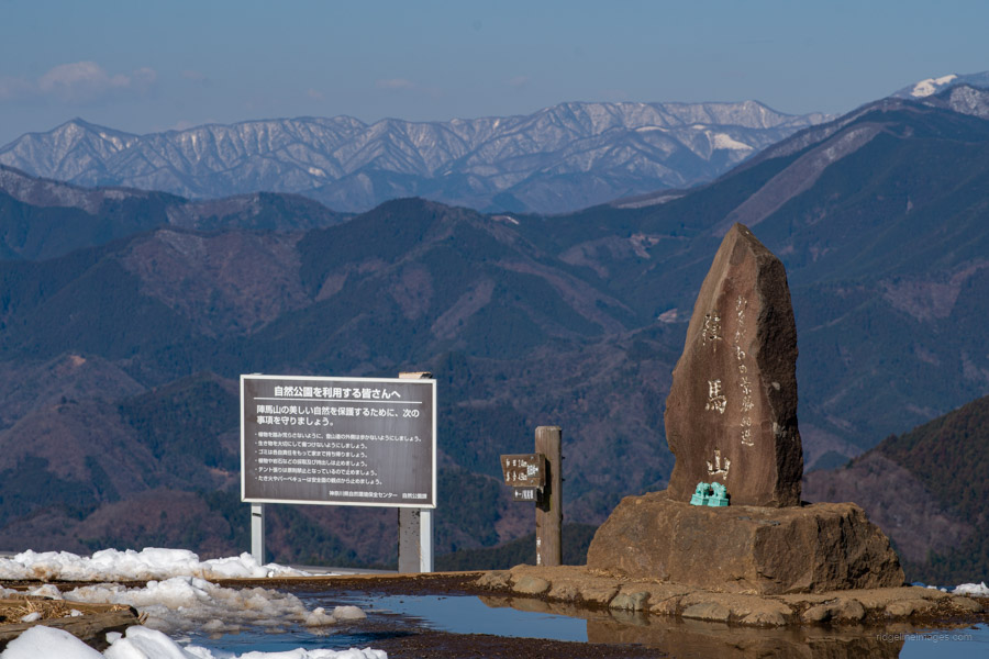
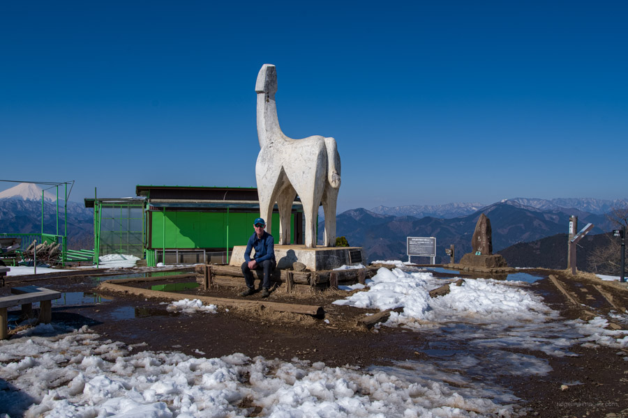
Reaching the summit, I was met with a glorious view of Fujisan, with the Tanzawa mountains in the foreground and more snow than I had expected. In clear conditions, you can also see Enoshima. A nice little bonus was that the feature image of this post was selected as Japan Today’s “Picture Of The Day“!
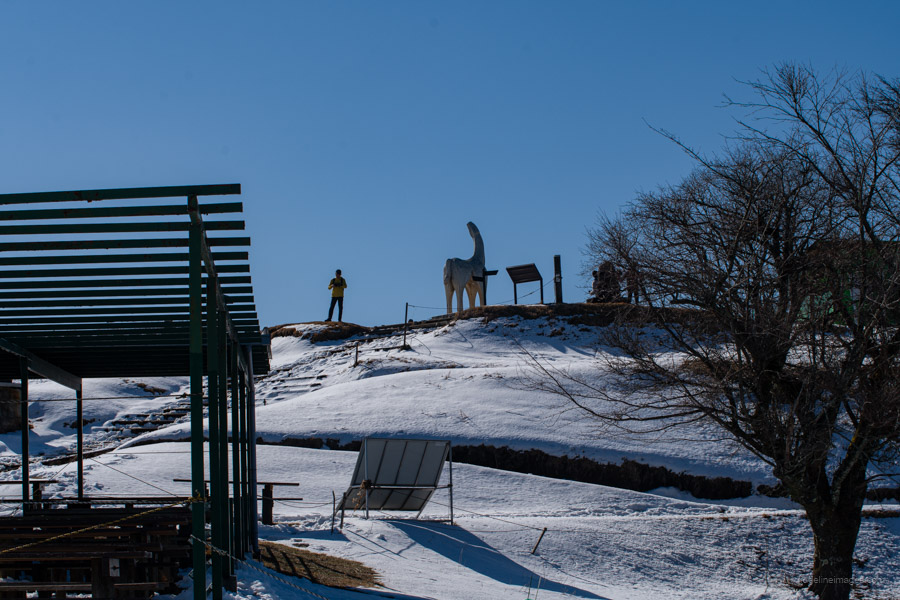
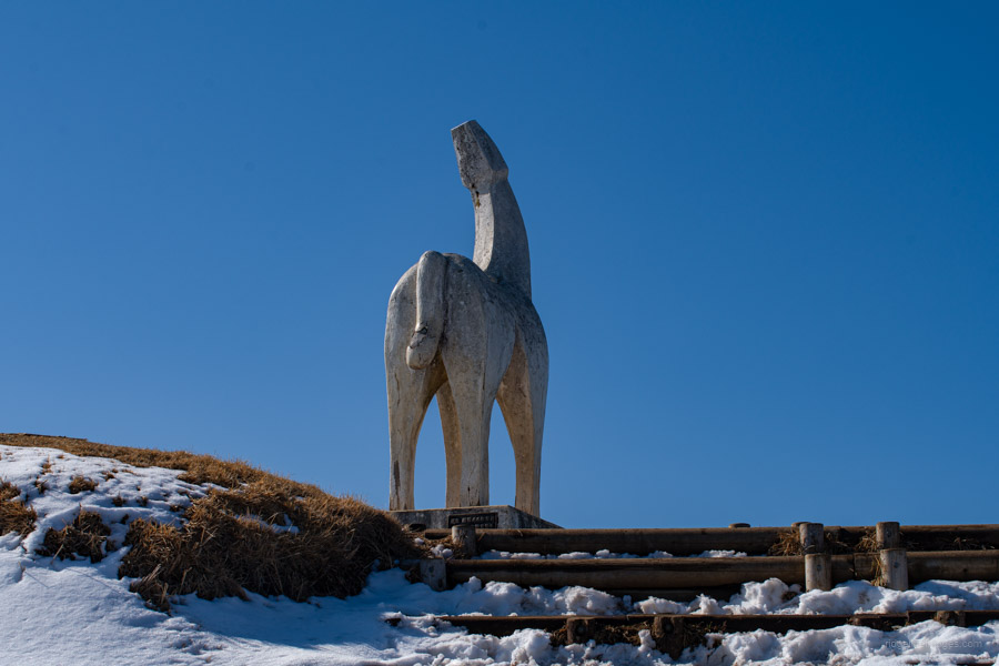
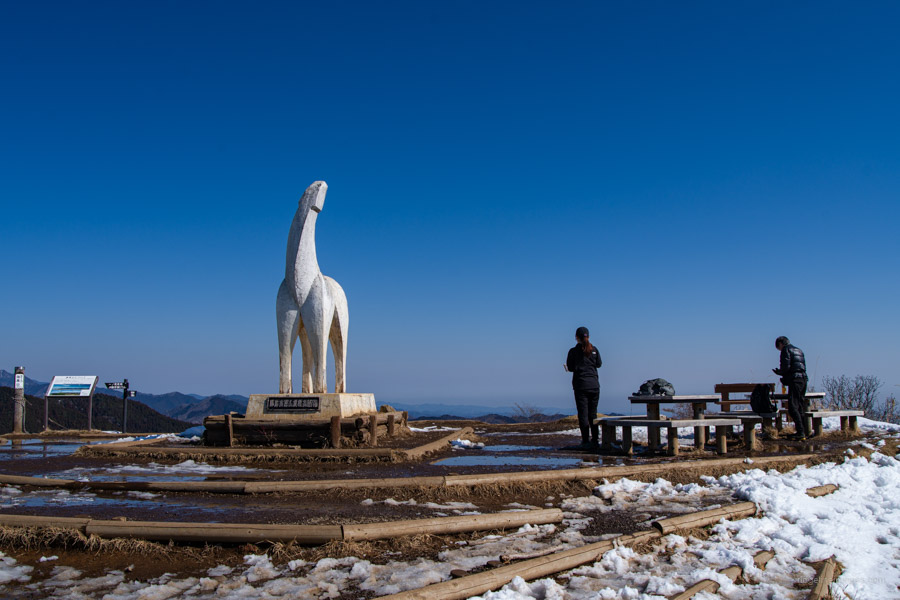
Of course, a highlight for any hiker visiting Jinbasan is its famous white horse. Theories about the origin of the mountain’s name vary. One suggests it stems from a pronunciation shift of Chigayaba, meaning “thatched field”, as the area was once used for harvesting reeds. Another theory is that the characters for Jinba 陣馬, meaning “horse camp”, were chosen because a military horse camp once stood there. The horse itself was placed there in the late 1960s to promote the mountain as a tourist destination.
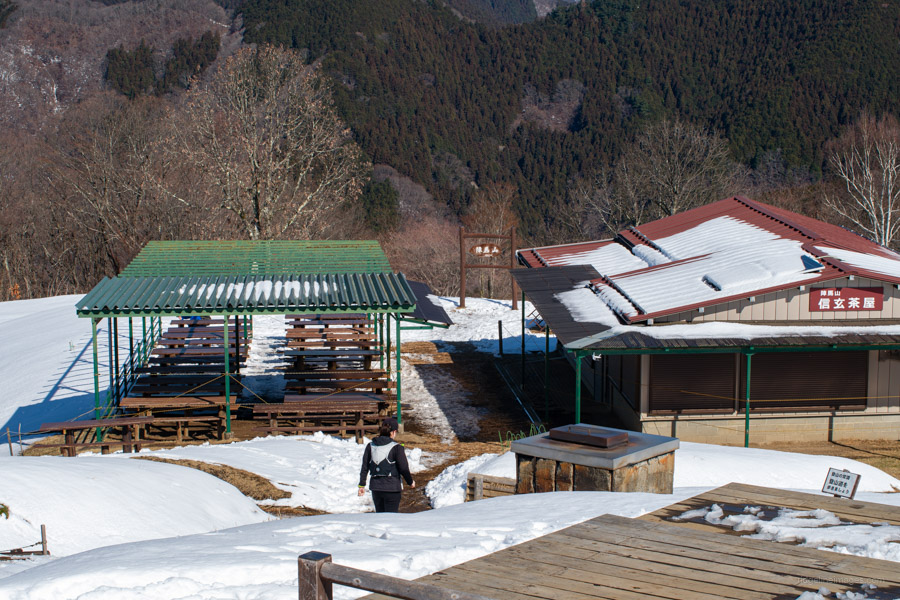
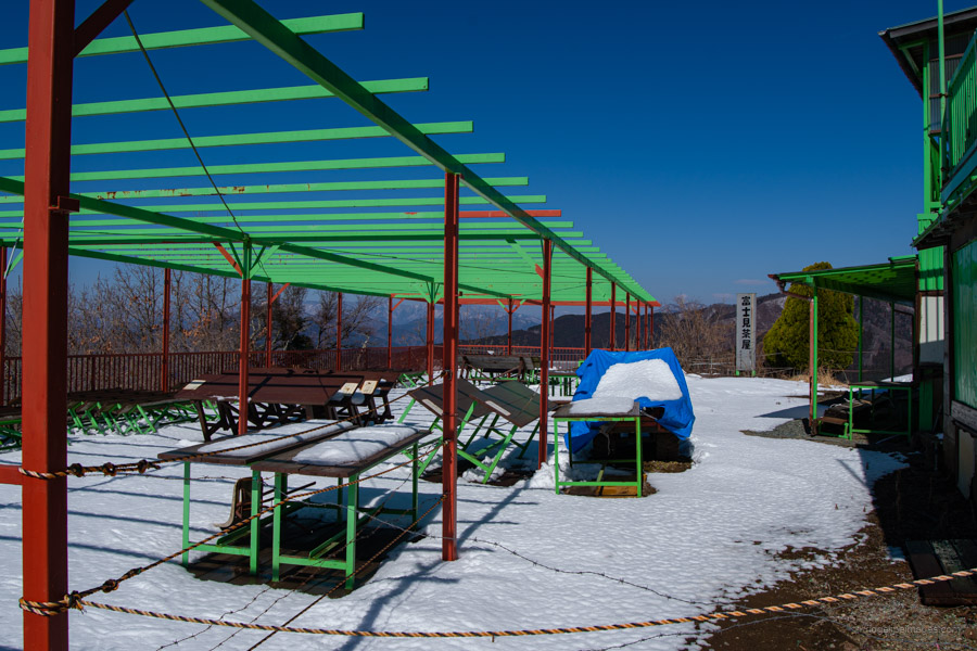
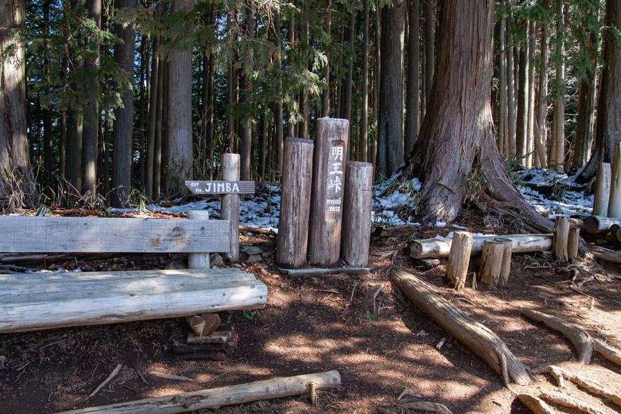
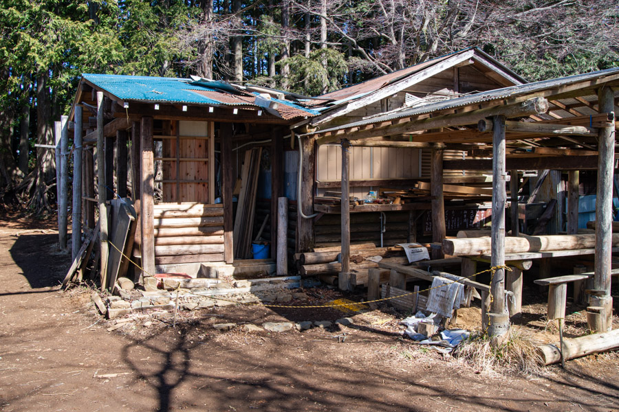
After soaking in the view, begin heading along the ridge toward Meio-toge 明王峠. In shaded areas, the snow along this section toward Narako-toge 奈良子峠 was also quite deep. When I first passed Meio-toge back in 2014, there was a functioning teahouse, but unfortunately, it now appears to be shuttered. This means there are only two remaining teahouses between Mt. Jinba and Mt. Takao, namely at Mt. Kagenobu and Mt. Shiroyama.
From Meio-toge, it’s a short 10-minute walk to Sokozawa-toge 底沢峠, where you begin the descent back to Jinba Kogen Shita, completing the loop. This descent trail is less travelled than the main route to Mt. Jinba but remains in good condition. About halfway down, it merges with the starting point of the Nanakubo Forest Road. Buses run roughly once an hour, so it’s worth keeping this in mind before leaving Meio-toge.


That’s a nice mountain.
I used to drop by the peak when I was on bike.rides. It’s only 1〜2 km from the Wada Pass.
Great photos! I took a group up to Jimba for a trailrun the day before your hike, on 春分の日. You certainly had a better view!
One correction – There is one more teahouse between Jimba and Takao at Mt Kagenobu. There had been two on Kagenobu, but the lower teahouse was taken down last year. The proprietors moved over with their dogs to take on the Shiroyama hut. The upper hut is still operating.
Cheers, Andrew. My original plan was also to hike on the same day as you, but visiting Jinbasan a day later turned out to be just about perfect—aside from a slight haze.
Thanks for the heads-up about the teahouse at Kagenobu; it had completely slipped my mind.