Knowing Where You Are Isn’t the Same as Being Found
Sponsored content, produced in coordination with COCOHELI. All opinions are my own. Feature image courtesy of COCOHELI.
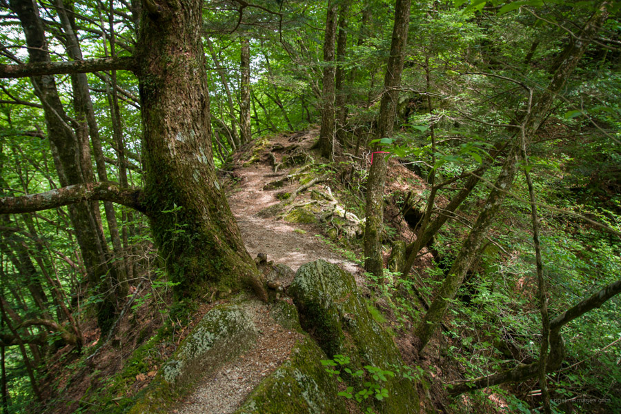
When a hiker goes missing in the mountains, the first question seems simple enough: where are they? In steep, forested country, the answer can be extraordinarily hard to pin down. A person can be a few hundred metres from a trail and still be almost impossible to find. A helicopter covers a lot of ground in an hour, but only if the crew has some idea where to look, and only if the weather lets it fly.
I often think about this when I’m walking through dense forest. If I were suddenly teleported even ten metres off the trail, I could be in a world of strife. I would know roughly where I was. Nobody else would.
That is the part of the problem that gets overlooked. The missing person usually has a fair idea where they are. What they can’t do is tell anyone. A broken leg and no phone signal, a head injury, hypothermia that has progressed from shivering to confusion, a phone lost or smashed in a fall: the information exists only in the hiker’s head.
We tend to think of a rescue as beginning when somebody is found. In practice there can be a long period before anyone knows where to start looking. That gap is the reason I have carried a small transmitter on every hike since 2021.
More Visitors, More Accidents
According to the National Police Agency, 246 foreign visitors were involved in 174 mountain accidents in Japan in 2025. Both are the highest figures since the agency began keeping separate statistics for foreign visitors in 2018, and more than 80 percent of those involved were hiking, mountaineering or backcountry skiing. Across all hikers, the most common cause of accidents was simply getting lost, at just under 31 percent.
Those figures cover visitors only. Foreign residents aren’t counted separately from Japanese hikers in the wider data. Most mountain accidents happen at a known location: an injury, exhaustion, a party that can’t go on. Even most lost hikers can still phone for help. Getting someone off the mountain is expensive and sometimes dangerous, but it is a logistics problem, and it is usually over within a day.
A search for someone whose location is unknown is a different kettle of fish, and time works against everyone. If a hiker is never found, the family can be left in legal limbo for years, unable to settle the estate or claim life insurance. Under Article 30 of Japan’s Civil Code, a family court can declare a missing person dead only after seven years, or after one year if they were caught in a life-threatening event such as an avalanche.
How a Search Starts
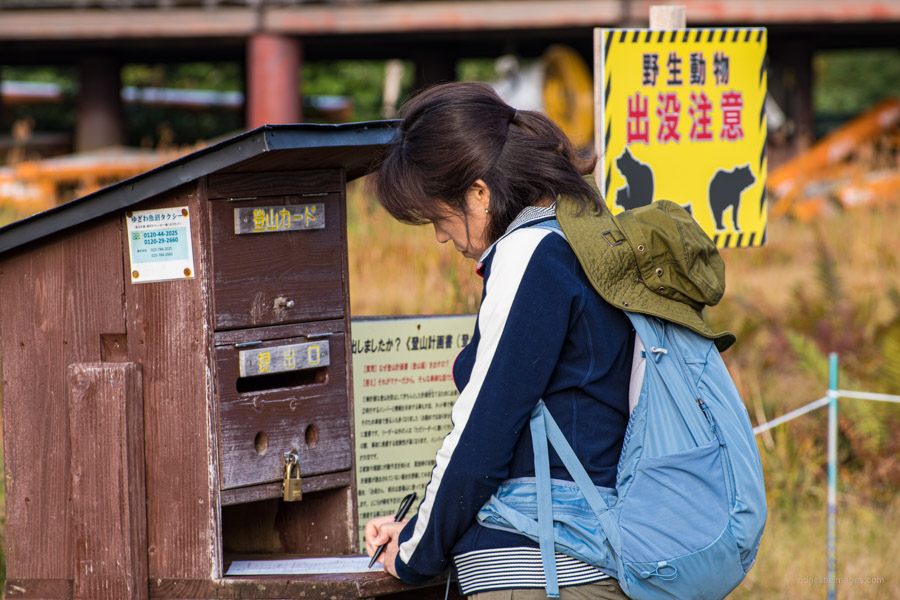
In Japan, a mountain search usually begins with a call from someone who isn’t on the mountain: a partner, a colleague on Monday morning, a hut warden whose expected guest hasn’t arrived. The call goes to 110, and the police start trying to narrow things down. Was a hiking plan lodged? Is a car sitting in a trailhead car park? When did the phone last connect to the network, and roughly where? Has anything been posted on social media or a hiking app? Did anyone pass them on the trail or see them at a hut, and when?
Each answer takes territory off the map. A hiking plan with a named route can reduce a whole range to a single ridge. A GPS track shared with a friend can narrow the search to one stretch of trail. A solo hiker who told nobody where they were going, whose phone was off, and who arrived by train and bus with no car to find, leaves the police with very little to work with.
The same problem exists in mountainous country around the world. In Taiwan, one volunteer searcher has built his whole approach around piecing these scraps of information together.
Searching in Time First
Petr Novotny of 跑山獸 Beast Runners (YouTube) searches for missing hikers in Taiwan’s mountains as a volunteer and was the subject of a recent CNN report. When I contacted him for this article, he explained that he starts not with the map but with the clock. “Searching in time means collecting any evidence related to the time of day,” he told me.
A timeline might run like this: CCTV at 5:35 am as the hiker leaves home on a scooter, another camera on the road at 6:20 am, a LINE message to a friend at 9:20 am, a sighting on the summit at 10:30 am. Each point fixes a time and, often, a place.
The details matter. In one case, a photo sent with a message showed the moon in the sky and no vegetation, which meant the man was above the treeline. Knowing the area, Petr could tell he was climbing a particular mountain, which gave the search a starting point. He was later found deep in a creek. In another case, a hiker was last seen standing on a summit. Nobody saw him on the way down, so Petr kept open the possibility that he had taken the wrong descent, into deeper, higher mountains. He had.
Phone records add another layer. A signal that vanishes at 11:30 am and one that stays in the same place for the next 24 hours point to very different situations: a hiker who has wandered lost into a creek, or one who has had an accident and can’t move. “Anything off trail is exponentially harder to search for,” he told me.
The cases he is drawn into rarely involve a satellite messenger such as a Garmin inReach. A hiker who can send an SOS usually doesn’t need a search at all. The hard cases are the ones where the hiker can’t call for help.
When the Hiker Can’t Call
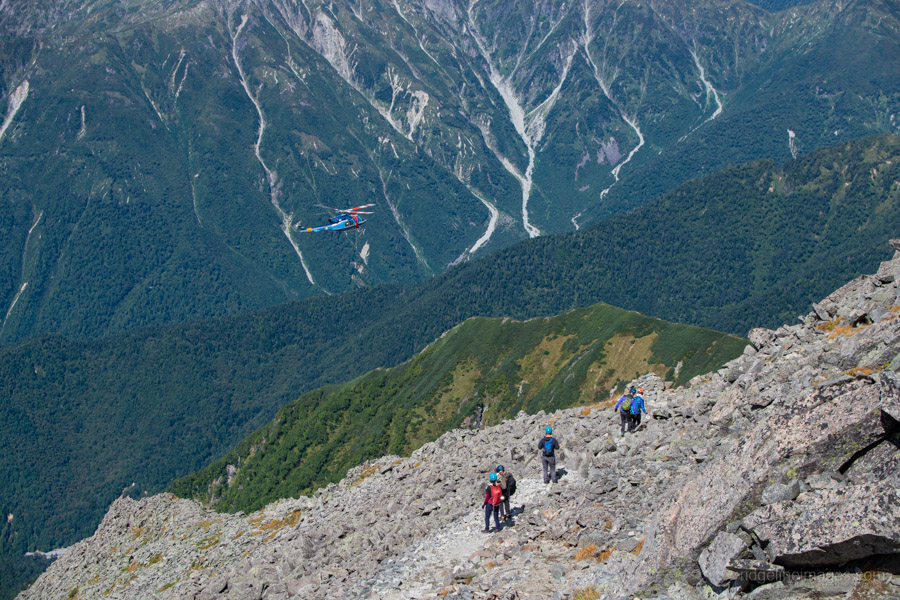
Hikers today carry plenty of location technology, and each piece assumes something. A phone needs signal, battery and an owner able to use it. A satellite messenger removes the signal problem but still needs someone to send the message. A personal locator beacon (PLB) needs someone to press the button, and isn’t an ordinary option on land in Japan. In many emergencies, the hiker is injured but can still raise the alarm, and in those situations these devices are the right tools. All of them assume the hiker is conscious and able to act.
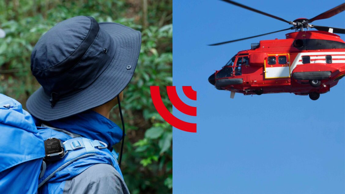
COCOHELI is built around the opposite assumption. Run by AUTHENTIC JAPAN, a company based in Fukuoka, it is a membership search service. Members carry a small transmitter that sends out a signal continuously. There is no button to press and nothing to switch on in an emergency.
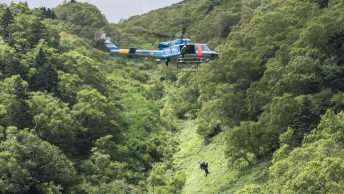
If a member fails to return, their family can request a search. Helicopters, drones and ground teams equipped with directional receivers can detect the transmitter’s signal and home in on its source. COCOHELI likens it to a tin-can telephone: the signal gives searchers a line to follow towards the person carrying the transmitter. With GPS, by contrast, the device only works out where you are. That position then has to be sent to searchers over a separate link, such as the mobile network, ELTRES or satellite messaging, and in the mountains that link may not be there. The position itself can also be imprecise: COCOHELI says GPS can be out by up to 100 metres in the mountains.
COCOHELI flies its own contracted helicopters from 11 bases around the country. On top of that, the company says police and fire services in 42 of Japan’s 47 prefectures have adopted its receivers, so the public agencies that would be searching for you anyway can pick up the signal too. Where they haven’t, COCOHELI’s own teams cover the gap.
COCOHELI finds people; it does not carry out the rescue. Once a position is established, it is passed to the police, fire and other public services, who get the person off the mountain. What the service shortens is the time between someone being reported missing and someone knowing where to send a team. In the year to November 2025, COCOHELI handled 231 cases.
The standard system has one acknowledged weakness: a receiver can only find a transmitter if it is carried over the right area. With a hiking plan on file, searchers know where to start. Without one, “which mountain?” can stall a search before it begins.
The GPS+ model, introduced in early 2024, is designed to narrow that gap. It adds GPS and a low-power network called ELTRES, which can transmit position data to COCOHELI’s servers. COCOHELI acknowledges that ELTRES doesn’t reach most mountain areas, although tracks have been logged intermittently in many of them. This is not live tracking. Instead, it can provide a rough indication of where a member entered the mountains. GPS+ helps answer “which mountain?”: any positions that get through are stored, so searchers can see where the member was last recorded. The search signal, which works independently, then helps answer “where on it?” About one in five new members now choose GPS+.
What It Can and Can’t Do

A transmitter doesn’t make you findable in every situation. Terrain blocks and bends radio signals, so someone at the bottom of a narrow gorge, or on the far side of a ridge from a search aircraft, may be hard to detect. Searchers still have to get close enough to pick up the signal, and weather that grounds helicopters grounds the receivers they carry.
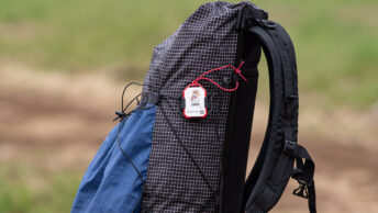
Your own body gets in the way too: it is mostly water, which absorbs radio signals. COCOHELI’s carrying advice follows from this: keep the transmitter off the ground, away from your body and clear of metal. In practice, that means clipping it to the outside of your pack rather than keeping it in a hip pocket, where you could end up lying on it after a fall.
But the limits are only half the story. Radio doesn’t depend on anyone being able to see you. In thick bush, darkness or cloud, a receiver can pick up the signal even when the person carrying it is invisible from a few metres away. And because COCOHELI searches are often carried out from helicopters and drones, a receiver can sweep a far larger area in far less time than a search on foot. COCOHELI says its search teams are trained to work with how the signal behaves, and can locate people in situations where a visual search would be difficult or slow.
COCOHELI won’t prevent an accident, warn you the weather is turning, or replace a hiking plan, a map, a partner or the judgment to turn back. If you’re conscious and can make a call, the company’s guidance is to call 110 or 119 first. Out of mobile range, its SOS DIRECT service lets a compatible phone send an SOS by Starlink Direct satellite messaging to COCOHELI’s search desk.
The company sees the phone and the transmitter as complementary, not competing. A phone lets you raise the alarm yourself. The transmitter is a dedicated search tool for when you can’t. It’s small, relatively cheap and built for long battery life, so it can be carried alongside a phone or GPS.
Five Years as a Member

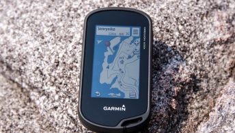
I joined in 2021 after another hiker told me about the service. It seemed an easy way to add some peace of mind, and I wrote about why at the time. Most of my hiking is solo. About 40 percent of my trips are overnight, anywhere from one night to eight, and I often hike in areas where phone reception is unreliable. My Garmin GPSMAP 67 always knows exactly where I am, but it has no way of telling anyone. I usually end up chatting with other hikers on the bus or at the trailhead, and one of them might remember me, but that is a thin thread to hang a search on.
I have never needed to be searched for. The transmitter has spent five years waiting for a day I hope never comes.
What has changed is habit. I use the standard unit, clipped to the outside of my pack by its lanyard, and charge it at least every couple of months and before any longer multi-day trip. I submit a hiking plan through Compass and send my wife the GPX track of my route. I’m more vigilant about sharing my plans than I was before I joined, partly because the transmitter is far less useful without that information.
I don’t expect technology to make hiking risk-free. What a transmitter addresses is one narrow question: if something goes badly wrong, how quickly can someone find you? It is a question worth asking before you set out, especially for foreign residents, whose family may be on the other side of the world and the last to notice they are missing.
Practical Notes for Foreign Hikers in Japan
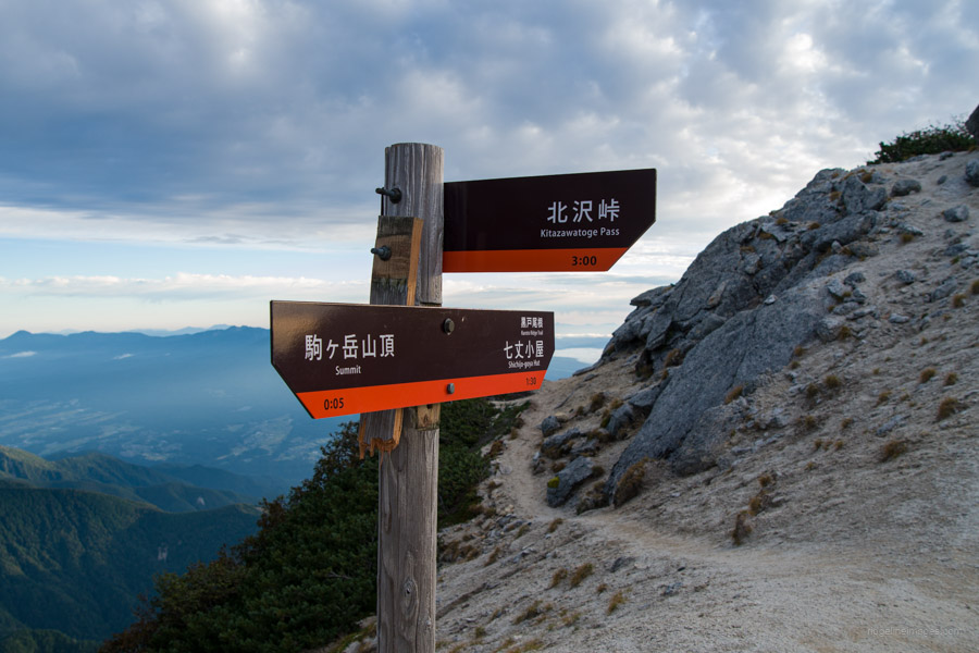
Emergency numbers. 110 is the police; 119 is fire and ambulance. Report a missing hiker to the police on 110 and call 119 for an injury or medical emergency at a known location. If you have reception and can call, calling is still the most direct route to help. Have the key details ready in Japanese: your name, the mountain, the trail and what has happened.
File a hiking plan. The tozan-todoke tells searchers which mountain to start on, and in some areas it’s a legal requirement. Nagano requires one on designated trails. Gifu requires one on its side of the Northern Alps and on several active volcanoes, with fines of up to 50,000 yen for hiking without one. Huts may ask anyway: in the Southern Alps, staff routinely ask for your route and an emergency contact when you check in. Use the box at the trailhead or file online through Compass. Include your route, hiking dates, how you got there and when someone should raise the alarm if you don’t return.
Tell an actual person. A plan lodged with the police helps once someone raises the alarm. A friend expecting you back on Sunday evening is the person who raises it. If your family is overseas, make an explicit arrangement with someone in Japan.
Joining COCOHELI. Sign-up and the app are in Japanese only, but the search desk takes reports in English. Overseas residents can join, but it’s a commitment: membership runs for a year, and the basic plan costs 6,600 yen a year plus a 3,300 yen joining fee at the time of writing. Every plan includes searches arranged by COCOHELI up to 5.5 million yen, along with personal liability and outdoor gear cover; the SUMMIT plan adds personal accident insurance. You also need an address in Japan to receive the transmitter, a Japanese landline or mobile number, and payment by credit card, Apple Pay or Google Pay. The transmitter is on loan and must be returned. Short-term visitors may find it easier to rent one locally. In Hakuba, for example, Hakubakan rents them by the day or trip.
There is a difference between being able to say “I know where I am” and being able to say “someone else can find me”.
• Weight: standard transmitter about 20 g; GPS+ transmitter (GPS+ and SUMMIT plans) about 45 g.
• Battery: search signal for around two months on a charge; GPS+ also sends its position for about two weeks, where ELTRES coverage reaches. Standard unit charges by Micro USB, GPS+ by USB-C.
• Range: up to about 16 km from the air in good conditions, or 5 km or more with a handheld receiver on the ground.
• No SOS button: the transmitter is there to be found, not to call for help.
• Cover: searches arranged up to 5.5 million yen on every plan, plus liability and gear cover; SUMMIT adds accident insurance.