.
Chikukomagatake Shrine 竹宇駒ヶ岳神社 – Ojiragawa Gorge 尾白川渓谷
Distance: 3.8 km
Elevation change: 260 metres
Highest point: 1030 metres
Start: Chikukomagatake Shrine
Finish: Chikukomagatake Shrine
Difficulty: ▅▅▅▅▅▅▅▅▅▅ ❸
Map: Yama to Kogen Chizu 山と高原地図 [No.44 北岳・甲斐駒 KITA-DAKE·KAIKOMA]
GPX TrackKML TrackGSI MAPPDF Topo Map
Ojiragawa Gorge: Pristine Waterfalls in Yamanashi
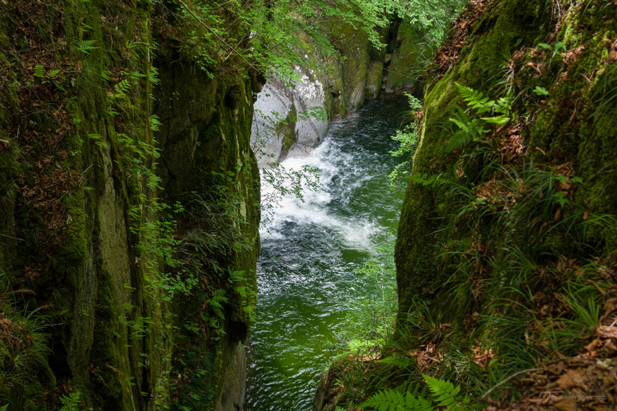
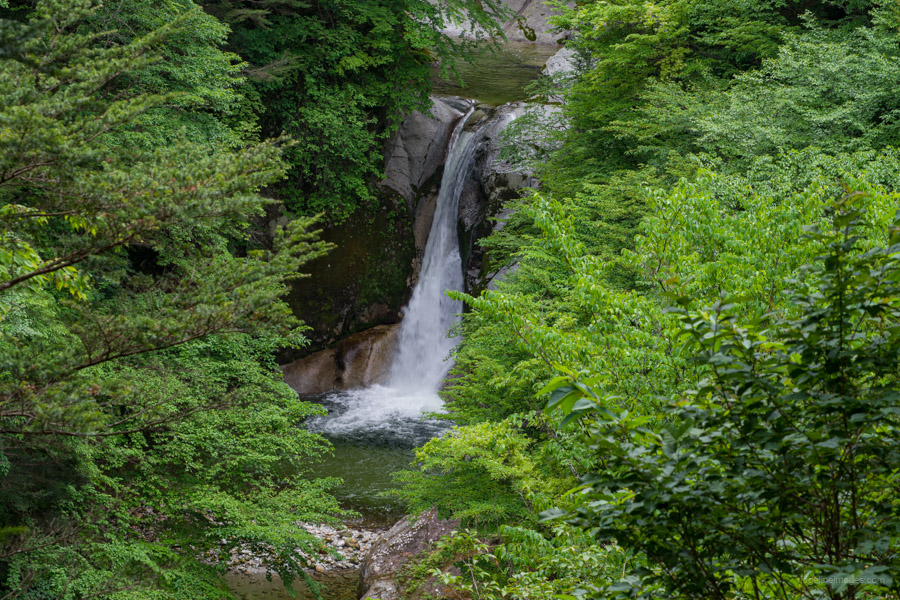
The headwaters of the Ojiragawa River begin their journey above the Shichijo Hut on the Kuroto Ridge route to Mt. Kaikomagatake in the Southern Alps. The emerald-coloured waters of the Ojiragawa River are known for their clarity and have been selected as one of Japan’s top 100 rivers. The Ojiragawa Keikoku 尾白川渓谷 through which it flows, features many sandy banks and waterfalls, including the Jinja Falls, famed for its graceful appearance as it cascades down in three tiers.
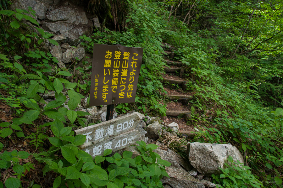
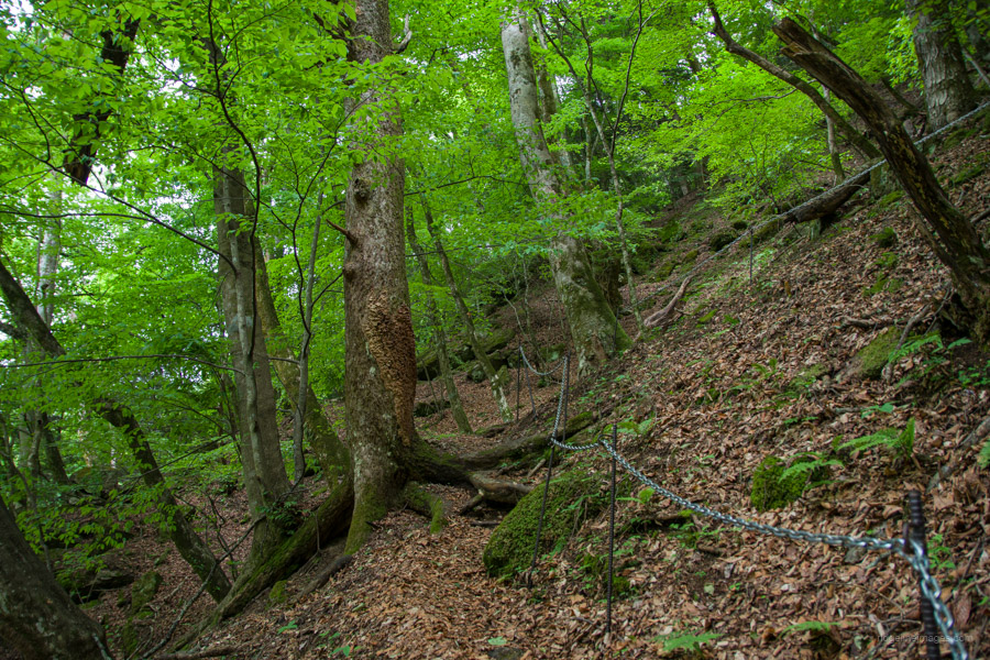
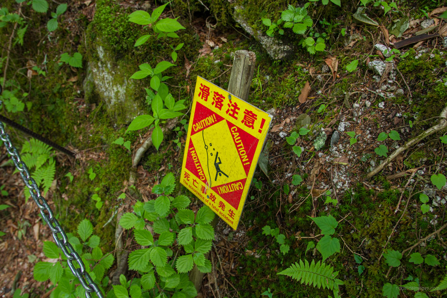
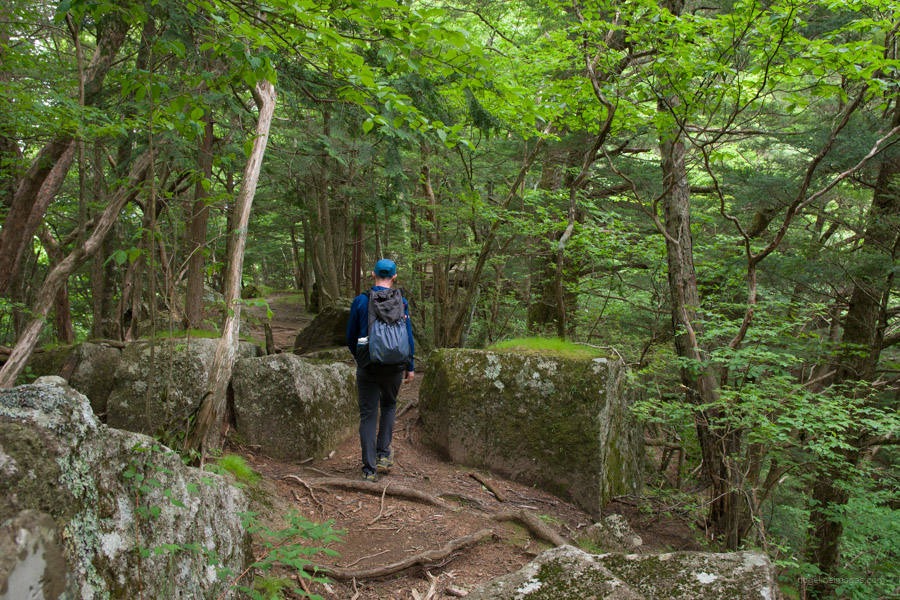
The loop course should be undertaken in an anticlockwise direction heading upstream, using the ridge course for the return journey. At a leisurely pace, it takes 3 hours to complete and should not be undertaken without proper hiking footwear, as it includes steep slopes and slippery areas.
To reach Ojiragawa Gorge 尾白川渓谷 from Tokyo, take the JR Main Line to Nirasaki Station 韮崎駅. From there, catch the 8:45 am bus departing from bus stand 3 to Michi-no-Eki Hakushu 道の駅はくしゅう (33-minutes and costs 1,040 yen). From Michi-no-Eki Hakushu, it takes around 50 minutes to reach the car park at the entrance of Ojiragawa Gorge. It is also possible to book a ‘mountain taxi‘ that departs from Kobuchizawa Station at 9:00 am. The fare is 1,500 yen on weekdays and 1,800 yen on weekends. For 2024, this service runs from June 15 to November 15. Considering the travel cost and distance, it’s worth spending a night at the quaint Hakushukanko Ojiro Campground 白州観光 尾白キャンプ場 (1,500 yen).
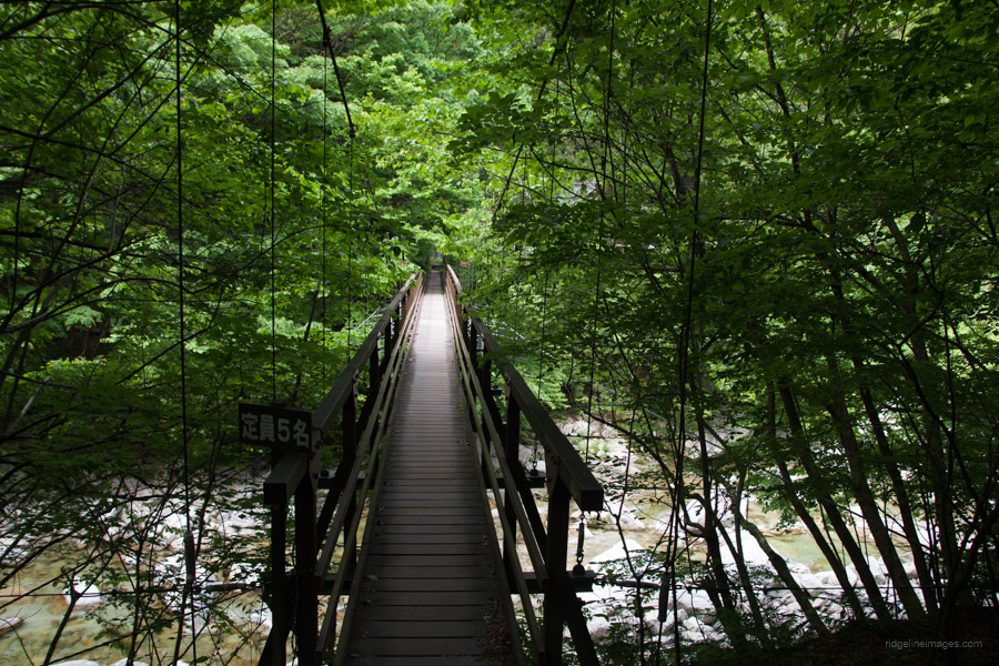
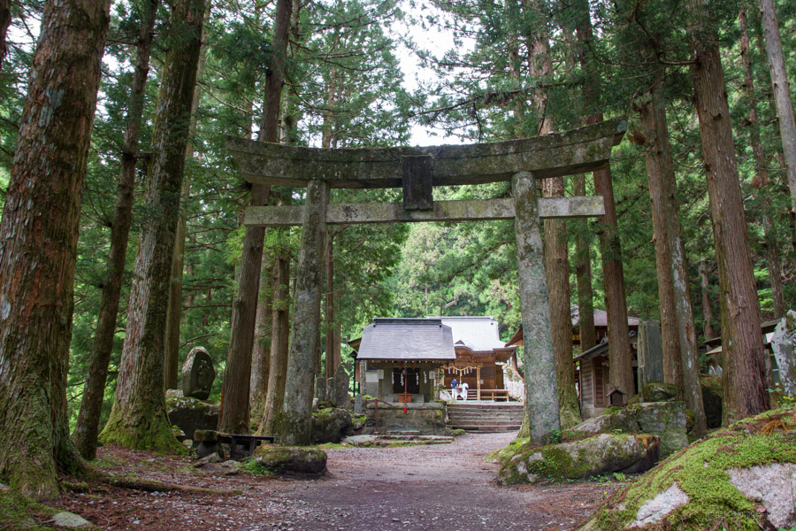
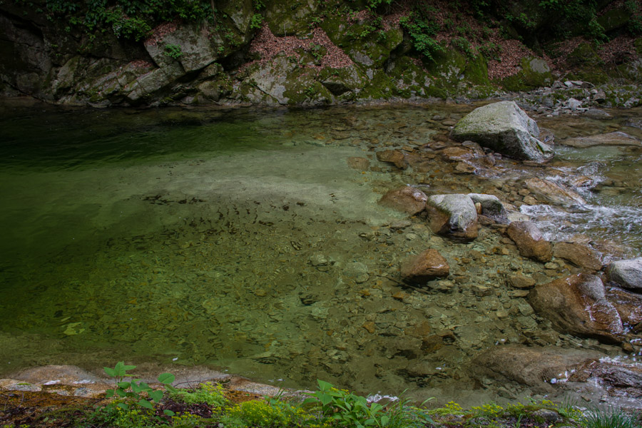
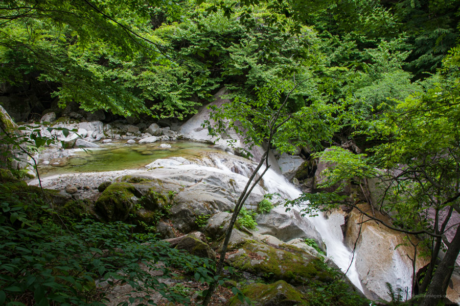
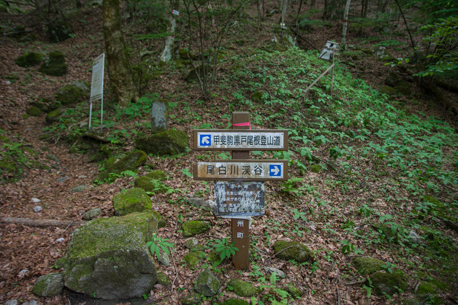
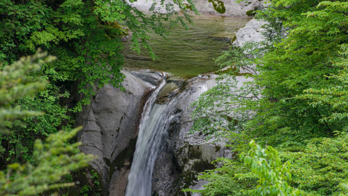
After passing the trailhead for Mt. Hinata and the Chikukomagatake Shrine 竹宇駒ヶ岳神社, you cross the suspension bridge and enter the true heart of the Ojiragawa Gorge. Flowing beneath the bridge is the Ojiragawa River, with its clear, pure waters characteristic of a granite-fed river. To reach Sengabuchi 千ヶ淵, the first waterfall, cross the bridge and descend to the riverbed. If you go straight at this junction, you’ll be on the Kuroto Ridge course that leads to Mt. Kaikomagatake. The emerald-coloured waters make Sengabuchi an ideal spot for a refreshing dip on a hot summer day.
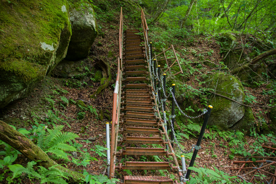
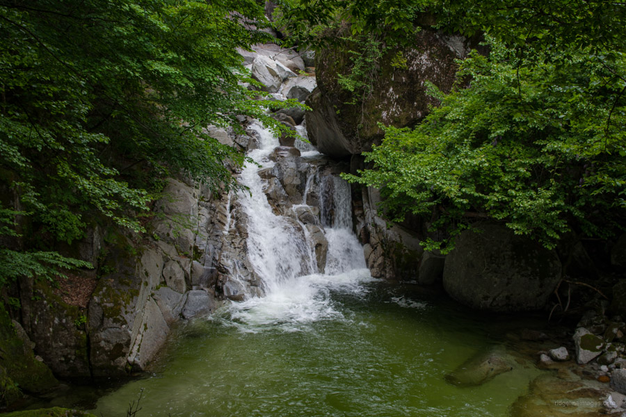
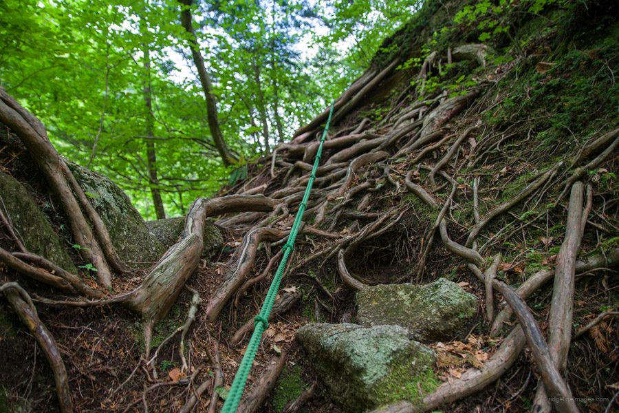
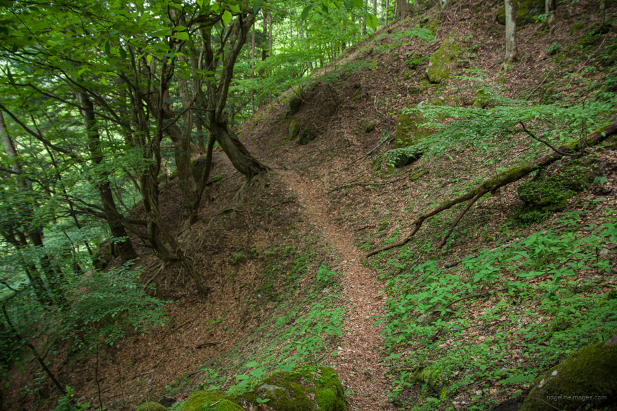
From Sengabuchi onwards, there’s a steep uphill climb aided by a Showa-era steel-fabricated staircase. Overall, it’s a challenging route with exposed sections, including fixed ropes and chains, and areas where you need to navigate fallen trees and rocks. The next landmark is Sanno-taki 三の滝, a roaring waterfall where you can feel the invigorating negative ions. Following this is Asahi-taki 旭滝, though getting a good view requires a potentially risky descent onto a ledge when water levels are high.
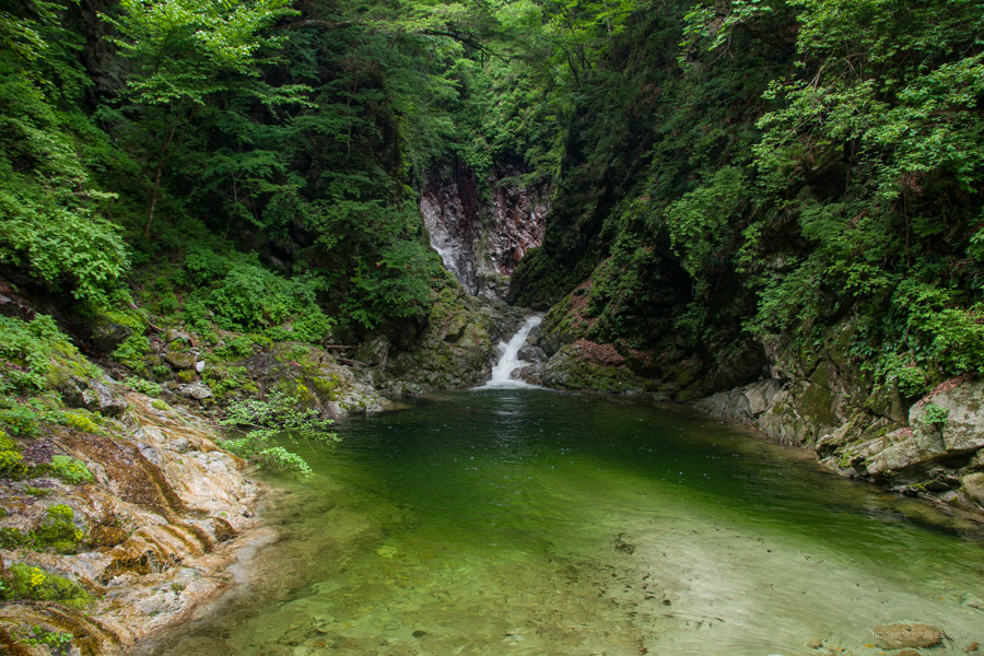
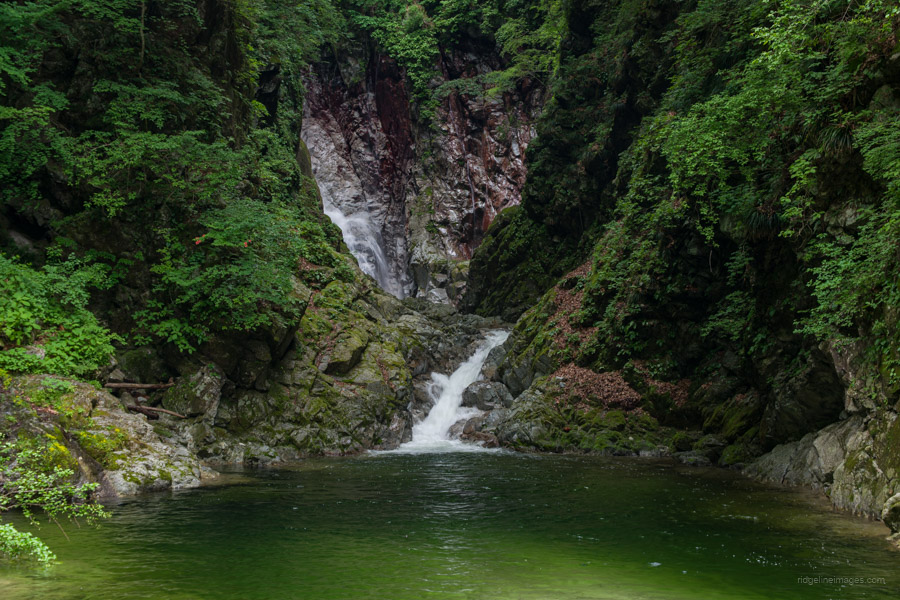
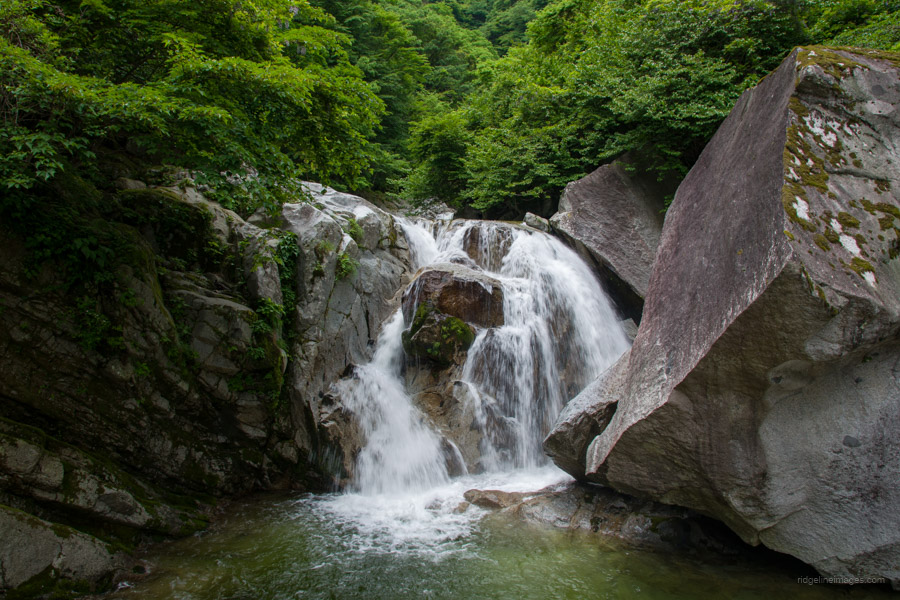
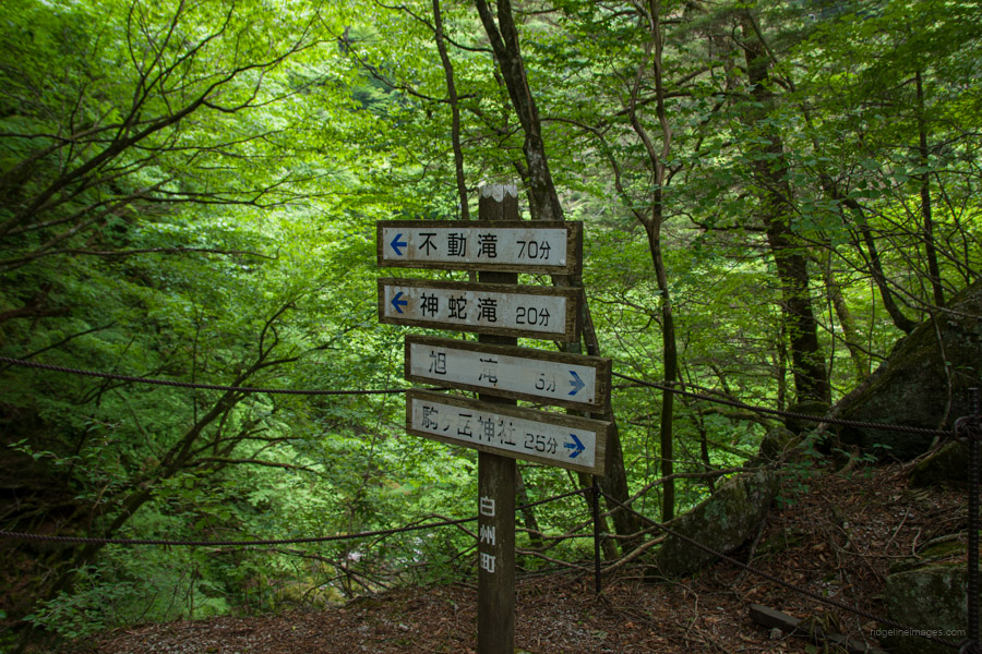
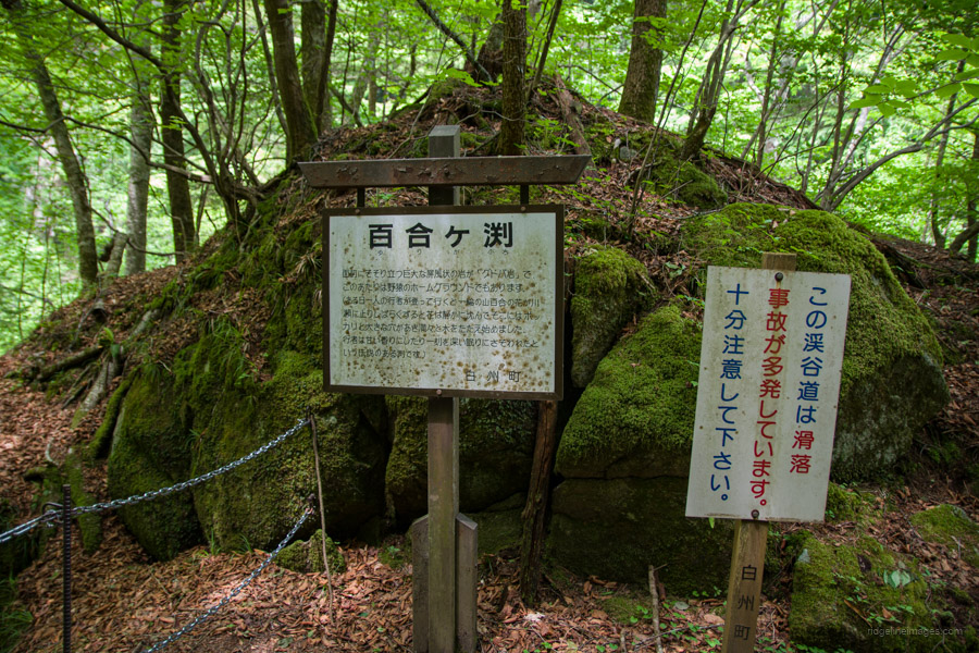
From Asahi Falls, leave the valley and climb for another 30 minutes to arrive at Yurigafuchi 百合ヶ淵. You can glimpse this abyss from a vantage point along the trail. Next, utilise the fixed rope to climb up some tree roots and follow the narrow ridge path. At long last, you will find Jinja-taki 神蛇滝, a three-tiered waterfall visible across the valley. The hike to Jinja-taki takes roughly 1.5 hours from the car park, including photo stops and breaks.
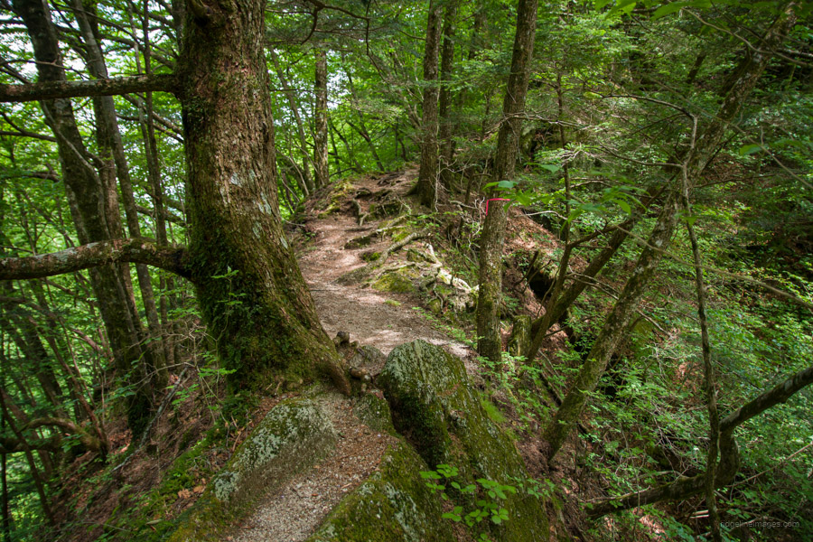
This waterfall is said to have three tiers, but perhaps because the trees have grown so thick, only two tiers are visible from here; in autumn and winter, you can probably see all three levels. The fine view coupled with ample space makes it a perfect spot for lunch. If you’re still looking for more adventure, it’s also possible to continue to the furthest falls, Fudo-taki 不動滝, a further 45 minutes away. Otherwise, when you’re ready, begin the ridge traverse, which crosses the Kai-Komagatake trail branch before descending back down to the suspension bridge.