.
Mt. Sogakusan 惣岳山 – Mt. Iwatakeishiyama 岩茸石山 – Mt. Takamizusan 高水山
Distance: 9.2 km
Elevation change: 543 metres
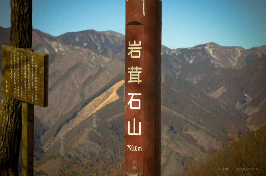
Highest point: 793 metres
Start: Mitake Station (Ome Line)
Finish: Ikusabata Station (Ome Line)
Difficulty: ▅▅▅▅▅▅▅▅▅▅ ❷
Map: Yama to Kogen Chizu 山と高原地図 [No.25 奥多摩 OKUTAMA]
GPX TrackKML TrackGSI MAPPDF Topo Map
Winter Escape On Tokyo’s Door Step
Many of the best hikes around Tokyo are situated along the Ome Line 青梅線 which stretches from Tachikawa to the town of Okutama. This hike takes in three mountains, with excellent views provided by Mt. Iwatakeishiyama.
Weekend and public holiday access are conveniently provided through the Holiday Rapid train service ホリデー快速 Holiday Kaisoku from Shinjuku, which makes stops at Tachikawa, Haijima, Ome, Mitake, and Okutama, among others. There are three services from Shinjuku, with the first departing at 07:44 and arriving in Okutama at 09:15. The train splits at Haijima, with the three front cars headed for Musashi-Itsukaichi, so it pays to listen to the English announcements to avoid disappointment. Alighting the train at Mikate Station 御嶽駅 there is a Visitor Center open from 09:00–16:30 (closed on Mondays), which provides a good variety of guides and maps. If possible, I really recommend picking up a copy of the Okutama Nature Information Map, 1:50,000 annotated in both English and Japanese. The Visitor Center also stocks handy B4-sized 1:25,000 topographical maps of the local area free of charge.
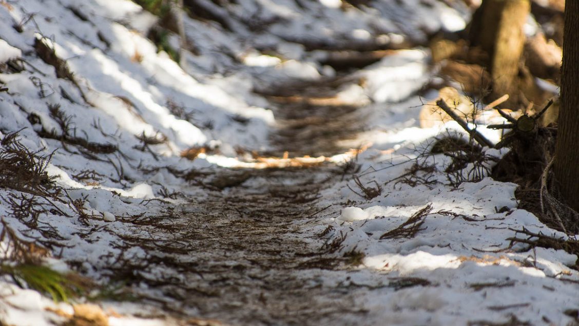
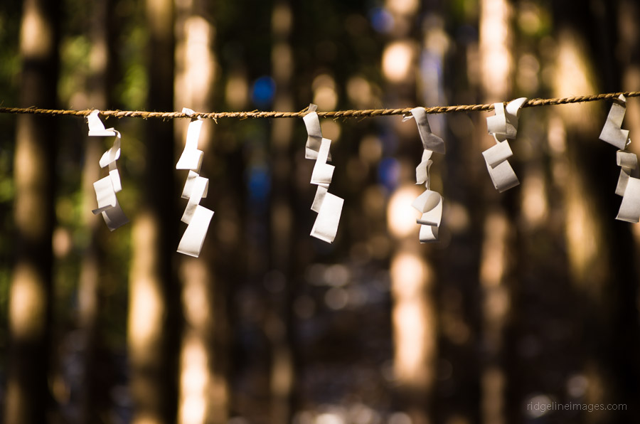
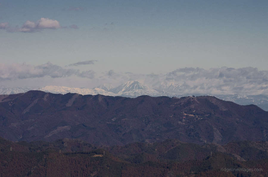
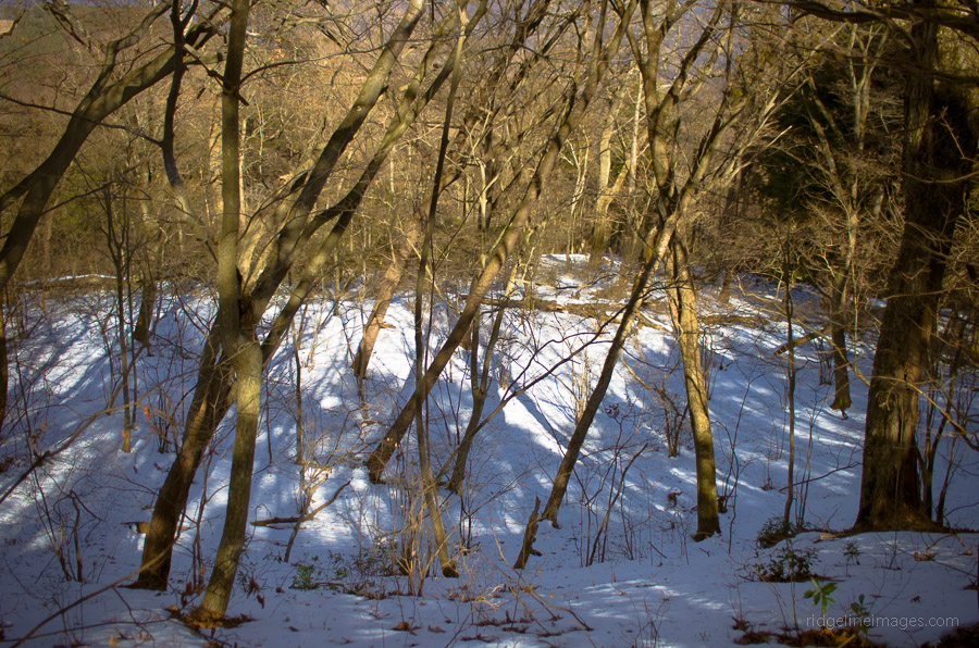
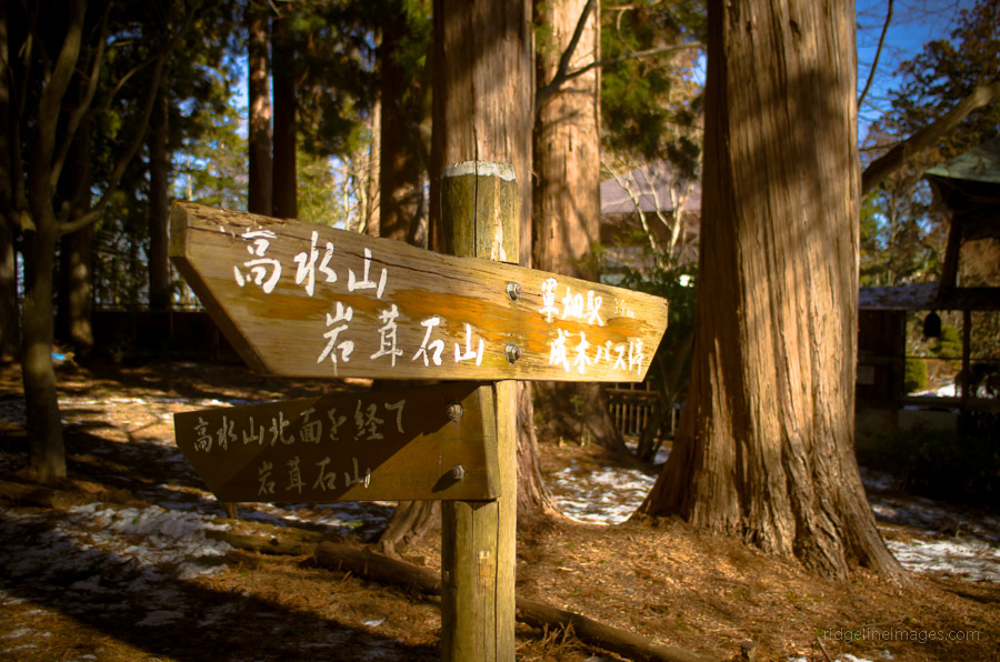
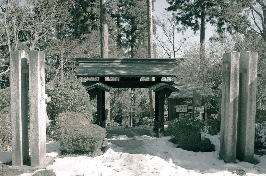
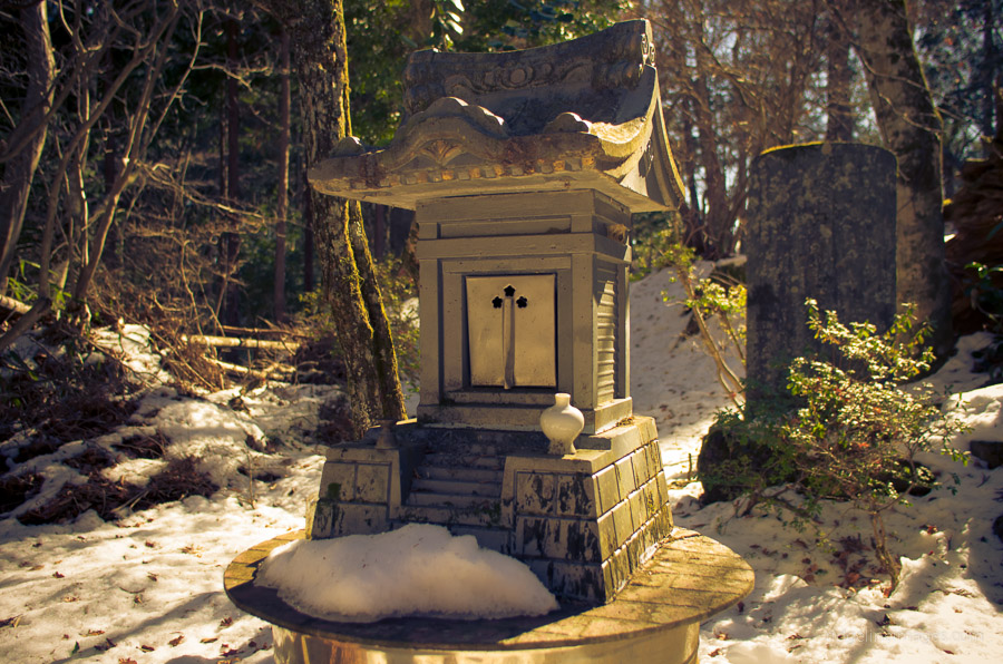
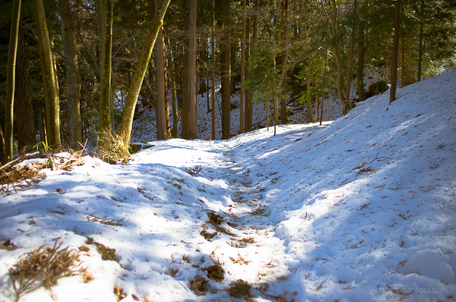
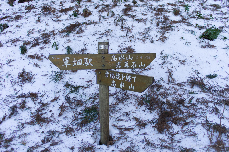
Weekends at Mitake Station are pretty packed, with most visitors heading up to Mt. Mitakesan. Exiting the station, you need to turn left, walk 60 metres, and cross the railway line where there are signs pointing to Mt. Iwatakeishiyama. Next to the trailhead, there is a small shrine that you pass by. The hike itself is well marked, and after an hour, the trail intersects with the option of heading directly to Mt. Takamizusan if desired. Heading up further, you pass Mt. Sogakusan 惣岳山 (756 m) which, although shrouded with trees, has some benches to rest on next to the Aojinja Shrine. The snow from last week’s dumping made the last section up to Mt. Iwatakeishiyama 岩茸石山 (793 m) a little treacherous with steep ice covered rocks. The view from the summit was pretty decent with glimpses of snow-capped Mt. Asama 浅間山 in Nagano Prefecture. After lunch, it was a short 30-minute walk across to Mt. Takamizusan 高水山 (759 m) and down to a snow-covered Takamizu-san temple 高水山常福院 which made for a prime photo taking opportunity.
The final stretch affords some good views towards Tokyo proper and the Skytree. After passing the dam wall the walk back to Ikusabata Station 軍畑駅 takes around 25 minutes, following the stream down. Just before you pass under the elevated railway line, there is an indistinct sign on your right pointing upwards to the station.


Great post David – thanks. I think perhaps it’s worth noting that some sections of this trail can be quite challenging. In particular, in between Mt. Sogakusan and Mt. Iwatakeishiyama where there is a steep rocky ridge that requires use of both hands and feet to tackle. The trail close to Mt. Iwatakeishiyama also requires a little care in both directions if wet or icy.
Most people seem to tackle this trail from Ikusabata to Mitake rather than the other way around. I guess it’s down to personal preference, but I find walking on the road quite boring, so for me the road section around Ikusabata is definitely better tackled coming down rather than going up!
As an intriguing footnote – I wonder if anyone knows the reason for the quite impressive dam near to Ikusabata, which seems total overkill for such a small stream. There is a warning sign that appears to indicate possible danger from volcanic lahars, but to my knowledge there are no volcanic peaks anywhere close to this area.
Glad to hear you enjoyed the hike and appreciate the feedback! Your right the section from Mt. Sogakusan heading to Mt. Iwatakeishiyama can be a little gnarly and regretted not bringing along a pair of crampons. I have done the hike in both directions and agree that walking downhill to Ikusabata Station makes the last section a little more tolerable though in summer the stream is great for taking a dip. As for that dam you’re talking about, I used to think the same, completely over engineered though given the mountains are often subject to torrential downpours it probably provides some comfort to those nestled in the valley below. The last time I did the hike I came across some deer hunters which resulted in a near miss with one unsuspecting deer leaping at maximal velocity in front of me near that dam wall!
Did this hike today…Trail was epic with lots of powdered snow and strong anabatic winds on the way to Iwatakeishiyama. Going down from Sogaku to Iwatakeishi was the hardest part, since rocks were steep and slippery. Thanks for your post.
While the winds were certainly strong today the upside would have been the no doubt clear views afforded from Mt. Iwatakeishiyama. Also with yesterday’s half decent snowfalls it doesn’t surprise me that the trail a little difficult to negotiate.
Yes, the views were awesome. I can see whole Tokyo, including Skytree clearly 😀 Also, I had so much fun with the trail.
Just did this hike this morning. I am lucky and was able to catch the first train out there so I was on the trail just after 5:30 am. The first part from Mitake station to Sogakusan was a little tough for me, but maybe that was just because I hadn’t woken up yet. After that and the rocky bit between Sogakusan and Iwatakesan that other people have also mentioned, it was gentler and easier for me to tackle. There was great forest cover the entire way keeping everything cool given the heat lately, until of course the road at the end. Unlike the winter (unsurprisingly), the view from Iwatakesan wasn’t as clear as it could have been. I was surprised however that I could actually just see the outlines of the buildings downtown, but I couldn’t see Mt. Asama at all.
Overall it was a great hike. Not too busy, and barely saw anyone until I was finally on the way down from Takamizusan and everyone else was going up. Even saw a snake about a meter long making its way along the side of the trail, couldn’t tell what type though. I ended up arriving at Ikusabata station just before 10, making your time frame pretty much on point.
Thank you for this post and all of the others that you have on this site. Trying to see how many I can accomplish!
Thanks for the comment. Wise decision making an early start as it’s the only practicable way to hike these low-lying trails during the summer months. Haven’t seen a snake in a while though I’m more concerned about coming across suzumebachi at this time of year.
Hi David,
We will be in Tokyo on first week of December and would like to do some easy hiking. Do we need to wear any special shoes for hiking?
I can’t decide where to hike but any recommendation ? Will it snow in most mountains?
Many thanks for your advise.
Hi Janet,
In early December there isn’t usually much in the way snow below the 2,000 metres. In the low-lying mountains around Tokyo you can expect daytime temperatures around 5-10 degrees Celsius with overnight temperatures dropping below zero. As for footwear you’ll be fine with regular hiking shoes or boots. If you’re after fine views and snow free plateaus I would suggest Mt Jinba, Mt. Iwatakeishiyama, Mt. Hinodeyama and Mt. Mito for easy getaways around Tokyo.
Guys, the map is wrong. Especially the start where you can not follow a simple path. The path starts directly left of Jionji Temple. I looked for your path and saw something that look like it, at first. After 10 Meters it was impossible to continue and difficult to return. So please correct it. Please.
Thanks Nic! I have made the correction. I know many folk rely on these maps for navigation so making them accurate is a priority.
Hi David. I did this one in reverse this morning since I wanted to stop at Maunga, a used mountaineering shop just below Mitake Station. I had done this course last spring soon after arriving Japan and didn’t like it then. Probably the group and the hike leader that time. Today was better although I still hate the 30 minute road march at the beginning (your end) and the denuded mountain side I climbed up after the huge unneeded dam. Once I made the ridgeline it was a very enjoyable trail including four mountains (check Yamap). In order of ascent, Takamizusan, Iwatakeshi, Mabotokeyama, and Sogakusan. Last time we skipped the best two, Iwatakeshi and Sogakusan because they were sorta off the main trail but right next to it! Nice views from Iwatakeshi!
Not terribly crowded but surprisingly there were many hikers out today. Maybe I passed 30 or 40 total including those at the summits. Just under four total hours to complete the hike at a pretty good pace with stops to eat and change shirts from sweat soaked to dry at three of the peaks.
Thanks for your writeup of this trail. Glad I returned.
Cool Tim, glad you enjoyed the hike. It’s an oldie but a goodie apart from as you say that last (or first) portion of roadside walking. It’s one trail I would mind returning to as some point as from Iwatakeishiyama the views on a clear day are second to none. There can’t be too many Tokyo based hikes from this blog still to tackle!?
David, yep I’m nearly done with this list. Kumotori and Tanzawa are all that remain. I’ve mapped both and can do each when the days get long enough (light-wise) as day trips (I am not a camper nor do I want to lug overnight stuff with me while hiking).
BTW, I did a ridgeline (like the title!) hike above Lake Miyagase this past weekend. Takatoriyama and Mt Bukka. Super steep up/down but I was in beast mode on the way up and bested the Yamap time estimate by 35 minutes. The ridgeline between the mountains was easy and I had some great views all the way to Sagami Bay and I think Mt Tanzawa with a bit of snow on top. Now I have to do some more research and find other hikes around Miyagase.
I’ve been meaning to do that Mt.Bukka hike for ages and Mt.Nabewari too when I come to think of it. As for Mt. Kumotori and Mt.Tanzawa they are both doable as longish day hikes. I’ve stayed in both of their respective mountain huts which are pretty decent and would be another alternative to lugging your camping gear with you.
I did this hike in reverse last weekend. The descent towards Mitake was quite challenging! I believe the slope here is steeper than the Ikusabata side. And because the rainy season just ended, some parts were still slippery. A large section between Iwatakeishi and Sogaku was completely bald because the wood was being harvested. It might be because of all the harvesting work that there were a lot of loose rocks on the trail down (additional challenge!).
There’s also a section that’s closed off due to harvesting right before Sogaku’s peak, so the only option was to climb a short rocky hill on all fours.
Trail update (Tuesday, Aug. 18, 2020) : did the route from Ikusabata to Mitake. After a week of hot sun, the trail has dried out, and is in good condition. As Cubes said, just before Sogaku, sad to see a large denuded hillside – felt like a post-fight battleground. Finishing at Mitake gives you food options, and the old (but good) ramen shop opposite the station has had a refit. Nearby, Maunga used outdoor store has a decent selection of stuff.