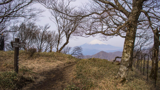
Hiked on Apr 28, 2013 Aug 24, 2023 . Hinodeyamakita Ridge 日ノ出山北尾根 – Mt. Hinodeyama 日の出山 – Mt. Mitsumuroyama 三室山 Duration: 5 hours Distance: 11 km Elevation change: 652 metres Highest point: 902 metres Start: Mitake Station (Ome Line) ...
Hiked on Apr 28, 2013 Aug 24, 2023 . Hinodeyamakita Ridge 日ノ出山北尾根 – Mt. Hinodeyama 日の出山 – Mt. Mitsumuroyama 三室山 Duration: 5 hours Distance: 11 km Elevation change: 652 metres Highest point: 902 metres Start: Mitake Station (Ome Line) ...
Hiked on Apr 4, 2013 Nov 2, 2025 . Mt. Tonotake 塔ノ岳 – Mt. Tanzawa 丹沢山 – Mt. Hirugatake 蛭ヶ岳 Duration: 2 days Distance: 23.7 km Elevation change: 1383 metres Highest point: 1673 metres Start: Okura Bus Stop Finish: Higashino Bus Stop ...
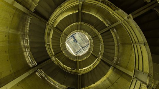
Unearthing the Longest Fish Ladder in Japan On recent nature outing near Okutama I stumbled across non-descript administrative building which just happens to house the longest fish ladder in Japan. The fish ladder is situated along a scenic stretch...
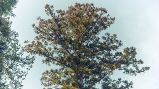
The Spoils of Early Spring Outings Tempted with the lure of warm weather for the first time this year, I made an ill-fated decision yesterday to set out knowing very well I had a good chance of succumbing to hay fever. This ignominious fate first...
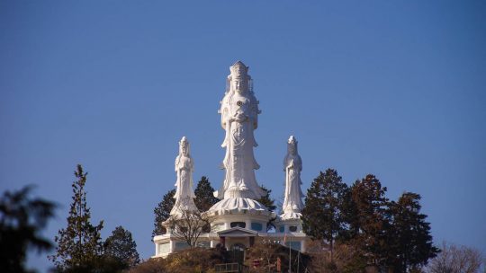
A Bodhisattva Inspired Kannon Temple The township of Naguri is more than just a launching pad for local trekking adventures and includes the impressive Hakuunsan Torii Kannon 白雲山 鳥居観音 which makes a formidable statement on the surrounding landscape...
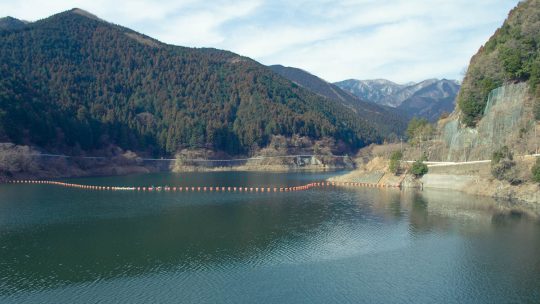
Hiked on Feb 28, 2013 Aug 23, 2023 . Naguri Lake 名栗湖 – Mt. Makinooyama 槙ノ尾山 – Mt. Bonomine 棒ノ峰山 Duration: 6 hours Distance: 11.2 km Elevation change: 736 metres Highest point: 969 metres Start: Sawarabi-no-Yu Bus Stop Finish: Sawarabi...

It has been almost two years since purchasing the EIZO SX2762W FlexiScan LCD monitor and with almost 3,500 hours on the clock, I felt it was time to revisit my original review (included below) and add some closing remarks. The primary reason for...
A Pilgrimage to the Quintessential Temple While yesterday was unfathomably cold, today Kyoto turned into one gigantic puddle with incessant rain putting a dampener on things so to speak. Stoically we decided to adhere to our original itinerary by...
The Shrine of 10,000 Torii Kyoto is a city I have been rediscovering for many years and is undeniably one of the best places to point a camera in Japan. In fact it’s hard to take a bad photo – well most of the time anyway. Last weekend I again had...
Hiked on Feb 13, 2013 Aug 23, 2023 . Mt. Hinodeyama 日の出山 – Mt. Mitake 御岳山 Duration: 6 hours Distance: 18.6 km Elevation change: 712 metres Highest point: 902 metres Start: Musashi Itsukaichi Station (Itsukaichi Line) Finish: Mitake...
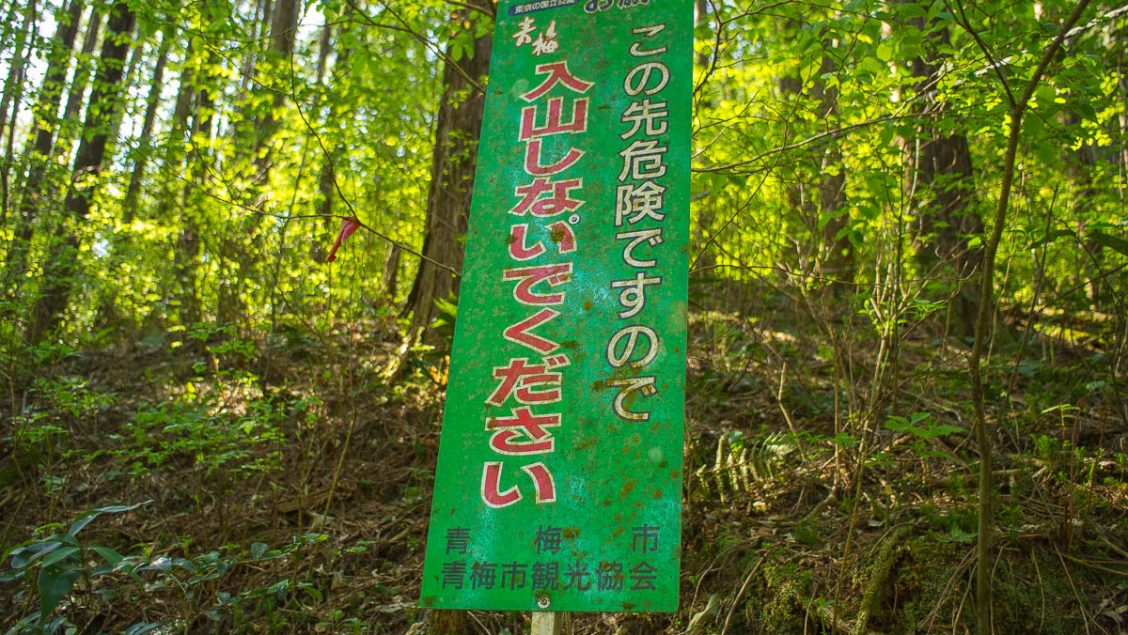
Japanese Mapping Nomenclature Debunked Knowing your limits, keeping safe and out of harm’s way should be your number one priority when hitting the mountain trails and a big part of this is being able to read Japanese maps. While maps, signs and...
Hiked on Jan 27, 2013 Aug 23, 2023 . Mt. Sogakusan 惣岳山 – Mt. Iwatakeishiyama 岩茸石山 – Mt. Takamizusan 高水山 Duration: 4.5 hours Distance: 9.2 km Elevation change: 543 metres Highest point: 793 metres Start: Mitake Station (Ome Line) ...
Hiked on Jan 17, 2013 Aug 23, 2023 . Mt. Kobotoke-Shiroyama 小仏城山 – Sagamiko Station 相模湖駅 Duration: 4 hours Distance: 11.4 km Elevation change: 409 metres Highest point: 670 metres Start: Takaosanguchi Station (Keio Takao Line) Finish:...