.
Shinhotaka Ropeway 新穂高ロープウェイ – Yarigatake 槍ヶ岳 – Kamikochi 上高地
Distance: 35.2 km
Elevation change: 2090 metres
Highest point: 3180 metres
Start: Shinhotaka Ropeway bus stop
Finish: Kamikochi bus stop
Difficulty: ▅▅▅▅▅▅▅▅▅▅ ❺
Map: Yama to Kogen Chizu 山と高原地図 [No.40 槍ヶ岳・穂高岳 YARIGA-TAKE·HOTAKA-DAKE]
GPX TrackKML TrackGSI MAPPDF Topo Map
The Yarigatake Classic Traverse
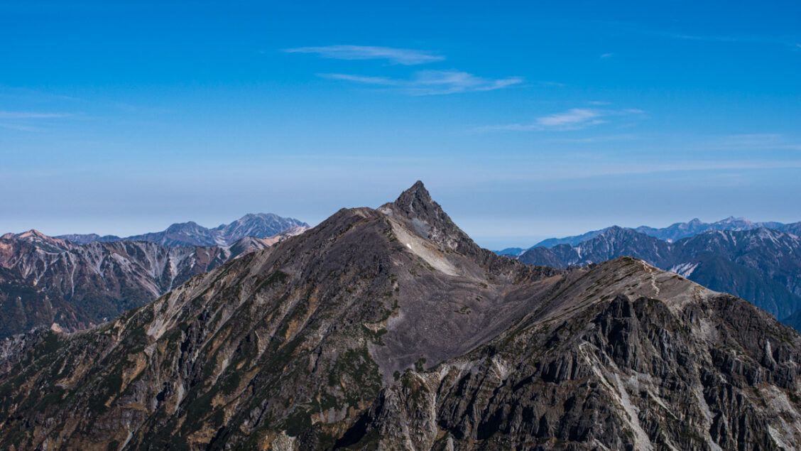
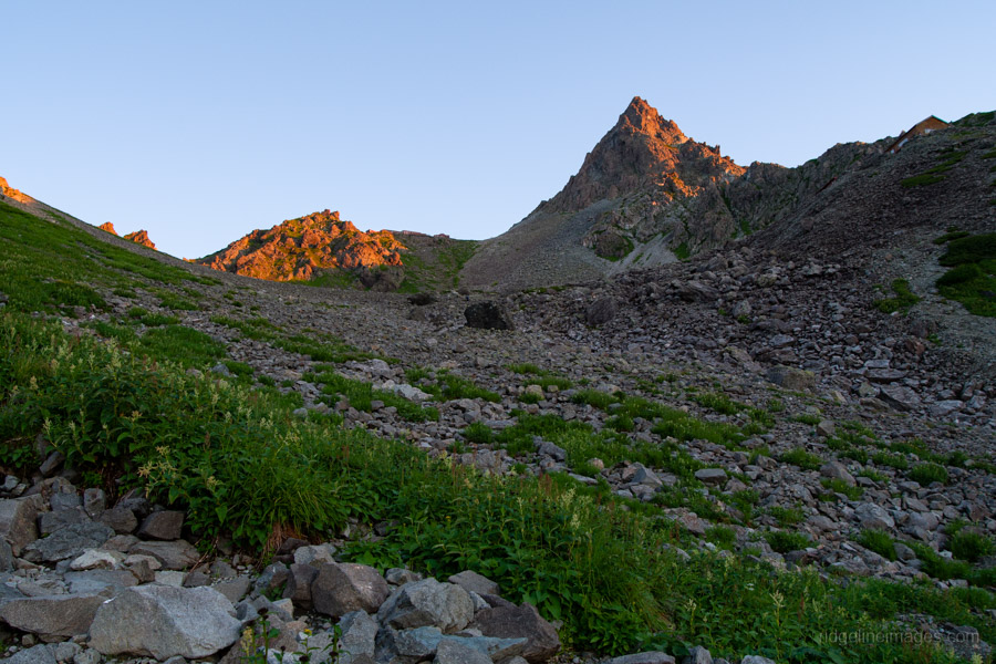
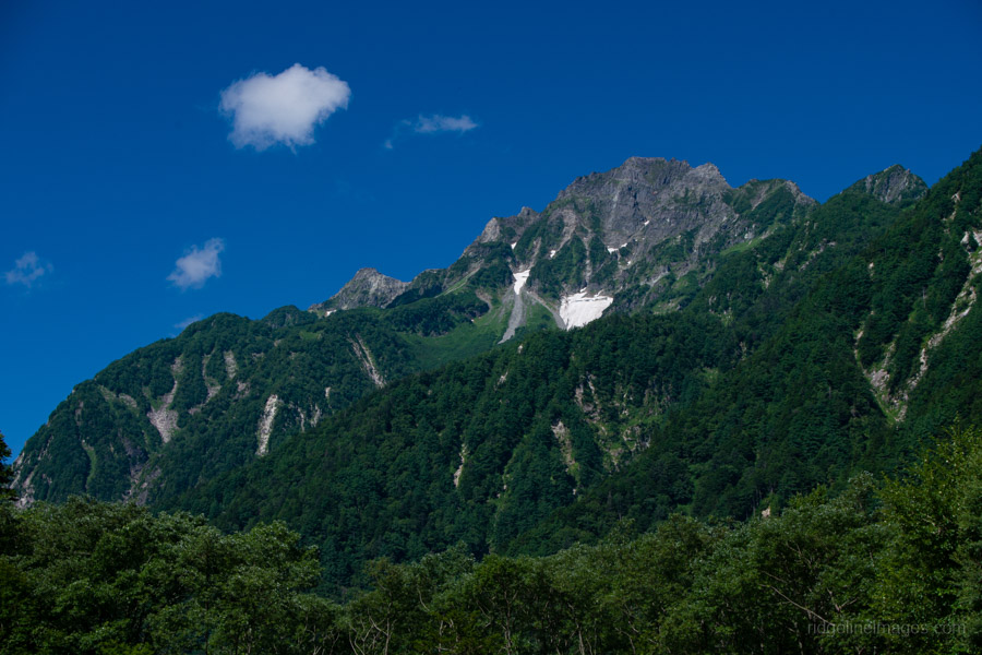
Mt. Yari’s distinctive, spear-like silhouette makes it one of the most iconic peaks in the Northern Alps. It’s both one of the 100 Famous Japanese Mountains and the fifth-highest mountain in Japan, and it seems to exert a magnetic pull on climbers, remaining a dream destination for many. Located in the southern Hida Mountain Range, Yarigatake serves as a natural crossroads, with numerous routes leading to its summit.
Last year, I had planned to climb it from Sugoroku-goya, but after a couple of days trudging through miserable weather, the wind went out of my sails, and I decided to wait for another day. For this attempt, I chose a point-to-point route: ascending via the Hidasawa route 飛騨沢ルート from the Shinhotaka Ropeway 新穂高ロープウェイ and descending the popular Yarisawa route 槍沢ルート to Kamikochi. While the distance is long, the trail is free of any real hazards – apart from the final push to the summit, a thrilling scramble to the mountain’s very tip.
Day 1: Into the Stormy Hida Mountains (9.9 km)
Getting to the trailhead is essentially a reverse of how I ended my Northern Alps Traverse. While it’s possible to take the Alpico overnight bus or drive, both options have drawbacks if you’re planning a classic point-to-point traverse. For example, if you park at Shinhotaka Onsen, getting back from Kamikochi requires two bus transfers. And if you take the overnight bus from Shinjuku Expressway Bus Terminal (Busta Shinjuku), it arrives at Hirayu Onsen at 3:55 am – leaving you with a three-hour layover before the first connecting bus to the Shinhotaka Ropeway, which doesn’t depart until 7:00 am.
A far better option is to take the first Azusa Limited Express of the day, which arrives in Matsumoto at 9:38 am. From there, head over to the Matsumoto Bus Terminal (bus stop 7) and catch the 9:55 am bus to Hirayu Onsen 平湯温泉 (90 minutes, 2,800 yen). Since this bus is often full, it’s best to book online in advance. At Hirayu Onsen, transfer to the bus bound for Shinhotaka Ropeway, which departs at 11:40 am (45 minutes, 910 yen). Tickets can be purchased at the ticket counter inside the terminal building.
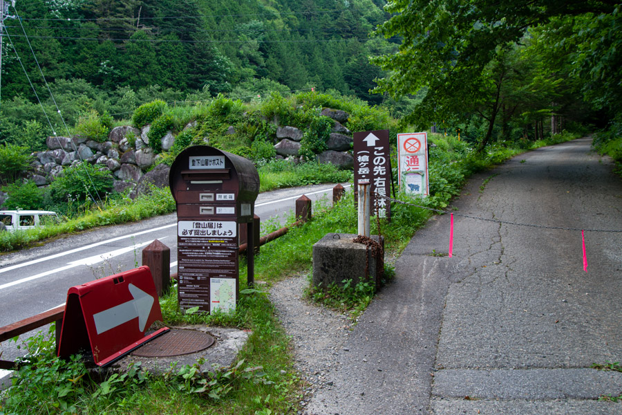
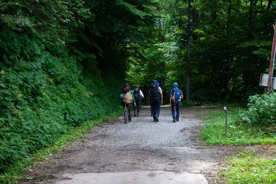
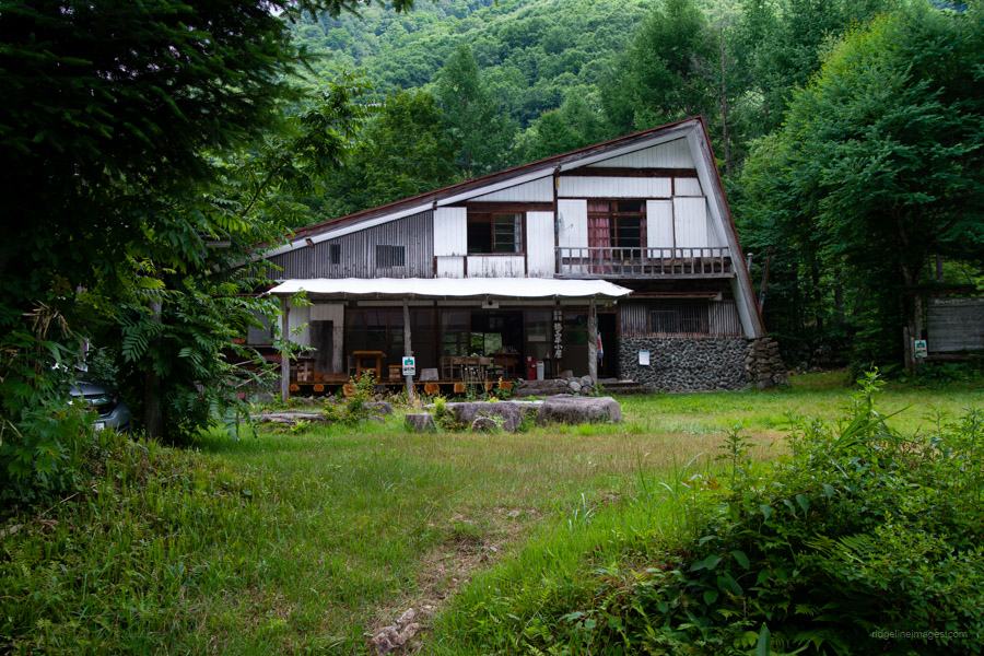
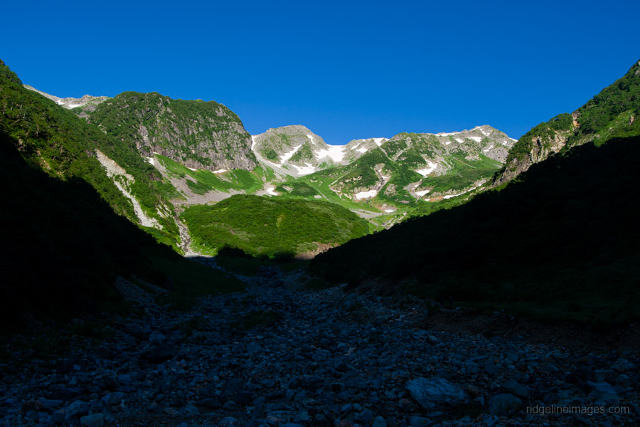
From the bus stop, pass beneath the ropeway cables and head up the sealed road, continuing past the gate where you can post your hiking plan at the trailhead mailbox. Follow the gravel forestry road, passing the quaint Hotakadaira-goya 穂高平小屋. After about 90 minutes, you’ll reach Shirodashi-sawa-deai 白出沢出合, where the forestry road ends.
I soon discovered that arriving after midday in summer isn’t ideal – it wasn’t long before the first rumbles of thunder rolled in. After quickly polishing off lunch, the heavens opened, and I promptly donned my raingear. The rain didn’t let up until shortly before I arrived at the campsite.
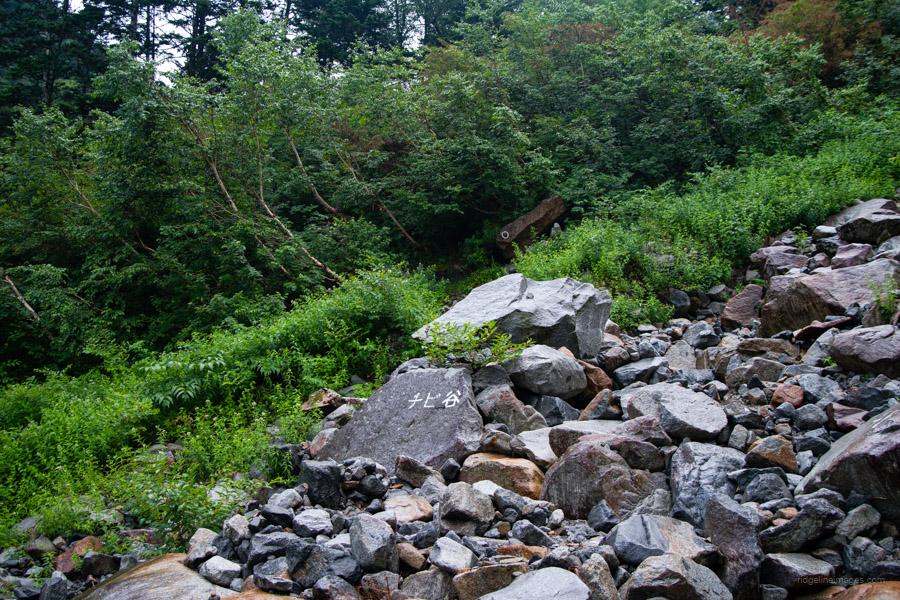
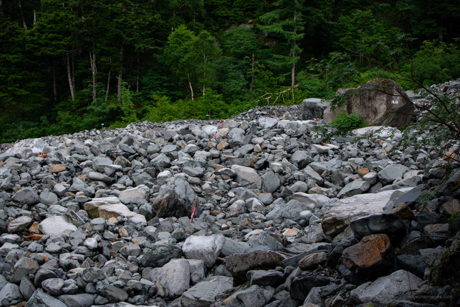
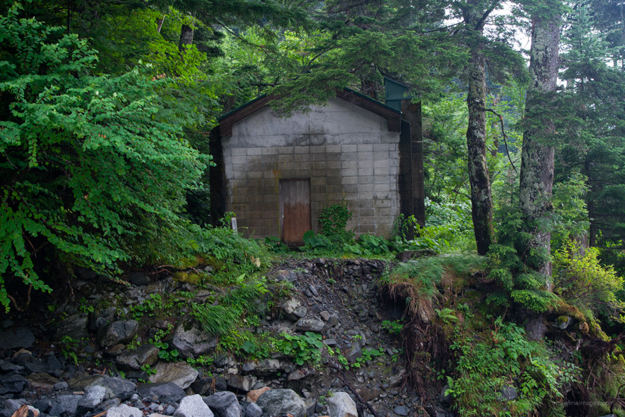
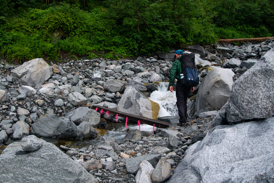
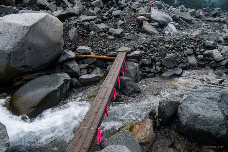
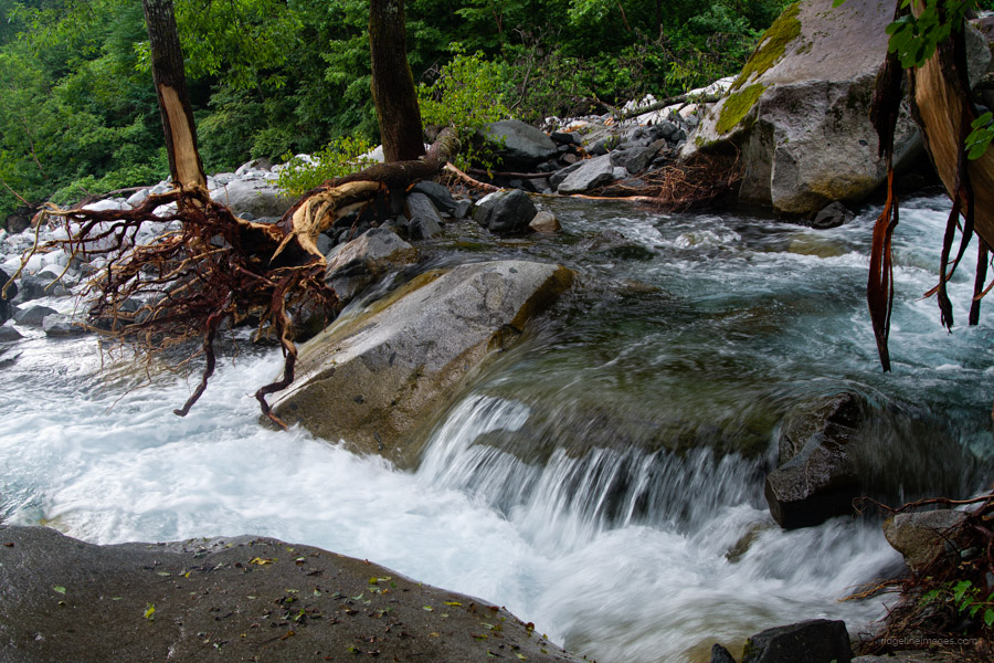
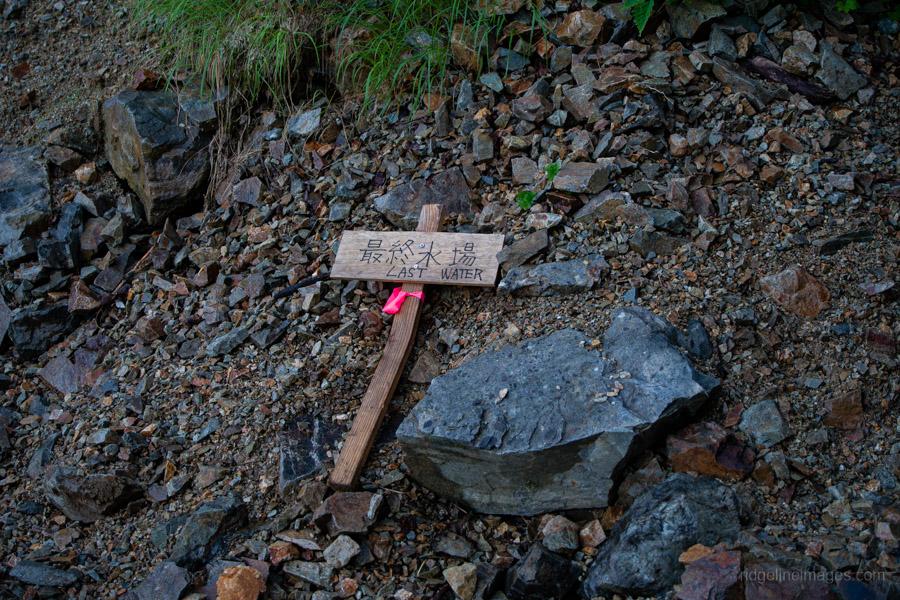
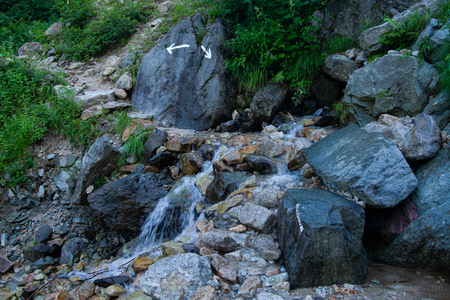
From here, you cross the first of several rocky gullies, keeping an eye out for pink tape marking the opposite bank. The trail is generally well maintained and easy to follow. Along the way, another hiker warned me about the river crossing at Takidani 滝谷. In case the makeshift bridge has been washed away and the river is impassable, it’s possible to take refuge at the Takidani-hinangoya 滝谷避難小屋 – a rough-looking emergency hut built from breeze blocks.
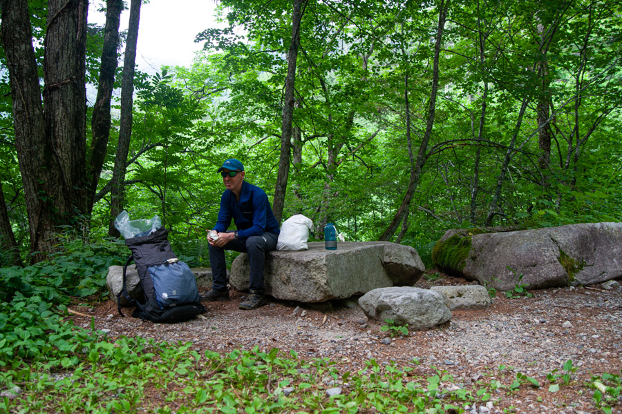
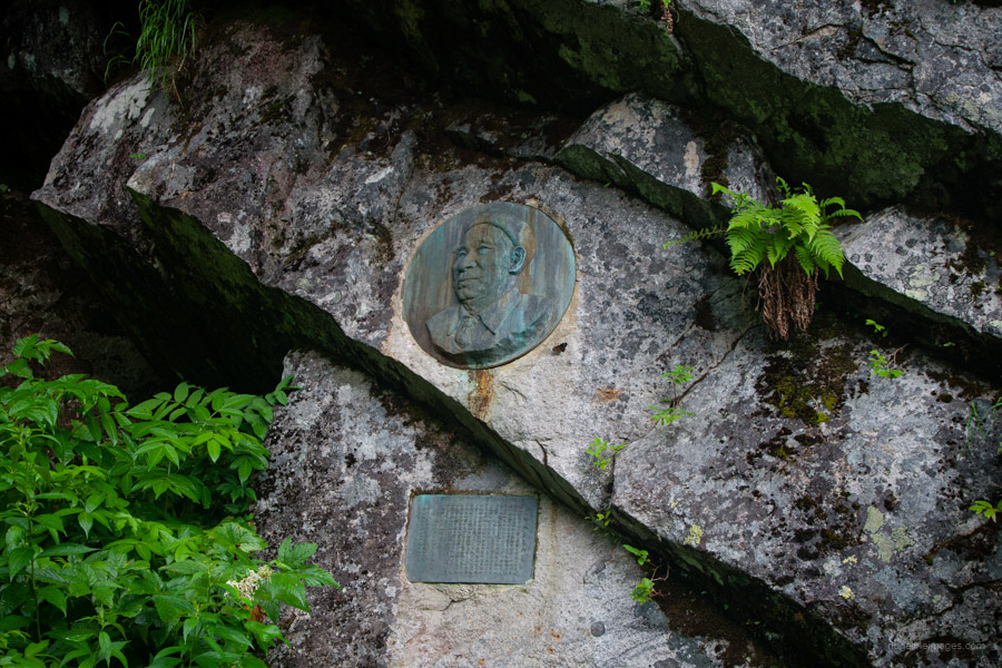
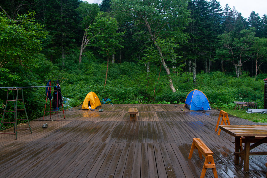
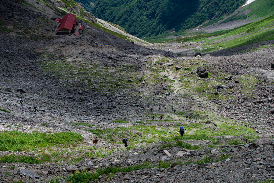
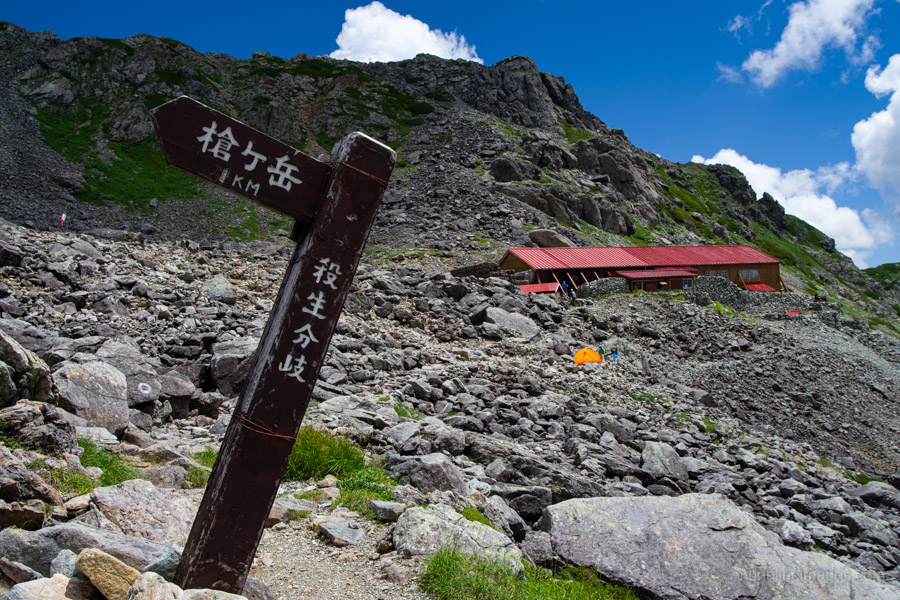
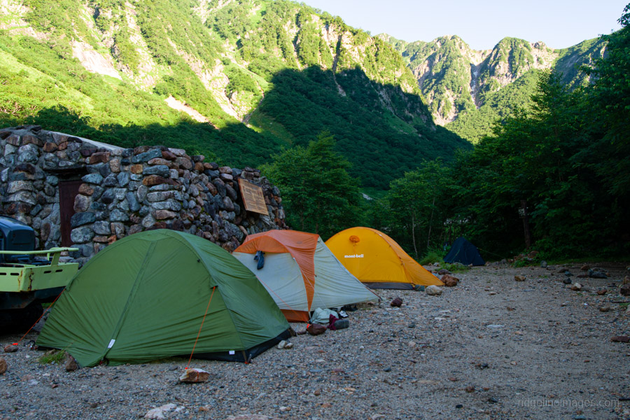
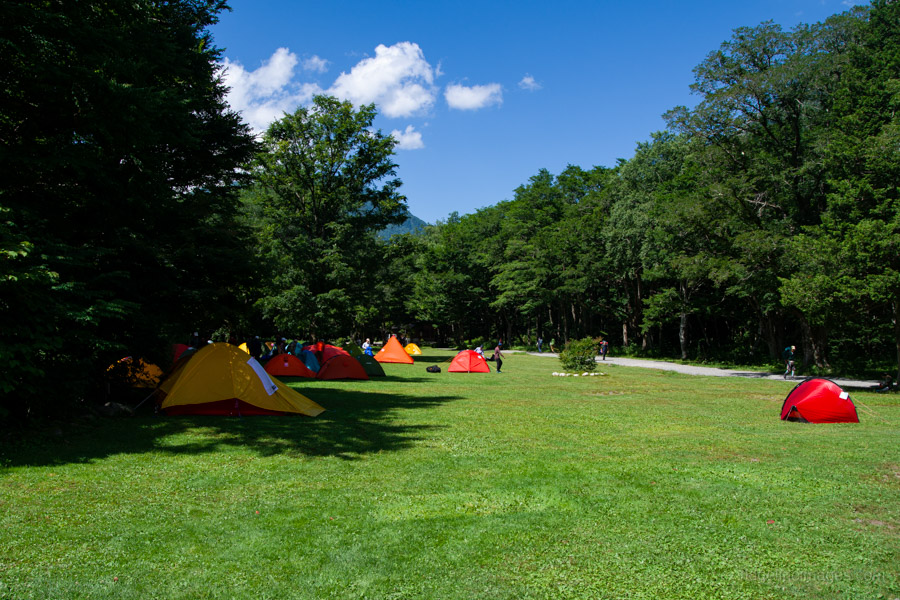
After passing the Fujiki Relief 藤木レリーフ – dedicated to a famous rock climber – it takes about an hour to reach Yaridaira-goya 槍平小屋 (campsite 2,000 yen). As a helicopter resupply run was scheduled for the next morning, I had to pitch my tent on the decking in front of the hut. The main campsite, which is spacious, is located behind the building.
Day 2: Summit Push and Thunder at Sesshou Hut (5.8 km)
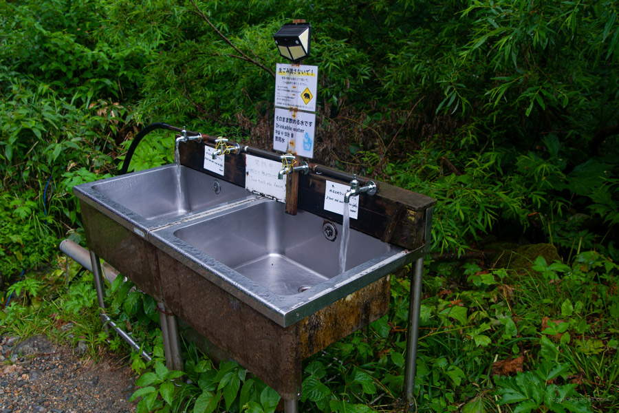
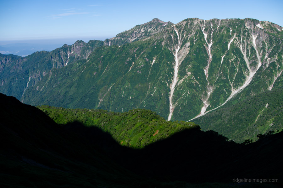
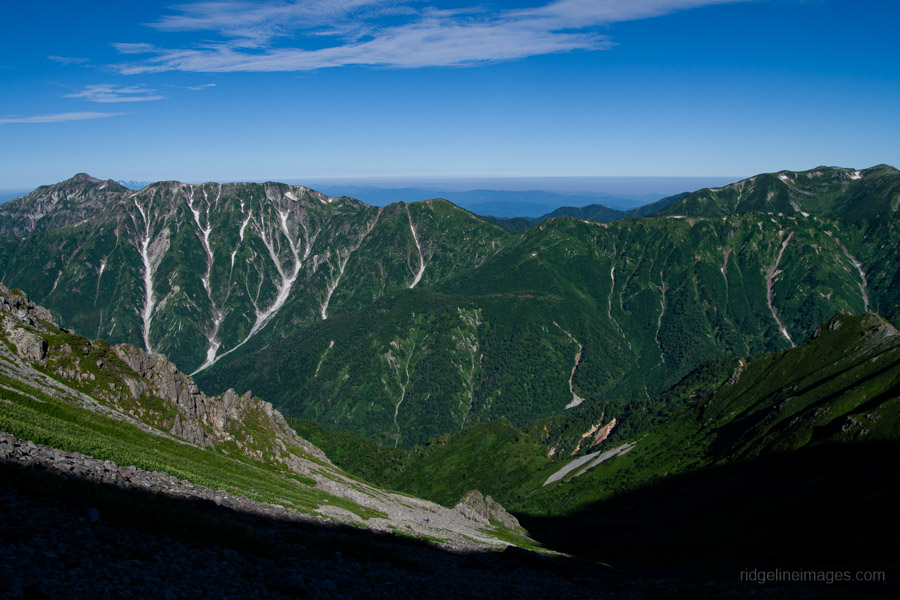
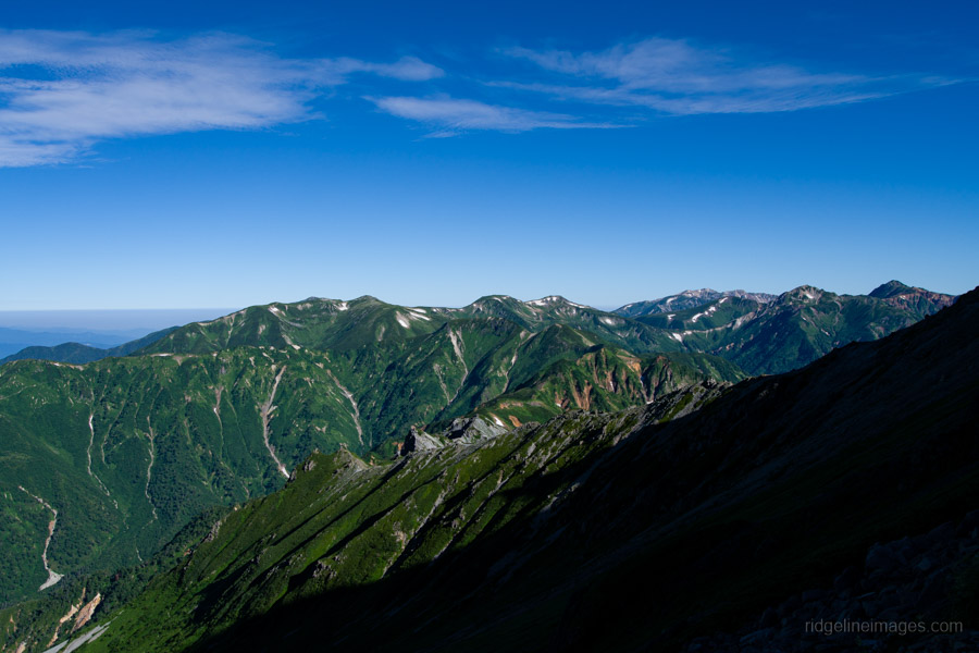
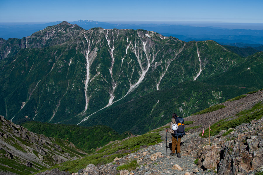
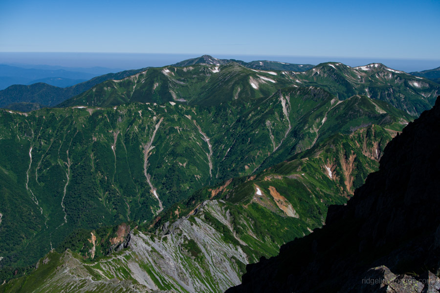
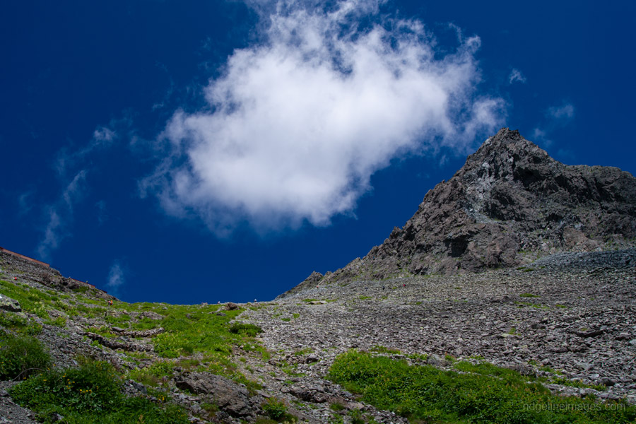
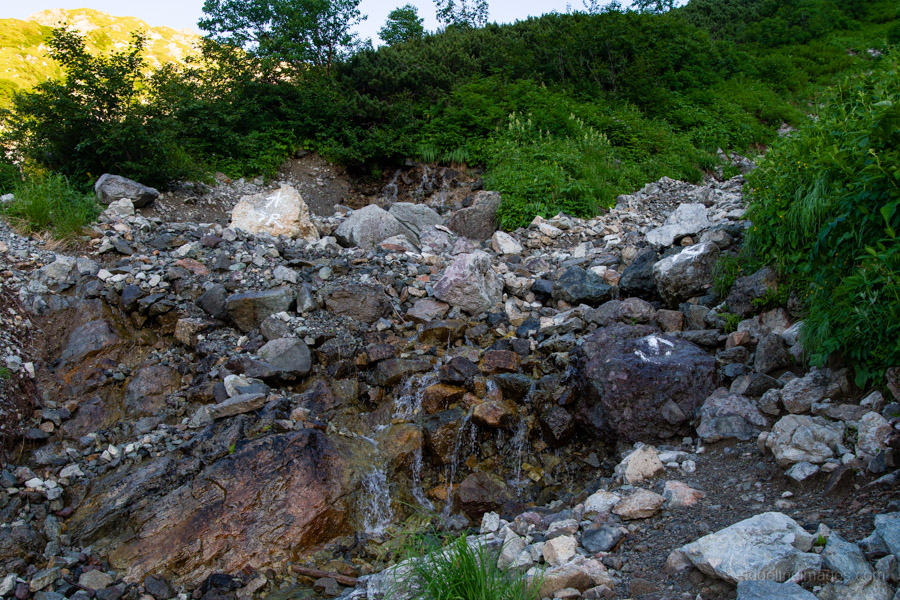
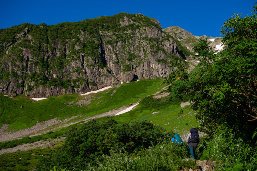
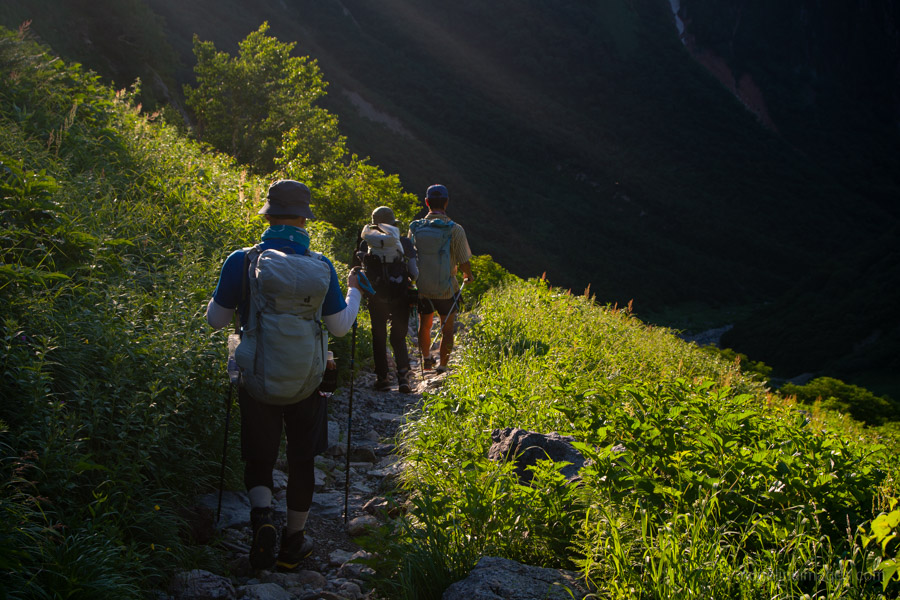
The following morning, I was greeted with clear skies and was as eager as ever to get back on the trail. My soaked socks and shoes served as a reminder of the honest day’s hiking I’d put in the day before. From behind the campsite, the path stays in the forest for about an hour. Along the way, there are a couple of spots to refill your water. After clearing the treeline, turn right at the first-aid trail junction. From here, the trail gradually steepens, offering magnificent views of Mt. Sugoroku and the surrounding peaks.
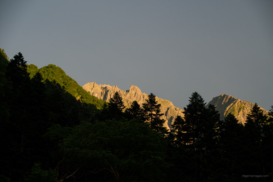
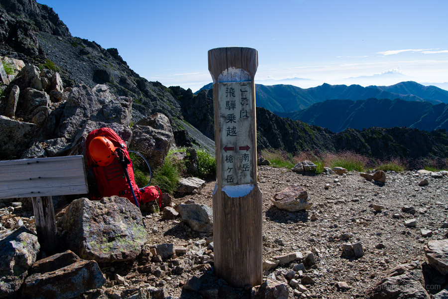
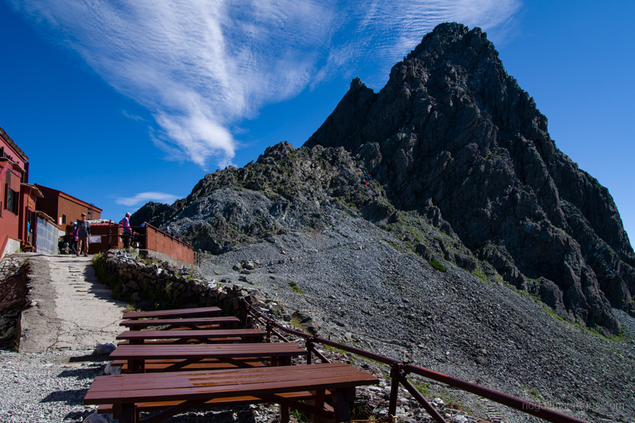
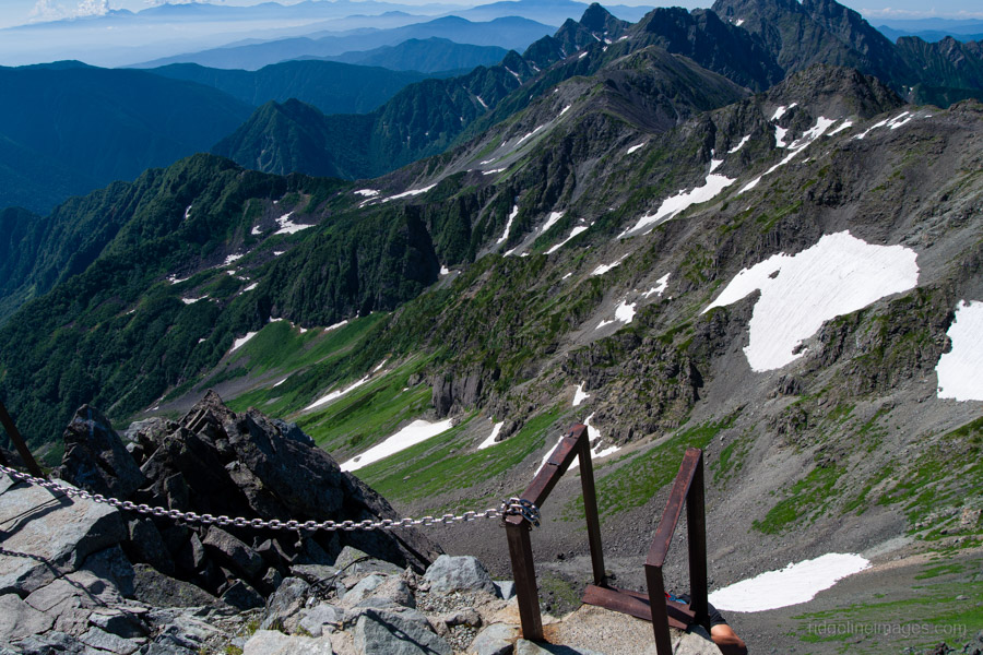
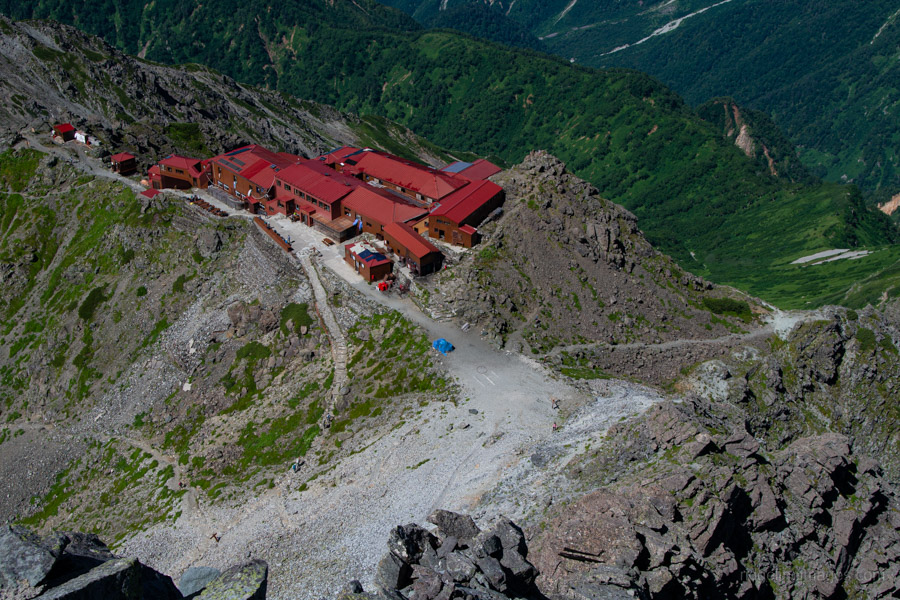
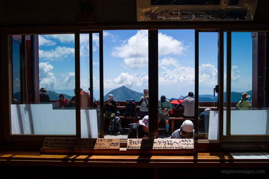
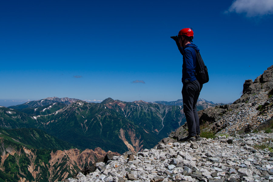
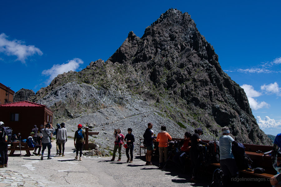
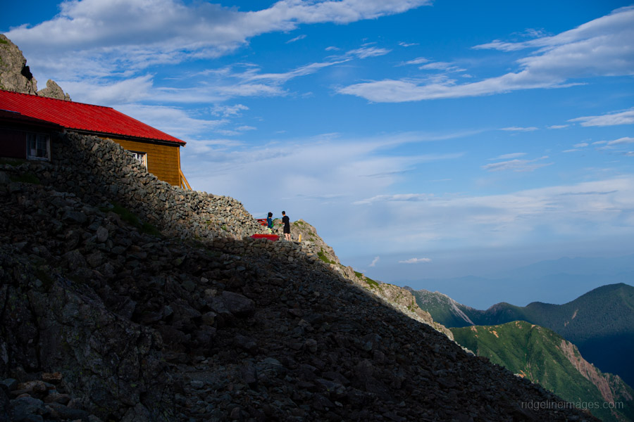
The zigzagging ascent eventually leads to Hida Nokkoshi 飛騨乗越, where the first full view of Yarigatake 槍ヶ岳 (3,180 m) finally comes into sight. After passing the small, exposed campsites, continue on toward Yarigatake-sanso 槍ヶ岳山荘. I dropped into the lodge to rent a climbing helmet, which can be done for 500 yen.
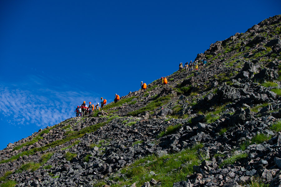
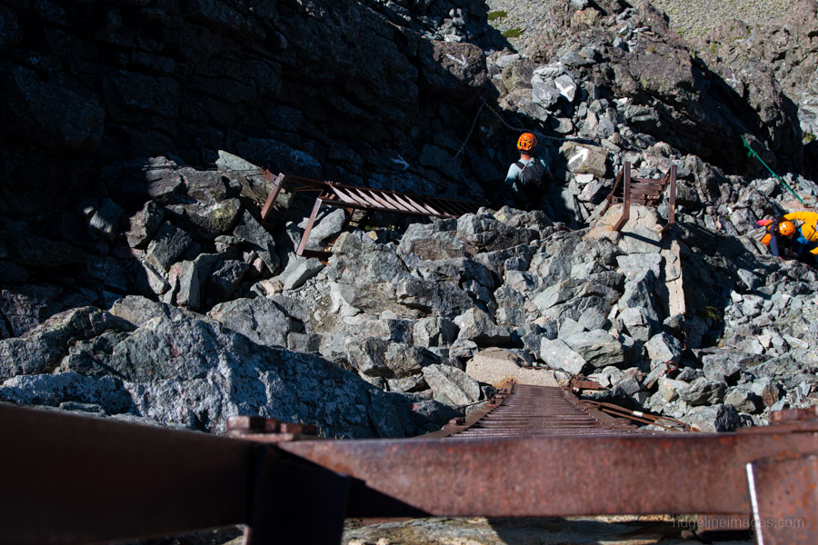
Now the real fun begins. The climb starts with a fairly standard chain section. There are plenty of good footholds, so it’s not difficult. About halfway up, the ascent route separates from the descent path, and you start scrambling over rocks without the help of chains. Fortunately, there are ample handholds, giving you plenty of room to manoeuvre. Off to the left is Ko-Yari – a smaller, almost manicured version of the main peak.
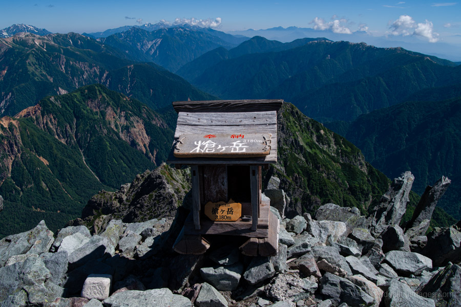
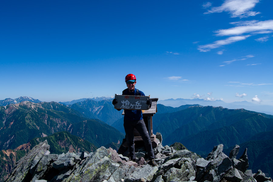
The crux of the climb is two vertical ladders that add a thrilling finish. There’s something priceless about the relief on climbers’ faces as they gingerly step off that final ladder. If the clouds are clear, you’ll feel on top of the world, with a stunning 360-degree panorama. After soaking up the summit atmosphere, return via the descending ladders and follow the descent route back down to the hut.
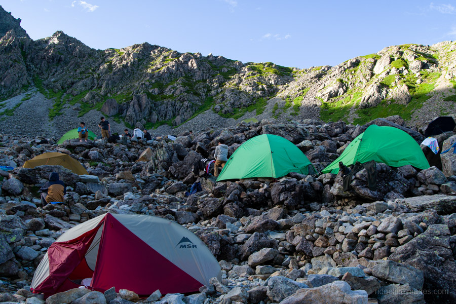
Since it was still mid-morning, I decided to continue down to the Sesshou Hut 殺生ヒュッテ, which also serves as an overflow campsite. I figured it would be quieter as well. The other option was to push on to the Baba-daira campsite, which, while rather lovely, has limited views – and I was hoping to wake up to a beautiful sunrise.
My intuition proved spot on. Not long after I’d set up my tent on the rocky ground, another thunderstorm rolled in – this time with hailstones!
Day 3: Stars, Sunrise, and the Long Descent to Kamikochi (19.5 km)
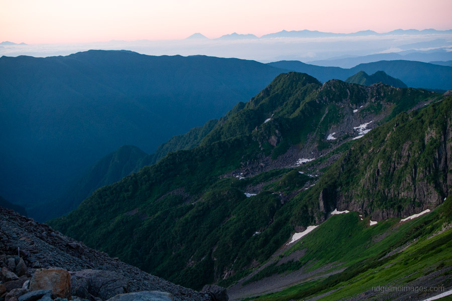
During the night, I witnessed what had to be one of the best star-filled skies I’ve ever seen. The Milky Way’s glowing gas cloud was truly something to behold. The view from my tent at dawn wasn’t bad either, with Fuji-san and the complete Yatsugatake Mountain Range clearly visible. The group of high schoolers, however, were probably less thrilled – having somehow left behind the pole sections from their three-person Montbell tent. One of the perils of packing up before first light.
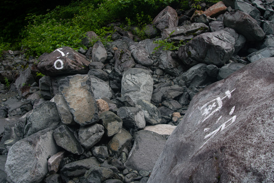
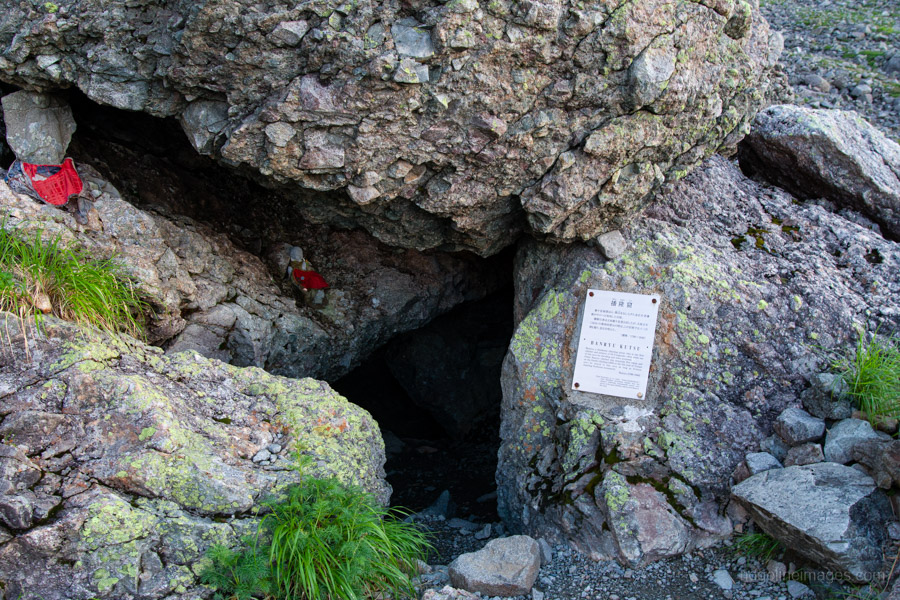
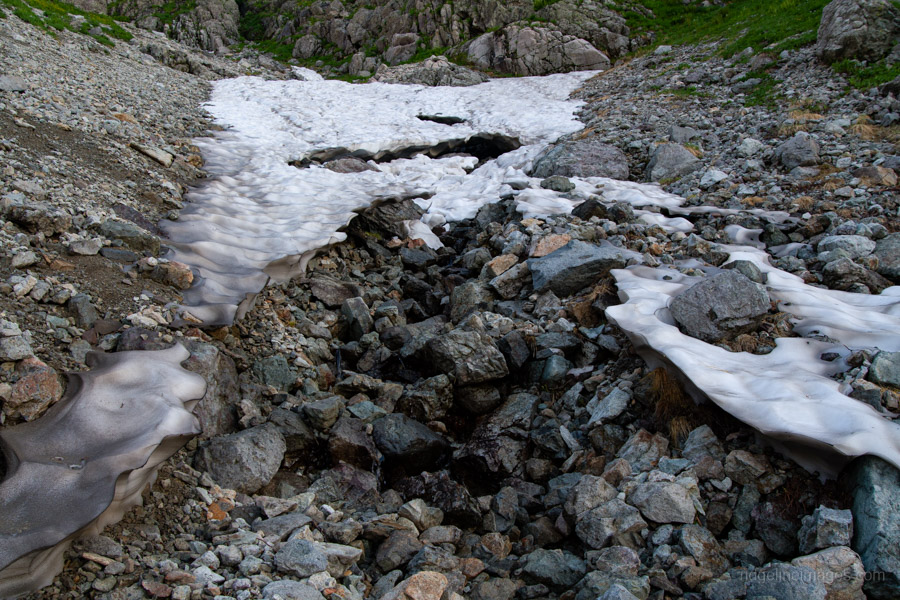
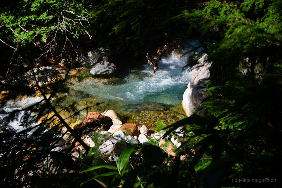
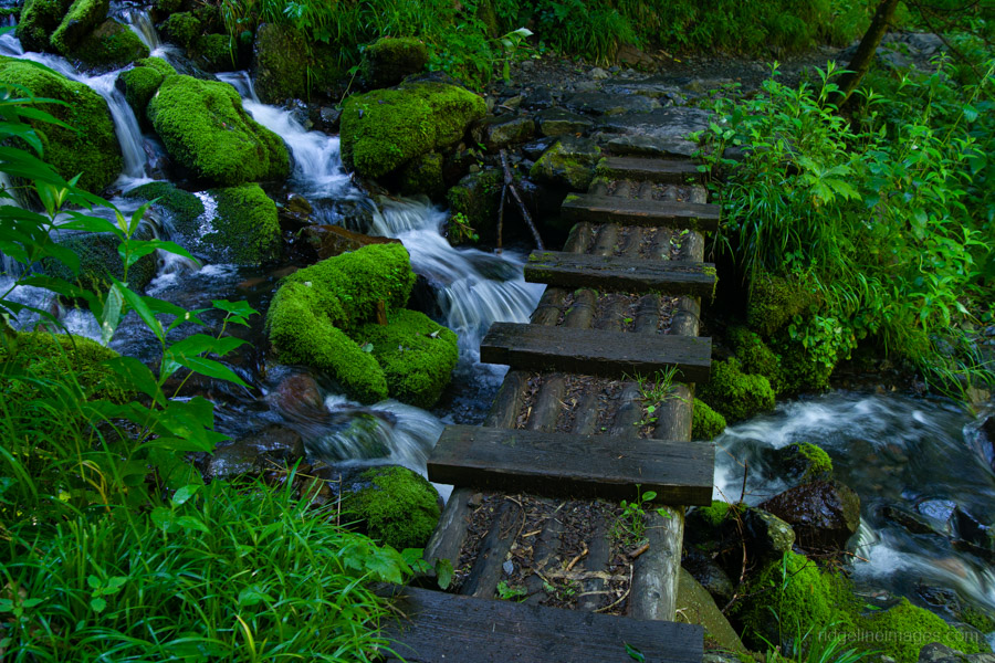
Although the day’s route is just under 20 kilometres, it’s thankfully all downhill. The first landmark of the morning is Banryu’s Cave 播隆窟, named after the Buddhist monk who first reached the summit in 1828. As the trail descends, the slopes gradually become covered in Japanese creeping pine, with a few spots where snowmelt trickles into streams – ideal for refilling water. A little farther on is the junction at Tenguhara 天狗原分岐, which offers an alternative return route to the Shinhotaka Ropeway. There’s also a turnoff at Mizumata Nokkoshi 水俣乗越 that links up with the Omote Ginza Traverse Trail.
After a solid two hours of walking, I arrived at the sheltered Baba-daira Campsite ババ平 (2,000 yen), located at the bottom of the valley. It has toilets, running water, and additional tent sites on the dry riverbed. It’s managed by the Yarisawa Lodge 槍沢ロッヂ, about 30 minutes farther down the trail, where you can pay your camping fee.
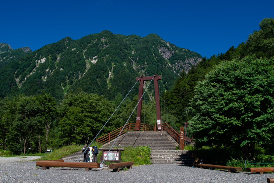
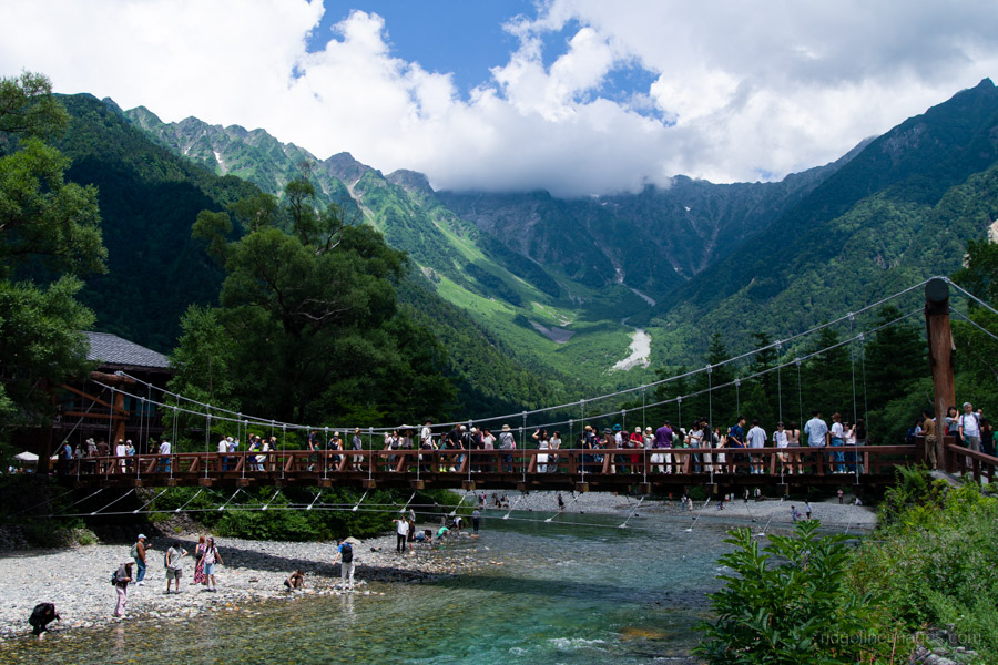
From there, the gentle trail continues along the picturesque Yarisawa River, crossing several wooden bridges over its confluences, eventually arriving at Yokoo-sanso 横尾山荘, where I camped on my first night during the Mt. Karasawa hike. Rather than crossing the Yokoo Ohashi Bridge toward Karasawa, continue straight ahead. This marks the start of the more touristy stretch of Kamikochi, with a mix of hikers and more casually dressed sightseers.
After leaving Yokoo-sanso, the trail remains mostly flat for the remainder of the walk to Kamikochi. Another delightful camping spot is found on the grassy flats around Tokusawa Lodge 徳沢ロッヂ. Later you pass by Myojinkan 明神館 and the Konashidaira Campsite 小梨平キャンプ場, eventually leading you past the always bustling Kappabashi Bridge and on to the Kamikochi Bus Terminal. As expected, the next bus was fully booked, so I had to wait around an hour. In total, the hike down from the Sesshou Hut took around seven hours.
For the return trip, you can purchase a combined bus and train ticket to Matsumoto (3,710 yen). The bus goes first to Shinshimashima Station 新島々駅, followed by a 30-minute train ride to Matsumoto.


Thank you David for this excellent reminder of an amazing place.
I covered some of this same terrain some years back in mid-October, getting on the 7.40am Nohi bus from Takayama and setting off from Shinhotaka up the valley by 9.30am, lunch at Yaridaira (hut already closed) and hit the Yari summit at 4.30pm then spending the night at Sessho Hutte. There were only a couple of people at the large hut, and the upstairs sleeping area got to a memorable -1 degree for most of the night! (Why would you keep a large thermometer on the wall? Perhaps to know when you need to put your beer in the fridge to avoid it freezing?)
Day 2 was back up Yari in the early morning light, then via Otenjo to Jyonendake with stunning views everywhere and snow monkeys everywhere munching on the red berry laden bushes on the Jyonen ridge.
Day 3 was again over Jyonen, down into the Azusagawa valley through Kamikochi and up to the summit of Yake Dake as I was losing the light. Stayed in the hut near there and enjoyed the clearest stargazing night I’ve ever experienced in Japan.
The next morning was a gentle couple hours back down to Shinhotaka and a memorable hot foot bath before taking the public transport back to the big smoke of Nagoya via a quick nip up to the summit of Norikura Dake.
With superb mid-late autumn conditions, it was a truly memorable few days, thank you for bringing it all back to me.
Hi Stewart,
Glad to hear this brought back a good dollop of nostalgia for you! To your credit, you certainly managed to pack a lot into those short three days. And apart from the cold at night, mid-October brings plenty of advantages – as you found by sneaking in this trip before the huts shut down for the winter: clearer, crisper air and no doubt far fewer hikers. Well played!
And many thanks for the meticulous historical references – to the Fujiki memorial plaque and Banryu’s cave, both of which I’ve managed to miss despite several visits to the area. It’s good to see both of these historical figures commemorated – Fujiki led one of the first ascents of Takidani in August 1925 (still a challenging climb), in August 1925, climbing neck-and-neck with a team from Waseda, town vs gown. Interesting about the summit ladders on Yarigatake: oddly, I don’t remember any ladders in the 1990s – only chains. But perhaps my memory is deficient ….
Thanks for reading, PH. It’s understandable how easy it is to miss interesting details – especially with so much stunning terrain competing for attention. As for the rusted-looking ladders clinging to Yarigatake, they look like they’ve been there since Banryu’s day! Jokes aside, given how unforgiving the weather is up there, it’s hard to say how long they’ve actually been in place. Still, having just chains on that final stretch would definitely up the stakes.
Hello! Sir David,
Just a quick question is it required to get a climbing insurance if your gonna hike
mt. Yarigatake?? Thank you!
Hi Allen,
While it’s not mandatory, it’s definitely a wise idea to have some hiking insurance before heading up there. You can easily buy short-term coverage online in Japan – for example, through the Tokio Omotenashi Policy – even just for a few days.
You can find more details and compare available options here: Japan’s Hiking Insurance Providers Compared