.
Senzoku-toge 千足峠 – Shinyanone-toge 新矢野根峠 – Gozenyama 御前山
Distance: 10.5 km
Elevation change: 493 metres
Highest point: 733 metres
Start: Shiotsu Station (Chuo Main Line)
Finish: Uenohara Station (Chuo Main Line)
Difficulty: ▅▅▅▅▅▅▅▅▅▅ ❸
Map: Yama to Kogen Chizu 山と高原地図 [No.29 高尾・陣馬 TAKAO·JINBA]
GPX TrackKML TrackGSI MAPPDF Topo Map
This Lowly Mountain has Much to Offer
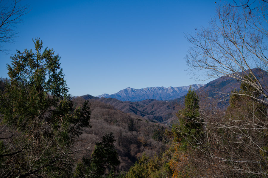
Mt. Takatsuka is located in the Doshi Mountains not far from Mt. Kuratake in the south-eastern part of Yamanashi Prefecture. The mountain is bestowed as one of the 100 Famous Yamanashi Mountains. Although a relatively low-lying mountain there are more than a few ups and downs to keep you honest. A nice bonus is convenient access to both trailheads from the JR Chuo Main Line. A downside is lack of Fujisan views although the summit affords a decent panorama to the north. A good time to visit is in spring when the Rhododendrons (tsutsuji) are in bloom.
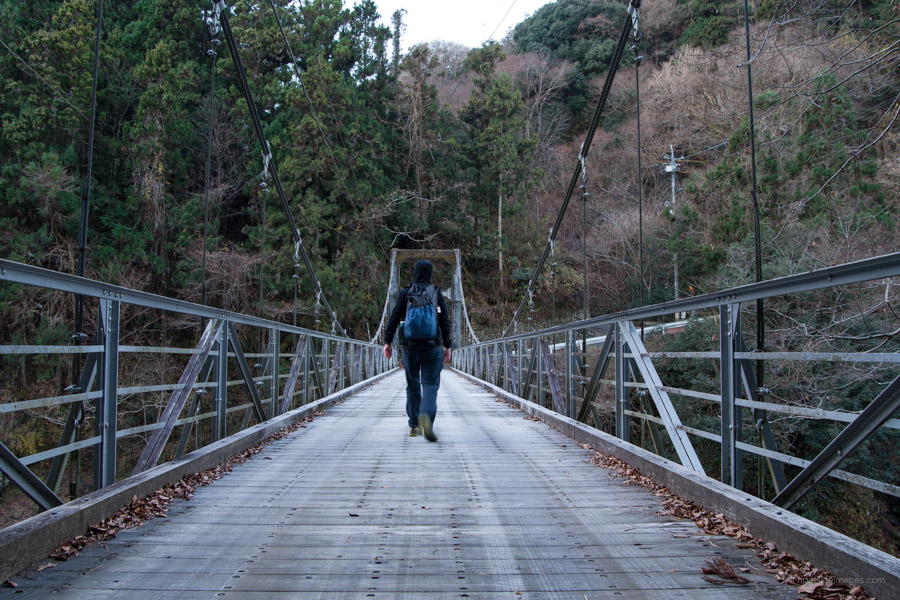
While the hike can be undertaken in either direction, I feel moving towards rather than away from Tokyo makes the return trip feel shorter. From Shinjuku Station, take the JR Chuo Line to Takao Station where you can change to an Otsuki or Kofu bound train and get off at Shiotsu Station 四方津駅 (1 hr 30 mins, 1160 yen). From the ticket gate turn left, follow the road that dips under the railway underpass and turn left again at the T-junction. Continue along this narrow street for about 1 kilometre. Look for a sign on your right that steers you towards a wooden vehicular suspension bridge. For an alternative but longer route to the summit, follow the same road from the station but instead go right after about 100 metres.
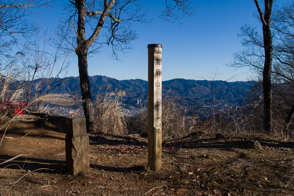
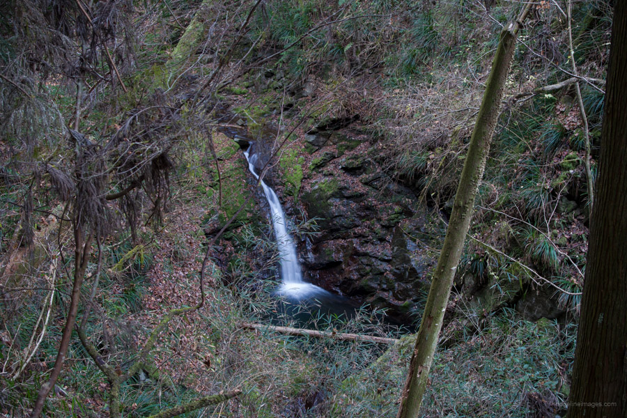
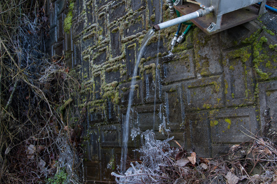
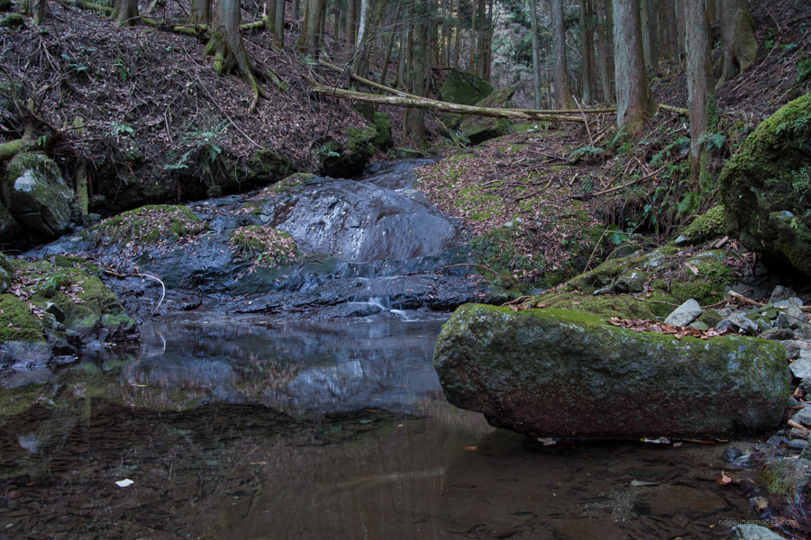
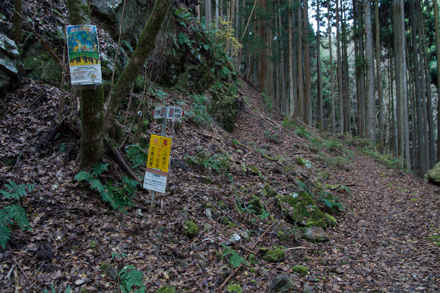
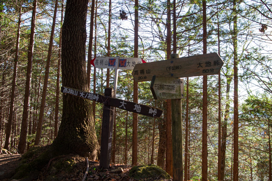
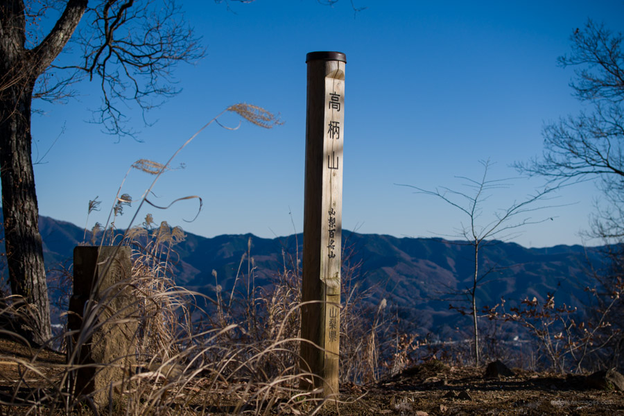
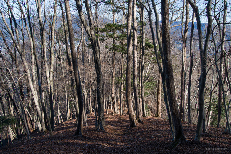
After crossing the bridge wander up the paved road and turn left when it diverges. From the station to the trailhead proper takes around 50 minutes. At first the trail tracks along a river which has some interesting rock formations. Just before full-fledged climbing begins there is a water source to top up your supplies. The trail climbs steeply through plantation forest before arriving at Senzoku-toge 千足峠. From the pass it’s a further 15 minutes to Mt. Takatsukayama 高柄山 (733 m). Through a break in the vegetation, you can make out the Tokyo Skytree! The route to the summit is well signposted and easy to follow, though is occasionally indistinct approaching the Uenohara side. The biggest hazard are piles of dry leaf debris concealing all manner of foreign objects ready to bring you unstuck.
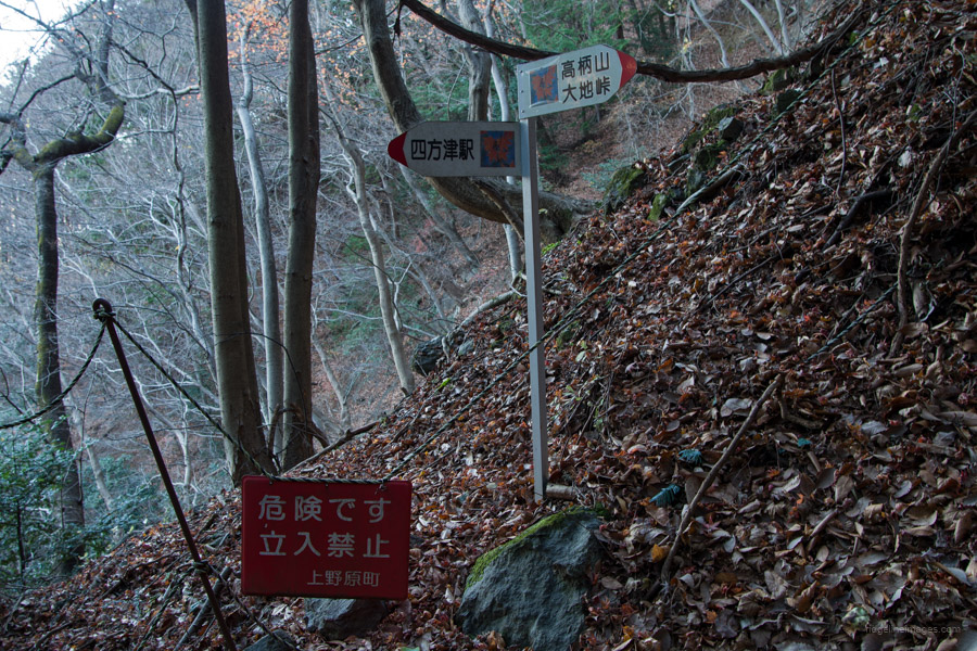
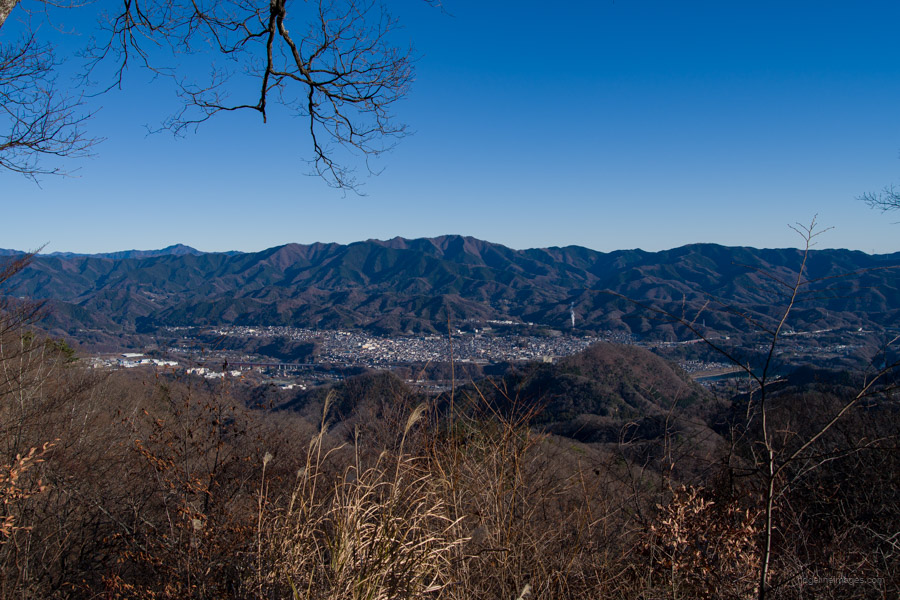
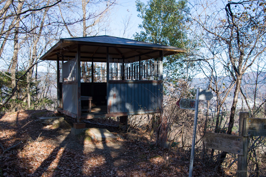
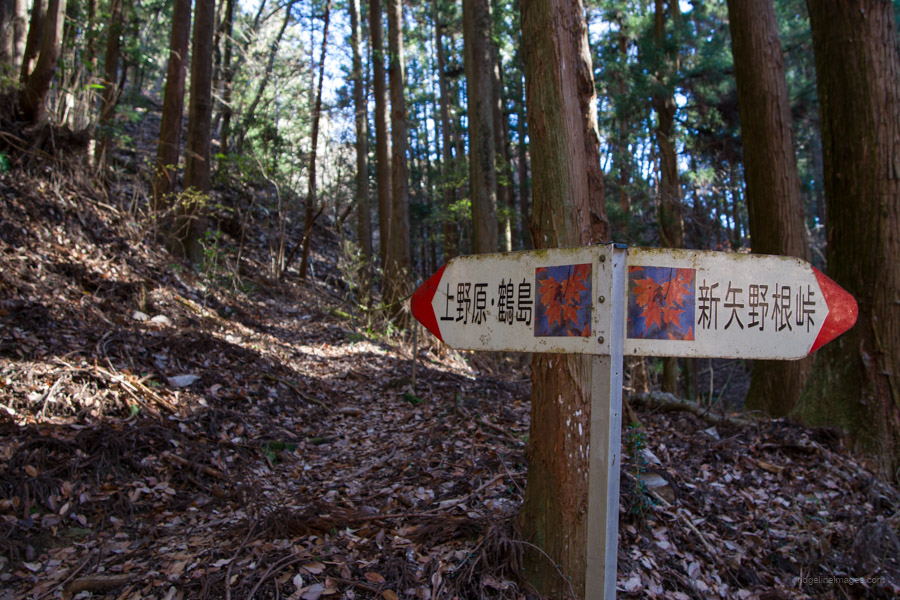
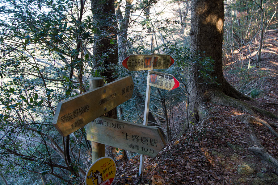
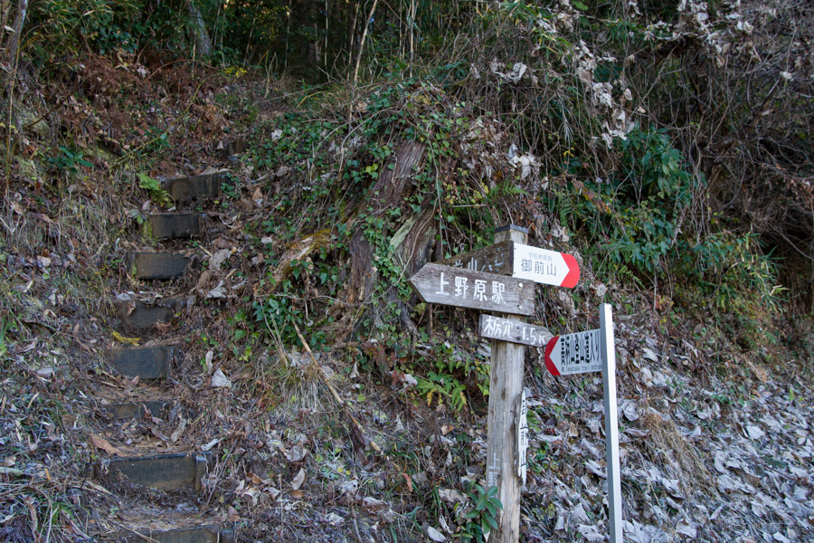
From the summit, left to right you can make out Mt. Mito, Mt. Shoto, and Mt. Jinba together with Uenohara township beneath. When you’re ready to head off proceed towards Shinyanone-toge 新矢野根峠 and Tsurushima 鶴島. After descending for a while there is a rickety looking pavilion at Shinyanone-toge along with a signpost that heralds a further 2 hours to Uenohara Station 上野原駅. From here on the up and downs become more vigorous as the trail cuts a path around the mountainside and descends through a valley.
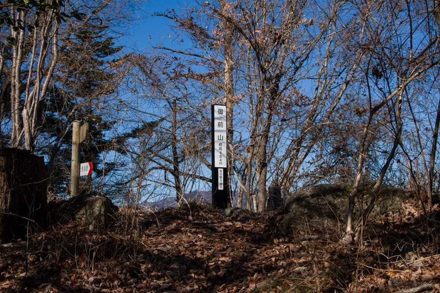
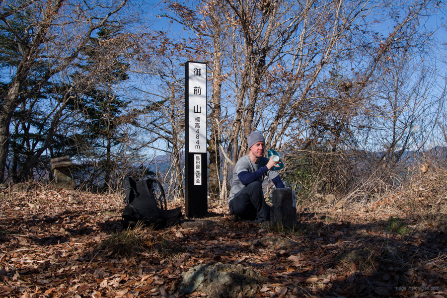
After reaching the valley bottom the trail rises abruptly to Gozenyama-bunki 御前山分岐 where an alternate path to the trailhead deviates right. Pressing on to Gonzenyama 御前山 (484 m) finds a steep climb abetted with fixed ropes. The summit is hemmed in on all sides with forest that shrouds the outlook. The final section drops quite sharply, though thankfully there is plenty of ‘tiger rope’ on hand to help maintain a steady footing. The hike pops out at the side of a cemetery and a deer gate fixed with a drop rod. After that it’s a leisurely 20 minute road hike across the Katsura River to Uenohara Station.


Well-done.
I found out the other day that one of my colleagues lives near Shiotsu. We had a nice chat about Ogi and Momokuroyama.
I thought of you this weekend. I passed through UkaiToriyama on Sunday. 🙂
I noticed you also did the first part of the hike in reverse. Like yourself a bit surprised how steep some sections were and very thankful for the ropes. Ahh, Ukaitei a delightful spot. Must find an excuse to head back there again.
I found your website only recently, but happy I did! Last week I did Bukkasan and today this hike. Both were lovely (although caught by ヤマビル on both occasions lol) and almost no people. An update: for Gonzenyama 御前山, they actually removed trees so now you have a nice view over the town.
Since fall is coming, can you recommend me some of your hikes for the best leaves, but few crowds? Thanks!
Thanks, Patrik, and I appreciate the update on Gonzenyama it’s great to hear they’ve opened up the view. Unfortunately, those leeches tend to stick around until autumn.
As for your question, some good spots to enjoy the autumn leaves without too many crowds include the Lake Okutama Ikoi-no-Michi trail (reopening in November), Shiraiwa Falls, the Hinohara Sasaone Ridge between Mt. Jinba and Mt. Mito, and Mt. Iwadono. A little further afield, Mt. Narakura is also a nice option. That said, even at the more popular leaf-viewing spots, an early start usually makes all the difference.