.
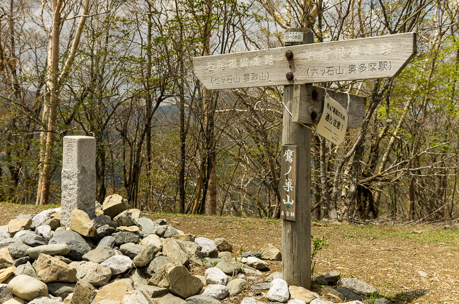
Mt. Takanosu 鷹ノ巣山 – Mt. Kayanoki 榧ノ木山 – Mt. Kurato 倉戸山
Distance: 12.5 km
Elevation change: 1116 metres
Highest point: 1736 metres
Start: Naka Nippara Bus Stop
Finish: Kuratoguchi Bus Stop
Difficulty: ▅▅▅▅▅▅▅▅▅▅ ❹
Map: Yama to Kogen Chizu 山と高原地図 [No.25 奥多摩 OKUTAMA]
GPX TrackKML TrackGSI MAPPDF Topo Map
Breathtaking Views and Tranquillity at Mt. Takanosu
Mt. Takanosu has long held a special affinity for those living in the Okutama area. During the Edo Period the mountain was off limits to low ranking citizens on account they might poach the local hawks which the nobility considered for themselves. On my descent from Mt. Kumotori last year, I opted to bypass Mt. Takanosu due to underestimating the effort required to walk the Ishione Ridge. While this hike has been spilt over a more leisurely two days (note that you will be climbing 1,100 metres on the first day) it can also be undertaken as a day outing provided an early start is made.
Day 1: A Tough Ridge Climb to the Hawks Nest (5.8 km)
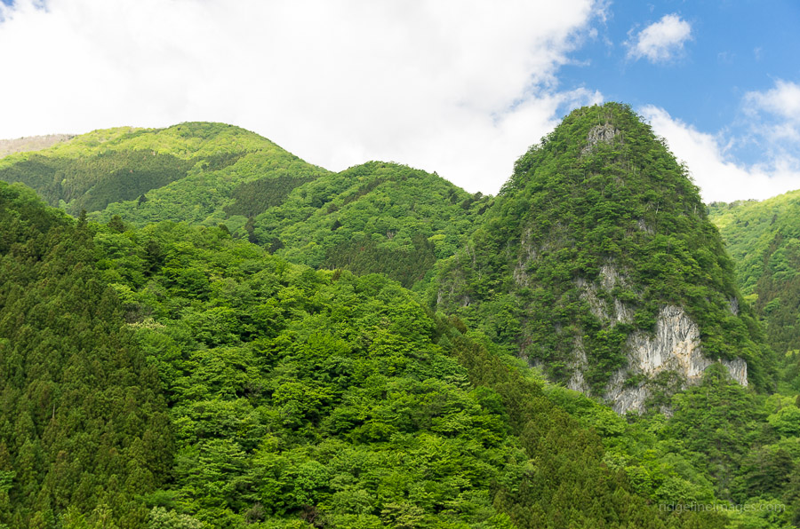
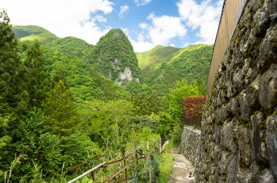
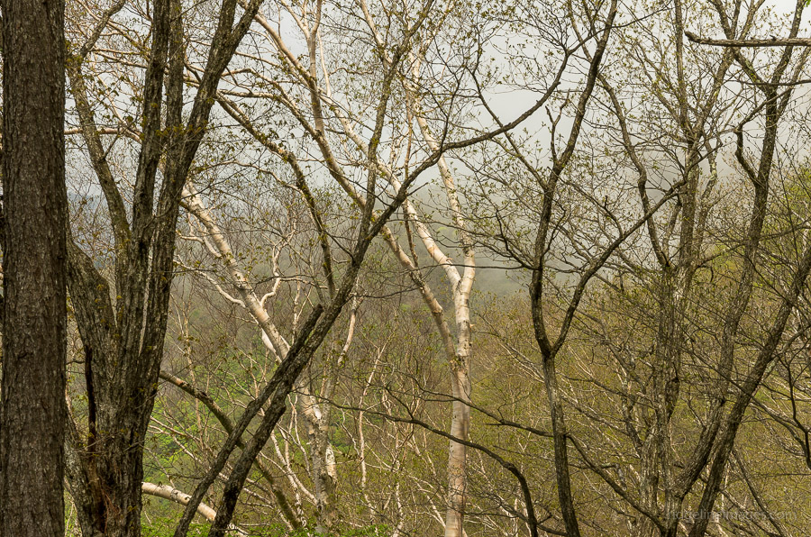
Access to the trailhead is met by taking a train to Okutama Station and picking up a Nishi Tokyo bus bound for the Nippara Shonyudo 日原鍾乳洞 (25 minutes, 450 yen). Time permitting the Nippara Limestone Caves are also worth exploring in their own right. The nearest bus stop to the trailhead is actually Naka Nippara 中日原 one-stop beforehand. Rising in front of you is the imposing Inamuraiwa Rock 稲村岩 which needs to be conquered before the onerous ridge climb to the summit begins. The first section starts off gently enough, walking through a sheltered ravine, although there is a fairly steep slope before reaching the Inamuraiwa Rock. Scampering up the rocky knoll provides a limited view back through the valley.
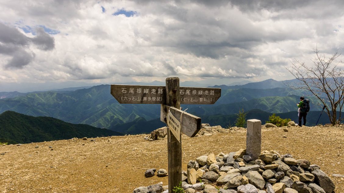
After taking a short rest, be ready for a long and sustained ascent along the Inamuraiwa Ridge 稲村岩尾根 and depending on the amount of gear you’re lugging, it can take upwards of 2.5 hours, as I discovered. There is little respite on the ridge and apart from amusing myself with the spectacle of some 40-plus-year-old discarded steel Fanta cans it’s hard going. Before the last push to the summit, you pass through the Hirumeshi-kuinotawa ヒルメシクイノタワ which was displaying some Japanese honeywort Cryptotaenia japonica coming into bloom. From here, the top seems near but be prepared for a couple of false summits before finally reaching Mt. Takanosu 鷹ノ巣山 (1,736 m).
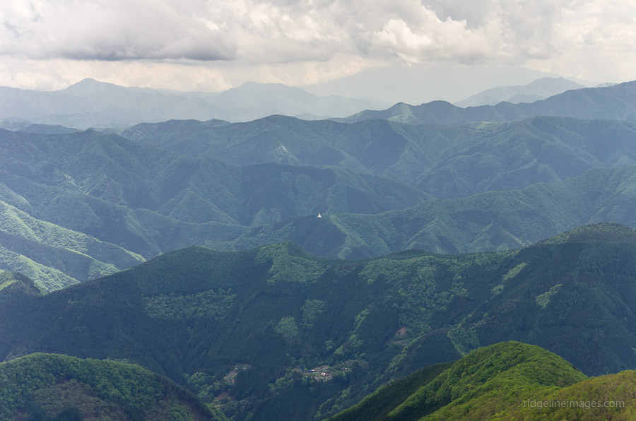
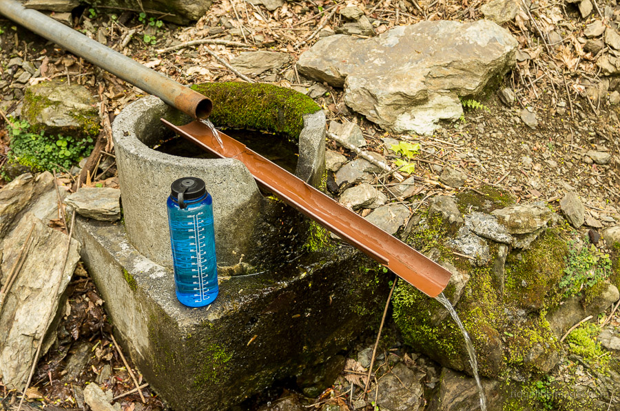
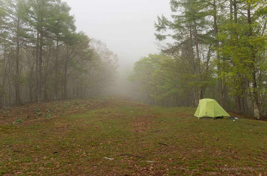
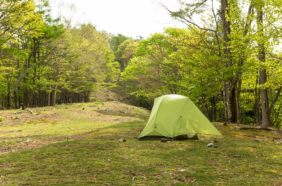
Being a weekday, I had the summit of Mt. Takanosu mostly to myself, and presumably other would-be hikers had been put off by the malevolent grey skies brewing on the horizon. Views from the summit don’t disappoint delivering stunning vistas to the south including the white crested Tokyo Peace Pagoda on Mt. Odera. With the weather rapidly deteriorating, it was thankfully only a short 20-minute stroll down to the campsite at the Takanosuyama Refuge Hut 鷹ノ巣避難小屋. While this isn’t an officially sanctioned campsite, there is a nice clearing for pitching a tent, and a water hole is situated 200 metres away along the trail heading to Kudari.
Day 2: Roped off Trail Necessitates a Change of Plan (6.7 km)
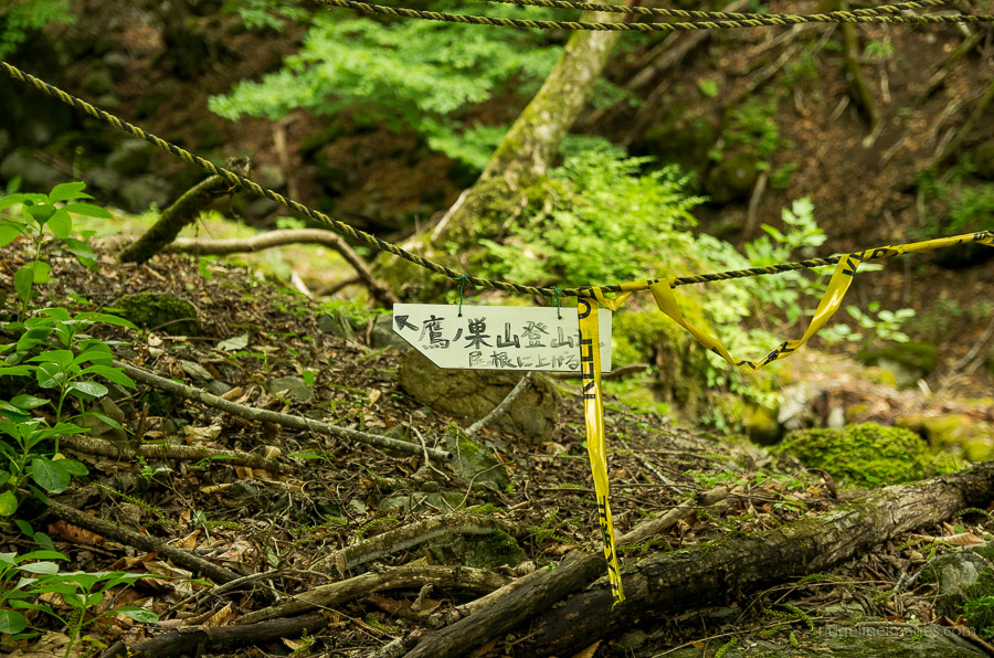
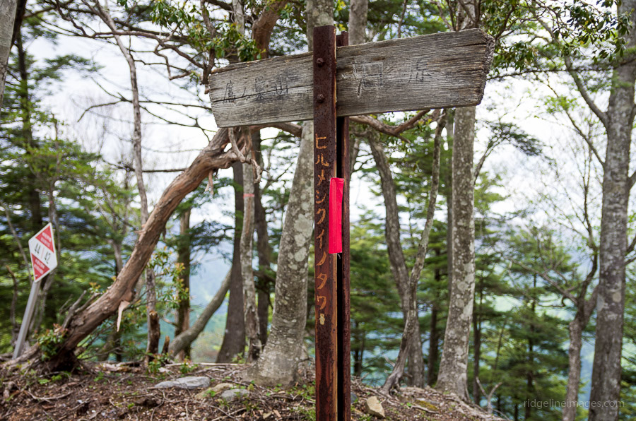
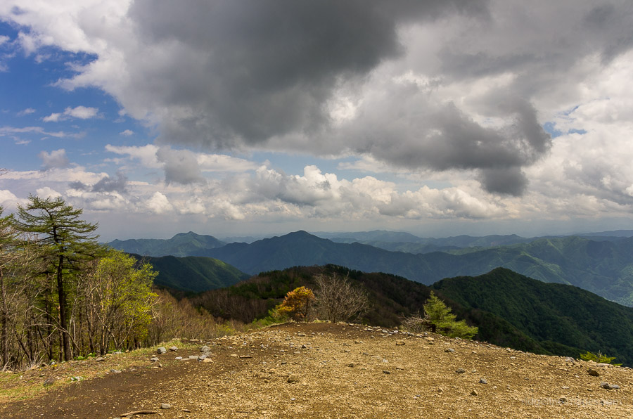
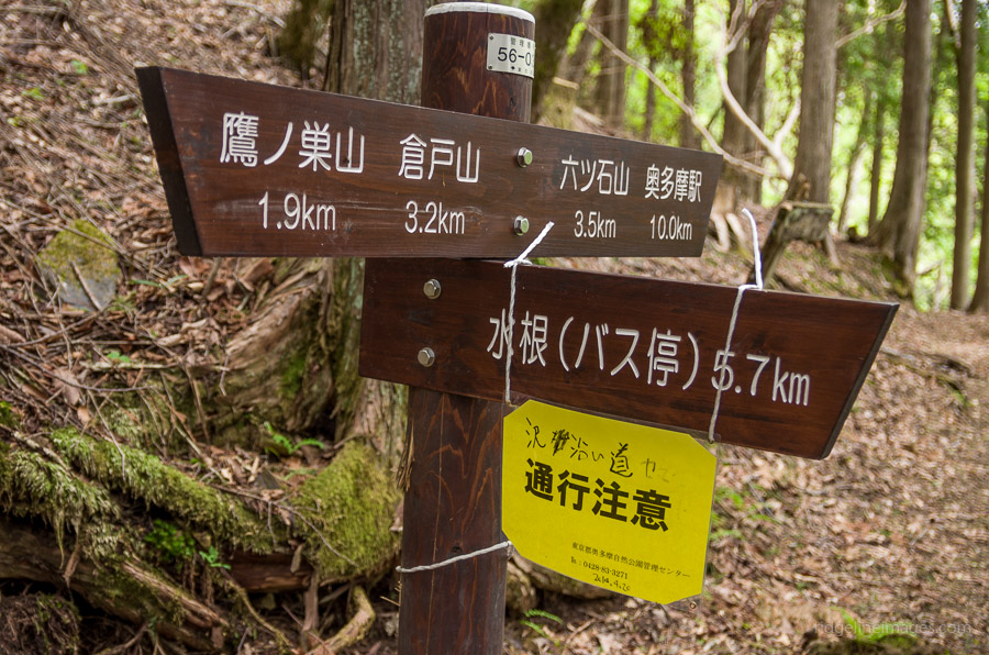
The previous night, I was awoken a couple of times by some light rain and the sound of deer feeding on the grass outside the tent. The sun rising at around 04:30 made oversleeping kind of impossible, and dragging myself out of my sleeping bag was made much easier. The original plan was to follow the Ishione Ridge for a short distance and then veer right, down to Lake Okutama via the Mizunezawa Forestry Way. This plan was soon thwarted on account of finding the trail entrance roped off with a sign revealing the impassable section of the trail. Mercifully, only a little backtracking was needed to get back to Kayandai Ridge.
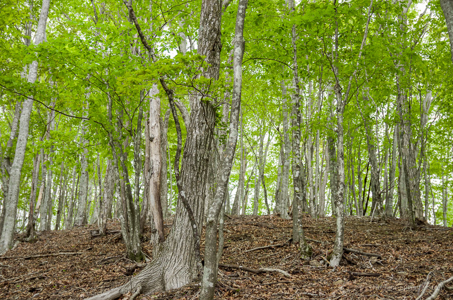
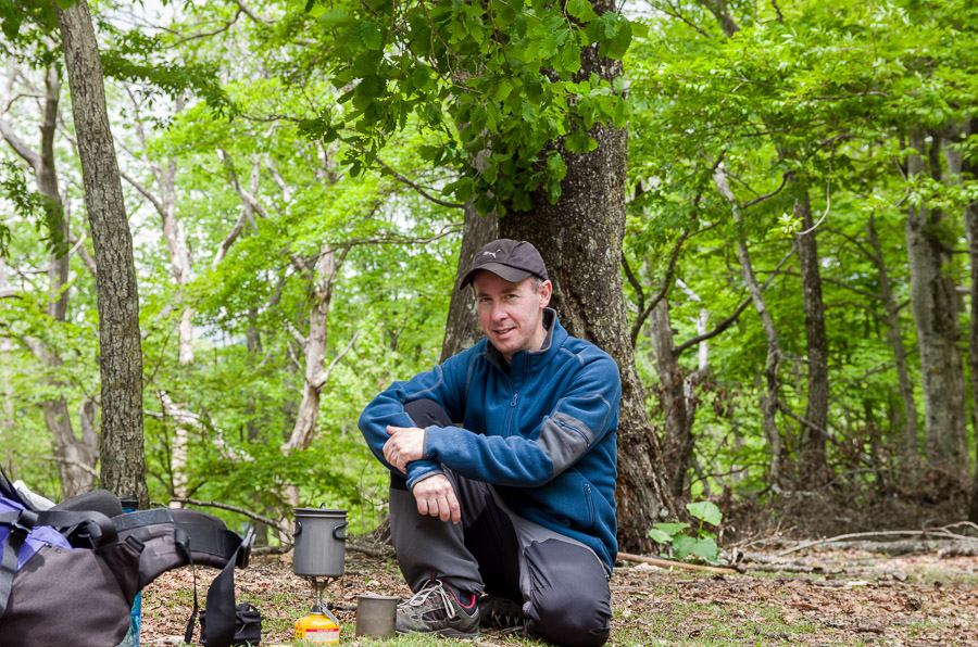
The ridge actually turned out to be surprisingly scenic, especially where it passes through an area of larches near Mt. Kayanoki 榧ノ木山 (1,485 m). The first part has a fairly benign gradient and takes around one hour from the Ishione Ridge trail junction to reach Mt. Kurato 倉戸山 (1,189 m). The summit here has a beautiful grassy field, making it an excellent lunch spot. The final descent to the Kuratoguchi bus stop 倉戸口バス停 starts out pretty steep and becomes more so progressively, so take extra care with your footing. Before you hit the road, which snakes around to the bus stop, look for a small shrine with decent views across Lake Okutama. Buses returning to Okutama Station are few and far between so best to confer with the Nishi Tokyo bus timetable in advance.


Hi, I just wanted to let future readers know that my wife and I did this hike yesterday (Nov 5th) as a day trip from Tokyo (rather than two days). Fantastic hike.
Timing was as follows:
6:46am – Departed Tokyo (Shinjuku Holiday express. Train was packed!)
8:35am – Departed Okutama. Note, they needed 3 full buses for all the hikers that day! But most hikers got off and did other trails north of Okutama.
9:30am – Arrival at trailhead
12:30pm – summit (spent 20 glorious minutes taking in the view – the top of Fuji was not cloud covered, lucky us)
3:10pm – arrival at Kuratoguchi bus stop back to Okutama.
4:18pm – Train departed back to Tokyo
We maintained a steady, but comfortable pace, being able to maintain conversation with limited heavy breathing. Though your calves will definitely be feeling it those first two miles!
Thanks for posting a great hike for us to follow!
Excellent stuff and nice to hear you both got an uninterrupted view of Fuji san from the summit. Thanks for posting your timings, very helpful 🙂
Just to update this one: currently (10 Oct. 2021), the Nippara bus is not running due to typhoon damage. Before any Okutama trip needing buses, it’s always best to phone Okutama Visitor Centre to make sure the bus is actually running. The staff advised me to take the weekend 7.42am bus (#14 Stand 2) to Mizudani (40 mins), which I did. From the Mizudani bus terminus (vending machine, toilets), head uphill for the 3km road walk, with splendid views, to the Sengen Ridge trailhead. There’s a big newish wooden sign for this — you can’t miss it. After 5 mins on trail, you get to a torii, marking the 3.9 km to Takanosu. Now the good news: this route is much easier than the Inamuraiwa Ridge. You have about 1km of steepish ascent til it eases up, then flattens out to reveal a huge shiitake mushroom log farm — this thing is hundreds of metres long, and quite a sight. Continuing, you come to the main water hole on the trail proper, as mentioned in David’s write-up. The refuge cabin is a further 2 mins away. From there, it is 1 km to the summit. From the Sengen Ridge trailhead to the summit is about 1.5 hours. From the summit, choose your route down. The most popular seems to be the 12 km Ishione Ridge to Okutama Station, which I did. If you don’t fancy all that, you can still follow the Ishione Ridge, then turn down to Mizune Bus Stop. The Sengen Ridge route has very few signs, but is easy to follow. A map is a very good idea for this area.
Appreciate the update regarding the bus info. Just a side note, having checked both Nishi Tokyo Bus 重要なお知らせ (Important Notices) and Okutama Visitor Center homepages they make no mention of the Nippara bus not running. I find it a little disconcerting that it would seem the only way to get this information is to actually call them, rather than do the simple thing, that being make such news available in real time. Moving on…starting out from the Sengen Ridge trailhead sounds like more fun than the Inamuraiwa Ridge and would make for a nice autumn hike. Also, at long last I see that the Mugiyama-Ukihashi (floating bridge) has reopened thanks to a rise in water levels.