.
Kitazawa-toge 北沢峠 – Choei-goya 長衛小屋 – Ko-senjogatake 小仙丈ヶ岳
Distance: 11 km
Elevation change: 1003 metres
Highest point: 3033 metres
Start: Kitazawa-toge
Finish: Kitazawa-toge
Difficulty: ▅▅▅▅▅▅▅▅▅▅ ❹
Map: Yama to Kogen Chizu 山と高原地図 [No.44 北岳・甲斐駒 KITA-DAKE·KAIKOMA]
GPX TrackKML TrackGSI MAPPDF Topo Map
Senjogatake: The Queen of the Southern Alps
Senjogatake is a majestic Hyakumeizan peak in the Southern Alps, renowned for its impressive cirques that have earned it the nickname “The Queen of the Southern Alps”. It’s a popular choice for hikers tackling their first 3,000-metre mountain. Thanks to the high trailhead at Kitazawa-toge (around 2,000 metres), the elevation gain to the summit is only about 1,000 metres – making it one of the more approachable climbs among Japan’s 3,000-metre-class peaks, despite the Southern Alps’ reputation for remote and difficult mountains. Access, however, has become less convenient in recent years, and if you’re coming by public transport, you’ll likely need to dedicate one day to travel and start your hike the following morning.
Day 1: Reaching Kitazawa-toge and Camping by the River (0 km)
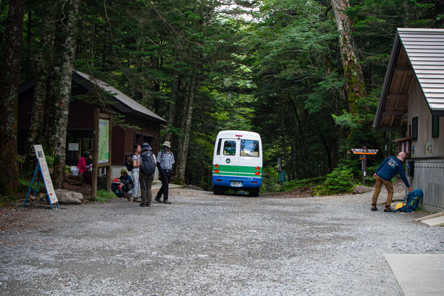
Getting to the trailhead has become more of a mission, as the road from Hirogawara to Kitazawa-toge 北沢峠 has remained closed due to landslide damage from Typhoon Hagibis in 2019. These days, reaching Kitazawa-toge means taking the Chuo Main Line to Chino Station 茅野駅 and transferring to the JR Southern Alps Geoliner 南アルプスジオライナー bound for Todai Park 戸台パーク. For 2025, the service runs from July 18 to October 13 on Fridays and weekends, and daily from August 1 to 11. The bus departs at 10:40 from the stop in front of the Koban on the west side of Chino Station, arriving at Todai Park at 11:45 (1,800 yen). Tickets can be purchased online or paid in cash on board – no reservations required.
If you’re traveling on a weekday, the only option is to take a local bus from Inashi Station 伊那市駅 on the JR Iida Line, transferring at Takato. As this route requires three separate buses, it’s difficult to recommend unless you’re coming from the Nagoya direction. For those driving, there’s a large car park at Todai Park where you can leave your vehicle for up to five days for just 1,000 yen.
Since I wasn’t starting my hike until the following day, I took local trains to Chino, arriving about 30 minutes before the scheduled bus departure. Unsurprisingly, there was already a good number of hikers waiting in line, but I managed to snag a seat, while a few latecomers ended up standing for most of the ride. After getting off at Todai Park, drop your pack in the queue and head inside to purchase a shuttle bus ticket from the vending machine (2,740 yen return). There are six shuttle buses a day, starting at 5:30 am.
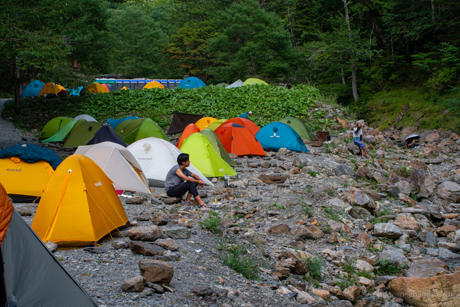
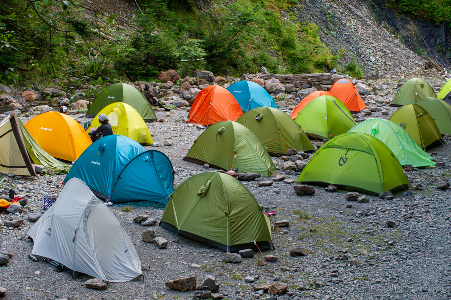
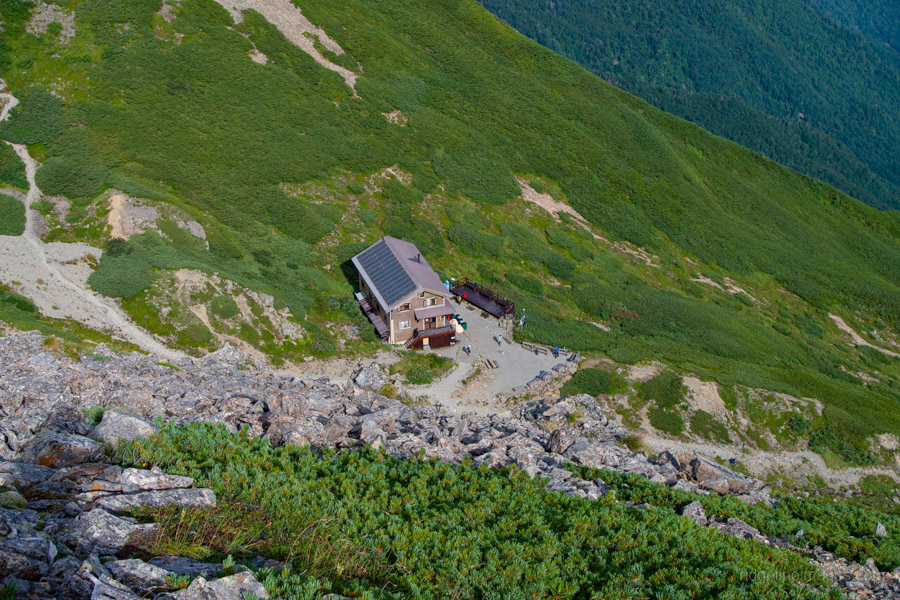
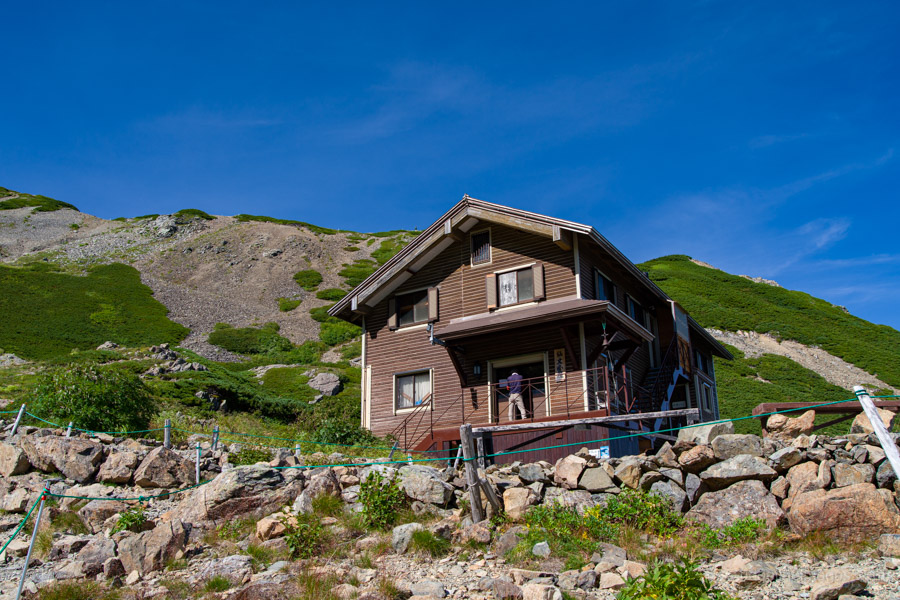
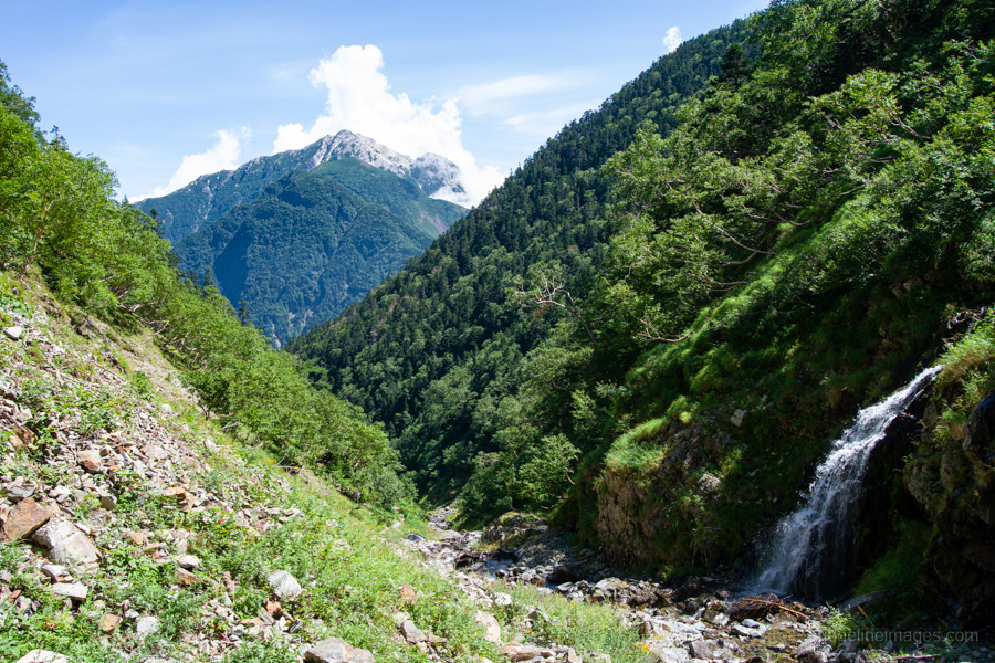
After leaving home at 6:30 am, I finally reached Kitazawa-toge a little after 1 pm. Even if you’re driving, the earliest you can start walking is around 6:30 am, which – especially in summer – feels rather late given the heat. From Kitazawa-toge I headed down to Choei-goya 長衛小屋 to pitch my tent. Sites there are first-come, first-served and cost 1,000 yen. The campsite is quite spacious, which is fortunate given its popularity, as it also serves hikers heading for Mt. Kaikoma. Many people climb these two mountains on consecutive days, though if you’re up for more of a challenge, I’d recommend tackling Mt. Kaikoma via the Kuroto Ridge, which sees far fewer hikers.
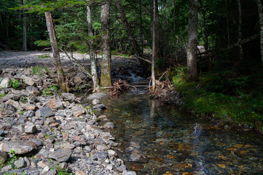
The highlight of this campsite is its location beside a clear, fast-flowing river, with what looks like a dammed-up section near the back where hikers can take a dip. After finding a shaded spot, I spent much of the afternoon with my feet dangling in the water, brewing a cuppa, and napping in the cool shade.
Day 2: Climbing Senjogatake and Returning via Yubusawa (11 km)
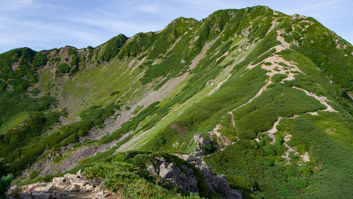
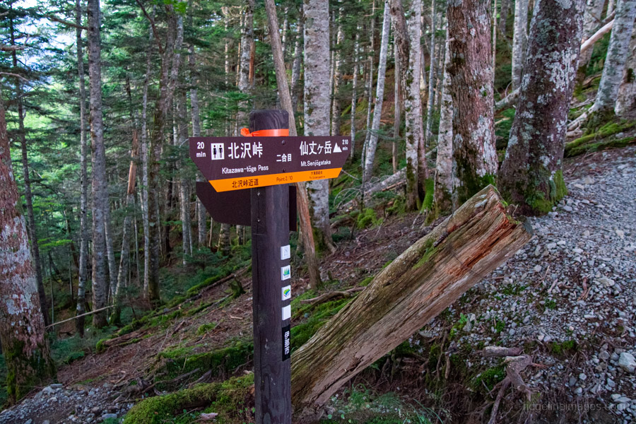
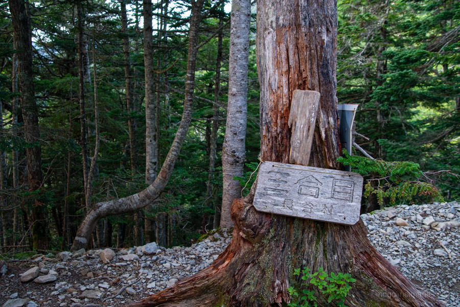
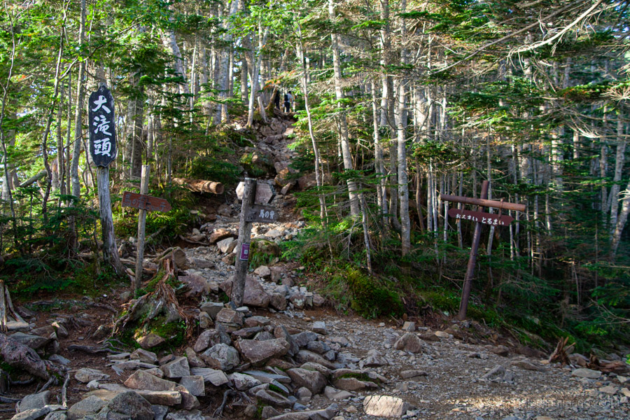
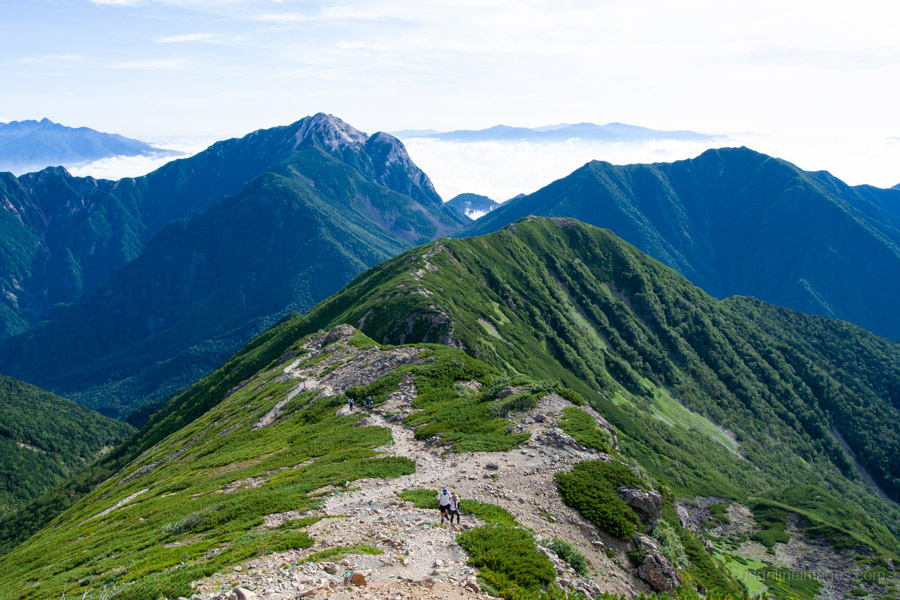
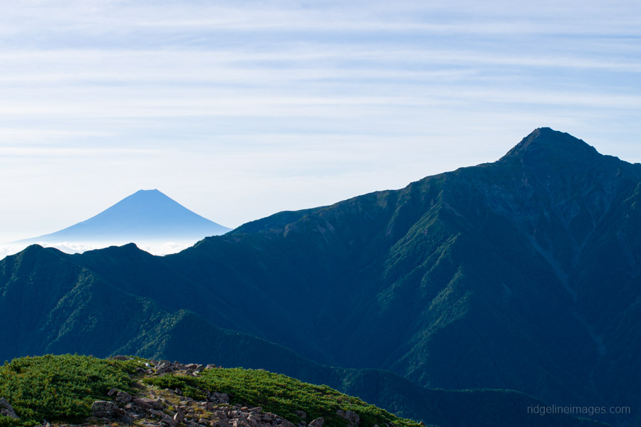
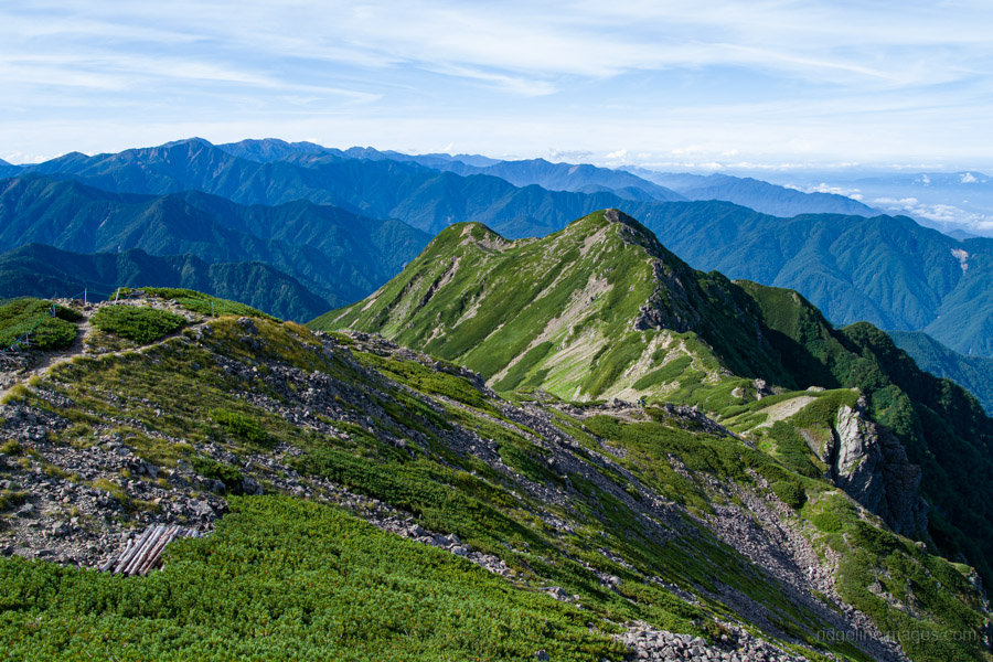
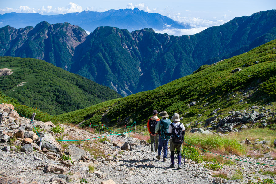
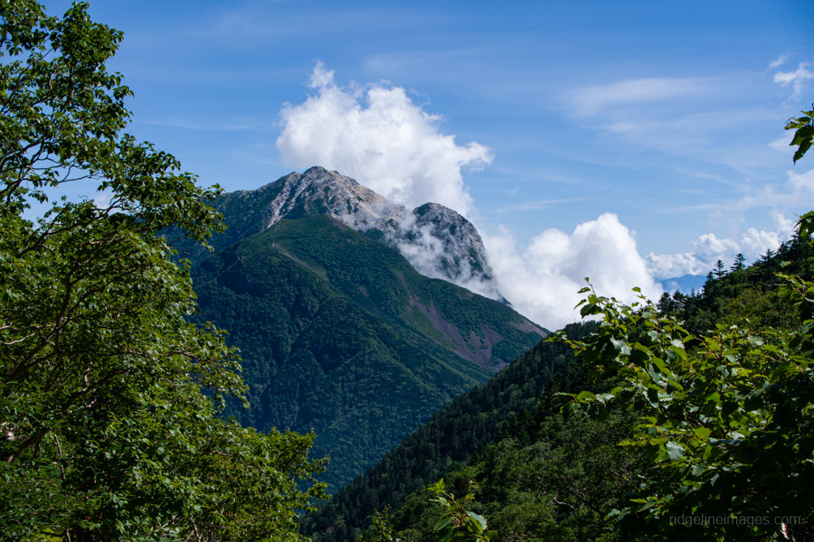
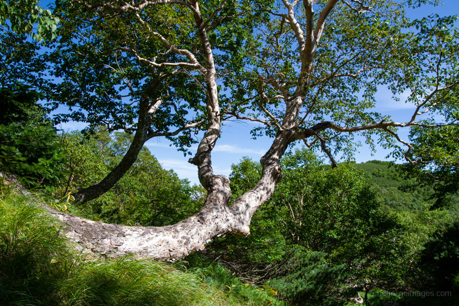
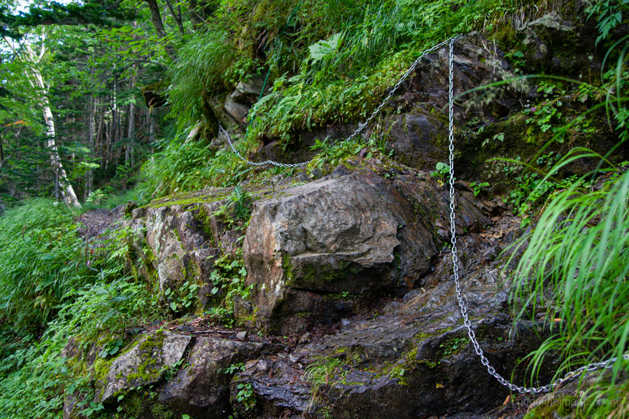
I drifted off to sleep quickly to the sound of the stream and woke to clear skies. The forecast, however, called for another hot day, so after fuelling up, I left the campsite promptly at 4:30 am. The trailhead proper is a short walk back up to the gravel road, starting on the opposite side of a rough-hewn bridge. From here, the trail climbs steadily through dense primeval forest for about 30 minutes to the 2nd stage 二合目, where it meets the route coming directly up from Kitazawa-toge. Continuing along the gentle ridgeline, you eventually reach the 5th stage 五合目, where a junction appears – the left fork offers the best views. Not long after this point, you finally break through the treeline and begin to take in some magnificent scenery: Mt. Kaikoma rising behind, Fujisan off to the left, and even the jagged pinnacle of Yarigatake visible in the distance.
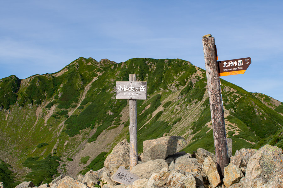
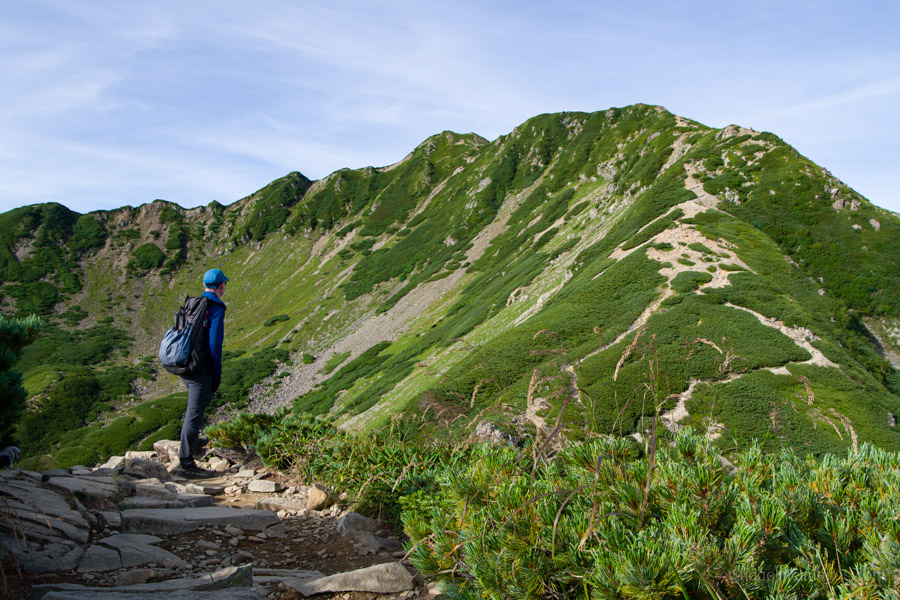
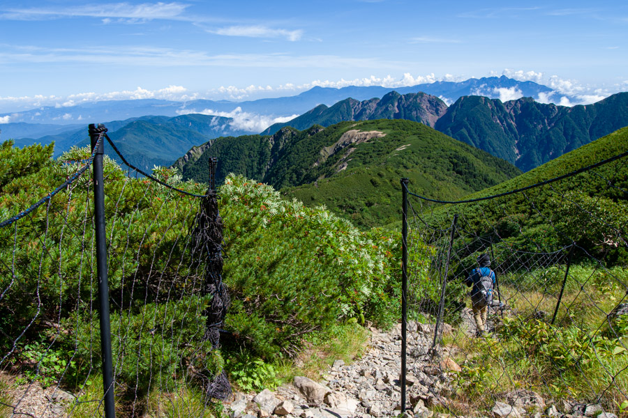
Down below you can spot Choei-goya, the starting point, and across the valley sits Umanose Hut, which I would pass later on the way down. Looming directly ahead, however, is Ko-senjogatake 小仙丈ヶ岳 (2,864 m), the forerunner of Senjogatake. At first glance it looks like a gentle rise, but in reality it’s a surprisingly steep ridge. This area is dotted with nanakamado (Japanese rowan) trees, their bright red berries standing out against the green. From Mt. Kosenjo, there’s a magnificent view of the Ko-Senjozawa Cirque, one of three glacial cirques carved into the mountainside. Beyond this point, the trail continues along a mostly flat ridge lined with Japanese creeping pine, with the occasional bit of rock scrambling.
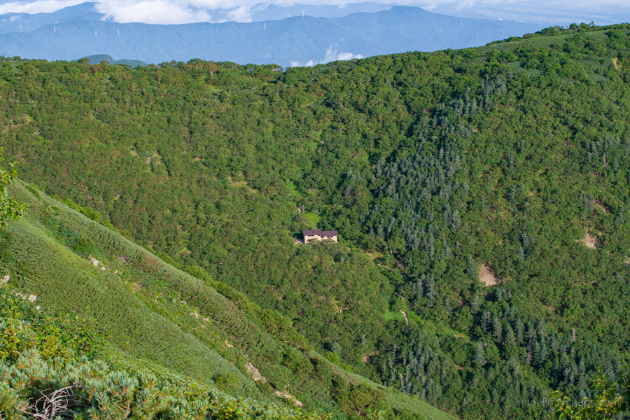
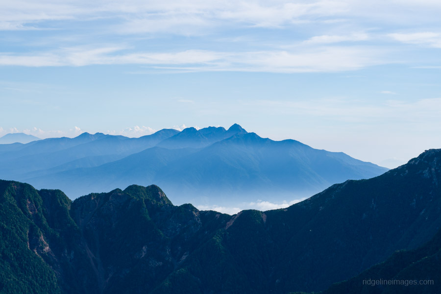
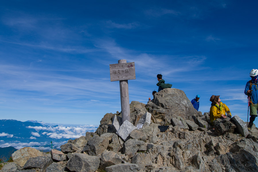
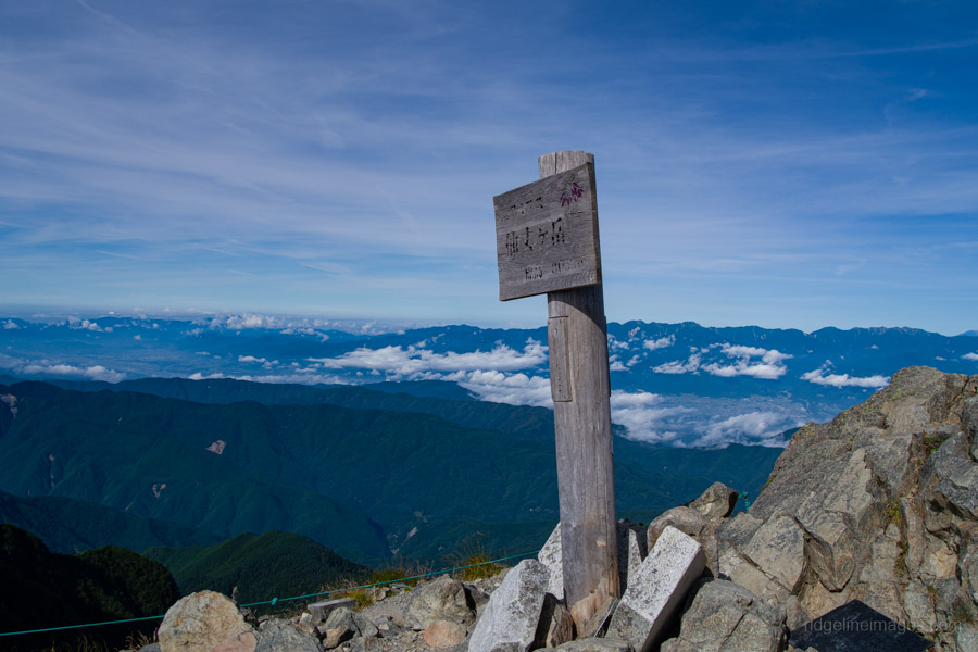
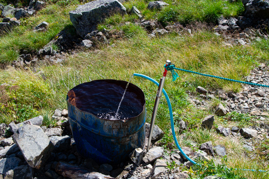
The summit of Mt. Senjogatake 仙丈ヶ岳 (3,033 m) is shaped like a horseshoe, enclosing the Yabusawa Cirque. The ridge makes a wide curve toward the top, with Senjo-goya 仙丈小屋 sitting just below. From the campsite, it took me about three and a half hours to reach the summit. The reward is a sweeping 360-degree panorama stretching almost the entire length of the Southern Alps. If you want to extend the hike a little, consider an out-and-back to nearby Daisenjogatake 大仙丈ヶ岳. After soaking in the views, head down to Senjo-goya, which makes a great spot for a rest on the benches and has a reliable water source a short way below the hut.
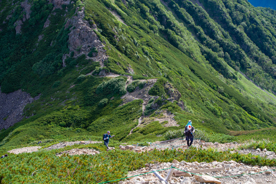
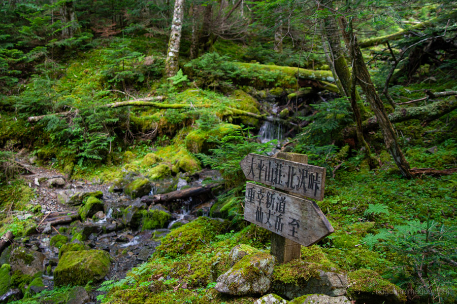
Continuing down the trail, veer right at the fork to reach Umanose-hyutte 馬の背ヒュッテ, a small hut beside the Yubusawa stream. From here, instead of cutting back across to the main ridge trail as most hikers do, continue following the Yubusawa – I only passed a handful of people along this section. The path on the left bank is rough and gravelly, but it passes a decent-sized waterfall on the way down, and about halfway along there’s a log bridge crossing. After the final stream crossing, it’s only a short walk to Ohira Sanso 大平山荘, followed by another fifteen minutes back to Kitazawa-toge.
After returning to the campsite, I had time for lunch and a few hours of rest before catching the shuttle bus back to Todai Park. The return JR bus unfortunately doesn’t leave until 17:00, arriving at Chino Station around 18:15 where I grabbed a bite to eat before hopping on the Asuza back to Tokyo.


Nice!
I’m jealous. It’s looking like the calendar won’t allow me an overnight this summer.
The views were great, but gosh it was hot by mid-morning. I’m already looking forward to some cooler autumn hikes.
Not even just one overnighter? That’s too bad.
I’m really impressed with your ability to keep trucking through the summer. I know it’s cooler up top, but I can’t help but go to ground until mid-September. Autumn can’t come soon enough!
I hear you! I was just grateful I didn’t have to start hiking right after arriving at Kitazawa-toge, and getting a good chunk of the climb done in the early hours while it was still bearable made all the difference.