.
Mt. Imakuma 今熊山 – Mt. Kariyose 刈寄山 – Kongo Falls 金剛の滝
Distance: 13.7 km
Elevation change: 447 metres
Highest point: 687 metres
Start: Imakumasan Tozanguchi Bus Stop
Finish: Musashi-Itsukaichi Station
Difficulty: ▅▅▅▅▅▅▅▅▅▅ ❷
Map: Yama to Kogen Chizu 山と高原地図 [No.25 奥多摩 OKUTAMA]
GPX TrackKML TrackGSI MAPPDF Topo Map
Terrific Beginner-Friendly Trail Close to Tokyo
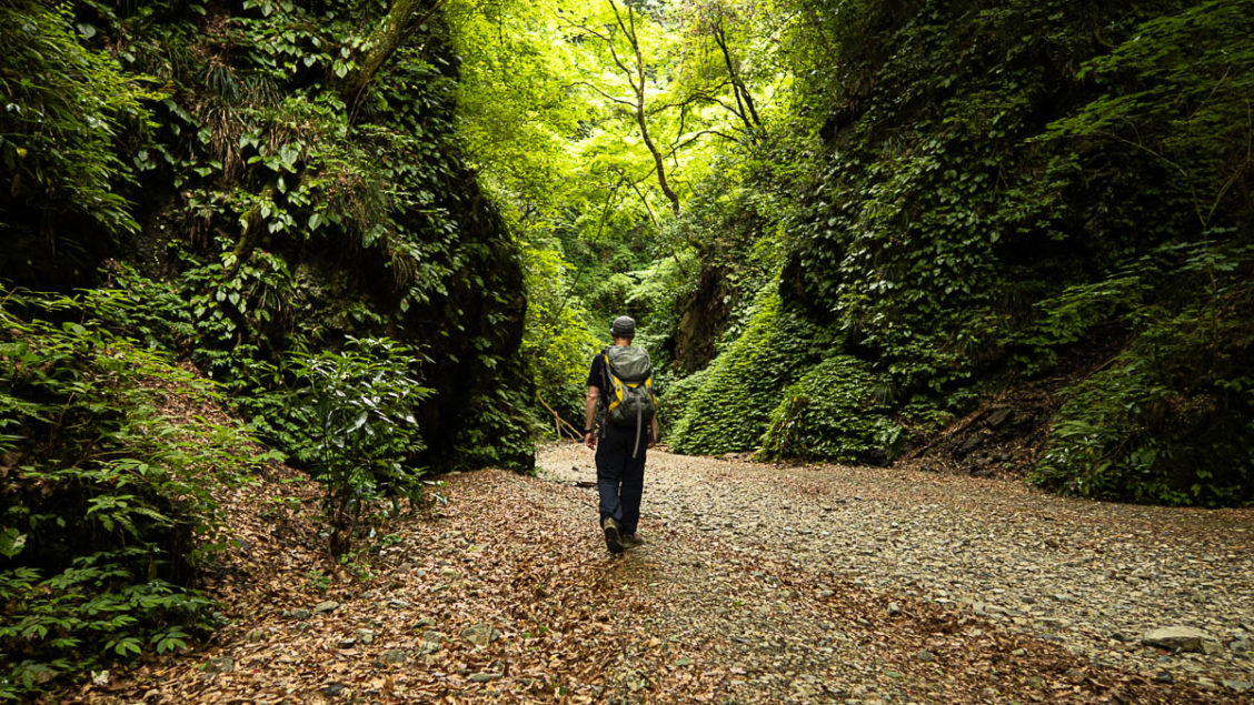
If you’re after a nature fix close to downtown Tokyo this hike to Mt. Kariyose in Akiruno City may fit the bill. The hike is well signposted and apart from some tightly laced switchbacks down to the Kongo Falls it is suitable for most people who have a basic fitness level. As the hike falls under the 1,000 metre ceiling make an early start during the hotter months to dodge the midday heat. For the record I caught the 06:25 bus and was back at the station around 13:00.
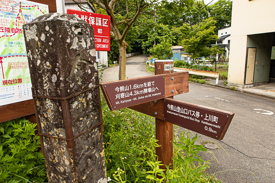
The easiest access to the trailhead is by taking a bus (bus stop no.2) from outside Musashi-Itsukaichi Station getting off at Imakumasan Tozanguchi 今熊山登山口 (6 mins, 220 yen). Forgoing the bus adds an extra 3 km of road side walking. From the bus stop mosey back up the road turning left at a large stone pillar engraved with the Imakumasan Shrine 今熊山神社入口. The trailhead proper begins just over a kilometre further along this road below the aforementioned shrine.
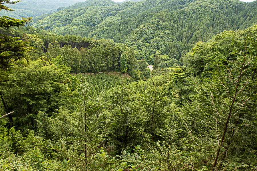
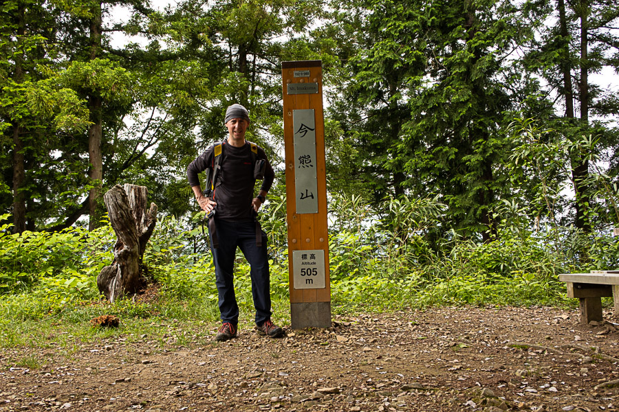
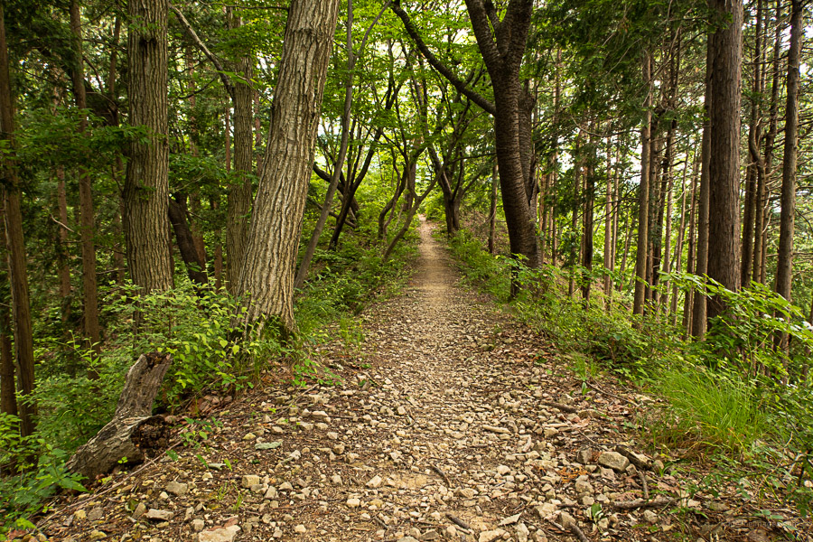
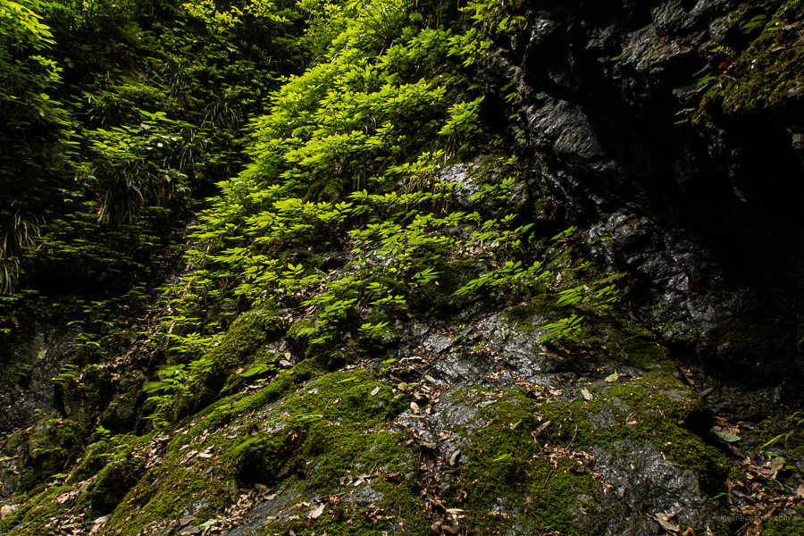
It takes 40 minutes to reach Mt. Imakuma 今熊山 (505 m) a short 100 metre detour from the main trail which also retains the upper shrine. Just before the summit there is a clearing with restroom facilities. From here it’s another 3 km across to Mt. Kariyose 刈寄山 (687 m). Some tracks of forest are quite serene providing a real sense of being deep in the mountains. At a couple of spots, you can make a traverse to skip a small peak. The only distraction to the stillness is intermittent clatter coming from a distant limestone quarry but thankfully soon forgotten.
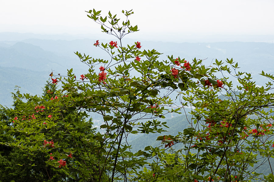
Just before reaching Mt. Kariyose the trail passes through a logging area with an option to tackle a longer loop hike via Mt. Ichimichi 市道山 or even further afield to Mt. Jinba 陣馬山 finishing at Wada-toge, although allow 7 hours for this latter daytrip. While the summit is somewhat hemmed in you can expect a mighty view back towards Tokyo in fine weather.
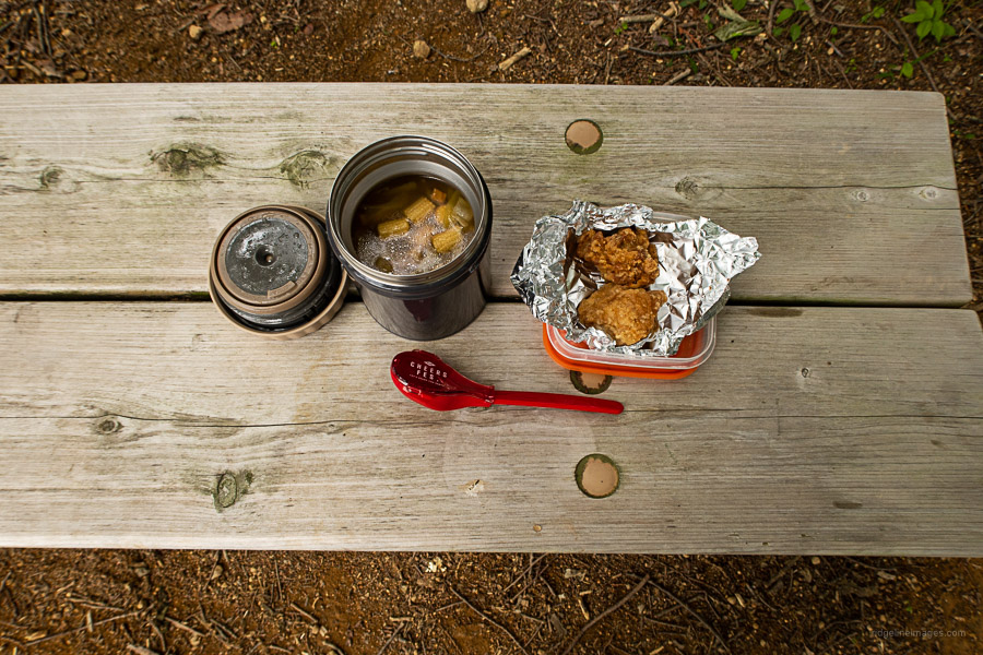
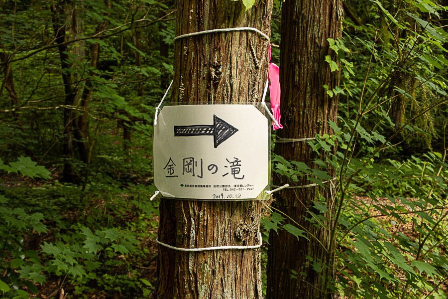
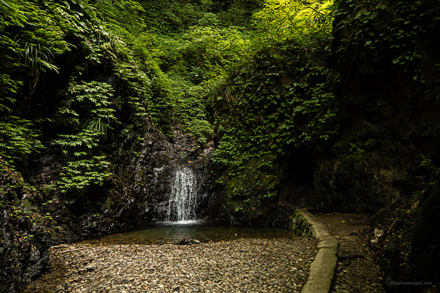
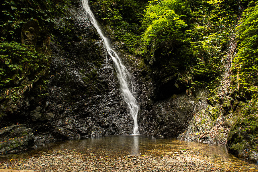
After wolfing down some homemade soup and fried chicken I was back on the trail. If you don’t wish to retrace your footsteps back to the Shrine, one option is to descend to a minor road which takes you to the Sawadobashi Bridge 沢戸橋. It’s marked as a dotted line and steep so perhaps best tackled heading up rather than down. When you return to the shrine the trail to the Kongo Falls 金剛の滝 commences on the opposite side. Take care with your footwork as some sections leave little room for error.
The wide, flat valley that ushers you to the falls was just as stunning as I remember from my first visit a couple of years back. It’s certainly one the prettiest forests I’ve seen this close to Tokyo. I also felt fortunate to have it all to myself. The upper falls are accessible via a chiselled-out rock passage. When you’re ready to head off, return to the trail junction, turn left and start heading up. The trail follows above an electrical substation eventually reaching Komine Park 小峰公園. From the outermost perimeter of the park it takes 20 minutes to reach the Komine Visitor Center, followed by a further 25 minute walk back to Musashi-Itsukaichi Station along the Akikawa-Kaido.