.
Naguri Lake 名栗湖 – Mt. Makinooyama 槙ノ尾山 – Mt. Bonomine 棒ノ峰山
Distance: 11.2 km
Elevation change: 736 metres
Highest point: 969 metres
Start: Sawarabi-no-Yu Bus Stop
Finish: Sawarabi-no-Yu Bus Stop
Difficulty: ▅▅▅▅▅▅▅▅▅▅ ❸
Map: Yama to Kogen Chizu 山と高原地図 [No.25 奥多摩 OKUTAMA]
GPX TrackKML TrackGSI MAPPDF Topo Map
Battling Up The Sengaku Ridge
Slap-bang between Shomaru Station (Seibu Chichibu Line) to the north and Kawai Station (JR Ome Line) to the south, you find the charming Naguri Village 名栗村. Nestled in the footsteps of some overarching mountains, the town provides a distinct contrast to neighbouring Ome City and is the kickoff point for this hike.
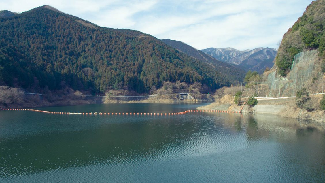
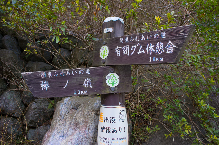
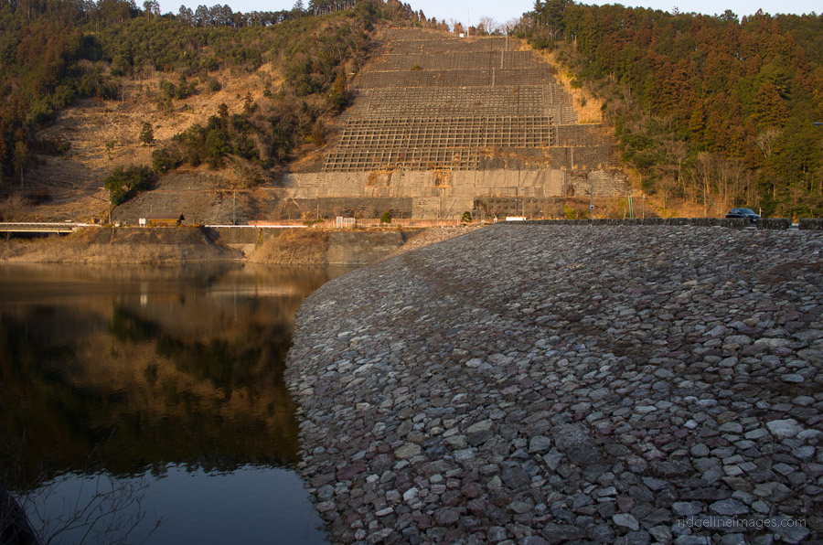
Getting to the start of this walk entails taking a bus from Hanno Station 飯能駅 to Sawarabi-no-Yu さわらびの湯 which takes approximately 50 minutes. From the bus stop, look for a sign pointing towards the Arima Dam 有間ダム which steers left over the bridge and onwards towards Naguri Lake 名栗湖 a further 1 km.
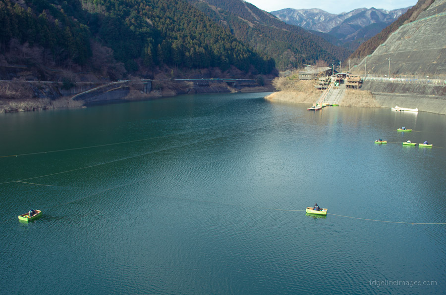
From the Arima Dam, you are afforded a good view up through the valley, with only some over-engineered concrete mountainsides to blemish the vista. The walk grips the northern edge of Naguri Lake and passes the iconic Naguri Canoe Aelier a traditional canoe builder which knocks together some rather nifty handmade water vessels. From here, the walk to the Ochiaibashi Bridge and Arima Fishing Place, located near the trailhead takes around 45 minutes. Reaching the river, you can find a sign directing you towards Mount Bonomine 棒ノ峰山 (kanji variants: 棒ノ折嶺、棒ノ嶺).
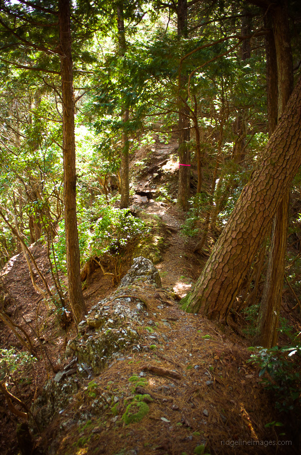
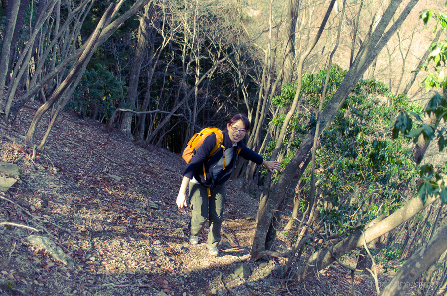
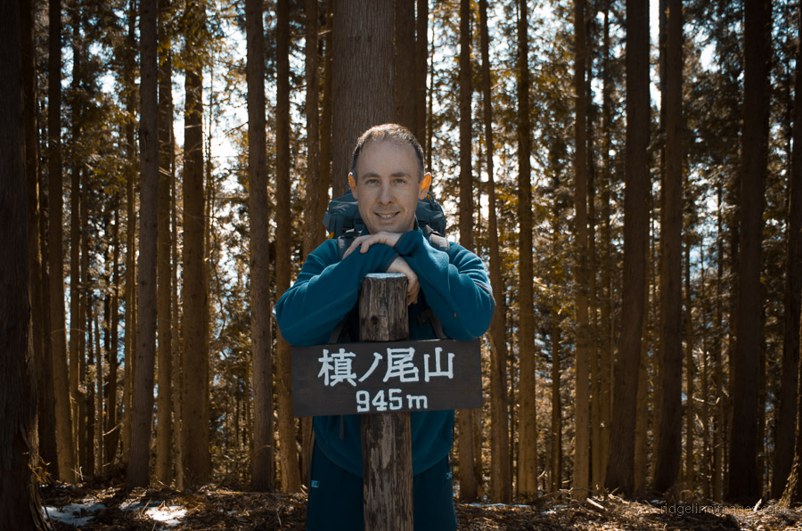
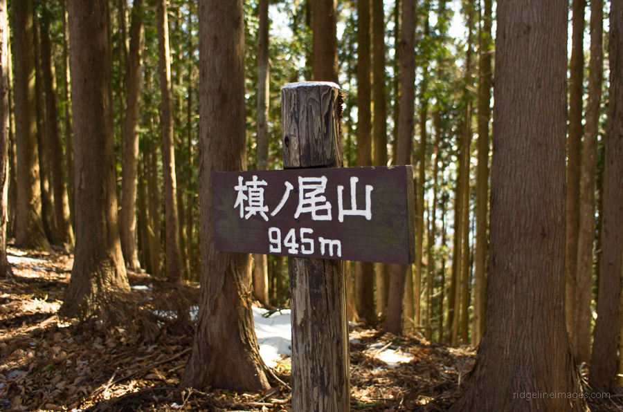
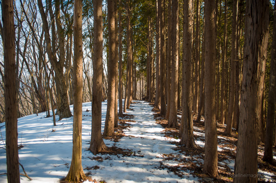
The walk itself starts with a take-no-prisoners approach as it steeply winds out of the sugi forest leaving you at times feeling a tad exposed. The Sengaku Ridge 仙岳尾根 is mostly well marked, though it doesn’t appear to receive a lot of foot traffic, and is best described as one long goat trail until the upper reaches, where it eventually opens out onto a forestry road. The last section involves a moderately difficult scramble through brush leading to the top ridge and eventually Mt. Makinooyama 槙ノ尾山 (945 m), providing a sheltered lunch spot.
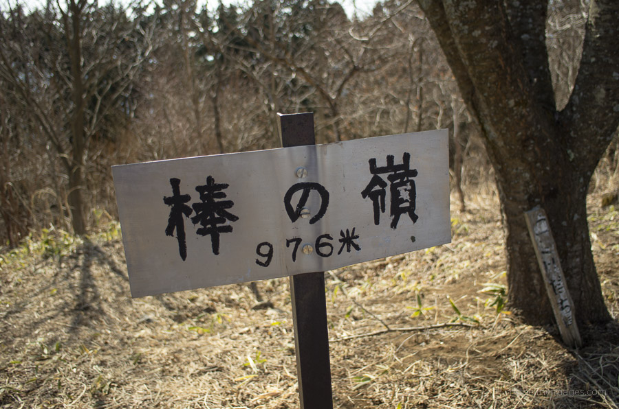
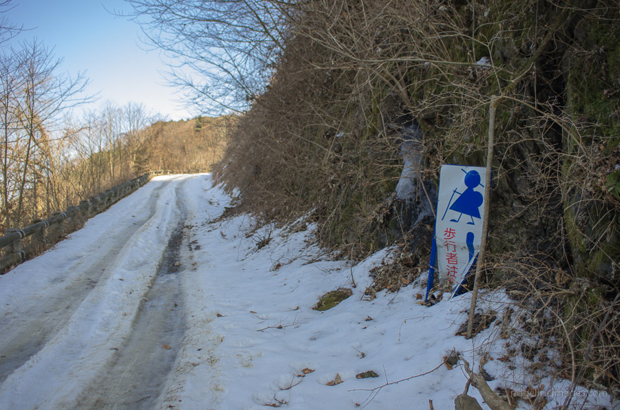
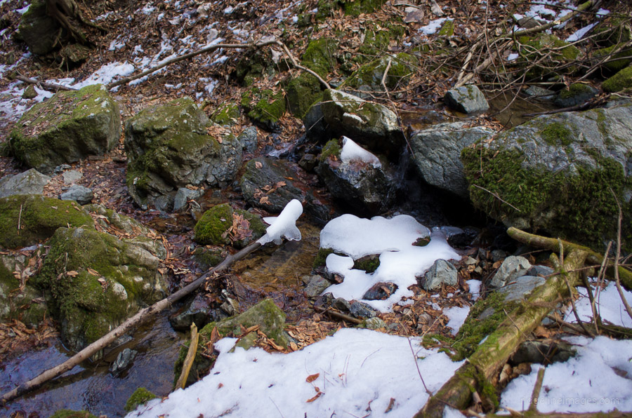
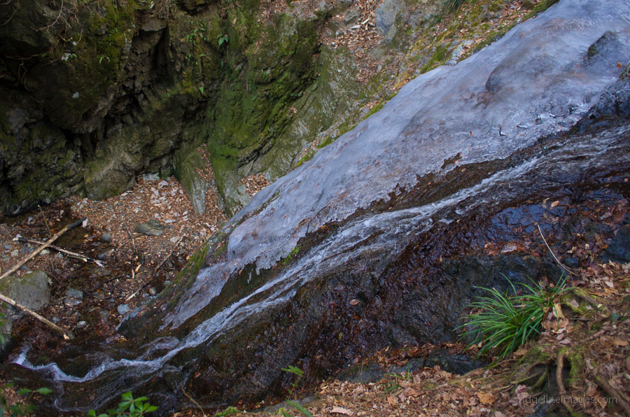
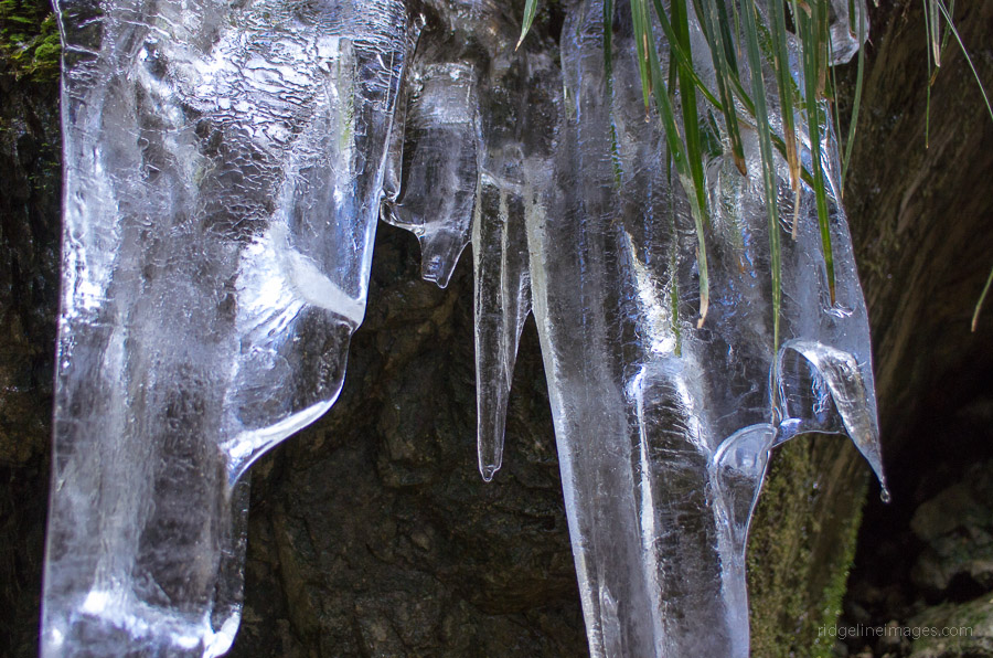
After lunch, it was a further 20 minutes across to Mt. Bonomine 棒ノ峰 (969 m) whose wind-swept top yields generous views towards Niigata and downtown Tokyo. With most of the exposed snow having melted, the area resembled a morass of gooey mud, ready to make a quick reckoning of any boots venturing forth. After cleaning off said debris, we were ready to head down to Gonjiri Pass ゴンジリ峠 where the option exists to head directly back to the Bus Stop or to follow the scenic Shirayazawa Creek, which has carved out an impressive gorge. Choosing the latter made for a pleasant route back to Naguri Lake following The Kanto Fureai Trail 関東ふれあいのみち was somewhat time-consuming due to the precarious snow and ice on the trail.


I recently did this hike in reverse of what is recommended. The section of the road that grips the northern side of the Naguri Lake is currently closed. In other words, you can walk to a certain point, but there are signs stating that you cannot go through all the way. Thus, when I came down the Sengaku Ridge and walked along the road, I had to take the road that goes around the southern side of the Naguri Lake.
It was tough hike for this beginner, but I appreciated the ruggedness of the trails. I did get somewhat lost going down the Sengaku Ridge. A sign seemed to point into the forest rather than indicating to continue down the ridge. I took it and lost the trail due to the huge amount of fallen leaves on the ground. Rookie mistake. I should have continued to follow the map you provide and head straight down the ridge. I’m going again in a week with my two teenage kids. I won’t make that mistake again.
Thanks for the info regarding the road closure on the north side of the lake. It’s been a while since I tackled this hike. A few years ago, I passed the Makinooyama trail branch on a ridge hike to Mt. Tenmoku. This ridgeline doesn’t see many hikers and is also an alternate but longer approach to Mt. Kawanori.
Here’s one:
Hanno Station to Nago Bus Stop. Hike to Mt. Warabi. Descend to Sawarabinoyu Onsen (Naguri Lake) Bus back to Hanno Station. Did this in winter w/ some snow. Nice hike.
It’s on the Hanno City hiking map, available from Hanno Station Tourist Office
Thanks for the tip. Would you believe it for my hike today I was tossing up between Mt. Warabi and Mt. Kukiyama I ended up going for the latter owning to a chance of some good Fujisan views which there were plenty.
Warabi — Nago Bus Stop : toilet facilities, vending machines for water nearby. Likely you’ll see no-one on the ascent. Some ropework around rocks (not too bad) on one section. Coming down, really pleasant forest stroll. You should meet some hikers here who piston Warabi from the lake. At Sawarabi , the main food shop has a fridge full of Carvaan craft beer (Hanno brewery). Very nice !
I took a shorter loop course crossing the dam and using the Shirataniza Trailhead (from the Seibu site: https://www.seiburailway.jp/railways/hiking/kenkyaku/bounomine/index.html) . It followed a stream for the ascent with a lot of rocks and boulders, with chains and ropes in some places. It could be tough if wet. The trail for the descent had a lot of tree roots, so you had to be careful with your footing. Overall, a nice little climb and hike. As some other posters mentioned their beer, I had some Carvaan beer at their pub at Hanno Station.(Jan 11, 2025)
I’ve heard great things about Carvaan and hope to visit sometime—especially when the weather warms up, and you can relax on the balcony with a few quiet ales!