.
Karasawa Junction 涸沢分岐 – Hanadate 石楠立 – Mt. Banjiro-dake 万二郎岳
Distance: 9 km
Elevation change: 366 metres
Highest point: 1,406 metres
Start: Amagi juso tozanguchi Bus Stop
Finish: Amagi juso tozanguchi Bus Stop
Difficulty: ▅▅▅▅▅▅▅▅▅▅ ❸
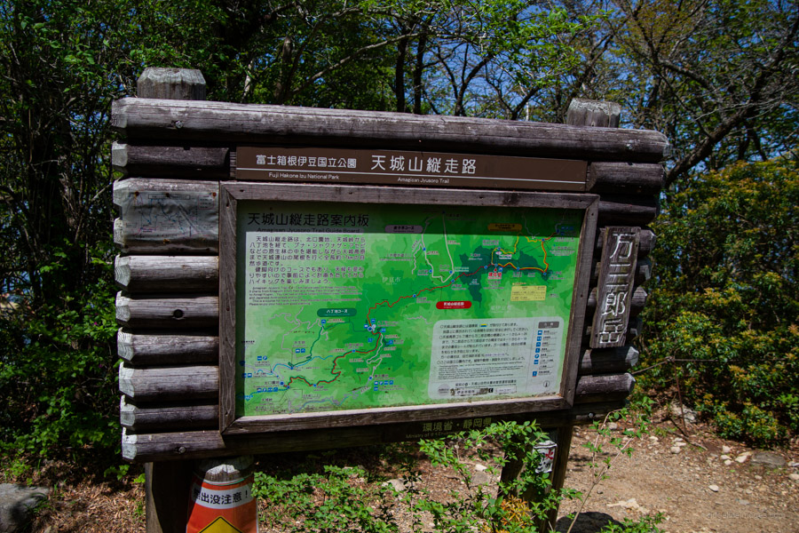
Map: Yama to Kogen Chizu 山と高原地図 [No.23 伊豆 天城山 IZU]
GPX TrackKML TrackGSI MAPPDF Topo Map
Mt. Amagi’s Shakunage Loop: Beech Forests & Blooming Rhododendrons
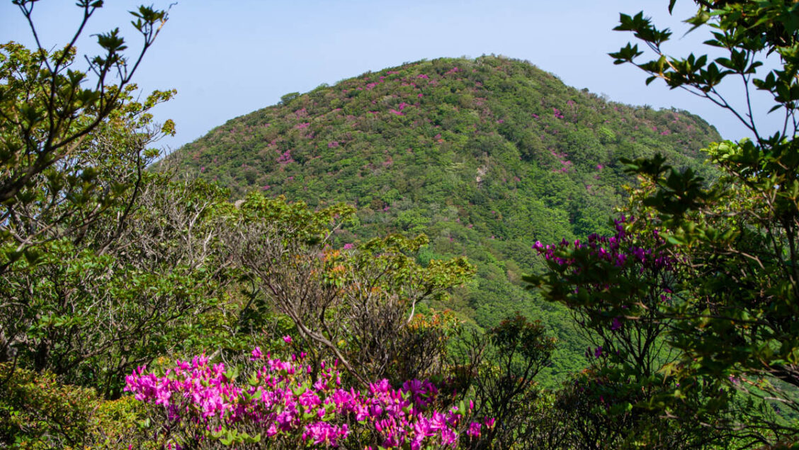
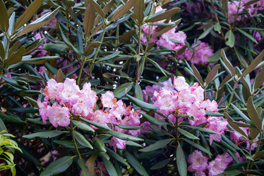
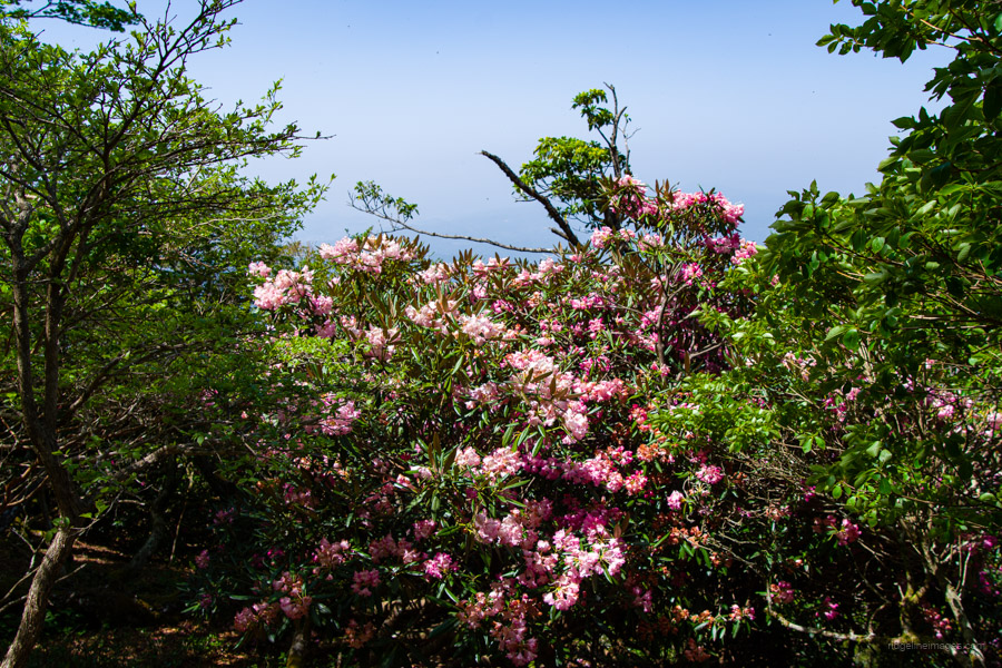
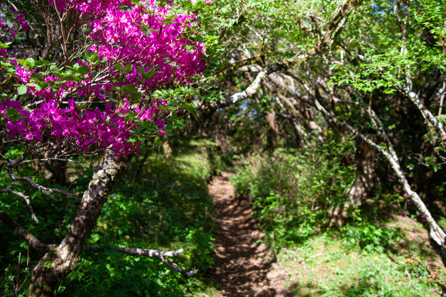
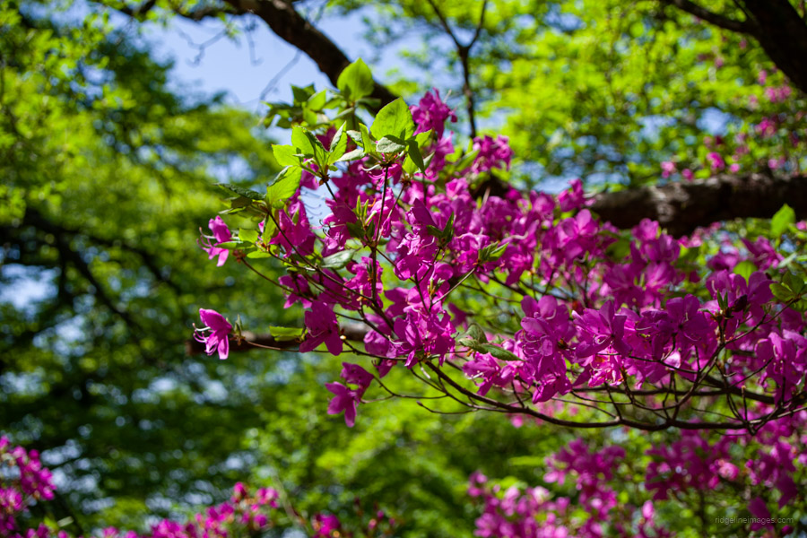
Mt. Amagi is the collective name for a mountain range located in the central part of the Izu Peninsula in Shizuoka Prefecture. It is one of Japan’s 100 most famous mountains and is known for its mossy primaeval beech forests and a species of rhododendron that grows only on the Izu Peninsula. This range also includes the highest peak on the peninsula. While views along the hike are limited, it attracts hikers year-round, with peak popularity from mid-May to early June when the pink-hued Amagi-shakunage rhododendrons are in bloom. Whether this modest mountain range deserves its place among the Hyakumeizan is up for debate – but what’s beyond doubt are the magnificent, ancient beech trees encountered along the hike.
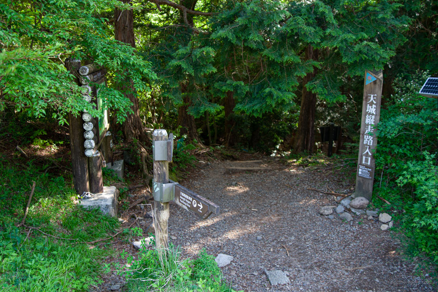
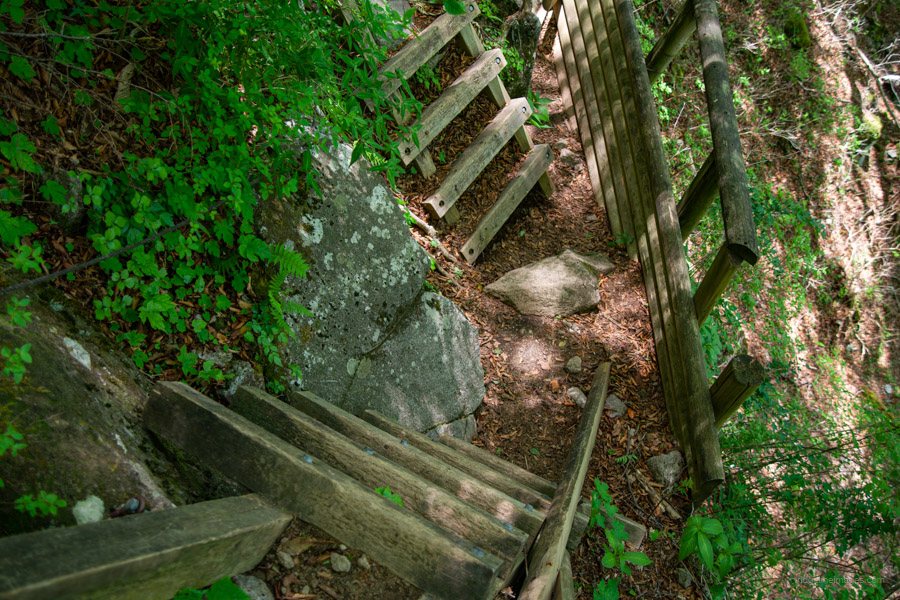
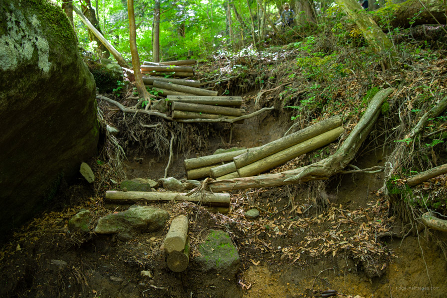
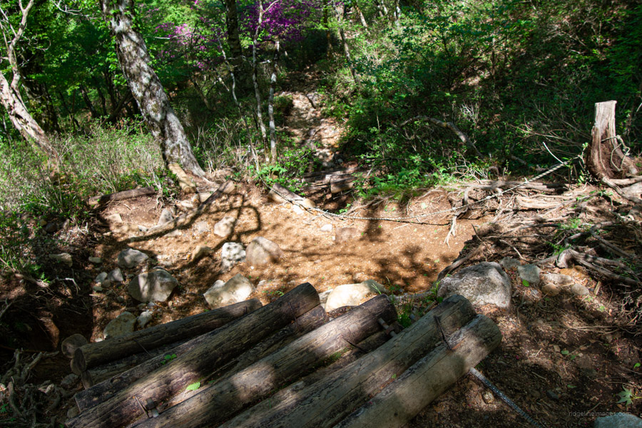
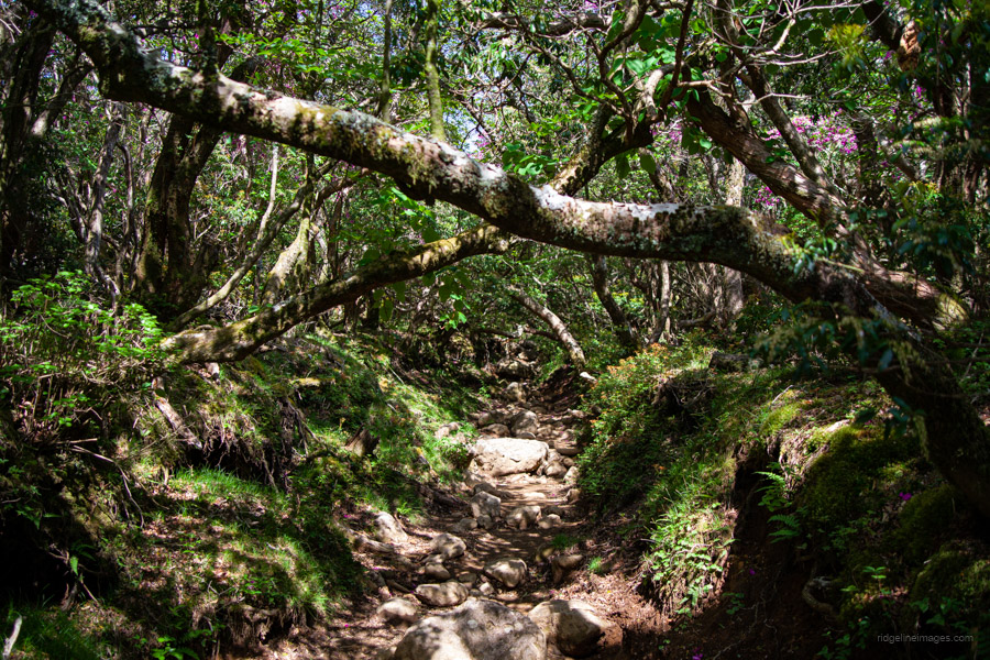
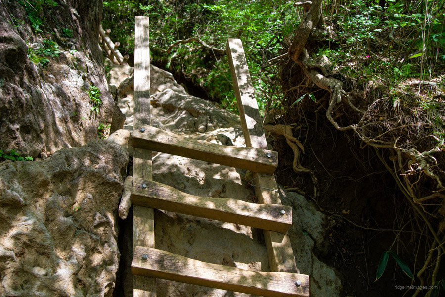
This loop hike, known as the Shakunage Course シャクナゲコース, starts and finishes at the Amagi-Kogen Golf Course. The trail is very well marked and only steep in a few sections, making it a suitable option even for beginners. Ropes cordon off sections of the trail to prevent hikers from straying. Unfortunately, due to the mountain’s popularity, there is significant trail erosion – particularly along the main route to Mt. Banzaburo. For those looking for something longer, the Amagisan Juso Trail offers a 17-kilometre traverse from Amagi Pass through Hacho Pond to the Amagi-Kogen Golf Course.
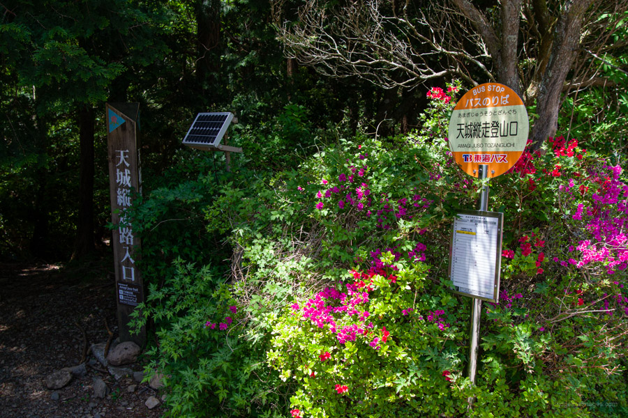
The quickest way to reach the trailhead is to take the Shinkansen from Tokyo Station to Atami Station, then transfer to the JR Ito Line and get off at Ito Station 伊東駅. The journey from Tokyo takes about 1 hour and 20 minutes and costs 4,070 yen. At Ito Station, turn left after exiting and head over to bus stop No. 2 to catch a bus bound for Amagi-kogen Golf Course 天城高原ゴルフ場. The bus ride takes approximately 55 minutes and costs 1,340 yen; IC cards are accepted. The actual final bus stop – and where you should get off – is Amagi-juso-tozanguchi 天城縦走登山口.
I took the 10:15 am bus, though there is an earlier one at 7:55 am. Note that on weekdays, there is only one afternoon return bus service, departing at 4:45 pm. On Saturdays, an additional service runs at 3:20 pm during peak periods: Golden Week (April 27–May 2), summer (July 27–August 15), and New Year’s (December 30–January 2). In winter, the bus only runs as far as Sky Hills スカイヒルズ下, which is about 3 kilometres shy of the main trailhead. The restrooms are located next to the trailhead carpark.
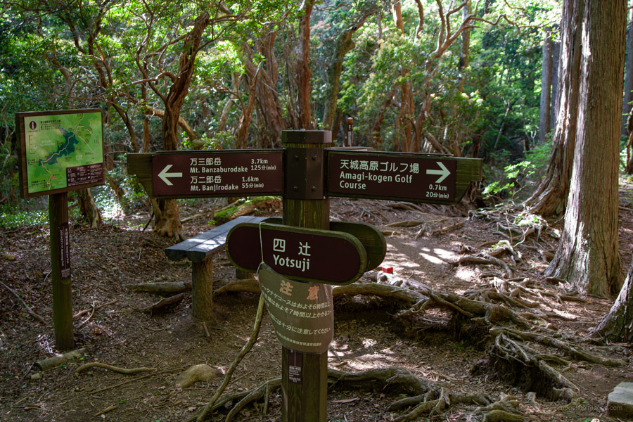
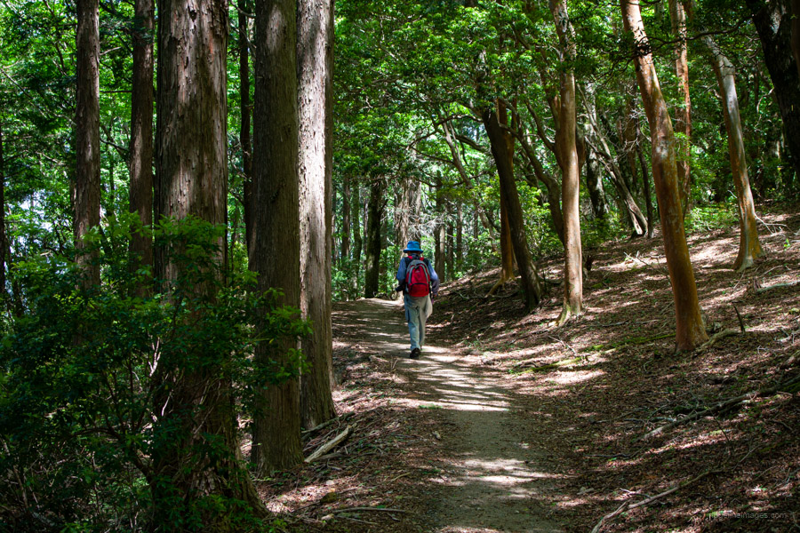
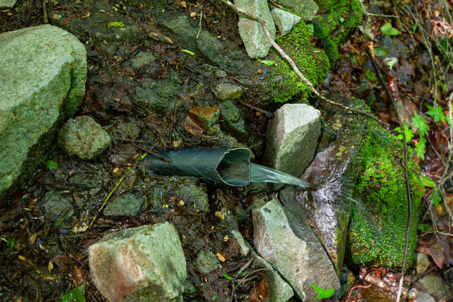
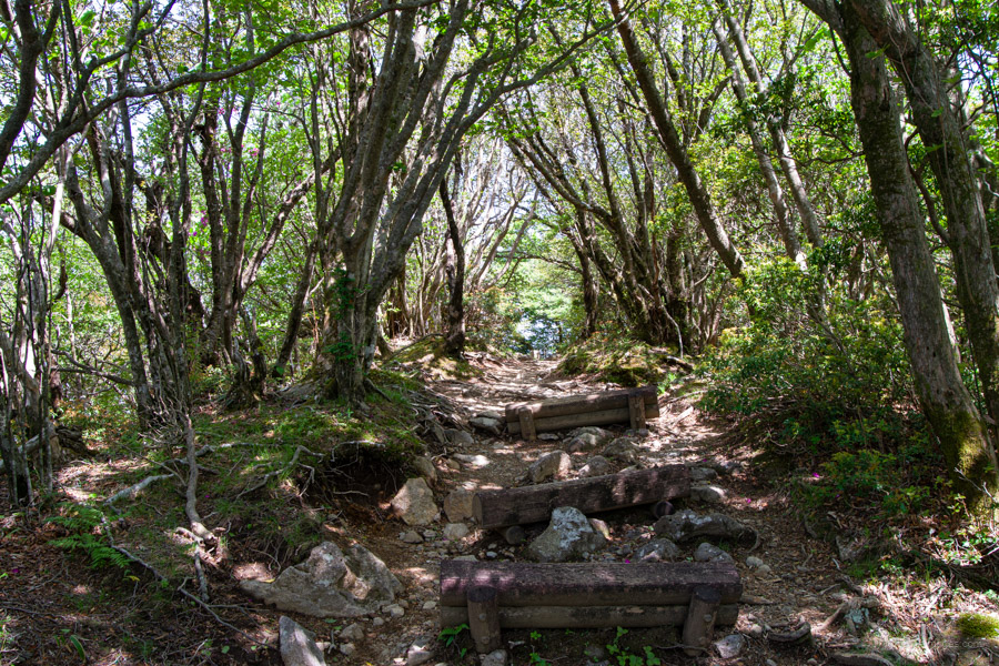
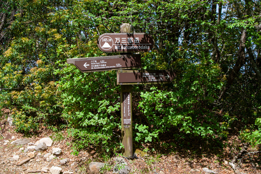
The trailhead begins right in front of the car park entrance, and it takes about 15 minutes to reach the first trail junction at Yotsuji 四辻, where the trail splits in two directions: one towards Mt. Banjiro-dake and the other towards Mt. Banzaburo-dake and Hacho-ike Pond 八丁池. The course can be undertaken in either direction, but you’ll avoid most hikers by veering right here and first traversing around to Mt. Banzaburo. For the most part, the hiking trail is surrounded by old-growth beech forest, is rocky in places, and has a water source that runs under the trail.
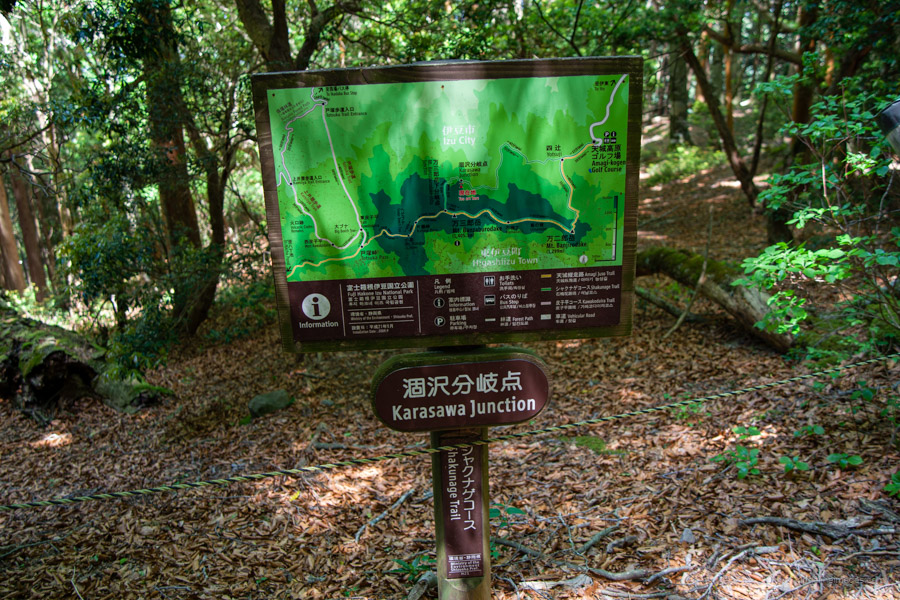
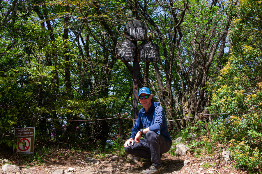
Next up is the Karasawa Junction 涸沢分岐点, where a fairly steep ascent begins towards the summit of Banzaburo-dake 万三郎岳 (1,406 m), the highest point of the range. It takes a little over two hours to reach the open summit, which is surrounded by trees. There are benches at the top, making it a good spot to stop for lunch.
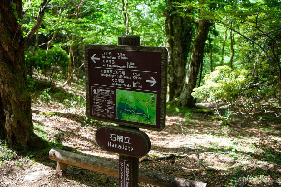
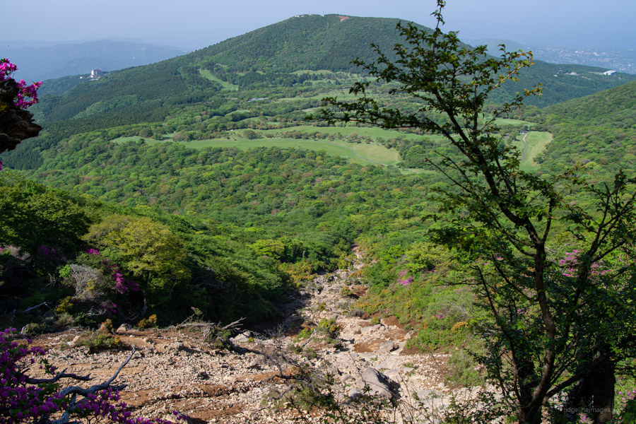
When you’re ready to continue, follow the ridgeline to Banjiro-dake 万二郎岳 (1,299 m), about an hour away. To get there from Banzaburo, you’ll first descend into a saddle before climbing back up. This saddle, known as Hanadate 石楠立, provides a view back toward the Amagi-Kogen Golf Course.
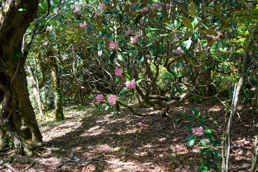
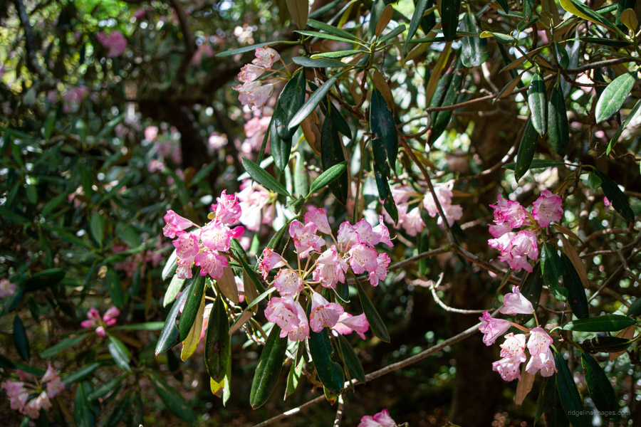
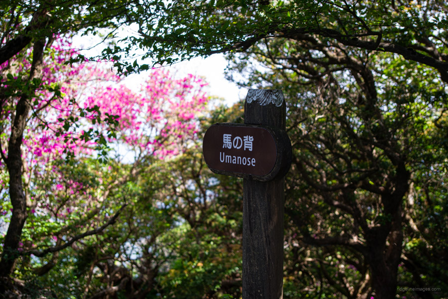
Next comes Umanose 馬の背, and in clear weather, it’s possible to see the Izu Islands from this stretch. Around this area, you’ll also find many blooming shakunage in springtime. Shortly after, you’ll pass through what’s known as the “Japanese Andromeda Tunnel,” named after the asebi アセビ – a white-flowering shrub that blooms from March to May. According to an information board along the trail, the plant is toxic – potent enough to make a horse stagger as if drunk after eating it. This is why its name, 馬酔木, translates to something like “Drunken Horse Tree.”
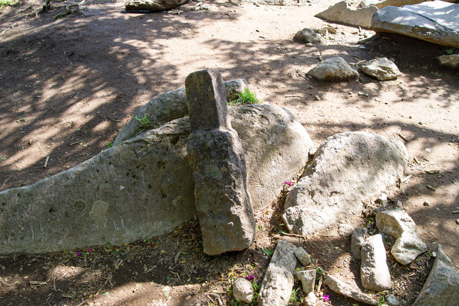
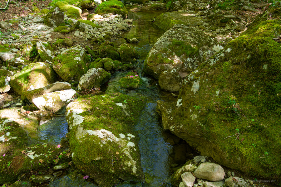
After reaching the enclosed summit of Mt. Banjiro-dake, where its uprooted triangulation station stands, or rather lies, as a testament to erosion, the trail begins a reasonably steep descent back to Yotsuji. Just before reaching the junction that completes the loop, the trail follows alongside a stream. The hike finishes by retracing your footsteps back to the trailhead, where you wait for the return bus to Ito Station.


Isn’t that a nice mountain?
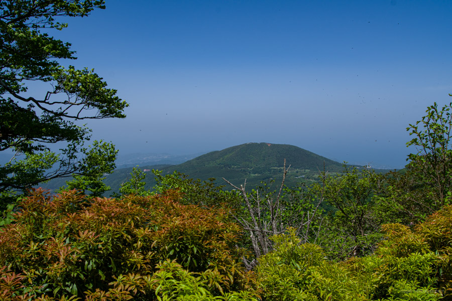
I was thinking about this the other day. I have relatives visiting and they went up Mt. Omuro on Izu, which I remembered looking down on from Amagi.
Izu is truly a playground.
It really is a great one! I especially loved some of those ancient beech trees. Can’t believe it took me this long to make it down that way.