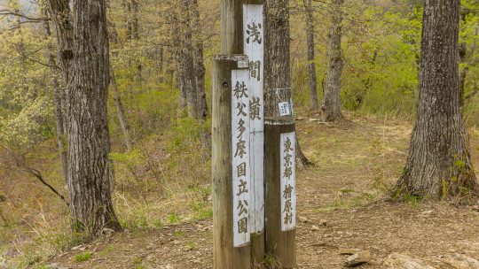
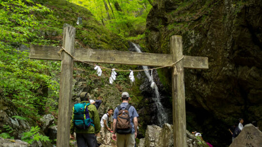
Hiked on Apr 26, 2014 Aug 23, 2023 . Hossawa Falls 払沢の滝 – Mt. Sengenrei 浅間嶺 Duration: 4 hours Distance: 7.8 km Elevation change: 623 metres Highest point: 903 metres Start: Hossawa no taki iriguchi Bus...
David grew up in the eastern suburbs of Melbourne, Australia, with hiking and outdoor pursuits being a major part of his life for as long as he can remember. He has been writing, snapping photos, and sharing his adventures on RIDGELINEIMAGES.com since 2013.
At university, David majored in environmental management and holds a Graduate Diploma of Education. He has been living in Japan for over 15 years, first in Fukushima Prefecture and now in the Tokyo Metropolis. With a love of hiking and photography, he felt the best way to combine the two was a blog to provide some inspiration for others to enjoy the myriad of trails and outdoor offerings on Tokyo’s doorstep. You can follow David on Instagram @ridgelineimages.
Hiked on Apr 26, 2014 Aug 23, 2023 . Hossawa Falls 払沢の滝 – Mt. Sengenrei 浅間嶺 Duration: 4 hours Distance: 7.8 km Elevation change: 623 metres Highest point: 903 metres Start: Hossawa no taki iriguchi Bus...
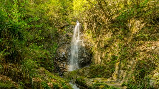
Tokyo’s Famed Hossawa Falls One thing that never fails to amaze me about living in Tokyo is unearthing its hidden natural treasures. Many readers this would be probably surprised to learn that Tokyo contains one of the One Hundred Waterfalls...
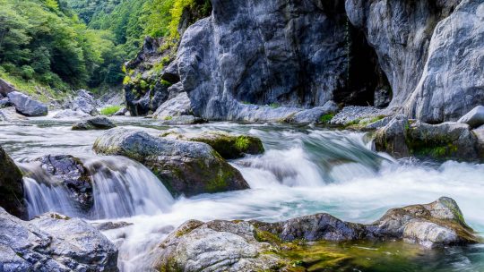
Hiking Trails on Tokyo’s Doorstep Given Japan’s mountainous terrain it should come as no surprise that Tokyo’s fringes boast many great hikes. So with that said, it’s time to dust off the hiking gear, grab some friends and hit the trails. The...
Hiked on May 4, 2013 Aug 23, 2023 . Mt. Odake 大岳山 – Nokogiriyama 鋸山 Duration: 5.5 hours Distance: 14.5 km Elevation change: 916 metres Highest point: 1266 metres Start: Mitake Cable lower station...
Hiked on Apr 5, 2014 Mar 22, 2025 . Mt. Jinba 陣馬山 – Meio-toge 明王峠 – Mt. Magoyama 孫山 A variation of this hike includes a beginner loop course that descends slightly after Meio-toge, passing through Sokozawa-toge. Duration: 4...
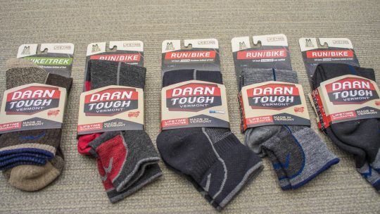
A virtually indestructible sock with a lifetime guarantee Let’s talk socks for a minute. If there is one single item in your hiking arsenal apart from your shoes perhaps, that is likely to make you miserable out on the trail it’s probably your socks...
Hiked on Mar 31, 2014 Aug 23, 2023 . Oyama Afuri Jinja 大山阿夫利神社 – Mt. Oyama 大山 Duration: 4 hours Distance: 6.3 km Elevation change: 942 metres Highest point: 1252 metres Start: Oyama Cable Car Bus Stop...
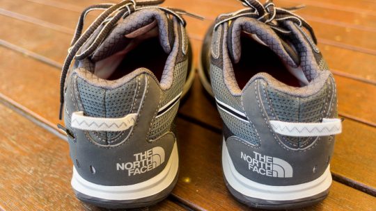
A Performance Trail Running Shoe from The North Face Trail running shoes provide a nice contrast to the rugged and heavy leather boots which accompany me on multi-day hikes. For day hikes and of course trail running I prefer the simplicity of a...
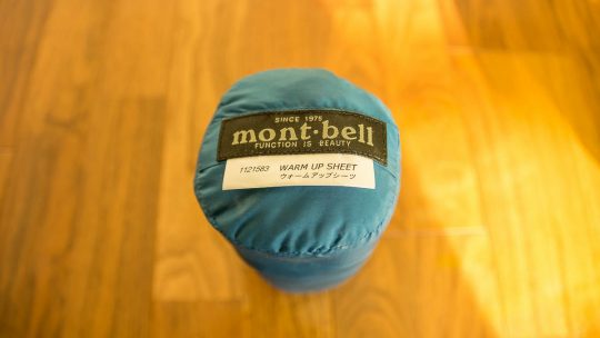
A lightweight mesh sleeping bag liner After purchasing my lovely new Nanga sleeping bag last year I decided the best way to keep it in pristine condition was to pair it with an inner sheet. Sleeping bag liners are an ideal way to add a little extra...
Heat reflective emergency blankets, mylar blankets or space blankets have been around for the seemingly decades and were originally developed by NASA in 1964 for the US space program. As a young fella I distinctly remember carrying one around in my...

A Guide to Selecting a Compass Without question becoming lost would have to be one of the most unsettling and frightening things that can happen on the trail. Bad weather may present unexpectedly or you may do all the right things but somehow still...
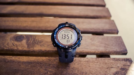
Introducing the Triple Sensor, Ver. 3 Casio Protrek PRW-3000 In the era of mobile and smart phones it’s probably not unsurprising to read that I have not worn a watch for more than ten years now. The downside however is when you have to rely on a...