.
Mt. Okuratakamaru 大蔵高丸 – Mt. Hamaiba ハマイバ丸
Distance: 16.1 km
Elevation change: 805 metres
Highest point: 1781 metres
Start: Yamatoten Mokusan Onsen Bus Stop
Finish: Yamatoten Mokusan Onsen Bus Stop
Difficulty: ▅▅▅▅▅▅▅▅▅▅ ❷
Map: Yama to Kogen Chizu 山と高原地図 [No.26 大菩薩嶺 DAIBOSATSU-REI]
GPX TrackKML TrackGSI MAPPDF Topo Map
One of Yamanashi’s 100 Revered Mountains
The original plan for this hike was to finish at Sasago Station on the JR Chuo Main Line but as with all best laid plans, weather tends to be the final arbiter. With the weather deteriorating on first day and slippery slopes prevailing on the second, forced an early earlier than expected exit. What follows is an improvised loop trail beginning and ending at the Yamatoten Mokusan Onsen.
Day 1: Sunny Hastily Shifts to Overcast (8.3 km)
What I hadn’t realised on my hike to Mt. Daibosatsu last year was that a bus service actually operates directly from Kaiyamato Station 甲斐大和駅 to Kamihikawa-toge, the main staging area below the mountain.
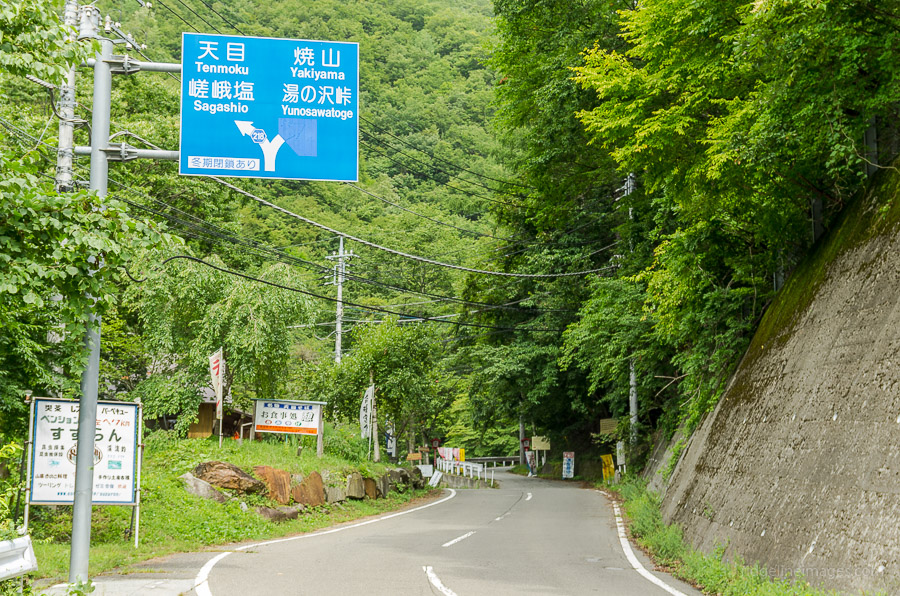
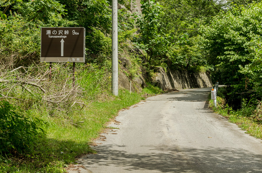
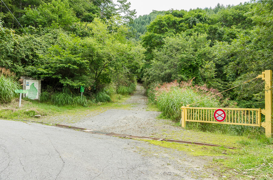
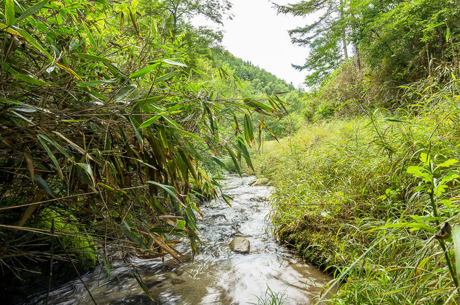
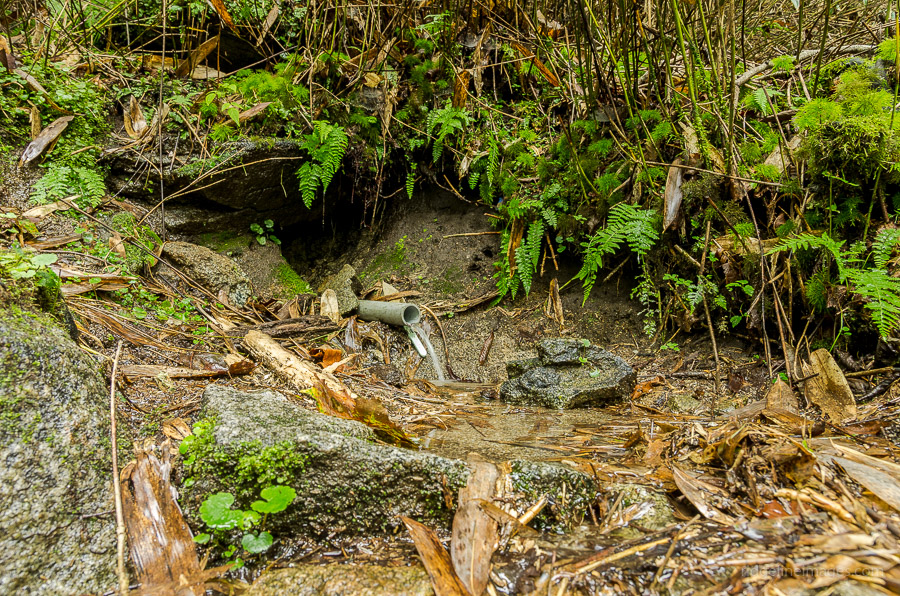
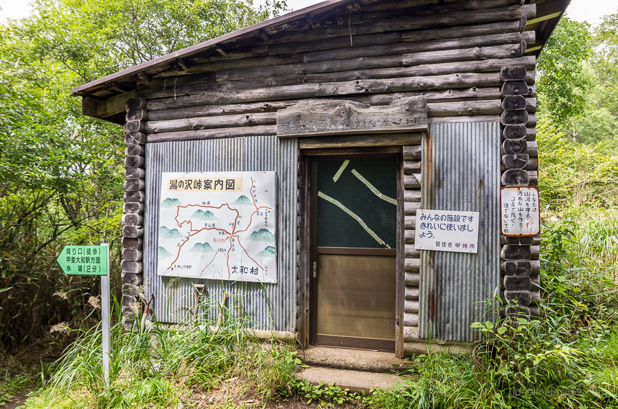
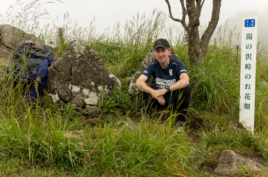
On weekends there are three morning buses to the Yamatoten Mokusan Onsen (15 mins, 300 yen) from Kaiyamato Station. From the bus stop make a beeline across the road and follow a minor road heading to Yunosawatoge 湯ノ沢峠. This road shadows a river and it should take around 90 minutes to reach the trail head which is signed posted next to a local area map. From here it takes another hour or so to reach Yunosawatoge. Just before you reach the emergency hut look for a watering hole on your right. Fill up sufficiently if you’re planning on camping out on the ridge.
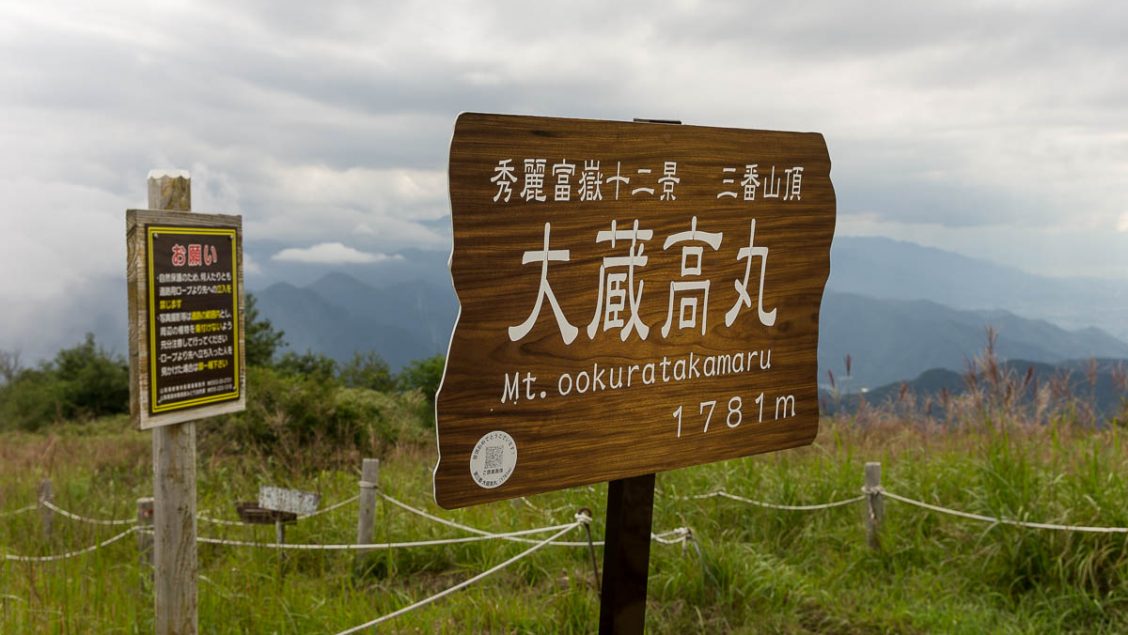
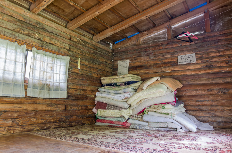
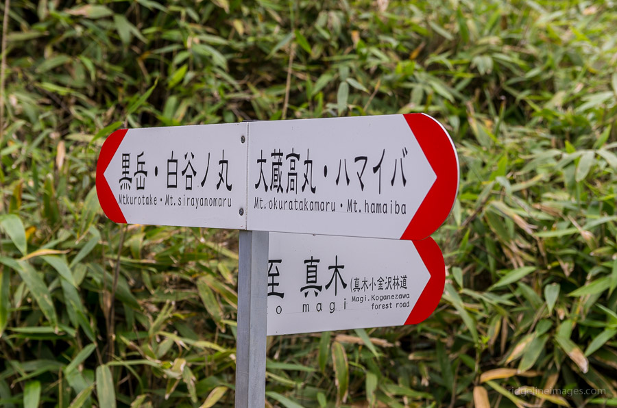
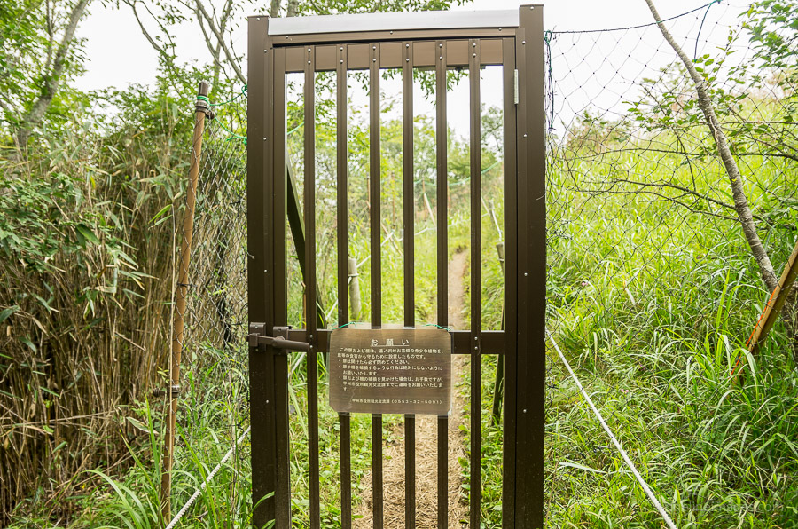
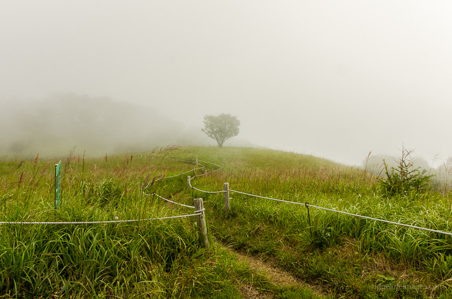
Apart from the hut there is a car park and restroom facilities. Unfortunately there aren’t any tables or benches so make do with eating lunch beside the trail. A little way up from the hut marks a key four way trail intersection so turn right for Mt. Okuratakamaru 大蔵高丸 (1,781 m). Given the fragile grassland ecosystem several deer gates have been installed along with roped off trail. Along this ridgeline fine weather ordinarily finds splendid views of Mt. Fuji but with a heavy fog it was hard enough just staying on the trail. Whilst camping isn’t officially permitted, there is a particularly nice spot beside Mt. Hamaiba ハマイバ丸 (1,752 m) if arriving late in the afternoon.
Day 2: Rain and Slippery Slopes (7.8 km)
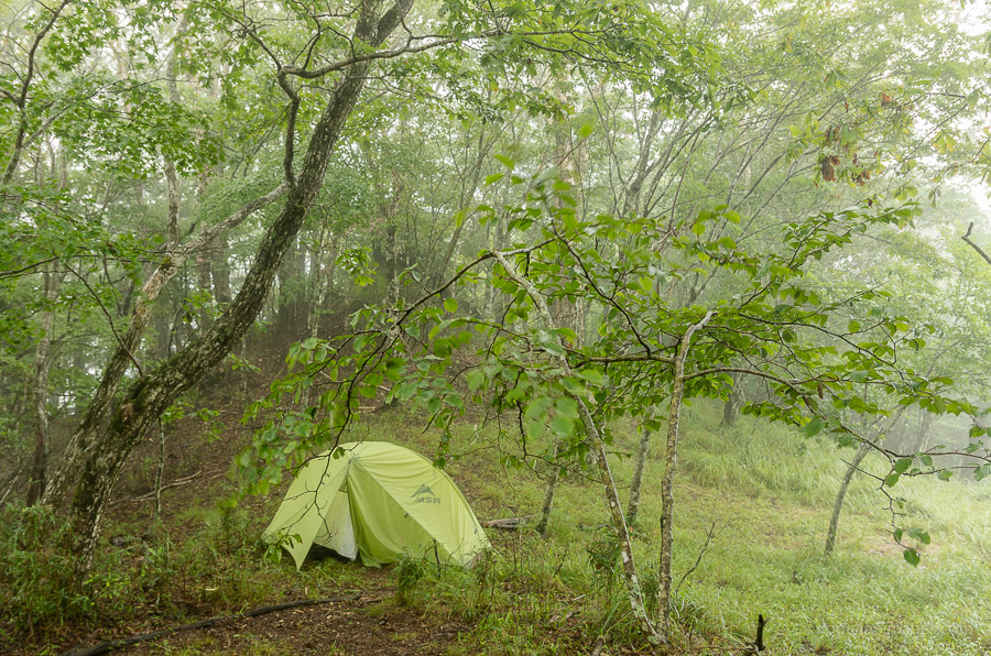
The rain steadily increased through the night and was doing its best to curtail the hike. Thanks to a well-drained campsite and a double walled MSR tent, fortunately all was dry inside and the vestibule worked a treat preparing breakfast. My immediate concern however was getting off the mountain safely. From Mt. Hamaiba down to Komeseoi Pass 米背負峠 requires descending some 250 metres, which at times resembled a veritable mud slide. In the wet, traction here is nigh impossible and to add insult to injure there isn’t much in the way of vegetation to grab hold of. Needless to say even with excruciatingly slow progress I managed to take a fair tumble.
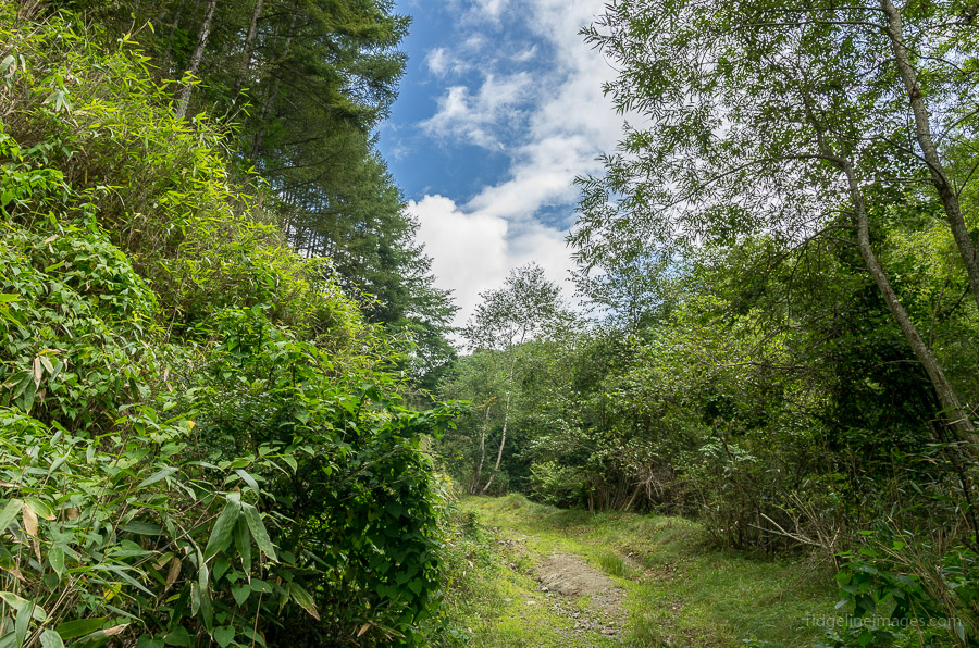
From the pass it was a no brainer that to continue onwards was foolhardy so plan B was to trace back along different river trail which met up with a forestry road back to the Yamatoten Mokusan Onsen. This gated off road evidently hadn’t had traffic in sometime with several fallen logs and a lot of general debris. For the most part the road was pretty uneventful though does call for walking through a rather long eerie tunnel, one in which the sunlight barely pervades the other side. Best bet is to put on the headlight and walk expeditiously though the 300 metre passageway. It was a relief to finally be back at the bus stop. A staff member at the onsen kindly called a taxi for the short trip back to Kaiyamato Station.


Does hiking in japan does not require guides?
I take you mean trekking guides? Whilst these services certainly exist in Japan the vast majority of hikers however choose to travel independently which is generally quite safe.
Hello and thank you for those really nice hiking reports and pictures. Would you by chance know if there are any bus running during winter? The schedule you linked says it’s until the 13th of december, but I was wondering if the area remains accessible during the coldest months of the year, as it would be a really nice playground to introduce my girlfriend to winter camping. Thanks
That is correct the last bus service of the year to Kamihikawa-toge usually finishes on second Sunday of December. Having said that, the taxi fare from Kaiyamato Station to Yamatoten Mokusan Onsen is only around 3,000 yen and if camping out on the ridge the next day you can walk back to Sasago Station. From late December onwards there will be a decent amount of snow cover over the higher ranges.