.
Mt. Jinba 陣馬山 – Meio-toge 明王峠 – Mt. Magoyama 孫山
Distance: 9.4 km
Elevation change: 434 metres
Highest point: 857 metres
Start: Jinba Kougen Shita Bus Stop
Finish: Sagamiko Station (Chuo Main Line)
Difficulty: ▅▅▅▅▅▅▅▅▅▅ ❸
Map: Yama to Kogen Chizu 山と高原地図 [No.29 高尾・陣馬 TAKAO·JINBA]
GPX TrackKML TrackGSI MAPPDF Topo Map
A White Concrete Horse and 360 Degree Views from Mt. Jinba
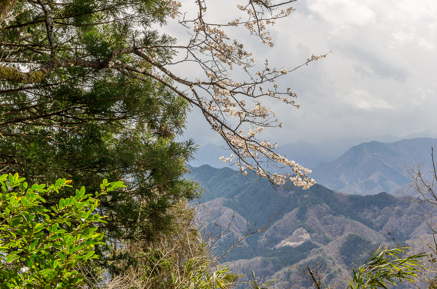
Escaping the crowds isn’t something that can be easily accomplished on the mountain trails surrounding Mt. Takao, even more so when blessed with exquisite weather. With that in mind, I headed out to the lesser-visited but no less impressive Mt. Jinba 陣馬山. In contrast to Mt. Takao, the summit of Mt. Jinba has uninterrupted panoramic views and although Mt. Fuji was cloaked in cloud cover the white-crested peaks of the Southern Alps could be glimpsed.
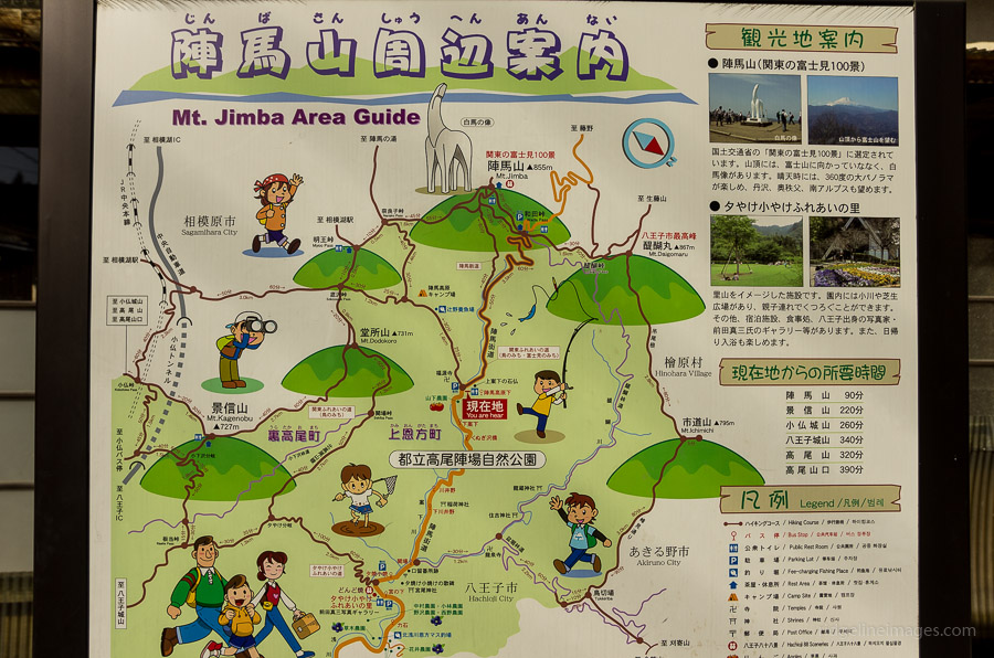
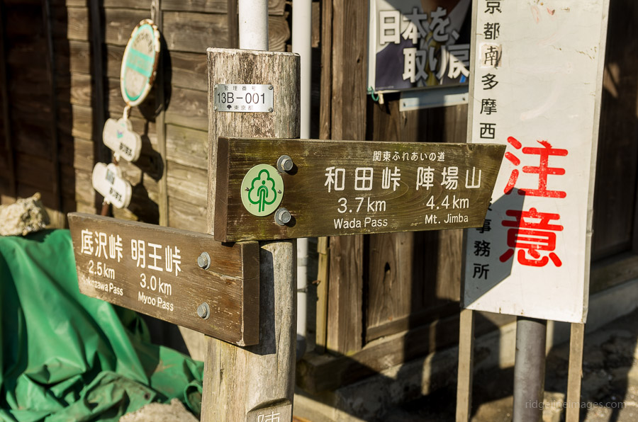
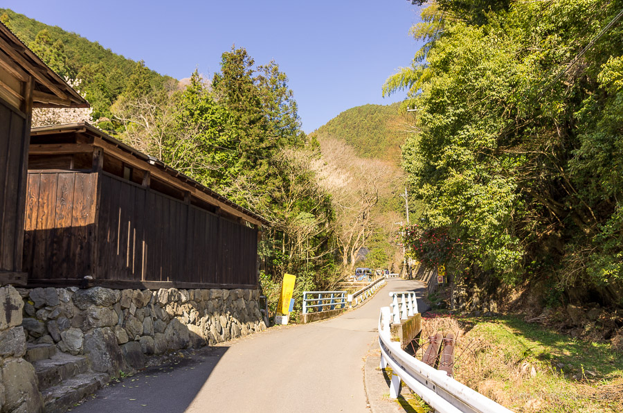
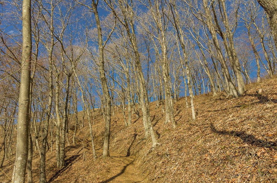
The first and best advice is to make an early start if possible, as even on the second bus of the morning at 07:30 there was a fair crew lined up, Nishi Tokyo Bus timetable. Buses depart from outside the north exit of Takao Station 高尾駅 look for one bound for Jinba Kogen Shita 陣馬高原下 at bus stop 1. The ride follows the Jinba-Kaido Ave, takes around 35 minutes, and costs 640 yen. At the Jinba Kogen Shita bus stop, there is an area guide map to reference if necessary, but basically, look for a sign on your right pointing towards Wada Pass and Mt. Jinba. The first section requires walking on a paved road for approximately 1.5 km and you should find the trail entrance veering off to the left. The trail, as you can imagine, is well-trodden and should take a little over an hour to reach the summit from the bus stop.
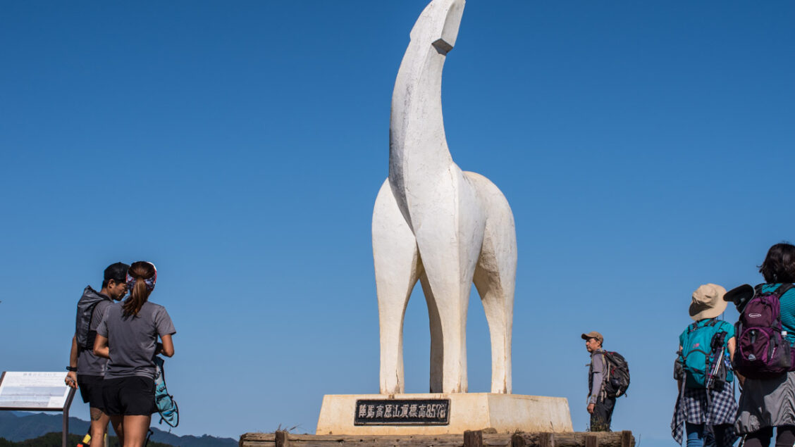
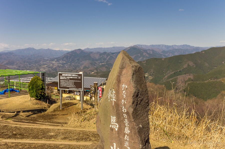
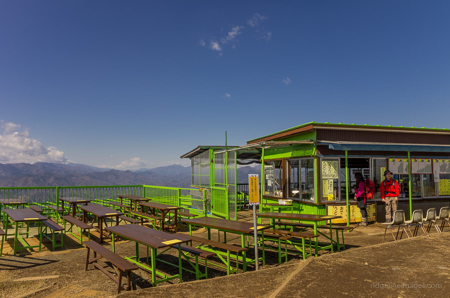
The summit of Mt. Jinba (857 m) is famed for a white concrete horse. The statue, which some even think bears a resemblance to a giraffe, was erected in 1969 by the Hachioji Tourist Association, courtesy of the Keio private railway corporation. There is also an engraved stone proudly stating that the mountain is one of the fifty scenic locales of Kanagawa, though technically the mountain shares the border with Tokyo. Apart from the horse, there are some tables and benches and a small restaurant to refuel.
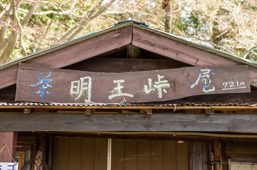
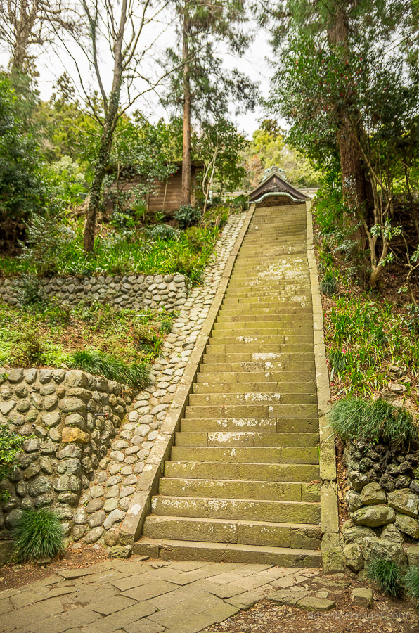
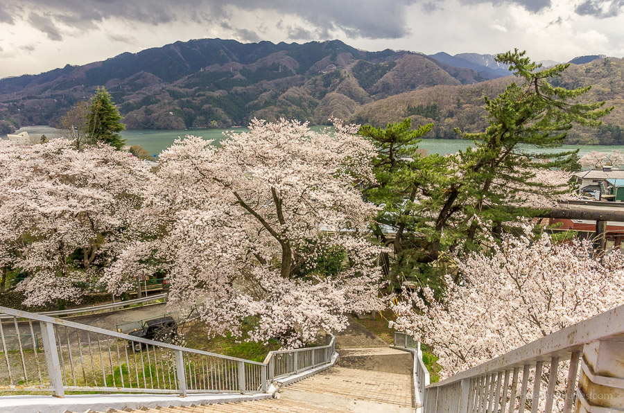
From here, there is the option of making the long trek across to Mt. Takao, some 15 km away. This hike continues along that same ridge until Meio-toge 明王峠 where it swings down right towards Sagamiko Station 相模湖駅. The hike to Meio-toge was a veritable highway for trail runners coming across, presumably from Mt. Takao, and I did my best to stay well clear. At Meio-toge, there is an old homestead with a refreshments stand and the owner was keen to draw attention to some prominent nearby mountains. The last downhill stretch to the station was mostly devoid of foot traffic and included a couple of nice spots for taking lunch overlooking the Sagamiko Lake. When you arrive at the shrine, head down the stairs, over the elevated pedestrian crossing, and left for a five-minute walk to Sagamiko Station.


thanks for taking the time and putting up the info old chap!….i will try this weekend……
rossco from scotland
Good luck with the hike Ross and I suggest making an early start given this oppressive heat we’re having now.
Regarding access to Mt Jinba: by “Takao station,” do you mean Takao on the Chuo line? NOT the one on the Keio, line, right?
Thanks,
JT
That is correct JR Takao Station on the Chuo Line.
Thanks, David, for the reply.
I plan to hike in late November and early December. My hope is for the usual clear winter skies with no precipitation!
Jeff
is there lots of yellow jackets there
If your referring to the Japanese giant hornet there are plenty and are particularly active from June through October.
Did this today it was lovely thank you so much for the instructions. For anyone else trying this the last couple of the signs read Yose Shrine 与瀬神社 instead of the station
Cheers for that Jude. Glad to hear you enjoyed the hike.
Just did this hike with a friend. Great trail!