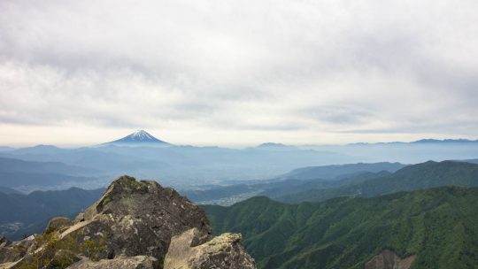
Splendid Backdrop Scaling Yatsugatake Mountains Last summer near perfect conditions provided an excellent opportunity to take a three day hike over the Yatsugatake Mountains. These volcanic mountains are situated on the border between Nagano and...
Splendid Backdrop Scaling Yatsugatake Mountains Last summer near perfect conditions provided an excellent opportunity to take a three day hike over the Yatsugatake Mountains. These volcanic mountains are situated on the border between Nagano and...
Hiked on May 21, 2015 Aug 24, 2023 . Kougen Hut 高原ヒュッテ – Mt. Kentoku 乾徳山 – Mt. Douman 道満山 Duration: 2 days Distance: 11.1 km Elevation change: 1186 metres Highest point: 2013 metres Start: Kentokusan...
Hiked on May 2, 2015 May 18, 2021 . Shougen Toge 将監峠 – Mt. Hiryusan 飛竜山 – Sanjounoyu 三条の湯 Duration: 3 days Distance: 34.5 km Elevation change: 1489 metres Highest point: 2069 metres Start: Ochiai Bus...
Hiked on Sep 18, 2014 Nov 15, 2021 . Karisaka Toge 雁坂峠 – Mt. Suisyoyama 水晶山 – Mt. Koreisan 古礼山 Duration: 3 days Distance: 23.9 km Elevation change: 1528 metres Highest point: 2158 metres Start:...
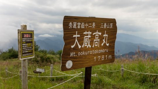
Hiked on Aug 31, 2014 Sep 2, 2021 . Mt. Okuratakamaru 大蔵高丸 – Mt. Hamaiba ハマイバ丸 Duration: 2 days Distance: 16.1 km Elevation change: 805 metres Highest point: 1781 metres Start: Yamatoten Mokusan Onsen...
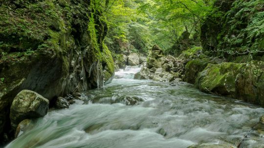
Hiked on Aug 12, 2014 Aug 23, 2023 . Nishizawa Keikoku Bus Stop 西沢渓谷入口 – Nanatsugama Godan Falls 七ツ釜五段の滝 The Nishizawa Gorge hiking trail closes during winter (December 1st-April 28th subject to change depending on snowfall) for the...
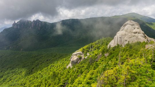
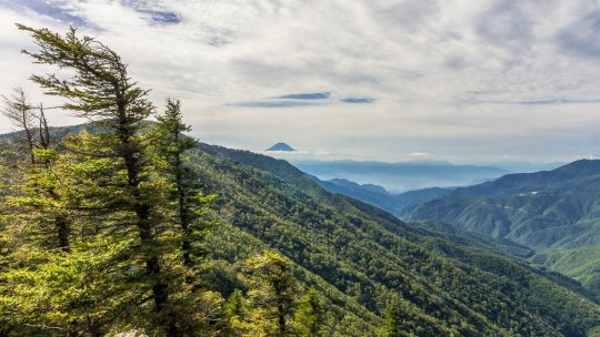
A Climb up the Dainichi Boulder Aside from scaling the majestic peak of Mt. Mizugaki, another equally stunning viewpoint was delivered from the Dainichi Boulder 大日岩 on the first day. I previously passed by this rather massive rock conglomeration...
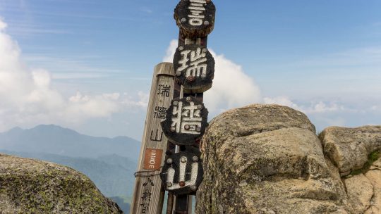
Hiked on Jul 31, 2014 Aug 23, 2023 . Mizugaki-sansou 瑞牆山荘 – Mt. Mizugaki 瑞牆山 Duration: 5.5 hours Distance: 5.9 km Elevation change: 720 metres Highest point: 2230 metres Start: Mizugaki-sansou ...
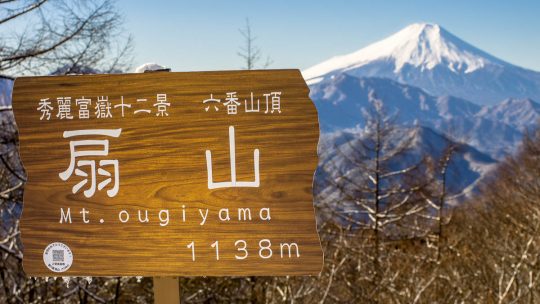
Hiked on Dec 28, 2013 Aug 23, 2023 . Mt. Ougiyama 扇山 – Mt. Momokurayama 百蔵山 If you wish to shorten the hike and leave out Mt. Ougiyama, you can tackle just Mt. Momokurayama on its own. Duration: 6 hours Distance: 13.4 km...
Hiked on Oct 31, 2013 Aug 23, 2023 . Hinata Ooya 日向大谷 – Mt. Ryokami 両神山 Duration: 2 days Distance: 10.3 km Elevation change: 1093 metres Highest point: 1723 metres Start: Hinata Ooya Bus Stop...
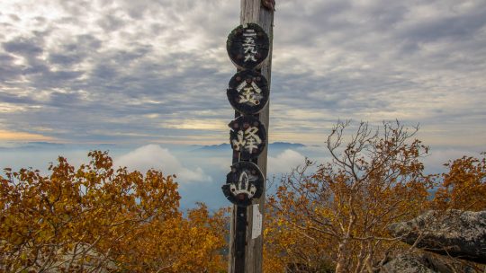
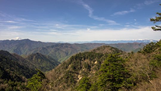
Hiked on Sep 30, 2013 Aug 23, 2023 . Mt. Kinpu 金峰山 – Mt. Kobushi 甲武信ヶ岳 Duration: 3 days Distance: 26.8 km Elevation change: 1089 metres Highest point: 2599 metres Start: Mizugaki-sansou Bus Stop...
Hiked on Sep 21, 2013 Nov 10, 2024 . Mt. Daibosatsu 大菩薩嶺 – Daibosatsu-toge 大菩薩峠 – Tabayama Village 丹波山村 Duration: 2 days Distance: 20.7 km Elevation change: 1156 metres Highest point: 2056 metres ...