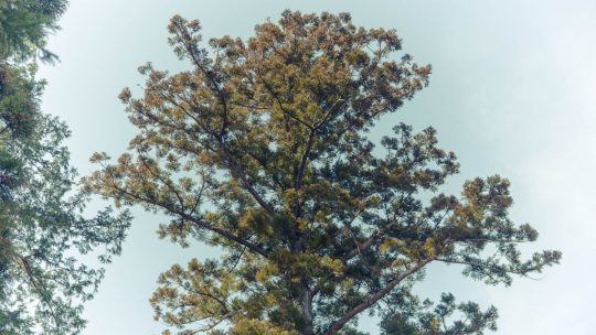
Hiked on May 4, 2013 Aug 23, 2023 . Mt. Odake 大岳山 – Nokogiriyama 鋸山 Duration: 5.5 hours Distance: 14.5 km Elevation change: 916 metres Highest point: 1266 metres Start: Mitake Cable lower station...
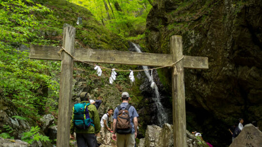
Hiked on May 4, 2013 Aug 23, 2023 . Mt. Odake 大岳山 – Nokogiriyama 鋸山 Duration: 5.5 hours Distance: 14.5 km Elevation change: 916 metres Highest point: 1266 metres Start: Mitake Cable lower station...
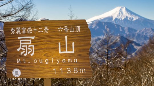
Hiked on Dec 28, 2013 Aug 23, 2023 . Mt. Ougiyama 扇山 – Mt. Momokurayama 百蔵山 If you wish to shorten the hike and leave out Mt. Ougiyama, you can tackle just Mt. Momokurayama on its own. Duration: 6 hours Distance: 13.4 km...
Looking Back on the Year The main impetus for getting this blog started was frustration with the lack of information in English on hiking trails around Tokyo. Over the past year I have relished the opportunity to document my experiences and realised...
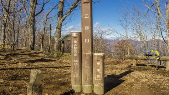
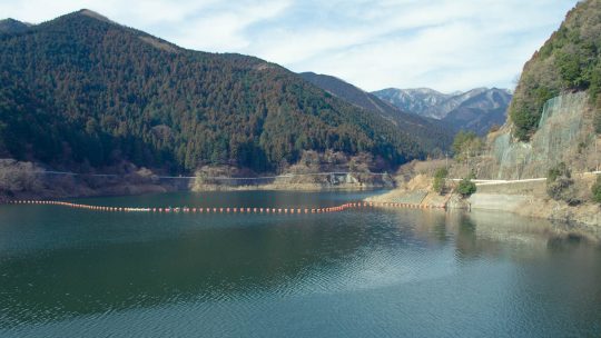
Hiked on Dec 12, 2013 May 5, 2024 . Mt. Iyo イヨ山 – Mt. Nukazasu ヌカザス山 – Mt. Mito 三頭山 The floating bridge near the Ogouchi Jinja Bus Stop is temporarily closed due to the declining water level of Lake Okutama. For the...
Hiked on Oct 31, 2013 Aug 23, 2023 . Hinata Ooya 日向大谷 – Mt. Ryokami 両神山 Duration: 2 days Distance: 10.3 km Elevation change: 1093 metres Highest point: 1723 metres Start: Hinata Ooya Bus Stop...
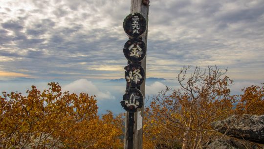
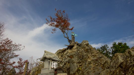
Hiked on Sep 30, 2013 Aug 23, 2023 . Mt. Kinpu 金峰山 – Mt. Kobushi 甲武信ヶ岳 Duration: 3 days Distance: 26.8 km Elevation change: 1089 metres Highest point: 2599 metres Start: Mizugaki-sansou Bus Stop...
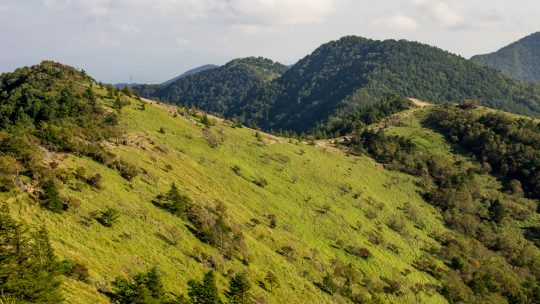
Hiked on Sep 21, 2013 Nov 10, 2024 . Mt. Daibosatsu 大菩薩嶺 – Daibosatsu-toge 大菩薩峠 – Tabayama Village 丹波山村 Duration: 2 days Distance: 20.7 km Elevation change: 1156 metres Highest point: 2056 metres ...
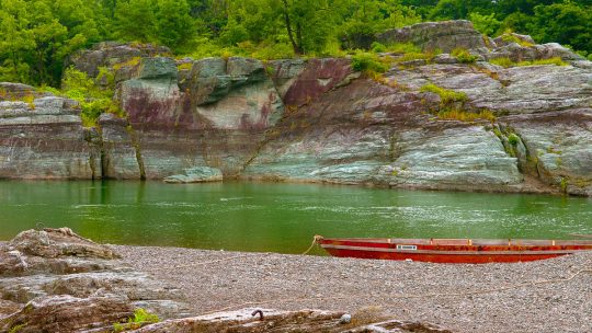
The Tatami Walls of Nagataro June is a great month for getting out and exploring some unfrequented spots within easy reach of Tokyo before the pervasive summer heat sets in. This entry introduces Nagatoro-machi 長瀞町 an attractive riverside town on...
Hiked on Jul 4, 2012 Aug 24, 2023 . Mt. Bonomine 棒ノ峰山 – Mt. Kuroyama 黒山 – Nasaka Pass 名坂峠 Duration: 6 hours Distance: 14.7 km Elevation change: 577 metres Highest point: 969 metres Start: Kawai...
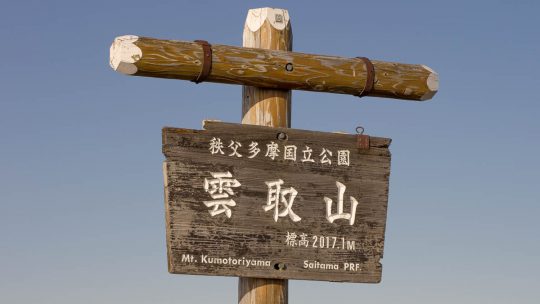
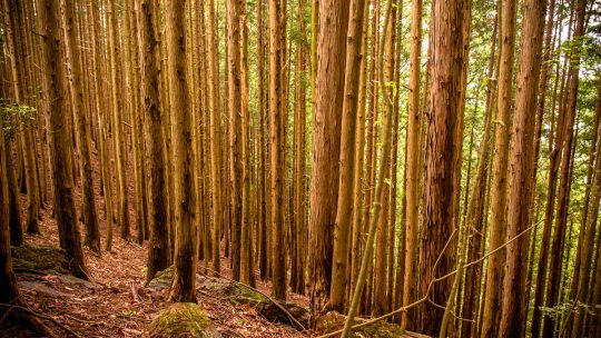
Hiked on May 23, 2013 Aug 22, 2023 . Mitsumine Shrine 三峯神社 – Mt. Kumotori 雲取山 – Mt. Mutsuishiyama 六ッ石山 Duration: 2 days Distance: 29.2 km Elevation change: 977 metres Highest point: 2017 metres Start:...
Hiked on Apr 28, 2013 Aug 24, 2023 . Hinodeyamakita Ridge 日ノ出山北尾根 – Mt. Hinodeyama 日の出山 – Mt. Mitsumuroyama 三室山 Duration: 5 hours Distance: 11 km Elevation change: 652 metres Highest point: 902 metres...
Unearthing the Longest Fish Ladder in Japan On recent nature outing near Okutama I stumbled across non-descript administrative building which just happens to house the longest fish ladder in Japan. The fish ladder is situated along a scenic stretch...
The Spoils of Early Spring Outings Tempted with the lure of warm weather for the first time this year, I made an ill-fated decision yesterday to set out knowing very well I had a good chance of succumbing to hay fever. This ignominious fate first...
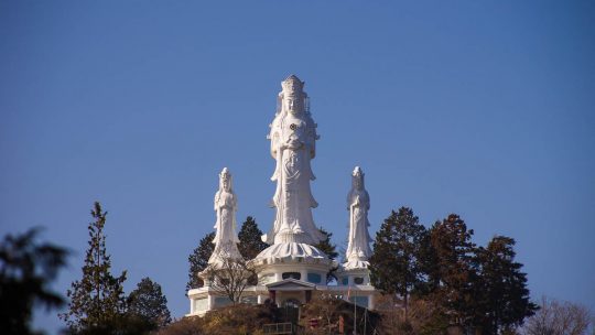
A Bodhisattva Inspired Kannon Temple The township of Naguri is more than just a launching pad for local trekking adventures and includes the impressive Hakuunsan Torii Kannon 白雲山 鳥居観音 which makes a formidable statement on the surrounding landscape...
Hiked on Feb 28, 2013 Aug 23, 2023 . Naguri Lake 名栗湖 – Mt. Makinooyama 槙ノ尾山 – Mt. Bonomine 棒ノ峰山 Duration: 6 hours Distance: 11.2 km Elevation change: 736 metres Highest point: 969 metres Start:...
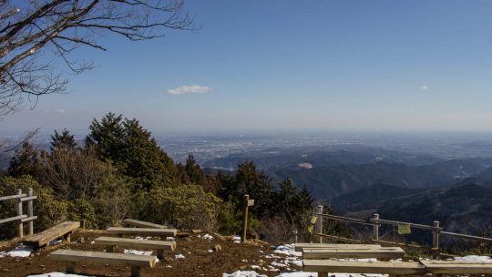
Hiked on Feb 13, 2013 Aug 23, 2023 . Mt. Hinodeyama 日の出山 – Mt. Mitake 御岳山 Duration: 6 hours Distance: 18.6 km Elevation change: 712 metres Highest point: 902 metres Start: Musashi Itsukaichi Station...