.
Mt. Ninoto 二ノ塔 – Mt. Sannoto 三ノ塔 – Mt. Gyoja 行者ヶ岳
Distance: 15.1 km
Elevation change: 1161 metres
Highest point: 1491 metres
Start: Yabitsu-toge bus stop
Finish: Okura bus stop
Difficulty: ▅▅▅▅▅▅▅▅▅▅ ❹
Map: Yama to Kogen Chizu 山と高原地図 [No.31 丹沢 TANZAWA]
GPX TrackKML TrackGSI mapPDF Topo Map
Climbing Tonodake from Yabitsu Pass via the Omote Ridge
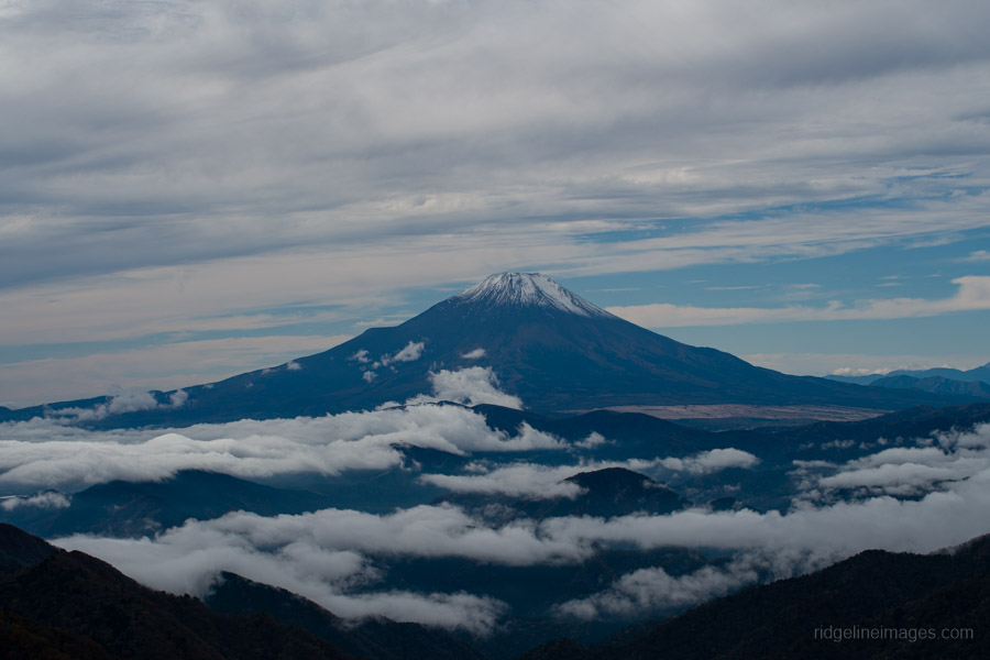
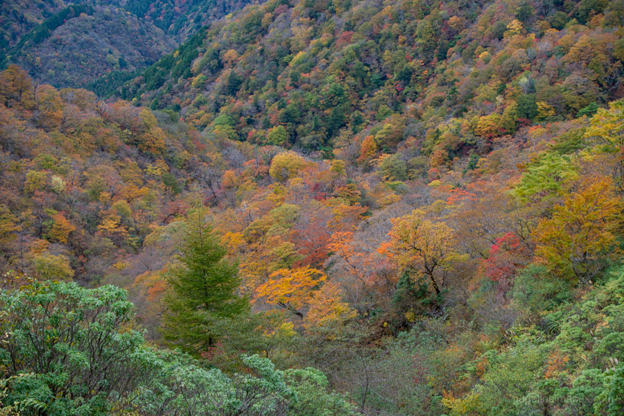
When it comes to hiking in the Tanzawa Mountains, no peak is more popular than Mt. Tonodake. I first climbed it via the well-trodden Okura Ridge on a two-day traverse via Mt. Tanzawa – which also happened to be my first overnight hike for this blog. This time, I set out from Yabitsu Pass, ascending the Omote Ridge 表尾根, reputed to offer more frequent and expansive views, before descending by way of Okura Ridge. Though the ridge was undulating and at times taxing, it proved far more enjoyable than expected, with clear autumn skies opening up sweeping vistas of both Mt. Fuji and Sagami Bay.
From the ticket gate at Hadano Station 秦野駅 on the Odakyu Odawara Line, turn right and head down the stairs to the bus stop. On weekends and public holidays, there are four morning buses to Yabitsu Pass ヤビツ峠, with the first departing at 7:20 am. On weekdays, however, there is only a single departure at 8:25 am (48 minutes, 570 yen). Given the shorter daylight hours, especially in autumn, it’s best to aim for one of the earliest departures.
Leaving the ticket gate, I made a beeline for the bus stop and was surprised to find a long queue already forming. Thankfully, a second bus soon arrived to pick up the overflow, and I was lucky enough to snag the last seat on board. Although Mt. Tonodake is hiked year-round, the peak season is around Golden Week, when the azaleas are in full bloom. If you visit during that time, you’ll apparently find queues so long they spill out down to the main road.
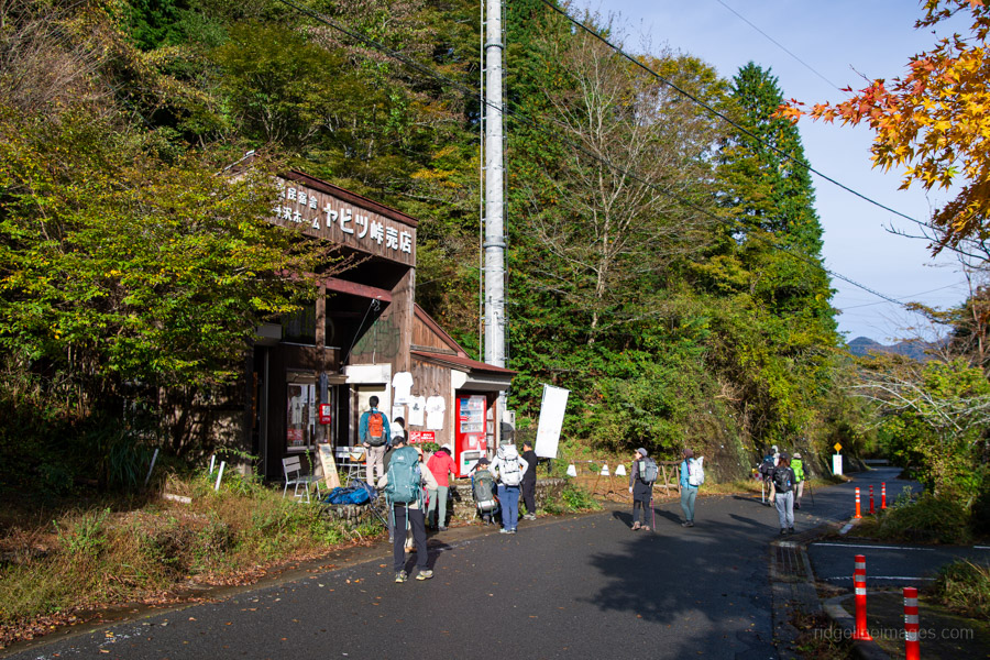
After taking the winding bus ride up to the pass, you’ll find restrooms, vending machines, and even a small shop. From there, walk along a paved road that slopes gently downhill for about 20 minutes. If you continue just a little further, you’ll reach Gomayashiki-no-Mizu 護摩屋敷の水, one of Japan’s 100 famous springs – a great place to top up your water bottles before starting the climb.
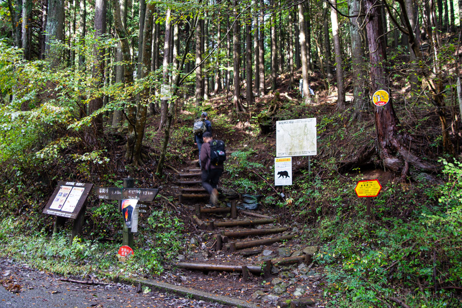
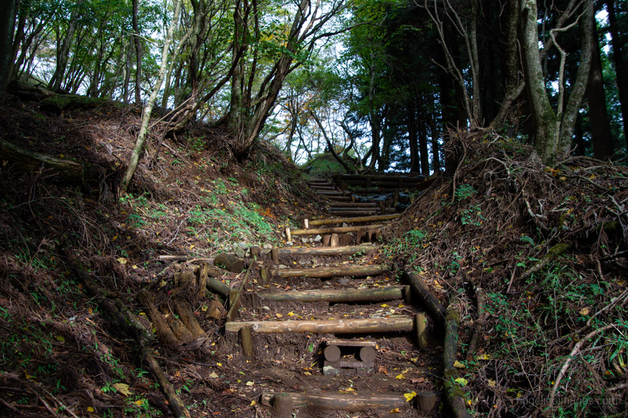
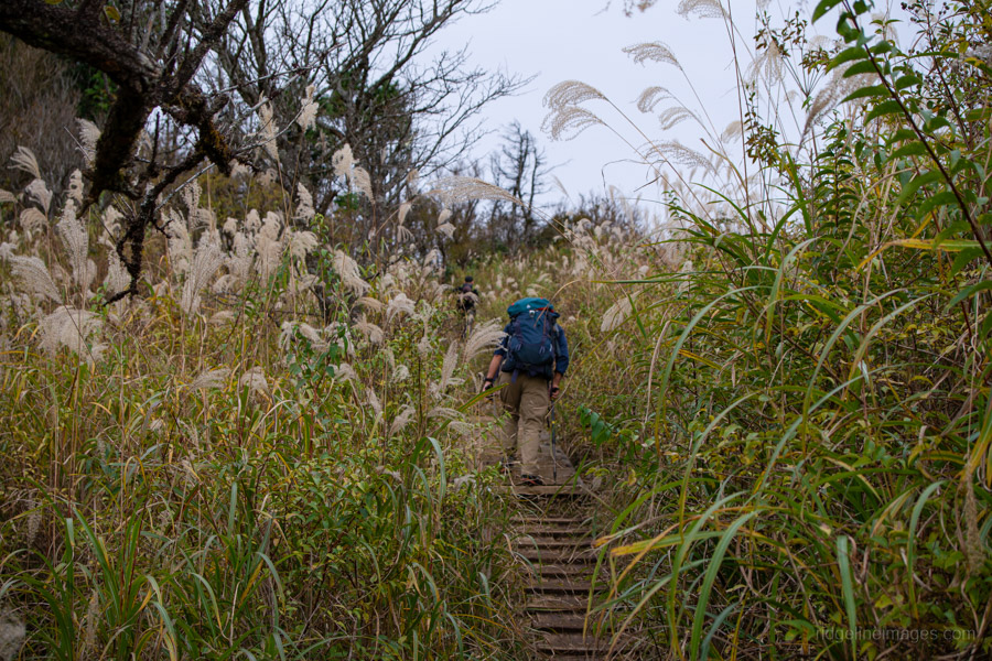
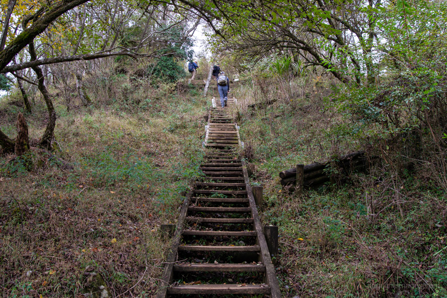
The trail begins, unsurprisingly, with a long set of steps – the hallmark of nearly every hike in the Tanzawa Mountains. As this is a popular route, you’ll encounter plenty of fellow hikers, and at least in the early stages, the trail can feel a bit congested.
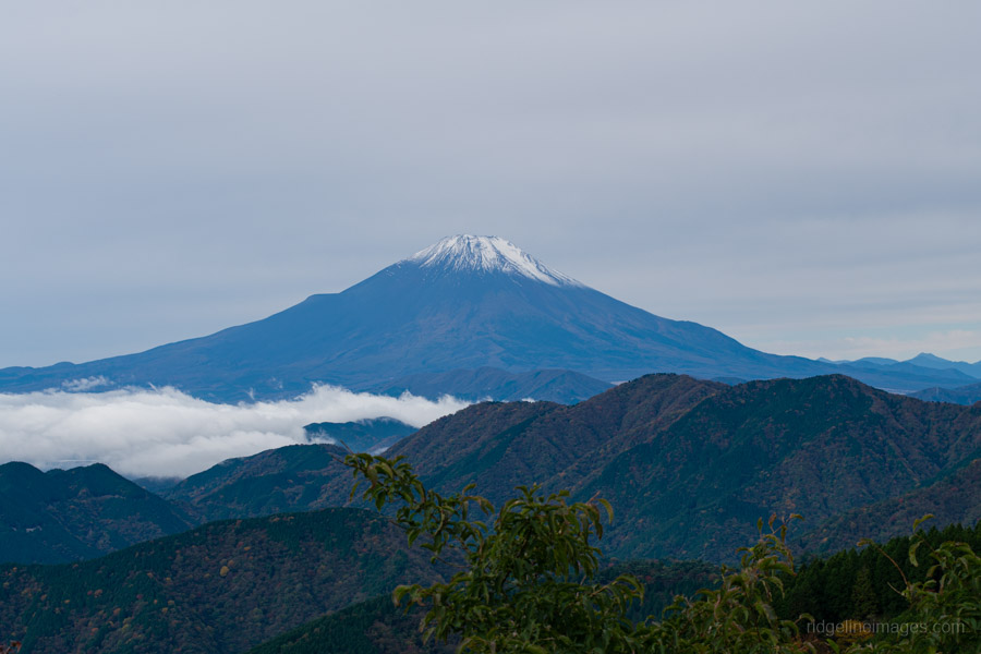
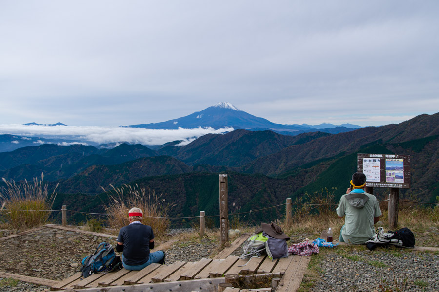
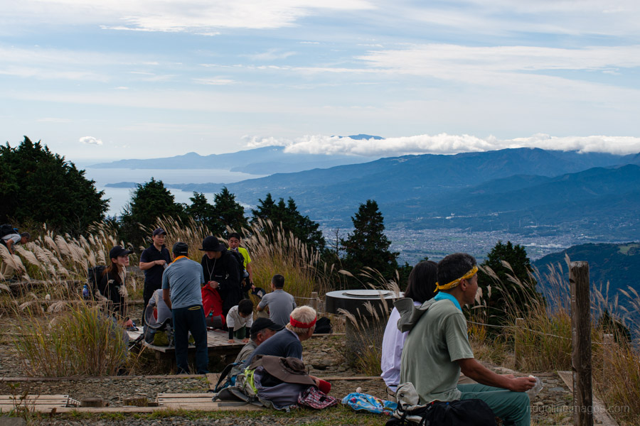
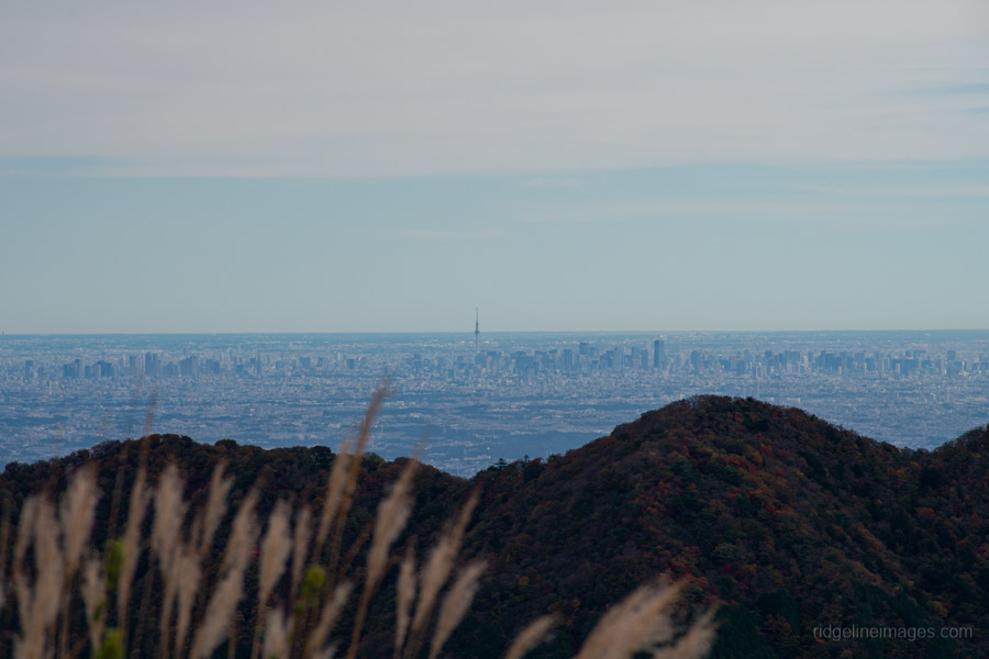
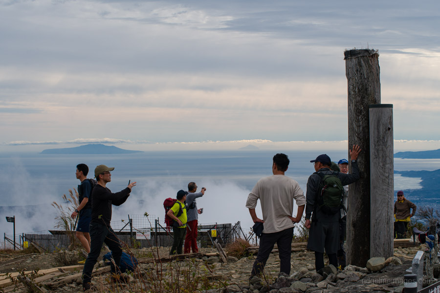
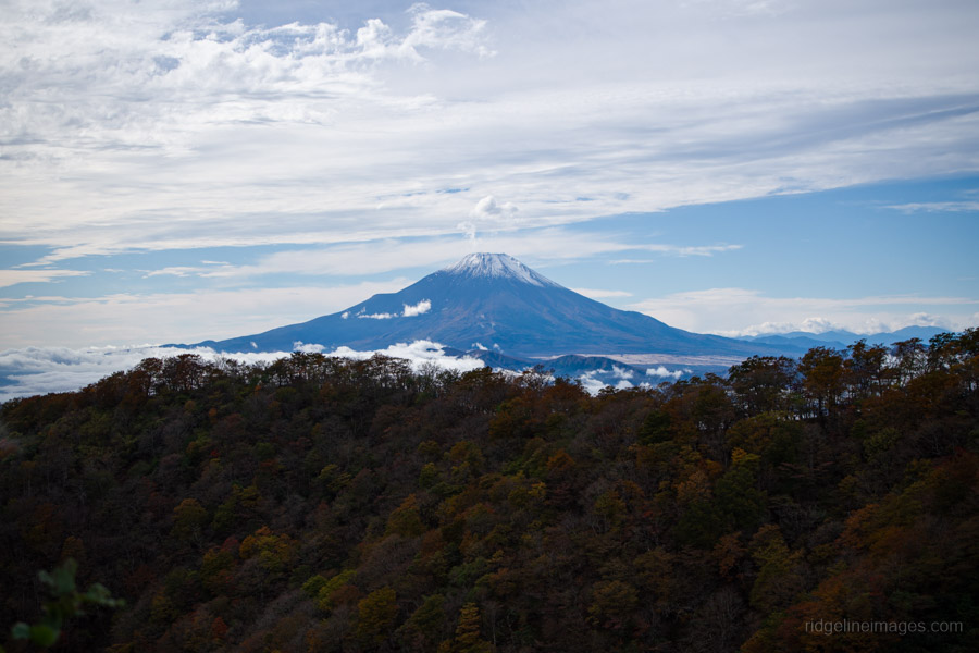
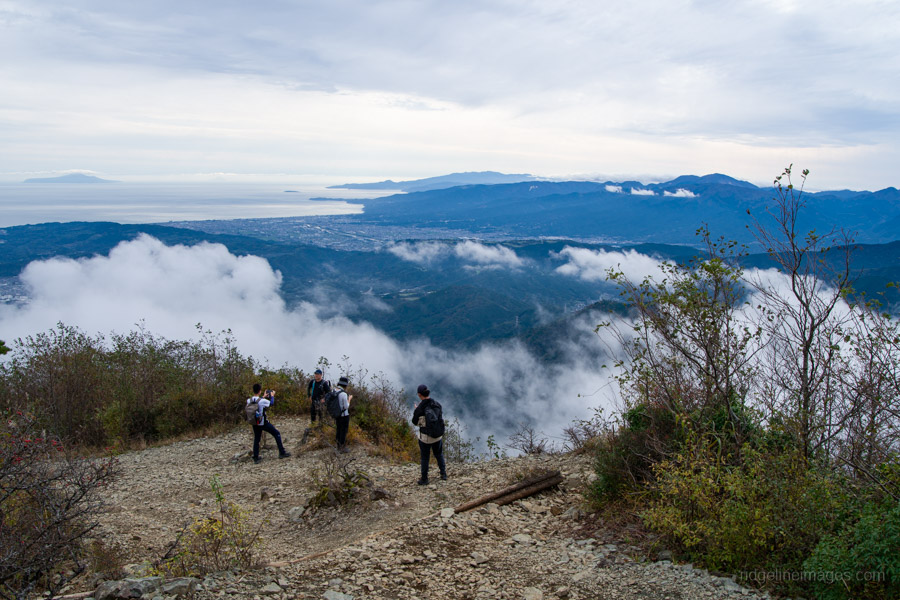
As you gain elevation, Mt. Oyama gradually comes into view behind you, and about an hour after leaving the bus stop, you’ll reach Mt. Ninoto 二ノ塔, the first peak along the main ridge and the first spot where Mt. Fuji makes an appearance. There are benches here, making it a good place to rest and shed a layer. Even better views, however, await at neighbouring Mt. Sannoto 三ノ塔, 1,205 m, about a 10–minute walk from Mt. Ninoto – along yet another stretch of stairway hell. The summit of Mt. Sannoto was so clear that day I could make out not only Tokyo Skytree but also Izu Oshima and even the faint silhouette of tiny Toshima.
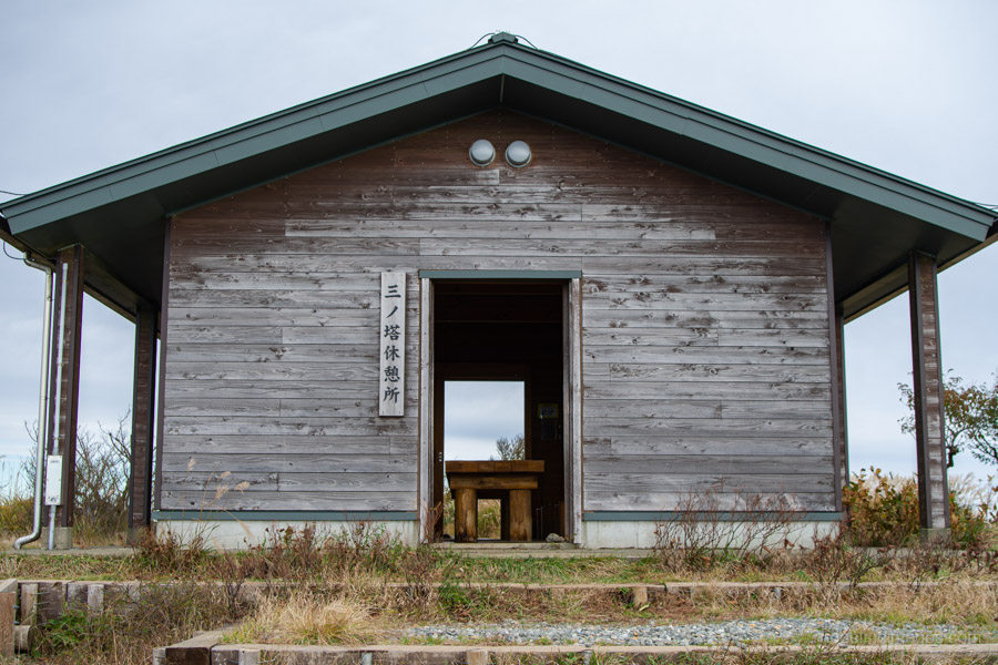
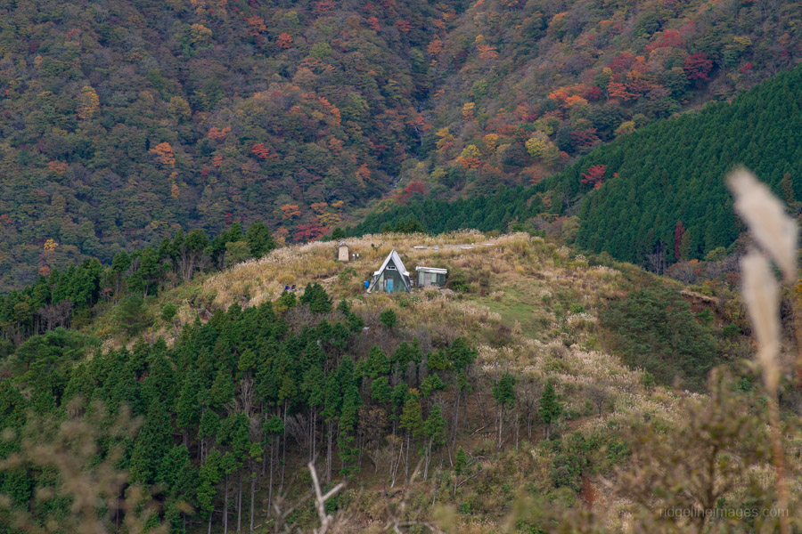
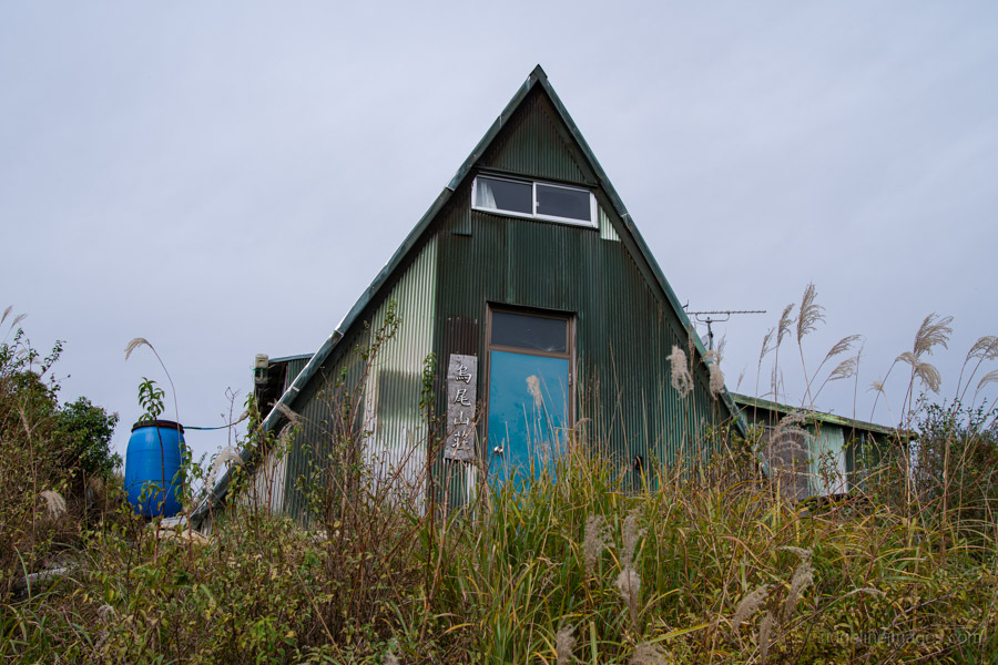
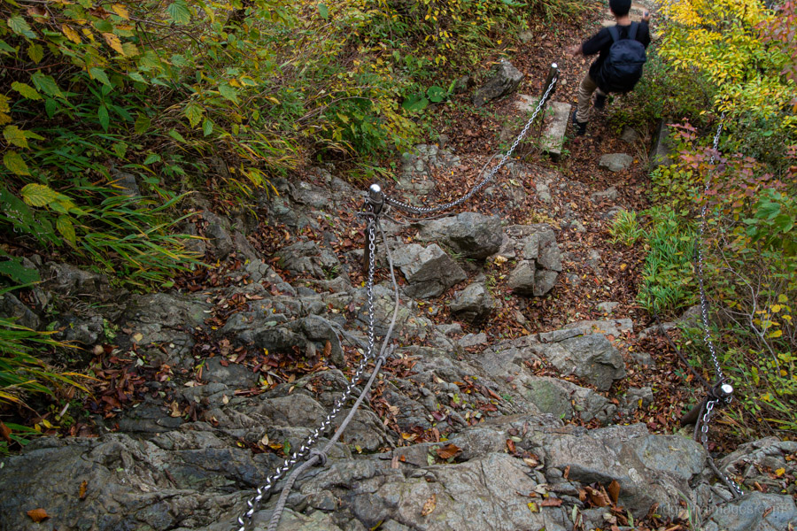
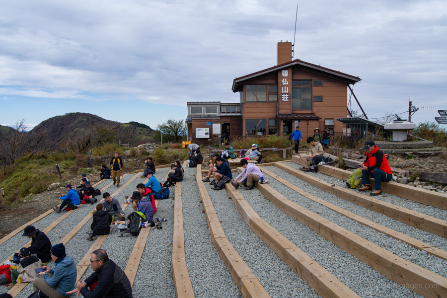
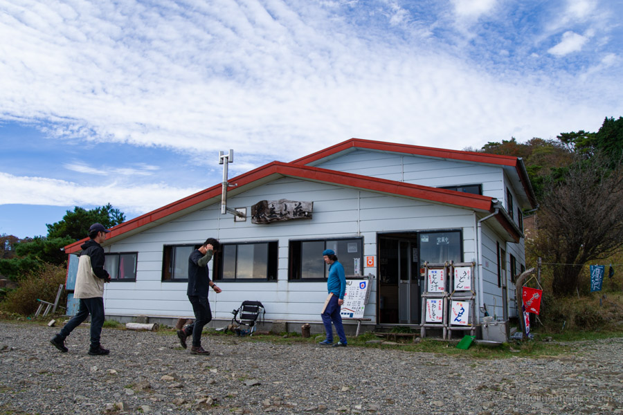
Next up is a steep descent to Mt. Karasuo 鳥尾山 (1,136 m), recognisable by its triangular-roofed hut, which has recently ceased operations. This section also features the first of two fixed-chain areas along the ridge, followed by a short climb back up to the hut. The summit here is spacious and dotted with benches, making it an excellent spot to rest and take in the views.
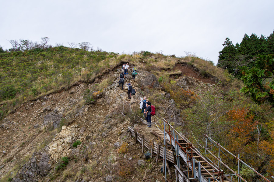
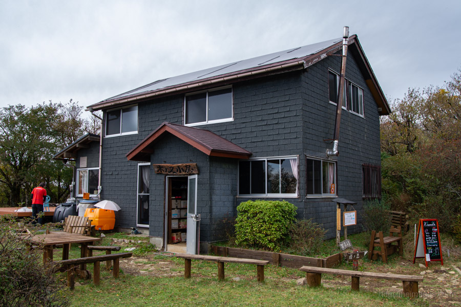
As you approach Mt. Gyoja 行者ヶ岳, the trail becomes steeper, with rocky stretches both before and after the peak. A small traffic jam had formed at the second chain section, though the steps are solid and the climb itself isn’t particularly difficult. Continuing on, a scaffolded path built over loose scree leads to Mt. Shindainichi 新大日, and a little further on, you’ll come to Kinomata-goya 木ノ又小屋. From here marks the final push to the summit.
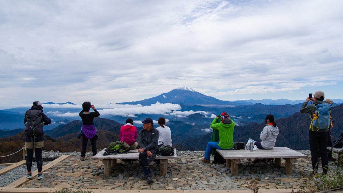
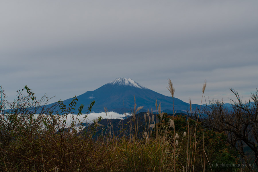
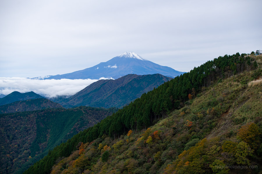
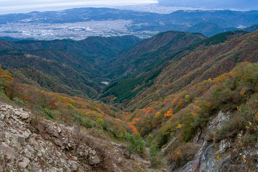
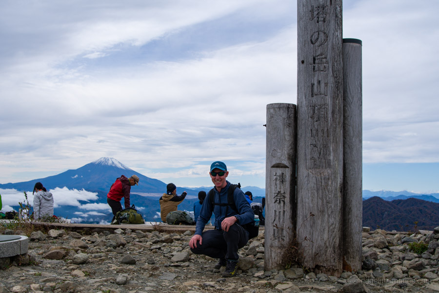
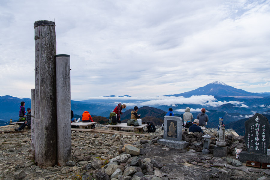
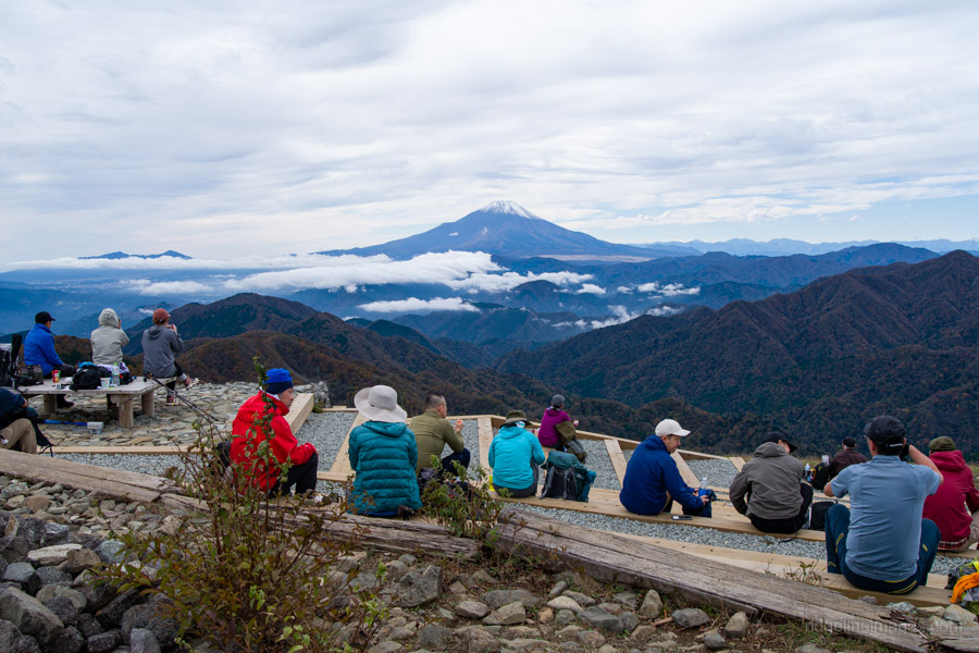
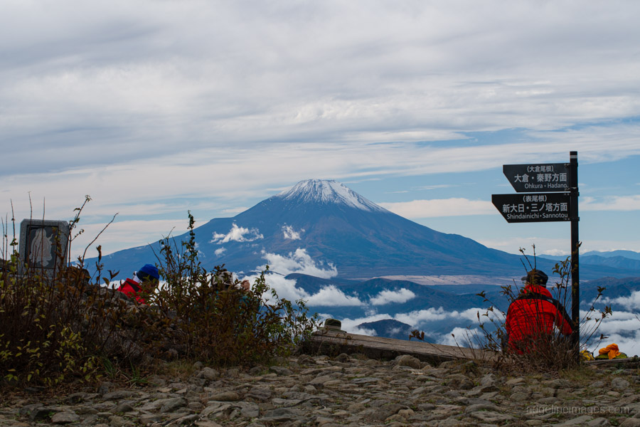
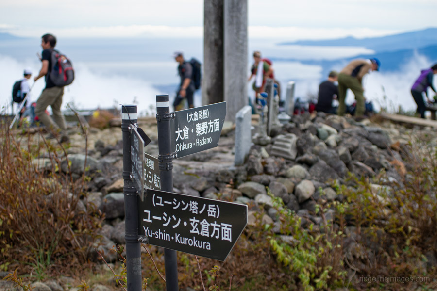
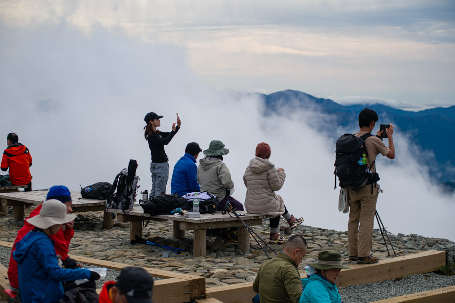
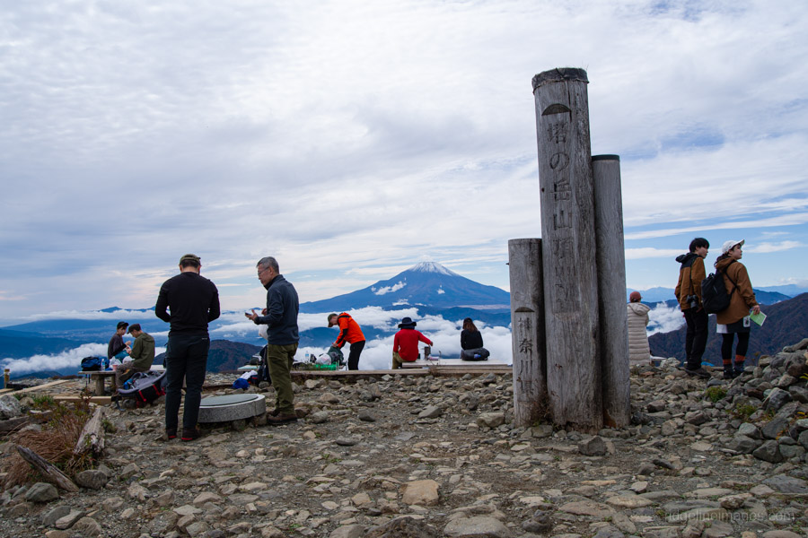
All told, it took me almost exactly four hours – the standard course time – to reach Mt. Tonodake 塔ノ岳 (1,491 m). Near the summit, I noticed a couple of guys awkwardly trying to position their camera for a group shot, so I offered to take the photo for them – a favour they gladly returned. As expected, a sizable crowd had gathered to enjoy the stunning, unobstructed view of Mt. Fuji. In the distance, the snow-capped peaks of the Southern Alps were also clearly visible.
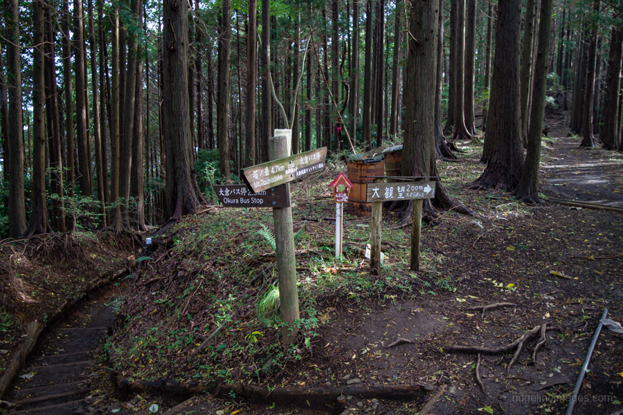
The main reason for starting this hike from Yabitsu Pass ヤビツ峠 is the plentiful bus service from Okura 大倉. Before that, however, you’ll need to tackle the long descent down the Okura Ridge – a 7 km stretch with an elevation drop of about 1,200 metres. This ridge is famously (or infamously) nicknamed Baka One バカ尾根, the “Fool’s Ridge”, for its seemingly endless, monotonous slope. It’s almost entirely made up of stairs – from start to finish.
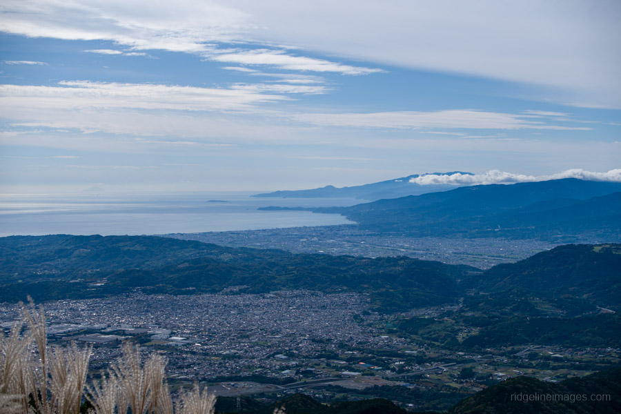
Continue past Kinhiyashi 金冷シ, where the trail branches off towards Mt. Nabewari 鍋割山. As you descend the scree slope, Sagami Bay spreads out before you. To the left, you can see the main ridge you traversed earlier in the day, with Mt. Oyama rising gracefully in the distance.
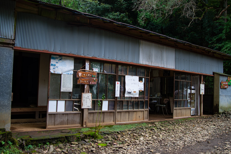
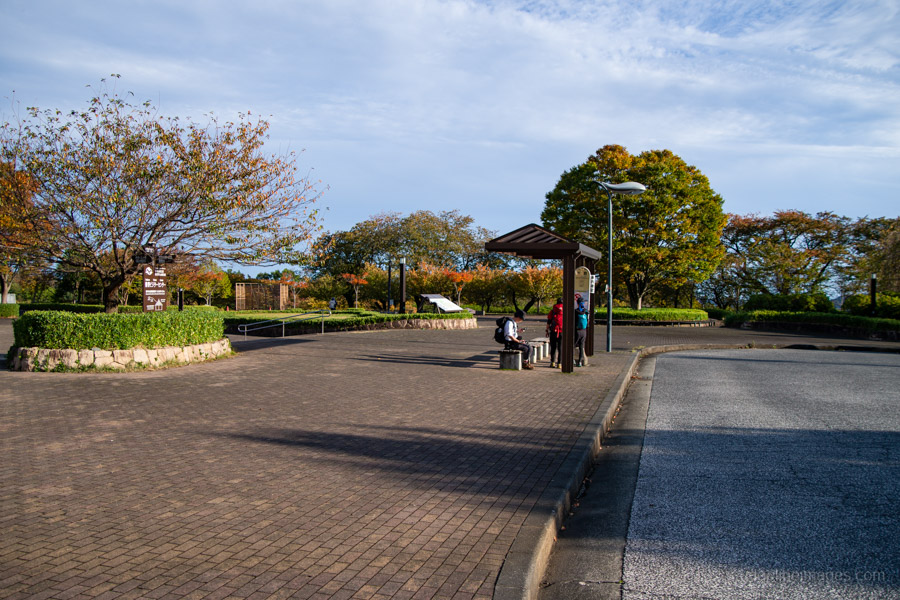
Along the way, you’ll pass several mountain huts and tea houses, including the white-painted Hanadate Sanso 花立山荘, Horiyama-no-ie Tea House 堀山の家, Miharashi Chaya 見晴茶屋, and Kannon Chaya 観音茶屋 – the latter advertising coffee for a mere 300 yen. Most were open and doing a brisk trade with weary hikers stopping for a rest. I arrived back at Okura 大倉 right on 3:15 pm, with plenty of time to reward myself with a well-deserved soft serve from the adjoining restaurant-cafe and then bus back to Shibusawa Station (15 minutes, 250 yen).


懐かしい
Tanzawa is nice.
And especially so when Fujisan isn’t hiding behind a curtain!
I remember the first time I saw it from Ninoto. I wasn’t expecting it, and it was a great surprise.
I saw the big guy a few times over the past few days. Those were nice surprises, too. The forecasts were for so much rain but it turned out that both Saturday and Monday were good days for hiking.