.
Mt. Tenranzan 天覧山 – Mt. Tonosu 多峯主山
Distance: 7.6 km
Elevation change: 95 metres
Highest point: 195 metres
Start: Hanno Station (Seibu Ikebukuro Line)
Finish: Hanno Station (Seibu Ikebukuro Line)
Difficulty: ▅▅▅▅▅▅▅▅▅▅ ❶
Map: Yama to Kogen Chizu 山と高原地図 [No.23 奥武蔵・秩父 OKUMUSASHI·CHICHIBU]
GPX TrackKML TrackGSI MAPPDF Topo Map
A Great Spot to Enjoy Natural Surroundings in Saitama
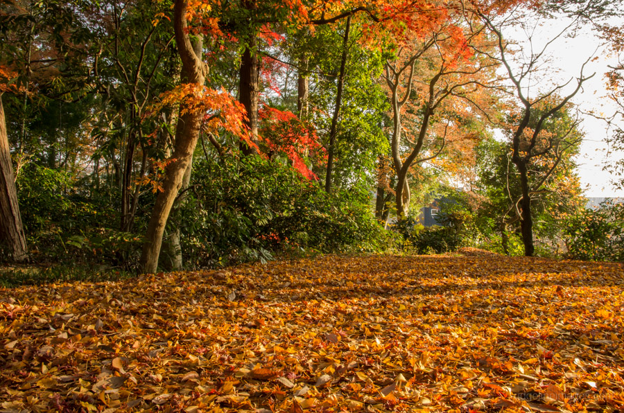
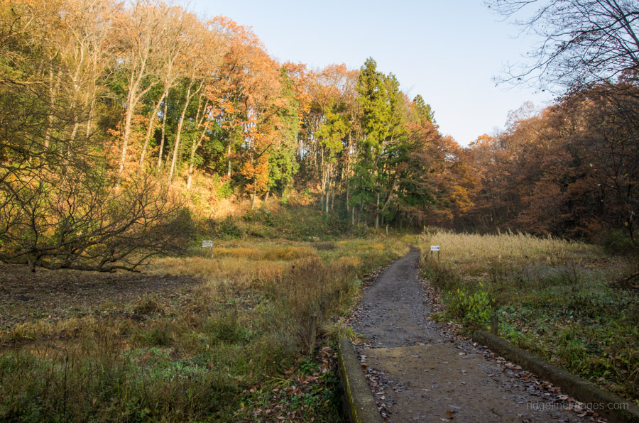
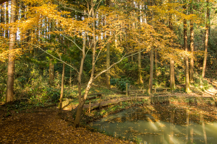
Located at what might be considered the commutable edge of Tokyo, Hanno City in Saitama Prefecture is a great spot to enjoy local natural surroundings. During the summer months the Iruma River which runs through the city is a drawcard for swimming and BBQs and in the autumn the changing Fall colours draw sightseers to a nature reserve north of river.
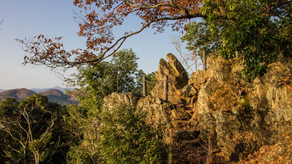
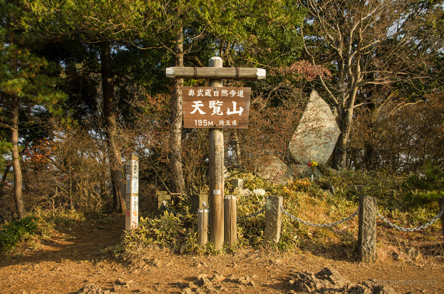
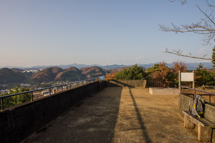
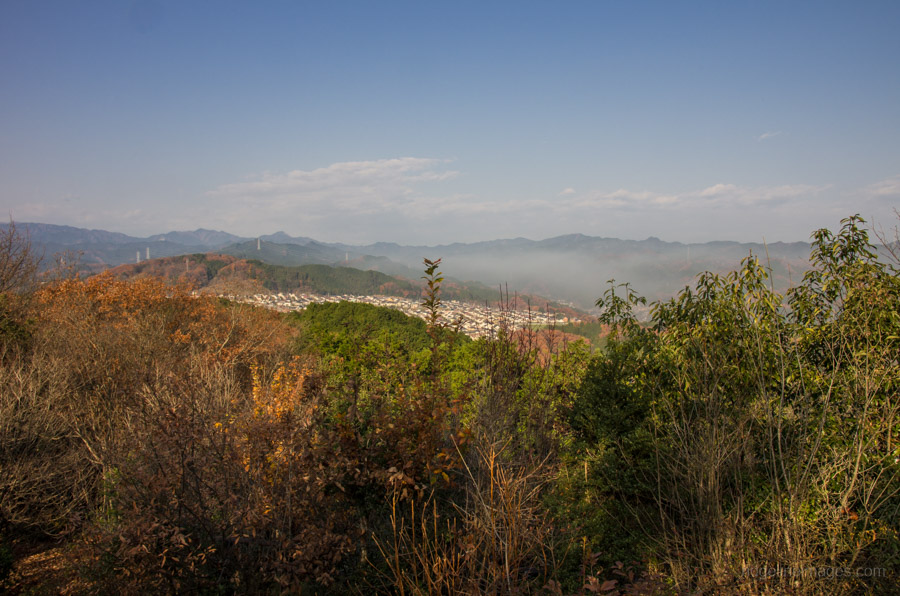
This family oriented hike is accessible from Hanno Station on the Seibu Ikebukuro Line around an hour from central Tokyo. From the train station check the local area map or visitor information center and head towards the Central Park and the Nonin-ji Temple. It takes around 20 minutes to reach the temple compound or alternatively take a bus to the Tenranzan-shita 天覧山下 bus stop. The trail up to Mount Tenranzan 天覧山 (195 m) skirts around the right side of the temple taking you past a lower rest area before popping out at an observation platform which on clear days provides views from Mt. Oyama crossways to Mt. Takanosu and of course Mount Fuji. From here the trail heads down a stepped embankment where you can wander around to Mt. Tonosu 多峯主山 (271 m). The full course is around 9 kilometres and an alternative return option takes the Okumusashi Nature Path thru to Koma Station.


I knocked this course out this morning. Thanks for listing this nice, easy trail. Just what I wanted, a bit of exercise, some nice views of Fuji, nice forest, and close to home. And a real rarity in Japan, plentiful free parking near the trailhead! Wow.
I hit four peaks in the park. I know most aren’t listed on maps. One, in fact, on Yamap didn’t have any marker but there was a small shrine up there. I feel guilty calling these mountains when they’re all less than 300 meters in height. But … mountains they are according to Yamap.
Again, really a nice easy walk in a nice park. Even my wife will join me for this one next time.
For a hike so close to Tokyo you’re right it does tick quite a few boxes. I’d imagine the view from that lookout platform would have been awesome today given the clear winter air we’ve been having.
Yes sir. Really nice Fuji views from there and everywhere this past week! Including Mt Jinba this morning 🙂
Hey, David. Did this one today, quite a humid day and I was melting, but a nice morning all in all. Pleasant little town to walk around and ended up after the two mounts with a dip in Iruma River. Thanks again, a Ko-fi coming your way.
Going up to Kumotori with a friend next weekend. Wish us luck!
Cheers Francisco, a dip in the river at the end is always a nice note to finish on. I think you’ll love Kumotoriyama, I know I did when I climbed it years back. It’s a rather grueling hike so make an early start.
Thank you for sharing this route! I’ve been trying to figure out how to explore Hanno and your routes are perfect! Ii just did it this afternoon
No problem, Linda. Glad to hear you found the info handy and enjoyed the hike 🙂