.
Yashajin-toge 夜叉神峠 – Jizo-dake 地蔵岳 – Hirogawara 広河原
Distance: 26.8 km
Elevation change: 1460 metres
Highest point: 2840 metres
Start: Yashajin-toge trailhead bus stop
Finish: Hirogawara bus stop
Difficulty: ▅▅▅▅▅▅▅▅▅▅ ❹
Map: Yama to Kogen Chizu 山と高原地図 [No.44 北岳・甲斐駒 KITA-DAKE·KAIKOMA]
GPX TrackKML TrackGSI MAPPDF Topo Map
Exploring the Majestic Houou Sanzan
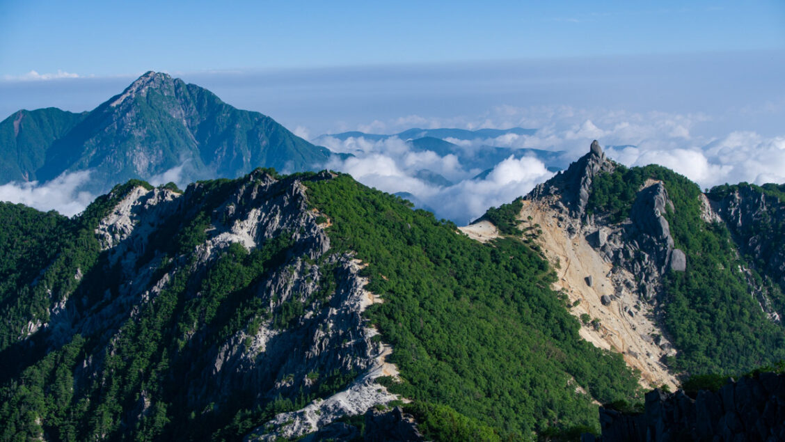
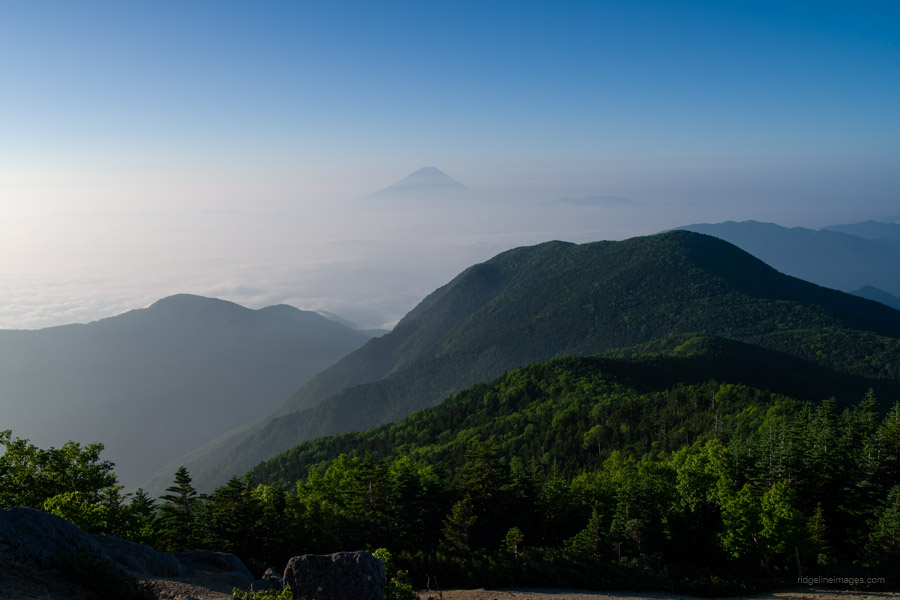
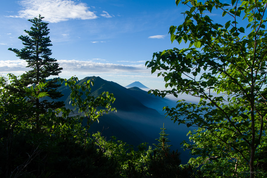
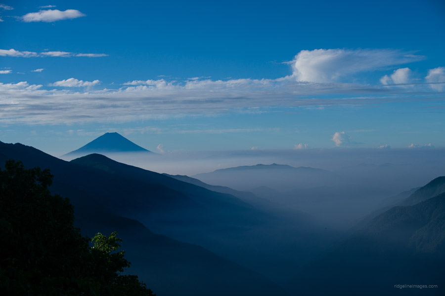
If you’re after views – and let’s be honest, who isn’t – you’d be hard-pressed to find a 3-day hike with more spectacular panoramas of the Southern Alps. As many bloggers and guidebooks before me have noted, on clear days the views of Mt. Fuji and across to Kita-dake from Yakushi-dake and the surrounding peaks are simply beyond words.
Mt. Houou (literally “Mt. Phoenix”) stands as a kind of vanguard to the Southern Alps, its chalky, granite ridges marking a striking introduction to the range. The name refers collectively to three peaks – Mt. Jizo, Mt. Kannon, and Mt. Yakushi – known together as the Houou Sanzan 鳳凰三山. As their religious names suggest, these mountains have long been objects of worship. Compared to the deeper, more remote peaks of the Southern Alps, the Houou Sanzan are relatively accessible, making them a popular gateway for hikers new to the region. The sharp obelisk-like form of Mt. Jizo is especially iconic, visible from the Kofu Basin and emblematic of the “front line” of this formidable mountain range.
Day 1: Starting the Ascent from Yashajin-toge (8.2 km)
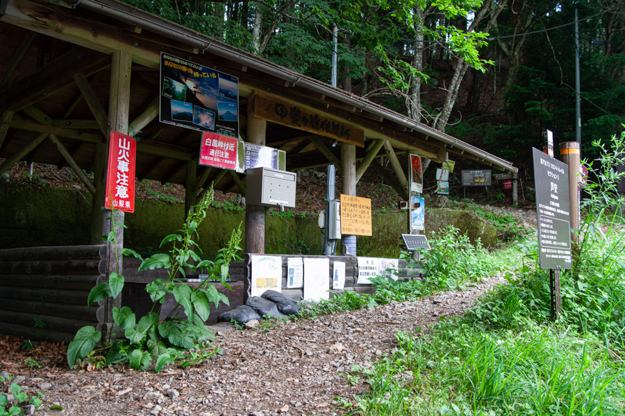
Getting to the trailhead is the same as for the Kita-dake hike, except you’ll be alighting at Yashajin-toge. From Shinjuku Station, it’s about 90 minutes to Kofu Station 甲府駅 by limited express train. From there, take a Yamanashi Kotsu bus from the south exit (bus stand no. 1). During the busy season (mid-July through late August), there are six daily buses starting as early as 4:35 am in the morning. The ride to the Yashajin-toge trailhead 夜叉神峠登山口 takes around 1 hour and 20 minutes and costs 1,760 yen one way. You can pay the bus fare in cash or by IC card. Since I was hiking outside of peak season, the first bus didn’t depart until 9:05 am in the morning.
The first thing that struck me was the distinct lack of hikers – only two of us set out from the trailhead. In fact, I passed just a handful of people on the first day, only slightly more on the second, and just one other hiker on the final day – despite the glorious weather. In contrast, I remember encountering just as many people within the first ten minutes on both of my previous climbs to Kita-dake!
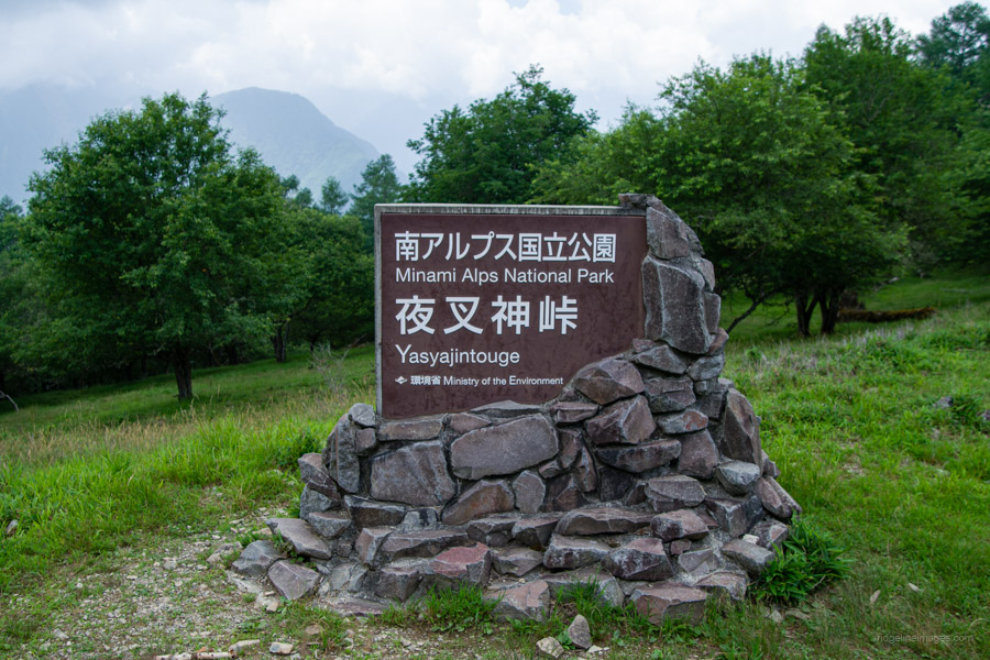
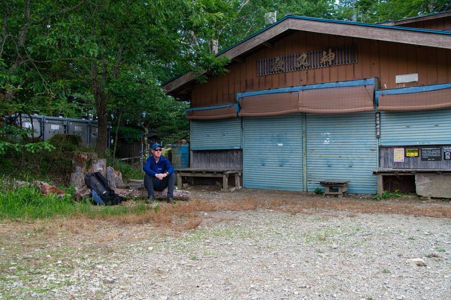
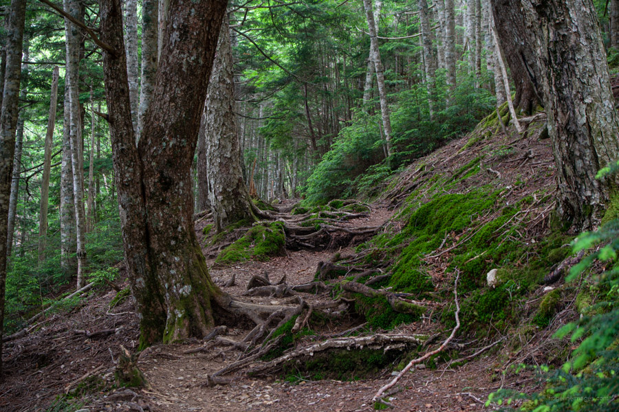
At the trailhead, you’ll find a restroom and a vending machine. The trail begins with a gentle climb, taking about an hour to reach Yashajin-toge 夜叉神峠. Next to the Yashajin-toge Hut 夜叉神峠小屋, there’s a campsite, though it likely doesn’t see much use due to its proximity to the bus stop and the lack of a water source. The weather on the first day was cloudy, but on a clear day, the view from in front of the hut offers a stunning outlook of the beautifully aligned Shirane Sanzan peaks.
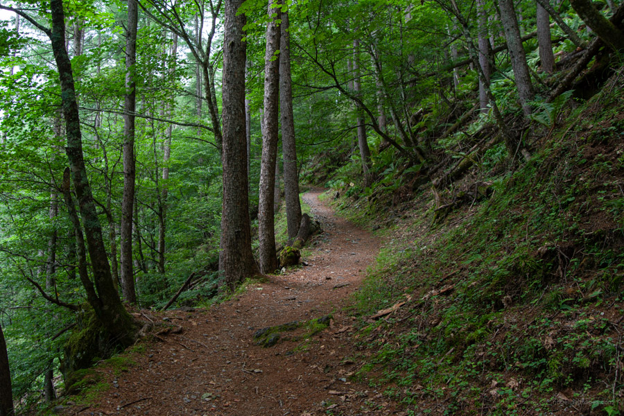
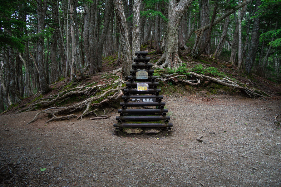
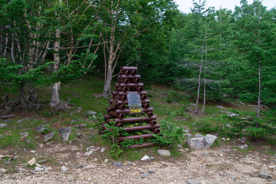
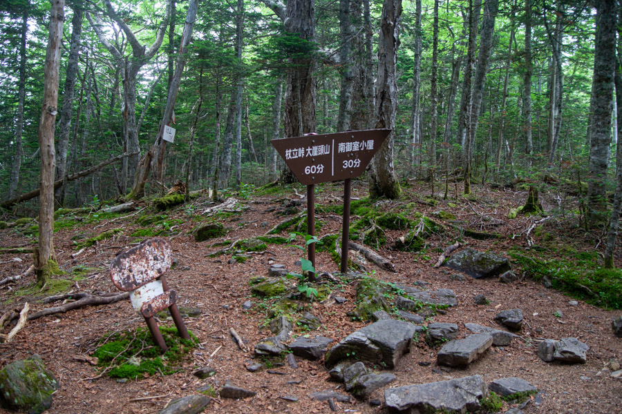
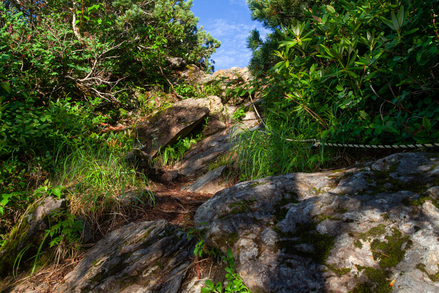
From here, the well-marked trail follows the ridge. After about an hour and a half of steadily steeper climbing, you’ll reach Tsuetate-toge 杖立峠, which makes a good lunch spot – especially for those arriving on the later morning bus. Beyond this point, the trail opens up into a clearing known as the Kajiba-ato 火事場跡, or “burned-out area.” You’ll also come across another distinctive cairn made from metal pipes – one of several dotted along the route.
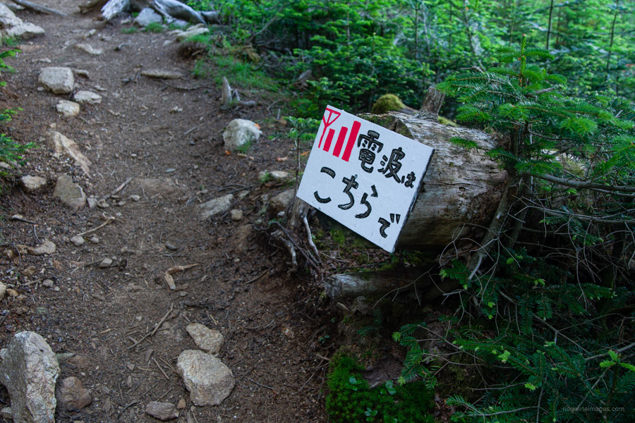
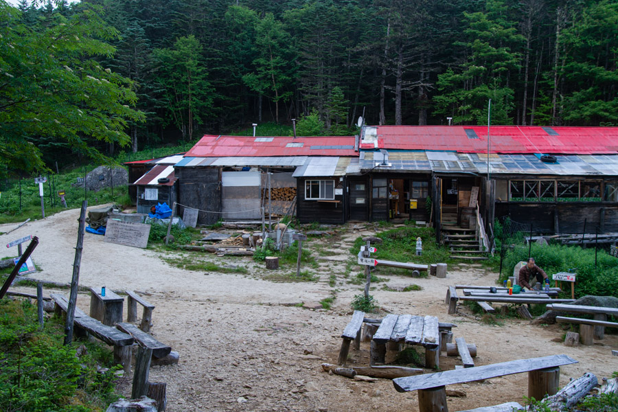
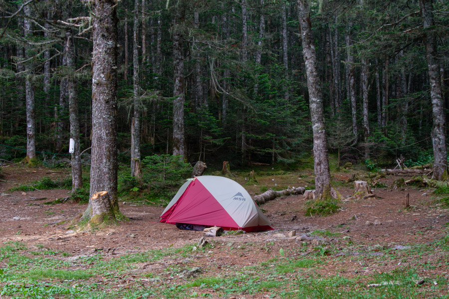
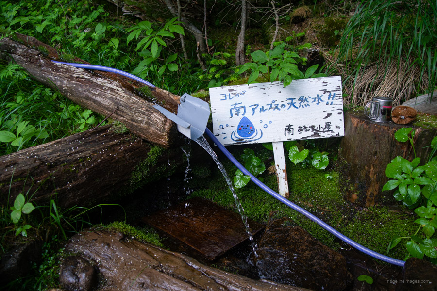
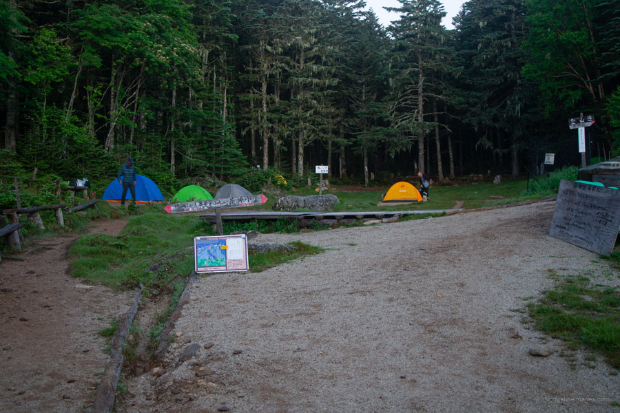
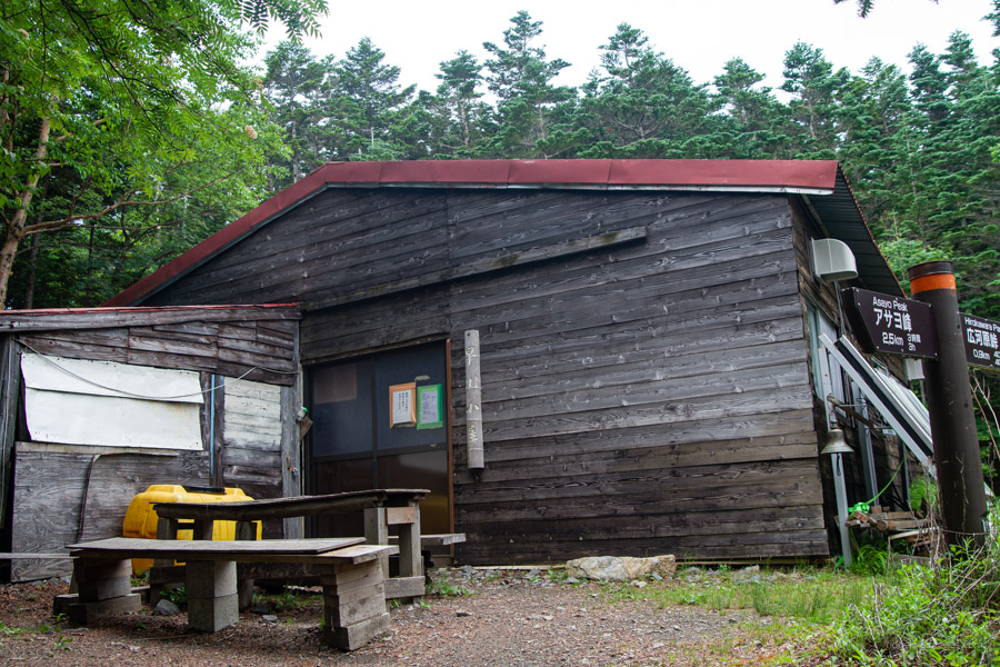
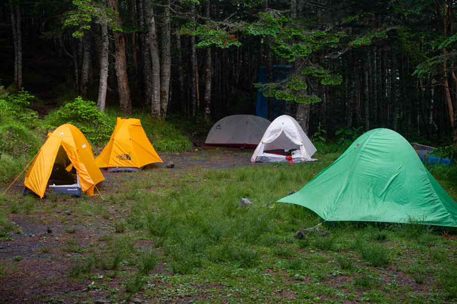
Next up is Ichigo-daira 苺平, where you can make a detour to a viewpoint at Tsuji-yama 辻山, which adds about 30 minutes to the hike. Given the overcast conditions, I decided to skip it and made a beeline down the gentle slope to Minami Omuro-goya 南御室小屋. On the way look out for signposted spots indicating areas with mobile phone reception. The hut itself, along with its flat and spacious campsite (2,000 yen), is sheltered from the wind and, importantly, has a reliable water source right next to it.
Day 2: Traversing the Houou Sanzan Peaks (9.2 km)
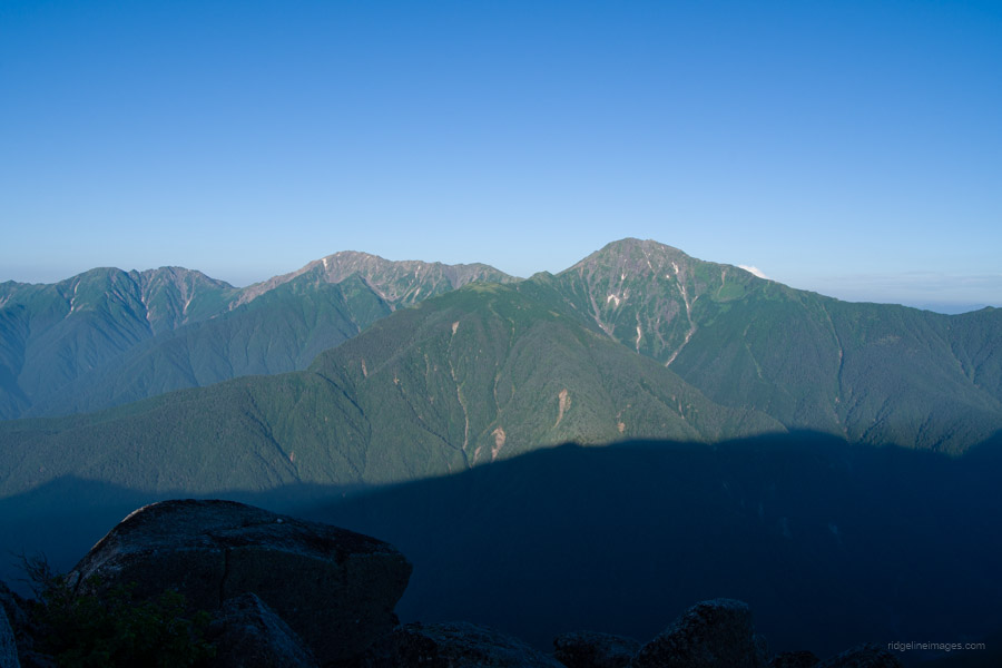
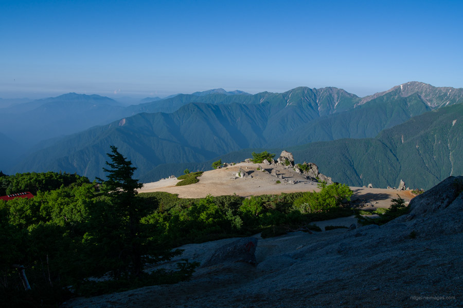
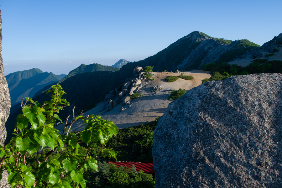
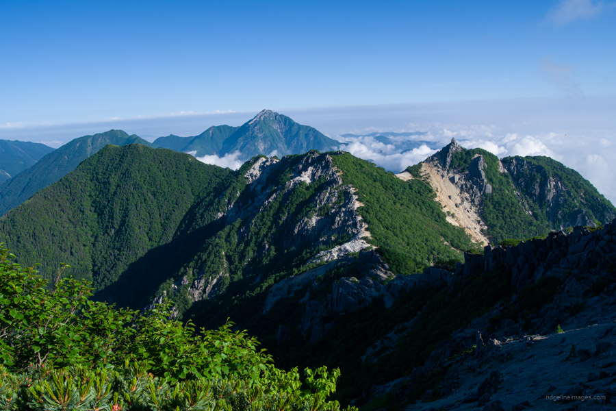
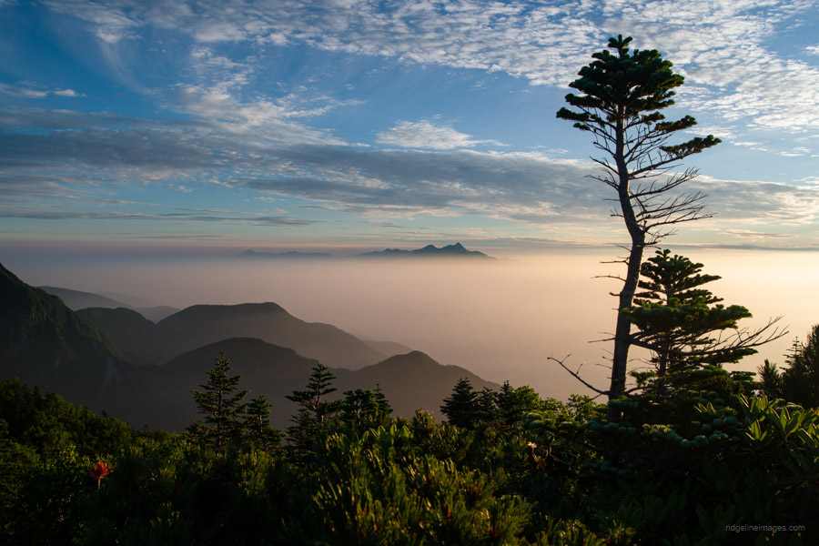
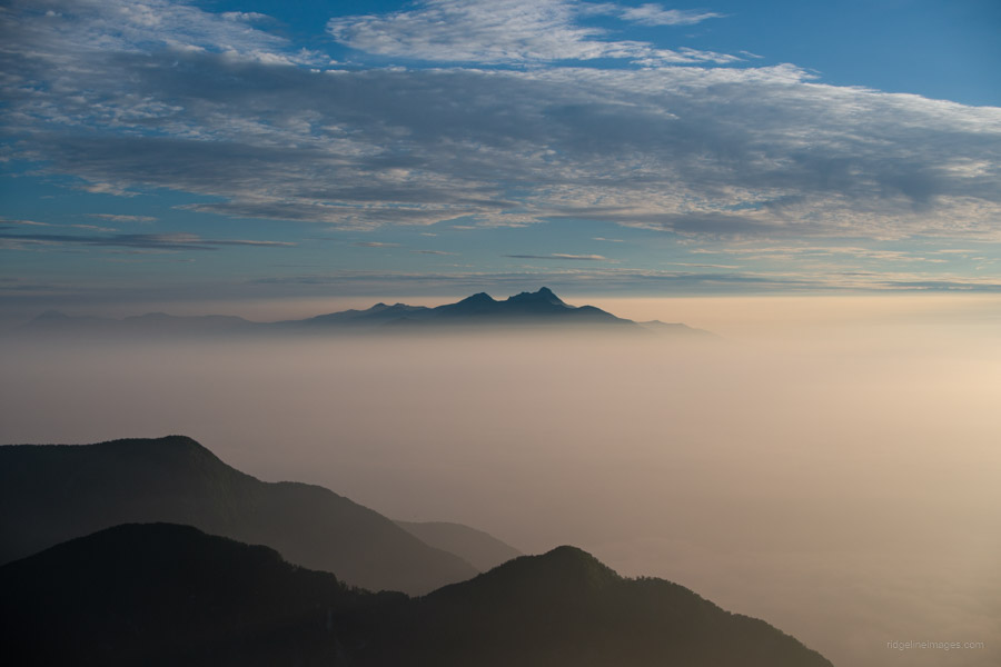
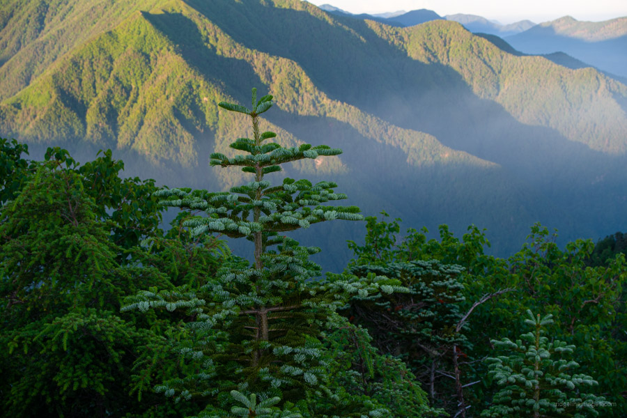
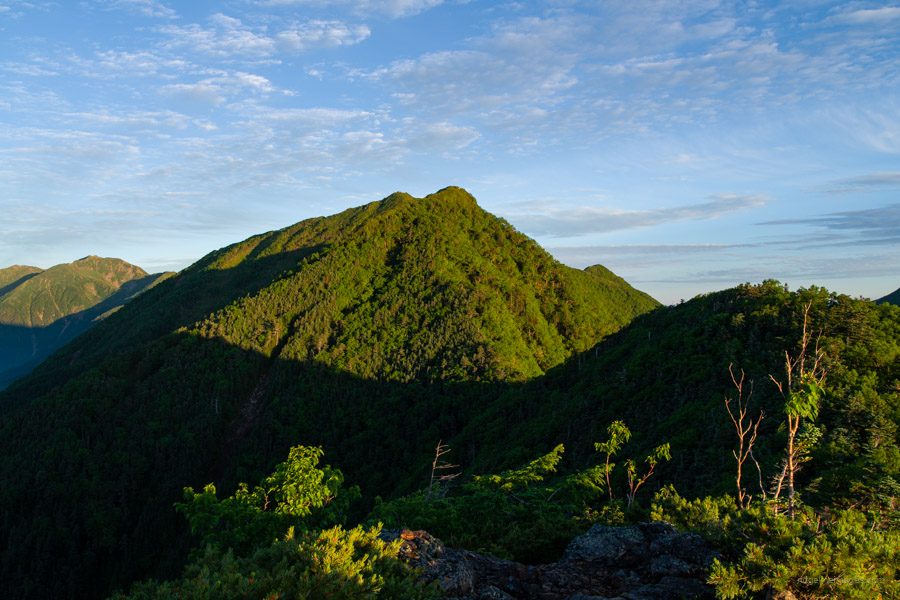
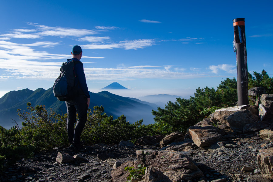
I slept well and was the first to leave the campsite at 4:30 am, eager to make the most of the fine weather. Behind the hut, the trail climbs steeply up a slope of exposed granite. About 45 minutes after setting out, I broke through the treeline and was rewarded with the first spectacular views of the morning – Kita-dake and Aino-dake standing tall across the valley, with Senjogadake and Mt. Fuji front and back. From there, the route follows the gravelly ridge with the red-roofed Yakushidake-goya 薬師岳小屋 soon coming into view.
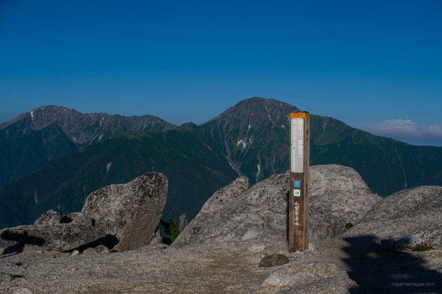
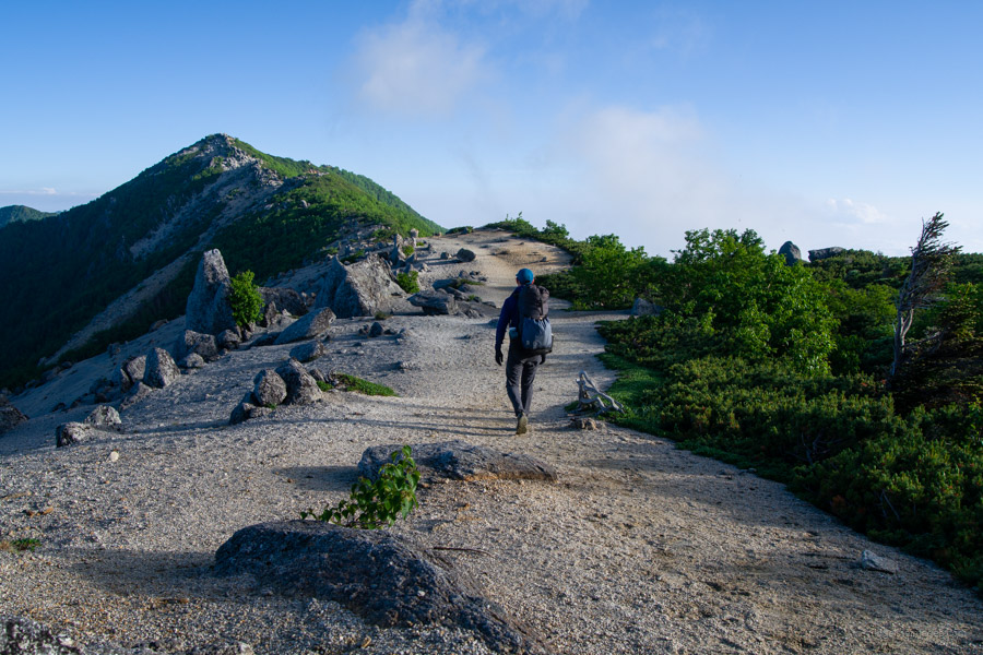
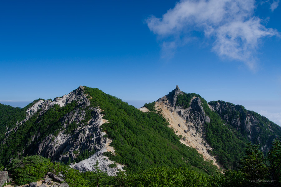
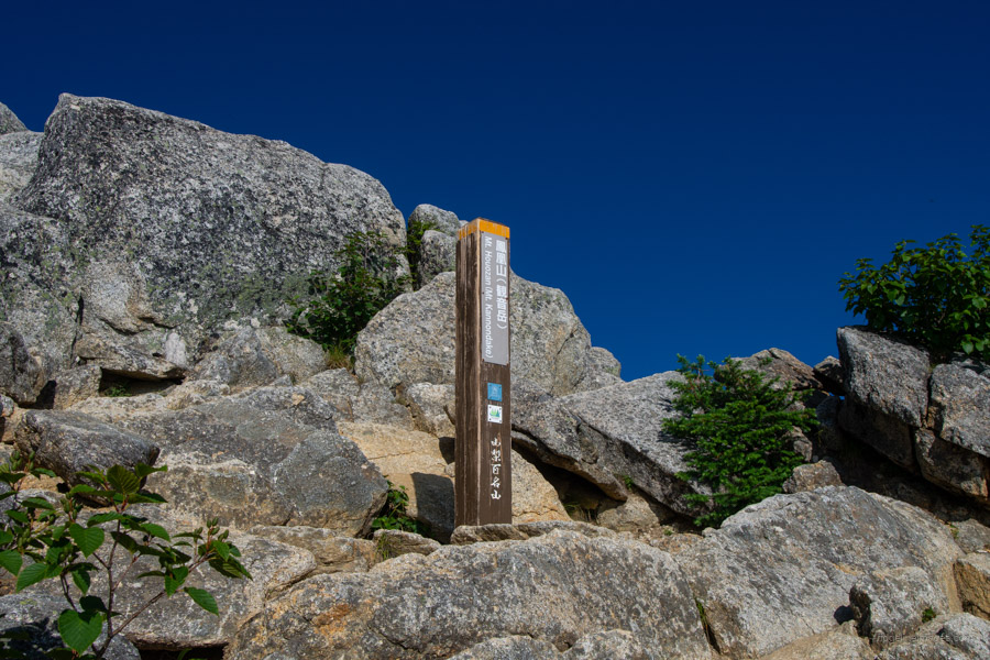
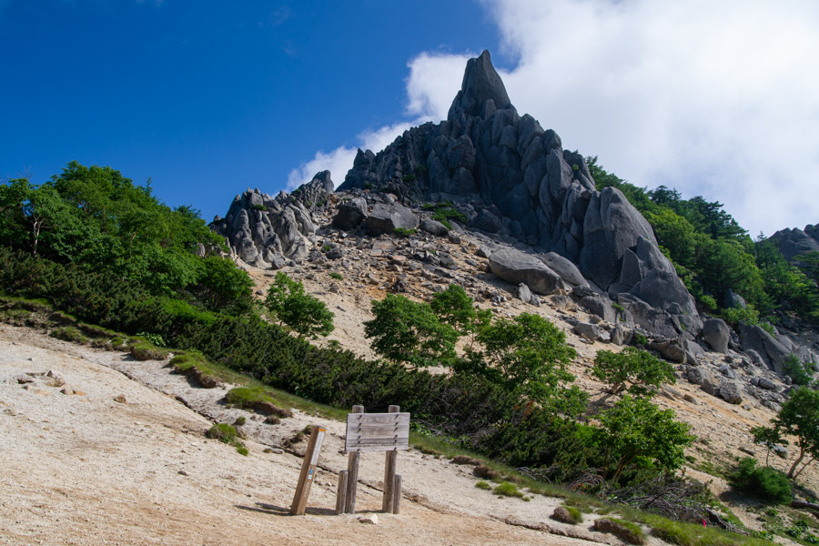
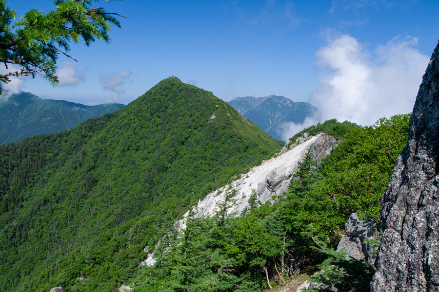
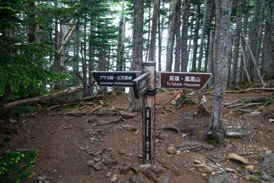
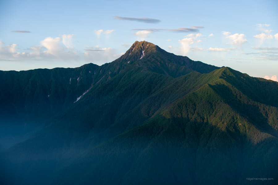
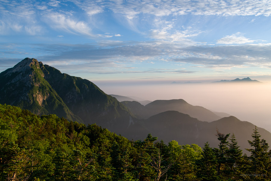
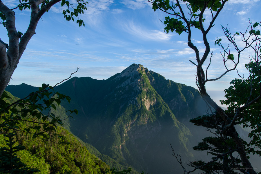
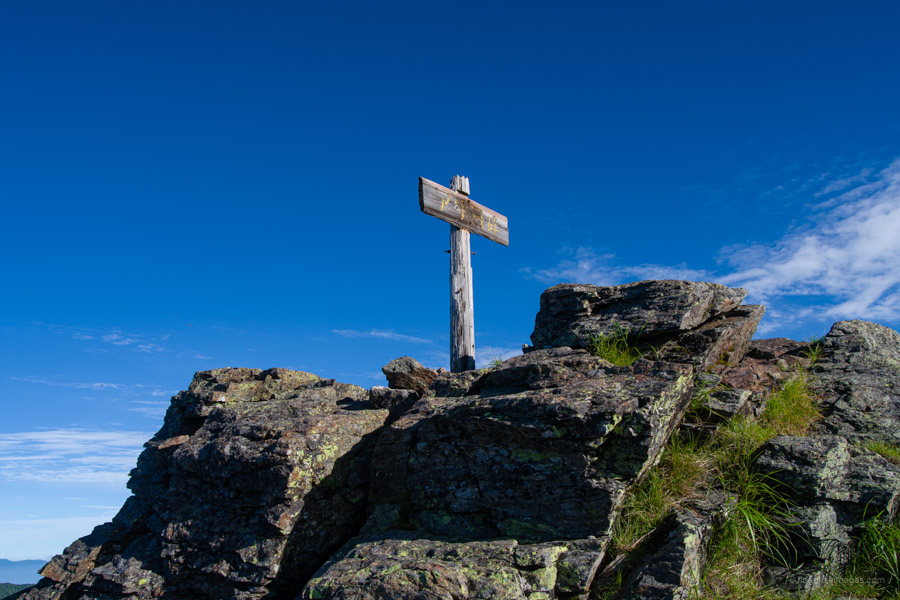
After dropping down to the hut, it’s a short climb to Yakushi-dake 薬師岳 (2,780 m). From the summit, the ridgeline ahead appears gentle at first glance – but once you’re on it, you’ll find a surprising number of ups and downs as the trail continues toward the neighbouring Kannon-dake 観音岳 (2,841 m). From Kannon-dake, the view to the north suddenly opens up, revealing Jizo-dake 地蔵岳 – the final peak of the Houou Sanzan traverse. Its striking obelisk-shaped summit stands out dramatically against the skyline, with Mt. Kaikoma rising prominently beyond.
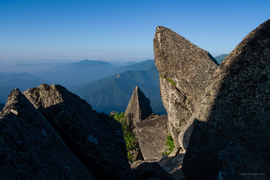
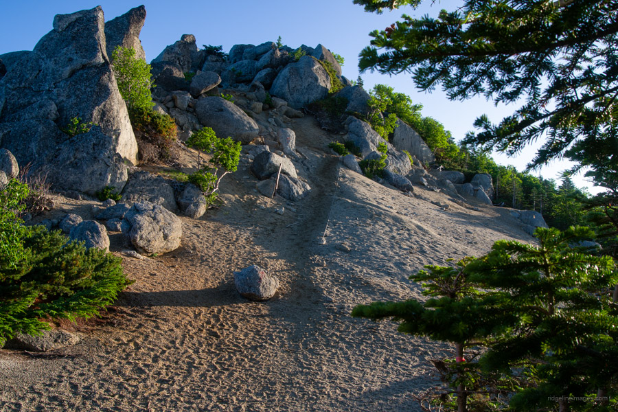
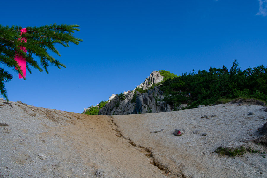
The trail from Kannon-dake to Jizo-dake is steep and rugged, with several significant ascents and descents. The name Houou-zan is said to come from the obelisk on Jizo-dake, which resembles the beak of a phoenix. While the true summit is technically the top of the obelisk, a summit marker is placed nearby for convenience. Unlike somewhere like Yarigatake, there are no ladders or chains to assist in climbing to the top – and in any case, scaling the obelisk is not recommended due to the exposure.
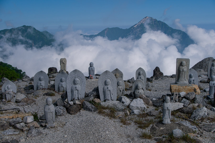
It’s best to leave your pack at the pass, as you’ll be returning there after the short out-and-back to the sandy saddle at the base of Jizo-dake. This area, known as Saino-kawara 賽ノ河原, is home to many Jizo statues enshrined along the trail. According to an old custom, couples who are unable to have children may take one Jizo statue home from here – and if they are later blessed with a child, they return two in gratitude.
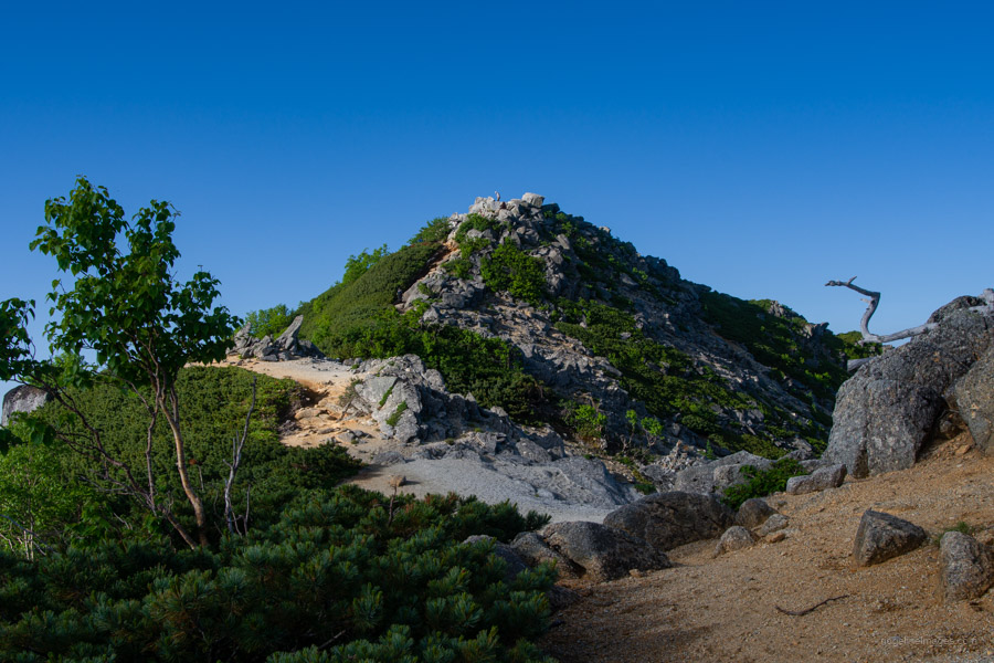
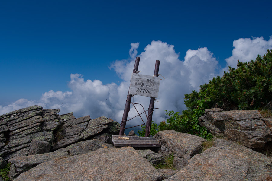
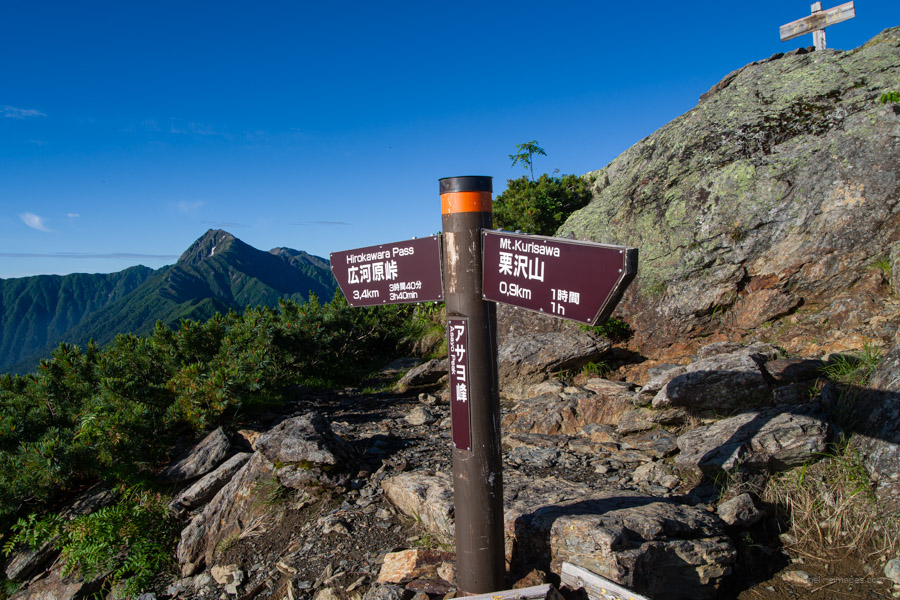
After returning to your backpack, the next task is tackling Mt. Takane 高嶺 (2,779 m). It’s a rather formidable peak that sees far fewer hikers, as most choose to descend via Jizo-goya instead. The blazing sun on your back doesn’t make the climb any easier. One side of the trail drops off steeply, so it’s best to take it slow and tread carefully. The summit is broad and flat, carpeted with dense mats of Japanese creeping pine. From here, the trail begins its descent toward Hakuho-toge 白鳳峠, already visible below. Although it was still before 9:00 am, clouds had begun to roll in.
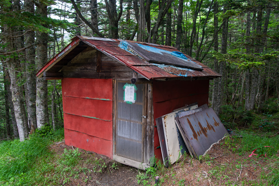
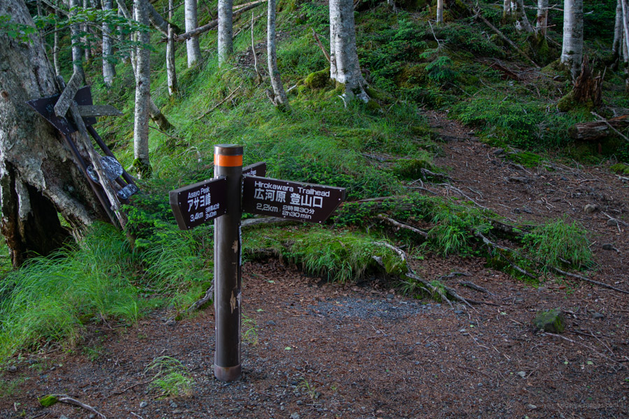
As the altitude drops, you re-enter the forest. It takes around 45 minutes to reach Hakuho-toge, followed by another 90-minute hike to Hayakawaone-goya 早川尾根小屋 (1,000 yen), passing Hirokawara-toge 広河原峠 on the way – this would be the descent route for the following day.
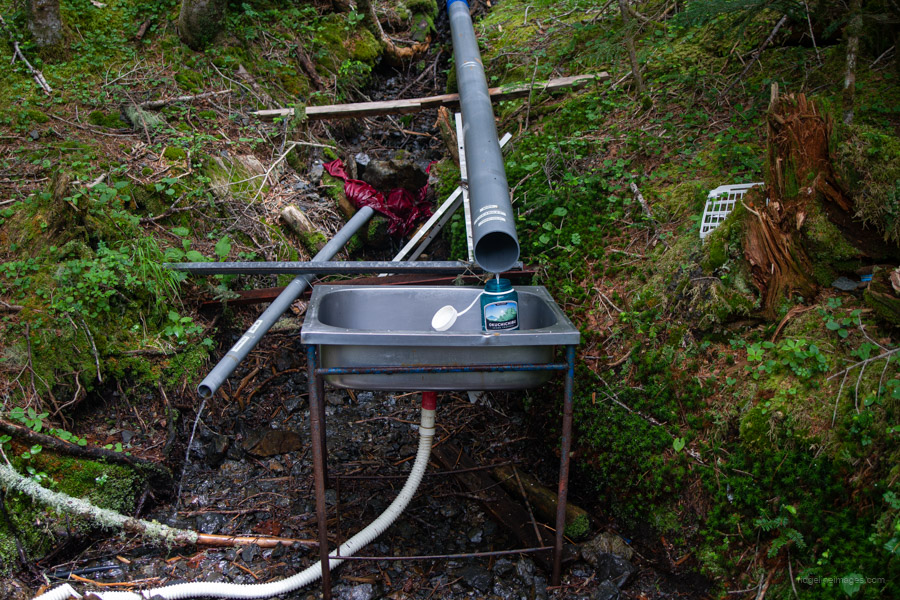
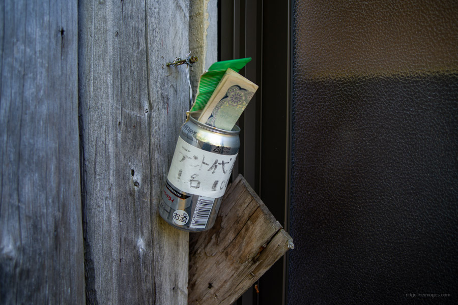
Once at the hut, my first priority was to check whether the mizuba (water source) was flowing, and then to find a suitable spot to pitch my tent. When the hut manager isn’t in attendance, you pay the ¥1,000 camping fee (or ¥2,000 for the emergency hut) by stuffing your notes into – of all things – a beer can!
Day 3: Summiting Mt. Asayo-mine and Steep Descent (9.4 km)
The final day’s challenge is a round trip from Hayakawaone-goya to climb Mt. Asayo-mine, a peak on the Hayakawa Ridge between Mt. Kaikoma and the Houou Sanzan. Though relatively unknown, Asayo-mine offers spectacular views, surrounded on all sides by some of the region’s most prominent mountains.
The signpost at the hut was a little disconcerting, showing a one-way time of 3 hours and a return of 5. However, traveling light and with fresh legs, I managed the return trip in 4 hours – including almost 30 minutes spent enjoying the summit. Thankfully, after the afternoon rain the day before, the morning dawned clear and bright. As with the previous day, I set off at daybreak, wearing my headlamp until sunrise.
After about 20 minutes of walking through the forest, I reached the first open views of the day – Kita-dake bathed in the morning sunlight to the left, and the Yatsugatake range poking through a sea of clouds to the right. It was truly spellbinding. Ahead, a large rising peak dominates the view, but this isn’t Mt. Asayo-mine – it’s an unnamed summit just before it. Before reaching the true peak, you’ll need to cross several of these smaller false summits along the ridge.
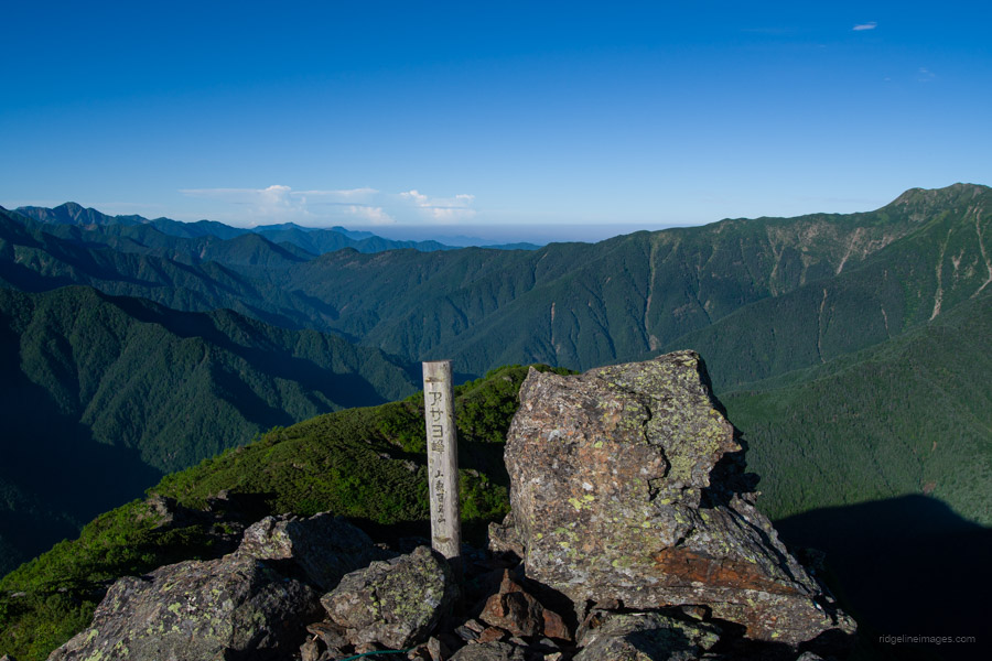
After a relatively benign start, the trail becomes noticeably steeper past the halfway point, turning into a rocky path that requires scrambling on all fours at times. The final false summit is Miyoshi-no-atama ミヨシノ頭, after which the trail drops to a saddle before the last push up to Mt. Asayo-mine アサヨ峰 (2,799 m).
Just below the summit, the terrain flattens out again into a zone of creeping pine, above the treeline. The summit is more commonly approached from Kitazawa-toge and done as a day hike, whereas the route from Hirokawara that I followed is more of a quiet backdoor approach. Fortunately, I had the summit entirely to myself. Although it’s a minor mountain, Asayo-mine holds two distinctions: it’s listed among both the 100 famous mountains of Yamanashi and the 300 famous mountains of Japan. And it’s completely worthy of those accolades with its sweeping 360-degree views in all directions.
For the descent, retrace your steps back to Hayakawaone-goya to pack up your tent, then return to the trail fork at Hirokawara-toge. As with the previous day, mist and cloud rolled in early and obscured the views. If you’re aiming to catch the midday bus from Hirokawara 広河原, plan to leave the campsite by 9:00 am in the morning.
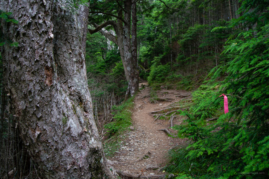
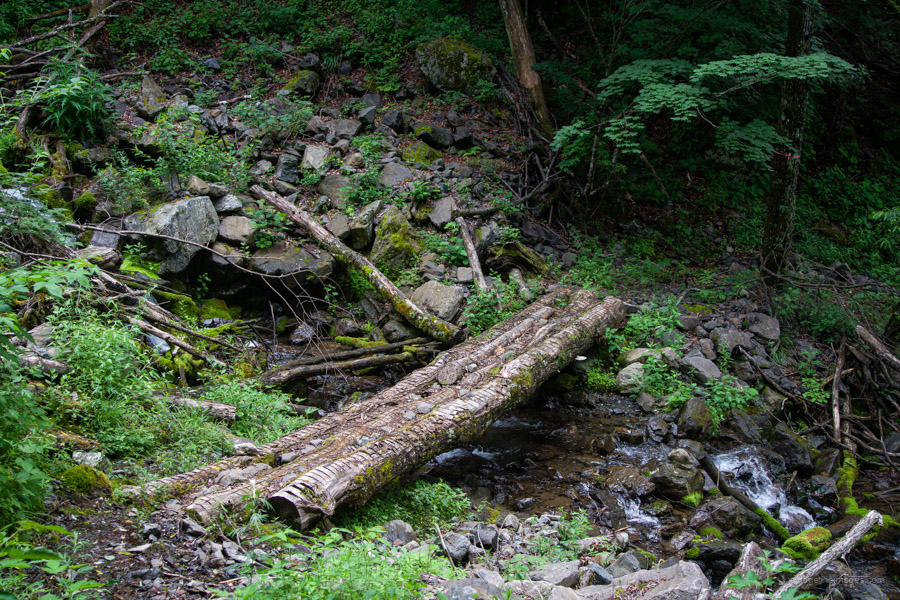
The descent to the Hirokawara-toge trailhead 広河原峠 is quite steep and would be difficult to follow without the help of pink tape markers. About two-thirds of the way down, the trail detours alongside a stream.
Once you hit the road, veer left – it’s a further 20-minute walk to the Hirokawara bus stop. Since the first part of the bus ride travels along the Minami-Alps Forest Road, there’s an additional 300 yen contribution fee, which can be paid at the ticket office across from the bus stop. The ride back to Kofu Station costs 2,400 yen and takes approximately 2 hours.


I’m totally impressed by the beautiful weather and the views you had during the hike — but even more so by the photos you took! Absolutely stunning. Wish I could have been there too.
Thanks! On the first day, the weather signs weren’t all that encouraging, but thankfully it cleared up just when it mattered. Really couldn’t have asked for better conditions in the end – glad you enjoyed the photos!
Thank you for this trip down memory lane. A fabulous ridge walk. I did it as an overnighter in excellent conditions in early June many years ago when the road and tunnel at Yashajin toge was still closed. I parked at Yashajin toge and hiked the ridge line to Jizo dake and slept on the ground close to the jizo entertained by the twinkling lights of the chuo sen/Kofu area. Day 2, I proceeded further along the ridge before dropping down into the park and returning via Hirogawara and the tunnel to Jashajin toge. Had it all to myself, not a single person encountered in the two days, other than the minder at the tunnel barrier. I found that absolutely mind-boggling.
Thanks for the comment, Stewart. I can well believe that, although even in early June you’d expect at least a few hikers making their way up from Aoki Kosen, especially since Houou-goya opens in late April. As I mentioned in the report, I was also surprised by how few people I met on this hike – based on our experiences, it seems the Hayakawa Ridge still somehow manages to fly under the radar, even in good conditions.
I’m jealous. This one’s been on the bucketlist for a while.
Well done!
Cheers! It was on my list too. When you do get around to doing it, make sure to include Mt. Asayo-mine – it’s truly the jewel in the crown of this hike.
Thanks Dave. Great to see such wonderful images of Houou in the green season. I really need to get back above the treeline.
Cheers, Willie.
Indeed, the green season was rather spectacular. Just for kicks, I went back and reread your debrief from Houou – you and Patrick (who seems quite the character!) certainly don’t do anything by halves, dragging yourselves out of a fairly unenviable situation. So yes, I think you definitely deserve another crack at that trio under more genial conditions!