.
Mt. Yougaisan 要害山 – Tenguiwa 天狗岩 – Umabikisawa-toge 馬引沢峠
Distance: 11.2 km
Elevation change: 228 metres
Highest point: 414 metres
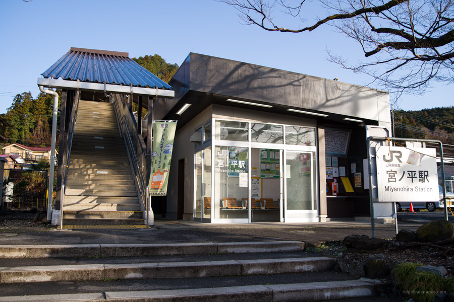
Start: Miyanohira Station (Ome Line)
Finish: Higashi-Ome Station (Ome Line)
Difficulty: ▅▅▅▅▅▅▅▅▅▅ ❷
Map: Yama to Kogen Chizu 山と高原地図 [No.25 奥多摩 OKUTAMA]
GPX TrackKML TrackGSI MAPPDF Topo Map
Loop Hike in the Ome Nagabuchi Hills
If you spread out the Okutama Yama to Kogen Chizu and glance to the far east, you can spot what is quite possibly the closest ‘real’ hiking trail to Tokyo at just over 40 klicks as the crow flies from Shinjuku Station. Enter Tenguiwa and Akabokko located in the Nagabuchi Hills 長淵丘陵 that form an arc on the boundary between Ome City and Hinode Town south of the Tama River. With the highest elevation barely attaining 400 metres makes great year-round hiking for all ability levels. What Akabokko lacks in height it makes up with a 180-degree panorama of the Okutama and Musashino area.
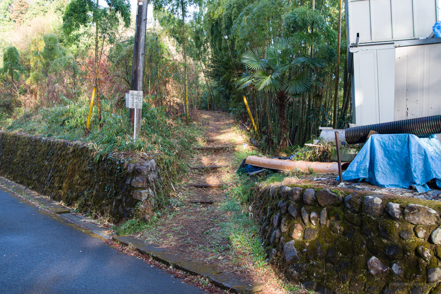
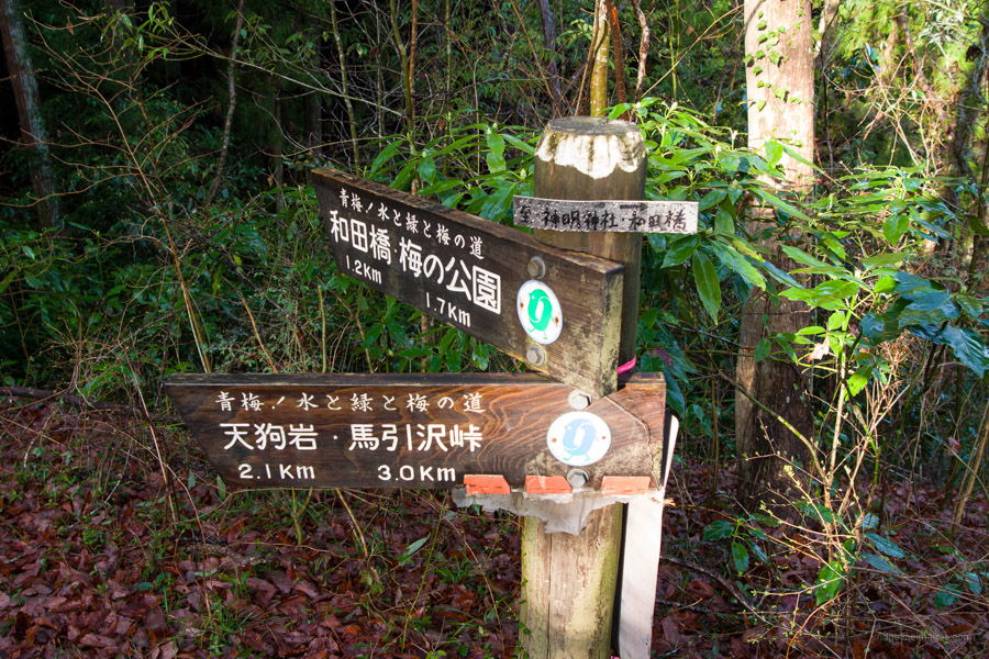
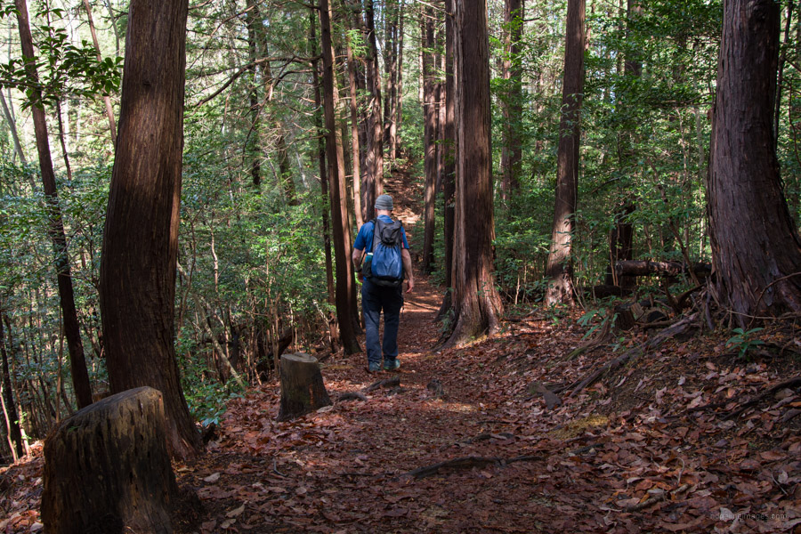
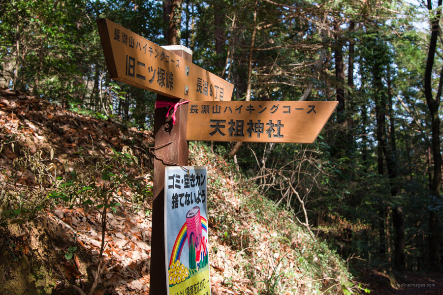
The hike kicks off from Miyanohira Station on the Ome Line around 1 hr 20 mins (820 yen) from Shinjuku Station. You can also approach from Hinatawada Station and pass by Umeno Park one of the best spots for plum blossom viewing in Tokyo. From the station go right along the Ome Kaido then turn left at the first traffic light and cross the Tama River. From the bridge it’s possible to make out a silhouette of the conspicuous tree on Akabokko. At the T-intersection turn right towards the Wadainari Shrine where there is trail sign signalling the way to Tenguiwa (2.8 km). You can either continue up this road or skirt around to the left as I did and use the alternate trailhead. Take your pick, as they meet further up. The hike is generally well signposted and easy to follow.
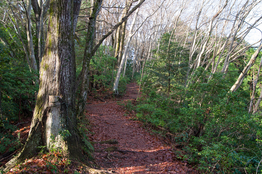
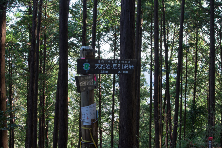
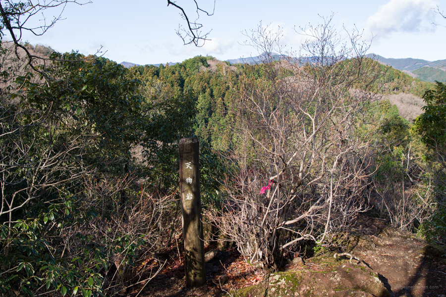
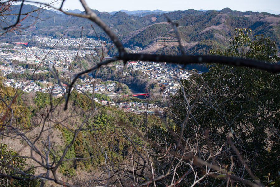
After passing the quaint Shinmei Shrine there is a short climb up to the ridgeline. Following a quick rest one option is a 30-minute round trip to Atagoyama 愛宕山 (394 m). The summit has a very old Japanese mountain cherry and apparently the view to the north is good in winter. Continuing east finds a steepish descent and Mt. Yougaisan 要害山 (414 m) an easily missed hilltop that happens to be the highest point. Next up along the undulating ridgeline is a short detour to Tenguiwa 天狗岩 that offers a nice view through Ome City.
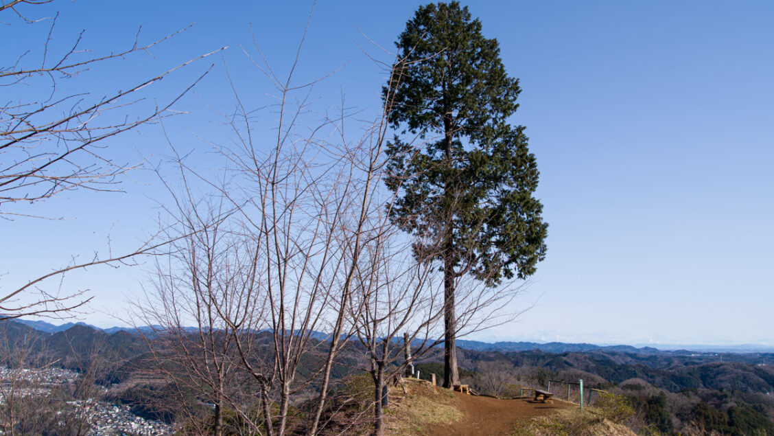
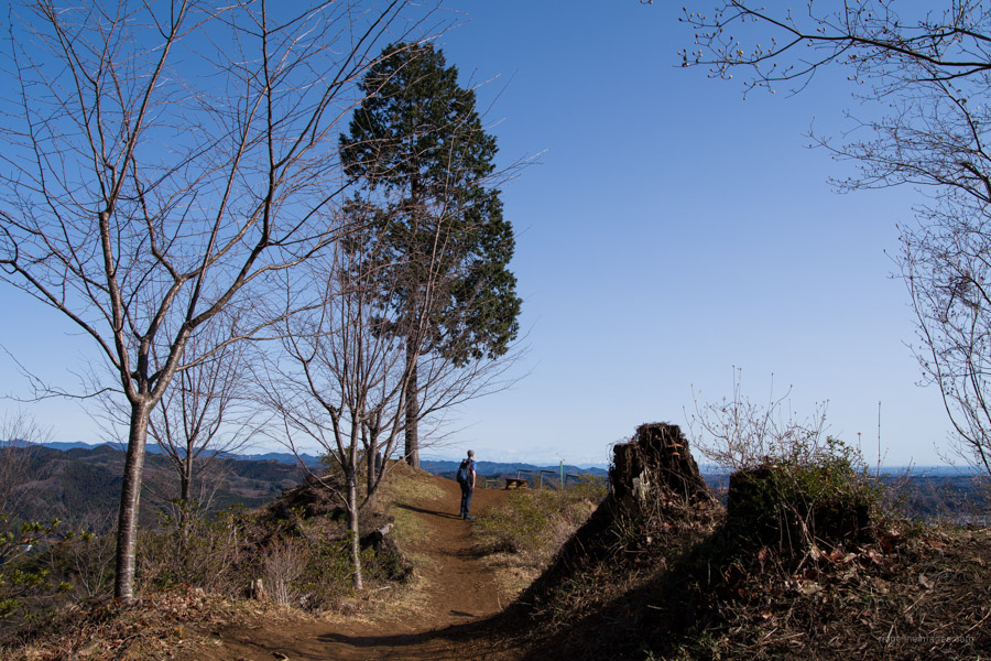
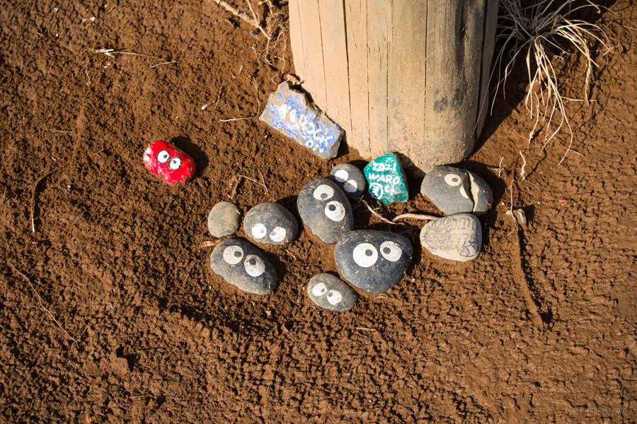
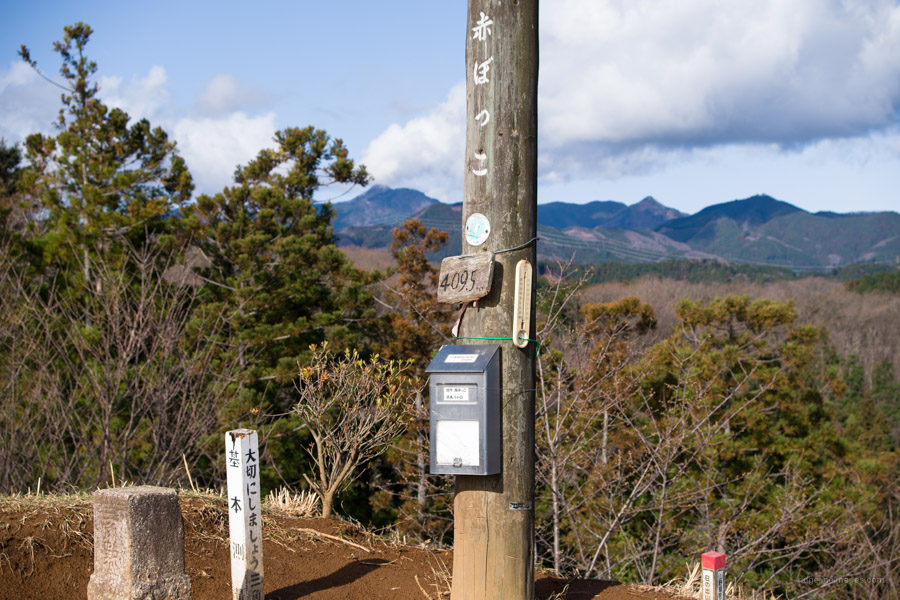
A further 5 minutes from the trail junction brings you to Akabokko 赤ぼっこ (410 m). Famed for its lone hinoki (Japanese cypress) that juts out on a narrow ridge and views that stretch as far as Tokyo Bay, Mt. Tsukuba and Mt. Asama. Legend has it the mountain received its name after the Great Kanto earthquake where the top soil gave way exposing a layer of red loamy soil underneath. There is a third-class triangulation station along with a couple of judiciously placed benches to savour the magnificent view. For some unbeknownst reason the signpost is adorned with Makkuro kurosuke of Totoro ilk inspired stones.
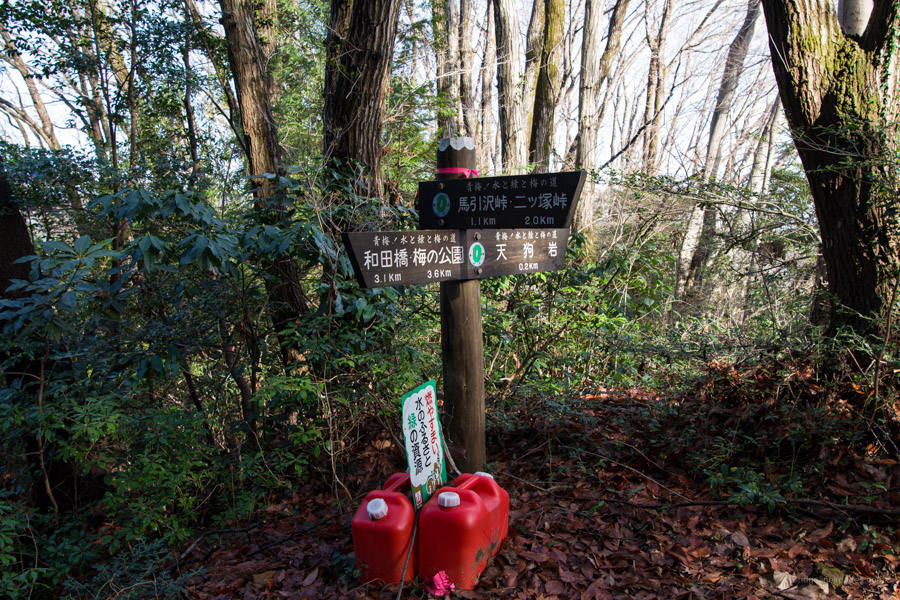
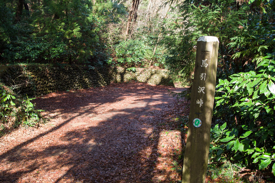
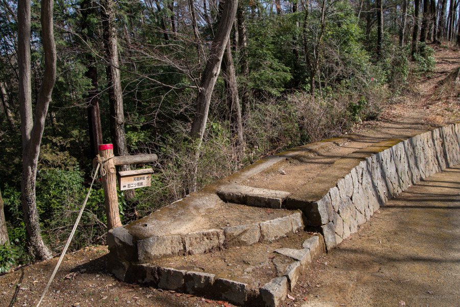
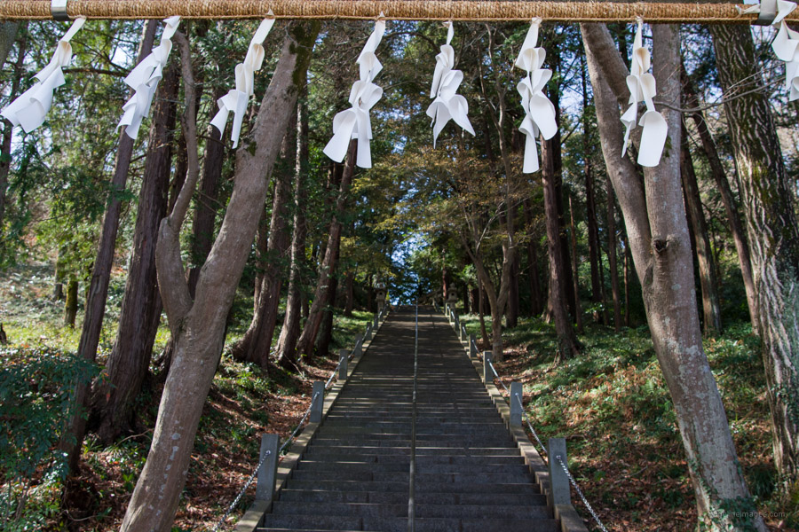
When you’re ready to head off the hike for a period follows a perimeter fence housing a landfill. Thankfully the noise stemming from the facility is short lived. About halfway along is Umabikisawa-toge 馬引沢峠 and between here and Futatsuzuka-toge 二ッ塚峠 are some fine specimens of konara (jolcham oak) and Japanese mountain cherry. At the trail fork carry on in the direction of Yoshino Kaido 吉野街道. Here begins a gradual descent to a paved road before continuing the Nagabuchi hiking trail 長淵ハイキングコース. After reaching the upper Tenso Shrine 天祖神社 proceed down a long flight of stairs veering left onto the Akikawa Kaido for a 30-minute road hike across the Tama River to Higashi-Ome Station.


Akabokko has a surprisingly nice view, doesn’t it?
Indeed it does! I only found out about it relatively recently. I noticed you also climbed it the other week which was a further incentive to have a look.
Useful info thanks!
No problem. It’s a good half day hike especially factoring in it’s so close to Tokyo.
Nice write up. I haven’t been on this trail for several years even though its very near my home.
During my hike I was hunting for several (about 11) GeoCaches that are hidden along that trail.
With the warmer weather here now, I think I’ll go out and enjoy that trail again.
I enjoy your post. Thanks.
Thanks Carl and recommend you do. It’s a beaut spot, best enjoyed in the early morning before the hordes arrive.
Thanks for this pretty-close-to-tokyo trail.
We took this May 24, 2022. We only saw 3 other people (weekday) Early on where we made a sharp left on the trail, we could see through that there was a ridge, so we walked up and saw an enormous solar farm going in down below and clearing for i guess another one right where the ridge is as well. We saw something move and thought -maybe a bear-but we got a picture which other hikers on the trail identified for us as a kamoshika. We looked it up later and apparently they are quite territorial. I hope someone is finding this one a new home!
Definitely glad we took the two jumps off the main trail to Tenguiwa (my favorite!) and Mt. Akabokko.
Also at the end of the trail on the road as we walked to Higashi Ome, we saw an interesting restaurant (closed Tuesdays) that’s built in an old traditional warehouse (kura), aptly named Mayakura.
It’s hard to believe it’s so close to Tokyo with rather nice panoramas from the two viewpoints. Speaking of bears, yesterday I saw my first Japanese black bear! It was about 50 metres away, and thankfully running in the right direction that is away from me. I’ll have some details in the next hiking instalment.
I didn’t do any hikes last summer, but trying to pick close, less strenuous ones this year and choose this one for today.
It was a weekday and I didn’t see anyone until the very last section and then only 5 people in total and literally walked through cobwebs most of the way.
The open space at Akabokko was hot so didn’t spend much time enjoying the view. Thunderstorms were forecast for the afternoon so kept a good pace just in time for the Express train and a nice beer on the way home.
PS: Small note on the route, they added a new traffic light by the fire station, so don’t turn there.