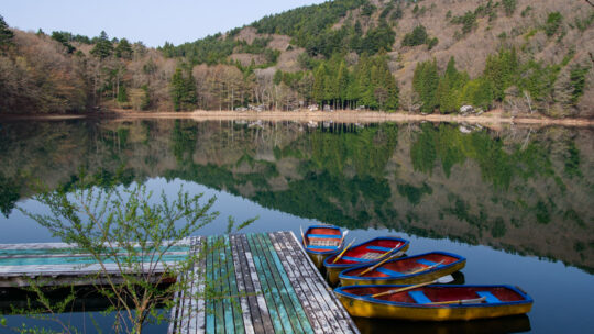
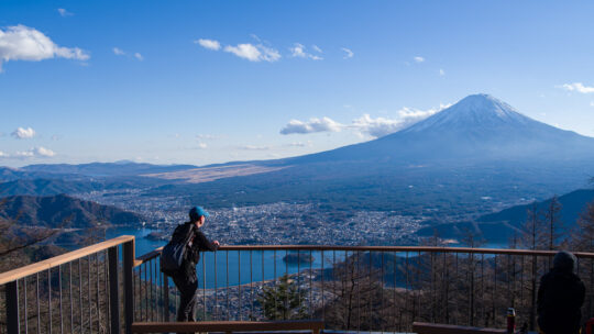
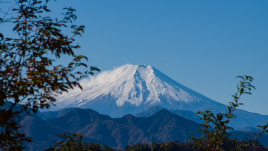
Hiked on Feb 2, 2026 . Koyodai observation deck 紅葉台 – Sankodai observation deck 三湖台 – Mt. Haneko 羽根子山 Duration: 4 hours Distance: 9.3 km Elevation change: 520 metres Highest point: 1355 metres Start: Koyodai Iriguchi bus stop ...
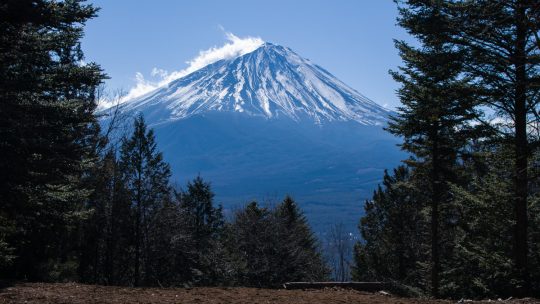
Hiked on Feb 2, 2026 . Koyodai observation deck 紅葉台 – Sankodai observation deck 三湖台 – Mt. Haneko 羽根子山 Duration: 4 hours Distance: 9.3 km Elevation change: 520 metres Highest point: 1355 metres Start: Koyodai Iriguchi bus stop ...
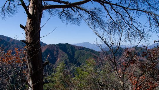
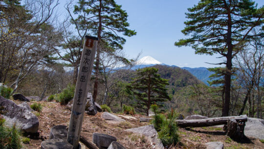
Hiked on Nov 30, 2025 . Akiyama Nijurokuya-yama 秋山二十六夜山 – Tateno-toge 立野峠 Duration: 5 hours Distance: 10.4 km Elevation change: 442 metres Highest point: 972 metres Start: Shimozaki bus stop Finish: Yanagawa...
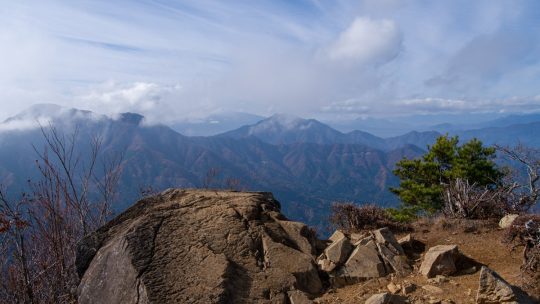
Hiked on Nov 23, 2025 . Akaiwa 赤岩 – Mt. Nijurokuyayama 二十六夜山 – Sennin-mizu 仙人水 Do not attempt this hike unless you have experience in route-finding and make sure you carry a topographic map and handheld GPS device. Duration: 5 hours...
Hiked on Nov 7, 2025 . Kamihikawa-toge 上日川峠 – Ishimaru-toge石丸峠 – Mt. Omatei 大マテイ山 Duration: 2 days Distance: 17.2 km Elevation change: 1262 metres Highest point: 1900 metres Start: Kamihikawa-toge bus stop ...
Where Did Akibare Go? Summer in Japan has become a bully. In years past, the lingering heat in the Kanto region was a mild inconvenience – something you grumbled about while fanning yourself through September. But lately, it’s turned downright...
Hiked on Aug 23, 2025 . Kitazawa-toge 北沢峠 – Choei-goya 長衛小屋 – Ko-senjogatake 小仙丈ヶ岳 Duration: 7 hours Distance: 11 km Elevation change: 1003 metres Highest point: 3033 metres Start: Kitazawa-toge ...

Not the Quiet Afternoon I Had Planned Exhausted from a gruelling morning traversing the three peaks of Mt. Houou, I arrived at Hayakawaone Hut on the second day of a three-day hike, ready for a quiet, solitary lunch. What I got instead was an...
Hiked on Jul 8, 2025 . Yashajin-toge 夜叉神峠 – Jizo-dake 地蔵岳 – Hirogawara 広河原 Duration: 3 days Distance: 26.8 km Elevation change: 1460 metres Highest point: 2840 metres Start: Yashajin-toge trailhead bus...
Hiked on June 27, 2025 . Village Hakushu ヴィレッジ白州 – Suisho-Nagi 水晶ナギ – Hokugino-daira ホクギノ平 Duration: 2 days Distance: 22.9 km Elevation change: 1357 metres Highest point: 2037 metres Start:...
Hiked on May 3, 2025 . Kamihikawa-toge 上日川峠 – Mt. Tanayokote 棚横手山 – Mt. Koshutakao 甲州高尾山 Duration: 2 days Distance: 20.9 km Elevation change: 1207 metres Highest point: 1627 metres Start: Kamihikawa-toge Bus Stop...
Hiked on Apr 18, 2025 . Beacon Tower ruins 烽火台 – Shibire-toge 四尾連峠 – Mt. Obata 大畠山 Duration: 2 days Distance: 21.5 km Elevation change: 1025 metres Highest point: 1279 metres Start: Ichikawa-Hommachi Station...
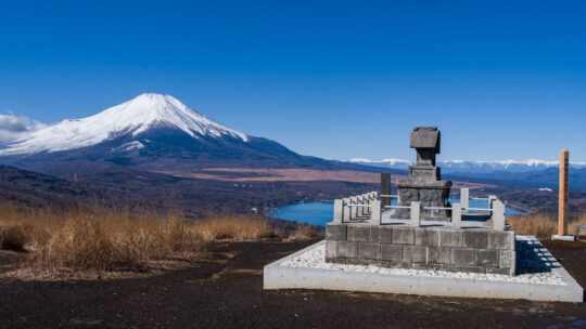
Hiked on Feb 14, 2025 . Yamanakako Panorama-dai 明神山パノラマ台 – Mt. Mikuni 三国山 – Mt. Takasasu 高指山 Duration: 4.5 hours Distance: 10.5 km Elevation change: 338 metres Highest point: 1328 metres Start: Mikuniyama Hiking Course Iriguchi...
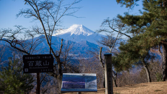
Hiked on Feb 7, 2025 . Konpira-kyu 金比羅宮 – Mt. Daidosan 大同山 – Mt. Momokurayama 百蔵山 If you wish to include neighbouring Mt. Ougiyama, you can also undertake it as a station-to-station hike starting from Torisawa Station. Duration: 4.5 hours...
Hiked on Dec 17, 2024 . Misaka-toge 御坂峠 – Kurodake Tenbodai 黒岳展望台 – FUJIYAMA ツインテラス Duration: 6 hours Distance: 12 km Elevation change: 783 metres Highest point: 1793 metres Start: Mitsutoge Iriguchi Bus Stop Finish:...
Hiked on Nov 30, 2024 . Mt. Shomureyama 聖武連山 – Mt. Nodake 能岳 – Mt. Yaeyama 八重山 Duration: 4 hours Distance: 9 km Elevation change: 265 metres Highest point: 543 metres Start: Oduku Bus Stop Finish: Ohori Bus Stop ...
Hiked on Nov 9, 2024 . Keikan Shrine 鶏冠神社 – Roppongi-toge 六本木峠 – Marukawa-toge 丸川峠 . Duration: 6 hours Distance: 15.3 km Elevation change: 826 metres Highest point: 1716 metres Start: Ochiai bus stop Finish: Daibosatsu-toge...