Where Japan’s Mountain Names Come From and What They Mean Place names in Japan can range from tricky to downright impossible – even if you know your kanji. Ask most native speakers how to pronounce 水松山, a quiet, forested peak in Tokyo’s Okutama...
Where Japan’s Mountain Names Come From and What They Mean Place names in Japan can range from tricky to downright impossible – even if you know your kanji. Ask most native speakers how to pronounce 水松山, a quiet, forested peak in Tokyo’s Okutama...
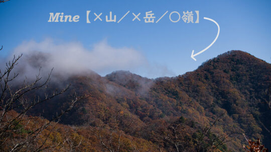
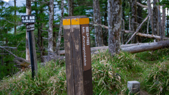
What’s in a Name? Japan’s Mountain Kanji Explained Studying kanji, or Chinese characters used in the writing of Japanese, can leave even the most ardent student exasperated at the best of times, and that’s before they ever open a hiking map. Place...
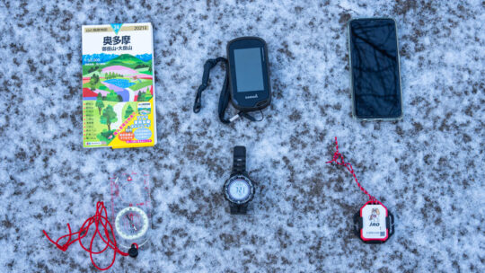
Navigation Toolkit You Need to Safely Hit the Trail Over the years one thing this blog has tried to hammer home probably the most is keeping safe and out of harm’s way on the trail. Even with the best preparation it doesn’t take much for things to...
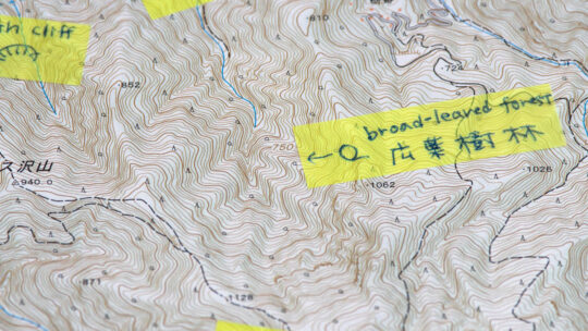
GSI Topo Maps: A Beginner’s Guide In this previous article I described in some detail the finer points of reading “Yama to Kogen Chizu” topographic maps, this time we turn our attention to the Geospatial Information Authority of Japan (GSI) and...
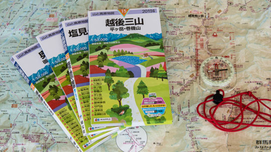
The Low-Down on Japanese Hiking Maps The map images and contents of this article have been obtained with the permission of the publisher (株式会社昭文社 Shobunsha Publications, Inc.). Writing about topographic maps i.e. a map which uses elevation contours...