Hiked on Mar 17, 2018 . Fujimitoge Lookout 富士見峠展望台 – Mt. Miyatsuka 宮塚山 Duration: 4 hours Distance: 13.3 km Elevation change: 376 metres Highest point: 376 metres Start: Habushiura Campground Finish: Habushiura Campground Difficulty: ...
Hiked on Mar 17, 2018 . Fujimitoge Lookout 富士見峠展望台 – Mt. Miyatsuka 宮塚山 Duration: 4 hours Distance: 13.3 km Elevation change: 376 metres Highest point: 376 metres Start: Habushiura Campground Finish: Habushiura Campground Difficulty: ...
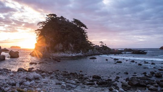
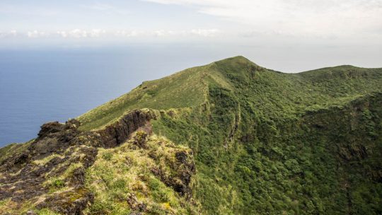
Hiked on Mar 16, 2018 . Tojinzushiro 唐人津城 – Kanbiki Lookout 神引展望台 Duration: 3 hours Distance: 6.4 km Elevation change: 96 metres Highest point: 109 metres Start: Kamanoshita Campground Finish: Oura Beach Difficulty: ▅▅▅▅▅▅▅▅▅▅ ❶ ...
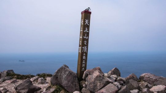
Hiked on Mar 29, 2017 Dec 11, 2021 . Mt. Tenjo 天上山 Duration: 6 hours Distance: 10.6 km Elevation change: 540 metres Highest point: 572 metres Start: Tako Bay Campground Finish: Tako Bay Campground Difficulty: ▅▅▅▅▅▅▅▅▅▅ ❷ Map:...
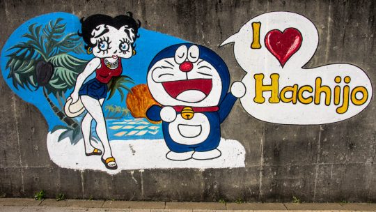
A Subtropical Oasis Within the Tokyo Metropolis Doraemon and his sidekick Betty Boop cut to the chase in this eloquent mural cherishing Hachijo-jima and I can only concur. The island’s subtropical climate, 287 kilometres (178 miles) south of Tokyo...
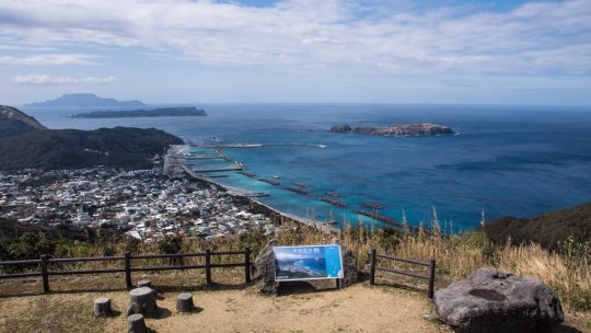
Hiked on Apr 6, 2016 Jul 20, 2021 . Hachijo-fuji 八丈富士山 Duration: 7 hours Distance: 17.1 km Elevation change: 854 metres Highest point: 854 metres Start: Sokodo Camping Ground Finish: Sokodo Camping Ground Difficulty: ▅▅▅▅▅▅▅▅▅▅ ❸...
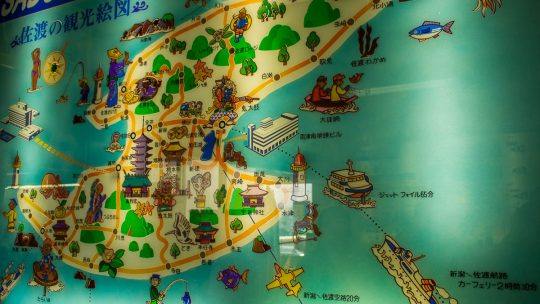
Tumultuous Beginnings and an Indeterminate Future Sado Island – a population that continues to decline. Back in the halcyon days of 1950 its inhabitants peaked at 125,000 while fast forward to 2011 and it has fallen markedly now hovering around half...