Shiromaru Dam fish ladder

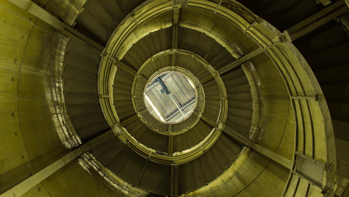
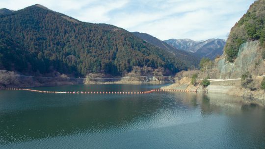
Unearthing the Longest Fish Ladder in Japan On recent nature outing near Okutama I stumbled across non-descript administrative building which just happens to house the longest fish ladder in Japan. The fish ladder is situated along a scenic stretch...

Hiking and hay fever in Japan

The Spoils of Early Spring Outings Tempted with the lure of warm weather for the first time this year, I made an ill-fated decision yesterday to set out knowing very well I had a good chance of succumbing to hay fever. This ignominious fate first...

Hakuunsan Torii Kannon

A Bodhisattva Inspired Kannon Temple The township of Naguri is more than just a launching pad for local trekking adventures and includes the impressive Hakuunsan Torii Kannon 白雲山 鳥居観音 which makes a formidable statement on the surrounding landscape...

Mt. Bonomine 棒ノ峰山

Hiked on Feb 28, 2013    Aug 23, 2023 . Naguri Lake 名栗湖 – Mt. Makinooyama 槙ノ尾山 – Mt. Bonomine 棒ノ峰山   Duration: 6 hours   Distance: 11.2 km   Elevation change: 736 metres   Highest point: 969 metres   Start:...

EIZO FlexScan SX2762W Revisited

It has been almost two years since purchasing the EIZO SX2762W FlexiScan LCD monitor and with almost 3,500 hours on the clock, I felt it was time to revisit my original review (included below) and add some closing remarks. The primary reason for...

Kiyomizu-dera Kyoto

A Pilgrimage to the Quintessential Temple While yesterday was unfathomably cold, today Kyoto turned into one gigantic puddle with incessant rain putting a dampener on things so to speak. Stoically we decided to adhere to our original itinerary by...

Fushimi Inari Taisha Kyoto

The Shrine of 10,000 Torii Kyoto is a city I have been rediscovering for many years and is undeniably one of the best places to point a camera in Japan. In fact it’s hard to take a bad photo – well most of the time anyway. Last weekend I again had...

Mt. Hinodeyama 日の出山

Hiked on Feb 13, 2013    Aug 23, 2023 . Mt. Hinodeyama 日の出山 – Mt. Mitake 御岳山   Duration: 6 hours   Distance: 18.6 km   Elevation change: 712 metres   Highest point: 902 metres   Start: Musashi Itsukaichi Station...

Reading Japanese Hiking Maps

Japanese Mapping Nomenclature Debunked Knowing your limits, keeping safe and out of harm’s way should be your number one priority when hitting the mountain trails and a big part of this is being able to read Japanese maps. While maps, signs...

Mt. Iwatakeishiyama 岩茸石山

Hiked on Jan 27, 2013    Aug 23, 2023 . Mt. Sogakusan 惣岳山 – Mt. Iwatakeishiyama 岩茸石山 – Mt. Takamizusan 高水山   Duration: 4.5 hours   Distance: 9.2 km   Elevation change: 543 metres   Highest point: 793 metres  ...

Archives