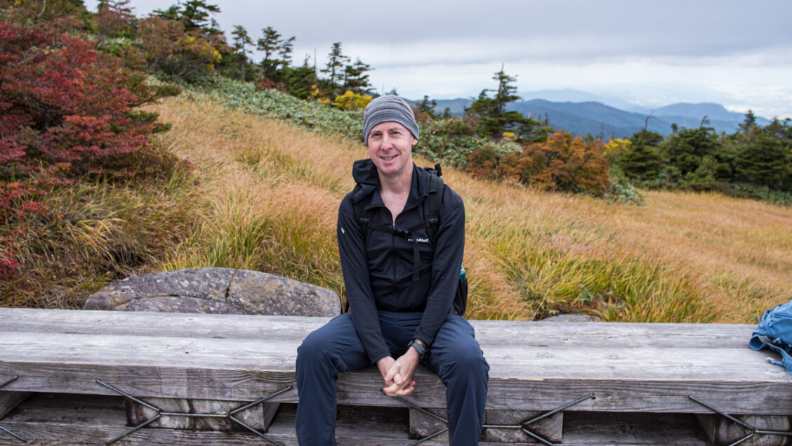
Who am I?
I’m a Tokyo based outdoor blogger and nature-lover with a passion for climbing mountains, taking photos, and sharing my adventures. Hiking has been a major part of my life since my childhood days in the Scouts and later through my involvement in outdoor activities at high school and university back in Melbourne, Australia. My first taste of hiking in Japan came when I was living in Hyogo in the early 2000s where I climbed Mt. Fuji and Rokkōsan which towers above Kobe and Osaka Bay. Since returning to Japan and settling in Tokyo I have spent a large portion of my free time over the past ten years spreading my love of hiking through writing about my outdoor adventures on this blog.
What is Ridgeline Images?
The website where I post my hiking chronicles is of course here RIDGELINEIMAGES.com. The reason for getting Ridgeline Images started (and continuing it to this day) was the lack of information in English on hiking trails around Tokyo and to inspire more people to engage with the outdoors. I know from personal experience, that when people don’t have much information about the trail, they are less likely to go because of the unknown. Since writing my first blog post in January 2013 I have published over 140 hike reports from my ramblings around the Greater Tokyo Area including more than 2,000 km of detailed trail notes – spanning twelve prefectures.
My main goal when writing these hike reports is to help my readers answer two questions. Do I want to do this hike? And do I have all the reliable information I need to do this hike safely? The routes range from easy half day walks that are well-marked and travelled to long and strenuous multi-day treks. Making the Japanese outdoors accessible to people of all hiking abilities has and will remain a priority of the site.
I have also written numerous posts about exploration of outdoor ruins, sightseeing spots, how-tos, along with some gear reviews. Each month without fail I have written a blog post ALL completely free of maddening display ads. More than 1.5 million people have visited the site, and I know from your feedback and comments many of you have gotten some inspiration and revelled in some memorable adventures of your own.
What is my Goal?
Put simply, it’s to spend more time in the outdoors, documenting a whole heap more hikes and adventures to share with you. Hiking is one of the most popular pastimes in Japan and has attracted a robust following amongst foreign residents as well as international visitors seeking independent and self-guided walks. To help meet the needs of such hikers, I want to continue documenting every hike with detailed descriptions, lots of photos, directions to the trailhead by public transport and what to expect as far as duration, distance, elevation gain, terrain, and dangers along with downloadable GPX track and PDF map files. It is my goal to be able to provide you with more hikes (preferably 2 new hikes a month) plus one general post sharing my knowledge and titbits about hiking in Japan.
Putting all of this information together and onto the website takes many hours of hard work and maintaining the running costs add up such as website hosting, premium WordPress plugins, and behind-the-scenes services to keep the site fast and secure. I want the blog to be one of the best resources for hiking in Japan and a place where people come to in order to get the answer to common questions. If you would like to help me create new hiking guides and resources, please consider supporting me on Patreon. I appreciate it, and every new supporter that jumps on board energises me to keep the blog going.
Thank you.
David Lowe
One does not climb to attain enlightenment, rather one climbs because he is enlightened.
— Zen Master Futomaki
私は何者か?
私は東京を拠点に活動しているアウトドアブロガーで、山に登ったり、写真を撮ったり、自分の冒険をシェアすることに情熱を注いでいます。ボーイスカウトに参加していた子供の頃から始まり、アウトドアアクティビティにのめり込んだ高校や大学時代、そして現在も、ハイキングは私の人生の主要な部分を占めています。私が日本で初めてハイキングを経験したのは兵庫県に住んでいた2000年代の初めで、富士山、六甲山などに登りました。その後オーストラリアのメルボルンに帰りましたが再度日本に戻り、自分の時間の大部分を自身のアウトドアの冒険についてブログに書きとめ、10年以上に渡りハイキングへの愛を広めてきました。
Ridgeline Images(リッジラインイメージズ)とは?
私のハイキングの記録を残しているウェブサイトは、もちろんここ「RIDGELINEIMAGES.com」です。10年以上に渡りRidgeline Imagesを今日まで続けている理由は、東京周辺のハイキングコースに関する英語での情報が不足していること、より多くの人にアウトドアに興味を持ってもらいたいという思いからです。私の過去の日本でのハイキング経験から、登山道に関する情報が少ないと、そこを訪れる可能性は低くなると身をもって知りました。2013年1月から現在まで、首都圏を中心とした12の都道府県、2,000キロ以上に渡る詳細なトレイルノートを含むハイキングレポートを140回以上公開してきました。
ハイキングレポートを書くにあたっての私の主な目標は、このハイキングをしたいのか?そして、このハイキングを安全に行うための信頼できる情報が網羅されているか?という読者の疑問に答えることです。紹介しているルートは、半日程度の簡単なコースから、数日間かけて行う長く険しいトレッキングまで様々なバリエーションに富んでいます。このサイトは日本の全てのハイキングレベルの人たちにとって役に立つものであることを第一に考えています。
他にも、廃墟や観光地の探索、ハウツーやハイキングギアのレビューなど、数々の記事をブログに残してきました。ブログを開始してから毎月欠かさず記事を書いていますが、煩わしい広告表示などは一切ありません。これまでに150万人以上の方がこのサイトを訪問して下さっています。フィードバックやコメントから、多くの方がここからインスピレーションを得て、思い出に残る冒険を楽しんでおられると知り、とてもうれしく思っています。
私の目標は?
簡潔に言うと、アウトドアに多くの時間を費やし、より多くのハイキングや冒険を記録し、皆さんと共有することです。ハイキングは日本で最も人気のあるアクティビティの一つであり、在日外国人だけでなく外国人旅行者の間でも人気があります。そのようなハイカーのニーズに応えるために、ハイキングコースの詳しい説明、豊富な写真、登山口までの公共交通機関を利用した道順、ハイキング所要時間、距離、標高差、地形、危険性などの情報を、ダウンロード可能なGPXトラックとマップのPDFファイルとともに記録し続けたいと思っています。より多くのハイキング(できれば月に2回)とハイキングに関する私の知識、ちょっとしたお役立ち情報などをお届けすることを目指しています。
情報をすべてまとめてウェブサイトに載せるには何時間にもおよぶ作業が必要で、さらにはウェブサイトのホスティング、プレミアムWordPressプラグイン、サイトを高速かつ安全に維持するための表には見えないサービスなどのランニングコストもかかってきます。私はこのブログが日本のハイキングにおける最高のリソースの一つとして、また、ハイキングしたいと考えている人の疑問を解消するための場所であってほしいと願っています。もしあなたがRidgeline Imagesを読むことにコーヒー数杯分の価値があると思うならば、ぜひ Ko-fiでこのブログへの支援を検討してくださると幸いです。みなさんからの寄付とそのお気持ちは私がブログを続けていくための活力になっています。
このサイトを訪問していただきありがとうございます。今後ともよろしくお願いします。
デイビッド ロウ
本サイトの連絡先
リッジラインイメージズに関するお問い合わせはロウ・デイビッドまでお願いします(davidlowe25[@]hotmail[.]com – 日本語可)。Facebook、Instagram、Twitterでも連絡が付きます。
Lovely site David. Beautiful photos.
Thanks Chrissy very kind of you and equally your shots on A Wild Land are also lovely.
no idea how i’ve only just stumbled across this. Really interesting stuff and great presentation.
much love
Thank you, that’s very nice of you to say 🙂
Hi David,
Your site is absolutely awesome. Many Thanks
I have noticed that you support ridgeline images with advertising. I hate adds and block them. But in some sites it seems not fair to take a free ride. How can I contribute to your site so it can continue its good service?
Thank you, it’s very kind of you to say so. I’m currently looking into what options might be available for those wishing to support this blog aside from affiliate links.
Thanks David, please when you come with a way to support the site let me know. Also if there are other ways to contribute.
Tomorrow a group of friend from Slovakia, Chile, Singapore and Japan all living in Tokyo will day trip to https://ridgelineimages.com/hiking/mt-iwatakeishiyama/. Welcome anyone to join. # 17. Everyone’s friendly.
Would like to correct my words “I hate adds” for “in my view adds diminish great content”
Sorry for that.
Came upon this lovely Website while researching using a GPS device for an October hiking trip to Japan. Thank you for this great service, and yes, I will gladly buy you a coffee.
My pleasure, Steve! Thanks for commenting and for the coffee. Enjoy your Japan hiking trip.
This site has been a great resource for our family since moving to Tokyo last year, planning day hikes with our toddler. Thanks for running it and if you ever decide to collect this wisdom into a book, I’d sign up for a copy. I really wish someone would write a great hiking guide for Japan or Tokyo area!
So glad you like the blog Sara. I totally agree the Kanto region sorely needs a decent hiking guide in English.
Hi David, delighted to have found your site. I’m travelling to Japan in a few days and will have about 6 days free to hit the hills. I’ll definitely be checking out the site for inspiration and tips. Andrew
Cheers Andrew 🙂 Enjoy the hiking here and with a bit of luck you’ll score some half decent weather.
Beautiful
Thanks
Any Recommendations for 2 weeks camping in September Want easy access to Tokyo.
Is Hanaka the best bet. Probably have a JR pass or any suggestions .
What about Sainokuni or Shiraiwakeiyuen.
Those look beautiful too.
Thanks,
Mike
What about
I’m not sure where “Hanaka” is to be honest. The other two campgrounds would be good choices especially Shiraiwakeiyuen a beautiful spot along the river. Please check my blog post “20 Places to Pitch a Tent Around Tokyo” for some other ideas.
Hi David,
I’m very glad I came across your site. I will save it in my favorites as soon as I’m finished writing this. My family and I are Americans living in Japan. My daughter will graduate this year and then head to a college in the States. As an “end of an era” expedition, we plan to walk a lot and hike a mountain together each month until her graduation in July. I’m excited to survey the information you have on your site. After my daughter leaves Japan, I still plan to hike more of Japan’s mountains, so I plan to visit your site for the foreseeable future. I’ve hiked a few here already and love the outdoors. I hope to see you out on the trail sometime. Thank you for serving the international community in Japan.
Hi Jim, thanks for following the blog and appreciate you taking the time to comment. I wish you and your daughter all the best in your hiking endeavours and let’s hope it won’t be too much longer before all of us can venture back to our beloved mountains.
Thanks, David. I’ve found your blog so useful and recommend it all the time.
Please put me on your blogroll. I like to stay in touch with kindred spirits.
No dramas Patrick and appreciate you spreading the word about the blog. Look forward to following your hiking adventures ?
Dear David, thanks a lot for giving us the opportunity to find hikes in Japan in English- your maps are so detailed, that our first tour on Mt. Takao was a plain succes. Even though my wife an me are quite experienced hikers, our tour yesterday took us a bit longer than you indicated – namly about 5 instead of 4 hours, partly due to the stairs all along the way, which we are not used to.
As you really do a great job for the expats here ( there not many garmin/outdoor active trails for available for Japan ) I also decided to sponsor you via Patreon.
I however would have on question: when I tried to download the GPX Track to send it to my Garmin Fenix 6, the connect app indicated upload error- have you got an idea why? So I used the Ride with GPS app, which worked very well. Best regards, Stephan Heisler
Hi Stephan. Firstly, much thanks for your support on Patreon and good to hear you and your wife enjoyed the Takaosan hike. As for the suggested hike times they roughly match up with Yama-to-kogen map along with a little leeway for some occasional rest stops.
As for why you had an upload error with your Garmin Fenix 6, I’m not sure. The Ride With GPS compatible devices page mentions the Garmin Fenix, Fenix 2, and Fenix 3 are compatible but perhaps Fenix 6 isn’t which would seem a bit strange. Instead of clicking on “Send to Device” where you sync the route to your phone or GPX the other option is to upload the GPX Track using the Garmin Connect website. In order to do this, click on the “GPX Track” (red) button on the blog to first download the file. The advantage of this method is that it includes the Points Of Interest. Unless you’re a RWGPS premium member clicking on “Send to Device” strips out the POI data. I always download the POI-included GPX file myself, and upload that to the blog for people to download.
Living in Tokyo 5 years and only just found this whilst researching Nanga sleeping bags. Wonderful resource, thank you for keeping this going it’s a treasure trove of information. I’m hiking and bike packing when time / family allows.
Thanks for the kind words about the blog, Nick.