Tag: shrine

Mt. Kinpu 金峰山

Hiked on Sep 30, 2013    Aug 23, 2023 . Mt. Kinpu 金峰山 – Mt. Kobushi 甲武信ヶ岳   Duration: 3 days   Distance: 26.8 km   Elevation change: 1089 metres   Highest point: 2599‬ metres   Start: Mizugaki-sansou Bus Stop...

Ueno Village Gunma Prefecture

A Cave, Suspension Bridge and Dam – Ueno Village has it all! Apart from our hike to Mt. Kasamaruyama and visiting the Ireino Sono Shrine we took some time out to visit some of Ueno Village’s other tourist offerings including the Fujido...

Mt. Kasamaruyama 笠丸山

Hiked on Jun 23, 2013    Aug 24, 2023 . Jizoutoge Pass 地蔵峠 – Mt. Kasamaruyama 笠丸山   Duration: 3.5 hours   Distance: 4.3 km   Elevation change: 479 metres   Highest point: 1189 metres   Start: Otsuchi Ueno...

Nagatoro Town

The Tatami Walls of Nagataro June is a great month for getting out and exploring some unfrequented spots within easy reach of Tokyo before the pervasive summer heat sets in. This entry introduces Nagatoro-machi 長瀞町 an attractive riverside town on...

Mt. Kumotori 雲取山

Hiked on May 23, 2013    Aug 22, 2023 . Mitsumine Shrine 三峯神社 – Mt. Kumotori 雲取山 – Mt. Mutsuishiyama 六ッ石山   Duration: 2 days   Distance: 29.2 km   Elevation change: 977 metres   Highest point: 2017‬ metres   Start:...

Hinodeyamakita Ridge 日ノ出山北尾根

Hiked on Apr 28, 2013    Aug 24, 2023 . Hinodeyamakita Ridge 日ノ出山北尾根 – Mt. Hinodeyama 日の出山 – Mt. Mitsumuroyama 三室山   Duration: 5 hours   Distance: 11 km   Elevation change: 652 metres   Highest point: 902‬ metres...

Hiking and hay fever in Japan

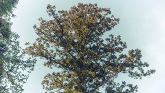
The Spoils of Early Spring Outings Tempted with the lure of warm weather for the first time this year, I made an ill-fated decision yesterday to set out knowing very well I had a good chance of succumbing to hay fever. This ignominious fate first...

Fushimi Inari Taisha Kyoto

The Shrine of 10,000 Torii Kyoto is a city I have been rediscovering for many years and is undeniably one of the best places to point a camera in Japan. In fact it’s hard to take a bad photo – well most of the time anyway. Last weekend I again had...

Mt. Hinodeyama 日の出山

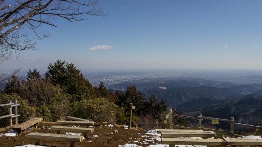
Hiked on Feb 13, 2013    Aug 23, 2023 . Mt. Hinodeyama 日の出山 – Mt. Mitake 御岳山   Duration: 6 hours   Distance: 18.6 km   Elevation change: 712 metres   Highest point: 902 metres   Start: Musashi Itsukaichi Station...

Archives